
-
 11303 Hits
-
 74.01% Score
-
 4 Votes
|
|
List |
|---|---|
|
|
Dynamic List of Bitterroot Trailheads Chaffin Creek Trailhead Chaffin Creek TrailheadThere is a growing number of people doing some sort of backcountry activity in the Bitterroot Mountains – Hiking, Mountaineering, Trad Climbing, Sport Climbing, Toprope, Bouldering, Ice Climbing, Aid Climbing, Big Wall, Mixed, Skiing, whatever. Many of those people are either members of, or are using, the SummitPost website. One bit of information which is nice for such a person to have handy, is a set of easy-to-follow directions for finding the trailhead where they’re planning to begin their adventure. 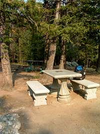 Bass Creek Overlook picnic area. Bass Creek Overlook picnic area.And, as many of you already know, some of the trailheads in the area provide access to more than one destination. Several come to mind, not the least of which is the Little Rock Creek Lake Trail which provided access for climbers interested in reaching either El Capitan or The Como Peaks. So, it seems to me that a list of the Bitterroot trailheads including up-to-date directions on finding each one would be convenient and useful. As I’m familiar with some of the trailheads used for access to our destinations, I’ll be happy to begin the list, add to it as time allows, and do my best to keep it useful. I would appreciate any and all constructive suggestions from other members who have used, or plan to use, any of the Bitterroot Mountain Trailheads. I am also soliciting any and all contributions to this trailhead list. If you wish to contribute, please, please do so. In order to keep the list as useful as possible, I’m suggesting that each trailhead listing be as similar as possible in format to each of the others, and should include the following… 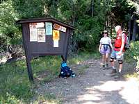 Trapper Peak Trailhead Trapper Peak Trailhead• Accurate, up-to-date driving directions – this should include mileage information, current road conditions, pertinent signage, road names, and required turns. (It never hurts to include the compass direction along with “turn right.”) • External links – include links to the destinations (summits, boulders, etc) those who access your listing are likely to visit. • Pictures – it never hurts to include an image or two of the trailhead, the crappy road used to reach it, and/or the most likely destinations. Once you have a trailhead page ready to contribute, send me a Private Message so I can attach it to this page, or, just attach it yourself. AND, if you have any thoughts or suggestions, please Private Message with those too. If you're interested in which summits can be reached from the trialheads listed below, you can find them in my guidebook, "Hikes and Climbs to Bitterroot Mountain Summits." Thanks. Trailhead ListFor your convenience here is a table of the trailheads currently attached to this page. If you are not especially familiar with the area, the Latitude and Longitude and Elevation may help you find them.
|