Your object was successfully created.

|
|
Route |
|---|---|
|
|
40.12800°N / 107.533°W |
|
|
Hiking, Mountaineering, Scrambling |
|
|
Summer |
|
|
Half a day |
|
|
Class 3 |
|
|
Overview
The South Ridge is a nice cros country route. It is a fun little climb, mostly class 2, but with a short class 3 section, and a class 1 ATV track for part of the way. The crux is crossing all the fallen logs on the ridge!
Getting There
Getting there is half the fun, and make sure to have the White River National Forest Map before attempting to drive to the trailhead. This is absolutely necessary and is the only map showing all the roads with the correct numbers. The Colorado Atlas also shows the roads, but they are marked with the incorrect numbers! The topographic maps don’t show the road numbers, and not all the roads.The driving directions won’t be too detailed here since you better have the Forest Service Map, and because I came from a different direction (Craig and Hamilton) than most Coloradoans would. Most Coloradoans will approach the peak from Meeker.
The first objective is Yellow Jacket Pass. This is reached from either County Road 15 north of Meeker or south of Hamilton (CR 15 is known as CR 45 for the Moffat County section). From either route (make sure to have the map!!!), drive the good gravel road to Yellow Jacket Pass. Turn east here and onto County Road 48 which becomes FR 250 once it reaches the national forest boundary. Follow FS 250 east for about 10 miles (passing many junctions along the way) to FS 290 which comes in from the left. A high clearance 4wd is required from here on. If you have a car, park here.
If you have a 4wd, turn left on FS 290 and follow it to a junction with FS 299 which comes in on the left. I parked here because FS 290 was a big mud hole beyond here. It was also really rough in one section just beyond, so unless the roads are really dry, park here, even in a 4wd.
 This is Kessler at the beginning of the Class 3 section of the ridge. This is the first little band. It can be climbed directly just above and just left of Kessler's head.
Route Description
This description will assume that you parked near the junction of FS 290 and FS 299 as described above. For the parking area, cross the creek and continue along the rough and rutted FS 290 4wd track. If driving there are big mud holes and some rough spots, but driving is not recommended due to environmental reasons. Follow the track through a meadow, and then to an ATV track taking off to the left (north). The track is marked as FS 297, but the sign was falling down, and may disappear?Leave FS 290 and follow the ATV track north. Eventually it will disappear and become a trail. Just follow the south ridge of Sleepy Cat Peak. The trail is faded away and is more a game trail then a hiking trail.
The first obstacle is the cliff band. Climb this as directly as you can for a little class 3 fun. Once you are above the cliff band, continue along the ridge to the summit. The crux of the route is finding a way around all the fallen logs. At a few sections, it is easier to get off the ridge on the right. There is one final scramble near the top and then more fallen logs before reaching the highest summit. Sawn logs along part of the ridge indicate that there may have been a trail here at one time (not on the maps), but it seems long gone other than game usage.
Strangely, there is part of an old (radio tower) structure (only one piece) right near the summit. It must have been helicopter serviced, and there is a little flat landing area which must have been used. Other than that, the peak is pristine, so enjoy the view of all the wild country and solitude that surrounds you.
This route is around five miles round trip and takes about half a day. There is a summit register on the top that was left by myself.
Note: The class 3 cliff band can be bypassed on the return from the summit via the alternate route I have marked on the map above. We went up the ridge itself, and down this alternate route.
 This is where the easy scrambling begins on the South Ridge.
Essential Gear
A good pair of boots is needed. Make sure to take the White River National Forest Map in order to find the trailhead.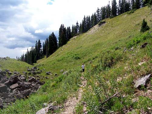 This is part of the sheep trail on the east side of the peak that bypasses the cliff band.