Lava
A newcomer to volcanic regions thinks of lava as a fluid stream of molten rock, much like TV-programmes of Kilauea on Hawaii show. Many don’t realize that the most common kind of lava is rather more solid. Volcanoes spit out hot rocks which somehow get formed during their trip down the slopes, thus forming labyrinths of all shapes, colours and sizes.
Lava comes in all sizes - from house sized boulders to cobblestone sized rocks, from pumice gravel to tuff spires, from solid rocks to the finest sand.
It comes in all colours – deep black for the recent outbreaks, different shades of brown according to the period of the flow, bright red in the hottest areas in the craters, yellow and orange on the pumice fields, blue and green on the hydrothermal faults and bright white or yellow, wherever sulphur breaks the surface.
It comes in all shapes – and all of them are rugged and sharp edged.
“Dancing on Lava”
There is no such thing as a walk on lava – “scramble” or “rockhop” is more adequate as a description but both don’t quite meet the actual thing. It is a struggle to keep the equilibrium. You walk and jump across rocks of bizarre forms and with sharp edges. Losing your balance can be rather painful as a grab for the nearest hold will get you in touch with those sharp edged rocks. So you rather take a sidestep or two onto the nearest solid looking boulder only to find that it is balanced precariously and starts to tilt as you touch it. Having your 100pound girlfriend scrambling in front of you doesn’t help either – your 200+ pounds (with backpack) will dislocate rocks which seemed rock solid when she rushed along.
Then you reach a passage, where the rocks are embedded in sand or scree. You tread on the largest boulder you can find – only to note that the whole scree slope starts to slide. You step off the boulder but sink knee deep into the scree. The motion of the nascent avalanche gets a hold of you and by trying to scramble out of its way you only add to its motion. Finally you make it into the shelter of the nearest lava wall across which your girlfriend has already started to climb. As you pause for breath you hear a warning cry from above and a large rock comes tumbling down, directly heading for your knees. You take a dive into the next nook and while the rock passes by you realise you cut your arm on the rocks around you.
I call this
The Lava Dance – a highly improvised series of complicated steps and motions – worthy of any ballet dancer – and not much less exhausting.
This is the tale of a whole day of lava dancing – a day which had been planned quite differently.
The Root of all Evil: Pico Viejo
“We’re not going to climb Pico Viejo! Forget about it!”
I am leafing through our hiking guidebook of Tenerife and it is about three weeks before the start of our Christmas vacation to the island. I have arrived on the last page, which describes the tour to Pico Viejo, the second highest summit on the island and am dreamingly contemplating the picture of the huge and beautiful crater of the mountain. I think of it as the most beautiful spot on Tenerife, an island with an abundance of beautiful spots. Still I have never thought of climbing the mountain again, certainly not after the experiences of our first ascent.
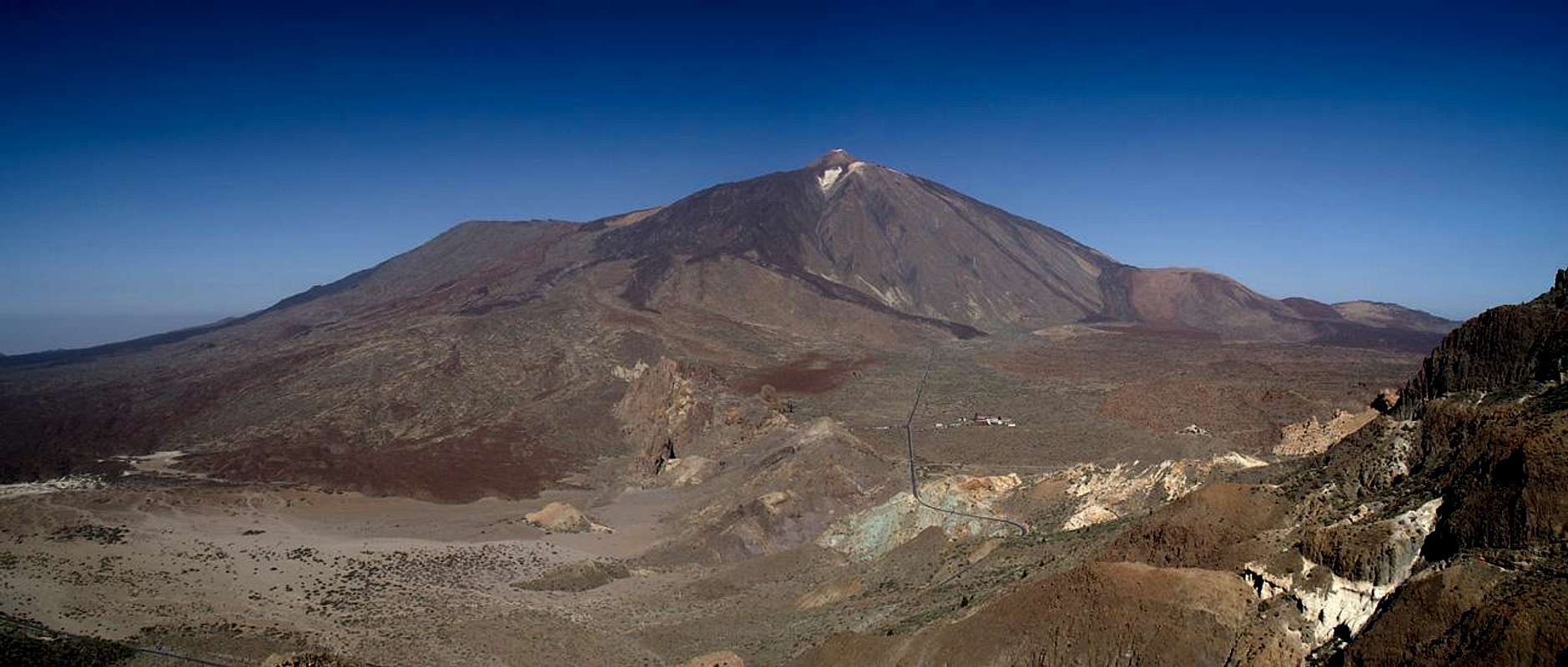
Tenerife, like all the Canarian islands, is of volcanic origin which is nowhere more evident than around the highest summit of the island (and the whole of Spain), Pico del Teide. El Teide has a perfect cone for its summit, a lot of lava tongues reach down its slopes right to the base and it shimmers in all colours that volcanoes can have. On its western slope there is a huge lateral crater, the “old peak” Pico Viejo. Though Pico Viejo is older than Teide itself, nevertheless, the latest outbreaks on Tenerife occurred on its slopes, covering them with fine cinder sand. Four years before we had climbed the mountain from its western side, struggling through the sand, which finally I called
the scree fields from hell.
So I wholeheartedly agree: no, we won’t climb Pico Viejo this time around.
Overview of the trip. It started near the cablecar, from where we hiked to the Teide trailhead.
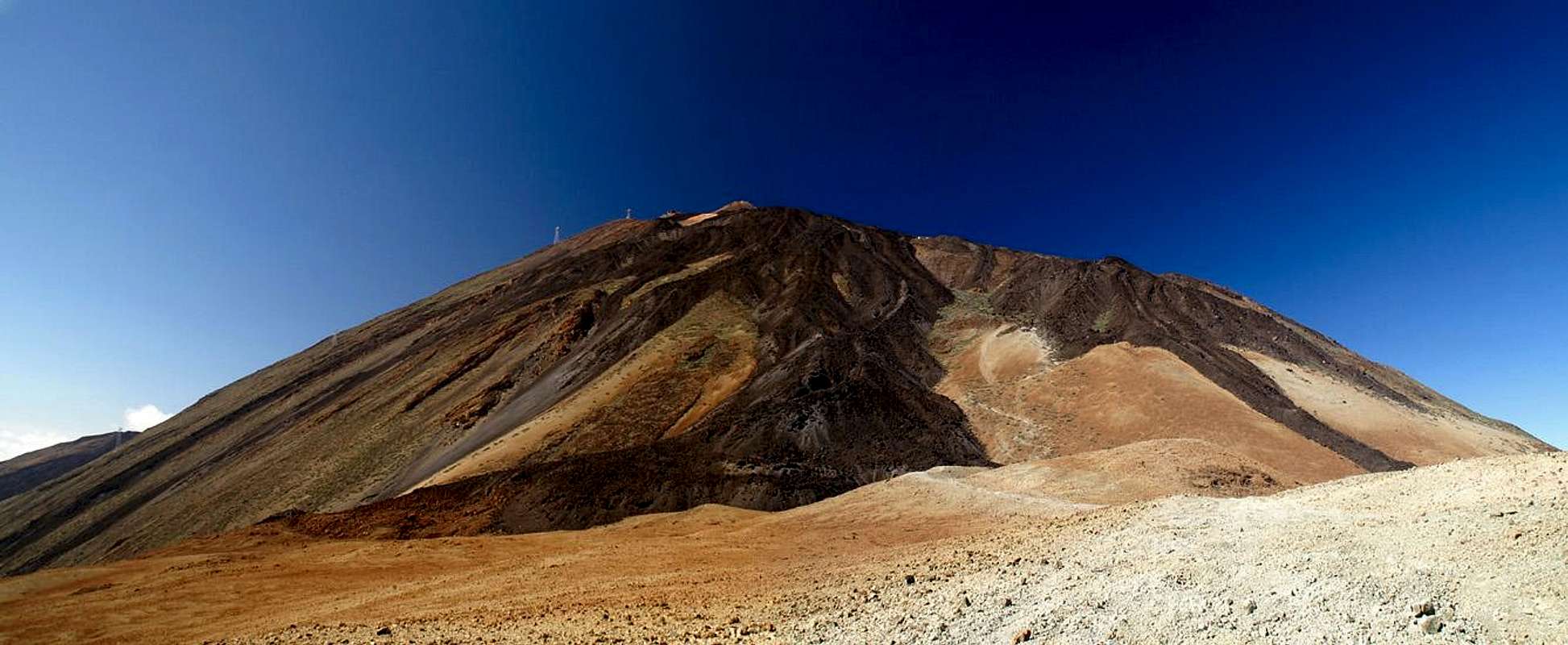
Next Montaña Blanca and the slope towards Altavista and the Teide summit.
Descent to Pico Viejo and from there down to the Roques de Garcia.
In the end a road hike back to the cable-car station.
Hide / Show labels |
Two days into the vacation the roles have changed – Judith is reading the guidebook in our holiday apartment and I am fooling around with my camera. Suddenly she surprises me with the words: “You know, we could climb Pico Viejo – but we should do it as the guidebook suggests – from above, by descending from Teide”. If you are familiar with the topology of Tenerife you know that the start- end endpoints of this suggested route are about 15km apart from each other and connected by a well trafficked road. The guidebook suggests doing the tour in two days, staying in Refugio Altavista for the night. However, this winter (2006/2007) the refugio is closed and since we don’t like to stay in huts anyway I know she is planning to do everything on a single day.
After having pointed out the distance, Judith shows me the fine print in the book – there is supposed to be an alternative route starting between Teide and Pico Viejo and heading down to the Roques de Garcia, “a route sparsely marked by stone cairns”. This will shorten the road hike to about a third with 5km still remaining.
The next day we climb Sombrero de Chasna south of the Caldera Rim of the Cañadas del Teide. From the rim we have a perfect look of the whole suggested route and we both are thinking about the suggestion and how we can perform the hike. I see too many lava tongues coming down between Pico Viejo and the road where we’ll have to park our car. It just doesn’t add up. Maybe if we start early?
On Christmas Eve we had noticed that the cable-car to Teide was closed. Since you need a permit for the summit – and we are way too lazy to get one – we need a day where no ranger is on Teide barring our way. We figure that if we want to reach the summit without a permit New Years Eve might be worth a try. Maybe the cable-car company will take another day off? We prepare for climbing Teide but leave the question of Pico Viejo unresolved.
On Dec 30th we look at each other and know we will go all the way. “Shall we get up early?” My suggestion is voted down. The summit of Teide will be attained in a little above three hours and from there it will be downhill all the way. No need for getting up early.
Still, I feel a little restless. But tomorrow will show…
First summit: Montaña Blanca
6:15 a.m. It is the morning of New Years Eve and we have just woken up. It is still dark outside and the sun won’t rise within the next 90 minutes. Time enough to have breakfast and then head up to the trailhead to Teide. We are staying at La Matanza oon the north coast, elevation 250m. A 50km drive will take us to about 2300m where we will start the ascent to Teide. High altitude sickness has to be seriously considered. The last time we climbed the mountain I returned with a splitting headache and a severely beating heart. At the time we slept at about 800m! Water is essential – and to take our time. But once we step over Teide to the other side there will be no turning back. I pack two backpacks – a large one for me and a daypack for Judith. We decide to wear normal Jeans since we expect cold temperatures at the high altitudes.
7:30 – We are in the car and head up through the densely populated Orotava Valley. The sun is coming up – at least we see the tip of Teide, Pan de Azucar, shining brightly. There’s not much traffic yet – but it is New Years Eve, a Sunday. The Tinerfeños are no early risers it seems.
We pass by El Portillo, the northern entry to the Teide National Park. Right now the sun is blasting in my eyes and I am trying to fish my sunglasses out of the backpack on the backseat. There are park rangers about – probably no summit luck today.
Now we pass by the trailhead. We prefer to do a long road hike in the morning, when there is no traffic than to do it all in the afternoon when cars and coaches abound on the highway. We reach the cable-car station. The gate is open – there will be tourists and – worse – rangers on the summit. Oh well, it’s too bad but nothing can be done anyway. A few paces behind the gate there is a parking lot. I park the car there and we get ourselves ready.
It is cold as we pace along the road, back to the Teide trailhead. So far our calculation was right. Only three cars on the highway so far. We pass by a mirador, a lookout point, wondering why there are already tourists out there. Only 500m left and we reach the trailhead.
A whole busload of hikers starts at the trailhead. Germans, of course. We try to pass them but they are far too many and they are hiking pretty fast. But now their guide starts telling something about the obsidian rocks among the pumice gravel and they stop. Time to say goodbye. We never see them again.
![Huevo del Teide in front of La Fortaleza]() Huevo del Teide Huevo del Teide | ![The summit of Montaña Blanca (2750m)]() Montaña Blanca Summit Montaña Blanca Summit |
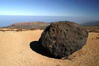
As we get to the long switchbacks which lead to Montaña Blanca a ranger passes us with his pickup. They always park on top of the mountain, which is another secondary volcano on the shoulders of Teide, to keep track of the climbers. Teide is the second most visited mountain in the world with 5-6 million visits a year. The rangers probably have a hell of a job. Here we hike through the Huevos del Teide, Teide’s eggs, large black lava bombs which are in stark contrast to the yellow, almost orange pumice they lie upon.
Teide as seen from Montaña Blanca. Refugio Altavista can bee seen to the right of the
large black lava tongue |
As we catch up with him right below the summit of Montaña Blanca he tells us that the last cable-car will descend at 2 p.m. Damn! We’ll be on top far earlier! Why couldn’t we have waited a bit longer? We could make a long pause at Refugio Altavista but what about Pico Viejo afterwards? We take a short break and eat some power bars.
Refugio Altavista
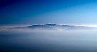
Up to Montaña Blanca the trail is fairly easy – it follows a dirt road – the one which the ranger drove in his pickup. Now the real ascent begins. It follows a steep pumice field between two lava tongues – steep but still pretty easy. We zigzag our way upwards and the higher we get, the better the views. We see the switch backing road and finally the mountains of the Cañadas Rim get into view. Above them hovers the island of Gran Canaria. We picked a perfect day – the air is as clear as it hasn’t been in the days before. The Sahara winds seem to have died down – there is no sand in the air.
View from the Estanzia de los Alemanes across the Cañadas del Teide towards Gran Canaria |
We reach a shallower part, the Estancia de los Ingleses, then we head up through a gorse field to reach the Estancia de los Alemanes. It seems that the Germans do take their rests higher up than the English ;-) But now we can’t avoid the lava anymore. There is a huge wall – some 150m high – on top of which Refugio Altavista has been built. The hut is more than 100 years old – it was built in 1893 and has been extended several times. Now is one such time. The hut is under construction, though on this Sunday nobody works here. There are two couples taking a rest here but we pass on. We are at 3200m now, only 300 left to reach the plateau beneath Pan de Azucar.
La Rambleta
Whatever happened to our decision to climb slowly I don’t know. We scramble through the lava, which is so worn down on this path that there are no sharp edges anymore. Since we have overtaken everybody, who started before us, we’ll be alone up there, right?
Wrong! The path meets the Rambleta, the aforementioned plateau near its north-western end, the Mirador de la Fortaleza. Suddenly we are surrounded by crowds, some clothed adequately but some in T-shirt, shorts and flip-flops. The mirador is packed full – there is barely a place to look out from. We climb across the wall and sit down on a lava spur in front of the mirador. 12:30 – time to have lunch.
![Pan de Azucar]() Pan de Azucar Pan de Azucar | ![Gran Canaria]() Gran Canaria Gran Canaria | ![Great contrasts: black lava, white sulfour]() Sulfur Hillock Sulfur Hillock |
By the time we are done, our backpacks are empty – we have put on every piece of clothing we brought and wonder how the tourons canstand the fierce and cold winds. We pick up our belongings and start to head along the touron trail towards the cable-car station. There’s a veritable traffic jam up here. The tourons have problems with their footing – but there is no easier trail than the one we’re on. I start to feel annoyed. And now my head starts aching. Again! We have been too fast. I take some aspirins and hope that they’ll keep the ache in check. I don’t hope for much, though. At least we will be going down from now on.
El Hierro, La Gomera and La Palma above Pico Viejo and the Teno Mountain Range |
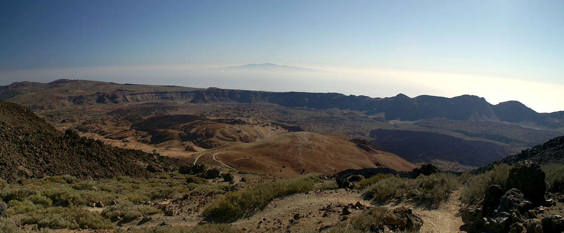
The western side of the touron trail – the one to Mirador de Pico Viejo – is quite empty. It’’s only 30min until the last cable-car goes down. Shall we wait? But probably the rangers will stay longer anyway. No, down we go! We pass a sulfurous hillock (smells like it, too) and head down to the other Mirador. The view is breathtaking: the whole Cañadas del Teide, the world’s largest volcanic crated is spread out beneath us. All the many mountains of its rim are perfectly visible and we can see the coast over their tops. Above them – in our back – Gran Canaria still hovers. In front of us looms the giant crater of Pico Viejo and above it the islands of El Hierro, La Gomera and La Palma. No, there surely couldn’t have been a better day to climb Teide.
The Descent to Pico Viejo
On the Mirador we meet a young German couple. He takes a look at his map and sees a dotted trail towards Pico Viejo and proposes to hike there. She’s all set against it. I warn them against going there. But why on earth am I doing it? My head is aching more than ever before as I pull my bootlaces faster.
After a few steps the trail vanishes and the lava starts. I am quite taken aback as I had expected scree and sand fields and an easy surf down to Pico Viejo! I confess that I haven’t really read the guidebook or I would have known. Damn! Luckily the rocks are large and I’m an expert rockhopper. Even if a rock slides beneath my feat or tilts I keep the balance. Judith with her shorter legs has a harder time but we manage. The trail is marked with occasional signs and with cairns. Still we lose our way and end up between two lava tongues with no sign of a path. We quarrel with each other but finally I give in and we climb back. Damn again! She was right – here is the trail. But we soon lose it once more only to find it some 40m beneath us. We take a shortcut and are back on track.
![Starting the Lava Dance]() Dancing on Lava Dancing on Lava | ![Pan de Azucar]() Pan de Azucar Pan de Azucar | ![Heading towards the saddle]() In the saddle between Teide and P. Viejo In the saddle between Teide and P. Viejo |
Meanwhile I start to wonder. Usually Judith waits when I take a photo, but now she’s storming onwards. She reaches the end of the lava and starts rushing out on the pumice saddle between Teide and Pico Viejo. What the hell is going on here?
I take my time – my head leaves me no other choice – and I’m looking for the rumoured descent path which should start somewhere around here. I can’’t see a thing. Here is the gorse field the guidebook speaks of – and there is the lava tongue. Where is that damn path.
Looking into the Pico Viejo Crater |
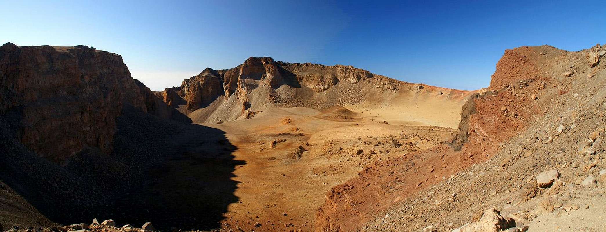
But first we must climb Pico Viejo anyway. We reach the south entrance to the crater – a gorgeous sight awaits us. The crater shimmers in all volcanic colours – simply great – and worth the hike! We have to turn around and climb the south slopes to the summit plateau. I have to admit that we lose our way once again. So we go cross-country now. Straight up through sand and scree. Yes – this is the Pico Viejo feeling. Remember the scree fields from hell?
Finally we are on top. And now I understand the reason, why Judith couldn’t wait. It’s 3:20 p..m. already. And the path we want to take is supposed to take three hours. We haven’t found the path yet. The sun will set around 6:30 p.m.! We need to hurry! So instead of taking our time on this most beautiful spot of Tenerife we turn around.
The Lava Dance
Now, two weeks after the tour, my mind still wants to blot out what follows now. We still don’t see the trail so we head down to the spot where the gorse field meets the lava tongue, hoping there will be a path there. The going is easy – finally the scree surf I was looking for hours ago! We meet the junction of gorse and lava – there are two cairns there!
Our joy is soon forgotten. Apart from the two cairns there is no path or cairn to be seen and we start going cross-country again. We follow the lava tongue on its side, then climb it as it turns too far west. Down it goes on the other side where another, even higher, lava tongue looms. We follow the valley but again are forced too far west. Up we scramble and catch our breath – the next lava wall is still higher than this one! But there might be the path over there!
The descent into the lava valley is UIAA II – an unsure scramble and then up again grade II. The good news: there are what look like cairns. The bad new: another wall to climb. We lose the path again and regain it. We climb countless lava walls and our strength seems to leave us. A short break to take in an apple. Let’s head up that next wall and then make a beeline for the Roques de Garcia down there. Nobody is thinking of shortcutting to the road.
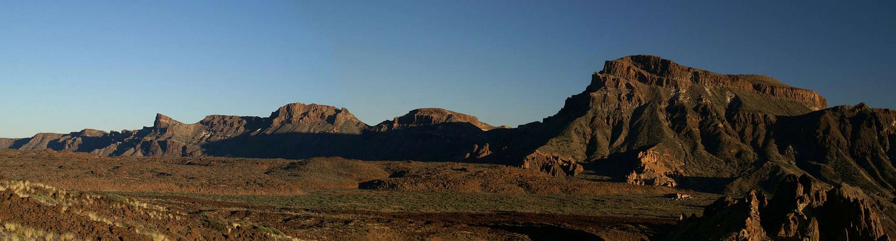
Cañadas del Teide in the setting sun |
Unbelievable – but there on top of the next wall – there is the path. Lots of cairns – though far apart from each other. The path seems to follow the top of the wall, though again, it appears to lead too far to the west. Its 5:30 now. One hour left to sundown. Hurry!
I have it fairly easy I must confess. I just follow in Judith’s steps. This is noot altogether unproblematic due to my larger weight but I don’t have to search for the trail. She has – and she slips several times. Luckily without any consequences. I would hate to carry her down this crazy slope! We lose the trail once more but it finds us again – it actually climbs down to where we are. We follow it and the Roques de Garcia are getting closer.
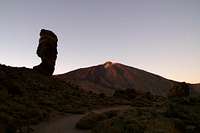
A Reward – Sunset Amidst the Roques de Garcia
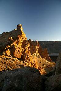
Shadows are getting longer. Mighty Guajara is casting a long one across half the Cañadas. There seems to be sand in the air still – whatever we thought up on the Rambleta. The Roques, Guajara and the caldera mountains are bathed in deep bright yellow. I pause every now and then to take a shot. Judith hurries on and I scramble after her. We both are at the end of our strengths. Judith picks up some grape-sugar (dextrose) out of her pockets and the next minutes are ok. I put away my sunglasses.
![Los Roques de Garcia during sunset]() Sunset Sunset | ![Roques de Garcia in front of Guajara]() Guajara and Roques de Garcia Guajara and Roques de Garcia | ![Moonrise above the Roques de Garcia]() Moonrise Moonrise |
Finally, as the sun sets, we reach those most improbable rocks on earth, the Roques de Garcia. If Teide is visited by 5-6 million people a year, the Roques are visited by twice as many. But now – in this beautiful light we have them for ourselves. It feels like a dream – like a reward for this tough day. If only my head weren’t aching so terribly!
![Roques Garcia sunset]() Last Light Last Light | ![Roque Chinchado and Teide]() Famous view Famous view | ![Roques Garcia sunset]() Bright light! Bright light! |
I take my time on the tourist loop and wherever there is a ray of light left on one of the towers I take a photo. Soon the light is gone and only Guajara, Pico Viejo and Teide, the three highest mountains of the island still get some light. This is turned off as we reach the parking lot of the Roques – Mirador de la Ruleta.
Trudging Back to Base
And now – back to the car. It is parked near the cable car – about 5km from the place we are. The first 3km are straight as a ruler, during the day cars drive 120km/h here – let’s hope they will go slower in the dark! Heading out we soon notice that traffic is way down. Occasionally there is a car but it doesn’t seem to be too bad. Until there is one angrily honking the horn at us, the next one flashes at us, there are two which blind us with their night lights. If we had expected to be picked up and delivered to base we would have been disappointed. No one thinks of stopping.
We trudge on – my head is out of control now. I don’t realize much anymore. But then I look west towards the Roques de Garcia and see a beautiful skyline against the mauve sky. I pick up my camera for the last time and shoot two pictures – the luckiest ones in the whole two weeks we stayed on Tenerife.
Skyline of the Roques de Garcia - all natural colours! |
As we turn the corner towards the cable-car station, about 500m from our car, a French couple stops and asks us if they could take us anywhere. We thank them and show them our car, they laugh and drive on.
Finally, the car! I pop some more Aspirins – we empty the last of our water – Judith produces some more powerbars. It must be magic!
What a day!
What Else There Was
A one hour drive takes us back home. Those final Aspirins seem to be made of stronger stuff than the ones before and I start getting better. The nightly views down towards the lighted towns in the Orotava Valley are breathtaking. So are the Christmas Illuminations that are still around everywhere. We reach the apartment around 8:30 p.m. It feels like 2 a.m.
A shower – then I cook a chicken curry dish – some blasted dishwashing. By 10 p.m. we are sitting on the sofa and watching the photos on the tiny camera display. Some, especially the sunset shots among the Roques seem to be exceptional. Thanks!
By 11 we drop into bed. At midnight a whole lot of fireworks go off but we turn around and sleep on.
Happy New Year Everybody!Statistics
Mountains climbed and touched:
Overall hiking time:
11h
Overall elevation gain:
1680m (5200ft)
Distance:
26km (17 miles)
Warning:
Don’t try to climb Pico Viejo on a single day. Don’t take the improvised descent route. Rather spend a night in Refugio Altavista and descend by the normal route to Bocca Tauce. The “Scree fields from Hell” are fun to surf down. Be sure to arrive at the endpoint before 4 p.m. so that you can hail one of the busses which can take you back to the Teide trailhead.


Comments
Post a Comment