
|
|
Mountain/Rock |
|---|---|
|
|
36.73168°N / 118.71504°W |
|
|
Tulare |
|
|
Hiking, Bouldering, Scrambling |
|
|
Spring, Summer, Fall, Winter |
|
|
10365 ft / 3159 m |
|
|
Overview
Nestled on the border of Kings Canyon National Park and the Sequoia National Forest in the southern part of the Sierra Nevada mountains, Mitchell Peak's views are rivaled by none. Mitchell Peak's summit views are some of the best in the Sierras (SF Chronicle). To the northeast, the mighty Palisade group with its jagged 14,000 foot mountains rise from the horizon. To the north, King's Canyon divides the land. To the South, nearby meadows dot the ground between forests full of giant Sequoias. Finally, to the southeast, the Kaweah Divide rises up mightily. The view at the top of Mitchell Peak exposes the true beauty of California.
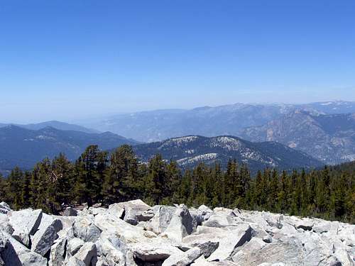 View from summit of Mitchell Peak
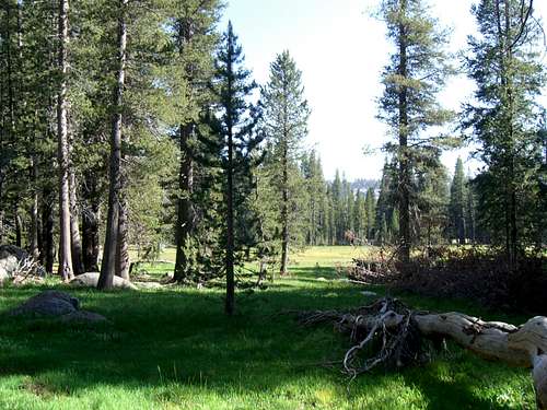
The Mitchell Peak trail ascends from the Marvin Pass trail head from 8100 feet. Weaving through shaded forests and meadows, the trail finally tops out at the summit boulder field. At the boulder field, the hike continues, scrambling up granite boulders to reach the true summit at 10,365 feet. At the top, there is a large and flat cement platform which used to host a fire lookout years ago. There is also a USGS marker just below the final boulder.
This is a great day hike. Unlike other hikes in the Sierras, it is quick and fairly easy. You don't have to wake up really early to make the top of Mitchell Peak. On the hike up, you can see the huge and amazing Sequoia trees that only exist on the west side of the Sierra Nevadas. Then at the top, you are struck by the amazing 360° views of all the surrounding area. All these factors combine to make Mitchell Peak a great mountain to put on your list.
Getting There

Mitchell Peak Trail
From Fresno, take Highway 180 to the park entrance. Continue a little further then turn right onto the Generals Highway south towards Sequoia National Park. The second left turn off the highway is Big Meadows Horse Corral road. Stay on the paved road all the way to the Marvin Pass cut-off which is a right turn onto a dirt road. This road loops around and dead ends at the Marvin Pass trail head and a dirt parking lot.
From the parking lot, take the Marvin Pass trail uphill for about half a mile. Here, you will reach a fork in the trail, stay right. The trail to the left goes to the Sequoia High Sierra Camp. Continue up the trail until after a steep section with switch-backs where the trail forks again. Now, turn left up the hill (right takes you to Rowell Meadows). The trail goes up the hill, traverses to the other side of Mitchell Peak, then climbs up to the top. The trail ends at a boulder field. Scramble about 200 yards to the top and take in the great views.
It's just under 3 miles all the way to the top and the trail ascends about 2300 feet. The hike up takes between 1 and 2 hours and the hike down can easily be done in 45 minutes.
Red Tape
National Park rules apply. No hunting. Fishing is allowed with a license. To get to the trail head, you need to pay the park entrance fee. No permit necessary for camping.
Camping
Mitchell Peak lies on the border between Kings Canyon National Park and the Sequoia National Forest. In the national forest, you have to camp 75 paces from trails and streams and fires are allowed below 10,000 feet. In the national park, the same restrictions for camping apply and no fires are allowed.
For more luxurious lodging, the Sequoia High Sierra Camp is just off the Marvin Pass trail and is very close to Mitchell Peak. It requires a 1 mile hike to get to it.
 Rowell Meadow
External Links
The San Francisco Chronicle really knows how great Mitchell Peak truly is. This is a good article
Heres the National Park Service website.
Alex Wood - Aug 11, 2008 11:25 am - Voted 10/10
One ThingMitchell Peak is inside of Jennie Lake Wilderness. Thats a pretty important fact. Other then that, great page!