
|
|
Route |
|---|---|
|
|
45.68330°N / 7.38330°E |
|
|
Via Ferrata |
|
|
Summer |
|
|
One to two days |
|
|
D (EEA) |
|
|
Approach and warnings
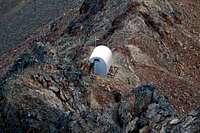
 First section of Via Ferrata, on NW Emilius ridge
WARNING!!!
From September 18th, 2008, Via Ferrata is temporaly closed for maintenance. Re-open day not forecast, at the moment.
Brief description
It takes two days (4 hrs the first, 10 hrs the second day) to complete this very long journey. 9 hours walking plus 5 hours in Via Ferrata. This route is for well trained expert hikers.Notice: there are two different possibilities to spend first day: to Bivacco Federigo-Zullo, at Col Carrel, or to Rifugio Arbolle. I strongly recommend to spend the night at Col Carrel. Second day will be shorter.
Best period: half July until late September. Avoid this Via Ferrata with bad weather, and after rain or snow. On Monte Emilius snow can fall even in summer.
Day One
 Arriving at Col Carrel
Important: avoid chairlift Chamolè! This is necessary only to get to Rifugio Arbolle or for the Via Normale. Second warning: do not go toward San Grato Chapel. This path has the same arrival at Col de Plan Fenetre, but is very longer.
The trail begins in front of Aosta-Pila cableway arrival station. Take care at the beginning of the trail: follow mark number 19a, for Alpe Chamolè. Cross the ski slope (in summer there is a downhill path for bikers) close to a farm (ten minutes from car parking), then head to another yellow panel. The trace seems to loose in another ski trail (SE direction). Follow this second ski slope for about half an hour.
When the real trail is met (I mean 19a, which hiker is thinking to follow ...), coming from rightside, we can feel finally ok ... in about 20 minutes the Chamolè Alp is reached (1 hr, 2154 m.). A little bit of confusion? Sure! The question is that the trail marks in Pila, for Chamolè Alp and Comboè Valley are very confused. 19a, 20a ... are quite the same. Suggestion: take care to understand where Becca di Nona summit is, and follow that direction.
Once arrived in Chamolè, turn E (left) direction crossing between Alp Chamolè small village (3 buildings), marching on a flat unpaved road (there is a trail that lead to Comboè lake, behind village: avoid it!), until marktrail number 20a is reached. Follow the sweet trail, crossing a large pine forest to reach Col de Plan Fenetre (1h20m, 2221 mt.).
Ignore right sign for Col Replan, and descent into Comboè valley, to Comboè village (1h40m, 2125m.). The path forward coasting a small lake, crossing a small wood bridge (path number 16 begins here), then on leftside of a beautiful stream.
Just before the dale ends, a yellow panel indicates the direction (left, E) for Bivacco Federigo-Zullo at Col Carrel, in about 1h15m! The direction, and trail path number (16) are right: the time to get to absolutely no! From this panel to the pass it takes, normally, 1h45m.!
Don't miss this detour, otherwise you reach Rifugio Arbolle, after scrambling in a very steep and narrow gully (trailpath n. 14, marked only descending from Rifugio Arbolle toward Comboè valley, see Descent section).
Moving E direction, the path becomes steeper. After about one hour (at approx. 2630 m.), at the feet of Becca di Nona, turn right, to Col Carrel direction. After crossing a flat stony ground, the path becomes really harder and steeper, marching on stones, sands, then on last grass area, close to Col Carrel. Once arrived at the bivouac (4h00m, 2907 m.), great sightseen on Monte Rosa chain and Matterhorn (far ENE), Grivola (SW) and Mont Blanc (W).
Water in the small lake situated E from Col Carrel (2 min.): in dry years this lake may not exists in late season.
Day two
 Queued up to bridge access
 Getting out from the final wall
Via Ferrata del Monte Emilius
Via Ferrata begins about 30 meters over the bivouac. It takes about 4h30m/5h00m, and I strongly recommend not to come back from it.
There is an "escape lane" after 2 hours, near Petit Ferret. If you complete all Via Ferrata, use Via Normale to descent.
From bivouac, scramble leftside the ridge, following a very steep and tiring trace on slippery small stones to reach the begin of metallic cable. This Via Ferrata follows large stone steps and rocky nervous ridge.
There are never real danger, other then stonefalls from other people.
It takes about 1 hour to ascent to the Tibetan Bridge (I don't know if this is the correct english translation ... I literally translated from Italian ... this is my genuine Spaghetti English). After this little moment of thrill, panorama becomes wider on Grivola, Gran Paradiso, northside to Gran Combin, Matterhorn and so on. There are very spectacular passages, on beautiful stony towers, well protected by cable and iron steps.
In about 2 hours, from bivouac, the summit of Mont Ross di Comboè, where ends the first part of Via Ferrata. The regular pyramid of Monte Emilius towers in front of ridge continuation, while rightside, Arbolle dale opens significant views on Lac Gelè and the regular trapezoid shape of Mont Garin.
To meet again the cable and the beginning of the second part of Via Ferrata, scramble close to the ridge for about ten minutes. The metallic cable helps to go beyond the round shape of Petit Emilius. Then Via Ferrata keeps up with a brief descent. A yellow panel points out the "escape path" to Rifugio Arbolle (about 1hr30m), descending a sandy/stony ground steep (S direction).
A long series of stone crossing bring to the most exciting section of this Via Ferrata. Here there are some vertical passages on red towers ... a cross and a tower ... a cross and a tower and so on.
The last crossing head to the final and most difficult passage of the whole Via Ferrata: an irregular "cabled" wall rather vertical, rightside the main ridge (very often icy, at about 3500 mt.) without iron steps. This is the most technical and dangerous passage, because it's almost impossible not to cause stonefalls, ending this 20 meters long step. Watch out your friend below: one people per time on this upright jump.
 Getting started at Via Ferrata
Generic warnings!
It's extremely important to know that Via Ferrata conditions, may be completely different in late spring or early summer: some slices of this long ridge are sometimes without metallic cable protection and snow could be present along the way. Some little snowfields could resist, close to the ridge summit, and are very dangerous because of relevant steepness on both sides.Descente
Descent (without Chamolè chairlift): follow Via Normale, as described in reletad page to Rifugio Arbolle (2h00m from summit). Follow trail n. 14 (not indicated on yellow panels close to the shelter, only writings on the stones), N direction (turn right to Comboè Valley). Descent a very steep gully. In half an hour, the path is back on trail n. 16, where day before we ascent to Col Carrel, bivouac Federigo-Zullo. Forward to Comboè Alps, brief ascent to Col de Plan Fenetre, then straight ahead on trail 20a to Chamolè Alp. In about 45 minutes the path brings back to car park in Pila.Descent to Chamolè chairlift: from Rifugio Arbolle, turn left to Chamolè pass. Then descent to the round shaped lake, close to chairlift station (about 1h30 from Rifugio Arbolle). Take care about chairlift time schedule: until 17:00 or 17:30, it depends on summer period (cfr: www.pila.it).
Gear section
Alpin wears and boots, and a "Via Ferrata" kit. Helmet, please!Crampons and ice-axe could be useful if climbed out of season.