FROM “THE BIG D” TO GUADALUPE NATIONAL PARK
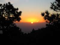
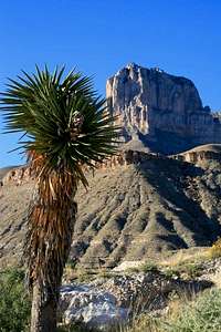
We got a bit of a late start leaving Dallas on Tuesday morning. The drive was 525 miles and about 9 hours. Interstate 20/10 is a long stretch of nothing. The good thing about the drive, once you pass Midland, the speed limit goes up to 80mph. Yee haw! We caught 54 and headed north in Van Horn. What a ghost town. Half of the buildings (shacks) were abandoned. We got gas, water and some snacks and headed out for a 60 mile drive to the park. Finally we spotted El Capitan straight in front of us, way off in the distance. It has a very distinct shape.
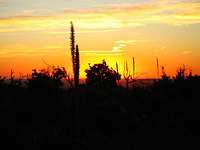
![El Capitan]() First siting of El Cap
First siting of El Cap
We just missed the visitor center hours, (8:00-4:30) so we headed to the Pine Springs campground and did the self pay. The sign said CASH ONLY. Eight bucks later we were setting up camp in site # 18. They have 20 tent camp sites and we counted about 5 other tents. We had a few hours of daylight to get everything situated and make dinner. The weather was warm and sunny until we finished dinner and then the WIND kicked in. We jumped in the bags early hoping to get a good night’s sleep for our climb the next day. Fat chance. The wind was fierce and it howled most of the night just slamming our tent. Must have been 50mph gusts at times. Finally we fell asleep at about 3:00 when the wind died down.
![Guadalupe National Park]() The visitor's center
The visitor's centerDAY 2
![Guadalupe National Park]() Pine Springs Campground in the wee morning hours.
Pine Springs Campground in the wee morning hours.Up before dawn. It was still pretty warm out. I slept in shorts and t-shirt. We got some very nice sunrise photos and had breakfast before we packed up camp. At the visitor center, we paid our park entrance fee, got our back country permit and a camp site @ Guadalupe Peak campsite. We got the weather report and all looked good so we headed out.
HIKE TO GUADALUPE PEAK BACK COUNTRY CAMP SITE
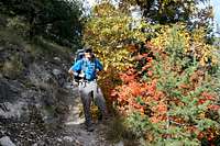
![Guadalupe Peak Fall Colors]() Fall Colors of Guadalupe National Park
Fall Colors of Guadalupe National ParkTO THE SUMMIT
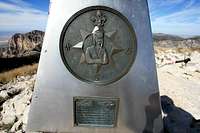
![Guadalupe Peak]() Signing the log
Signing the log![Guadalupe Peak]() Me on the summit
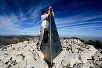
Me on the summit![Guadalupe Peak]() The Captain and me.
The Captain and me.HEADING DOWN
![Guadalupe Peak]() Easy Money
Easy Money![Guadalupe Peak Campground]() Another gorgeous sunrise
Another gorgeous sunriseMY ESSENTIAL GEAR
Garmin Forerunner 305![Tools Of The Trade]() My training partner
My training partner. These are a must have for me (especially for the hike down). I used them on the up and down. Great for keeping good balance while carrying a backpack. A definite knee-saver for the hike down.
UnBottle 100 oz. . A gallon per person, per day is recommended during summer months, but I did fine with 100 ounces. That included the water I used for meals and coffee, as well as drinking.
CONCLUSION
This was my 5th State Highpoint and by far the most fun! I felt a little bit of altitude discomfort when we first arrived at Pine Springs, but by the next morning I felt good. We did not encounter any animals nor did we sense any danger at any time. I spent a month reading about this peak on Summitpost and it was a huge help in my preparation! I hope my report helps future first-timers in their Guadalupe Peak endeavors!


Comments
Post a Comment