
-
 7363 Hits
-
 77.48% Score
-
 8 Votes
|
|
Mountain/Rock |
|---|---|
|
|
47.38220°N / 10.77304°E |
|
|
Hiking, Skiing |
|
|
Spring, Summer, Fall, Winter |
|
|
7762 ft / 2366 m |
|
|
Overview
 Zugspitze from the summit
Roter Stein has a visibility problem. From Fernpass to the south and from the east Gartnerwand with its huge south slope looks more interresting than this rocky peak. From the north you see the mountain only from around the city of Bichlbach or while driving from Bichlbach to Berwang. And at least from the west there are only a few places where it is visible from the valley. But don' t think this hidden mountain is not popular or seldomly visited. It is summited quite often since if offers four nice ridges and a spectacular summit block towering over gentle and grassy slopes with lots of cows and goats. Additionally the flora on this mountain is pretty beautiful and worth a second look.
There are two major trails to the top of Roter Stein which are secured by iron cables on some places. Both routes offer no problems and are beautiful according to the views down and to the surrounding mountains. During the winter months the summit is visited as well from the north (Bichlbächle) and east (Fernpass). The approach from the west is too dangerous in winter because of the big and steep west-slope of Kamp (2014m/6608ft).
 Wildspitze
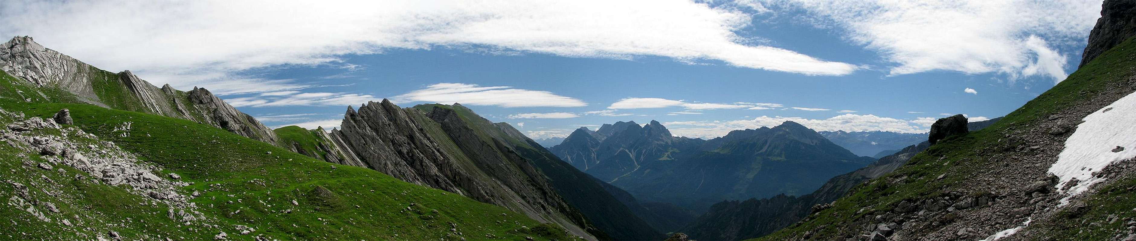
Roter Stein offers a breath taking summit panorama although there are several higher summits nearby. Looking towards Zugspitze across Gartnerwand si spectacular as well as the views of the western Mieming Range. To the south you have a look onto the glaciated peaks of Stubai Alps and Öztal Alps. Especially the view of Wildspitze and Hintere Brochkogel is amazing.
Summing all up Roter Stein is a beautiful mountain which is worth a visit if you want to ejoy a beautiful day with great views. But remember that you aren' t alone on this mountain, because it isn' t as unpopular or seldomly visited as I expected it to be. But if you want to escape from the people I recommend to add a traverse of Kreuzjoch towards Fernstein to your trip after summiting Roter Stein, since you' ll enter the lonely but splendid area around Kreuzjoch.
Maps And Routes Overview
Maps
Routes
You have the possibility to traverse Kreuzjoch to/from Fernstein if you want to do a huge trip with spectacular views. Look at the page of Kreuzjoch for more information. |  South ridge (from Fernpass/Bichlbächler Jöchle South ridge (from Fernpass/Bichlbächler Jöchle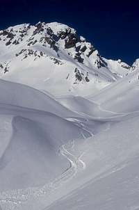 Roter Stein in winter Roter Stein in winter |
Panoramic Views
  |
 |
Getting There
 Relaxing cows
The trailheads of Roter Stein are either Bichlbach/Berwang or Fernpass.
By car
If you come from the south you need to get to the city of Nassereith first. This is easy since Nassereith has a connetion to Imst (road 189) and from there you have access to highway A12 (Inntal highway). Via this highway you reach Italy and Germany via Innsbruck or Italy and Switzerland via Landeck. From Nassereith road 179 lead up the Fernpass. Following the road you reach Bichlbach (or the road to Berwang) after a few kilometers.From the north you have access to Bichlbach/Berwand via road 179 either from Garmisch-Partenkirchen via Ehrwald or directly from Reutte. From both cities you have good road connections into Germany.
By train/bus
The trailhead at Bichlbach is easily reached by using the Ausserfernbahn connecting Garmisch-Partenkirchen and Reutte. From Garmisch-Partenkirchen you have access to the german railroads. The trailheads at Fernpass are a bit more complicated since you have to take a bus which drives quite seldomly (but often enough). The bus line connects Reutte via Ehrwald and Fernpass with Nassereith. A ride from Fernpass to Ehrwald costs 2 Euros (July 2008).For more information about austrian or german schedules of trains and busses visit www.oebb.at (austrian trains/busses) or www.bahn.de (german trains/busses).
Mountain Conditions
Weather
Webcams
|  Campanula cochleariifolia Campanula cochleariifolia |
Red Tape
There are no fees, permits or seasonal closures.
Parking at the trailhead at Fernpass is next to impossible since everyone makes a stop there to enjoy the views or to take a rest. If you decide to start at Fernpass I recommend to park at Ehrwald and to use public transportation to and from Fernpass.
The trailheads at Berwang or Bichlbach offer parking lots since the is a little ski area, but I don' t know if parking is free.
Accomodation
There is no hut directly on the monutain. The closest hut is Loreahut (see Kreuzjoch page for more information). The area around Ehrwald is very touristic and has lots of hotels and places to stay. For more information visit the multilangual hompage of the area.
When To Climb
Roter Stein is climbed the hole year. I guess there is quite a constant "visitors rate".