Account of Events
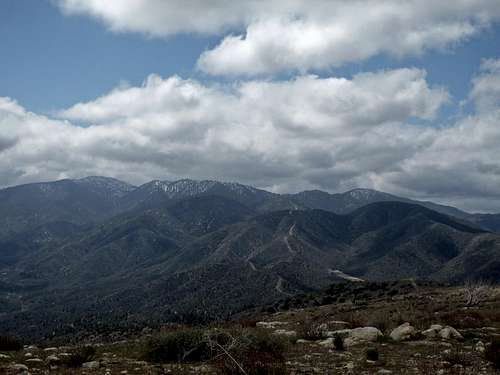
![Cole Point]() Cole Point from the summit of Mount Emma
Cole Point from the summit of Mount Emma
It was a cloudy, chilly Saturday morning when we met at the La Canada rideshare point. Our plan was to hike
Cole Point,
Mount Emma, and
Old Mount Emma as an in-and-out. All three peaks are on the HPS list and located in the northern part of the San Gabriel Mountains bordering the Mojave Desert. After we decided on the carpools we drove on the Angeles Crest Highway and Angeles Forest Highway past Mill Creek Summit to the Cole Point trailhead (4,160’), which is just north of the turn-off of the Aliso Canyon Road on the east side. We started hiking at around 9am. The first part up to Cole Point starts immediately along a steep use-trail. There is no warm-up period. We ascended a small gully right off the road to a saddle, which intersects with a fire road. From the saddle a faint use trail follows the ridge to the summit of
Cole Point (5,604’). As long as you stay on the ridgeline the route is fairly easy to find. It took us about 40 minutes to gain 1,450 feet in about one mile to reach the summit. We had a quick snack and continued along Cole Points East Ridge. The route now descended into a saddle and climbed again a small bump from where the ridgeline turned north. We descended along the ridge to the east of the Desert Marksman Shooting Range, where some folks apparently carried out their ideas of recreational activities. We continuously heard shots from below. This portion of the hike may be a little bit unsettling for some. However, we all assumed that they will aim at the right target. The ridge towards Mount Emma to the north traversed over several bumps, which were at spots incredibly steep. We voiced our concerns multiple times when we descended a 30% steep slope just to have to ascend an even steeper one right after. There were at least 4-5 slopes of more than 30% grade. Luckily, most were short up- and down-hills of only a few hundred feet. We all were very aware of the fact that we have to go back the same way again. The route crossed the Kentucky Springs Canyon Road and continued north towards Mount Emma. After about 4.3 miles we reached the summit of
Mount Emma (5,273’), where we found to our surprise many burnt trees. The views north over the Mojave Desert were beautiful but it was not clear enough to see the Southern Sierra. We had another small snack and then continued along the Mount Emma Ridge east towards Old Mount Emma. Here the winds considerably picked up. The ridgeline traversed another bump at P5080 before it continued to the summit of
Old Mount Emma (5,063’). We signed the register, had a snack, took some photos, and decided to leave very soon as the winds got even stronger. Besides the steep, about half-dozen ascents and descents to Cole Point the return route was uneventful. We were back at our cars at around 4pm after 12 miles of hiking with a total elevation gain of about 6,000 feet.
Disclaimer: The track was recorded on a Garmin GPSmap 60CSx with coordinate savings every 30 seconds. Mileage- and elevation readings were calculated after importing the gpx file into National Geographic’s Topo 4.0 software.
Many more pics and some vids on this
trip report from
Ze


Comments
Post a Comment