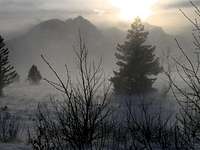
Sometimes you awaken during the darkest, most bleak winter days, and peeking through the window shows neighborhood chimney exhausts running horizontal in a strong wind, air temp around zero if you're lucky, and
Hard wind, low temps...
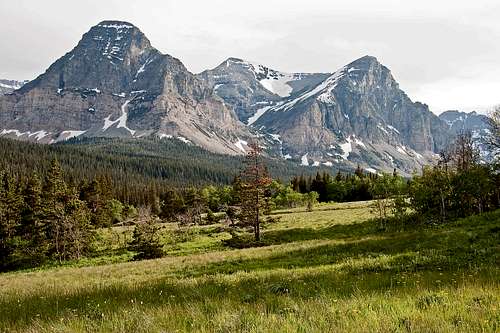
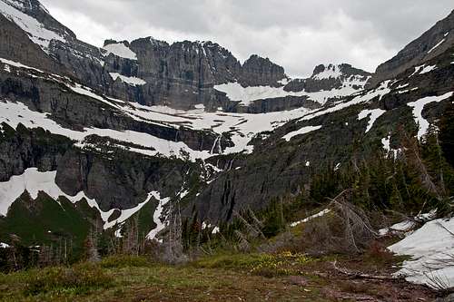
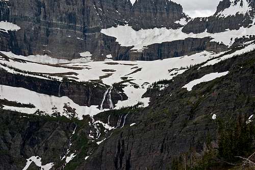
snowfall during the night doesn't compute because it has blown enough to make it difficult, if not impossible, to tell exactly how much of the stuff actually fell. Those are the times that what pulls you through is the thought of spring, and even though it is not always that grim, any winter has periods of snuggling fireplace joy when another word for the dark months is interminable. At such times the peaks seem impossibly distant, yet their calling is strong enough to penetrate even the most safe and warm haven. Winter has always played with my mind this way; occasional snowshoeing excursions are not the same as summits, so when warmer days finally arrive, it is a really substantial deal—but, and I know this is more than a bit self-centered, the issue under consideration is more than just the arrival of longer and less chill days. Hugely inconsistent from area to area, that time of year in this mountainous country where I live is a problem better stated (and this is what I really care about) as not that of getting from winter to spring, but from winter to climbing season.
Winter light...
Life has become too small here in town, and something akin to cabin fever runs endemic on the valley floors while the peaks frozen lure emanates through a sky still more often than not laden with gray and gloom, that depressing state lifting only occasionally (but tantalizingly, a bit more so than during the bleakest of the preceding winter months) to reveal the mountains beyond, such magical days showing their white beauty stark against a blue backdrop. Beautiful, and so very misleading! Nice to look
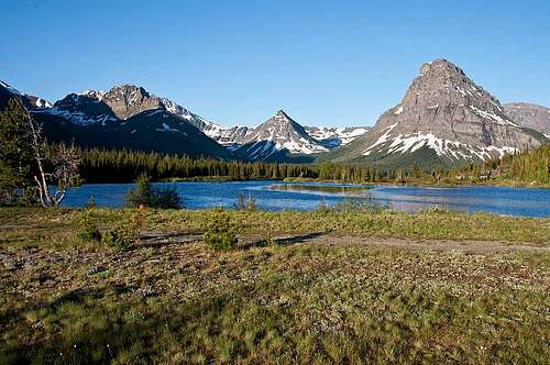
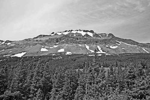
Curly Bear Mountain
at, but oh-so-deadly as winter loads accumulate, settle, shift, slide, and everything explodes in a monumental burst of powder, and the intelligently operative words (still) are keep out! Now, in this land of cabin fever the valleys have green grass, leaves on trees, piles of snow that have (finally) melted into a warmer season, rivers that are carving new furrows of worry on the faces of those living too close...and the high peaks are still closed for the duration.
My attention is on Glacier National Park, and I think it not an exaggeration to say it has been so since, oh, at least early last winter. Finally, a typically late (sigh...) spring is coming to the Northern Rockies, but it works from the bottom up, and at its own pace. I'm ready
It's all about the wind...
to go...NOW!...but don't have the final say; that determination comes from the NPS plowing crews. The reason for this has to do with an understanding that when the Sun Road opens, snow conditions will have ameliorated enough to reasonably consider exploration up and into the high country. And latest information is discouraging: "Maybe," by the Fourth of July; "Maybe then," for Logan Pass. "Maybe"—a word not having a whole lot in common with, "I'm ready to go...NOW!" Nevertheless there it is, on the GNP web site, in the papers, on the news. I'm in full-blown get-me-out-of-town mode, but the storms moving along the 49th parallel throughout the winter of 2007/2008, left too much in their wake, a cold spring compounded the situation, and now there is nothing for it but to wait. Wait, for some skilled, courageous people to move plows as best they can through weather and snow and all sorts of debris indigenous to what at times is a terrifyingly uncertain slope. People have been killed doing this work, so they don't rush; plowing begins the first Monday in April each year, and it is a long, dangerous job to opening day at the Visitor Center on top the world; the road will open as soon as possible, but not before. I'm antsy, in a hurry, but do not begrudge them their caution.
Logan Pass Closed
Oncoming Storm
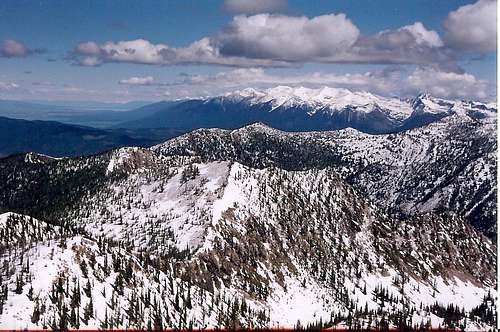
Hammered by wind
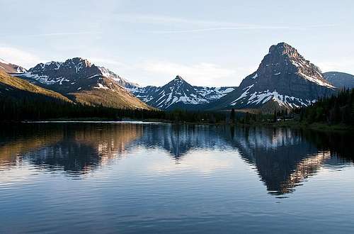
Logan Pass, at 6,646 feet the high point of Going-to-the-Sun Road, normally has the latest of the major pass openings in the Continental U.S., and opening day does indeed signal more than "just" the start of another tourist season in the park. It does do that, of course, but to put it simply, the pass being free and clear is a signal, the starter's gun for the climbing season. The Sun Road provides access to trails previously not available; the lower valleys and slopes have been open for a brief few weeks, but it is always a source of amazement when climbing at how rapidly those open lower slopes and trails become...not open. And how very much snow there is in this place! Mountains such as these are not much used in winter, and spring is often only an indication that some of the (lower) valleys are available for wandering, and it won't be too long until the same can be said of a few strategically-placed south-facing slopes. The fact that plows have been able to clear the road is always a sign—an omen!—that...well...even though patience is a difficult virtue, spring (and climbing season!) actually does exist, even at these climes.
A final winter reality check...
FIRST DAY TRAVEL, THOUGHTS
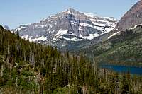
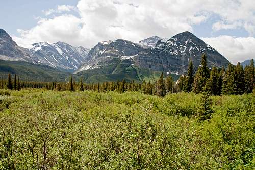
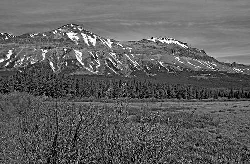
Mission Mtns - Spring arrives on the Valley Floors (Photo by Dottie Little Tent)
But it is mid-heading-for-late June, and enough is enough; I have a few days off work, and am going to the park. Even though the Sun Road is not open, and not much in the way of climbing can be done up high, I can't tolerate hanging around town, dreaming of what lies only a hundred or so miles north. No trip over Logan pass this time, but all is not lost; there are valleys and south-facing slopes, and wind-swept slopes, and trails not yet done because in the past it was a matter of always looking to climb into the high range. Now is the time to become more familiar with areas previously relegated to the back burner, so I'm heading out, and have no definite plans other than a few exploratory, non-summiting days spent in Glacier National Park. No promises, no guarantees, but it beats the alternative, which is not going. And besides, seeing those mountains full of snow against green valleys is not something easily forgotten. (Actually, I'm pretty certain "forgetting" is not part of the visual itinerary. And I'm not meaning photographic memory, either.)
It's always a thrill heading...anywhere...in this country! (Photo by Tim Sharp)
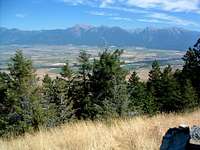
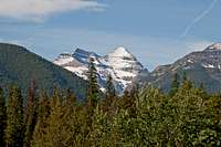
Mission Range. (Photo by Mike Hoyt)
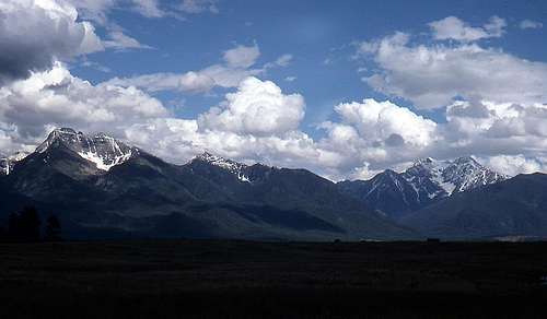
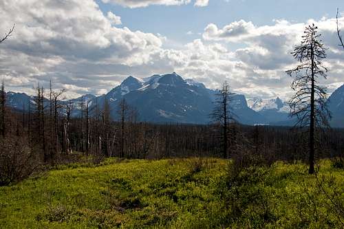
Always and always, it is a thrill heading out of Missoula, and not, like now, just when going north; this Western Montana landscape grabs hold, gets your attention! No matter the direction, one is dealing with wonderful country; no relatively desultory miles filling in the time until destination; going from place to place is a pleasure! And so it is this day. Past the Rattlesnake Wilderness to the first distant sighting of the Southern Missions from Evaro Hill, then a few more miles until climbing Ravalli Hill reveals the second view of the Mission Range, all 7,000 feet of them suddenly leaping into
Heading north, driving past McDonald Peak (Photo by NOO2)
goose-bump vision (never fails; those mountains are big!) as the crest is broached. Driving north along the great range's stunning western flank, I think about how in the first half of the Twentieth Century the Missions were seriously considered for National Park status. Most of the western half of the Missions are on the Flathead Indian Reservation, and such development would have been a financial windfall for the Salish-Kootenai Tribes, but they nixed the proposal (as they also did serious and lucrative logging offers), because they believed leaving the land untouched to be a better way of showing reverence—and also respecting future generations—in the natural way of things, than that of usage. On this day while heading north, on one side skirting both the National Bison Range, then the Ninepipe National Wildlife Refuge, and on the other, gazing at the proposed-but-not-to-be National Park, all while in search of an even larger area that was made such, well, it brings smiles to (finally) have town behind. Passing through great country to reach great country is such a treat!
On the way to GNP, you drive past the Missions. (Photo by Fred Spicker)
One thing most people don't realize is how much water this Western Montana country has; the tarns, rivers, and lakes in every nook, cranny, canyon, valley and basin cannot be avoided, must always be dealt with visually, sometimes physically, and are a constant reminder of nothing less than
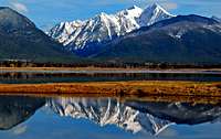
Flathead Lake and the Missions. (Photo by Flathead Native)
thousands of years of creation on the move. The long-gone Continental Ice Sheet (and what a sight it must have been!), along with its attendant glaciers, were responsible for much more, geologically speaking, than carved mountains, and coming into Polson brings the largest of the lakes into view. Flathead Lake is a beauty, and I always enjoy the drive around it, leaving heavily traveled Hwy 93 at Polson, taking the east side highway because not only does it save a few minutes, but has less traffic, sometimes practically touches the lake, and with its constant forest, shade, and views across the water, is just generally a drive to savor. It is interesting that this lake is the largest natural freshwater lake west of the Mississippi (191.5 square miles, whether or not you're interested), with another beautiful and unusually large body of water—Lake Pend Oreille (pronounced Ponderay)—being a comparatively few geographic miles further west in the Northern Idaho Panhandle, and having the resort community of Sandpoint nestled on its shores. I think about this sort of thing (and, of course, everything I've mentioned above) during my many drives to Glacier; the Northern Rockies, what are sometimes referred to as the Rocky Mountain part of the Pacific Northwest, are most definitely eye candy with depth! But always, the special thing about this particular drive—and I can feel it now, hear its very real siren call, see its outlines coalescing in my mind—is out there, coming closer as the miles of lake and mountains slip past: the best is yet to come. I am very glad to have left home, and am even on the verge of forgiving winter its deliberately long winterishness.
First view of Mount Stimson
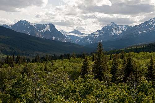
Passing through Bigfork, and the lake quickly recedes as the road enters the broad Flathead Valley. There is always a moment of bemusement at one of the road signs stating "West Glacier – 46 Miles," even though it is actually 36 miles. This sign has been there for years and I always wonder at the thinking behind not correcting the inaccuracy; to put it in the best possible light, perhaps it will be a pleasant surprise for those not familiar with the area to arrive at their destination more quickly than expected. On my right, the Missions are giving way to the northern Swan Range, and anticipation grows because I know that soon will be the first glimpses of mountains very different from—nice as they have been—what I have been driving past and through ever since leaving home. Always, at about this point in the drive, imagination takes over,
Hwy 2 gives up another view of Stimson
and the last few miles to West Glacier are an admixture of mental yearning (oh my, so blessed much to do!) and past-doings that crowd to the forefront of my mind to whirl and glow like an addiction, and oh-my-goodness I love this place!
A relatively few minutes later, the first distinctly GNP mountains have been visually dealt with, and West Glacier slides enticingly past the car window. No stopping on this day, however; the Sun Road being closed means the only method of reaching where I wish to be on the east side of the park is via about sixty miles of Hwy 2, by happy coincidence a drive through continuous forest, mountains, and river, the park on one side,
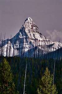
Mount St. Nicholas, from Hwy 2. (Photo by Kyledod)
mostly the Great Bear Wilderness filling space on the other. The road splits the two great areas, creating a nice problem of driving past canyons and open spaces showing unexpected and all-too-brief views of some of the finest topography around. I can't begin to count the number of times I've had to find a safe area to turn around, then backtrack so as to marvel at and photograph scenes visible only a fleeting couple seconds at highway speed. Hwy 2 is a truly wonderful drive, the road itself is very good, but be forewarned that even in the best of seasons and conditions often proves to be quite happily time consuming.
The miles pass, mental and real camera work is done, until finally all that remains is climbing to the heart of this larch-infested drive, the summit of Marias Pass. (And triggered by the tender green of spring, in a brief digression my mind slips to a different season, to what an autumn marvel are these trees, their needles turning deep burnt yellow, every bit as impressive in running through canyons and up mountains as the disparate deciduous colors of aspen or maple. In their glowing it always seems the
Winter Brownout!
needles are holding captive the last remaining warmth of summer, as though to stave off as long as possible what is to come.) At 5,213 feet elevation, Marias is the lowest pass through the Rockies between Canada and the Mexican border; it is a relatively gentle affair, broad on top, with—compared to the higher, more twisting roads to the south—not much in the way of engineering difficulty marring its building. Indeed, with the (notable) exception of the need for snow sheds and dealing with that kind of attendant weather problems, even the main line of the (then) Great Northern Railway found the actual construction to be relatively non-problematic, and that sharing the way with sixty or so miles of highway proved to be the most logical traverse through the Northern Rockies.
It is, however, the Continental Divide, and that happenstance brings together not only beauty, but interest. Today I take particular note of Summit Mountain, neither as ice-carved nor having as much sharp relief as the majority of GNP peaks, but from this Marias Pass perspective still big, still worthy as it marks the southernmost terminus of the Continental Divide Trail through the park. This past winter I began collecting visions of what a wonderful week it would be to do that trek, north to south, then continuing on another week or so through the Bob Marshall Wilderness. Whew! But for this present excursion the idea is, time allowing on the way home, to reconnoiter the trail as it crosses the pass, then skirts—all the while providing access to—Summit Mountain, with the idea being a future return trip to summit...Summit (sorry, I couldn't resist).
Summit Mountain and Marias Pass
A BRIEF DIGRESSION:
Aside from my exploration/climbing concerns, this low-lying path across the Divide has another item of interest: problematic weather. Historically, in fact, the pass wasn't discovered for many years by white explorers for the rather simple reason that it was invariably socked in with bad weather. Meriwether Lewis searched for weeks, finally gave up, and the Lewis & Clark expedition eventually crossed the Rockies further south (ironically, having to deal with more difficult terrain across the Bitterroots—the entire party came very close to perishing due to deep snow—than would have been the case had the hidden Marias Pass route been located). Living in Western Montana one becomes used to almost constant winter gray and gloom, but in addition, the one thing Marias Pass—and likewise GNP, especially east of the Divide—has, is an abundance of wind. Strong wind. Neighboring Waterton Lakes National Park is officially the windiest site in Canada, and the geological construct of the area forces weather patterns to slam against the divide, then slide south along what in Montana is known as the Rocky Mountain Front. This includes, of course, Glacier National Park, and then becomes the eastern edge of the Bob Marshall Wilderness.
Glacier's mountains are, along with those in Waterton, the windiest in which I've climbed. Calm days on Marias Pass are not common, and neither, for that matter, are they all that widespread on Logan Pass, a mere few miles north, and about 1,300 feet higher. Summer winds are, as a rule, considerably more reasonable than winter winds, which can be, in a word...awful. There is now an unmanned weather station on Logan Pass that according to rangers with whom I've spoken, during the winter cheerfully records days on end of sustained 100+ mph winds, and not to be outdone, in February of 2007 the summit of Marias Pass recorded an official 165 mph blast. One pays serious attention to the weather before entering these, or any, mountain climates in winter. There are very good reasons for doing so.
OKAY, TO CONTINUE...
Part way...
It has been a long, slow time since my last venture into Glacier, but now that is about to end, because from the Marias summit it is only 15 miles or so to the gateway community of East Glacier Park. After a most pleasant four hour drive I'm almost there, and nice as is this place, don't much loiter, but gleefully head down into a land now opening wide its arms as more and more GNP peaks come to dominate the view. Down, down, down, and then town, and heading out of town to find the Two Medicine Campground, buried in a magnificent landscape now maybe 30 minutes close after a very long winter, looming wonderfully bright in my mind's eye, and after the last few miles through a stunning anticipatory drive becomes real at my feet. Finally!
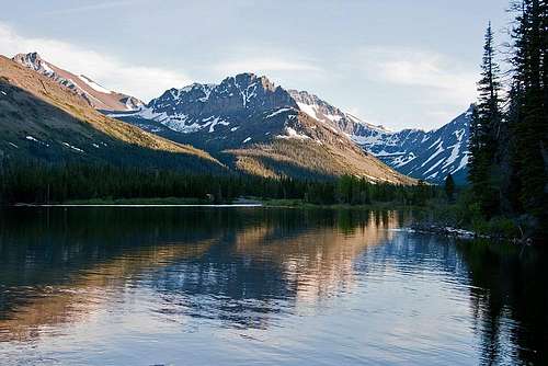
View from East Glacier Park
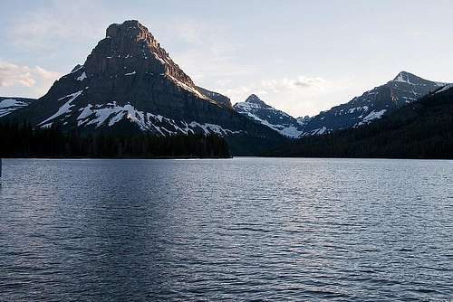
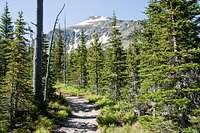
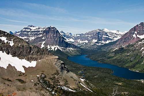
Of the park campgrounds easily accessed by road, Two Medicine is my favorite. It is not that this area is "better" than other Park areas—it is not, although neither is it less so—but I have always felt one of the really big-deal reasons to climb in GNP is THE VIEW, and with this campground location that sort of visual marvel has begun even prior to arriving, then continues with an unforgettable painting of mountains around a (very nearby) lake. There is, in addition, a surprisingly worthwhile convenience store, and a Ranger Station, the latter being a good and friendly source of information about, among other things, the four major trails in the immediate vicinity providing access to (or egress from) time spent in a mountain wonderland. One of these trails leads to Scenic Point, and is to be the first of my exploratory efforts.
A couple quiet moments around Two Medicine...
First things first, though, which is wandering the shore of Two Medicine Lake, taking in the happy coincidence of sunset and good weather (definitely not always a given in June), and in general just enjoying being where I am. (Finally!) Second things, and the following morning shows the previous evening's nice sunset has continued into an equally worthy sunrise, and what a terrific pair—sunset and sunrise, both memorable, leading the way along unknown paths! I tell you, if you're not careful, this place will get into your head, filling it with all sorts of...well, it brings goose bumps and emotion and it is good to be alive, is all. And actually, it can do those things even if you are careful. I think maybe that's the point. Anyway, I like this campground by Two Medicine Lake.
After a long winter, day's end, and I'm back in GNP.
INTERLUDE
SLIDING BETWEEN DAYS WITH LONE WALKER MOUNTAIN
And now to Scenic Point.
SECOND DAY—SCENIC POINT TRAIL
Early light on Two Medicine begins the first full day
Red Mountain Morning, and...
...first view of Appistoki
Many months have passed since that sunrise-laden morning, the worst of winter has come and gone, and still—looking at images from the outing, remembering THE VIEW as elevation gained brought more and more of the Two Medicine mountains into thrilling goose-bumply view, brought into collective focus peaks even further away and no longer in Two Medicine, and ultimately, despite that I was standing on a wind-swept bare ridge, revealed the lingering snow clogging the heart of this mountainous world—still, with all the accumulative advantage of hindsight I wonder what it was possessed me to put off this Scenic Point Trail not just for days or months, but years. What I learned that day is, this is not a trail should ever be put off.
(Starting is easy, and nothing special; the trail takes off within a couple hundred yards of the Ranger Station, there is a parking area, the trail head is well signed, and easy to locate. The first half mile or so is relatively level, then elevation gain becomes moderate (not at all what I'd call steep) and constant; the trail is quite good, and stays that way the entire distance to Scenic Point. And that's enough of the not-all-that-interesting matter-of-fact stuff.)
Rising Wolf Mountain
At this point I doubt it will surprise anyone for me to say the trail is a marvel(!), that the real surprise was my own on not having previously understood that the level of marvelness concerning any trail in GNP with a name such as "Scenic Point" would turn out to be so inordinately high. Things change quickly when climbing in these northern mountains, with a natural built-in drama never the same from place to place, and as I play it back in my mind now, on this morning it seems as though I were not on a path, but in an elevator made of glass, rising slowly, steadily, the view exploding into my brain as it expands out and out and ever out.
Rising Wolf, broadside.
It is an easy, unassuming beginning, resulting in the first visual encounter with an uplifted, carved landscape being the rather dominating east flank of Appistoki Peak, seeming only a stone's throw distant, then the marvelous ridge running from the as yet (and remaining so for quite some time) unseen Scenic Point to Mount Henry, of which both the precipitous east face and summit were hidden by the shoulder of Appistoki, which is, after all, a difficult thing to see through, and at this close proximity also difficult to see around. But the trail traverses, climbs, Two Medicine Lake—lost since the morning camera work—begins its reappearance, while Rising Wolf Mountain gives the near northwest a growing importance. Rising Wolf is the mountain whose lumpy, impressive east face has commanded attention the last few miles into Two Medicine. It is a large thing, and by any measure I know, magnificent.
Sky Walk to Henry
Mount Henry
Mount Henry, Appistoki Peak
Appistoki, Whitebark Pine...
The trail traverses, climbs, and it becomes not the familiar Rising Wolf east face in view, but now the south face, and at some point during this elevation gain vision opens enough to slip along the south face, eventually rising into the deep June snow blanketing the until-now-hidden summit. Higher than a few short minutes ago also brings Henry into sight and I marvel at the quiet beauty of the brown valley below as it contrasts against the abrupt and characterful face rising out of that smoothness, and hope I will have time to do the sky walk from Scenic Point to Henry's summit.
Mt. Helen, Whitebark Pine...
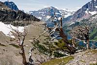
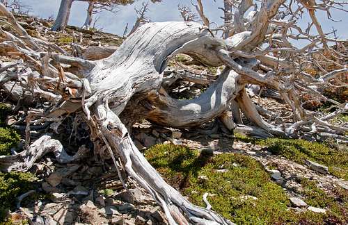
There is more to this day, however, than mountains crashing into visual perception, and I soon find myself moving through a remnant forest of blister rust-killed whitebark pine skeletons, their twisted remnants wonderfully picturesque and evocative. Sunlight illuminates these bleached sentinels of the high country, and I find the near-whiteness a most colorful addition to the landscape. I think if one lived to be a thousand, seeing this sort of thing would never become tiring—the natural way
After the Battle...
of things is so...original...always so seemingly right. Moving along, and there is someone relaxing by the trail, taking in the ever expanding view. This individual is a park ranger, and we converse for 15 or 20 minutes. I mention the possibility of climbing to the saddle between Henry and Appistoki, access of which is through the valley below; she says that would work, but there is a grizzly and cub in residence, and mama would no doubt be skeptical of trespassers. Point taken, and I'll stay with the wind-swept ridge I've been admiring all morning. She works for the Park Service each summer, has done so for years, and whenever the chance arises, makes the trek from Two Medicine to Scenic Point, then on into East Glacier Park—and her home—a total distance of about ten miles. It is a way of doing the necessary trail scouting, and besides, as she so eloquently put it, "It's a nice commute." No way can I top that!
Twisted remnants of Whitebark Pine add color to the landscape.
Mount Helen
The trail traverses, climbs, and by now it is clear that I'm dealing with one of those days that when placed in the lineup of all the mountainish days I've had, comes up as (to use a simple but heartfelt understatement) outstandingly memorable. I mean, for crying out loud all you have to do is look! Huge as they are in this small piece of the world, by timberline it
Helen, Phillips, Dawson Pass, Pinchot
is so very much more than Appistoki, Henry, and Rising Wolf. With elevation comes the ability to finally peer past Appistoki (but not over, the trail never gets high enough—quite—for that) into a defining moment, the idealization of what a mountainous country is about, the thing I had been tossing and turning over all winter. The trail traverses, climbs, now showing Sinopah and Rockwell, and Helen, Lone Walker, Pinchot, and more, and sometimes they do, but not today, today the names don't really matter. This is big country, the mountains (by whatever name) are big, the snow at the heart of things is big (and now I understand the plows creeping progress up Logan Pass), Two Medicine Lake is a jewel, and I'm oh so glad home is not even a blip on the horizon. The trail traverses, climbs, until on this day I am—at last—where I belong.
Two Medicine Vista...
Of course I spend too long admiring the surrounding countryside, the ridge running between Scenic Point and Henry is slightly more than two miles of unfamiliar (but probably not difficult) terrain, and feeling visually satiated decide there will certainly be another time to do Henry, and the best thing is to head down. In the meantime it is fun imagining what view Henry's summit, unencumbered by attempting to look through Appistoki, might provide! The jaunt back to camp is achieved relatively quickly, and arrival is early enough it is possible to take a short side trip before sunset.
Twin summits of Rising Wolf Mountain (L), Red Mountain (R)
Located immediately north of Two Medicine, the adjoining area is Cut Bank, which has a quiet campground at the end of about five miles of well-maintained gravel road. It is the least of Glacier's road-accessible camping areas, and despite that there is a good-sized creek nearby, the only one not having a lake in the immediate vicinity. What is there, though, is the trail head for entry into yet another portion of the park's interior, this via Triple Divide Pass. And...oh, I may as well say it—again...the usual GNP visual assault on one's senses. I have firm plans to return to the Cut Bank Area for a climbing excursion in about a month, so for now consider nothing in the way of exploration, but enjoy snapping pictures in the long light of evening. It is my hope that this quiet eddy in Paradise will never much succumb to the hordes, but remain silently personal, and it is with those thoughts moving into the growing darkness—and a camera full up with mountains—that I take reluctant leave of the day, and return to camp.
Cut Bank: A Nice way to end the day.
THIRD DAY—GRINNELL GLACIER TRAIL
Two Medicine Windy Morning
Painted Tepee Peak
Two Medicine Valley
It is the way of things that my slumber is not that of the world, that there is movement through the night, and with sunrise it becomes immediately apparent this day will be different. Dawn did not creep in on the quiet fingers of yesterday's light, but arrived in a rather
Henry, Appistoki, Painted Tepee...
Rising Wolf's East Face
confrontational manner on the back of a chill wind and clouds. Nothing majorly serious, but enough so as to require a jacket, then huddling through a quick breakfast before grabbing the camera and running into the deepening light to check what visual changes have been inserted into the day. Sunset, sunrise, twenty-four hours and another sunrise, and the differences wrought in Two Medicine are not subtle! It is all about light, wind, and clouds mixing with mountains and water; the presentation is a visual feast for my gluttony, and at day's beginning here's hoping I have enough common sense to stop looking, and just take the pictures.
Eagle Plume Mountain
Morning light illuminates the Cut Bank Area
So starts the second full day, and much as Two Medicine attracts, there is more to see, other areas beckon during spring's first excursion. It is nice to get in the car and out of the wind, but the problem is that I've never had success driving non-stop in Glacier (although to be honest I'm not sure that's a problem bothering me
all that much), and today is no different. Pictures of Red Mountain stop me (in the wind), so too Eagle Plume, as does (again) the enticing view while driving past the Cut Bank turnoff, then, of course Divide Mountain and the spectacular five-mile descent into St. Mary, stopping along the way to ponder the snow-choked views further inland (well, that's how I think of it), in the area around Logan Pass. Eventually though, I find myself counting down the last miles to whatever adventures this day has in mind for me in Many Glacier. Which—without giving away the story—will turn out to be quite memorable.
Kupunkamint, White Calf, and Divide Mountains. All are on the Rocky Mountain Front.
Many Glacier has one special memory that can never be relegated to a lesser stature, or erased: it is the site of my first successful GNP summits. The years-ago climb of Mount Henkel and Crowfeet Mountain (and oh the views they present!) are what started it all off; to this day I never drive into Many Glacier without fond remembrance of that initial successful foray, the consequences of which I expect to be ongoing the rest of my life. It is no different today; large memories and (equally large) mountains spar for primacy in my head, the last few miles pass quickly, and soon I pull into the parking lot serving as starting point for the Grinnell Glacier Trail.
Views driving into Many Glacier....
Overview, seen from Mount Grinnell approach
It is somewhat surprising that I've managed putting off doing this trail for so many years. (Sound familiar—like the procrastination on the Scenic Point Trail? The only explanation I can offer is that some people live and learn, the rest of us just hang out.) I've seen many wonderful photographs originating from its route, which is not at all difficult, and the glaciers are no more than a six-mile tramp through an absolutely thrilling
Grinnell Glacier Basin, from Mount Gould summit
assortment of quite large glacially carved upthrust. Also, I've been witness to very nice visual perspectives of both Grinnell and The Salamander glaciers, courtesy previous climbs of Mounts Grinnell and Gould. It will be nice to see the glacial pair at ground level, and so it is with a growing anticipation, if not outright excitement, I begin the trek through what for me is virgin territory, even though it is in a portion of the park much of which has been made familiar through many visits.
Striding out on this particular trail means covering a couple miles relatively level terrain while perambulating the western shore of Swiftcurrent Lake. This portion of the hike is part of a popular route encircling the lake, ending at the Many Glacier Hotel; it is an easy
Swiftcurrent Lake Symmetry
outing for those wishing to spend two or three hours experiencing a wilderness-type environment, then end back in the comfortably civilized arms of food, drink, and hot shower. So the initial foray was not that of solitude, but of encountering folks enjoying an uneasy step into a wild area filled with all sorts of animals, and real beauty. These first miles were indeed quite lovely; the lake, with its view of the luxurious hotel on the far shore,
Self-explanatory sign...
dwarfed beneath the overwhelming bulk of the Mount Henkel/Altyn Peak Massif, while in the direction I was headed, local favorite Allen Mountain comes more and more to the fore as an imposing presence acting the part of forceful guide into the mountaineering depths of my destination.
Allen Mountain fills the view...
It is a pleasant beginning, an easy half-hour or so warm-up, during which the distinction between wilderness and popular national park is blurred. I much prefer solitude, but those on the trail are enjoying their brief time in what for them is an alien world; they will return home with pleasant memories, and are content with not climbing the peaks, or for that matter, visiting the glaciers a mere five or six miles distant along this very good path. Two miles along the way, and the trail splits, with the option presented to either head (back) into human civilization, or expend additional effort through a wild wonderland so as to visit icy remnants from thousands of years ago. It is all there in close conjunction, civilization on the one end, a world of ice and history on the other, connected—if one so chooses—by a relatively few easy miles.
Piegan Mountain in a landscape...
At this point, of course, I head for the glaciers, but almost immediately encounter a somewhat disconcerting premonition in the form of a sign advising that snow on the trail is going to be a problem in approximately two miles. Noting, however, that the wording says, "Travel...is not recommended..." rather than a more definite admonishing of something along the lines of, "closure, travel forbidden, don't even think about it," I press on, thoroughly enjoying the unfolding wilderness vista, thinking (actually—hoping is probably a more accurate representation of my thoughts at the time) it may well be possible to make it through and over whatever snow is to be encountered as the trail climbs towards its ultimate icy destination.
Swiftcurrent Lake is quickly left behind, Allen Mountain begins giving way to views of a somewhat more distant Piegan Mountain, the incomparable east face of Mount Gould, the diminutive (well, diminutive if the comparison is to its close neighbor, Gould) Angel Wing, and the first thrilling views of the marvelous basin holding ancient bands of ice. This is country to love, to exalt over. You don't see for miles and miles, but see deeply, hugely, anciently. This is truly a profoundly epic treasure!
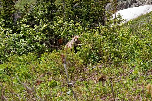
And then...it seems that more often than not, major occurrences have gentle, unsuspected beginnings that slip quietly into prominence until they are everything. A tapping at the door can be a butterfly, or a volcano—and so it was that a lady came rapidly down the trail towards me, and at her approach I could see she was a bit out of breath, and excited. Her words were simple, enough to get my full attention, "There's a bear ahead!" Further conversation revealed that the critter was around the next bend, quite close to the trail, and that there were a "few" people gathered to watch. (Of course they were. Just as in bear-caused traffic jams.) Rationalizing that safety in numbers was an advantage I moved around the bend (to join them), and...yup, there was a bear, alright. A big bear, and when the lady had said close to the trail, she
Another of those self-explanatory images
did not exaggerate. There were maybe four people (at the moment I wasn't counting, but was very glad for the company!), all of whom were aware enough to not get any closer than the trail. Bruin was maybe twenty feet away, chowing down, and seemingly ignoring the rabble. The thing about solitary bears (not the same situation as mother and cubs) is that it often seems as though they don't see you, or don't care, then you cross an invisible line, and suddenly and with no warning whatsoever you are indeed too close, they do care, and you are in a lot of trouble. Someone said something to that effect (maybe it was me, my attention was elsewhere), and to everyone's credit we all maintained the established uneasy (at least on our part) truce. Seeing bears from the car, or when they're a safe distance away on a mountainside, or on the far side of a meadow, is an enjoyable experience. When you are at ground zero, and it is being driven home how puny and vulnerable you are...it is not at all the same thing. Notevenclose!
At that moment what was a few feet in front of me was the world, and all I wanted out of this life amounted to a couple very quick photos (see, I hadn't totally lost it—and if growled or snarled at, I'd even be willing to forego those, and politely call it even), and then, as they say, "I'm outta here." Which is exactly what happened. Not the threatening
Stop! No entry...(?)
bruin-gestures, the pictures and "I'm outta here" part. With a great sense of relief at having bravely survived (as I was to put it later, when describing the scene to my friends) a vicious all-out bear attack, my day continued onward and upward to find a couple glaciers. (Actually, I'm rather proud of myself that upon fleeing—uh, I mean leaving—the bear scene, it was in the proper direction.)
The adrenalin rush didn't last long, and after a few minutes of checking around and behind (you know, just in case I was being sneakily, furtively pursued for some dastardly purpose best not verbalized in print), this land the bear considers home snapped back into mental focus, the trail continued its steady upward trend, Mount Gould became more and more (and more, and more, and...well, you had to be there; pictures don't do that sort of thing justice) dominant, I was becoming excited all over again at the prospect of what I knew to be something along the lines of stupendous beauty at trail's end, the sheer walls enclosing the glacial basin were looming ever larger, and...there was another sign in the road. And this time the sign was in the middle of the trail, suspended by a stout chain firmly attached far enough to each side that continuing on would take a quite deliberate effort.
A land sculpted by glaciers...
It is not an uncommon sight in this park to have trails closed, almost always due to bear activity in the area (once it was an over-zealous moose protecting her calf up and beyond the call of duty, and another time a closure was due to wolves in the vicinity, but usually the source of these restrictions are bears), and I have never—not even once—gone over, under, or around those chains. This time, however, I rationalized (sometimes we need all the rationalization we can come up with, makes it easier to get by) that the sign didn't actually declare the trail closed, but merely warned to keep off the "snow bridge," which was at any rate not yet visible. Ever since the bear encounter I had been walking in complete solitude, so it was an easy decision to slip (unseen) under the chain, and continue on into what would no doubt prove to be excitingly forbidden territory.
What the NPS called a "snow bridge" was really nothing more than a big drift in a run-off gully, situated such that its circumvention presented minor problems, and could well lead the inexperienced, or careless, into a fall, with the resultant possibility of injury—closing the trail was probably for the best. A lifetime of experience, however, made the drift not all that difficult to safely surmount, so I did just that and continued on the way. At this point the trail was still free of snow, but climbing steadily, resorting to switchbacks for quick elevation gain, and then—quickly—the way was no longer snow free, but in a matter of yards became buried-enough that no path was visible, and with still around a mile to go over anything but level terrain, the way constantly climbing...this was going to have to be it for the day.
The sort of thing that stays with you....
But never mind, I was close enough to see something special; the glaciers were now in full view, magnificently set off against walls of slate-gray defiance. Once a monstrous ocean of ice ripping and carving mountains into precipitous faces of grandeur, these remnants are all that remain, and are (in all honesty) not even large by Glacier National Park standards, but even after diminution over thousands and thousands of years, still clinging to life, respect has been earned. They made these incredible mountains what they are today, made them into something which it is possible to just barely wrap your arms around and embrace, something attainable, something to love. Here at trail's end, in the silence (even the wind had given way to calm) and solitude of genuine wild, I confronted a basin of glaciers. Confronted a marvel. Out of the quiet before turning back, softly spoken..."wow." Light and clouds and shadow were illuminating the ages shimmering before me, and nothing else worked. Just "wow."
Sunlight illuminates the Grinnell Glacier Basin
And that did it. Standing in awe, the high point of this second day incredibly equaling that of the day before, even matching the wonder of Two Medicine sunsets and sunrises. The plows, somewhere still chewing slowly, steadily, through a land of deep white were responsible for my being here. Winter storms and a chill spring were responsible. Lots of blame to go around as I stood trying to fill my head with something too big; failing, but the trying was sublime. I stood awhile, wishing to continue on, but there was no way. Then came the penultimate moment, and feeling (completely) satiated by it all, decided it was okay to start back.
Grinnell Glacier Basin—the Grinnell and Salamander Glaciers
Water everywhere!
Tree, Blue Flowers...(nice when enlarged)
Once on the way it was a quick and easy return, and whereas going the other way the monumental had been what attracted my attention, perhaps it was the late sun putting things differently, but these couple hours were more of an enchantment. Yes, Gould and Piegan, and (always before me) Allen were huge in the landscape, but in this brief time it was the smaller marvels I remember: the tree with blue blossoms, which upon closer inspection turned out to be from a vine entwined in an uncommon embrace. (Neat!) I remember the seemingly countless rivulets of water, flowing from melting snow far and not-so-far above. And the ever-present magical green of spring. The bear that was no longer there (which circumstance I recall as being important). Beautiful Swiftcurrent Lake, with the giant mountains as a backdrop, and even those were enchanting. I don't know how to describe the feelings coming together on that last afternoon, except to say that everything fell into place, and it all seemed so...right. The walk out wasn't long, but I wished it to have extended into forever.
A sense of scale...
That brought the second—and last—full day to an end, and as though the visions were a fever, they came to dominate my mind in such a manner that the drive to camp isn't much remembered. The random obligatory photos slowed the pace, but no matter, these days marking spring's first drive north harbored more than the usual fullness of memory, and frankly, even after a late return and dinner, settling down for the night wasn't particularly high on the list of things to do. So I sat by the tent, and awash in the feelings of a great landscape, drifted along with the fading light and did nothing. Some time later it became chilly, and I turned in.
Mount Wilbur and the B-7 Pillar end a very nice Many Glacier day.
Ending Interlude—Back to Camp
("...as though the visions were a fever, they came to dominate my mind in such a manner that the drive to camp isn't much remembered...")
Last views (this time around!) of the Saint Mary Valley and Cut Bank areas.
Red Mountain afternoon. What a terrific mountain!
"DO YOU COME HERE OFTEN?"
The original plan was to end this autobiography of a trip with an account of my search for, and then exploration of, at least a few miles of the Autumn Creek Trail (the sign/trail head is somewhat hidden off the railroad right of way, and not as easily located as is the norm for GNP) as a scouting expedition for future climbs. That final day's outing was successful enough to be etched onto this report in the guise of an afterthought afterword in livid, vivid black and white, but as I went through the photos from this trip, then began struggling with the words you've just read, the memories stormed back, and it seemed that last day added nothing (verbally) to what has been so far presented. Therefore I am going to end the written part here, and not with fresh words for the moment, but with something originally set down between two and three years ago, back when the GNP page was coming together. I've thought about those words often since then, they still ring true, and will work in this context as well as they do there. Then I'm going to (really) end this piece (but do check out the wordless Afterword) with a photograph that isn't even mine, but was taken in the northern part of the park by my friend Bob Bolton. It is the kind of wildlife photo acting as a lure, an invite to better places.
* * * * *
This is being written in early April, nine months after the accidental success that has been set down above. It is again time for the snow plows to tune themselves for the long work ahead, an effort not ending until the Visitor Center on top the world has been reached, thus opening this miracle of a land for another climbing season.
"Do you come here often?"
"Oh sure...as often as possible. Because when I'm face to face with these peaks there are no greater mountains on the planet. I mean, I know that's not true, but during the time spent on them...in their midst...no other possibility exists. To use a kind of common vernacular that gives a sense of perspective...well, they'll just about blow the top of your head off.
"Yeah, I keep coming back. It feels good as the everyday layers peel away, feels good to fill my mind with what is here. But I do admit that it gets harder to leave all the time. This place has a certain quality about it—I guess maybe you'd call it wildness—which in no way can be avoided, or ignored...not that that's the sort of thing you'd ever consider resisting. And even though that quality isn't in the least compatible with life back home, invariably causing no end of conflict and depression through drawn-out days of ordinariness, and despite that you know perfectly well those feelings will happen every time...still—you can't help but take them with you. Sometimes it is really tough leaving. You keep looking over your shoulder.
"So anyway...yes. I come here whenever possible. Always will."
And now I'm done with it.
—Vernon
Trumpeter Swans, Moose. Photo courtesy of Bob Bolton.
FOURTH DAY—AFTERWORD
SEARCHING FOR SUMMIT MOUNTAIN ON MARIAS PASS
(SILENT BLACK & WHITE MUSINGS TO TAKE HOME)
(Recommend clicking on these to enlarge as much as possible)
Left to Right: Summit Mountain (8770') —— Little Dog (8610') & Summit Mountains (8770')
Clearing, trees, mountain...
Left to Right: Little Dog (8610'), Summit (8770') —— Summit (8770'), Calf Robe (7948')
FINALLY!—AND THE END IS A METAPHOR
In Tribute
On March 1, 2011, Vernon Garner, Saintgrizzly, left us after losing a bold, inspiring fight against pancreatic cancer. Or maybe he won, for he is at last free of his pain and has "shuffle[d] off this mortal coil."
Vernon was an important contributor on SummitPost, but beyond merely making good, informative pages, he actually inspired many who read his work. No one put more work into his or her pages than Vernon did, and many of those pages, especially those related to Glacier National Park, the place he loved above all others, are works of art in both the writing and layout. More than one person has wanted to visit Glacier or go back to Glacier largely due to what he shared about that magnificent place.
Many people on SP counted Vernon among their friends, and many more saw him as one of the best, one of those who exemplified the spirit of this site. He was one of the best of us, he will be missed, and he will not be forgotten.
As a tribute to him, Vernon's pages will remain in his name.
There are so many beautiful images and phrases in here that I just couldn't condense enough to list a choice few-- my favorite, though, has to be "walls of slate gray defiance" (you should use a hyphen in there, though!).
I don't know what I'd do if I lived as close to GNP as you do; it might drive me mad waiting all those months to get there when it's just a drive away. At least here where I live, I have the "comfort" of knowing that it just isn't logistically possible to strike out for Glacier when the need seizes me, and that somehow makes the waiting more bearable.
I couldn't help but reading, but I'll hold off my given 10/10 vote until this is finished; that's out of respect for your full effort.
Thanks, Bob, for taking the time to read. The writing has most definitely been a chore--but heartfelt! And thanks, too, for "slate-gray..." (Now changed!)
Now, if I can just get all those images onto the page...!
Starting work on what I hope will be the finishing day on this TR, and decided, rather than merely assuming the writing to have been accurately copied from the original in Word, to actually read what has been transferred over to SP. It's a good thing I did, because an entire paragraph—the first in the "Third Day—Grinnell Glacier Trail" section—had been left out! I haven't a clue how that happened, but the beginning to that particular section makes MUCH more sense now!
Vernon, as usual. I'll be heading into the Bitterroots in a couple of weeks and will certainly let you know where and when. Like you, I'm READY to get back in the mountains!
Mike
Saintgrizzly - Apr 26, 2009 1:06 am - Hasn't voted
although I like my steak medium rare. this article is a GIANT T-Bone piece of work.
Saintgrizzly - Apr 26, 2009 1:11 am - Hasn't voted
Re: Another well done piece..
Thanks, Blake, for the comments. I've changed the font to "bold" on the section in question. How is that on your monitor?
Also, I'm not a hundred percent sure on the peak ID's listing Divide, White Calf, and Kupunkamint. Do I have it right? And in the photo taken from Hwy 2 ("winter brownout"), do you know the other peaks in the picture, the ones to the left of St. Nick?
I thoroughly enjoyed this one, Vernon. At first I thought Glacier was having a drought until I read toward the end that this trip was done eight months prior. I can tell you're itching for the high country, but I'm guessing your wait is a long one, without a doubt, at least for Glacier. The Colorado mountains are buried too, for that matter. Anyway, beautifully written and an absolute joy to read! Nicely laid out, too, with great photos. Glacier looks absolutely brutally cold and savage in winter. Very well done, as usual.
Saintgrizzly - Apr 26, 2009 11:47 am - Hasn't voted
Re: Outstanding & Inspiring
Thanks for the comments, Aaron...I thought many times during the act of putting this together how much you and Ellen would have enjoyed the experience!
Parents refers to a larger category under which an object falls. For example, theAconcagua mountain page has the 'Aconcagua Group' and the 'Seven Summits' asparents and is a parent itself to many routes, photos, and Trip Reports.


Comments
Post a Comment