
|
|
Route |
|---|---|
|
|
43.18440°N / 109.653°W |
|
|
Hiking, Mountaineering, Scrambling |
|
|
Spring, Summer |
|
|
Expedition |
|
|
Overview
The Glacier Trail is the standard eastern approach for Gannett Peak, the highest point in Wyoming. From trailhead to summit, the route is a grueling 25 miles each way, making it one of the longest standard routes, if not the longest standard route, for a State Highpoint.
The western approach via Titcomb Basin and Bonney Pass is a slightly shorter route, at 20 miles from trailhead to summit. However, the Glacier Trail is the preferred route of many summiters despite its longer distance because of a much shorter summit day. On average, the western approach (Titcomb Basin/Bonney Pass) requires 12-20 hours of climbing on summit day. Conversely, on average, the eastern approach (Glacier Trail) requires only 8-12 hours of climbing on summit day. As a result of a much shorter and less technical summit day, the eastern approach via the Glacier Trail tends to have a higher chance of a successful summit attempt on average.
Another advantage of the Glacier Trail is that most of the route tends to be melted out sooner than the western approach, making possible earlier ascents during the standard climbing season. It is not uncommon for climbers to climb Gannett Peak via the Glacier Trail by mid-June, especially during low-snowpack years.
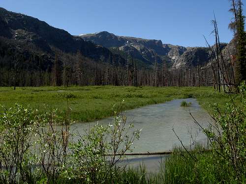
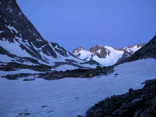 Approaching Gannett Peak Towards End Of Glacier Trail
The Glacier Trail is a very popular and easy to find/follow route. However, this is not to suggest the route is easy to walk. Multiple obstacles can make the hike to Gannett Peak a difficult trek. Loose rocks, rutted-out trail sections, mudholes, exposed tree roots, and pack-horses make this trail very rugged in many places. But the major obstacles that scare away many potential climbers on this route are stream crossings. There are a minimum of 15 stream crossings; almost all of them are minor but several are not. In particular, the Klondike Creek and Gannett Creek crossings tend to prevent the biggest challenges to users of this route.
Route Description
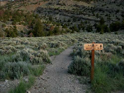 Trailhead
1) Three trails originate at the same trailhead: Glacier Trail, Bomber Basin Trail, and Whiskey Mountain Trail. Within the first 0.5 miles, the Whiskey Mountain Trail splits to the right from the Glacier Trail. Shortly thereafter, the Glacier Trail crosses a well-constructed bridge across a gorge containing Torrey Creek. After 3.0 miles, the Bomber Basin Trail splits to the right from the Glacier Trail.
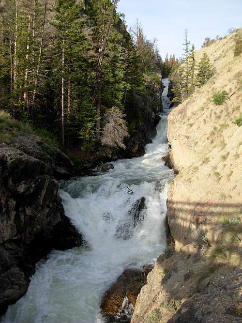 Torrey Creek
2) The Glacier Trail then steeply climbs approximately 30 switchbacks up the lower west slopes of Arrow Mountain, to approximately 10000' elevation. At this point, the Glacier Trail heads south along an open slope, then heads east across a small stream, then heads south along a western side of Arrow Mountain, before entering a large open plateau at approximately 10400' elevation.
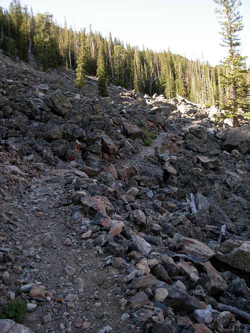 Ascending One Of Many Switchbacks
3) The trail crosses an open treeless plateau for a long distance. This stretch of the route can be a little de-moralizing, as Arrow Pass, at 10895' elevation, is the highest point of the Glacier Trail and is always in view during this time. However, due to the gentle slopes and no trees or landmarks for which to gauge distance, this stretch of the route will likely take longer than it initially appears.
NOTE: The "Old Glacier Trail", which is primarily used by outfitters, joins the Glacier Trail about 3/4 of the way across the open plateau, prior to Arrow Pass.
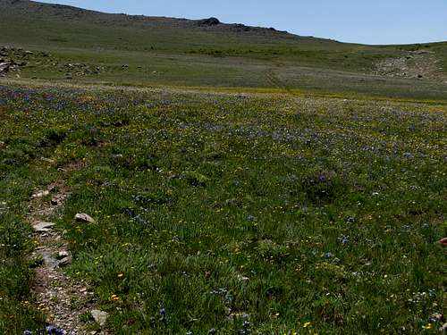 Ascending Open Plateau To Arrow Pass
4) After reaching Arrow Pass, the Glacier Trail descends through Burro Flat, another open treeless plateau, before entering a seemingly dead forest area. Phillips Lake (10160' elevation) is passed approximately two miles beyond Arrow Pass.
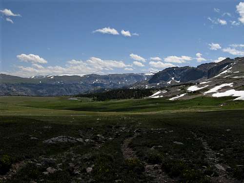 Burro Flat
5) The Glacier Trail then passes Double Lake (9960' elevation) and Star Lake (10270' elevation). Both lakes have multiple areas for which to setup backcountry campsites, and either lake would make for a full first day for most people.
 Double Lake
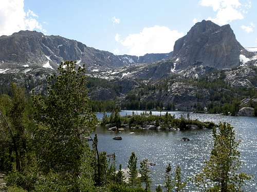
6) The Glacier Trail continues climbing until cresting at approximately 10360' elevation. After that point, the trail begins descending, and then switchbacking downward. Honeymoon Lake can be seen during portions of the switchbacks and, although it appears close, the Glacier Trail does not actually go directly along its shores.
 View Of Honeymoon Lake
7) The Glacier Trail continues descending through forests until essentially leveling-out. Downs Fork Meadows is passed, then later Big Meadows, then later the trail junction with Ink Wells Trail, and then finally the first views of Gannett Peak at approximately 18.5 miles from the trailhead.
 Downs Fork Meadows
8) The Glacier Trail then crosses Philsmith Creek, Klondike Creek, Floyd Wilson Meadows, and Gannett Creek before climbing uphill towards potential high camp locations. After 10400' elevation, the Glacier Trail basically follows Dinwoody Creek until ending at the base of the Dinwoody Glacier.
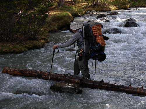 Fording Gannett Creek
9) High camps range between 10200' elevation and 10800' elevation (i.e. Tarns Camp). It is recommended to have a high camp as high in elevation as possible, preferably at Tarns Camp at the base of the Dinwoody Glacier, or else an early summit day start time and distance will be required.
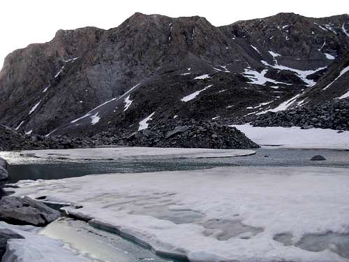 Tarn, Near Dinwoody Glacier
10) If starting a summit attempt from a high camp at Tarns Camp (10800' elevation), expect a climbing distance of three miles from Tarns Camp to the Gannett Peak summit (13804' elevation), using the standard Dinwoody Glacier/Gooseneck Glacier routes.
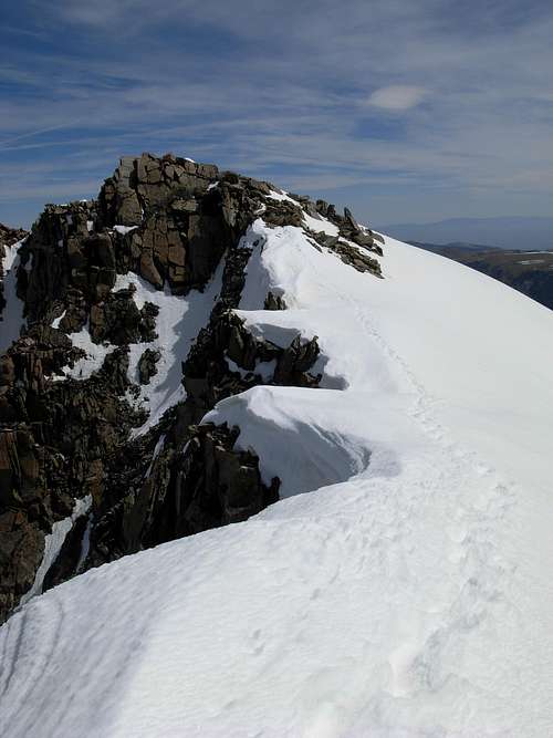 Gannett Peak Summit Ridge
Getting There
FROM DUBOIS, WY:
1) Drive approximately 4.0 miles south along Highway 26/287 to Whiskey Basin/Trail Lake Road, within a block of crossing a bridge over Jakeys Fork.
2) Turn right onto Whiskey Basin/Trail Lake Road, and then take an immediate left. This road turns into Forest Road #411.
3) Continue following the road (Forest Road #411) for 9.2 miles until its end at the Trail Lake Ranch parking area. The trailhead for Glacier Trail, Bomber Basin, and Whiskey Mountain originates at this location.
No wilderness permits or parking permits are required. However, a trail register is at the kiosk located near the trailhead.
Essential Gear
Personal Gear:
• Backpack
• Balaclava
• Bear-Proof Food Container (or store food away from campsite per Fitzpatrick Wilderness Rules & Regulations)
• Belay Device
• Bivy Sack
• Book
• Camera (if digital take extra batteries)
• Carabiners
• Crampons
• Earplugs
• First Aid Kit
• Gaiters
• Gloves and/or Mittens
• Goggles
• GPS Receiver
• Hat
• Harness
• Headlamp (with extra batteries)
• Helmet
• Ice Axe
• Insect Repellant(!!!)
• Jacket
• Knife
• Long Underwear (top & bottom)
• Matches and/or Fire starter
• Mountaineering Boots
• Pants (for wind/snow/rain conditions)
• Rope-Ascending System (i.e. Crevasse Rescue Rope-Tool)
• Sleeping Bag
• Socks
• Sunglasses (i.e. Glacier Glasses)
• Sunscreen (including Lip Protection)
• Toilet Paper
• Trekking Poles
• Warm Clothes (for Snow/Glacier Travel)
• Water Bottles
• Windbreaker Jacket
Group Gear:
• Tent (Four-season)
• Stove, cookset, and fuel
• Water filter(s)
• Glacier Rope
• Snow & Ice Protection
• GPS Receiver and First Aid Kit were already mentioned in “Personal Gear” list, but apply here as well.
Major Points Of Interest Along Glacier Trail
| EST. MILEAGE FROM TRAILHEAD | LOCATION | ESTIMATED ELEVATION |
| 0.0 | NEW GLACIER/BOMBER TRAILHEAD | 7600' |
| 8.3 | ARROW PASS | 10895' |
| 10.4 | PHILLIPS LAKE | 10160' |
| 11.1 | DOUBLE LAKE | 9960' |
| 12.4 | STAR LAKE | 10270' |
| 13.5 | VIEW OF HONEYMOON LAKE | 9800' |
| 15.5 | DOWNS FORK MEADOWS | 9300' |
| 17.0 | BIG MEADOWS | 9650' |
| 18.5 | INTERSECTION W/ INK WELLS TRAIL | 9700' |
| 19.0 | KLONDIKE CREEK CROSSING | 9750' |
| 19.5 | FLOYD WILSON MEADOWS | 9800' |
| 20.5 | GANNETT CREEK CROSSING | 10200' |
| 22.0 | TARNS CAMP | 10800' |
| 25.0 | GANNETT PEAK SUMMIT | 13804' |