
|
|
Mountain/Rock |
|---|---|
|
|
46.11556°N / 117.53991°W |
|
|
Garfield |
|
|
Hiking, Mountaineering |
|
|
Spring, Summer, Fall, Winter |
|
|
6379 ft / 1944 m |
|
|
Overview
 Diamond Peak
Diamond Peak is a mountain located in the Blue Mountains of Washington and is, arguably, the highest point in Garfield County, Washington. Several locations are considered possible candidates for the true highest point in the county, but Diamond Peak is the only named summit in that group. Diamond Peak is also the second-highest named summit on the southeastern quadrant of Washington.
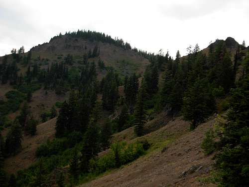
 Forested Slopes
Diamond Peak is most easily summited via the Mount Misery Trail #3113. The mountain summit is located only one mile from the eastern end of the trail. From the eastern trailhead for the Mount Misery Trail, prospective summiters need only to hike ~0.5 miles along the trail to an open saddle and then steeply ascend off-trail and scramble upper slopes to the summit, or hike a short distance further along the trail and do an easy bushwhack to the summit. A small communications post and a USGS Benchmark are each found at the summit.
 Diamond Peak Summit
NOTE: There was once a short trail named the Diamond Peak Trail, which local signs and maps still reference, originating approximately 0.25 miles northwest of the summit from along the Mount Misery Trail. Portions of the trail can be seen near the summit, but the path has long-since become abandoned and overgrown by thick groundcover/forestcover closer to the Mount Misery Trail. The old path followed the top of the northwest ridge, which would be straightforward and have less steepness (albeit longer) to do rather than summit the mountain via straightforward bushwhacking to the top.
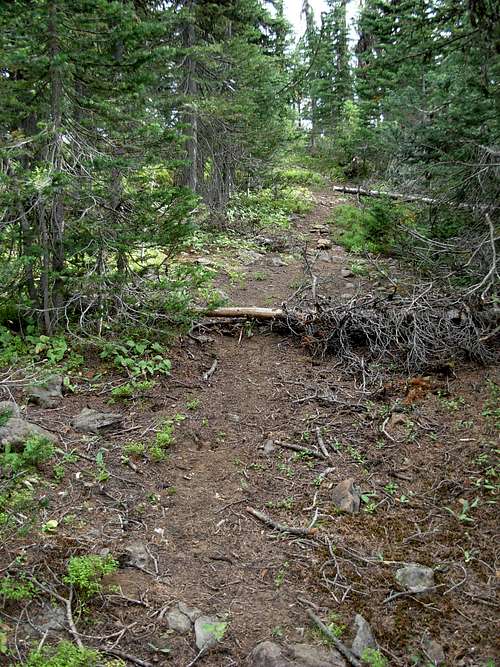 Portion Of Abandoned Diamond Peak Trail
Getting There
FROM HIGHWAY 12 IN POMEROY, WA:
1) Drive south on 15th Street.
2) After 15.0 miles, the road enters the Umatilla National Forest and becomes known as Forest Road 40 (FR-40).
3) After 15.0 miles further along FR-40, turn a hard right onto FR-4030 towards Mount Misery Trail #3113.
(NOTE: FR-40 encounters multiple roads at this intersection.)
4) Then drive 4.5 miles to the eastern trailhead for Mount Misery Trail #3113, on the leftside of FR-4030.
 Sign At Eastern Trailhead
FROM HIGHWAY 129 IN ASOTIN, WA:
1) Drive southwest on Baumeister Road. The road soon becomes known as Asotin Creek Road.
2) After 3.0 miles, turn right to continue on Asotin Creek Road. This road is soon known as Lickfork Road and later known as FR-41.
3) After 26.8 miles along Asotin Creek Road/Lickfork Road/FR-41, turn left onto FR-42.
4) After 1.0 mile along FR-42, turn left (south) onto FR-40.
5) After 7.3 miles along FR-40, turn a hard right onto FR-4030 towards Mount Misery Trail #3113.
(NOTE: FR-40 encounters multiple roads at this intersection.)
6) Then drive 4.5 miles to the eastern trailhead for Mount Misery Trail #3113, on the leftside of FR-4030.
 Mount Misery Trail
Status Of County Highpoint In Dispute
Although Diamond Peak is considered by many people to be the highest point of Garfield County, other possible county highpoint candidates do technically exist as well. This occurrence is due to multiple 6360' contours in the county in addition to Diamond Peak, so although it is unlikely those other candidates are actually higher the possibility still does exist until officially confirmed otherwise. For county highpointers, this is very important knowledge.Fortunately for county highpointers, the other Garfield County highpoint candidates are each near Diamond Peak. One possible candidate is a 6360' contour located a short distance northwest of Diamond Peak, and another possible candidate is a 6360' contour located on nearby Mount Misery. The Garfield County highpoint, regardless of which candidate is the "true" highpoint, is the 19th highest county highpoint in Washington.
For more information regarding the possible Garfield County highpoints, please visit the County Highpointers website.
Other County Highpoints Nearby
Diamond Peak and the other Garfield County highpoint candidates are located in a remote part of Washington. As such, county highpointers might be advised to complete multiple county highpoints in one trip.The Asotin County highpoint candidates (of which there are currently two) are located within six miles of Diamond Peak.
The Columbia County highpoint, Oregon Butte, is located only nine miles further than Diamond Peak along the Mount Misery Trail.
For more information regarding these and other county highpoints, please visit the County Highpointers website.
And Not Only County Highpoints...
In addition to being located near multiple county highpoint contenders, Diamond Peak is also located near several greatest prominence points of several counties (CoGPP). These include Peak 5139 a.k.a. "Prominencians Peak" (Garfield CoGPP), Saddle Butte (Asotin CoGPP), and Oregon Butte & Table Rock (Columbia CoGPP contenders).For more information regarding those and other CoGPPs, please visit the section dedicated to Washington CoGPPs on this website.
Red Tape
Currently, no Northwest Forest Pass or any other permit is required to hike Mount Misery Trail #3113 or to summit Diamond Peak.However, check with the Umatilla National Forest for current conditions, permits, etc.