
-
 11773 Hits
-
 79.04% Score
-
 10 Votes
|
|
Mountain/Rock |
|---|---|
|
|
37.98392°N / 107.58877°W |
|
|
Hinsdale & Ouray |
|
|
Hiking, Mountaineering, Scrambling |
|
|
Spring, Summer, Fall, Winter |
|
|
13260 ft / 4042 m |
|
|
Darley Mountain Overview
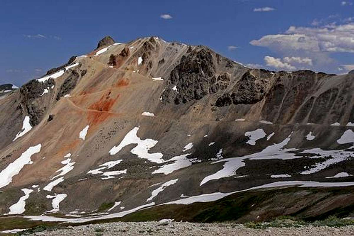 West Slopes of Darley Mountain.
Darley Mountain rises 13,260 feet above sea level and is located in the San Juan Range in Colorado. It is in between Hinsdale & Ouray counties and part of the spectacular Uncompahgre Wilderness. Its saddle is considered to be the top of Engineer Pass (12,740) leading to Lake City. This mountain was being mined for something back in the day and all that mining has clearly made an impact on it. From a distance, the mountain looks like a big, steep pile of yellow and orange sand with a few boulders by the summit. There is a large and wide mining road that zig-zags up to nearly 100 feet shy of the summit. Despite this mountain's unattractive properties, the summit provides you with an outstanding veiw of the entire San Juan Range.
In-depth Details

Elevation: 13,260
CO Peak Rank: 432
Range: San Juan
Counties: Hinsdale & Ouray
Quadrangle: Handies Peak
Coordinates: 37.9827°N, -107.5881°W
Prominence: 520'
Saddle: 12,740
Proximate Parent: Wildhorse Peak
Line Parent: Seigal Mountain
Isolation: 2.19 miles
YDS Class Rating: 2
Getting There
 Engineer Pass summit with Darley Mountain in the background
If you do not have a 4WD vehicle, but still want to hike this, I'd recommend taking Engineer Pass from Lake City.
There is only one route that has a trail to get you up this. According to a few other people there are 2 routes and one of which is on the SE slope. Here is a basic summary of the marked route.
West Slopes
From the top of Engineer Pass, go beyond a gate that is says "No Motorized Vehicles". From here, follow the wide trail up loose rock up about 2 or 3 switchbacks. Then from there, the wide trail ends and you are 100 feet shy of the summit. Scramble your way up extremely loose shale rock until you get to the summit. More detail about this route is in the routes section of the page.