Your object was successfully created.

[ Add another Image to Washington Top 100 (List) ]

Abernathy summits TOPO! map

Abernathy summits TOPO! map

Here's the TOPO! map I used to identify the Abernathy Peak pano summits. Note that 96 could be visible from North Gardner (depending on who's behind who), maybe even 98 if Rainer (126 mi) and Little Tahoma are visible. Only St Helens and Adams (163 mi) are probably out of range even on a super clear day. (1.4Mb)
larryN
on Dec 16, 2009 10:24 am
Image Type(s): Topo/Diagram
Image ID: 582856

Comments

Post a Comment
Viewing: 1-2 of 2
Tangeman

Tangeman - Dec 19, 2010 1:03 am - Hasn't voted

Gotta ask...

How and where did you get the info for this map? Did you just climb n' identify?

larryN

larryN - Dec 19, 2010 11:38 am - Hasn't voted
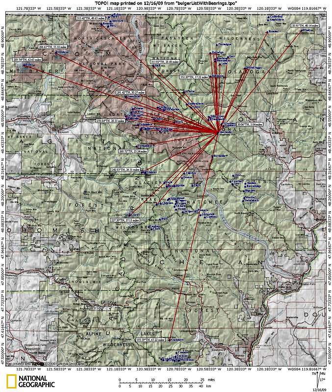
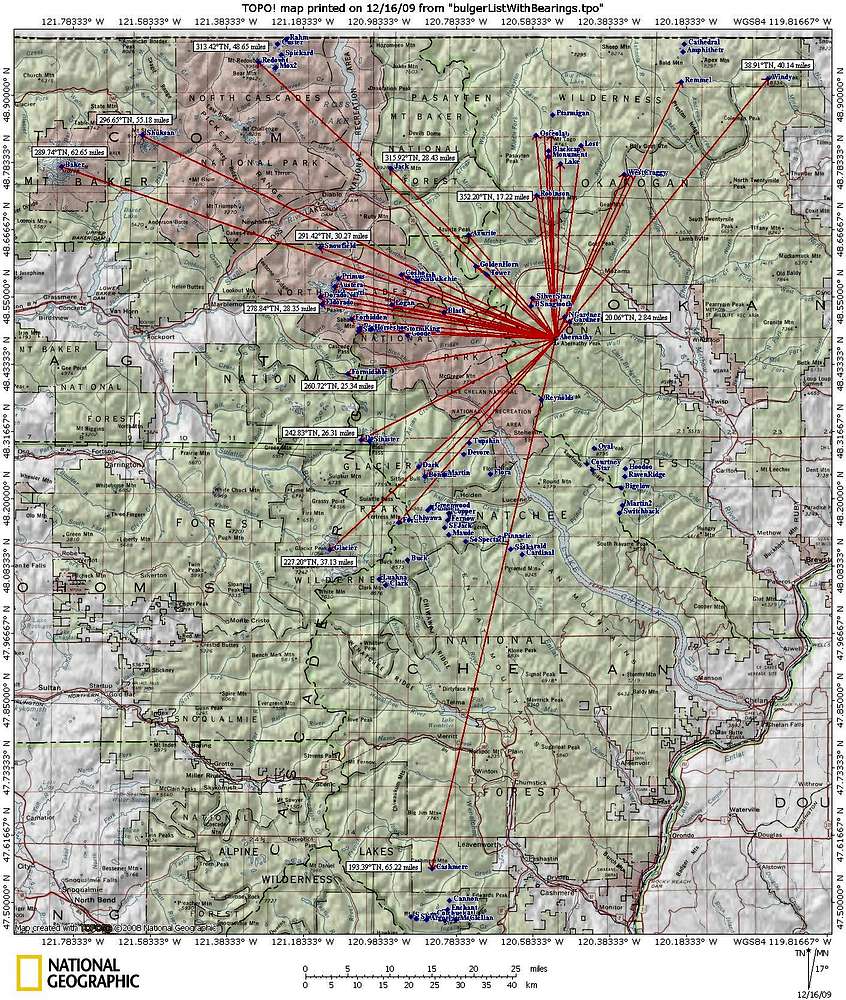
Re: Gotta ask...

I got the peaks' coordinates from the Summit post Bulger List page. That link is at the beginning of the Pano picture description. Then I pasted those coordinates into the TOPO! waypoint creation input. Creating all 100 of them probably took 20-30 min.

Viewing: 1-2 of 2