
-
 5676 Hits
-
 79.78% Score
-
 11 Votes
|
|
Mountain/Rock |
|---|---|
|
|
49.11454°N / 7.83641°E |
|
|
Hiking, Sport Climbing, Toprope |
|
|
Spring, Summer, Fall |
|
|
1178 ft / 359 m |
|
|
Overview
 Heidenpfeiler seen from its eastern base Heidenpfeiler seen from its eastern base |
Finally, after 66 climbing cliffs of the Südpfalz Area its tallest tower makes its appearance on SP: Heidenpfeiler, a pillar of 60m height measuring from its base to the structure on its summit. The pillar pops out of the eastern slopes of the Heidenberg Mountain, a typical Südpfalz hill covered in dense forest. Though named "Pfeiler", meaning pillar, in reality the cliff is rather what is termed massif in the local climbers' language, a ridge sticking out of a mountain, which drops away quickly revealing a sandstone formation.
The formation's real name is Schlüsselfels (Key Rock), a name however, which is used only locally. Among climbers it has become Heidenpfeiler, thanks to the climbing guidebook by U. Daigger und H.-J. Cron (see below), which for a long time was the only guidebook of the area. Even today it is the most widely used source of information as it lists virtually every climbable feature and thousands of Routes. Heidenpfeiler is no exception. It is climbed via the south face only, while along the north face a regular hiking trail leads to the airy summit.
 |  |  |
The tower can be divided in three sections: a lower on, consisting mainly of slabs, which are hidden beneath the forest canopy and which often are covered by moss, lichen and other greenery. This section ends at a big ledge, above which the second section follows. Still conisting of slab climbs, the tilt of the slabs almost turns to vertical right before it reaches a second ledge, which is mainly used as an escape route. The third and uppermost part consists of a finely structured summit block. Most climbs were established in the lower two sections but today the lowest section is only very rarely climbed anymore. Most climbers start from the first ledge upwards.
The first climb which is recorded in the guidebooks is Himmelsleiter (Stairway to Heaven), a route which winds up the eastern part of the south face. It was created by Hans Laub and Fred Frey, who together established more than 500 routes in the area. Together with other partners the two must have done more than a thousand first ascents! Here on Heidenpfeiler it is their only route, while Thomas Nöltner, Erich Schunk and Dieter Klan did most of the work here.
Climbing Routes on Heidenpfeiler and Heidenturm
 On the first ledge with the upper slabs and the summit structure above
The following table has a link to the tour database of the PK, where you can find the grades for the free routes plus additional information. Here is the link to the complete route database.
The size of this table stands in stark contrast to the importance of the tower. The number of documented routes speaks a different language. There are 84 routes, which are described in the climbing guidebook and no doubt many more, especially variations have been established without the knowledge of the authors.
It is strange that the tallest tower of the Südpfalz Area does not feature in the early climbing history of the area. Where other, smaller features were climbed in the early 1920s the first route on Heidenpfeiler was established only in 1960. It was Himmelsleiter (Stairway to Heaven), developed by the team of Hans Laub and Fred Frey, who created hundreds of routes together and in other teams. Today, the route has become the classic route on the pillar. Other recommendable routes include Topspin (7+/8, R. Mühe, E. Schunk, 1980) and Gorilladach (8+, D. Klan and others, 1982), a notorious roof climb. Most routes were created during the 1980s.
| Feature | Routes link | Summary |
| Heidenpfeiler | Heidenpfeiler | 13 routes with variations ranging from 6+ - 9- |
| Heidenturm | Heidenturm | 4 routes with variations ranging from 3 - 4 |
Getting There
 |  |
A good trailhead for the Heidenpfeiler is Weißensteiner Hof, a local farmstead to the north of the tower. There is ample parking space around the farm. A bit to the west there is another parking lot near PWV-Hütte Drachenfels, a kind of rustic restaurant / picnic area close to Drachenfels Castle. The access distance is some 500m longer. From the farm hike southwards for 200m until you reach the small Heidenturm, where the hiking path heads off and up towards the base of Heidenpfeiler.
From Frankfurt
There are two possible routes which both take equally long- Via Ludwigshafen
- From Frankfurt take motorway A5 southward to Darmstadt.
- There change to A67 south.
- At Viernheimer Dreieck turn onto A6 west. Leav
- e it at Frankenthaler Kreuz for A61 south.
- At Mutterstädter Kreuz take A65 south until you reach Landau.
- At Landau turn on B10 west.
- At Hinterweidental turn onto B427 south which will take you through Dahn to Busenberg
- Via Kaiserslautern
- From Frankfurt take motorway A3 west
- At Mönchhofdreieck turn onto A67 south
- At Rüsselsheimer Dreieck take A60 west
- At Kreuz Mainz Süd take A63 south
- At Kreuz Kaiserslautern turn onto A6 west
- At Kreuz Landstuhl turn onto A62 south
- At Pirmasens turn onto B10 east
- At Hinterweidental take B427 south to Busenberg
From Stuttgart
- Take motorway A8 to Karlsruhe
- At Karlsruher Dreieck turn north onto A5
- Tke the next exit to head for A65
- At Kandel you can leave onto B427 which will lead you directly to Busenberg.
Red Tape
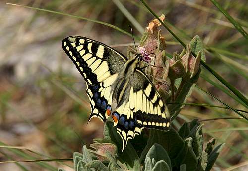 Papillo Machaon
The sandstone of Südpfalz forms lots of caves and overhangs. Though this makes it most interesting for climbers, two species of birds of prey compete for this habitat: the peregrine falcons and the eagle owls. Both are endangered and wherever there is a eagle owl pair found nesting in the sandstone the crag will immediately be closed. Generally this closure lasts from the beginning of each year through Aug. 1st. If breeding is not successful the closures will be canceled even before that date. For a list of closures see the Closure List of PK.
The use of magnesia is not allowed in the whole Südpfalz region. This is rather a directive or an arrangement than an outright law. Thus you probably will get away with using it but do so only when absolutely necessary. Magnesia closes the pores which you find in the sandstone and together they form a smooth surface which will get very slippery in wet conditions. The rule of thumb is to use magnesia in the highest difficulty sections and only extremely sparingly.
A list of guidelines can be found here (in German).
Accommodation
In Busenberg you can find pensions, apartments and restaurants. Have a look at the official site for more info. There is a campground at Neudahner Weiher, north of Dahn, a second one west of Dahn. Both are about 10 km to the north-west of Busenberg. A third campground can be found at Bruchweiler-Bärenbach, about 7km to the south-west.Weather Conditions
Maps & Books
Maps
As for maps there is a good overview map (1:50000) by Kompass Verlag but the best ones are the official topographic maps by the state government of Rheinland Pfalz, scaled 1:50000, 1:25000 and 1:5000. All official maps can be found on the web page of Landesvermessungsamt Rheinland Pfalz
1:50000
- Naturpark Pfälzer Wald
Kompass Map WK766
ISBN: 3-85491-523-3
- Pirmasens Süd
LVA RLP Map L6910
ISBN: 3-89637-193-2
1:25000
- Dahn
LVA RLP Map 6812
ISBN: 3-89637-147-9
Books
There are a number of climbing guidebooks on the region of Südpfalz. The best ones, however, have been published privately and are sold only in selected bookshops of the region.
- Hiking
- Pfälzerwald
B. & J.-Th. Titz
Rother Verlag
ISBN: 3-7633-4268-0 - Klettern im Buntsandstein
U. Daigger, H.-J. Cron
Westpfälzische Verlagsdruckerei St. Ingbert
ISBN: 3-00-0155457-4
- Pfalz - Klettern im Buntsandstein des Pfälzer Felsenlands
J. Richter, S. Tittel
Panico Alpinverlag
ISBN: 978-3-936740-41-7
- Pfalz ++, Klettern im Buntsandstein
R. Burkard, P. Weinrich
Published privately
- Klettern im Naturpark Pfälzerwald
Naturfreunde Lambrecht
Published privately - Pfalz & Nordvogesen en bloc
A. Wenner, Y. Corby, I. Bald
Panico Verlag
ISBN: 3-936740-19-4
  Climbing Guidebook |
Climbing