
-
 4566 Hits
-
 80.49% Score
-
 12 Votes
|
|
Mountain/Rock |
|---|---|
|
|
28.69818°N / 17.83987°W |
|
|
Hiking |
|
|
Spring, Summer, Fall, Winter |
|
|
6709 ft / 2045 m |
|
|
Overview
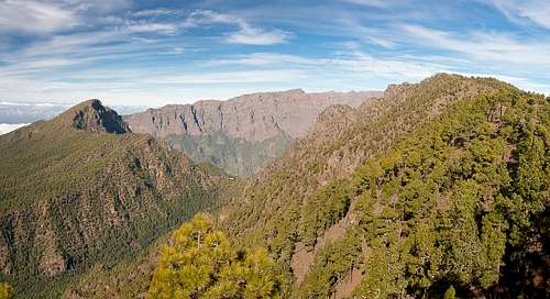 Pico Bejenado and Pico Corralejo seen from Pico Ovejas Pico Bejenado and Pico Corralejo seen from Pico Ovejas |
Cumbre Nueva is the second highest of the three mountain ranges on La Palma among the Islas Canarias. Still it does not attract as much attention as the giant erosion crater of the Caldera de Taburiente in its immediate north or the still active volcanic range of the Cumbre Vieja in its south. While its southern half - between Refugio del Pilar and Reventon Pass stays at levels little more than 1400m, the northern part steadily rises to culminate in Pico Ovejas (1854m) and Pico Corralejo (2045m). From there a small and narrow gap sepratates it from Punta de los Roques, the first summit of Caldera de Taburiente. Geologically the Cumbre Nueva Range is the remainder of a giant rift volcano, which piled up too quickly so that it became unstable and collapsed into the sea about 560.000 years ago.
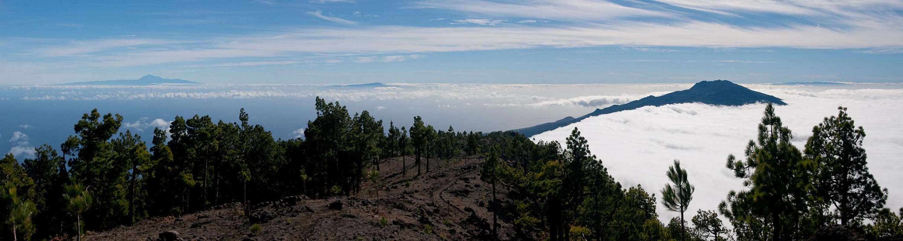
Pico Corralejo itself basically stands directly above the Cumbrecita Sadddle, a giant gap in Caldera de Taburiente, which separates Pico Bejenado from the rest of the crater. Thanks to this location Pico Corralejo is a wonderful lookout summit. Pico Bejenado and Punta de los Roques up close, La Palma's highest summits on the rim of the caldera in the mid distance and Cumbre Vieja further away in the south. Moreover,, on a clear day you can see three of the Canary islands from its summit: Tenerife, La Gomera and El Hierro.
 Tenerife Tenerife | 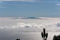 La Gomera La Gomera | 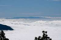 El Hierro El Hierro |
The normal route to our mountains follows the southern route to Punta de los Roques. It starts at some 800m at Ermita Virgen del Pino and follows an old Camino Real to Reventon Pass. From there it follows the steadily rising ridgeline of the Cumbre Nueva with wonderful lookouts along the way. Before it reaches Pico Corralejo the trail passes by Pico Ovejas, which also can be climbed by a short detour. The route is easy, yet still demanding due to the 1200m rise of elevation. A longer, but less demanding route starts at Refugio del Pilar. It starts at 1420m so that only 600m of elevation have to be gained.
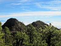 |  | 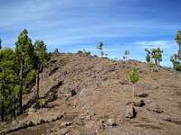 |
On its eastern side Pico Corralejo's summit is barely distinguishable from the remainder of the Cumbre Nueva Ridge. However, from its north and west gig basalt blocks bar the way. The route to Punta de los Roques also passes by the very summit, descending along its south and west sides to the saddle, which separates it from Caldera de Taburiente.
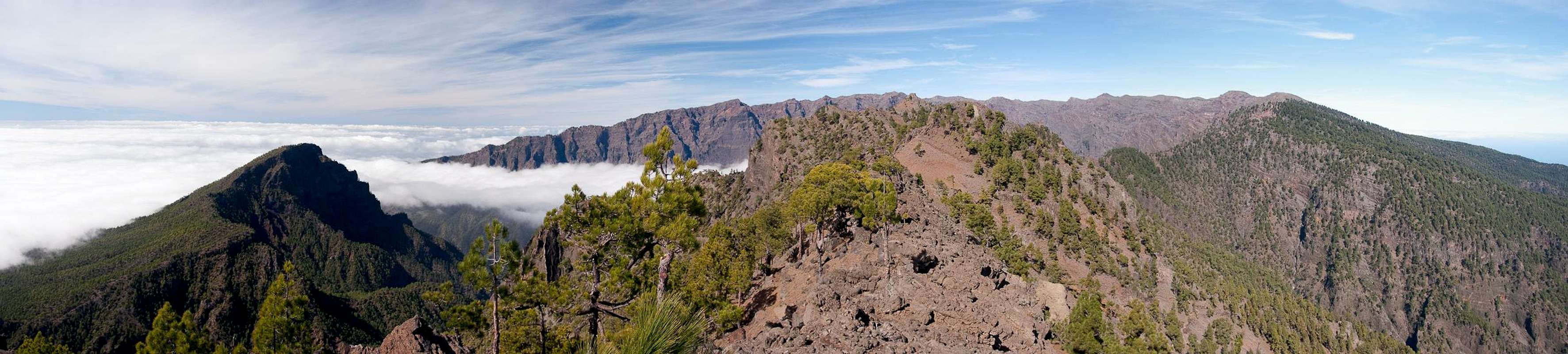
Panoramic View
  |
Getting There
 La Palma's east coast in the early morning light seen from Reventon Pass
La Palma, like all the other Canarian Islands can easily be reached from almost all major European airports. The airport is rather small and compared to Tenerife or Gran Canaria air traffic is rather low. There are almost no regular flights but all year round you'll be able to book charter flights.
To reach Ermita Virgen del Pino head out northward From the airport on LP-1, which you leave at a roundabout, heading in the direction of Los Llanos along LP-2. You cross the Cumbre Nueva through the long Cumbre tunnel and head down into the Aridane Valley. A few hundred metres after the intersection, in which the two tunnels (westward and eastward directions) meet, there is the visitor's center of the Caldera de Taburiente National Park. Turn right onto LP-202 direction Cumbrecita. After about 1km turn to the right (east). There are already signs for the Ermita which is at the end of the road.
To reach Rifugio del Pilar follow the instructions above until you leave the Cumbre Tunnel. Immediately afterwards (the two lane road combines into a single lane) turn onto LP-203 southward. Follow the road up to its (almost) highest point where you'll recognize the rifugio by the number of cars parked to the side of the road.
Red Tape
 |
The summit of Pico Corralejo is located directly on the park boundary of Parque Nacional de la Caldera de Taburiente. Within park limits straying off the trails is not allowed (and actually can be quite dangerous). Also camping is not allowed. But: to the side of Punta de los Roques there is a little hut (not maintained), the Refugio de la Punta de los Roques, which you can use for overnight accommodation. Trekkers, who do the double of Ruta de los Volcanes and Ruta de la Cresteria often use the refugio overnight.
Accommodation
Accommodation on La Palma is no problem. Every European travel office will be able to book hotels, rooms and apartments for you. I won't include any links here because all of them definitely are commercial. Another option is to rent a finca (rural house) from the owners directly. You'll have to google for these but sometimes prices are low enough for the scheme to be worthwhile.Weather Conditions
Usually all year round the Canarias have the same weather with little alterations: north-eastern trade winds which deposit fog and dew on the north-eastern slopes of the islands. The western and southern parts usually are very dry and there you'll get some hours of sunshine each day. Especially on the higher islands like La Palma you usually don't have to worry about weather too much. The mountaintops will stick out of the clouds.
There are no reliable weather forecasts for the mountain regions of La Palma. Often a cloudless day turns into a foggy one within half an hour. Especially the Cumbre Vieja Range is prone to these fogs and here orientation among the lava and scree fields gets very difficult. This is the main reason why you should never leave the trails there.
Forecasts for the coastal regions, however are available. You have to subtract 1°C for every 100m of altitude so that Roque de los Muchachos will still be near freezing when the coasts have already fine and sunny beach weather. The following table gives a little overview about the average weather data of the capital of Santa Cruz:
| Month | Jan | Feb | Mar | Apr | May | Jun | Jul | Aug | Sep | Oct | Nov | Dec |
| Avg. day temp.[°C / °F] | 21 / 70 | 21 / 70 | 22 / 72 | 22 / 72 | 22 / 72 | 24 / 75 | 25 / 77 | 26 / 79 | 26 / 79 | 26 / 79 | 24 / 75 | 22 / 72 |
| Avg. night temp.[°C / °F] | 15 / 59 | 14 / 57 | 15 / 59 | 16 / 61 | 17 / 63 | 18 / 64 | 19 / 66 | 21 / 70 | 21 / 70 | 19 / 66 | 18 / 64 | 16 / 61 |
| Water temp.[°C / °F] | 19 / 66 | 18 / 64 | 19 / 66 | 19 / 66 | 19 / 66 | 20 / 68 | 22 / 72 | 23 / 73 | 22 / 72 | 22 / 72 | 21 / 70 | 20 / 68 |
| Sunny Hours / Day | 5 | 6 | 6 | 7 | 8 | 9 | 10 | 9 | 8 | 6 | 5 | 5 |
Maps & Books
I have used a fantastic map by Freytag & Berndt which shows all of the many hiking and biking trails of the island. With its scale of 1:30000 it is still large enough to be useful for car tours as well. Moreover here you will find all the new designations and acronyms (which were changed some few years back).
- La Palma
1:30000
Edition Freytag & Berndt
ISBN: 3-7079-0346-X
The guidebook I used is every bit as good as the map with excellent tour descriptions. It is available in English as well but I am not sure about the quality of the translation.
- La Palma
A. and W. Wolfsperger
Rother Verlag
ISBN:
3-7633-4246-X (German)
3-7633-4808-5 (English)