
-
 6101 Hits
-
 83.69% Score
-
 17 Votes
|
|
Mountain/Rock |
|---|---|
|
|
47.51920°N / 10.87518°E |
|
|
Hiking, Skiing |
|
|
Spring, Summer, Fall, Winter |
|
|
7090 ft / 2161 m |
|
|
Overview
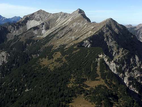
Geierköpfe as seen from Schellschlicht
Geierköpfe - vulture heads - is a rather uncommon name for a mountain. Located in the middle of Ammergau Alps, limited by the Ammerwald valley to the north and west, the Nadernach valley and Schellen valley to the south and the Neualm col to the east, the three summits of Geierköpfe - west summit, main summit and east summit - are prominent hights within the Kreuzspitze subgroup of Ammergau Alps.
Kreuzspitze, Kreuzspitzl, Schellschlicht, Kuchelbergspitz, Frieder and Friederspitz are the other prominent summits of this central subgroup, all surmounting 2000 m.
The name Geierköpfe originates maybe from vulture nests long time ago before men extirpated vultures in this region. Maybe it derives from a cave directly below the main summit which is shaped - if you let your imagination run wild a little bit - like a vulture head.

The vulture head shaped cave below main summit
Anyway Geierköpfe is an interesting hike. Most people climb the west summit, located high above beautiful Plansee lake, a fjord - like deep mountain lake southeast of Reutte. Not too many go on, following the short ridge to the main summit with its caracteristic summit cave. Only few do the whole traverse to the east summit. That involves some rock scrambling in bad rock and the problem how to get back to your ascend trailhead. In the “Main Routes” section there are some suggestions how to solve this problem.
Being a traverse monster myself I only can recommend the traverse of the whole Geierköpfe ridge, which is done best - in my opinion - from west to east. You can leave a bike at the eastern descend trailhead and bike down the descending Ammerwald road to Plansee trailhead where you started the traverse in the morning. And in summer Plansee offers a good and refreshing swim after a 6 to 7 hours day.
Getting There
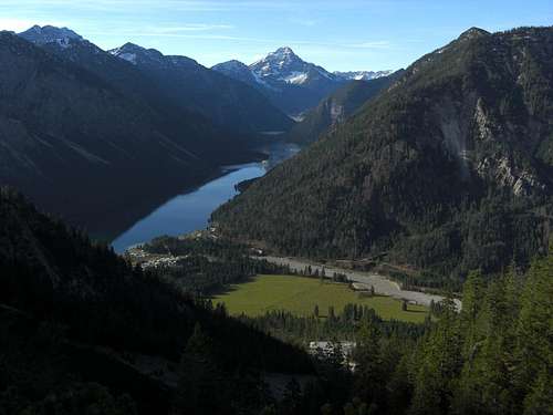
Plansee as seen from the southwestern ascent
Main trailheads are
all located in the valley between Graswang / Linderhof and Reutte.
You reach these trailheads
From Munich
The eastern trailhead is exactly at the German - Austrian border, there is a parking lot in front of the only switchback of the whole Graswang - Ammerwald road.
For the western trailhead traverse the border and go on the road L255 to “Am Plansee”. Turn left and follow the road to the campgrounds until you reach parking area number 2
.
From Reutte / Lechtal / Füssen
 West summit |
 Winter view of the northern Geierköpfe rockfaces Winter view of the northern Geierköpfe rockfaces |
 Geierköpfe as seen from Kramerspitz |
Railway and bus connections are complicated for this mountain. You can use the Außerfern railway from Garmisch-Partenkirchen to Griesen and use a bike to reach Am Plansee via Nadernachtal.
Main Routes Overview
Main hiking trails are:
 West and main summit as seen from Zwergenberg |
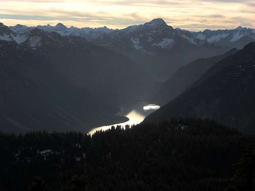
 Deep view to Plansee Deep view to Plansee |
 Plansee trailhead and Thaneller |
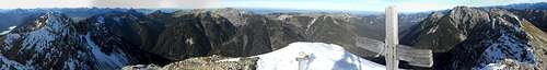 Summit panorama of Geierköpfe main summit
Geierköpfe north face with the ski route cirque
Traverse:
Ski route
A rather difficult ski route starts at Hotel Ammerwand parking area and uses the steep slopes and the huge north cirque up to point 2056 m of the Alpenvereins map, situated on the west ridge of the western summit. The last bit of that ascent is a steep chute which ends at a rock window which you have to pass through (ice axe and crampons required). The route then follows the west slopes up to the west summit. Ski down the same route. You need absolute low avalanche risk for that!
Red Tape & Accommodation
Geierköpfe south slopes
There are no special regulations as far as I know. Please note that the German parts of Ammergau Alps are a nature protection reserve with the usual restrictions like fire, camping, littering prohibited.
Geierköpfe summits are located in Austria but the eastern ascent route is partly on the German side of the borderline.
You find accomodation at:
No mountain huts are located in this region.
Gear & Mountain Condition
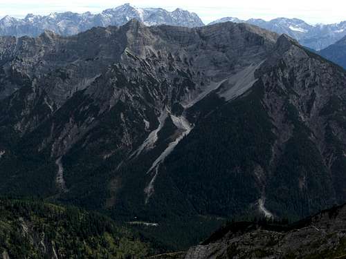
Geierköpfe main summit
Geierköpfe are a summer and autumn hike on sometimes steep and sparsely marked trails with withered red dots. The traverse from the main summit to the east summit needs some rock scrambling up to UIAA grade I in exposed terrain and bad and loose rock.
You need normal hiking gear and good shoes.
In winter and early spring, the north slopes and chutes offer a ski tour route up to the west summit. That undertaking needs full ski tour and avalanche gear.
Check the Tirol avalanche bulletin here.
Current Weather:
Maps & Guide Book
Evening view from below Geierkopf west to the west
Maps
Guide Book
Alpenvereinsführer alpin
Allgäuer Alpen und Ammergauer Alpen
Bergverlag Rother, München, 2008