
-
 28576 Hits
-
 83.69% Score
-
 17 Votes
|
|
Mountain/Rock |
|---|---|
|
|
39.47904°N / 106.59433°W |
|
|
Eagle |
|
|
Hiking, Mountaineering, Scrambling |
|
|
Summer, Fall |
|
|
13382 ft / 4079 m |
|
|
Overview
Gold Dust is a Colorado thirteener located in one of the arms of the Northern Sawatch Range. It is a peak few people climb and is a great place to look for solitude. Even some Vail residents will probably be unfamiliar with this peak yet is has a wonderful appearance and is composed generally of higher quality rock. This peak has some history involved that has to do with an Air Force pilot who is believed to have committed suicide by crashing his plane into the northern cliffs of Gold Dust. Craig David Button graduated from the New York Institute of Technology with an aerospace engineering degree in 1990 and was known as a very hard working man. On April 2 1997, Button and two other pilots started a training mission from Tucson AZ in A-10 Thunderbolt planes armed with Mk-82 bombs, ammunition and Magnesium flares. Button broke formation and flew northeast and turned the planes communication device off. Ground observers saw the plane zig-zagging and was last seen about 100 miles west of Denver. The plane crashed into Gold Dust likely after running out of fuel. The debris field was spread throughout the slopes above New York Lake and though his body was never found, many parts of the crash were recovered...however the 4 Mk-82 bombs were never found. Gold Dust isn't all that high in elevation and it's ranked the 330th highest peak in Colorado, but it's beauty and solitude make it well worth it.
For anyone interested, this was my first SP page I made back in December, 2010. Although it has since been improved and I have adopted pages that were started well before I joined the site, making this page was the beginning of my time on this website.
Getting There
The most conceivable way to climb this peak would be to take the trail towards Lake Charles from the Fulford Cave trailhead and campground (there are other ways to climb Gold Dust but they involve ridiculous amounts of technical knowledge and experience that I'll leave for someone else to describe).
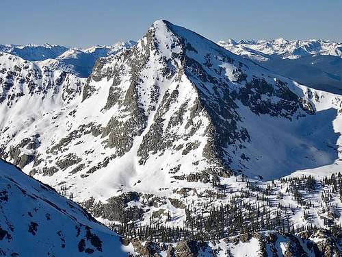
Pika (Right) and Gold Dust (Left)
To get to Fulford Caves, take exit 147 off I-70 in Eagle Colorado and follow these directions:
If coming from the east, turn left at Eby Creek Rd (off the ramp); Go right if coming from the westgo 0.3 mi
At the traffic circle, take the 1st right onto Grand Ave
go 486 ft
Turn left at Capitol St
go 0.4 mi
Slight left at Brush Creek Rd
go 0.4 mi
Take the 1st left to stay on Brush Creek Rd
go 0.6 mi
Take the 1st right onto Brush Creek Rd/Old Brush Creek Rd
go 15.3 mi
Turn left at E Brush Creek Rd
go 1.1 mi
Upon reaching the campground, take the left fork in the road to the trailhead which is only a few feet further (the right fork takes you to the campground loop).
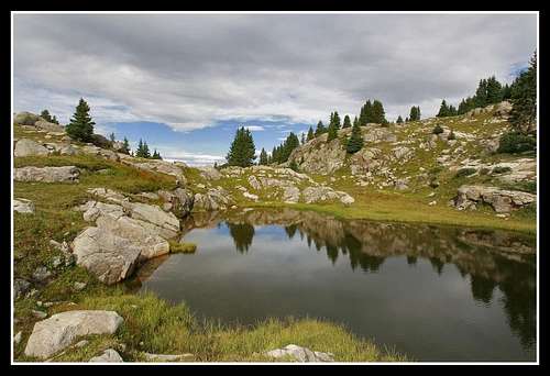
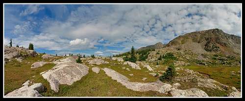
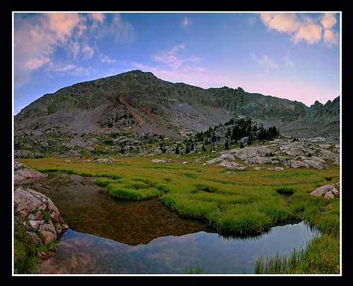
Start this early (5am is ideal but even earlier would give you more time to relax above treeline and take in the beauty), and do the trail in the dark to avoid thunderstorms. For the approach, take the popular Lake Charles trail which follows East Brush Creek to a point a half mile short of Lake Charles, a distance of about 4.2 miles. There will be a small pond before Lake Charles at 10,800 feet which will be your landmark. Turn left off the trail here and hike cross country up in a north to northeastward direction. The bushwhacking is pretty minimal if you take a good route. There is a few small cliff bands you can climb up. Gain 1000 vertical feet and enter the absolutely stunning Negro Basin. Get here right at sunrise for the most beauty and best lighting. A few small ponds in the middle of alpine tundra provide for some spectacular photos.
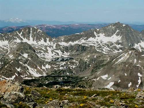
The valley sits at an elevation of about 11,700 feet. I took a long break here to let the place sink in and to take some nice photos. From here your route is pretty easy to see. Just start heading up the south slopes of the mountain. There are many areas where tundra and talus make slopes to make an easy class 2 ascent. Aim for the west (left) edge of the west ridge. Gaining the ridge was the only move that could be classified as class 3 as it's the only place that may require your hands depending on which route you choose. Once on the ridge it's a class 1 walk up the ridge to the summit. The summit area can be divided up into two (an east and west) summits. Get them both if you wish, they are only a five minute walk apart. The west summit is slightly higher. Awaiting you at the summit is panoramic views in all directions. To the north a steep 1,300 foot drop leads to the large New York Lake. North Gold Dust (Finnegan), and New York Mountain are seen. To the south Pika is seen. The traverse between Gold Dust and Pika is sitting right there but is a difficult class 4 traverse. To the east, the Mt. Jackson massif and to the west is the red Maroon formation mountains towards the Elk range.
Return your ascent route....Time required would be 6-10 hours round-trip depending on your speed, how many breaks/photos you take and how long you stay at the summit or in Negro Basin. A nice feeling we got on our return trip was that every person we spoke to on the trail was going to Lake Charles for day hikes or backpacks. We told everyone we had climbed Gold Dust and no one knew what it was. The summit register had't been signed since mid-July of 2010 and we climbed it at the end of August 2010.
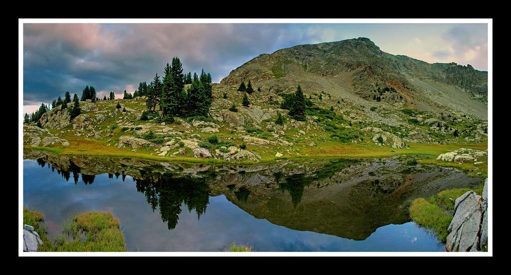
Tarns in Negro Basin
Gold Dust Peak from Negro Basin
Map
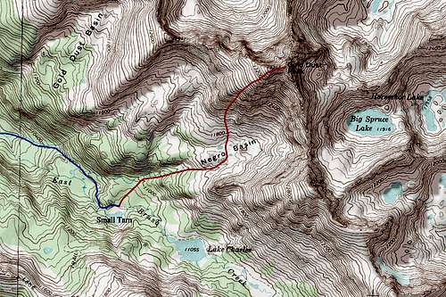
BLUE: Lake Charles Trail / RED: South Slopes Route - Class 2+
Red Tape
Fulford Caves are currently closed and the forest service is enforcing. A representative sits at the trailhead each day in the summer/fall to ensure no one goes up to the caves. Gold Dust is in the White River National Forest and the Holy Cross wilderness so no motor vehicles beyond the trailhead and dogs must be leashed.
Holy Cross Ranger District
24747 US HWY 24
P.O. Box 190
Minturn, CO, 81645
Phone: 970-827-5715
Camping
Camping is available at the Fulford Caves Campground. One could also backpack in to Lake Charles or Mystic Island Lake and climb Gold Dust the following day. Many more peaks can be climbed in this area from a base camp at Charles including Fools Peak, Pika Peak and Eagle Peak.
If you have time, the remaining hike (about 1 mile each way) from Lake Charles to Mystic Island Lake is worth it if you like lakes and photography as Eagle Peak backdrops Mystic Island Lake.
Photo Gallery
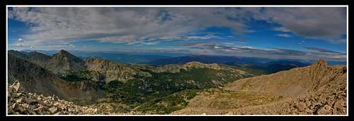 Looking west towards the Elk Mountains from the summit of Gold Dust | 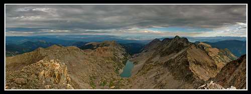 Summit view to the north showing North Gold Dust and New York Lake |
 Twilight on Gold Dust from Negro Basin | 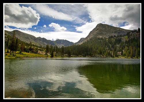 Lake Charles as a storm brews |
 Fools Peak seen from the slopes of Gold Dust Peak | 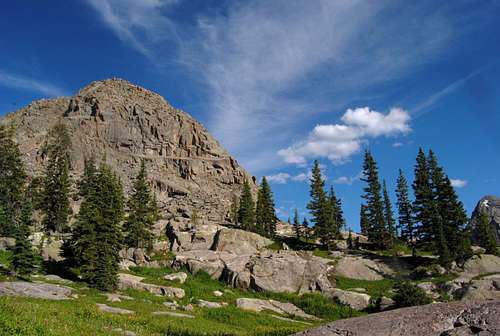 Gold Dust Peak |