Overview
Anvil Mountain is peak near
Silverton, Colorado, and it ranks as the 969th highest mountain in Colorado, and 1086th highest in the United States.
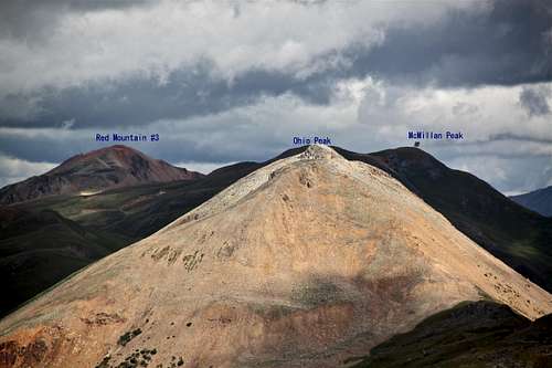
Parent Lineage: Ohio Peak
![Anvil Mountain]() Anvil Mountain and Silverton as seen from the south, Highway 550 Anvil Mountain and Silverton as seen from the south, Highway 550 |
is a very large feature which rises up to the northwest out of Silverton. It forms the backbone between Cement Creek and Highway 550 leading up to Red Mountain Pass.
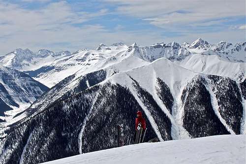
The plusses of recommending this hike are many. First, it is very close to Silverton. Second, it is not difficult and there are many places to turn around and return. The hike is very pleasant with a mixture of spruce trees, shade, openess. There is much evidence of elk and mountain sheep and little evidence of people. The mountain is also a popular back country ski destination.
![Anvil Mountain]() Approach from the northeast - Niagara Gulch Approach from the northeast - Niagara Gulch | ![up the Anvil Mountain]() Approach from the west - Highway 550 Approach from the west - Highway 550 |
Getting There
To get to the trailhead, drive north out of Silverton past the courthouse and keep straight on County Road 110. Do not take County Road 2, which goes right. Instead, continue past the park and drive up the hill. Shortly the road becomes gravel. Look for mile markers on the right and drive past the Alpine Loop sign and mile marker 3. Just past this, exactly as the road crosses the creek, look for a seldom used jeep trail going up through a field to the left. This is exactly 2.7 miles from Grand Imperial Hotel in downtown Silverton. Now for the decision - either find a place to park (accessible with 2 WD vehicles), or continue driving up the field (which is an avalanche path). This is a rocky road, and pretty steep, 4WD vehicle required. The rough dirt road gradually narrows over a mile until it becomes impassable to all vehicles. There are several spots to park along this section of the road.
Hike via Niagara Gulch
The dirt road on which you came, gradually narrows, and turns into a trail. The trail is easy to follow, and the views down into Silverton with the dominating feature of Kendall Mountain behind it. The trails has to cross a little creek coming in from the right. Cross this and carry on climbing gently to a second creek. This should be reached after less then 1 hr of hiking. From here the trail comes back left towards the main Niagara Creek and follows up to a grassy slope from where you can look up and see old mine. The trail becomes a little less discernable but heads up through the small spruce.
The simplest option from here is to bushwhack up the valley ahead of you to the saddle on the ridge. This will give you good views over the other side to Highway 550 and beyond. I found a small trail at the saddle, and followed it along the ridge all the way to the top of Anvil Mountain. The views from the summit of surrounding peaks are amazing.
Trailhead Elevation: 9770 feet at the county road
Elevation change: 2756 feet
Distance: 6 miles
Class: 2
West Approach from Highway 550
I have seen a trail over there in the summer, but my experience comes from the winter. Anvil Mountain is a popular back country ski mountain, and skiers use this approach. Park you car on Highway 550, 5 miles north from the intersection in Silverton (if coming from the south), or 16 miles south of Ouray. The parking spot is the turn off for a dirt road to Ophir Pass (not kept open during the winter). Cross the highway 550 to its eastern side, and follow a ridgeline towards the summit of Anvil Mountain. There is usually a visible trail in the winter (again this is a popular ski mountain). I have seen a trail when driving, and can imagine that even in the summer you can easily summit this way.
Cold Smoke This book describes several ski descents on Anvil Mountain.
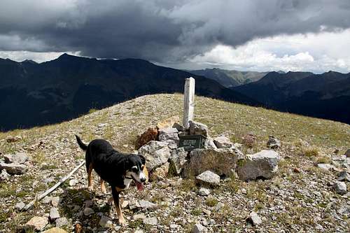
Summit of Anvil Mountain
The summit of Anvil Mountain is large (you can camp out there), and there is a nice summit cairn and summit log.
| |
![Light over Ohio Peak]() Looking North Looking North | ![Rainy Grenadiers]() Rainy Grenadiers Rainy Grenadiers |
![Sultan Mountain]() Sultan Mountain Sultan Mountain | ![U.S. Grant and South Lookout Peak]() U.S. Grant and South Lookout peak U.S. Grant and South Lookout peak |
![Looking down]() Looking down into the saddle Looking down into the saddle | ![Looking down]() Looking down towards Highway 550 Looking down towards Highway 550 |
Red Tape
There is no red tape. Parking is for free. The trailhead is not really marked, but easy to find.
Camping
You can camp right at the start of the trail at Niagara Gulch. This would be a primitive camping and it is free.
Or, this
link can show you a list of developed campgrounds and its ratings in Silverton area.
External Links

 17087 Hits
 85.87% Score
 21 Votes
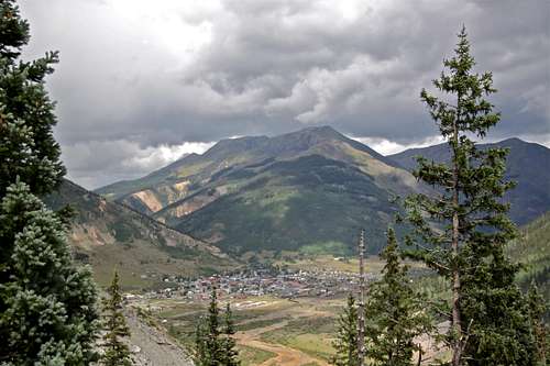 Anvil Mountain and Silverton as seen from the south, Highway 550
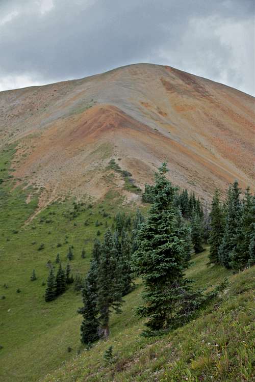 Approach from the northeast - Niagara Gulch
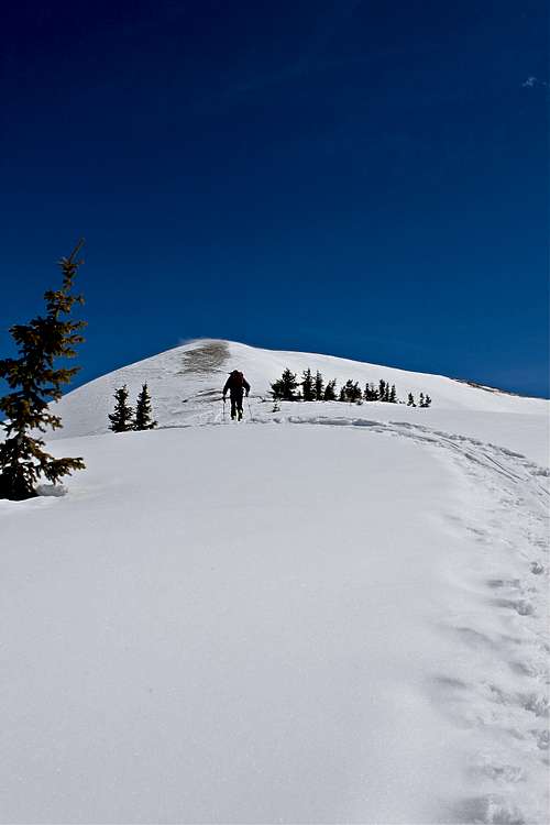 Approach from the west - Highway 550


 Looking North
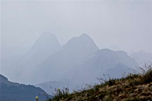 Rainy Grenadiers
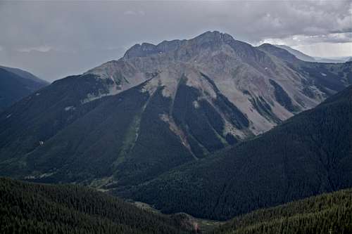 Sultan Mountain
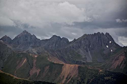 U.S. Grant and South Lookout peak
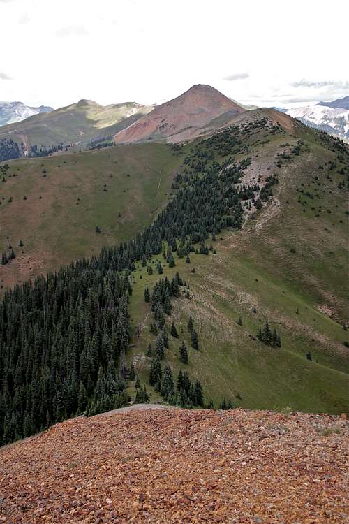 Looking down into the saddle
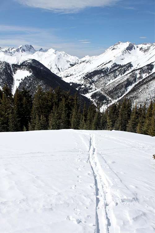 Looking down towards Highway 550