Box Elder (Wellsvilles) - November 2nd, 2011
After moving to Utah I spent about a week trying to get a feel for my new surroundings before setting out for my first hike. It was a sunny Wednesday, and with Powerball fever hitting the country I decided it would be a good excuse to travel to Idaho, a new state for me, buy a lottery ticket, and maybe climb a peak. My original plan was to climb Oxford Peak, between the towns of Malad City and Oxford, but I slept in a few extra hours and got off to a slightly later start.
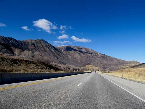
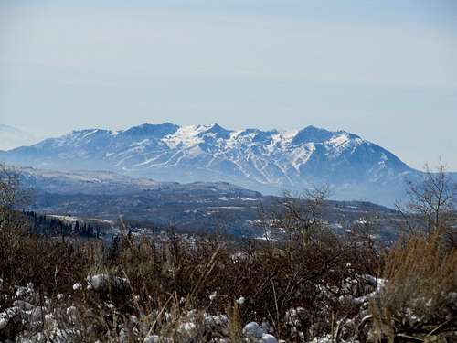
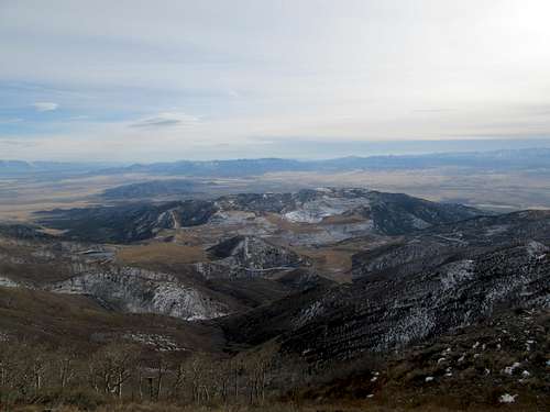
Though the days were getting shorter I wasn’t too worried, and with my mind still set on Oxford I headed north. As I drove up I-15 I started noticing less and less snow upon each new Wasatch Massif. Most of the south slopes of Ben Lomond peak were still bare, and further north I could barely see a few hints of white atop the upper reaches of the Wellsville Range. A quick peek at SP on my phone confirmed easy access to Box Elder Peak, and a run of the mill trail up. Wanting to get the hiking done earlier in the day, I called an audible and pulled off the highway the last second near Brigham City.
![Box Elder from US 89]() Box Elder from US 89 Box Elder from US 89 |
US-89 quickly leaves the desert and climbs into Sardine Canyon, a lush and beautiful valley with hints of evergreens and spectacular meadows. I made the hazardous U-Turn after the cement divider and found the trailhead with ease. The old jeep track provided easy going for the first mile or so, but the sign marking the turnoff for the Rattlesnake Canyon Trail had disappeared, leaving only a wooden post in place. There was a small trail branching off at the junction into a wooded gulch, but at the time I didn’t know whether or not it was just another game trail. I continued on the jeep track for awhile, but decided to turn back after it started a descent. Wilderness signs were apparent after about 30 yards on the trail past the junction, reassuring me that I was on route.
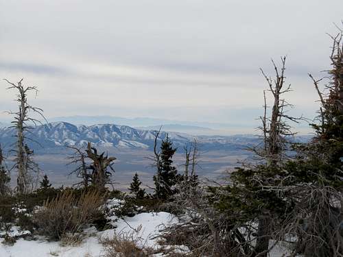
The trail climbed steeply and was occasionally hard to spot under a thick sheet of foliage. I huffed and puffed and agonized about how out of shape I was, and marveled at such a quick decline of stamina from Mt. Whitney two and a half months prior, or even Giant Mountain in the Adirondacks one and a half months beforehand. It was humbling, but I soon made it above timberline and my spirits were buoyed by the sight of the Bear River Range in the distance, across the Cache Valley and the city of Logan.
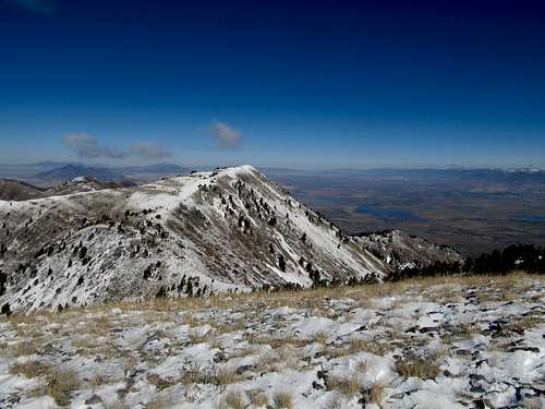
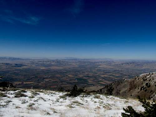
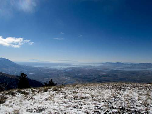
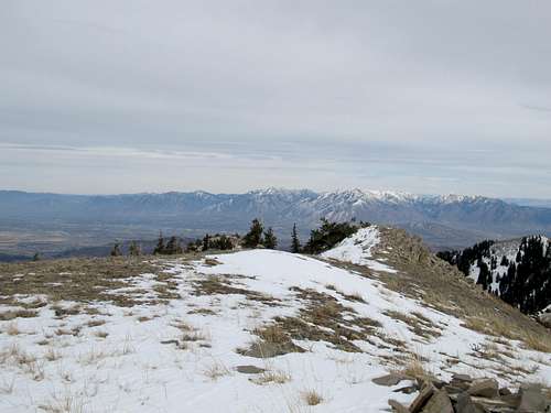
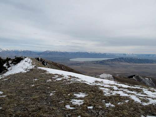
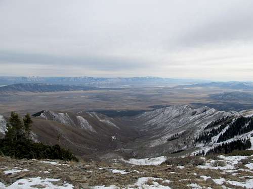
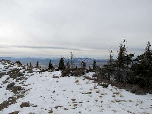
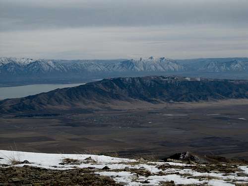
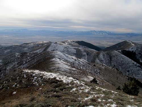
Above the trees the terrain was dry and bare, reminding me a little of the Tushars and Delano Peak about 300 miles or so to the south. There was still some snow cover when the trail traversed north facing sides of ravines, and other times the trail was slick, but overall the travel was easy. Cresting the main ridge of the Wellsvilles I was disappointed in the size of the Great Salt Lake. I had expected something bigger, I guess, and was dismayed to see only a few shallow ponds.
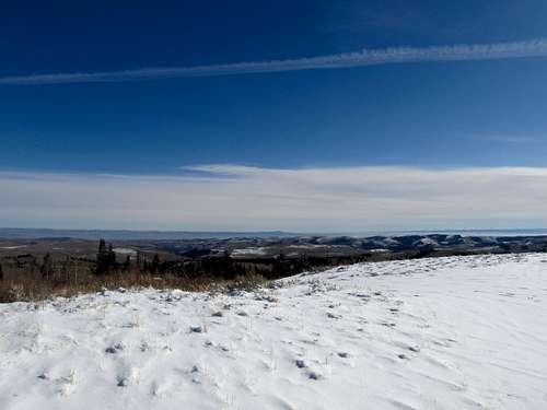
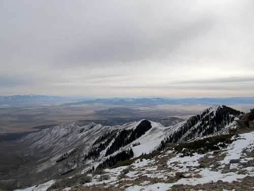
The snow was mostly constant along the ridge crest but wasn’t a problem for hiking boots. I tried to pick out Box Elder from the several vague bumps in the distance, but the results were inconclusive. To my right the slopes dropped steeply into the Cache Valley, and I wondered how corniced this ridge could be deep into the winter.
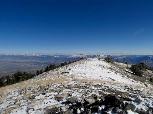
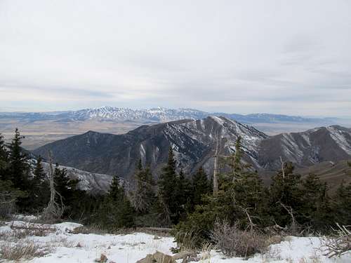
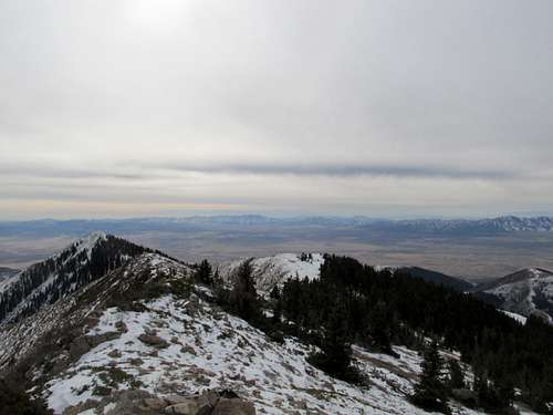
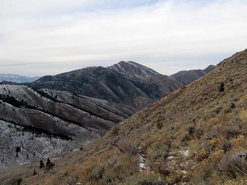
The views from the summit were spectacular, but the wind made it chilly, and I didn’t stay too long.
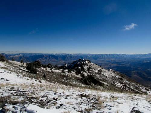
I tried to find the summit register, but the main cairn was covered with snow and I didn’t feel like digging through it.
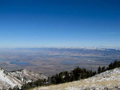
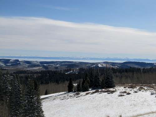
![Zoom towards Uintas]() Zoom towards Uintas Zoom towards Uintas |
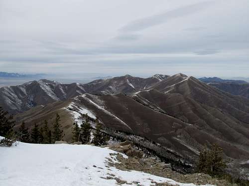
My left hamstring/knee started to bother me on the way down. I wondered if I was re-aggravating an annoying strain that had been reoccurring somewhat since May of this year. Unlike that trip however, I did not have a row of peaks lined up on consecutive days, so as long as I could make it back to my car I could give my joints plenty of rest. I made quick time through on the descent back through the snow, woods, and bare countryside.
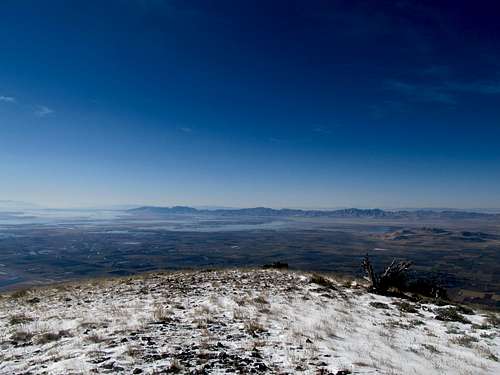
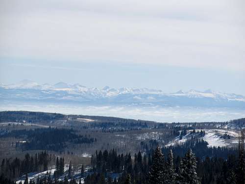
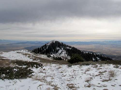
![Wellsvilles]() Box Elder & Wellsvilles Box Elder & Wellsvilles |
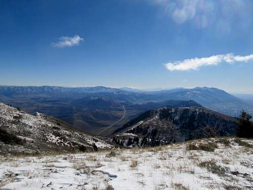
Alas, I didn’t strike it rich with my lottery ticket purchase in Preston, Idaho. I drove by Oxford Peak, my original destination, and made a mental note for further explanation, along with several other mountain ranges visible from the road. The desolation of Southern Idaho, compared even to Utah, triggered something inside me, and I called several friends from back home on my drive back down I-15.
Monte Cristo Interlude - November 9th, 2011
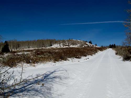
In between weekly rounds of interviews I decided I needed to get out of the city. I originally just wanted to check out Ogden Canyon, but found myself drawn towards UT-39 as it traversed the wide plateau of the Monte Cristo Range into Woodruff and Rich County. I saw a sign along the road marking a Mt. McKinnon, marked on my DeLorme Atlas, and decided to check it out.
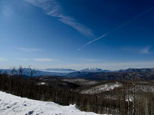
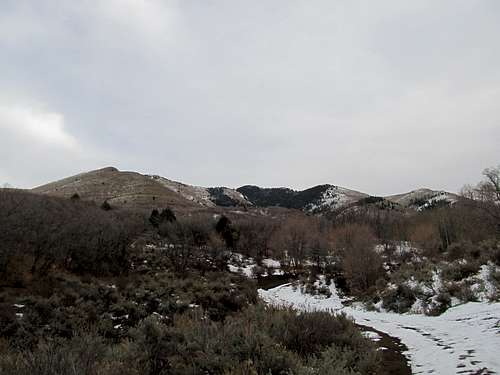
It was a quick walk up a snow covered forest road, and the views spanning the Wasatch Front to the snow covered peaks of the Uintas were outstanding for such a quick and easy outing.
Having not researched the area beforehand I had thought I was standing atop the highpoint of the Monte Cristo Range, but later Mountaingazelle’s excellent
Northern Utah Ranges Page informed me that I had missed a slightly higher point further south. Oh well. I continued on to see Bear Lake and took US-89 back through the Bear River Range and Logan Canyon. I figured access to the Tony Grove Road was kaput for the year, but found easy access right off US-89 to some of the northern peaks of the range, overlooking Bear Lake. Having marked them down for further winter exploration, I decided that my little trip was productive after all.
Flat Top Mountain - November 11th, 2011
I decided to venture up Flat Top Mountain in the Oquirrhs on a Friday before a weekend front moved in. I figured that with all the private property issues surrounding the peak, it was a good one to climb and get out of the way with. It had been a warm week, but from my vantage point in the Valley there was still snow covering the upper reaches of the range. I drove into Ophir fully expecting a snowshoe outing, but was surprised to see much of the south facing slopes almost completely bare of snow. The road continues about a mile and a half past Ophir to the passenger car trailhead, but I decided not to chance a creek crossing halfway past town, so I parked and set off, sans snowshoes, for the rest of the way.
The walk up the South Fork Road dragged on quite a bit, and I was relieved upon arriving at the 8,100’ saddle. I found the faint trail Dennis Poulin describes in his TR fairly easily, but lost it once as it traveled about a thousand feet up the first slope leading up to the west ridge of Lewiston Peak.
The trail contours to the left of a bump around 9,100’, and then continues up the slope to the main West Ridge of Lewiston Peak and the 9,600’ saddle. I missed the trail on the ascent and instead followed some game trails until I found myself on the south slopes of the ridge, rather than the ridge proper. No problem. After this realization I just scampered up through a few aspen groves and a couple of rocky sections to regain the ridge shortly before the 9,600’ saddle. It was a fun sagebrush traverse, just like the many I’ve done in Nevada and have become already accustomed to.
The last huff up the ridge was the toughest part. Snow was soft and deep immediately north of the ridge crest, though not deep enough to really posthole. The wooded northern aspect of the ridge made for a tedious ascent. I occasionally escaped the snow to scramble up some rocks along the cliffy ridge crest. Still out of shape, I was exhausted by the time I got to within a hundred feet of Lewiston’s summit. The terrain up looked really steep, and I noticed that peering through the trees I was already above the connecting saddle between Lewiston and Flat Top. I decided to forego this minor summit and instead descended about a hundred feet through sometimes steep snow.
I had been sweating on the sunny south slopes just earlier in the day, but it was freezing and very windy along the connecting ridge, as the south winds brought another storm front into the Salt Lake City area. The snow covered rocky talus were minor, annoying obstacles, but I soon found myself next to the odd wooden structure atop Flat Top’s summit.
I couldn’t see the mailbox, and Lowe Peak in the distance seemed higher. The views were great, but it was getting late in the day, and the wind was now blowing right through my gloves, chilling my fingers to the bones.
I took a few pictures and raced back down, but the ridge traverse was long, and escape from the elements not immediate.
At about the low point of the saddle I traversed back through the woods and snow to try to contour around the summit of Lewiston and its NW slopes below. Some steep sections choked with brush presented minor obstacles, but overall it was a simple, if slow and careful, descent. It was still cold, but I was sheltered from the wind, and the absolute still silence of the evergreen forest was a mesmerizing experience. I reached the W ridge crest around 9,700-9,800’ and trudged down, never really finding the trail until 9,400’ or so.
It was a long walk back down the South Fork 4WD road, and I had a lot of time to think. I was currently in the middle of a long job interviewing process. Having quit my job in the worst economy in several generations to move out west, the biggest question that had lingered on my mind was whether I was going to “make it” out here. Leaving Boston, however, had been tougher than I had imagined, and I delayed my departure by a few weeks in part to be able to spend time and say goodbye to friends and family. Now here in Utah, I often lay awake at night wondering not whether I was going to make it, but rather, whether I even
wanted to make it, or whether I could take the first signs of adversity as an excuse to return to Massachusetts. I remembered the long descent from Mt. Whitney two and a half months ago. It was a very long trudge, but made with great friends, and the memory loomed large in my mind as I trudged down the jeep track, missing the camaraderie from that hike as well as from hikes with friends in the White Mountains of New Hampshire.
My reverie was interrupted as I walked the last half mile of the Ophir Road back to my car. I had a very pleasant ten minute conversation with a woman from the Ault family that owns much of the land surrounding Flat Top Peak. She informed me that the route over Lewiston does pass over private property (Lewiston is owned by another family), but she didn’t mind me hiking there, but was overall more concerned about keeping ATV’s and 4-Wheelers on the BLM road and off her property.
I got caught up in the afternoon traffic on my way back to Sandy, watching the sun set behind the mountains I had just climbed. The storm front finally blew in that night and dumped another few inches in the area, but was not as bad as originally forecasted.


Comments
Post a Comment