Overview
![Mendota Peak]() Under Mendota Peak
Under Mendota Peak![Hiking towards Mendota Peak]() Hiking towards Mendota Peak
Hiking towards Mendota Peak 13,275 feet = 4046 meters is unranked
13er (= peak over 13,000 feet high) in northern
San Juan Mountains. It forms the south termination of
Saint Sophia Ridge.
Mount Emma forms the north end of Saint Sophia.
Saint Sophia ridge runs between
Mount Emma and ends with Mendota Peak. The whole ridge is above 13,000 feet and since there is not much elevation change between Mount Emma 13,581 feet and Mendota Peak 13,275 feet, there is no official ranking. If there would be a ranking, 13,275 feet would place Mendota Peak at about # 420 in Colorado! Colorado has the highest amount of 13ers and 14ers in the country.
The peak was named since it is a distinct peak at the end of the ridge, and views from Governer Basin and from Telluride side are impressive. Mendota Peak is a popular hike, and there is a nice trail from the Telluride side of the mountain.
I will describe the hike from the Telluride side. We used one trail to access it and another one to descend it. Both trails met below Mendota Peak in Cornet Basin. I believe that the peak is also climbable from the Governor Basin (from Ouray side), but there is probably not much of a trail, and the ridge is steeper and more loose per my opinion.
Governor Basin approach would be much shorter since you can drive into Governor Basin (it is a side drainage to Yankee Boy Basin).
Getting There
The hike starts in the town of
Telluride. Telluride is beautiful touristy town in western Colorado, it sits in a box canyon and is surrounded by beautiful peaks.
Vertical gain: 4,475 feet
Distance: 5.5 miles one way from the Oak Street (11 miles total)
Time: 4 hrs up, about 2-3 hrs down
Ease: mostly class 2, the final scramble involves class 3 moves
Trailhead: Tomboy Road from Telluride (road which goes over to the Imogene Pass).
From the old cabin at the top from
Oak Street walk about 35 to 45 minutes on
Tomboy Road (road leading to Imogene Pass) past 2 big switchbacks. Very soon, a clearing opens up to the left. The trailhead is on the left just before you would go into the aspens. This is the start of
Sheridan Crosscut Trail. It switches back sharply and goes NW up to a small rock outcropping. Take narrow path through the trees and go back to the right to cross another clearing. Walk through more aspens briefly to an intersection. Hike more steeply up to the left to avoid private property, and gain the low ridge. Try to stay on the most obvious trail, there are several faint deer/animal trails. The trail gets pretty steep at some sections, and trekking poles may be helpful here. Stay on the strongest trail ridge up through the woods to really steep fork under a big rock. To the right of the rock the route is not as steep. Stay on the ridge, ignoring most of the animal trails going to the left, until near the last evergreens on the ridge. Try to keep heading up into a high basin =
Cornet Basin with a nice view of
Little Mendota Peak and real
Mendota peak. It connects here with another trail =
Liberty Bell Trail. From here, there will be only one obvious trail circumnavigating Mendota Peak, and leading to a pass at 13,050 feet. Views are amazing!
The trail from Cornet Basin is pretty obvious, loose at some section and steep. At the top of the pass the trail turns north (left) and drops barely into
Marshall Basin, down a few hundred yards.
Mendota Trail continues to circumnavigate the peak until cairns start to point your way up. Take the trail that goes left up a very steep, semi-loose hillside to Mendota's ridge. Up there, turn left (west) at the wooden markers to walk briefly over to the summit. The orange markings on the wood is sign for helicopter landing (helitrax operates their backcountry skiing here).
Descent: initially the same way, take Mendota Trail over the pass into the Cornett Basin, then continue on the more visible trail = Liberty Bell Trail, which is much bigger and easier to follow compared to Sheridan Crosscut trail. Liberty Bell Trail eventually connects with Jud Wiebe trail and will bring you down to Tomboy Road.
Hike in images
![Sheridan Crosscut trail]() Sheridan Crosscut trail Sheridan Crosscut trail | ![Rock outcroppings]() Along Sheridan Crosscut Along Sheridan Crosscut | ![View from Sheridan Crosscut Trail]() View over the ski area View over the ski area | ![Little Mendota]() View of Little Mendota View of Little Mendota | ![Cornet Basin]() Cornet Basin Cornet Basin |
![13,000 feet]() Nearing 13,000 feet Nearing 13,000 feet | ![Steeper trail below the pass]() Steeper trail Steeper trail | ![Pass between Mendota and little Mendota]() Pass under Mendota Pass under Mendota | ![Into Marshall Basin]() Into Marshall Basin Into Marshall Basin | ![Long circumnavigation]() Mendota Trail Mendota Trail |
![Final Scramble]() Final Scramble Final Scramble | ![Scramble to the top]() My son scrambling up My son scrambling up | ![Catching up with breathing]() On Mendota's Ridge On Mendota's Ridge | ![Final push to the summit]() Final Push Final Push | ![Descent from Mendota Peak]() Descent Descent |
Summit views
Mendota Peak provides amazing views from its summit. Enjoy!
![Mount Sneffels]() Mount Sneffels from Mendota Peak Mount Sneffels from Mendota Peak | ![Increadible Yankee Boy Trio]() Yankee Boy Trio: Teakettle, Cofeepot, Potosi Yankee Boy Trio: Teakettle, Cofeepot, Potosi |
![Happy Summiters]() Happy sum miters Happy sum miters | ![View into Telluride]() Looking down into Telluride Looking down into Telluride |
![Wetterhorn and Uncompaghre]() Wetterhorn and Uncompaghre - 14ers Wetterhorn and Uncompaghre - 14ers | ![View towards Imogene Pass]() Looking over Imogene Pass into Grenadiers Looking over Imogene Pass into Grenadiers | |
![St. Sophia ridge and Mount Emma]() Saint Sophia ridge and Mount Emma Saint Sophia ridge and Mount Emma | ![View towards T5]() View towards T5 (far right peak) View towards T5 (far right peak) |
Red Tape
There are no fees to hike this peak.
Parking can be a problem if you decide to start to drive up Tomboy Road. You can probably cut about 1 mile each way, but this road is narrow and there is not parking along. So, park in town, and continue on foot.
Tomboy Road will be closed 2nd weekend in September for
Imogene Pass Run.
External Links
Weather
 Click for weather forecast

 15564 Hits
 89.01% Score
 28 Votes
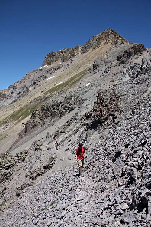 Under Mendota Peak
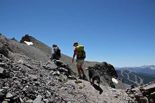 Hiking towards Mendota Peak
 Sheridan Crosscut trail
 Along Sheridan Crosscut
 View over the ski area
 View of Little Mendota
 Cornet Basin
 Nearing 13,000 feet
 Steeper trail
 Pass under Mendota
 Into Marshall Basin
 Mendota Trail
 Final Scramble
 My son scrambling up
 On Mendota's Ridge
 Final Push
 Descent
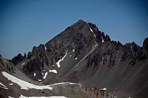 Mount Sneffels from Mendota Peak
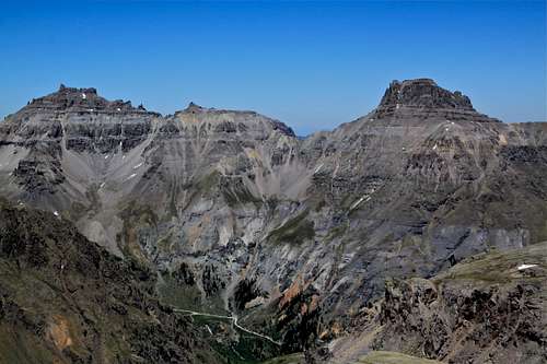 Yankee Boy Trio: Teakettle, Cofeepot, Potosi
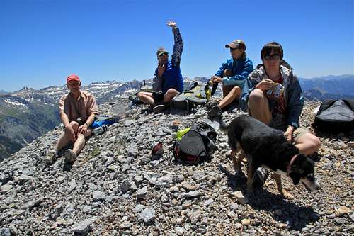 Happy sum miters
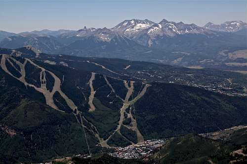 Looking down into Telluride
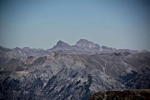 Wetterhorn and Uncompaghre - 14ers
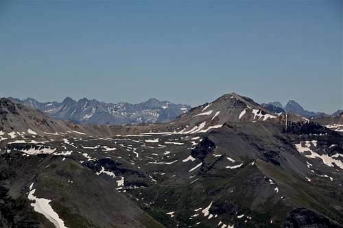 Looking over Imogene Pass into Grenadiers
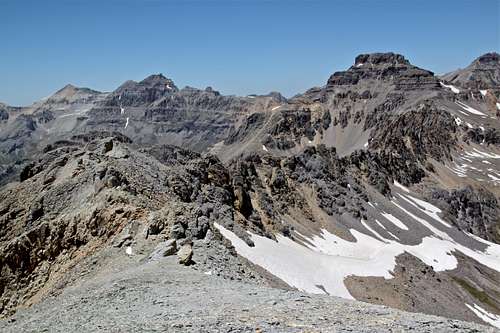 Saint Sophia ridge and Mount Emma
 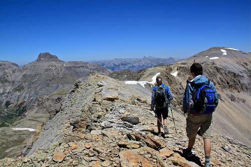 View towards T5 (far right peak)