
-
 25706 Hits
-
 86.85% Score
-
 23 Votes
|
|
Mountain/Rock |
|---|---|
|
|
44.90425°N / 111.85563°W |
|
|
Hiking |
|
|
10542 ft / 3213 m |
|
|
Overview
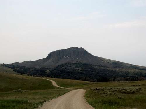
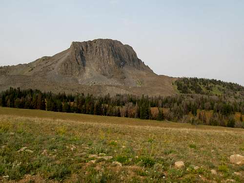
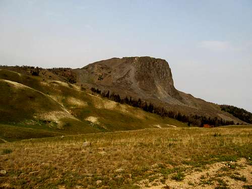
Black Butte has a lot going for it. At 10,542, it is the highest peak of the Gravelly Mountains, a lofty if not too intimidating range sitting west of the Madison Valley, and across from the mighty Madison Range, Montana’s second highest. Further west is the Ruby River Valley and the Snowcrest Range, a group of mountains and summits as compact as the Gravellys are spread out. And while most of the Gravelly Range is composed of gentle broad, prairied ridges and wooded canyons, Black Butte juts out abruptly, rudely even, from this landscape to proudly assert itself as the monarch of the range. To put it plainly, Black Butte is just a ridiculously good looking peak.
|
|
|---|
Pat Caffrey’s out of print book from 1985, Climber’s Guide to Montana, singles out Black Butte from among its mostly short, often one-lined descriptions and ticklists of Montana peaks, to highlight this little peak’s unique history and background:
…a black mass of volcanic rock. The bones of prehistoric animals have been found on it. Indian legend says that somewhere within this mountain is an underground stream of clear water, with a pebbly bed half gravel and half gold nuggets. The stream flows in a cavern which once served as a pathway to a geyser vent…the Indians carried away hundreds of pounds of nuggets each year to make into ornaments. Two chiefs quarreled over entrance rights to the sacred cavern. A great war ensued, and the stream ran red. Clouds darkened the land for three days, earthquakes ripped through the region, and all the geysers dried up. When the sun came back out, the mountain’s shape had changed from that of a crouching mountain lion into a giant armed with a club crouching over the treasure. Then the Great Spirit broke through the mountain saying, “whosoever tries to break into the sealed sacred treasure house shall perish without mercy or delay.” Thus some centuries before Columbus made his voyage, this story was firmly entrenched in the lore of the western Indians.
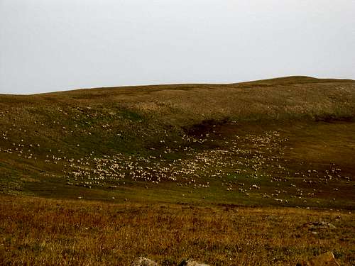
In the 1500’s along came the Spaniards looking for the Seven Golden Cities of Cibola, which lay somewhere north of Mexico. In 1836, according to Crow Indian legend, a party of “trappers” wearing Spanish dress made it to the area, looked around, and expressed interest in mining. There is nothing recorded of their fate, but the Spanish Peaks to the east are named for them. Whether or not the Gravelly Range is a rich gold deposit, it has an immense gravel deposit which, like a riverbed, follows the top of the range. In the early 1860’s poor bumbling prospectors, completely ignorant of the legend of the sacred cavern, blundered into all kinds of gold in the gulches heading up in this range. The town of Alder Gulch and Virginia City were born at one of the richest placer diggings ever found on this planet. Afterwards, Black Butte remained isolated and seldom visited. An occasional horse thief was disposed of by vigilantes in the mountain’s shadow. Later, sheep were brought up to summer pasture. In the 1940’s a hunter is rumored to have tracked a black bear into a cave and seen the sacred river. Afterwards he heard the Indian legend and returned, but could not locate the entrance.
Today you can see Black Butte, a geyser basin, and a mountain range made of gravel. You, of course, are a practical climber and don’t believe in irresponsible rumors and legends…look out and notice the beauty of this area and how good you feel. Greater treasure has no man.
|
|
|---|
And it is odd that a peak of this stature (including over 3,000’ of topographic prominence), attracts few “practical climbers” to seek its aesthetic treasures, particularly taking into account the fine 2WD gravel road that travels right below the base of this truncated peak. From wherever you choose the park the summit is but a hop and a skip away, and the rewards Mr. Caffrey has already described above in finer words than mine.
|
|
|---|
Getting There
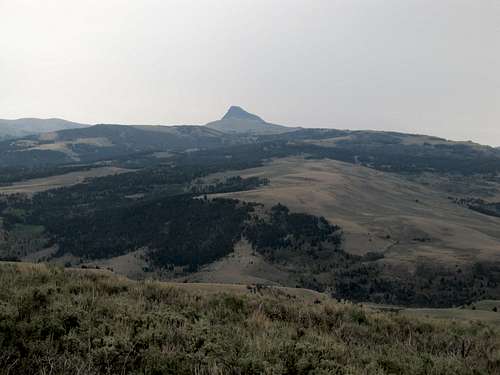
There are surprisingly a lot of graded dirt roads in this area suitable for passenger cars, but that doesn’t mean it’s easy going for your vehicle. While you can easily loop in Black Butte with some other peaks in the area same day, whether in the Gravelly’s (Bighorn or Lion, possibly) or in surrounding ranges (the Madisons and the Snowcrests are good choices either to the east or west), plan to budget some time in getting to this peak. The Gravelly Range Road is a mostly gravel road that will take you from the town of Ennis south all the way to the Centennial Valley and eventually the tiny hamlet of Monida on the Idaho border. You can connect to the Gravelly Range road by taking MT 287 (note, NOT US-287 south of Ennis) for a few miles, then bear left onto MT-249/Varney Road as it drives south through the valley to the small town of Varney. I ended up taking US-287 south out of Ennis for about 9 miles, then took a right onto the same Varney Road/MT 249 as it beelines west towards Varney for 4.4 miles (with a dip south and back up). This junction is signed off US-287 for both the “Gravelly Range Rd” and the “Ennis Fish Hatchery”.
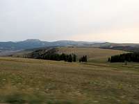
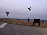 turnoff from US-287 turnoff from US-287 |
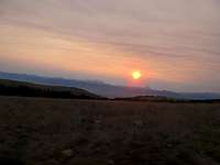 sunrise over Madisons sunrise over Madisons |
 good gravel road good gravel road |
|---|
After you cross a bridge crossing the Madison River take a left (south) onto the Gravelly Range Ridge, which quickly turns to gravel. (Here is also where MT-249 comes down from MT-287 as well. From what I can see this seems mostly or all paved from Ennis, so it might actually be a quicker option than US-287). Follow this road south miles as it winds along the west side of the River. Avoid the better (paved) road and the signs for either the Ennis Fish Hatchery or the Shining Mtn Loop at this point. 2.3 miles from the bridge bear right at a junction as you follow what should be the main road mostly SW towards the mountains. You can see the road ahead as it sidehills its way up into the Gravelly Range; as you climb follow the signs for Black Butte Guard Station to a "4 way" intersection directly northeast and below the sheer north face of Black Butte (around 30 miles from the bridge crossing the Madison River). The road initially starts out as FR-292 then becomes FR-290 when you bear left along the main Gravelly Range Rd when it reaches the open prairies of the ridge crest, around 14 miles from the bridge. Along the way bear left at the turnoff for Warm Springs Campground (this is MT-357/FR 163…passenger cars can reach Black Butte via this road from the Ruby Valley, the Ruby Reservoir, and/or the town of Alder) and bear right avoiding the road leading towards Johnny Gulch (the latter, MT-357 again and also FR 324, is another way for all cars including sedans to reach Black Butte from US-287).
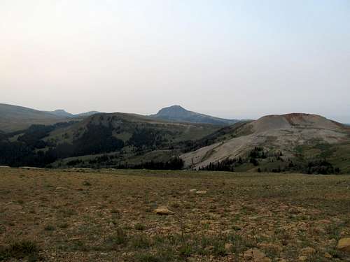
 Scenery along... Scenery along... |
 ...Gravelly Range... ...Gravelly Range... |
 ...Rd to Black Butte ...Rd to Black Butte |
|---|
The Four Way isn’t strictly a four-way, but two opposing T intersections within a mile of each other. You’ll know you’re nearing it as the sheer north face of Black Butte gets closer and closer. Descend down a hill and ignore a small pull off to the left. At the “Four Way”, bear left as the road right takes you through Cottonwood Creek (leads to the Ruby Valley…may not be passable for low clearance cars). Then bear right (south) at an intersection even though the signs say straight for Black Butte Guard Station. Here the road starts to wind along the eastern slopes of Black Butte before it begins to descend. You can see the southeastern aspects of the mountain now; park anywhere you see fit to begin your quick hike to the top of the Gravelly’s.
You can also connect with the Gravelly Range Road from the South by taking the Centennial Valley Road east from Monida (MT 509) then heading north towards the Ruby Valley before taking the turnoff right (east) at the Eureka Basin Road. I haven't driven the Eureka Basin Road or the Gravelly Range Road south of Black Butte but I believe they should all be good for passenger cars. Regardless of which way you're coming from a DeLorme or Benchmark Atlas would be very useful to have.
Climbing Up
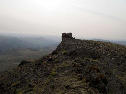
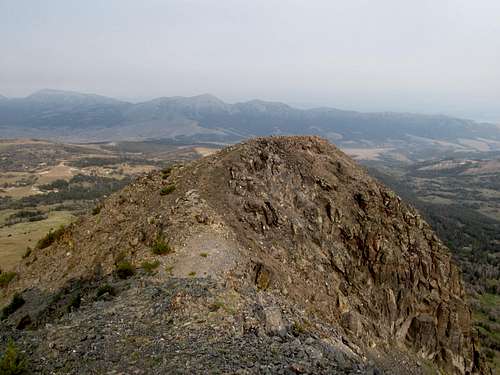
From where you park it’ll be around 3 miles RT and 1200’ net gain to the top of Black Butte, with some up and downs early along the way. Start up the open prairies and make your way up the small hills and through small drainages as you start noticing more and more of the black volcanic rock around you. At the steepest, rockiest portion of the hike around 10,000 ft you’ll run into a nice climbers’ trail (visible from Google Earth). Follow this trail up to the gentle upper reaches of Black Butte, avoiding the cliffs to your right, and eventually the summit.

|

|

|

|

|
|---|

|

|

|

|

|
|---|
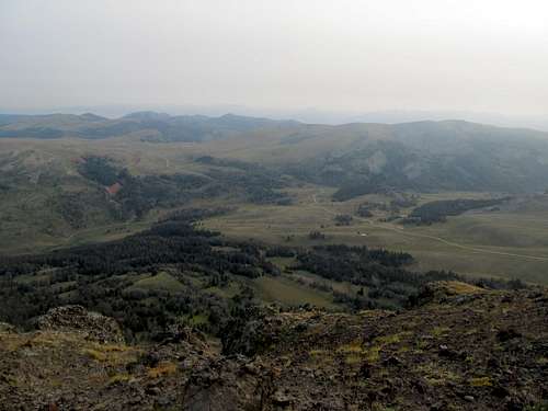
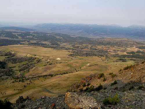
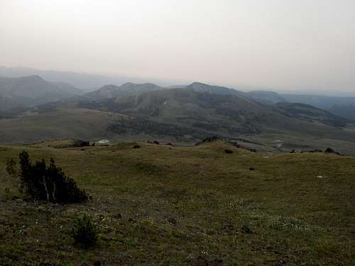
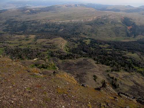
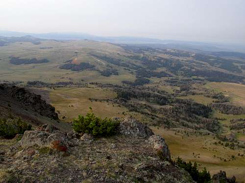
Views
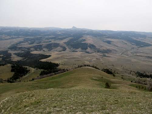
Even on a not so clear day I could see a lot of the surrounding ranges, including the Madison’s to the east, the Snowcrest Range to the west (and particularly Sliderock Mtn.), and the Centennials to the south. With better visibility you can probably see the Beaverheads, the Pioneers, and the Hollowtops as well. If Black Butte is your first summit of the day, it’s probably still pretty early; use this vantage point examine your surroundings and possibly find another peak to tackle in the area.
|
|
|---|---|
|
|
|
|
Et Ceteras
There are plenty of designed Forest Service Campgrounds in the area, and plenty of small roadways and pulloffs where you can camp in the open. For those more inclined to sleeping in a bed Ennis offers probably the closest lodging. Make sure you gas up before getting off the beaten path in this area; it may be a long time before you end up back in civilization. Most of these roads should be good for passenger cars, but may get sticky when wet, so check your weather forecasts before you head into the range.Also, make sure you have at least one spare tire. The roads are sedan "friendly", but they're still rocky, often washboarded, and often bumpy regardless.
Access is probably limited to the summer months unless you have a snowmobile. These roads are not maintained during the winter and may even be closed until July in a heavy snow year.
|
|
|---|
External Links
Gravelly Range Road: Great info on this beautiful Montana BywayBeaverhead-Deerlodge National Forest: Note that the Gravelly Range falls under the Madison district
|
|---|