
-
 5986 Hits
-
 87.76% Score
-
 25 Votes
|
|
Area/Range |
|---|---|
|
|
45.52200°N / 17.60340°E |
|
|
Hiking, Sport Climbing, Skiing |
|
|
Spring, Summer, Fall, Winter |
|
|
3130 ft / 954 m |
|
|
Overview
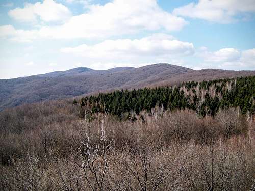
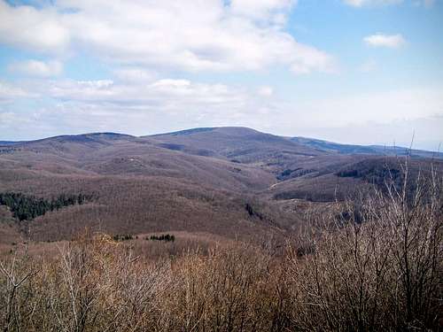
Central Papuk
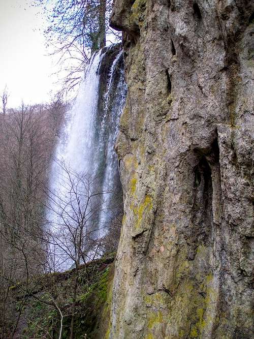
Jankovac waterfall
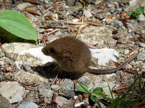
A young wood mouse
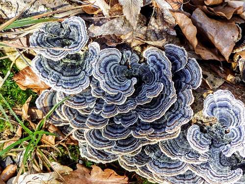
Colourful tinder fungus at Sokolina
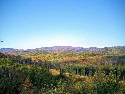
The whole mountain range is stretching in western-eastern direction in 70 km length. Its average width is 12 km. The eastern 30 km long part is called Krndija. There is an unnamed low-point (ca. 615 m) of the mountain ridge between M. Vincine (718 m) and Javori (712 m). This low-point is the approximate border between the two mountain ranges. From here Papuk is stretching in western direction, in 40 km length. The westernmost end of Papuk is distinct mountain group. This group is separated from the central group of Papuk with the saddle Đedovica (536 m). This western group has its own name: Lisina/Fekete-hegyek. This latter Hungarian name means ‘Black Hills’ and it is in accordance with the Croatian name of its highest summit: Crni vrh (863 m). Crni vrh means Black hill.
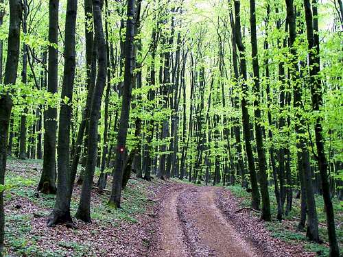
In the following text I will refer to the whole mountain range as "Papuk".![Dense forest on Lipovac]()
Forest on Lipovac
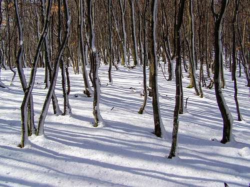
Forest on Lipovac
The highest peak of the mountain range is in the central group of Papuk. It is called Papuk vrh. It is 954 m high. It doesn’t sound too high. But when you look at the mountain range from northern direction, from the plain of Drava/Dráva river, it is quite impressive. The plain of this river is only on 100 meter above see level. Anyway the main western-eastern ridge of the mountain range is the drainage divide between Drava/Dráva and Sava/Száva.
Since 1999 Papuk is classified as a protected Nature Park due to its extraordinary geological and biological diversity and its valuable cultural heritage. In 2007 Papuk was awarded Geopark status - the first Geopark in Croatia.
The rocks in the GeoPark of Papuk were formed in great variety both from the aspect of structural characteristics and age. It means that rock formations of the past 600 million years can be found here, which were composed of crystalline, metamorphic (phyllit, chlorite schist, gneiss, migmatit and amphibolit), granite. Thanks to the carbonate rocks we can admire Karst features. The heritage of the Miocene age Pannonian sea are sediments with fossils.
More than 96% of the Geopark area is covered by forest. More than 25% of the Croatian flora is represented here by 1300 plant species. The most endangered plants can be found on the few grasslands of the Park. This rich vegetation is also a heaven for animals.
What to Do in Papuk?
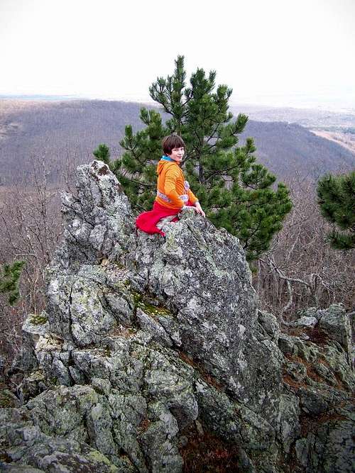
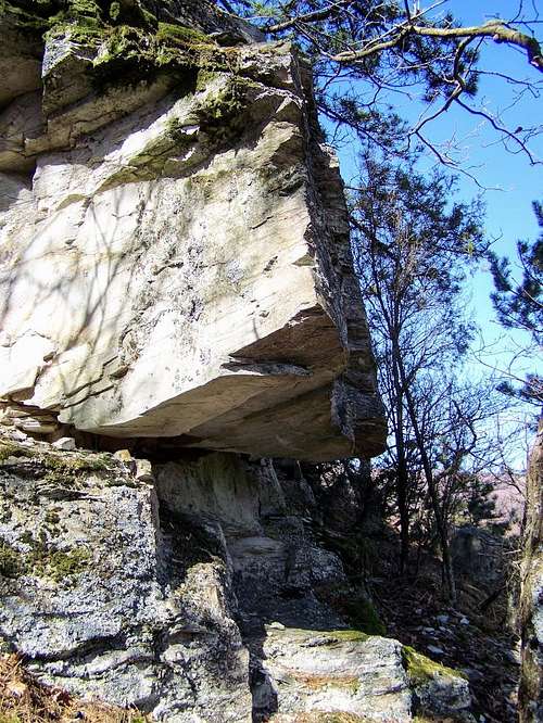
Scrambling on Tauberove stijene
Papuk offers beautiful environment with a relatively dense network of marked hiking trails. The length of the marked trails is approximately 200 km. Hiking in the Papuk mountains has long history. Nowadays there are 21 hiking communities with 3000 registered members in the surrounding province of Slavonia. Papuk is
Hiking at Jankovac
Sokolina - a sport climbing site
Some hiking routes advised by the Geopark:
| Route | Length | Duration | Max. Elevation | Elevation Gain |
| Velika – Lapjak – Nevoljaš – Jankovac | 8.9 km | 3h 15 min | 749 m | 615 m |
| Velika – Češljakovački vis | 8.5 km | 2h 15 min | 826 m | 614 m |
| Velika – Mališčak – Orahove vode – Ivačka glava | 8.8 km | 3h | 913 m | 705 m |
| Vučjak Kamenski ("Lula") – Kamengrad | 2.8 km | 45 min | 610 m | 290 m |
Sport Climbing
The first sports climbing route in Slavonia has been created on the location of Sokolina near Velika/Velikeváralja. On the rock, among heights up to 12 meters, ten routes have been marked. The rock is built of quartzite. It is a very solid rock wall. The full height of the rock is more than 50 meters, but its height is divided into several ledges. Sports climbing routes are located on the south-western part of the rock.
Mountain Biking
The following routes have been created and offered by GeoPark Papuk:
| Route | Length | Max. elevation | Elevation Gain |
| Velika - Sokoline - Mališćak - Velika | 18.5 km | 720 m | 532 m |
| Velika - Dubočanka - Velika | 20.8 km | 675 m | 446 m |
| Velika - Jezerce - Jankovac - Velika | 23.8 km | 760 m | 736 m |
| Venje – Donji Mitrovac – Hrnjevac - Venje | 10.9 km | 405 m | 226 m |
| Venje – Donji Mitrovac – Kutjevo – Vinkomir – Vetovo - Lukač - Hrnjevac - Venje | 19.2 km | 328 m | 306 m |
| Lake Duzluk (Orahovica) – Serbian Monastery – Kapavac – Castle Ružica – Lake Duzluk | 25.8 km | 792 m | 721 m |
Paragliding
A paraglide runaway is arranged on the southern slopes of Papuk, on the peak of Pliš (559 m). It is the first registered runaway site in this part of Croatia, and it is located near the Velika/Velikeváralja.
Important Summits and Places
In sequence from west to east:1. Crni vrh / Fekete-hegy2. Točak3. Lom4. Papuk vrh / Papuk-csúcs5. Ivačka glava6. Lapjak7. Nevoljaš8. Jankovac / Jankovác9. Češljakovački vis10. Kapavac
1. Crni vrh / Fekete-hegy

Fir trees at Djedovica Pass
The hilltop is made of nice red sandstone rocks. There is also a mountain shelter (cabin) on the summit.
2. Točak
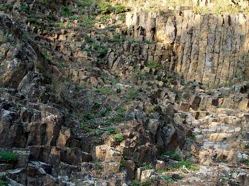
Basalt rocks at Rupnica
At the foot of the mountain you can find Rupnica. In 1948 it was declared as the first natural heritage site of Croatia. It is a site of an abandoned quarry with outcrop of columnar basalt. Rupnica is only in 4.5 km aerial distance from the peak of Točak. The main ridge connecting Točak, Lom and Papuk vrh was infected with mines in the Croatian independence war. In theory the area is cleaned now, and there is even a marked tourist path there, but still I would be very careful there and I wouldn’t leave the path anywhere.
3. Lom
View of Lom
4. Papuk vrh / Papuk-csúcs
View of Papuk vrh from Ivacka Glava
Panoramic view from the Zen Bench
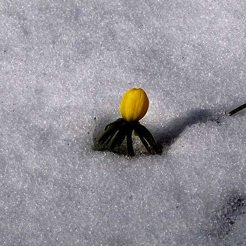
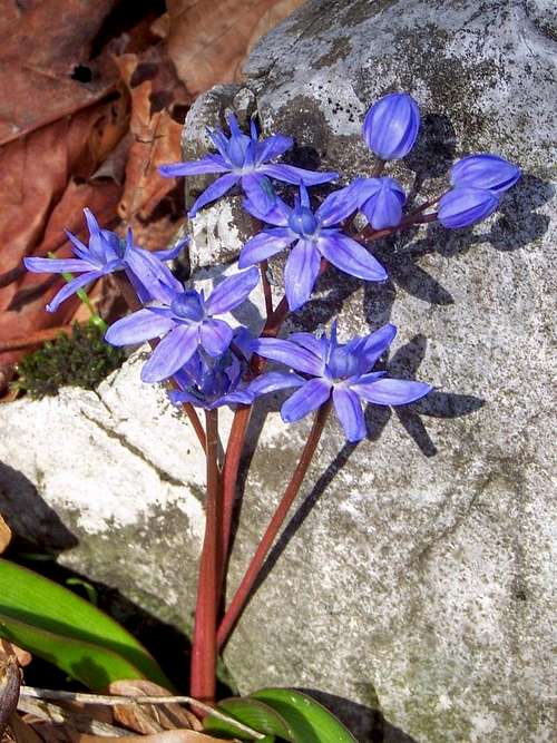
One of the first flowers of the spring
Military Zone
There were some mine fields around the peak (in theory cleaned by now), so take care where you go…
Wiew from the summit is excellent in western and southwestern direction.
This peak was the highpoint of the historic Virovitička/Verőce County.
5. Ivačka glava
This is one of the best peaks of Papuk. With its 913 m height it is the second highest peak of the mountain range. There is no military station on its top. The peak is a steep rocky hill, with very good view in western, northern and northeast direction.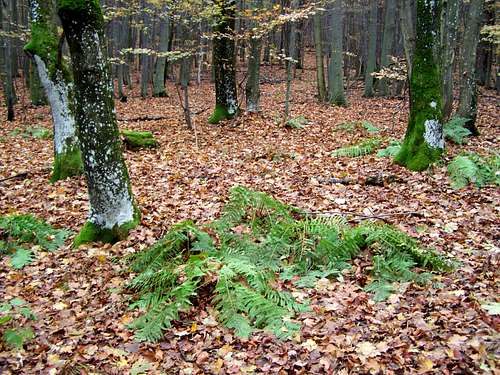 Forest with fern on Ivacka glava |  The summit rock of Ivačka glava | 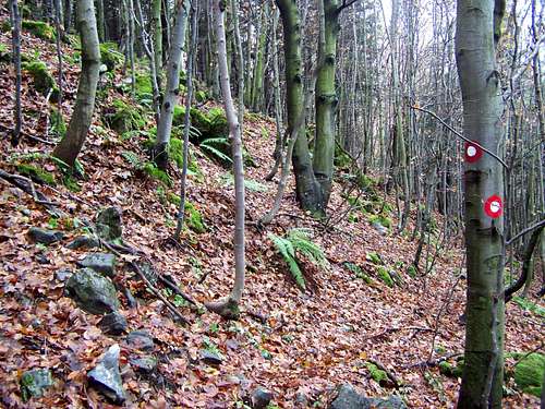 The north slope of Ivacka Glava |
6. Lapjak
Lapjak is not among the highest hills of Papuk – it is only 667 meter high. Still it is a very interesting place. This mountain has a the shape of a real mountain with its sharp pyramidal view from southern direction. The mountain is made of dolomite. A huge dolomite quarry is in operation in its western slopes. Luckily not much is seen from the tourist path leading on its main ridge. There are some rocky outcrops on the ridge. The most spectacular cliffs are called Tauberove stijene. A cross is erected here, and you can enjoy nice view from here towards the basin of Požega/Pozsega. These cliffs are only a few hundred meter far from the summit of Lapjak where you can find the log book of the mountain. The summit is covered by forest and there is no panoramic view from there.The old ruin of the castle called Stari grad/Velika vára can be found on the southern ridge of Lapjak. And also the small town – Velika/Velikeváralja – at the southern foot of the mountain has rich history. Its history is materialized by old church that has some medieval paintings on its external wall.
According to Wikipedia sources there is a thermal bath in Velika/Velikeváralja. This is not really true. The thermal bath is in very bad condition, and it is not in operation for long time.
 Stari grad / Velika vára | 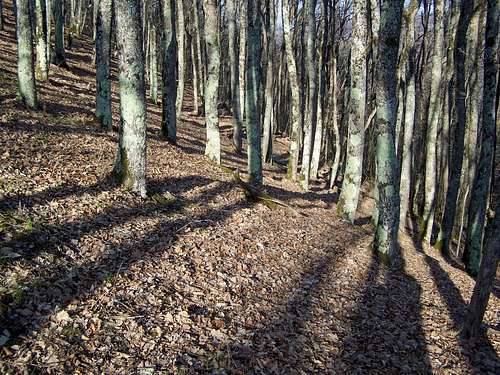 Beautiful forest on Lapjak | 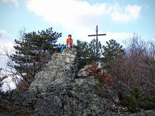 Tauberove stijene | 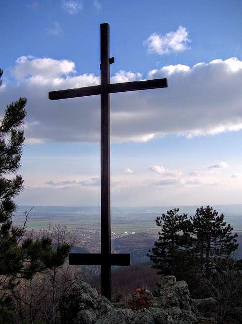 Lapjak summit cross |
7. Nevoljaš
Nevoljaš is a mountain near Nevoljaš Pass. This mountain has two summits. The north-western summit is the higher one: it is 771 meter high. This rocky peak (limestone) is covered by forest and no trail goes there. The lower south-eastern summit is 740 meter high. There is an outlook tower on this peak. From here you can enjoy perhaps the best panoramic view of the whole mountain range. In springtime the vegetation of this peak is the richest in the mountain range. The most beautiful flowers here are spring crocus (Crocus vernus), dog's-tooth-violet (Erythronium dens-canis), alpine squill (Scilla bifolia) among other common but still beautiful flowers like primrose (Primula vulgaris), snowdrop (Galanthus nivalis), ramsons (Allium ursinum), wood anemone (Anemone nemorosa), cuckooflower (Cardamine pratensis) and Helleborus odorus.In the Yugoslav era this peak was the upper station of a small ski resort. It is not in use any more. Tt couldn’t operate during the Croatian independence war. And later it wasn’t reopened. The warmer climate doesn’t support it any more.
A memorial of the local victims of the Croatian independence war can be visited at Nevoljaš Pass.
 Scilla bifolia | 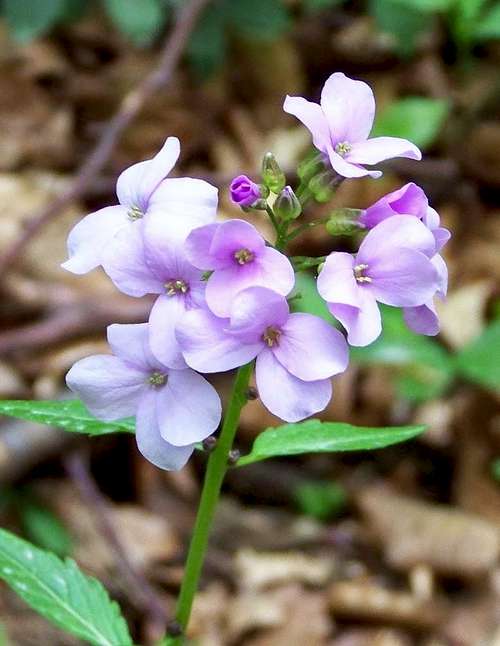 Cardamine pratensis | 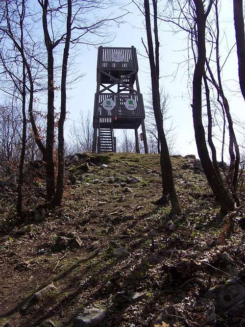 The outlook tower | 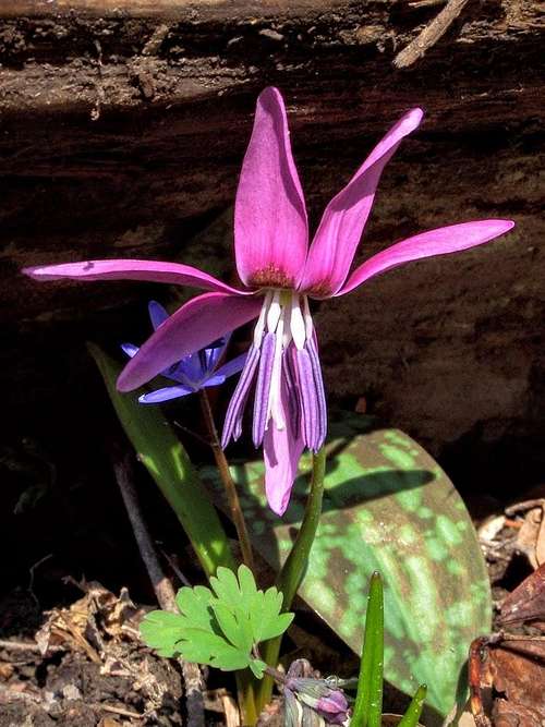 Erythronium dens-canis | 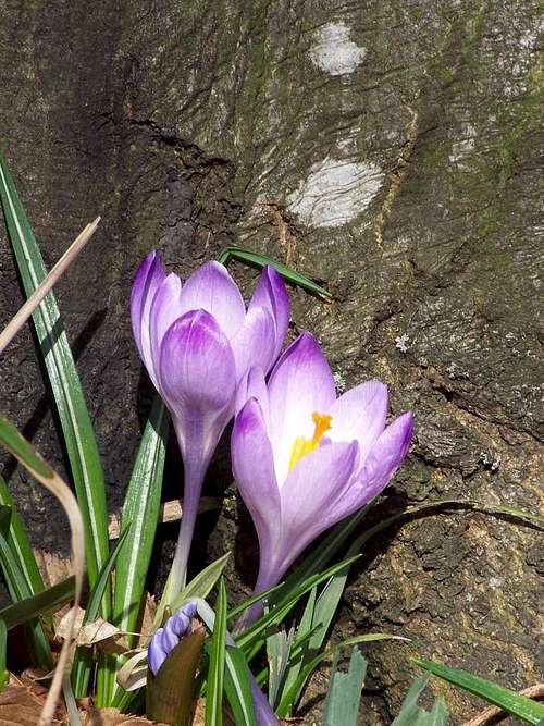 Crocus vernus |
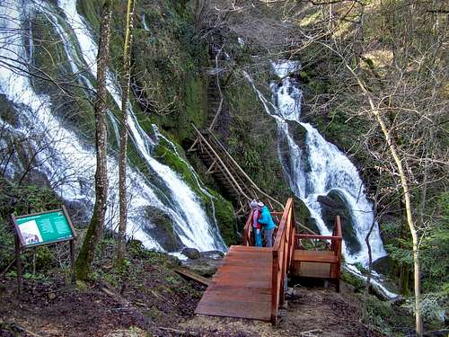
8. Jankovac / Jankovác
This is not a mountain but a small mountain resort with the best attraction of the whole mountain range. Here you can find a limestone cave, a huge karst spring, 2 artificial lakes and last but not least the magnificent waterfall. This is the biggest waterfall of the whole Slavonia province. Tourists get good service here in the local tourist hut. There is also a souvenir shop, and there you can buy a map of Papuk. In summer season (from the 30th April) car parking costs 10 HKR here.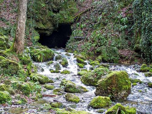 Jankovac karst spring | 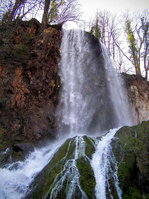 Jankovac waterfall | 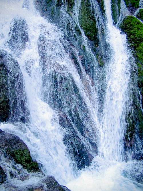 Jankovac waterfall |  Jankovac Lake |
9. Češljakovački vis
Češljakovački vis
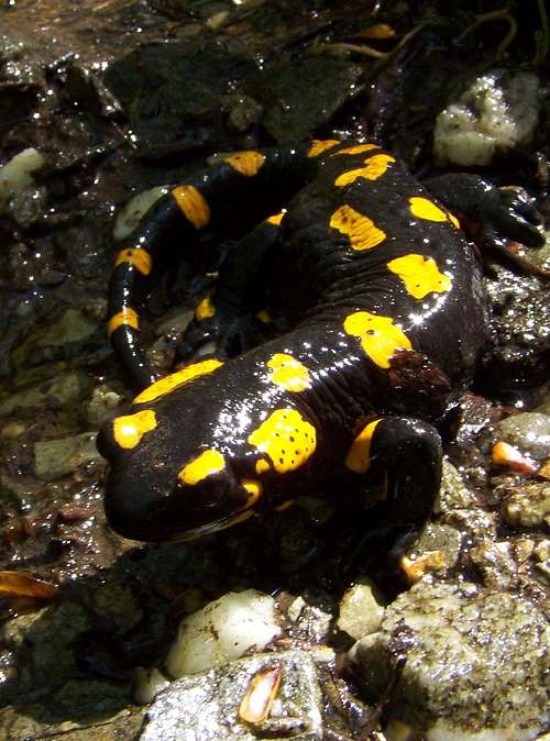
Fire salamander (Salamandra salamandra)
Forest on Češljakovački vis
The best thing of this mountain is the water source that you can find in 300 meter distance west to the official peak: if you are lucky, you can see fire salamander there.
10. Kapavac
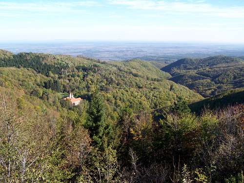
The slopes of Kapavac with the Serb Monastery
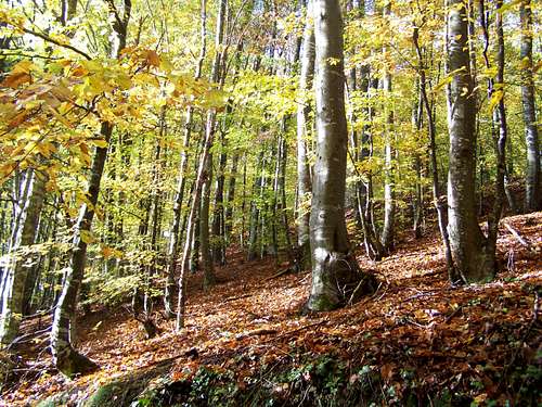
Beech forest in Krndija
History and People
Ružica grad
The ortodox monastery near Orahovica/Raholca
Kutjevo, Dvorac Turkovića
Kaštel Kaptol
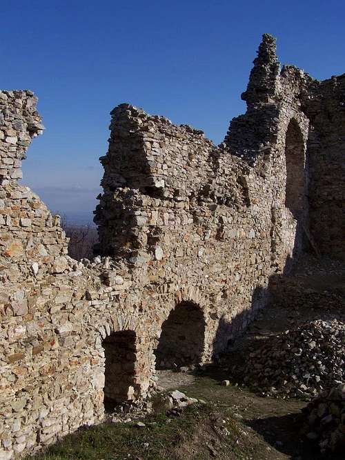
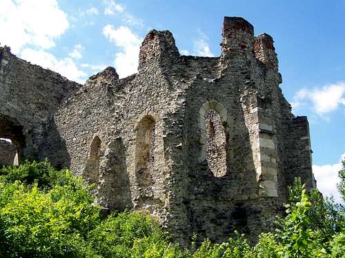
Stari grad
Castles of Papuk
Bedemgrad / Nekcsevár
This important castle was built around 1300 on a 407 m high hill near Gradac. In the next centuries it had many owners: the Aba family, the Lackffy family, the Garai family, King Matthias and the Újlaki family. The Turkish troops of x unsuccessfully besieged the castle in 1536. Five years later, in 1541 the soldiers of Ibrahim Pasha occupied the castle. 145 years later, in 1687 the Habsburg forces returned it for the Christian rule. Hussein Pasha tried to occupy it in 1690 but he didn’t succeed. Now the high gate tower of the castle with some gothic details can be still seen.
Stari grad / Raholcai Óvár
This castle was built in the 14th century not too far from the summit of Kapavac, approximately 700 m above see level. The ruins of the walls are quite high, but altogether this ruin is not so impressive.
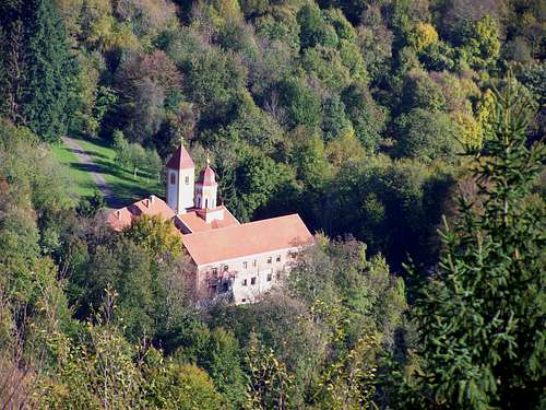
Ružica grad / Raholca vára
This is the most beautiful castle of Papuk. It was built in the 15th century by Miklós Újlaki, in gothic style. Later it was possessed by László Móré. Since it was an important castle, all powers put big effort to occupy it. The Turkish troops commanded by Yahya Paşazade Gazi Mehmed Pasha unsuccessfully besieged it in 1536. Six year later, in 1542 the Turkish troops were more successful – commanded by Murat Tardiç. The Habsburg forces could take it back only in 1687. Then the Turkish Hussein Pasha occupied it for a short time in 1690, but it was only a short episode. Soon he was obliged to leave the castle. And the abandoned castle collapsed during the following century.
Manastir Sv. Nikole / Szent Miklós-kolostor
This monastery is a curiosity from several aspects. It is a Serbian orthodox monastery. In Croatia there are only four Serbian orthodox monasteries! This monastery was not always possessed by the Serb Orthodox Church. Originally – in the medieval times – it was built by the Augustinians. So it was a Roman Catholic monastery. But it was abandoned and it collapsed during the era of the Turkish occupation. Afterwards the Serb Orthodox Church rebuilt the ruins. It is a miracle that neither during the second wold war nor during the Croatian Independence War it was not put on fire.
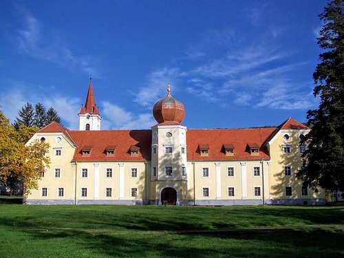
Dvorac Turkovića / Turkovich-kastély
This manor house is a special object. It was not always a manor house but originally it was built as a monastery by the Cistercian Order in Kutjevo/Gotó. The Cistercians abandoned the monastery in 1529, being afraid about the Turkish advance. They were right: the Turkish troops really occupied the small town and the monastery in 1536. After the long time of the Turkish occupation, between 1704-1735 the Society of Jesus rebuilt the monastery. At the end of the 18th century Joseph II ordered to close all monasteries – including this one. In 1882 the building complex has been sold to Baron Vencel Turkovich. And he transformed the buildings of the monastery into a manor house.
Kaštel Kaptol / Pozsegaszentpéter vára
This nice castle in not the usual mountain castle. Its core was the seat of the Canons of Požega/Pozsega. They fortified their church and their central buildings around 1500, in renaissance style. The Turkish troops occupied this fortification in 1537 and they left it in 1687. The castle is in quite good condition even today.
Drnovec grad / Darnóc vára
This castle was built in the 13th century. It was owned by the Monoszló and the Gara noble families. Turkish troops occupied it in 1542. They stationed a small garrison there for a while. Then they abandoned the castle. Now only minor ruins can be seen here.
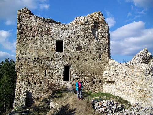
Stari grad / Velika vára
This castle was built in the 13th century by the Szudáni family, and later its Békeffy de Welyke branch possessed it. The soldiers of Yahya Paşazade Gazi Mehmed Pasha occupied the castle in 1537. In the next 150 years there was a big Turkish garrison in the castle and in the small town of Velika/Velikeváralja. The Habsburg forces occupied the castle in 1687, after a very bloody siege. The Turkish Empire could occupy it again in 1690, but only for a few months. The ruins of castle can be easily accessed on a marked tourist path.
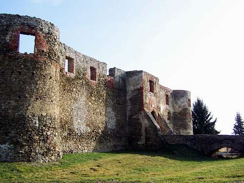
Kamengrad / Kővár
This is the biggest castle of Papuk. It was built on a remote place, on the top of a 600 meter high hill, in the 15th century. The castle had many owners: the Trötöl family, the Czeh family, Matkó Thallóczy, the Litwai Horváth family, János Zápolya, János Hoberdanz and Ferenc Tahy. The Turkish forces commanded by Yahya Paşazade Gazi Mehmed Pasha occupied the castle in 1536. They kept a relatively strong garrison of 130-140 soldiers in the fortification. The Habsburg forces could occupy the castle in 1687. But in the meantime the castle lost its importance, and soon they abandoned it. The abandoned castle collapsed.
Voćin grad / Atyina vára
This castle was built in the 15th century by the Athynai family. Later it was possessed by the Garai family, by King Mathias, by János Corvin and by the Batthyányi family. The Turkish troops occupied it in 1538. They garrisoned 50 soldiers in the small castle. The Turkish soldiers left the castle in 1687. They destroyed it when they left it. Now only a small ruin can be seen here.
The Turkish occupation and the system of the Military Frontier Provinces established by the Habsburg rulers changed the composition of people living here. Moreover, in the 19th century the area was attractive for other immigrants from the Austro-Hungarian Empire. The result was a very mixed population according to the census of 1910:
x
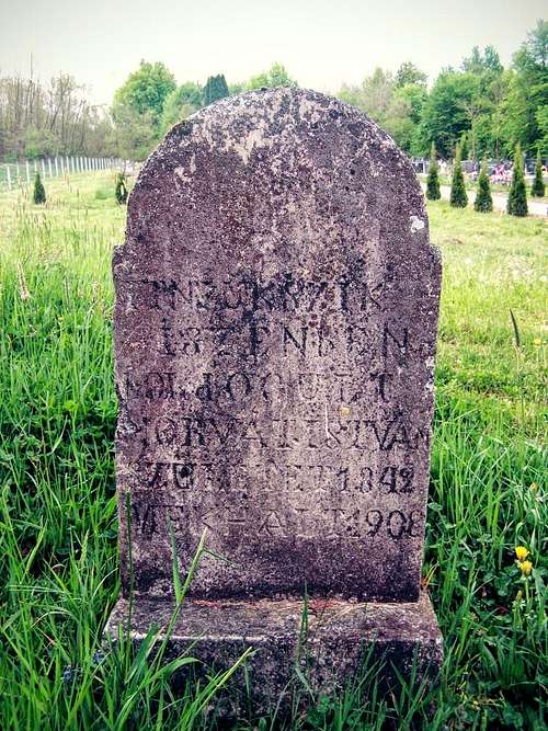
Hungarian gravestone in Humljani
| .Croats. | -Serbs- | Magyars | Germans | Czechs | Slovaks | |
Pivnica Slavonska | 21% | 62% | 10% | |||
Voćin/Atyina | 17% | 60% | 14% | |||
Slatinski Drenovac/Darnóc | 12% | 67% | 14% | |||
Orahovica/Rahonca | 40% | 29% | 19% | |||
Feričanci/Ferencfalva | 66% | 8% | 15% | |||
Našice/Nekcse | 60% | 5% | 13% | |||
Bektež | 38% | 8% | 23% | 9% | ||
Kutjevo/Gotó | 71% | 6% | 4% | 7% | 9% | |
Kaptol/Pozsegaszentpéter | 69% | 4% | 6% | 16% | ||
Velika/Velikeváralja | 94% | 1% | 2% | |||
Stražeman | 67% | 22% | 7% | |||
Sirač/Szircs | 26% | 60% | 2% | 7% | ||
Veliki Bastaji | 56% | 16% | 12% | |||
Đulovac/Gyula | 44% | 27% | 17% | |||
| Total | 40% | 35% | 12% | 7% | 2% | 1% |
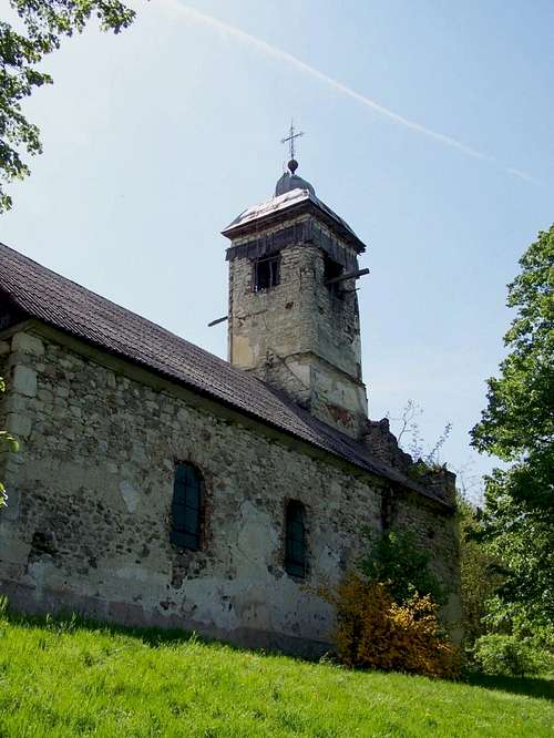
The church in Drenovac
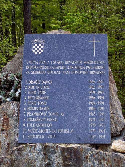
Memorial on Nevoljas Pass
From 1945 Yugoslavia has been recreated. But it didn’t exist for too long time. Croatia declared its independence in 1991. The Yugoslav army and local Serb paramilitary groups didn’t accept the independence of Croatia, and an intensive war escalated. Also the area of Papuk was intensively impacted by this war. The Croatian army recaptured the area from the Serb paramilitary groups between September 1991 and January 1992. One of the operations of this war was called Operation Operation Papuk-91. The western half of the mountain range was impacted by this operation. But there was fighting also in the villages on the north slopes of the mountains. A sad example is the fully destroyed village of Pušina. 184 Croatian and 516 Serbian soldiers died in the battles in Papuk. And much more were wounded.
Now there is peace in Papuk. Only destroyed houses and war memorials remind us on the cruel history.
How to Get There?
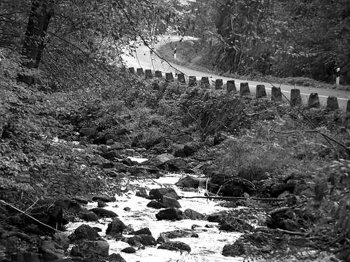
The road between Kamenska and Vocin
Bigger airports in the "vicinity" are in Zagreb/Zágráb and in Budapest. How to get to Papuk on road from these places?
Starting from Zagreb/Zágráb, take highway A1. Exit at Nova Gradiška/Újgradiska, in the direction of Požega/Pozsega. In Požega/Pozsega you are near the mountain and you must decide the last section of your route depending on your planned trailhead.
Starting from Budapest, take highway M6 and M60 to Pécs. Cross the Hungarian/Croatian border at Drávaszabaolcs. From there after 45 minutes’ drive you will be in Našice/Nekcse, near to Papuk. There you must plan the last section of your route depending on your planned trailhead.
The most obvious trailheads are along the 4 roads crossing the mountain range in south-north direction. These are the 4 roads:
____• Kamenska - Voćin/Atyina
____• Velika/Velikeváralja – Slatinska Drenovac/Darnóc
____• Kutjevo/Gotó - Orahovica/Raholca
____• Požega/Pozsega - Našice/Nekcse.
The best trailheads are along the road Velika/Velikeváralja – Slatinska Drenovac/Darnóc. This road is not paved but it is in good condition and can be used by usual passenger cars. The other three roads are paved.
Red Tape
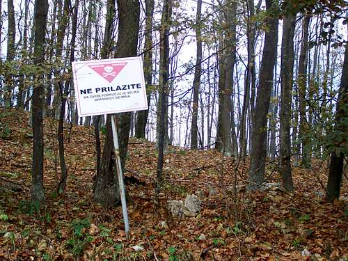
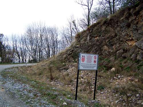
A standard warning board about mines
And now let me speak about the mine fields, too. The front line crossed Papuk in 1991 during the Croatian Independence War. Several minefields were created. Since then – in theory – all minefields have been cleaned. I don’t know how perfect such a cleaning work can be – so to be on the safe side I would recommend not to leave the used roads when walking on areas that may be still infected with mines. Where were these minefields?
Short answer: in the northern and western part of the mountain range.
Detailed answer: around these villages: Krasković, Kokočak, Stara Krivaja, Ćeralije, Bokane, Macute, Ozdakovci, Poljanska/Polyánc, Gornji Vrhovci, Kamenska, Kamenski Šeovci, Amatovci, Striježevica, Nježić and Klisa. And on the main ridge connecting the summits of Točak, Lom and Papuk vrh and Nevoljaš Pass.
Here is an overview map of the approximate location of the old minefields:
I take no responsibility for the completness of these data!
Maps
You can purchase a map about the central part of Papuk in the office of Geopark Papuk in Voćin/Atyina and in the souvenir shop at the tourist hut in Jankovac/Jankovác.Online map of Croatia is available here.
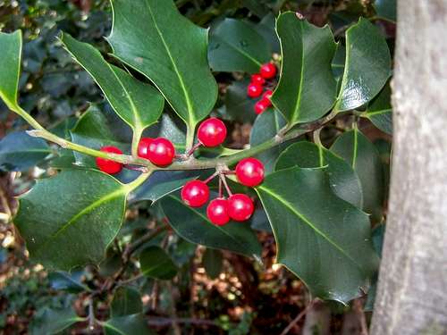 Ilex aquifolium | 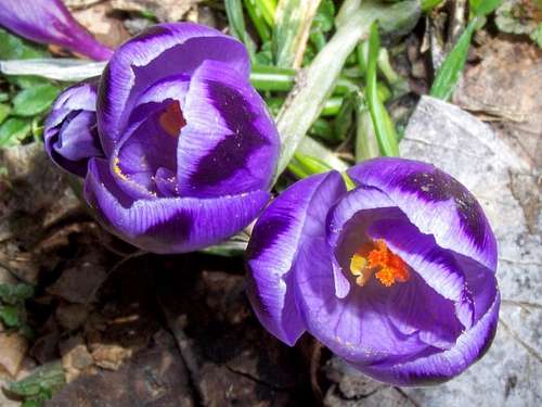 Crocus vernus | 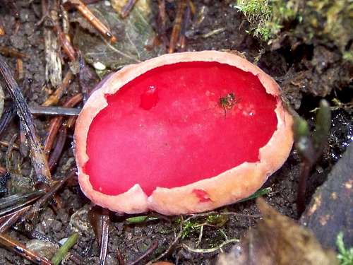 Sarcoscypha coccinea |