
|
|
Mountain/Rock |
|---|---|
|
|
50.12427°N / 123.02842°W |
|
|
Hiking, Mountaineering, Skiing |
|
|
Spring, Summer, Fall, Winter |
|
|
6017 ft / 1834 m |
|
|
Overview
Mount Sproatt is a mid-elevation peak located in the Coast Mountains of western British Columbia, Canada. The peak is underestimated as a summit destination, as it is surrounded by much more prominent and popular mountains, including Whistler Mountain, Wedge Mountain, and Rainbow Mountain. However, with open upper terrain and prominence of 319 meters (1047'), the summit of Mount Sproatt provides a picturesque 360° panoramic view of its dominating neighboring peaks and many mountains far away.
Eastern View From Summit
Standard ascents of Mount Sproatt are generally considered as non-technical. Although it is possible to summit the peak during Summer & Autumn seasons, the most desirable and popular timeframe to summit the peak is during Winter and Spring seasons. This is because much of the lower forested terrain is very brushy, and much of the upper terrain has slick mossy rocks and cliffs. However, during Winter and Spring seasons, snowpack on the mountain covers brush and rocks which might otherwise be obstacles.
Most of the people who summit Mount Sproatt are skiers and snowshoers. Summiters are usually people who are trying to avoid the crowds at the nearby Whistler ski area and/or who have become bored with more-popular snow destinations such as Whistler. Other summiters include people who are seeking a summit which has wide-ranging views or which provides a non-technical day trip.
Getting There
FROM THE TOWN OF SQUAMISH, BC:1) Starting at the intersection of Cleveland Avenue and Sea-To-Sky Highway, head north on the Sea-To-Sky Highway.
2) After 58.3 km, turn left onto Alta Lake Road.
3) Once on Alta Lake Road, there are two options:
OPTION #1: Drive 5.8 km along Alta Lake Road to a turnoff for Whistler Cemetery. There is parking near the cemetery. Begin ascents by hiking, snowshoeing, or skiing westward up the gated road nearby.
or
OPTION #2 (Recommended): Drive 6.0 km (only 200 meters beyond cemetery turnoff) to the side-parking area near a large "RAINBOW TRAIL" sign. Begin ascents by hiking, snowshoeing, or skiing up the trail, which starts on the south end of the side-parking area near the large "RAINBOW TRAIL" sign (APPROXIMATE ELEVATION: 685 m / 2250').

Trailhead For Rainbow-Madely Trail
------------
IMPORTANT: Most skiers prefer OPTION #1, while most hikers and snowshoers prefer OPTION #2.
Regardless of which option/starting location is used, the two options join together at a municipal water supply building approximately 1 km beyond either starting location. There are several signs at the building location.
Standard Summit Routes

Standard Summit Routes
Although multiple summit routes are possible on Mount Sproatt, there are two main summit routes which are commonly used. One option is the "NE Direct" route and another option is the "Hanging Valley" route, and both options are approaches from the north side of the mountain.
As mentioned earlier, regardless of which option/starting location is used, the two options join together at a municipal water supply building approximately 1 km beyond either starting location. Walk left by the building and then, once beyond the building, continue following the road-trail as it u-turns to the right and upward. Continue following the Rainbow-Madely Trail (road-trail) for at least 2-2.5 km further.

Rainbow-Madely Trail
The two standard routes are listed below, with both starting from the Rainbow-Madely Trail. Both routes eventually join back together on open northern terrain of Mount Sproatt.
------------
"NE Direct" Route:
Approximately 2-2.5 km from the municipal water supply building, and shortly after passing a small sign that says "4.5 km to Rainbow Lake" (or something similar), a small wooden bridge is encountered. Near the bridge (APPROXIMATE ELEVATION: 1035 m / 3400'), turn left (south) off-trail and begin ascending uphill. Try to find the best ascent route possible using best judgement. The forested terrain quickly gets steeper, with the steepest part being a 50-60 meter long sloped section. Due to the steep and typically icy slope of this route section, crampons (or microspikes) should be worn and an ice axe should be carried. However, the rest of the route should not require use by anything other than trekking poles and snowshoes (or skis).

Steep Forest Ascent
Once beyond the steepest section, the terrain becomes noticeably gentler-sloped. The treecover gradually thins out (APPROXIMATE ELEVATION: 1280 m / 4200'). As the terrain becomes more open, it temporarily becomes steeper before reaching the first of several large basins (APPROXIMATE ELEVATION: 1463 m / 4800').
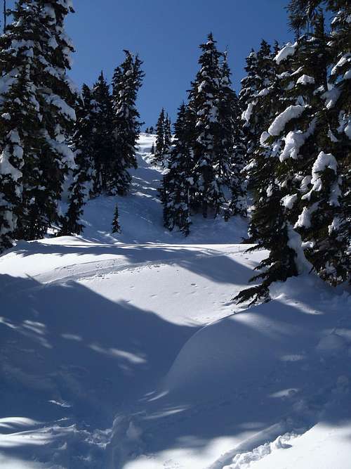 Coming Out Of The Thick, Steep Forest
 Approaching Temporary Steep Section Above Thick Forest
Cross the basin, and then go left around the ridge on the other side of the basin. Prior to this area is where the "NE Direct" route joins the "Hanging Valley" route (see description below).

Crossing Large Basin

Crossing Another Large Basin
------------
"Hanging Valley" Route:
This route does not have any one section as steep as the "NE Direct" route, but does have longer distance (approximately 2-2.5 km longer, roundtrip), more routefinding (due to nearby cliffs and misleading gullies), and, if not done correctly, some exposure (which the "NE Direct" route does not have). In contrast, the "NE Direct" route generally uses a "just keep going up" type of ascent, mainly in steep forest.
Approximately 1 km from the small "4.5 km to Rainbow Lake" sign, reach an
outhouse (APPROXIMATE ELEVATION: 1110 m / 3650'). The outhouse is located approximately 50-100 meters east of a big log bridge. A short distance beyond the outhouse, turn left (south) off-trail and begin ascending gently uphill and slightly to the right.
There are two forested gullies separated by steep, cliffy slopes. The easiest ascent routes are located east of the cliffs, whereas trying to steeply ascend the steep slope between the gullies leads to a more-difficult exposed slope. During Winter & Spring seasons, a large yellow/brown-colored icicle (nicknamed "pee-cicle" by locals) is seen on the front of the cliff that needs to remain on "climber's right" and is an excellent reference marker for which gully/slope to traverse. A photo of the "pee-cicle" is seen at this link. Ascending this section is commonly done only with boots or snowshoes, but crampons (or microspikes) and an ice axe should be taken as a precaution (depending on exact slope ascent route, conditions, and experience).
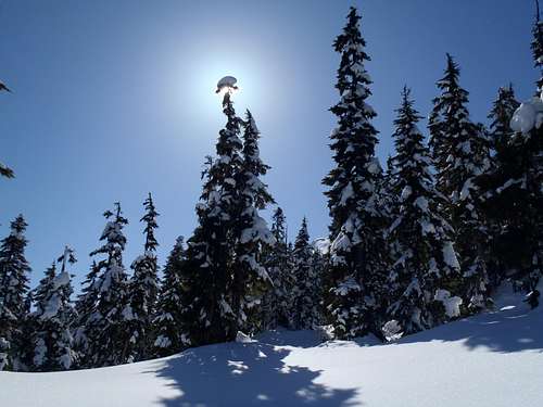
"Snow Halo" Atop Tree
Once above the steep section, the route enters a "hanging valley" (meadow). Continue ascending up to the other end of the valley, and then turn left to go around a ridge. Begin ascending a steep open gully/slope to reach more wide-open terrain above and beyond. Prior to this area is where the "Hanging Valley" route joins the "NE Direct" route (see description above).
Ascending Steep Open Slope...
------------
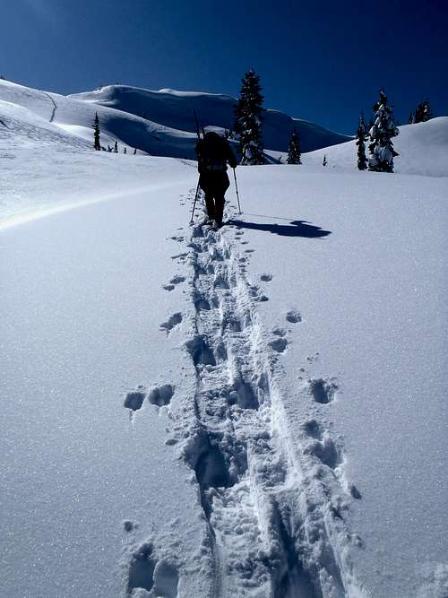
Upper Terrain (Both Routes):
Treecover continues to decrease and open terrain continues to increase. Continue ascending in a general southwest trajectory towards the summit. Avoid steep hills by traveling across large basins, and ascend gentle-sloped hills and side-traverses. The upper terrain of the summit approach should not be technical.

Approaching Northern Summit Ridge...
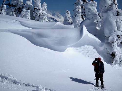
"Breaking Wave" Cornices (Not Very Dangerous)
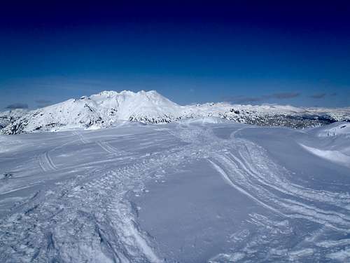
The summit ridge has multiple small hills and highpoint contenders. Most people believe the southernmost highpoint is the highest. The summit (1834 m / 6017') has no trees on it, allowing for vast views in all directions.

Sproatt Summit
Northern View From Summit
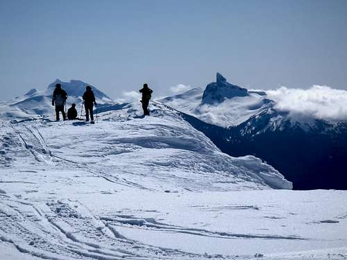
Southern View From Summit
------------
DISTANCE: 15-17 km (9-10.5 miles), roundtrip.
ELEVATION GAIN: Approximately 1179 m (3870').
Red Tape
Mount Sproatt is located within the watershed supply area of Whistler Township. No pets or motorized vehicles are allowed in the watershed.Gear Needed
10 EssentialsGPS
Hiking Poles
Snowshoes (or skis)
Ice Axe
Crampons (or microspikes)