
Comments
No comments posted yet.
|
|
Trip Report |
|---|---|
|
|
32.84535°S / 108.63656°W |
|
|
Mar 19, 2013 |
|
|
Mountaineering |
|
|
Winter |
First of all, I wanted to post this TR because I felt that the current beta for this winter route was hard to find as well as follow. So the purpose of this TR is to 1) confirm you can pretty much go anyway up to AZ's highest point and 2) if you do want to do the Dutchman/West Ridge route up, hopefully you get enough info here along with the other beta out there to actually find it!
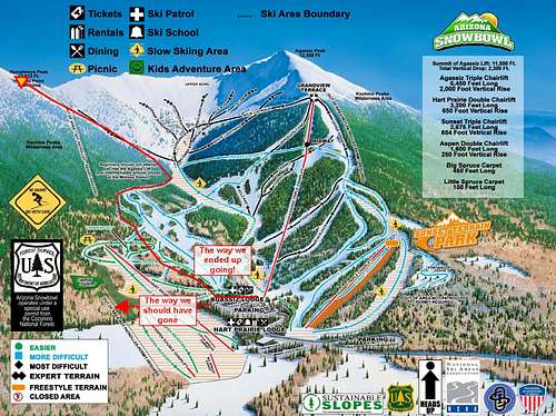
So here's a map of where we THINK you can catch the route as well as a visual summary of the route we ended up taking.
We parked at the Agassiz Lodge and made our way to the Hart Prairie run per the SP route instructions, or so we thought. We recommend visiting this map before setting out on your adventure! Knowing we didn't belong on the ski runs while the resort was open, made for skirting in and out of the trees undetected pretty entertaining. We also recommend you know which runs are open before planning to use them. Ski Patrol was pretty nice to us and let us work our way to the end of the catwalk instead of turning us around.
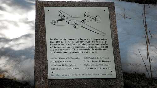
And if you're looking for the B-24 wreckage, this plaque, although pretty cool, is NOT the clue you need to know you're on the right track.
The following gear was brought and used/not-used:
We decided to save the 1/4 mile by parking at the Agassiz Lodge although we did see the Humphreys Trail start at the Hart Prairie Lodge. We recommend starting at the lower lodge to ensure you are on the trail! We were pleased to find that the Agassiz Lodge is equipped with running water and restrooms! We read that you can get the backcountry permits (guessing they are free?) at this lodge, as well, but we didn't realize that until too late.
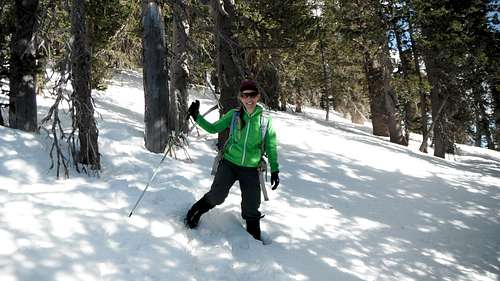
We knew to head north towards the Hart Prairie ski run and so we did! We kept looking for the wilderness forest sign that is described in the SP route page, but upon finding the B-24 memorial plaque felt that must be the way! So we started to head up, in the trees between runs. Eventually we were able to stay in the trees without crossing the ski runs. Snow was groomed, of course, on the runs, and was sparse in the trees at this lower elevation. We then found some nice blue runs that were seemingly closed, no evidence of recent skiing and decided to walk up them. We were encouraged by the run names of Dutchman (so Dutchman Glade must be nearby!) and B-24 (the wreckage must be this way!) until we were given a slap-on-the-hand by a ski patrol. At that point he let us finish walking up the catwalk provided we get off the runs as soon as possible. So at the end of the catwalk, we made our way north up the steep slope towards the saddle between Agassiz and Humphreys. Humphreys was not in sight but we knew to keep going north and once we got to the ridge, it was just a ridgewalk away. We were pretty sure that the slope we were going up was the Dutchman Glade because it met the description in the TRs we read... rockfall, steep, etc. However, we learned that lots of the slopes up this mountain met that description! We were able to stay in the snow most of the way up the ridge as the loose scree and talus was even more difficult to ascent.
We were able to stay out of the scree for the most part and stick with the snow. Snow was pretty decent since the sun was hidden most of the time. The wind started to pick up here, but was just enough to cool us down from the uphill-workout.
It was fun (but sometimes frustrating) to watch the elevation gain as measured by the Agassiz Lift in the distance. You have great views of Agassiz here, and sometimes the saddle on the ridge, but make sure to keep navigating to the LEFT, or NORTH, if Humphreys is the goal. You can't see it yet, and it's hard to judge the distance to the ridgeline.
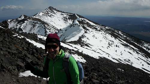
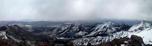
Once at the ridge, the view NORTHEASTish (or RIGHT) is of Agassiz, as shown in the photo below. The saddle between the two peaks is just above my head in the photo.
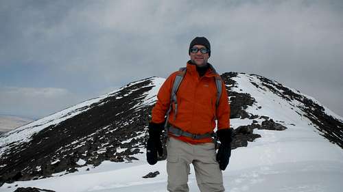
The view NORTHWESTish (or LEFT), as shown below, are the false summits of Humphreys! The ridge between the two peaks offers fairly easy hiking and the summit is probably less than 1 mile farther. The snow was not too slippery or steep. However, I can see how wind would make this much more dangerous. Downclimbing of the false summits can easily be avoided by hiking around them, but at the loss of the fantastic views. Do make sure that the snow is stable, especially around the cornices.
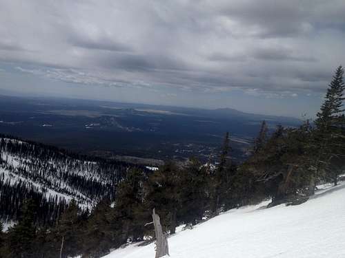
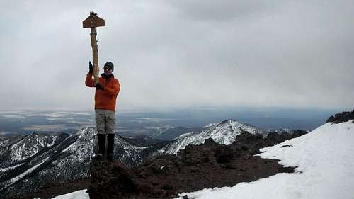
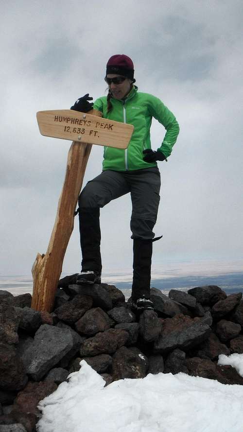
The summit offers your choice in dugouts for wind protection as well as signs to take photos with! Views even on this semi-clear day were breathtaking: Grand Canyon, Painted Desert, and more!
After snacks and photo taking, it was time to descend, hopefully before the snow got too soft! We went down a different slope than what we ascended, hoping it was the Dutchman Glade and we'd find the wreckage. After realizing we still hadn't found the right slope, we just set the compass for the Agassiz Lodge and tried to minimize post-holing in the trees. Glissading (on butt or feet) was possible (and fun) in several spots!
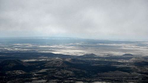
Photo below is the view looking north from the summit, into the "crater".
The Grand Canyon can be seen in the distance.