Prologue and Stats
ME: "Lets climb the west arete on Constance"
Dane: "Sounds pretty Cool! I'd really like to do that route"
ME: "It's pretty moderate and the weather has been warm lately should be dry"
Alright, so we have this random Monday in early June that sounds like the perfect time to do it right? Well, the scree and junk in Avalanche Canyon will be nicely covered but it's late enough that the trail to Lake Constance is snow free. As I weigh my options I come more and more to the conclusion this is the perfect time to do this route and to some extent I was correct....except for when I was wrong!
RT Mileage: 19 miles (Including bike travel)
RT Elevation Gain: 7,000 feet (Including bike travel)
Total gain rock climbing: ~1,100 feet
RT Time: 19 hours
Some ups and downs on a Topsy curvy roller coaster of a climb
I get off work Sunday afternoon around 5:30PM and finish packing up. I realize I won't be making my 6:00 meeting time so I call Dane to say I'll be a couple hours late. Our conversation goes something like this: "ah thats ok we can just head over tonight, camp at the washout and do it in a day no biggie" Oh If only If only.....
I end up picking Dane up in Seattle around 7:15 and we head over to Edmonds to catch the ferry. The sunset from the ferry was quite scenic and we got to see the sun descend behind Constance as the clouds drifted away. With a sunny forecast called for the mountains we were very excited. Just as we arrived at Kingston, it was getting dark and we got to Brinnon just before 10PM. I was able to stop at the gas station minutes before they closed to grab just a little more food that I was glad I did. 10 miles up the Dosewallips Road we hit the washout and went right to sleep in the car (or at least I did).
At first light we were up and bikes a ready and by 5:30 we were off. It was about 4 miles up the gentle gravel road to the start of the Lake Constance trail. I was wearing flip flops and carrying my plastic boots on my back, along with the rack and all that other stuff I appear to need to go alpine rock climbing. Shortly before the trailhead there is this rocky stream I try to bike through only to end up face down in the water with a bunch of scratches and a wet foot. "Stupid Pack!" is the first thing I can think of to say as if I would have made it across just fine without it.
We reach the trailhead around 6:30AM, stash our bikes under a bridge and I instantly realize it was going to be a difficult trail to hike in sandals but I didn't want to hike up in plastics and the thought of bringing approach shoes seemed to cross my mind while I threw everything in the car so off we were heading up 1,700 feet of rocky, steep and dirty trail through the old 2009 burn area and over many wet logs until we get to the flat area halfway up. We take a break here and I examine my sandals and am glad I don't have any broken toes yet.
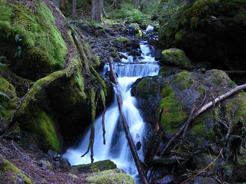
![Waterfall on Lake Constance trail]() Small waterfall along the trail
Small waterfall along the trailWe continue an additional 1,700 feet up even steeper and more grueling terrain which included a large amount of class 3 scrambling with exposure until we reach Lake Constance. I was shocked the NPS advertised this trail on their website...people could die here! It took us about 3.5 hours to hike the trail and shortly after 10 we were hiking above the lake. By this point I was not worried about time at all as I was assuming it would take merely a couple hours to climb the route then a couple more to descend. I had also looked at my map incorrectly and thought Mount Constance was 7,100 feet high...which would make the rock climbing portion only 600 feet long. I seem to recall as we climbed the route it was way more than 600 feet but I wouldn't find this out until on the ferry ride back lol. So we slogged up somewhat nice snow a long 1.5 miles up Avalanche Canyon to Crystal Pass. The final 300 feet sucked as the snow got softer but we managed to make it to the pass at 12:30PM. Along the way in the canyon, I remember the geology nerd inside me showing its true colors when we passed by a huge vertical wall of pillow basalt on the east flank of The Thumb.
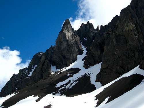
![Pillow Basalt Rock]() Pillow Basalt cliffs
Pillow Basalt cliffs
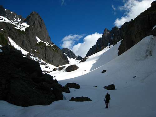
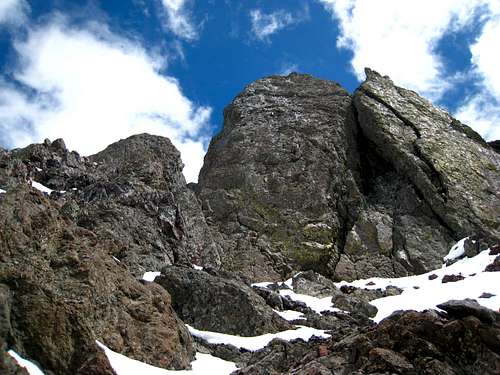
| ![Avalanche Canyon]() Dane headed up Avalanche Canyon
Dane headed up Avalanche Canyon
|
Anyways, once at the pass I racked up and we traversed around a small tower to get to the start of the steeper rock climbing. We agreed to simul-climb the first part of the route as much as possible. As I started up the first right-trending ledge and up the rock the clouds rolled in and it became foggy. WHAT! I screamed... it was bright and sunny moments ago! Onwards, I continued up a 20 foot vertical crack with a piece of red webbing around a chalkstone at its base as my first tried and true piece of pro! At the top of the chimney I belayed Dane up and we realized we were moving slower than molasses in January...or did we just stat the route really late? I don't know has to be one of those things. "Isn't this a grade 1 or 2 climb" I ask myself....like The Tooth? Maybe it pays to check the grade as well instead of looking at the YDS class and thinking uneasily quick "Oh I can lead that!" lol
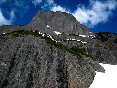
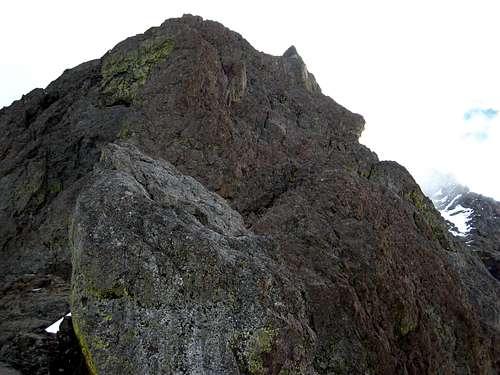
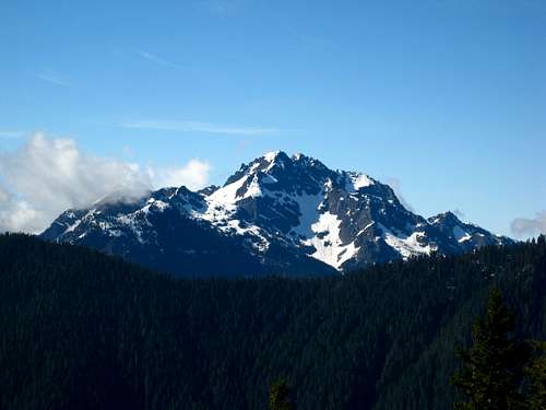
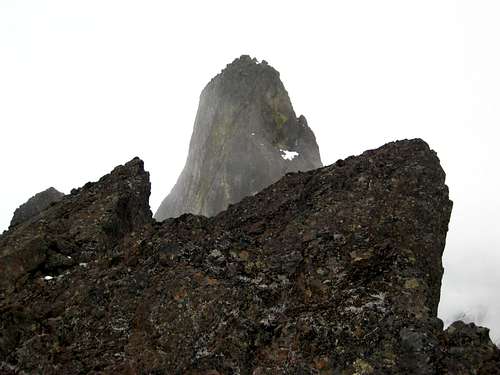
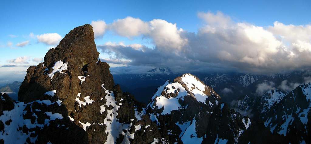
![Mount Constance]() A look at the rugged south and west faces of Constance
A look at the rugged south and west faces of ConstanceAbove the wide crack I continue around through some snow covered class 3 easy terrain that isn't so easy when snowy. I quickly realize my rock shoes are worthless and put the boots back on and find a way up a dripping wet slab to reach the base of two towers. My route description tells me to find a ledge on the right side of the right tower which low and behold there was a perfect ledge. So we continued simul-climbing across this ledge and up to the crest of the arete where we traverse a short but rugged flat section of ridge (which was horribly snow covered) to the big ledge at the base of the upper wall. Dane and I decide to pitch the rest of the climb out. So we rest a little in complete fog while I curse the blasted weather forecasters for getting it so wrong it felt like 3 rights only sometimes make a left! I thought about the nice views of the Brothers we had earlier in the morning.
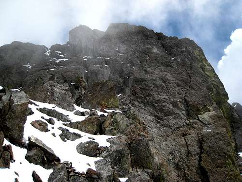
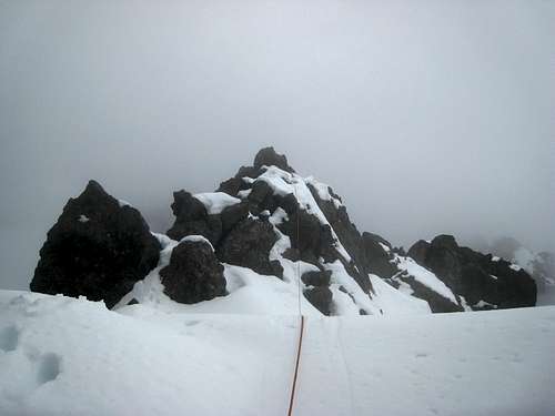
![Looking towards the crux]() My only glimpse of the upper wall
My only glimpse of the upper wall
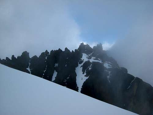
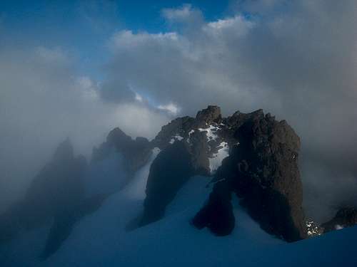
| ![Foggy traverse]() Traversing the arete to the big ledge...in fog
Traversing the arete to the big ledge...in fog
| ![The Brothers]() View of the Brothers earller that morning
View of the Brothers earller that morning
|
So once we were both ready to go, I started up the crux wall which began as a right trending ledge, then a left one and then up past two pitons and continuing left to a piton at the base of a 15-20 foot chimney. I belayed Dane up here since rope drag was annoying. Once he got up I started up the chimney and thought I'd try and take advantage of our full 70 meter rope. So I continued up a mellow section of run-out face climbing, then reached a vertical wall that I went around to the left side of. I noticed a nice left facing open book and started right up as the rope drag got worse. Probably should have belayed at the base of this open book but I was committed now. I get to the top and begin making a hand traverse left to what I can clearly see is easy snow covered scree. Just as I'm about to reach easy terrain I hear a scream something on the lines of "Out of rope!"
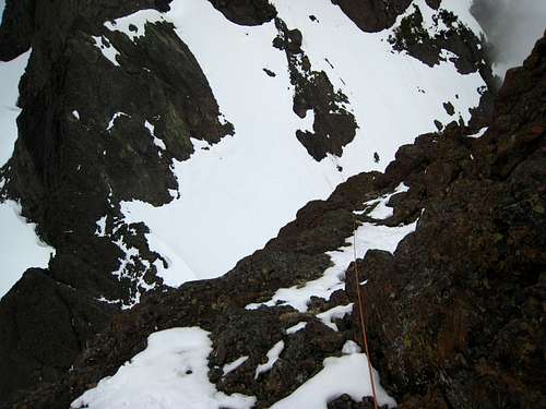
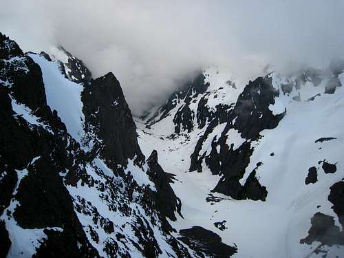
![Avalanche Canyon]() Looking down Avalanche Canyon near the end of the route
Looking down Avalanche Canyon near the end of the routeDrat! I'm 10 feet away! I was forced to stand on a questionable foothold on a smooth snow covered slab and make an anchor with a well placed chock and a couple crappy cams. I begin a very uncomfortable belay and as Dane climbs I am thinking about the very comfortable belay I could have 10 feet to my left!!! Soon enough Dane makes it to me and I have him just continue to the easier terrain instead of bothering with the dumb spot I was in. All this time it's still foggy and I'm being dripped on every once in awhile from an unknown water source. Dane boots up some snow just above me and I finish the route and meet him at the nice easy section he's standing on...only after an event I won't describe that involved lots of yelling.
OK finally we are done! "What time is it?" Damn...it's 6:00??? It took us over 5 hours to climb 600 feet??? (remember I misread the map!). Well now that I was thoroughly demoralized that I am a god awful slow leader (although slightly less demoralized afterwards when I found out it was almost twice as long as I thought) and that the summit was still an hour of snow covered class 3-4 exposed scrambling away (on the standard route) we began our descent. Dane had been up Constance before via the standard route so I was hoping we would have a smooth descent.
Wait...is it that tower we traverse? Does that gully look right? What the heck is that?
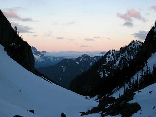
All questions I peppered Dane with the entire way down (sorry man). I led the climb so I figured he could lead us down the standard route since he'd done it before. However with the fog and way too much snow covering all traces of a trail or cairns, least to say we were very confused and our descent involved loads of route-finding, snowy and wet class 3-4 scrambling and steep snow to traverse that I might add was incredibly soft to the point we would set off our own wet slides below us every step! Once we hit the summit ridge crest we scrambled down to the south some class 4 stuff and managed to find the ledge around the left side of the first set of towers. Dane then recognized the Finger Traverse and opted against the Terrible traverse since it would involve losing elevation and traversing loose snow with a death cliff below. However upon reaching the finger traverse it was dripping so he did a good job of finding the bypass to the right side of the tower. Once around that tower we descended to a large snowfield and after more route-finding issues we finally figure out we must descend to the left around the rib instead of climbing up through one of the notches. Once past that we locate the notch above the north chute, then finally find the correct snowfield to descend to reach the notch above the south chute. I scream to Dane in the process "Wait there is another ridge between us and Avalanche Canyon" thinking we had gone too far but to my relief he stated that's how it's supposed to be. I had noticed it was finally beginning to clear up and we actually got to see a nice sunset.
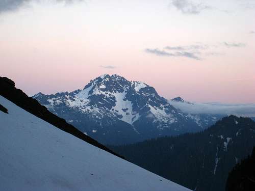
![Sunset from the south col]() Finally a nice view! Sunset from the notch above the south chute
Finally a nice view! Sunset from the notch above the south chuteSo down we went. There was about 2-3 inches of snow covering most of the scree in the upper south chute making the descent a little less terrible. Once we got to the next notch we could clearly see Avalanche Canyon and we were smooth sailing down awesome plunge stepping snow to the Lake. By now however the sun had set at twilight was getting dimmer. Once back at the lake we both rank a load of water and grudged about the 3,600 foot hike down the steep trail in the dark. I'll spare you the details and just say it sucked...I was wearing plastic boots the whole way down. At 1AM we made it back to the car after only 19 or so hours from when we started. We went right to sleep
zzzzzzzzzzzzzz


Comments
Post a Comment