
|
|
Mountain/Rock |
|---|---|
|
|
46.89980°N / 10.03300°E |
|
|
Mountaineering, Aid Climbing |
|
|
Spring, Summer, Fall |
|
|
9131 ft / 2783 m |
|
|
Overview
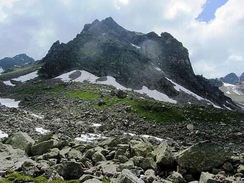
Kleinlitzner from the approach in the Kromertal
The normal route to the summit is an attractive Via Ferrata, grade B/C. That puts it within reach of hikers without mountaineering experience, but with a head for hights, the proper gear and someone else to come along on the climb to explain how to use it.
The "ß" in German words is pronounced as an "s".
Ignoring some finer points, in writing it can be replaced by "ss", which means that Grosslitzner is just a different spelling of Großlitzner. See here for a more elaborate explanation.
Ignoring some finer points, in writing it can be replaced by "ss", which means that Grosslitzner is just a different spelling of Großlitzner. See here for a more elaborate explanation.
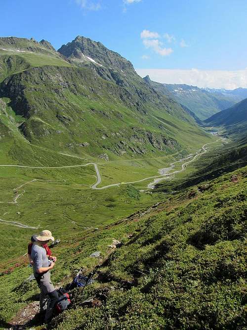
Following the border further to the southeast, the ridge drops to the Seelücke (2776m), then rises to Gross Seehorn (3121m), the highest peak in the direct vicinity. "Lücke" means "gap", and there are marked hiking trails over both of them. And further along on the ridge, just past Gross Seehorn, is Großlitzner.
Directly north of Großlitzner and Gross Seehorn lies the small Litzner glacier. Both from the route and from the Kleinlitzner summit, there are great views of all the surrounding peaks and this little glacier.
At 2538m, near the start of the Via Ferrata, lies the Saarbrücker Hütte, a welcoming place to spend the night or just for refreshments. I recommend their cake!
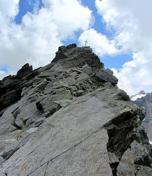
Kleinlitzner from the south, seen from the trail to the Seelücke. If you look closely, you can see the summit cross. The last part of the normal route is by the short easy ridge on the left side of the summit, but it doesn't look easy to get up there in the first place. Fortunately a Via Ferrata leads the way.
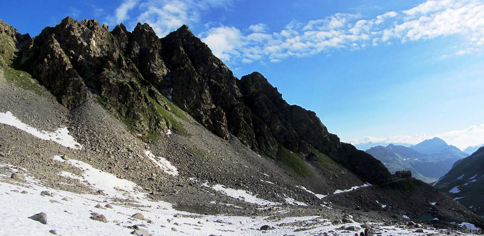
Scroll to the right to see the Saarbrücker Hütte low on the west ridge.
Scroll to the right to see the Saarbrücker Hütte low on the west ridge.
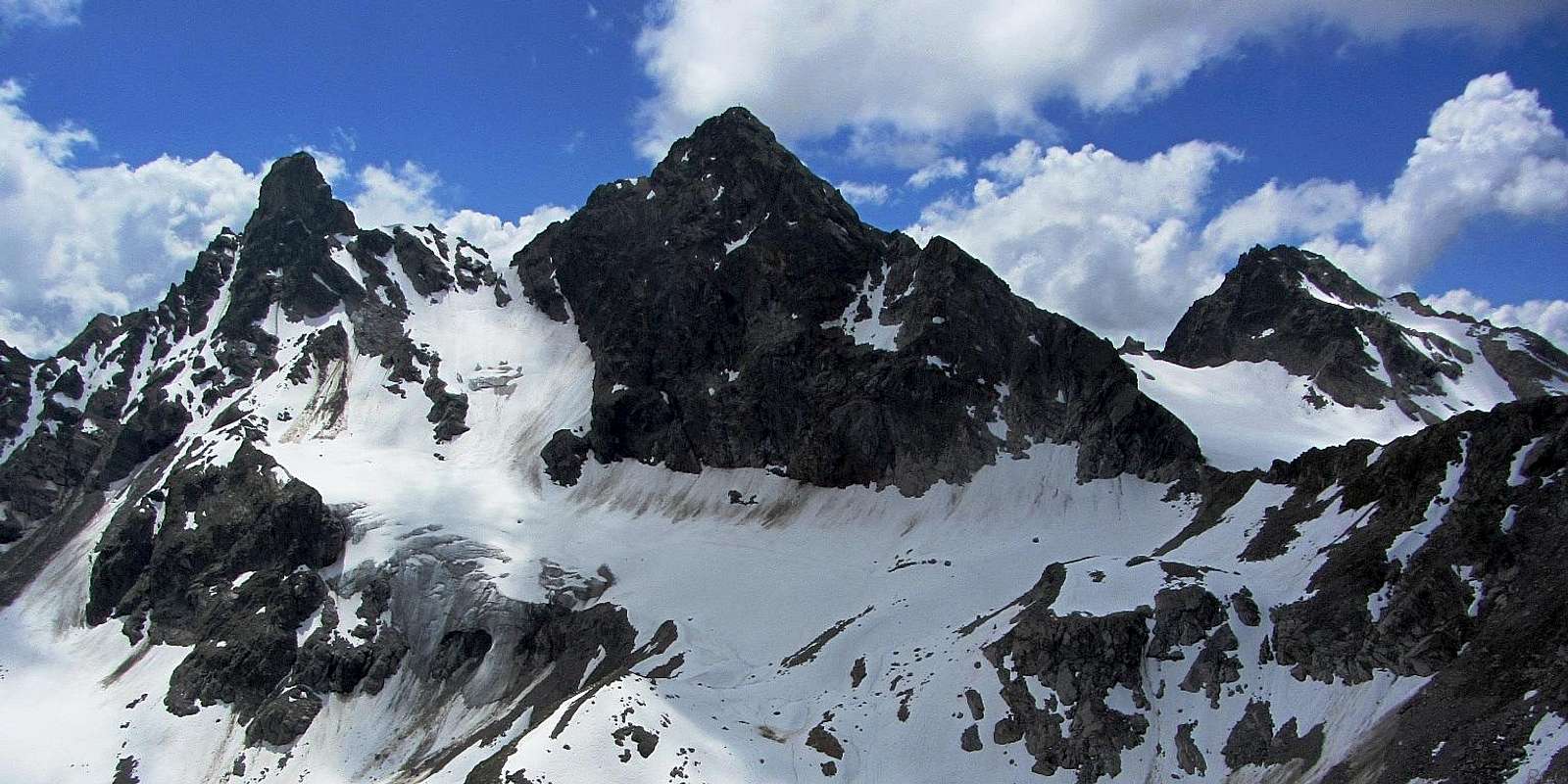
View south from the Kleinlitzner summit. From left to right: Großlitzner, Gross Seehorn and Chlein Seehorn.
Getting There
Google map centered on the Saarbrücker Hütte. Switch to satellite view and zoom in, and you can clearly see it.
View down the Kleinvermunt valley from Bielerhöhe, with the Silvretta Hochalpenstraße towards Galtür
To avoid the road, there are hiking trails branching off at various sections. On foot, count on two hours to get to the refuge.
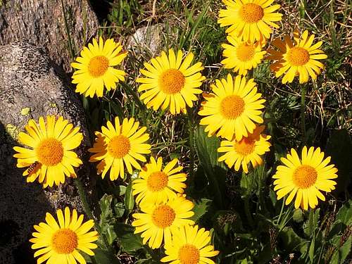
Arnica montana growing on the flanks of Tschifernella
The road leading to the Vermunt Stausee as well as to Bielerhöhe is the Silvretta Hochalpenstraße. This is a toll road, but on the plus side, parking is free. In winter the road is closed. NOTE: In 2013, the toll road closes early on the western side, on 30 September. You can still get there from Partenen by the Vermuntbahn cable car and a shuttle bus, or you can drive up from the eastern side.
Buses frequently travel along the Silvretta Hochalpenstraße. The toll part is between the Austrian villages of Partenen and Galtür. The only way to get to Partenen is from Bludenz, to the northwest, and similarly, the main road to Galtür is from Landeck, to the northeast. Both Bludenz and Landeck have a train station. For detailed travel information, check out OEBB. You can search directly for Bielerhöhe or for Vermunt Kraftwerk (that's German for power station).
From Switzerland, all approaches are longer. The shortest routes from Switzerland to the Saarbrücker Hütte are from Klosters-Monbiel via the small Seetalhütte, or from Klosters-Schlappin, but I don't know how long either of these routes takes. Let me know if you have done this, so I can update the page. Klosters can easily be reached by train. Swiss trains are expensive, but the network is very good.
Normal Route
OSM map of Kleinlitzner, with the hiking trails in the area and even the Kleinlitzner Via Ferrata
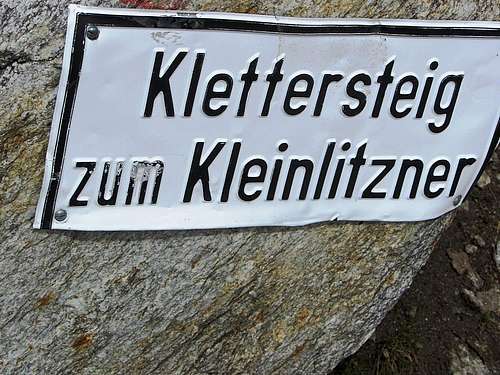
Sign marking the turn-off to the Via Ferrata, about 300m west of the Saarbrücker Hütte
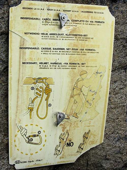
Multilingual information panel at the start of the Kleinlitzner Via Ferrata
Eventually the route comes to a saddle not far below the summit. The cross beckons, and it's just a matter of minutes now. It's easy scrambling all the way to the top, and once again secured by a steel cable.
Expect about two hours from the Saarbrücker Hütte to the summit and back. If the route is busy it may take a bit longer.
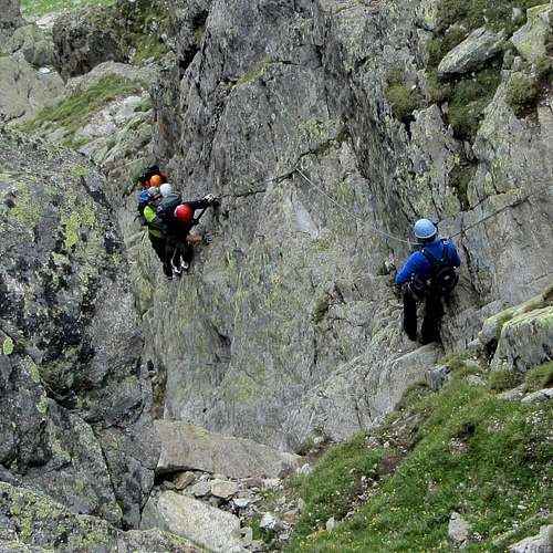
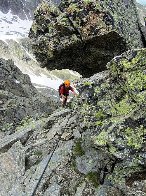
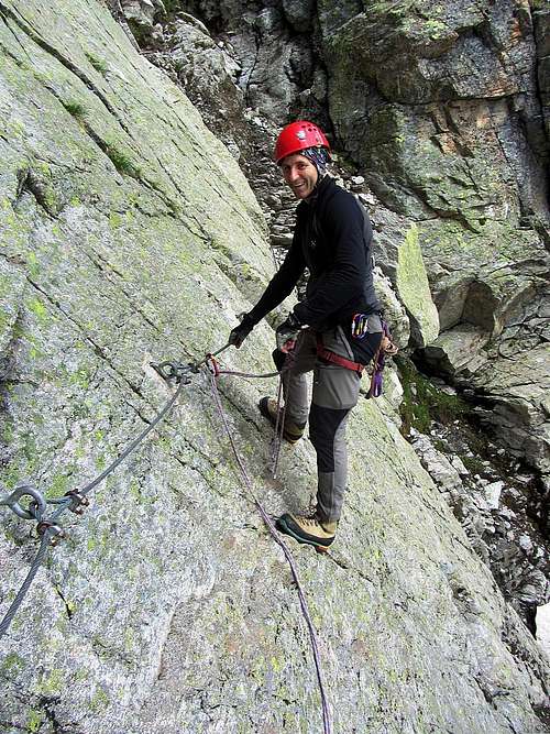
A group of climbers on the route. Apart from the cable that you can use, there are lots of steel pegs to stand on.
The final scramble
A solo climber on the final meters - note the steel cable securing the route
Using the steel cable and a bit of friction makes this short traverse easy
Red Tape
The Silvretta Hochalpenstraße between Partenen and Galtür is a toll road. Even as a bus passenger you have to pay extra on top of the fare; in 2013, I paid € 3.50.When to Climb
Best from mid to late spring to early autumn, as long as there isn't too much snow so the Via Ferrata isn't all covered up.Accommodation
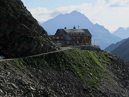
Saarbrücker Hütte
There are lots of accommodation options in the nearby villages, including Partenen and Galtür. In winter this is a busy ski area, but in summer it's more relaxed and usually there is plenty of room.

Alpenrose in the Großvermunt valley, west of the Madlener Haus
External Links
Kleinlitzner Klettersteig - A good description of the route, in German.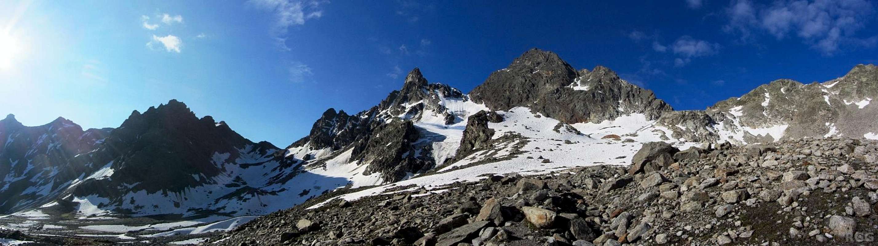
Early morning panorama of the Glotterspitze, Grosslitzner and Gross Seehorn from close to the Saarbrücker Hütte