
|
|
Mountain/Rock |
|---|---|
|
|
46.95860°N / 10.09940°E |
|
|
Hiking |
|
|
Spring, Summer, Fall |
|
|
7205 ft / 2196 m |
|
|
Overview
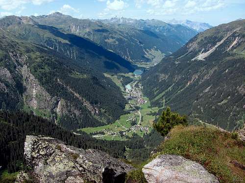
The view to the west from the summit cross. The nearby village of Partenen lies more than a 1000 m below.
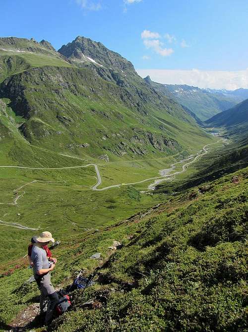
The main ridge of the Breitspitze extends to the east. It's wide and undulating, although not so wide that you could get lost. About one kilometer east and some 50 meters lower, it reaches the key saddle.
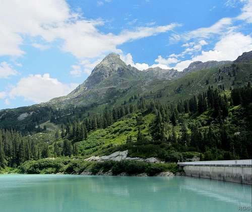
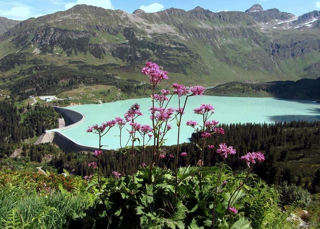
Ballunspitze from Kops. The structure on the right is the dam.
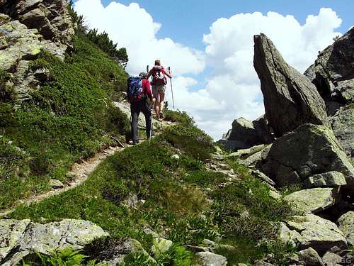
On the undulating east ridge
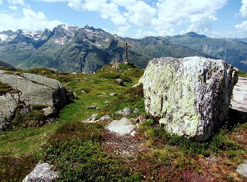
The summit cross on the Breitspitze is clearly not on the highest point - this big boulder is
Near the summit, the south side is very steep too, and the north side is only marginally easier. But further east that changes, and on both sides of the ridge are a couple of hiking trails leading up to the saddle.
Northeast of the mountain lies Kops Speicher, a pretty lake. It's an artificial reservoir, serving the Kopswerk hydroelectic powerplant lower down in the Montafon.
While the ridge is above the tree line, the lower slopes are forested, and the banks of lake as well as some open areas in the forest and alongside the trails have an abundance of flowers.
View from the slopes of the Breitspitze, with the Verwall Group on the other side
Getting There
The nearest trailhead is at Kops (1855m), next to the big dam of the lake. It's at the end of a road that starts just outside of Wirl, the last settlement high up in the Paznaun valley, just above 1600m. In contrast to the small road, there is a surprisingly large parking lot at Kops. Much better known than Kops or Wirl are the nearby ski villages of Galtür and Ischgl.Alternatively, some longer routes start in the Montafon at Partenen (1051m), or just a little big higher up the road from there (around 1100m). There is a service road from Partenen to Kops, closed for public motorized traffic, but easy to follow on foot or bike.
Partenen and Wirl are connected by the scenic Silvretta Hochalpenstrasse, going over Bielerhöhe, a 2037m high pass. This is a toll road, and because of the high pass and relatively light traffic it's not kept open all year. It shuts down sometime in the fall and opens again in spring. In 2013, the section of the road between Partenen and Bielerhöhe closed early, for road works.
The Silvretta high alpine road from Bielerhöhe to the Paznaun valley.
The mountain is Vallüla (2813m); the Breitspitze is on the other side.
Close to the start of the Paznaun valley lies the city of Landeck. Frequent public buses from there service the Paznaun valley. Some of them go up to Kops Speicher as well, shortly after crossing over the Zeinisjoch (1842m). The bus stop is one kilometer east of Kops itself and there is an easy trail along the shores of the Kops Speicher. In fact, you can easily stroll all the way around the lake.
Partenen can be reached all year round from the northwest. Near the western edge of the Montafon lies the city of Bludenz.Landeck and Bludenz are well connected by motorway and by train.
This region of the Alps has relatively few roads. Especially when coming from the south, you may already be close, but if you travel by car you still have a long drive. For example, Klosters, Switzerland, is less than 20 km away to the southwest, yet by car it's a 3 hour drive.
To get to Partenen, the shortest and quickest option would be the long western detour, around Liechtenstein.To get to Kops, if the Hochalpenstrass is open, continue from there over Bielerhöhe. If it is closed, the western detour gets longer still: Instead of leaving the motorway at Bludenz, continue east to the start of the Paznaun valley just before Landeck.
Alternatively there is the long eastern route, via Italy, over the Reschenpass to Landeck and then up the Paznaun. Which route is faster depends on where exactly in Switzerland you come from.From Germany, in the north, it's not quite as bad. Bludenz can be reached conveniently over the Autobahn all the way from Germany. Landeck is close to the Fernpass, an important north-south connection in the Alps, but unfortunately not an Autobahn. This route is rather susceptible to traffic jams; by commercial vehicles during the week or by holiday makers during weekends.
Accommodation
 Ballunspitze in winter from Galtür
The nearest place to stay to the Breitspitze is near the Zeinisjoch, where your options include a campground and a hotel.
Routes
Open Source map of the area showing the many trails
From the key saddle, it's about 15 minutest to the top. There are two trails on the ridge, which join shortly before the summit.
All the hiking trails first have to gain the ridge, at or near the key saddle. There are four of them, and if you consider the many junctions further down, there are numerous routes and variations. I'll mention the main ones.
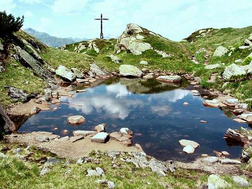
Even close to the summit there was water on the broad, undulating east ridge
- From the nearest trailhead at Kops (1855m), the total elevation gain is less than 400 m, making it a fine outing for the whole family on a nice summer day. Kops lies northeast of the mountain, right next to the lake. The route first crosses the dam, and then turns east, following the southern shores of the lake. Soon there is a sharp turnoff to the right, and that's the way up. It's never really steep. Higher up, approaching the ridge, the route passes a number of small high alpine lakes. In fact, even on the ridge itself there are puddles and tiny lakes. There are signs at all the junctions along the trail. The route gains the ridge just west of the key saddle.
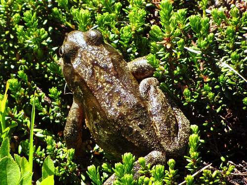
This toad lived near one of the ponds high up
- From the summit station of the Birkhahnbahn, the ski lift from Wirl, follow the up and down trail to the east, traversing the lower northern slopes of the Ballunspitze. The trail descends to a junction in the middle of the ski area, at about 2000m, before it starts to go up seriously. At that junction you can also hike down, and a little lower turn left for Kops, or right for the Zeinisjoch.
- From Partenen (1051m), or the roadside near the turnoff to the private road to Kops, a much more quiet route goes up the valley south of the Breitspitze, along the Vallülabach. At a junction at around 1900m the left branch heads up steeply to the key saddle, the other one keeps following the Vallülabach to the Vallüllasee (±2150m), and from there another trail rises more gently gently to the key saddle.
External Links
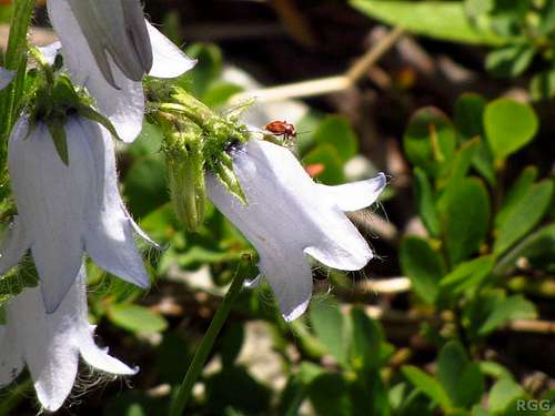
Ladybug on Campanulla alpina - on the slopes of the Ballunspitze, not far from the lake
Montafon