
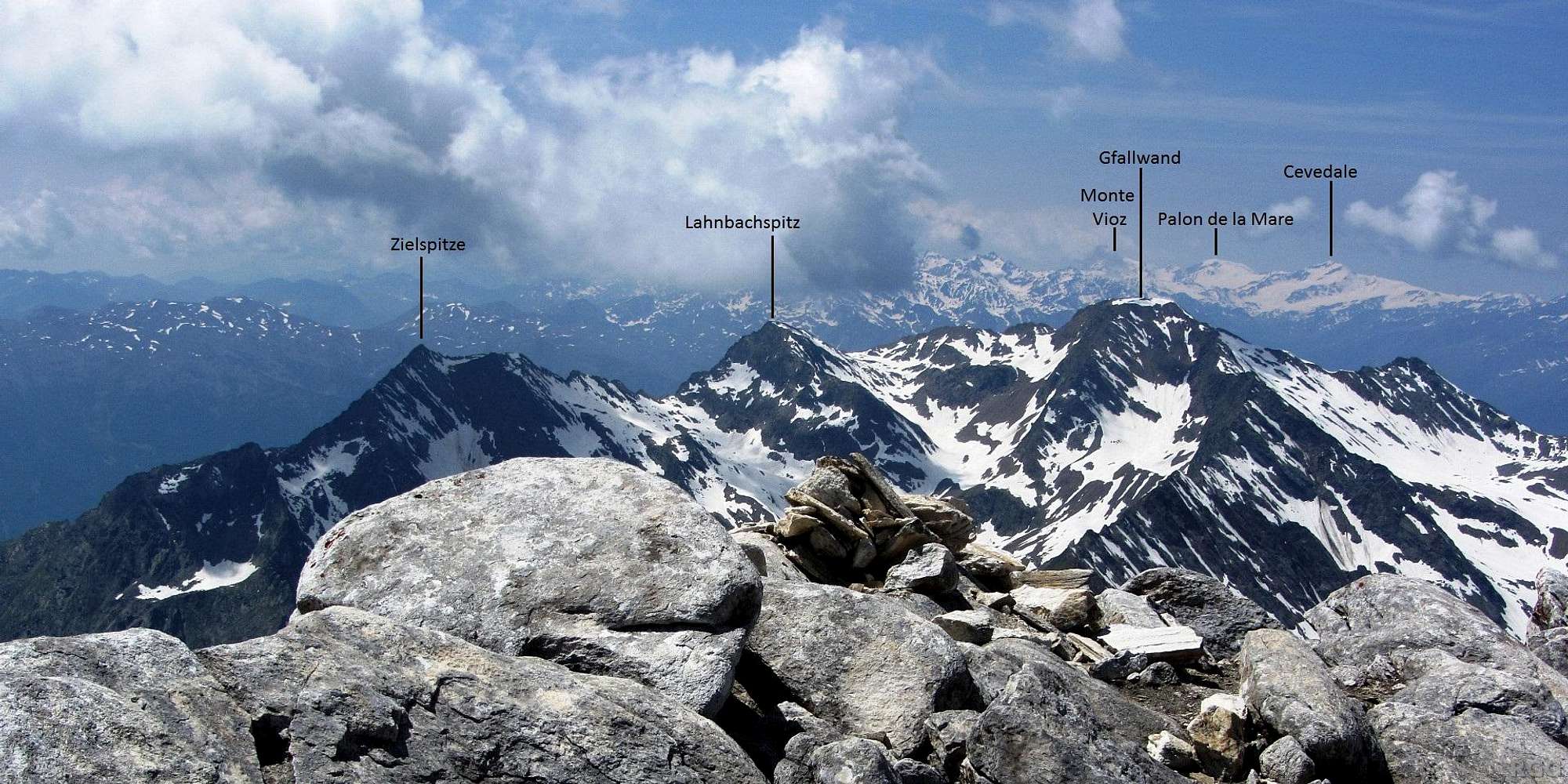
Annotated Lodner summit view towards the Gfallwand and beyond to the distant Ortler group
To give a idea of the distances involved, the Gfallwand is 5 km to the southwest, Cevedale about 45km.
Today I started at the Lodner Hütte (2259m), located just southeast of here, deep down in the valley. It's invisible because the bulky mass of the Lodner. The climb took me 3 hours.
I'm just enjoying myself day by day, and have no plans for tomorrow yet. Only at breakfast do I finally decide to try the Gfallwand. If I had known that today, I might have studied it more closely now! Most of the route is visible here, although not very detailed. I would go the easiest route up, the WNW ridge, starting at the Ginggljoch on the very edge of the photo on the right. Crossing the rocky false summit required a bit of scrambling. It was never difficult, but there were a few pretty exposed spots between the false summit and the saddle to its left. From there to the big, flat true summit it was easier, and less exposed too. On the way down, from that same saddle I opted to descend the snow slope on the north side, traversing back to the Gingglejoch far below the false summit.
15 July 2013.


