A bit of background
Nevada, the Silver state has intrigued me for years. It is sparsely populated and has just a few main roads that are paved. It still has the old west feel to it and the history of the state is rich and full of what made the frontier of America wild. One of my Nevada goals was first to reach the highest point in all 17 counties, a goal I accomplished on Mt. Grant in June of 2008.
After finished up the county highpoints, I needed another goal in Nevada to keep me involved and the list of Nevada prominence peaks with over 2000 feet of prominence came to my rescue. My true love affair with the state really began when I started chasing
this list that contained over 169 summits and that doesn't even include another 8 peaks that are known to the prominence peakbagging community as error range peaks. So overall, there are 177 peaks in Nevada that I wanted to visit and in doing so, I have been practically to every part of the state and on every kind of road imaginable.
The real challenge of Nevada prominence peakbagging is the "getting to" these peaks. While some can be accessed rather easily off of pavement, the majority are miles from anywhere and requires a high clearance vehicle with 4 wheel drive. I also carry two extra spare tires and extra gas, food and water. It is ideal to also be in the company of another similarly equipped vehicle in case of a breakdown. In some of the areas, you can be back there and not see another vehicle for days.
My list of peaks achieved can be found
HERE
This trip report page will only be concerned with what I have done in 2013 and hopefully it will be of interest to a few of you but I have really created this page for myself, my family and a few like minded friends. The distances traveled, the money spent and the time required will not be dwelt upon since you can assume that each foray I have made from my home in Lehi Utah to these rarely visited peaks involves cost, time and travel. Fortunately I am blessed with a wife who understands my passion for this craziness and encourages me to do this stuff as long as I have a partner that is with me so I don't become one of those people who disappear off the face of the earth while doing so.
Nevada is not just a big desert as many people think, it is a diverse state and has more mountain ranges in it than any other state outside of Alaska. It is part of the Great Basin and has a desert like climate but the mountains are rich in fauna and flora. Bristlecone pines, one of the oldest living trees, can be found on the majority of the ranges if they are over 9000'.
Bears are only found in the western part of the state and do not exist in the majority of the ranges but wild horses and antelope are abundant as are members of the deer and elk families. Mountain lions and coyotes are the main predators to be found but are elusive and seldom seen.
This will be a work in progress as I will be continually adding peaks and pictures, maps and improvements as this trip report takes shape. My current map of all the peaks I've visited (over 119) can be found
HERE.
One thing you will note that I like to include pictures of benchmarks if the mountain has them and register pages too. Registers to me are a bit of the history of the climbing aspect of the mountain and shows whether the mountain is visited often or not. Some registers have many entries and then there are those that have just a handful of visitors in a 20 year period. An example would be Ray BM Mountain, west of Cherry Creek in eastern Nevada. When Greg Jagielski and I were there, we were the first to sign the register in over 8 or 9 years. Most of the registers you find were placed originally by Gordon MacLeod and Barbara Lilley or John Vitz. Kudos to these people who often found their way to the top of a mountain without GPS or any prevous information being available.
Another tip on visiting these peaks is to do your homework on the mapping and create a lot of waypoints. I highly recommend using the GPS technology to aid your effort and many of the peaks now have information available thanks to either
Summitpost or
Peakbagger. I also like the
Benchmark map books to help me in finding ways to access these isolated mountains.
Warning: It is not wise to travel in what I call the "outback" of Nevada without a sturdy high clearance vehicle, preferably with 4 wheel drive. I often carry two spare tires and always extra water and extra gas. Always top off your gas tank in the towns that you encounter as often gas stations are few and far between. For example, between Ely and Tonopah, it is 167 miles to the next gas. If you go off road you will use more gas and so plan accordingly. It is best to travel with another similarly equipped vehicle so that in the event of a breakdown, you don't have a 40 mile hike to get to help. Be aware that roads can get washed out overnight and flash floods can be a hazard. Rain will turn some of the roads into muddy traps and should you get in the situation where it rains on the roads you need to travel over that you might have to wait for a day or several days for the roads to dry out. Cell service is sketchy and not a sure thing although I have found an item called the
Wilson Sleek that helps boost signal in places where normally you don't have service. If you are by yourself, I'd even think about a satellite phone but that is because I might be a bit paranoid. Normally, I either travel with another vehicle that is driven by a person who knows what they are doing and both Dennis and Ken are skilled off road drivers. A shout out to Bob Bolton here who took the time to instruct me in the fine art of off road driving a few years back and my 2005 Toyota Tacoma that has taken a beating but still hums like a kitten when I get it back to pavement. I've had my share of scratches and dings and ripped off mud flaps and bent parts but I never cease to be amazed at what a sturdy and capable truck it has been, thank you Toyota for a great product. Good tires are a must. Anything less than 6 ply will be problematic and I shredded my share of tires before I learned that good tires are so important. Don't skrimp on tires, you will regret it. Over the Memorial day weekend this year, Dennis, Ken and I traveled for the whole weekend after we left pavement without seeing another vehicle. And that was over a holiday weekend. Be self sufficient and realize that the main service areas would be Elko, Ely, Tonopah and Winnemucca in the vast interior of the state. One last word, don't drive dirt roads if bad weather is probable, find something else to do and always check your forecasts before venturing into the "outback" of Nevada.
Note that each picture has information embedded - just click on it#1 - Garfield Hills Range Highpoint (8085') - March (Trip 1)
![Garfield Hills (NV)]() Garfield Hills
Garfield Hills
My first trip for 2013 was to the Tonopah area of the state. I Drove from Lehi Utah, an 8 hour drive and met up with Ken Jones at a gas station in Tonopah Nevada. I had started very early in the morning and met up with him about noon. I was really road weary so rather than take both vehicles as we normally do, I asked if he minded driving to our first objective. So we drove in Ken's vehicle (a 4 runner) to
Mina Nevada and then left pavement using
Dennis Poulin's peakbagger TR, found our way to the saddle at 7600'.
![Garfield Hills HP (NV)]() On the road in On the road in | ![Garfield HIlls HP (NV)]() Heading for the saddle Heading for the saddle | ![Garfield Hills HP (NV)]() Ken heads up Ken heads up |
The summit of Garfield Hills range Highpoint is just over 8000 feet but our route consisted of following an undulating path to get to our summit. Nothing technical or difficult, just working our way through the knee high brush and watching out for ticks. It was a good peak to start our Nevada effort off on. The roads to get to that saddle where Ken parked was decent although the roads had to be dry otherwise some of the roads we had to travel on would have been impassable.Overall, it was about 2 miles and less than a thousand overall feet to reach the summit.
![Garfield Hills HP (NV)]() Register Register | ![Garfield Hills HP (NV) pg 2]() Register Register | ![Garfield Hills HP (NV) pg 3]() Register Register |
A note about distances in Nevada. When I left Wendover for Ely, one of the first signs you see mentions that there is no gas for 120 miles. Fill up in Wendover if you come from SLC. There is a shell station that still sells gas with no ethanol in it, very rare indeed. Then when you leave Ely, the same kind of sign tells you that the next gas is 167 miles. Yikes. Only in Nevada. On my trip back one time from Tonopah in 2012, I drove 130 miles without seeing another vehicle and this was on US 6.
![Garfield Hills HP (NV)]() Looking east Looking east | ![Garfield Hills HP (NV)]() Looking north Looking north | ![Garfield Hills HP (NV)]() Looking south Looking south |
With 2125' of prominence, Garfield Hills comes in at #146 on the Nevada prominence list.
#2 - Lone Mountain (9108') March (Trip 1)
![Lone Mountain (NV)]() Lone Mountain as seen from where we car camped
Lone Mountain as seen from where we car camped
After Garfield Hills HP, Ken and I retreated to Tonopah for a nice Mexican dinner at one of the few places to eat in town that we had experience with. From there, we drove back east to find a place to car camp for the night and in doing so, drove several miles toward the mountain that was next on our agenda, Lone Mountain, #29 on the Nevada prominence list with 3808'of prominence. A nice mountain but a bit of a challenge considering it still had a fair amount of snow that we would have to contend with.
![Lone Mountain (NV)]() Car Camping spot Car Camping spot | ![Lone Mountain (NV)]() Heading toward Springdale cyn Heading toward Springdale cyn | ![Lone Mountain (NV)]() Ken heads into the canyon Ken heads into the canyon |
Using
Dennis Poulin's TR we went up via the Springdale canyon route. Don't be fooled by his "Easy & Fun hike" description, it was neither "easy" nor "fun". We followed the wash till' it turned into Springdale Canyon and it was slow going and several places had snow to contend with. There were several class 3 spots that we had to scramble up but always a fairly direct way to the peak. We left the canyon at the 8200' mark and worked our way directly up the hillside, avoiding snow where possible to the summit. A ammo can register was found in the largest rock shelter and the register book was contained in a ziplock. The peak seems to get about one ascent a year although some years none. The register went back to 1989.
![Lone Mountain (NV)]() Heading up the route Heading up the route | ![Lone Mountain (NV)]() The summit is over there The summit is over there | ![Lone Mountain (NV)]() Summit Area Summit Area |
The road to where we parked for our trailhead was 8.5 miles from US 6 (near MP 47) but the last mile or two was very rough and slow going. We parked at 6840' and you could camp at where we parked (fire ring present). I'd only consider high clearance and 4WD recommended for the last two miles as one rock shelf is encountered in the road that a passenger vehicle wouldn't get past. If not so equipped, you'll add several miles to your effort. While our route was slow going (for us), it was a decent route up to the summit. We noted in the register that some of the others who had been to the summit had come up the SW ridge. The views from top are exceptional.
![Lone Mountain Register (NV)]() Register Register | ![Lone Mountain (NV)]() Witness benchmark Witness benchmark | ![Lone Mountain (NV)]() Ken on the summit Ken on the summit |
After we made our way back down to where our vehicles were parked, we noted with dismay that the weather report for the next day was really bad and it would serve us well to head to our homes since our desire to climb Mt. Miller was not to be rewarded. We felt good however with finally getting Lone Mountain, a nice p3k that we had been looking at every time we drove by it.
#3 Worthington Peak (8968') - April (trip 2)
![Worthington Peak]() Worthington Peak - pic by Victor Zhou
Worthington Peak - pic by Victor Zhou
Dennis and I had been in Arizona most of the week preceding my next visit to Nevada and while there we had climbed some nice peaks like Dos Cabezas, Bassett, Reilly, Woodchute, Weaver, Bill Williams together with Rick Hartman. Dennis also picked up Pinnacle Ridge, Glen and Kendrick during the week but it was time to head home and we planned on picking up a few in Nevada along the way. Making the long drive from Williams Arizona took us through Las Vegas at rush hour and finally all the way to Rachel Nv near area 51. We stopped at the little store in Rachel and had an ice cream before getting after a camping spot and at least we didn't see any aliens or their kind during our short visit although there were plenty of posters and items that you could purchase with "aliens" on them. Scary, nah.
![Worthington Peak (NV)]() Steep slope Steep slope | ![Worthington Peak (NV)]() Rocky terrain Rocky terrain | ![Worthington Peak (NV)]() Dennis Dennis |
Dennis and I found a car camp spot, about ten miles from Rachel and awaited for the morning to arrive so we could make our attempt on Worthington Peak. A nice
summitpost page has been put up for it and that aided our efforts in finding the correct place to park and start our climb from. Worthington has 3088' of prominence and comes in at #60 on the Nevada 2000 foot prominence list.
| | ![Worthington Peak (NV)]() Almost there Almost there | ![Worthington Peak (NV)]() Dennis on the summit Dennis on the summit |
The slope leading up from where we were able to park, was really steep. As another
peakbagger put it "Worthington Peak was very short, with a very modest amount of gain. But it was deceivingly difficult, as it averages almost 1700 vertical feet per mile on the way up, and nearly all of it on rocky, difficult terrain." He hit the nail on the head as while there wasn't a great distance involved on this one, it was unrelenting in its steepness and often times we were moving across tricky and sometimes moving terrain. Overall it was about 3 miles round trip but with an elevation gain of over 2100'. The summit views were outstanding in all directions and this summit doesn't get too many visitors as shown by the entries in the register. A red can covered the glass bottle indicating that Richard Carey, the guy who places the red cans had been there recently.
![Worthington Peak register can]() Register can Register can | ![Worthington Peak (NV)]() Troy Peak Troy Peak | ![Worthington Peak (NV)]() Looking east Looking east |
Dennis and i signed the register and started down. I found the going down to be almost as slow as the ascent because careful foot placement was important for most of the descent. Dennis moves a bit faster on this terrain and there were times when he patiently waited while I did my "careful" footwork but eventually we reacquired our vehicles and that is always a great feeling.
![Worthington Peak (NV)]() Looking south Looking south | ![Worthington Peak register]() Register Register | ![Worthington Peak register page]() Register Register |
After we made our way back to the main dirt road, we headed for the Quinn Canyon mountain range where we made a driving exploration of some of the roads. Being stopped by snow and finding the traction iffy on the road we were on, we decided to turn around and leave this range for another day.
![Worthington Peak]() Rachel is over there Rachel is over there | ![Worthington Peak (NV)]() Quinn Canyon range Quinn Canyon range | ![Worthington Peak (NV)]() Almost down Almost down |
The next day after finding a car camp spot just off the highway near Warm Springs, we first did
Rawhide Mountain (well, Dennis did, I just waited in my vehicle while he did it since I already had done it a year prior) and then afterwards we headed for the highpoint of the San Antonio Range where we had an unlikely meeting with several of our friends.
For more info on Worthington Peak, check out both the Summitpost page and the reports on
peakbagger.com #4 San Antonio Range HP (8520') - April (Trip 2)
![San Antonio Mountains HP (NV)]() San Antonio Range
San Antonio Range
The previous year, Ken Jones and I had driven to what you might call the trailhead for this prominence peak but I was having really bad back pain so I had to opt out of climbing this mountain. That was a shame because I had already put in the effort of finding the right roads (some rather rough) and unlocking the roads in such a manner that I found the right one to get close. It was only 1200' of gain by the time I found the right spot and less than 4 miles round trip for the hike. So, it was kind of a vendetta peak for me as I wanted to even the score with this one and it made a nice finish peak for my ten days of hitting the peaks of Arizona and Nevada trip.
![San Antonio Mountains HP (NV)]() First gate next to highway First gate next to highway | ![San Antonio Mountains HP (NV)]() Heading towards the range Heading towards the range | ![Where we parked]() Our trailhead next to the mine Our trailhead next to the mine |
After we finished with Rawhide Mountain and made the drive towards Tonopah via US 6 but then cutting north on Nevada highway 376, we both made the drive that took us to where Ken and I had parked the year before. This time my back was feeling great as were my legs and Dennis and I literally ran up this peak on this visit. We found the high point (and its register) and enjoyed some brief minutes on this one as we took in the expansive views that were offered to us in all directions. One of the comments in the register mentioned another spot that seemed to vie for the high point designation so Dennis took his surveyors type scope that he uses to check elevations out and went over to the other point. It was his conclusion that the high point of the San Antonio range was indeed where the register was located. I believe Ken Jones came to the same conclusion the year before.
![2013 in Nevada]() Heading up Heading up | ![San Antonio Range HP (NV)]() the route the route | ![2013 in Nevada]() Summit ahead Summit ahead |
After spending a minimal amount of time on the summit (thanks to a very cold wind), we retraced our route and soon found ourselves back at our vehicles.
The traditional can of V8 was enjoyed and notes were taken to put in our logbooks and we were back on the road that led back to pavement.
![2013 in Nevada]() The sulmmit The sulmmit | ![San Antonio Range HP (NV)]() Another view of the summit area Another view of the summit area | ![2013 in Nevada]() Almost back to trucks Almost back to trucks |
As we got to within about two miles of the highway, we noticed a couple vehicles heading our way. It is really rare to encounter other vehicles while chasing these seldom visited peaks so seeing a couple vehicles, one with a camper on it and the other one a passenger car was a bit of a surprise. Then I noticed that they had stopped and one of the occupants was outside his car waving me down. Imagine my surprise when I discovered that it was none other than Andy Martin, and in his hand he was holding a Summitpost report that I had put up a year prior. Another pickup was parked nearby and that occupant was also outside his vehicle as it seems they were looking for a spot to camp for the night. In the camper vehicle was Bob Packard and Adam Helman.
![Some of the best]() 4 of the best 4 of the best | ![San Antonio Range meetup]() Like a mini convention Like a mini convention | ![2013 in Nevada]() Richard and Dennis Richard and Dennis |
They were all going after the San Antonio range highpoint and when Andy saw two vehicles (mine and Dennnis's) heading their way, they thought they could get helpful information from the drivers but he was blown away to discover that it was Dennis and I. I had spent a week peakbagging with Andy a couple years before in the southern Utah area of the Henry mountains and San Rafael Swell areas. Also in the other truck was Richard Carey, a well known peakbagger and a guy that Dennis had climbed Mt. Rainier with. Small world in the world of peakbagging.
We decided to camp together for the night and spent a fun evening sharing stories and in a couple cases getting acquainted. I had never met Richard Carey before but I certainly knew who he was. He is the guy who always places a red can over the register bottles you find on so many of the western peaks. I had hiked with Andy before as well as Adam Helman and I had met Bob earlier on an attempt at Tiefort Mountain in California. Adam noted that our group
represented 6 of the ten top prominence peakbaggers in the USA, all at one spot and all who would summit the same peak on back to back days. Andy had brought his wife Sarah who was also a pretty active peakbagger and would accompany Andy on several summits on their current trip before heading back to Arizona. Dennis and I headed for home the next morning where at Battle Mountain he headed west on I-80 and I headed east. One regret was passing up Saddle Mountain, a prominence peak that I still needed but I needed to get a permit from the Maggies Ranch office on the way home and needed to be there during their office hours. That permit would enable us to climb our next peak, Beaver Peak north of Carlin in a few weeks so I had to leave Saddle Mountain for another day.
For additional information, See my
summitpost page #5 Beaver Peak (8791) - May (Trip 3)
![Beaver Peak (NV)]() Beaver Peak (NV)
Beaver Peak (NV)
The permit I acquired by stopping by the Maggies Ranch office back on May 2nd paid dividends when Dennis, Ken Jones and I decided to put together a week trip in late May. Our first objective was Beaver Peak and having that permit was essential in our being able to access and climb the peak. We all met north of Carlin and car camped not far from the busy mine road that was active all hours of the night (we weren't aware how busy that mine is). From where we camped, the next morning we drove out to the "Red Ranch House" and started up the dirt track that we needed to travel on by opening several gates (and closing them) on the way to what we had picked for a "trailhead".
![2013 in Nevada]() Car Camp Car Camp | ![Beaver Peak (NV)]() Dealing with the gates Dealing with the gates | ![Beaver Peak (NV)]() Beaver Peak Beaver Peak |
Our route went up from a gate (that we had to climb over due to not being able to open it) and we headed directly uphill toward point 7343. We encountered a fenceline that we ended up passing over and found an old Cat Track that facilitated getting up to a ridgeline just east of point 8048. From there our route was obvious and both Ken and I skirted the north side of the small peaklet of 8452 and then descended to a saddle between 8452 and Beaver Peak. Dennis elected to go over Peaklet 8452 as it has more than 300 feet of prominence. Ken and I dropped to the saddle mentioned and then just went staight up the slope that led to the actual summit of this rarely visited peak. We found a benchmark and a register and the register had just a few entries in it, four to be exact since it was placed in 1999. We were visitors 5,6, and 7.
![Beaver Peak (NV)]() Ken heads up Ken heads up | ![Beaver Peak (NV)]() Dennis nears the saddle Dennis nears the saddle | ![Beaver Peak (NV)]() Beaver Peak Beaver Peak |
7 people in almost 14 years but perhaps that is understandable when you take into consideration that you have to get a permit from the property owners. One thing we did notice during our ascent of the mountain was that a ranch truck pulled up to where we had parked and checked out the permit hanging from my mirror. Yes, they do check and it does pay to take the time to get it. I was treated very favorably when I had picked up the permit back on May 2nd. I was even thanked by the manager. A facebook page for the Maggie's ranch exists and is worth a look if you ever get interested in going after this one.
![Beaver Peak (NV)]() Dennis on the summit Dennis on the summit | ![Beaver Peak (NV)]() Register Register | ![Beaver Peak (NV)]() Benchmark Benchmark |
The descent was uneventful and from there we headed back to the graded road that led us to the Red Ranch House and headed north on it to intersect the highway that would lead us to our next objective, Wilson Peak.
Both Ken and Dennis have posted GPS tracks which clearly show our route (on peakbagger.com). The overall stat's : Roundtrip mileage 7 Elevation gain 2800'
)
Beaver Peak#6 Wilson Peak (8507') - May (Trip 3)
![2013 in Nevada - Wilson Peak]() Wilson Peak (NV)
Wilson Peak (NV)
After we hit the pavement after our summit of Beaver Peak, we proceeded westerly on the highway and when it started to go north, we found a cafe-bar that served almost the whole area. At one time it had gas but the EPA state requirements made that something this small business couldn't afford so the closest gas is at the junction back where you hit the highway to Elko (or Elko itself for gas and supplies).
We had a great hamburger and listened to some gal hit a jackpot on one of the two slot machines they had in there. Heading north, we found a place to car camp at the place where the pavement ended and the dirt graded road began. Some cows seranaded us to sleep and other than that (and it was cold), we got a good night sleep in our vehicles.
The next morning, we were up bright and early and ready to go do battle with Wilson Peak. It was cold, very cold for a May night with the temps dropping down into the 20's but after some defrosting of the windows and getting the truck warmed up, I was ready to get moving. Breakfast was oatmeal so I had some good energy to use during the day.
![2013 in Nevada - Wilson Pk]() The road we used The road we used | ![2013 in Nevada - Wilson Pk]() Ken and Dennis Ken and Dennis | ![2013 in Nevada - Wilson Pk]() Nearing the summit Nearing the summit |
We went up on the west side by taking a mining road that is on the west side of the mountain. Go left at the fork where the pavement ends and watch for the mining road which you can see cutting up the side of the mountain. The road is kept open at the present time by a mining operation and requires 4WD & high clearance to deal with the steep parts and has a couple of hairpin turns that are a bit tricky.
![2013 in Nevada - Wilson Benchmark]() Benchmark Benchmark | ![2013 in Nevada - Wilson TH]() Where we parked Where we parked | ![2013 in Nevada - Wilson Peak]() Section we hiked Section we hiked |
We parked at the top of the road just before it drops down at almost 7100' elevation. ( 41.6016 116.2044 ) We found a place to easily park two vehicles just above the road and from there we walked down the road and then followed it up as it passed through the mining operation and where another truck was parked. The road ends at that point and from there we found our way up the slopes to a saddle on the west side of the peak and then easy hiking to the summit where we found a glass jar register and a couple of benchmarks. Terrific views. If you can't make it up the road in a vehicle, no problem, just walk the road up from the base.
![2013 in Nevada - Wilson Pk register]() Register Register | ![2013 in Nevada - Wilson Peak]() Summit area Summit area | ![2013 in Nevada - Wilson Peak]() Getting ready to go down Getting ready to go down |
Our descent to the mining road went really fast and we noticed that the miner had moved his truck from where he had been parked earlier. We had a chance to talk with him and found out a little about him and where he was from. He noticed my Cabela's cap and commented that Cabela's was his favorite store. I told him that I lived just two miles from Cabela's in Lehi and he said, "Hey, I live about five miles from that store". It turned out that he lives in Pleasant Grove Utah although mining takes him away from his family a good chunk of the year, that is where he called home. He had slept in his truck as he was the only member of his mining crew and it turned out that they needed to keep someone on the claim at all times as the BLM had certain requirements for an active mining operation. Soon we had to take our leave but we enjoyed our visit with the friendly miner from Utah. He said he had climbed Wilson Peak several times as there are times when he had to take a break from mining and get some good exercise in. We hiked back up to the crest where we had parked our vehicles and made the steep descent on the road back to the main road.
#7 Goshute Peak - May (Trip 3)
![Goshute Peak]() Goshute Peak
Goshute Peak
After we had climbed Wilson Peak, it was time to turn our attention to one peak that both Ken and I had wanted for quite a while. Weather, snow or mud had kept us from going after it before this time but now conditions looked good and while it was a pretty good drive from Wilson Peak to where we'd make camp, it was well worth the effort.
Using maps, waypoints and some tips from Mark Nichols, we found our way up Felt Canyon to a point where we could fit three vehicles off of the rough track which got us to what would become our trailhead. TICKS. They were everywhere and suddenly car camping took on a new flavor, fear. I hate ticks and all they have to offer and I picked a bunch off of me as they were in the grass where we had to walk. Dennis had more than his share and Ken had enough to keep him on full alert. I found two crawling on me prior to going to sleep for the night and from that point on, I envisioned them everywhere and sleep wasn't all that great.
The next morning, while it was cold, there seemed to be less of a problem but the route we would be taking was one that utilized old horse trails. Perfect of course for picking up ticks but ironically, once we left our vehicles and the road, we didn't see another tick all day until we returned. Each of us had ideas of what would be the best route to the summit as Mark Nichols wasn't really high on the route that he and Andy had chosen. In fact, Andy got injured on that route and had to have the county SAR team come in and help get him off the mountain. Dennis felt really good about a route he had come up with and the best part is that it went up the drainage which was in the same area where we parked our vehicles (Tick City). As we went up his route, it really was surprising that it was almost the perfect way to go. We never encountered any of the stuff that Mark and Andy had and we were on the summit almost before we expected to be. Dennis had solved the route problem of Goshute Peak perfectly and Ken and I were the ones who benefited from his route finding.
We were treated to a dazzling display of yellow wildflowers on the ascent and we were now enjoying this hike like we really hadn't expected to. The last bit to the summit had some high class 2 stuff but nothing was difficult or technical. On the summit, we enjoyed the views and the ancient brislecone trees that were close by. With Pilot peak looming to the south and the salt desert obvious to the east, we settled in and enjoyed reading the few entries in the register and having the lunches we had brought with us.
Goshute Peak
Also being brought up to date today and should be finished by this evening.
For a great route to the summit, see Dennis Poulin's GPS track. The key is to find your way into Felt Canyon and be able to get to where we started our hike from (we also car camped there)40.4746
114.2735.
We turned off the highway at a dirt road just beyond the sign for Blue Lake using a waypoint 40.4905 114.1530. From there we worked our way to a waypoint I'd set for the jeep track that heads up Felt Canyon at 40.48555 114.22455 The track up Felt Canyon starts off OK but gets rougher as you go. Overall, we got three vehicles almost to the end of the road (one was a tundra) but we paid the price with some of paint getting scratched and I snapped an antenna off my truck. Still, the track was doable and you could walk from any point where you became uncomfortable with the conditions.
We did have a problem with ticks in the canyon but not on the route up to the peak. A horse trail led up most of the drainage until the angle steepened but the route was pretty straightforward and easy to do. It helps to have the summit waypoint on your GPS and just head for it. We were able to skirt around some small rock bands and never had anything that was more than class 2. A nice hike via this route.
From Ken Jones:
"
This one had been in our sights for a Dean and Ken trip for several years, but there kept being too much snow on the peak or bad weather that forced us south. Maybe we should have invited Dennis earlier - it sure went well with him along, and was not nearly the brush-bashing mess we had been "looking forward to."
For our route your goal is to drive up Felt Canyon as far as you can. You will need 4WD, and high clearance, and a tolerance for scratching your vehicle on overhanging brush and trees. We camped at our parking area, and if your timing is similar to ours you will also need a tolerance for ticks and mosquitoes.
The following is from our way out, where we were continuing south. You might turn off the highway farther north to intersect this route, as we did, if you were coming from Wendover.
On Alternate Hwy 93 go to virtual milepost 34.3 and find a gravel road heading off the west side of the highway. Zero your odometer.
0.0 Leave highway
0.5 Continue straight (north) - ignore additional right forks
2.1 Keep left, up the wash (trending southwest)
4.6 Fork in wash - better road goes left and up a ridge to climb out of the wash, but keep right and continue up the wash
5.4 Go left, on mapped Jeep Trail - it gets rougher
6.3 A fork goes right to Felt Spring - stay in wash
8.2 If you get this far you should park here
You will be at the second of two forks in the wash, just west of the "F" of "Felt Canyon" on the 7.5" map. The track continues to the west and doubtless to other possible routes. We went north-northwest up the non-roaded wash at this point to its head, then bore left up the southeast ridge to the peak. There are a number of little cliff bands, but these can generally be passed on the left. There is some brush on this route, but not nearly as bad as reports of other routes have sounded. See Dennis's GPS track for details of where we walked.
#8 High Bald Range HP (9249') - May (Trip 3)
![2013 in Nevada - High Bald Peak]() High Bald Range
High Bald Range
After leaving the Goshute area, the three of us headed south to Lages junction and then north again on highway 93. Cutting inland at the appropriate road, we then made our way towards one of the least visited peaks in Nevada, High Bald HP. After we left the highway, we didn't see another vehicle for the next two days. Ken Jones put up a nice description of how to get to this peak on peakbagger and I'll quote it below before continuing on with this trip report:
"Get yourself to the intersection of county roads 783 and 784 in Butte Valley, right by Quilici Spring. There are several ways to do this - you could come in via Cherry Creek and drive north on CR 21, west on BLM 4015, and north on county 784. Or you could leave US 93 on county 783 ("Butte Valley Road") and follow it to the intersection. There are many other ways to get here, and they vary in quality of road and length of drive. But you can reach this point on good gravel roads.
![2013 in Nevada - High Bald TH]() Our camping area and TH Our camping area and TH | ![2013 in Nevada - High Bald]() The route The route | ![2013 in Nevada - High Bald]() Looking back Looking back |
Just north of the intersection (<100 yards) a lesser road heads west towards Medicine Spring. There was a BLM sign on the ground at this point when we visited. Follow this road (high clearance) as it winds to the SW quarter of section 18. Go south and follow the road toward Mud Spring (decent road to here) and beyond (much rougher; we used 4WD). Keep left at the junction marked 2104 meters on the topo and continue as far as you are comfortable. We went beyond the end of the mapped road and found a very nice camping spot on the ridge where the GPS track begins."
We drove as far as we dared on the roads he describes and just when we thought we might have to backtrack, we found a great spot that seemed made for our three vehicles. We spent the night with the only sound being the wind as it blew over the area we were car camped at. In the morning, we took our time and enjoyed a leisurely pace for breakfast and all too soon, we found ourselves hiking up toward the summit area which was not a huge distance away. Following horse trails, we soon ran into the trail makers themselves who seemed to wonder what these strange two legged animals were that were heading toward them. This is wild horse country and we saw them everywhere we looked. A small group of about 5 grudingly gave way as our path to the summit led right toward them.
![2013 in Nevada - High Bald]() Wild horses ahead Wild horses ahead | ![Ken and I atop High Bald in Nevada]() Ken and I Ken and I | ![Dennis and I on High Bald (NV)]() Dennis and I Dennis and I |
The route to the summit was relatively gentle and soon we found ourselves on the summit and impressed with the terrific views we had in all directions. We found the glass bottle register and signed in while we took some time to relax on the summit. As we looked in different directions, we could small groups of wild horses just about everywhere. This area is indeed wild horse country.
![2013 in Nevada - High Bald Benchmark]() Benchmark Benchmark | ![High Bald Register]() Register Register | ![2013 in Nevada - HIgh Bald]() West to Pearl Peak West to Pearl Peak |
The summit itself was a relatively broad area and we found a cairn there containing a register bottle and a nearby benchmark. The views were outstanding and we were also fortunate to really have a perfect weather day, blue skies and no wind. Nice.
![2013 in Nevada - High Bald]() NE to Spruce Peak NE to Spruce Peak | ![2013 in Nevada - High Bald]() South South | ![2013 in Nevada - High Bald]() North North |
After a nice summit stay and taking our pics (some are posted here) we began our descent down to reach our vehicles and get to the long drive that was ahead of us as our goal was to find a road on the west side of the Butte Mountain range that would put us fairly close to our next peak.
High Bald Range HP#9 Butte Mountain Range HP (9052') - May (Trip 3)
![Butte Mountain (NV)]() Butte Mountain Range
Butte Mountain Range
Driving back to the junction near Quilici Spring (mentioned in High Bald TR), we headed south for quite a ways. Using Benchmark's mapbook, we were able to figure out the road system that eventually led us to Caboose Spring. Again, let me refer to Ken Jone's comments that he posted on peakbagger:
"Get yourself into Butte Valley on CR 19 west of Black Mountain. CR 19 is good gravel, and this spot can be reached from many directions. take one of the two forks of the Y that join together and proceed to Caboose Well (actively pumping while we were there). Here the road becomes more obscure and high clearance is needed (and possibly 4WD). Heading west from the well is a two-track across the flats. It doesn't look like much - in fact, we looked at it and went another way on our way in. We shouldn't have. If you can clear the brush in the center of the track at the beginning, it gets better. Follow this across the valley to the 5-way junction and take the northwest trending fork (just north of the main junction). This track leads into the canyon northeast of the peak. High clearance and 4WD are a good idea, and a lack of respect for your truck's paint job. The road/jeep trail continues as shown on the map, and then just stops. We camped here.
From the end of the road we followed horse trails, mostly, as indicated on the GPS track. Lots of horses in these mountains. No technical difficulties."
![Butte Mountain (NV)]() Caboose Well and Butte Mountain behind it Caboose Well and Butte Mountain behind it | ![Butte Mountain (NV)]() Heading for the mountain Heading for the mountain | ![Butte Mountain (NV)]() Check out the green arrow Check out the green arrow |
Since Ken pretty well described how we got to where we car camped, (at the very end of the jeep track), we spent what was left of the afternoon relaxing and getting dinner and our packs ready for the hike on the following day. The only reason I knew about this jeep track was thanks to information provided to me by Greg Jagielski who had done used this route to gain the top of the peak. John Vitz had accessed this peak from the west side of the range but since Greg had done it fairly recently, it seemed best to follow his lead.
In the morning, we were up early enough to get breakfast and then started following a pretty decent trail made by the local wild horses of the area. One feature of following a horse trail in the spring however is ticks. Yes,
ticks and wild horses go together but as a person who hates ticks, I don't really like their relationship. Before the hike was over, I had found at least 30 ticks on me and Dennis had picked up another 15 or so. Ken who followed in our steps, was least attractive to them so he only had less than a dozen to flick off his nylon fabric (they can't cling to nylon as well as cotton). Well anyway, ticks aside, there were plenty of good trails established by our horsie friends and just as soon as you'd lose one trail, another one would show up and generally would go in the direction we wanted it too. Later on during our hike, we could hear some of our wild friends snorting and making noise and we discovered that there were about 6 or 7 horses fairly close to us as we proceeded up the mountain.
![Butte Mountain register]() Register Register | ![Butte Mountain (NV)]() Wild Horses Wild Horses | ![Butte Mountain (NV)]() Heading up Heading up |
Eventually, we finally were able to close on the summit and we all gave each other high fives as we stepped onto the highest point and had achieved success. A few of the horses checked on us but left when they saw that we had the high ground.
![Butte Mountain (NV)]() View from the summit View from the summit | ![Butte Mountain (NV)]() View from the summit View from the summit | ![Butte Mountain (NV)]() Heading down Heading down |
As often is the case, there were very few names in the register over the past
18 years, only 6 peakbaggers before us and since the world of prominence peakbagging is a small one, we knew who each one was. Amazing that we were 7,8, and 9 overall but there were a few others that had visited the top but very few, maybe 3 or 4. There had been a fire on the mountain and a couple listed were firefighters. As you make your way up and down the mountain, you pass through the burn area and it is extensive.
With our visit to summit over, it was time to get down and head for the next objectives, Ray Benchmark peak for Dennis and Ken and North Lovell peak for me. As things turned out, bad weather that evening chased us all home so trip number 4 into Nevada for me came to an end but a successful one, netting five really neat peaks and having such a special time with Dennis and Ken as partners. The highlight of the trip was picking off Goshute Peak but the low points of the trip were dealing with ticks, a lot of them. Fortunately we were able to get them all before they got us. My fifth trip into Nevada was just a couple weeks away when Dennis and I got together for some more good ones.
Butte Range HP
#10 Pearl Peak (10848') - June (Trip 4)
![Pearl Peak from Ruby Lake]() Pearl Peak - pic by joseyinnet
Pearl Peak - pic by joseyinnet
Dennis and I met in Elko near the Wal-Mart on the 12th of June with the goals of picking up Pearl Peak, Big Bald, Troy and Egan in the time we had. It was a 4 day window for me as I was working at the dental hygiene college 3 and 4 days a week so I had to grab what days that I could.
![Pearl Peak]() Pearl Peak is over there Pearl Peak is over there | ![Pearl Peak]() Almost there Almost there | ![Pearl Peak]() Looking back Looking back |
Heading south from Elko on Hwy 227 and then south on Hwy 228. On paved highway, it is roughly about 32 miles to reach Jiggs, a wide spot in the road with a bar and gathering place for the locals and continued south a few more miles (about 3) where we turned right on a great wide gravel road that continues south on NV road 719 towards the Bald Mtn Gold Mine. The paved road continues to Harrison Pass, but instead we turned right and it was here that Dennis zeroed his odometer (I failed to remember to do so and these are his mileages on his Tundra so your mileage may vary a bit) and we stayed on this good road for 10.4 miles slowing down several times as we passed through some ranches. Leaving the ranches behind, we watched for and then turned left on signed road 57362. The sign is one of those BLM picket like ones so don't be looking for a big sign, this one simply has the number 57362 on it and was located on the right side of the road. We followed road 57362 all the way to where we parked, but there are some forks and turns in the road. At 11.6 miles we stayed left, at 14.1 miles we went left, at 14.4 miles went straight, and at 15.3 miles straight again. At 16.6 miles passed an abandoned rock cabin on the right, at 17.0 miles reached a T intersection and went right. At 20.6 miles reach a water trough on the left and we shifted into 4WD as the road got a bit rougher and yes, high clearance is recommended. This became our "highway in the sky" At 21.0 miles we topped a ridge and turned left and headed for a road that is cut into the side of the hill ahead of you.
![Register page]() Register page Register page | ![Witness Marker]() Witness Benchmark Witness Benchmark | ![On the summit]() Summit Summit |
There was a great view of another higher ridge and the steep road leading up to it. This higher ridge is at about 9700 ft and we reached it at about 22.9 miles. We drove down the other side of the ridge ( a snow field would have stopped here if we had been a little earlier in the season) and up another still higher ridge to about 10250 ft at 25.3 miles. Cass House Peak is a short distance off to the left at this point. We could see the road continue towards Pearl Peak but could only drive about another .25 mile before we were stopped by snow.
It was both amazing and a bit scary at the same time to drive this as we did and the steepness wasn't apparent until we were making our descent later in the day. Still, it made it possible to pick up this peak on the same day as I had driven from Utah as instead of having over 4000 feet of elevation gain, it cut that down to about 1400 feet, considering the up and down nature of the ridge and was also fun since we were able to bag two "bonus" peaks during our visit. One on the way to Pearl and then Cass House peak afterwards.
From where we parked near Cass House peak. we had a bit over 5 miles for the round trip hike with an elevation gain (counting the ups and downs of the ridge) of between 1300-1400'. We went over the top of peaks 10563, 10449 and 10547 on the way to Pearl Peak and then traversed around these small peaks on the return to our vehicles. A beautiful hike on an almost perfect day. As mentioned earlier, the descent on the road was really steep and I was glad I had Lo-Lo on my truck to help keep my momentum under control.
An uneventful return to the main road allowed us to head for Big Bald and our objective for the next day.
#11 Big Bald Mountain (9303') - June (Trip 5)
![2013 in Nevada - Big Bald Mountain]() Big Bald Mountain
Big Bald Mountain
The drive down to Big Bald is nicely described by Dennis below but prior to making the summit of this peak, we found a spot off the road on the way in and car camped there for the night.
![2013 in Nevada - Big Bald Mountain]() Our trailhead (arrow) Our trailhead (arrow) | ![2013 in Nevada - Big Bald Mountain]() Heading up Heading up | ![2013 in Nevada - Big Bald Mountain]() Close to the top Close to the top |
From Dennis's peakbagger trip report:
Dean and I drove to the trailhead for Big Bald using the roads on the west side of the range. We took the road to Overland Pass at the south end of the Ruby Mountains. The Barrick Mine Road is a terrific road on the west side of the Ruby Mountains. In my Benchmark Atlas, the road is numbered 006. We drove east on this road for about 4.2 miles from the Barrick Mine Road to an unmarked road that goes south. This is an ok road and 4WD is not really required but high clearance was nice.
I zeroed my odometer and went 2.6 miles to a fork and turned left, at 5.2 miles we reached the top of a ridge and turned right, and at 5.7 miles we stopped at 8375 ft on the east slope of Big Bald.
![2013 in Nevada - Big Bald Mountain]() The mine The mine | ![2013 in Nevada - Big Bald Mountain]() Benchmark Benchmark | ![2013 in Nevada - Big Bald Mountain]() Register Register |
From where we were able to drive to, the distance to the summit was about a mile and less than a thousand feet of gain. From the time we parked to the time we returned to our vehicles, we could hear a constant dull roar coming from the mine to the south. It was an easy hike through grass and short brush up to the summit where there is a big communication tower. There is a terrific view of the mine from the summit and it almost blows you over when you see it. The road to the communication tower goes through the mine and there is restricted access on the roads in the mine area. Greg Jagielski told me an interesting story about the mine road as he and Kadee attempted to drive up it but half way up were stopped by a mining truck and told to turn around and get off the property as they had no permit to be there. Greg then climbed it from the north but from a different spot then we did.
![2013 in Nevada - Big Bald Mountain]() Looking north Looking north | ![2013 in Nevada - Big Bald Mountain]() Communication facility Communication facility | ![2013 in Nevada - Big Bald Mountain]() Heading down Heading down |
Dennis and I retreated back to our vehicles after checking out the register and the views and taking our usual pictures. From there we retraced our way back to the Overland Pass road and made our way south so that Dennis could pick up Buck Mountain, one I already had done. I waited at the trailhead while he scampered up and back before we were to make the long drive down to Troy Peak.
Trip 4 Big Bald Mountain#12 Troy Peak (11298) - June (Trip 4)
![Troy Peak (NV)]() Troy Peak
Troy Peak
After picking up Big Bald Mountain and Buck Mountain (Dennis), we made the long trip to Troy. After gaining the pavement about 15 miles south of Buck Mountain, we headed to Ely for gas and a subway sandwich. Then it was south via US 6 to the turnoff to Vegas via the town of Lund. About 20 miles south of Lund, there is a rest area and about a mile or two beyond that is the turn off that we needed that would allow us to take dirt roads out to the middle of nowhere to find Troy Peak. Troy peak is best accessed via Scofield Canyon but the weather was been tough to the road in Scofield and much of it is washed out. We used our high clearance and 4 WD capability to get us to within 2 miles of where the road used to go and found a spot just off the road to car camp and also use for our trailhead.
Let me use Dennis's peakbagger trip report as it is very well done:
![2013 in Nevada - Troy Peak]() Camp spot Camp spot | ![2013 in Nevada - Troy Peak]() Washout Washout | ![2013 in Nevada - Troy Peak]() Bad condition Bad condition |
"Dean and I filled a full day of hiking on Troy Peak. We accessed the peak from the east off of Hwy 318. We were heading south on 318 and reached the Sunnyside Rest Area where I zeroed my odometer. We continued south 2.8 miles and turned west towards the Kirch Wildlife Area. At 5.1 miles we took the right fork, at 9.6 miles continued straight, at 10.9 miles took the right fork, and at 25.1 miles turned right on a lesser road signed as 412. We proceeded straight towards Scofield Canyon ignoring all branch roads. The road was ok for about 4 miles and then started to deteriorate as we entered the canyon. We drove this road for 6.2 miles on increasingly rough road. 4WD is a must along with high clearance. If you don't want to beat your vehicle up, stop at about 5 miles and hike from there. We stopped about 2 miles from the Wilderness boundary at about 6600 ft. We didn't want to beat our vehicles up anymore so we hiked this last 2 miles. We made a good decision. The road is undriveable with a standard 4WD vehicle.
![2013 in Nevada - Troy Peak]() Wilderness Boundary Wilderness Boundary | ![2013 in Nevada - Troy Peak]() Huge Ponderosa Huge Ponderosa | ![2013 in Nevada - Troy Peak]() Sidehill Springs Sidehill Springs |
We car camped along the road and started hiking early the next morning. We hiked into the canyon, past the Wilderness boundary sign, took a right up the north Scofield drainage towards Sidehill Spring. At Sidehill Spring we emerged from the forest, stashed some of our water supply, and climbed up the steep grass covered slope towards the cliffs above. Just before the cliffs, we passed through an aspen grove and then encountered the cliffs. We had pictures from a Summit Post page of the route through the cliffs. We never saw anything that looked like the pictures.
We encountered the cliffs at about 9,700 ft and turned right along the base of the cliffs. The aspen trees grow right up to the cliffs so it is a little brushy, but there seems to be a climbers path along the base of the cliffs. We climbed along the base of the cliffs looking for a route up. at about 10,100 ft and maybe a half mile from where we first encountered the cliffs we found a talus filled drainage that went up. We climbed up a couple hundred feet and then encountered a mild 30 ft Class 3 little section at the top of the drainage that we scrambled up. At the top we were in another rock encircled drainage that did not look promising. We traversed to the right into the next drainage about 150 yds away and entered the promised land. We could see a good nontechnical route up a steep slope covered with pine cones, pine needles, and small talus. We climbed this slope all the way to the ridgeline at about 10,700 ft. Here we encountered a climber's trail that we followed all the way to the summit.
![2013 in Nevada - Troy Peak]() Heading up Heading up | ![2013 in Nevada - Troy Peak]() Our crux pitch Our crux pitch | ![2013 in Nevada - Troy Peak]() Dennis is about there Dennis is about there |
We came down the same way we went up. In hindsight, it would probably be easier to stay below the aspen trees and traverse up the grassy slopes until we were closer to the ramp we used through the cliffs. The route along the base of the cliffs had lots of ups and downs and some brush.
Summary Total Data
Elevation Gain:4800 ft / 1463 m
Distance:10.2 mi / 16.4 km
Route:Scofield Canyon
Trailhead:6498 ft / 1980 m
Thanks to Dennis for taking the time to put that together. I will add that this is a tough hike. There were several times when I just wanted to say "go on, I'll wait for you here" but I wanted this peak too badly to do that. I just had to reach down and keep pushing and Dennis was patient enough with my slow pace the last mile or so to help me achieve my goal. No, Troy wasn't easy but the feeling of accomplishment I got was amazing. I felt proud of myself to persevere and get this one and when I got to the top, I had a few tears of joy. As I age, these big peaks get tougher and tougher. Hard to believe I could day hike Mt. Whitney when I just about turned 65, 22 miles and over 6500' of elevation gain and return to my wife with a smile on my face after a 14 hour day. No, being almost 73 exacts a toll on speed and endurance but I can still pull these off, just at a slower pace. Thanks Dennis, you were a champ on this one.
![Troy Peak - Summit pose]() Dennis on top Dennis on top | ![2013 in Nevada - Troy Peak]() Register page Register page | ![2013 in Nevada - Troy Peak]() Witness Benchmark Witness Benchmark |
After we finished our celebrating on the summit, checking the register and taking pictures along with a small lunch, it was time to start back down. I then realized how steep the last section was and thanks to Dennis's spot on routefinding, we made it back down to the aspens with only a couple spots of getting off route and needing to backtrack. By the time we reached the water cache near Sidehill spring, I was running on fumes. We took the time to fuel up again and with renewed energy, I was good to go for the remainder of the distance back to the trucks. Troy is a great peak, one of the best I've had the privilege to visit in the state of Nevada and one I will be proud of. In fact for 2013, it is definitely one of my top 3 peaks. The others? Hole in the Mountain near Wells and Dos Cabezas in Arizona.
We got back to our trucks and decided to stay another night at our camping spot so we were able to get a good dinner and get to bed early as it had been a full day. We'd make the drive up to Egan BM Peak the next day by getting an early start and go back through Ely again since paved roads were so nice after being on dirt roads for mile after mile.
#12
Trip 4 Troy Peak#13 Egan (BM) Peak (10120') - June (Trip 5)
![Egan Mountain (NV)]() Egan (BM) Mountain
Egan (BM) Mountain
From Ely, we followed Ken Jones fine directions as posted on peakbagger as part of his trip report to get as close as we could to the mountain. This is what Ken had to say:
"About 15.5 miles south of where Hwys 6 and 93 split in south Ely, at about virtual milepost 54.8 on US 6/50/93, find a road heading south-southwest. It goes by a Nevada Division of Forestry facility and a state prison early on. Zero your odometer at the highway, and proceed as follows (this drive requires high clearance and 4WD, at least when I was there):
0.0 Leave highway and pavement
4.0 Pass signed junction to the Horse and Cow Camp Loop, continue straight
5.7 Keep to the right and cross a cattle guard
8.1 Reach a T junction and turn left (south)
9.4 Turn right onto a lesser road, signed "White Rock" - high clearance advised
10.9 A mapped lesser road goes left, but keep right on better road
11.7 Keep right
11.8 Cross cattle guard
11.9 Keep left at fork
13.0 Reach South White Rock Spring - road has mud hole, and I crossed just downhill from road; road gets even rougher and I needed 4WD
14.3 Spur goes right, stay left/straight
14.5 Skip another spur to the right
15.2 Pass Summit Spring, continue straight
15.4 Reach saddle, go left on grassy track
15.6 I parked here in a clearing; in less muddy conditions you may be able to drive (with HC 4WD) along my GPS track to just below 9600'"
![2013 in Nevada - Egan BM]() Heading for the mountain Heading for the mountain | ![2013 in Nevada - Egan BM Peak]() Up there is the summit Up there is the summit | ![2013 in Nevada - Egan BM Peak]() Nearing the ridgeline on SW side Nearing the ridgeline on SW side |
Ken's directions were really helpful and while the road was rough and required high clearance and even 4WD in a few spots, we were able to get further along the jeep track than he'd been able to go as we had few issues with wet or muddy spots. We could have actually taken the road all the way to its end but decided to park and walk it after reducing the distance and elevation gain by another 200 feet and probably about 1/2 mile.
![2013 in Nevada - Egan BM peak]() Summit area Summit area | ![Egan BM peak Benchmark]() Summit Benchmark Summit Benchmark | ![Egan BM peak register]() Register Register |
The end result was an easy hike of less than 800 feet and about a mile and a half each way. We had the summit's highest point waypointed and just worked our way up towards it.
Getting over on the west side of the mountain enabled us to find a relatively easy way up through some ledges and rocks to the summit. It was nice to get this mountain after the big day we'd had on Troy but it was time for me to head home while Dennis was going to stay in the area and get a few more peaks before heading for Oregon. It was a great great trip, 4 nice mountains and a couple bonus peaks (peaks that have less than 2000' of prominence) for a nice total of 6 peaks in 4 days.
![2013 in Nevada - Egan BM peak]() Looking NE towards Ely Looking NE towards Ely | ![2013 in Nevada - Egan BM peak]() Northward towards Ward Mountain Northward towards Ward Mountain | ![2013 in Nevada - don t fall into this]() Hole in the ground Hole in the ground |
#14 Fagin Mountain (9147') - August (Trip 5)
![Fagin Mountain (NV)]() Fagin Mountain
Fagin Mountain
It is hard to believe that July was skipped for a visit to Nevada but instead I replaced that trip with a visit to Washington State and a week of backpacking with my three sons, two son in laws and 4 grandson's. We went to the Enchantments and enjoyed each others company.
![2013 in Nevada - Fagin Mountain]() Fenceline to the summit Fenceline to the summit | ![2013 in Nevada - Fagin Mountain]() Surrounded by brush Surrounded by brush | ![2013 in Nevada - Fagin Mountain register]() Register Register |
I had a chance to hike some more peaks with Ken Jones in August and we were hopeful of getting 5 specific mountains but had to settle for 3 when the weather which we dodged all the time we were there finally caught up to us and chased us home a couple days earlier than we had planned on.
I met Ken in Ely on a thursday morning at a good Mexican establishment that makes great food. It's called Margarita's and is a couple miles north of the Ely city limits. We had lunch there and then made the drive out to Eureka, got some gas and then drove 24 more miles west on US 50 to a turn off for the 3 Bars road which is a good graded gravel road. Another 16 miles or so put us at the Ferguson ranch but I'm going to let Dennis Poulin's trip report fill you in on some specifics:
![2013 in Nevada - Fagin Mountain]() Summit cairn Summit cairn | ![2013 in Nevada - Fagin Mountain]() View to the south View to the south | ![2013 in Nevada - Fagin Mountain]() View to the north View to the north |
"In about 10 miles from Hwy 50 take the left fork towards the Ferguson Ranch. At 16.5 miles from Hwy 50 I reached the Ferguson Ranch that is a working ranch but is little more than a double wide mobile home. Just before the ranch there is a lesser road that goes straight while the good road turns left into the ranch. I followed this lesser road about 1.5 miles where another road goes right and I turned onto this road, followed it over a small hill and then down into Ferguson Creek. The road here got worse the further I went. It crossed the creek a couple of times, passed some cows and in about 2.0 miles from the right turn passed a spring at the head of the valley. From the spring up to the saddle is about 0.9 mile and it gains about 900 ft. This is a steep narrow rocky 4WD road. When I got to the saddle at about 8,450 ft where I stopped at a barbed wire fence and gate and parked."
![2013 in Nevada - Fagin Mountain]() View to the northwest View to the northwest | ![2013 in Nevada - Fagin Mountain]() Looking down at the saddle Looking down at the saddle | ![2013 in Nevada - Fagin Mountain]() View to the southwest View to the southwest |
The hike from the saddle (if you can get up that far in a vehicle, fine, if not, hike from where you need to stop) is eastward straight up the fence line to the summit. The barb wire fence is broken in a couple places near the summit, so it isn't a problem getting over. There is a short stint through some trees and then a bushwhack the last couple hundred feet up to the top. The summit isn't much to look at but there is a cairn there and a glass jar register. Another rock about 15 or 20 feet to the north might qualify for being the highest spot but other than the summit cairn, most of the summit is covered by brush. Ken and I made short work of the hike up and back and there wasn't much reason to spend hardly anytime on the summit. The most difficult part of this one is the drive.
From Fagin, we retraced our route to US 50 and headed west toward a rest area that doesn't have a restroom. A mile (maybe more, maybe less) or so we watched for the Monitor Valley road that takes off to the south. That was our target and then we drove into the gathering dusk to a spot which we had waypointed and led to our next goal, Wildcat Peak.
#15 Wildcat Peak (10508') - August (Trip 5)
![Wildcat Peak (NV)]() Wildcat Peak
Wildcat Peak
When we left Fagin Mountain and started heading for Wildcat Peak, a good 60 miles away, we knew we'd run out of daylight before we could get there. When we made the turn on the graded dirt road that runs south into the Monitor Valley, we had 36 miles to get to a waypoint that would be where we'd need to turn off.
![Wildcat Peak (NV)]() Road in Mill canyon Road in Mill canyon | ![Wildcat Peak (NV)]() Brush Brush | ![Wildcat Peak (NV)]() Looking back Looking back |
About 5 miles from the turnoff, we ran out of daylight and twilight and any light at all. Fortunately, my waypoint was right on the money and we found the road that would lead us into Mill Canyon, the way we wanted to approach this peak. John Vitz had offered us the only tidbit of information that we had on this peak by mentioning that he'd gone in from the east side via Miller Canyon and had taken the road to its very end. That is what we intended to do but now that it was dark, we were trying to find a spot that was off the road but wide enough and flat enough to take care of our trucks for the evening.
![Wildcat Peak (NV)]() Heading for the saddle Heading for the saddle | ![Wildcat Peak (NV)]() Ridge to the summit Ridge to the summit | ![Wildcat Peak (NV)]() Scramble section Scramble section |
As we lucked out and found a spot that would serve us well for the night, we grabbed some food out of our vehicles via headlamp and settled in for the night. The star show was incredible. With no light pollution of any sort in this area of Nevada, we could see parts of the universe that we normally wouldn't be treated to. We "oohed" and "aahhed" for an hour or so before common sense said we needed our beauty rest for the day ahead so relunctantly we gave up on the stars and the milky way and went off to sleep land.
![Wildcat Peak (NV)]() Onto the summit Onto the summit | ![Wildcat Peak (NV) Benchmark]() Summit benchmark Summit benchmark | ![Wildcat Peak (NV)]() Register Register |
The next morning, we made our way up the rough and rutted road into the canyon where the road actually improved. We followed it and was able to
get to its end although we had a couple places where we had to backtrack a bit to get on the correct part of the road that would continue on. Suddenly the road ended abruptly in a small clearing and it was time to lace up the boots and see if we could find a route that would work for us. Our plan was to follow the drainage up to a saddle and then take a ridge up to the summit area. It worked pretty good, but the brush in the drainage was bad and we knew we'd have to figure out a better way (we did) on our return
![Wildcat Peak (NV)]() Register page Register page | ![Wildcat Peak (NV)]() Looking south Looking south | ![Wildcat Peak (NV)]() Looking north Looking north |
It was almost two miles from where we parked to the saddle but it had also been slow going as we worked to find our way through the brush. All the while, we kept looking up at the hillside to the south and knew that if we'd gotten up there, it would have been faster. We filed that away and used it to our advantage on the return. Ken Jones GPS track reflects the route we used, both up and down (
access here) Once we hit the saddle, we had a bit more brush to deal with for the first bit but once we were above the brush, it was so much easier to make progress. The last bit before the summit was a rocky cliffy area that had an easy way through it but it was here that we had a bit of class 3 scrambling to do, nothing difficult, we just had to use our
hands and common sense for a short distance.
The summit itself had a benchmark, a register and a cairn and some great views. After a short visit and lunch, we headed down the way we came although we debated another route down but for some reason, it seems to work best if you know the route and terrain already. After leaving the saddle, we kept to the right (south) side of the drainage and it was so much easier than fighting the brush. We managed to stay out of the brush until almost the very end but it was with relief that we found ourselves back at the vehicles and had picked up no hitchhiking ticks. Ken and I saluted each other with a V-8 toast and packed up and got ready to head for our next objective, Shoshone Peak which was to the south of us.
#16 Shoshone Peak (10907) - August (Trip 5)
![2013 in Nevada - Shoshone Peak]() Summit area of Shoshone Peak
Summit area of Shoshone Peak
Heading south on the Monitor Valley road, a good dirt and gravel high speed road, we headed for our next objective, Shoshone Peak. We left that road and headed for Meadow Canyon which also is the way to get to South Jefferson Peak but we took a road that led along Antone Creek, crossing it several times as it led up towards Barcelona summit. Our goal was a saddle near sub peak 9235 where we car camped for the night but the value of starting our hike from there was it gave us a direct line right to the summit, which was 1800' above us and less than 2 miles away. The road up to the saddle has spots where high clearance and even 4WD was needed and some sections weren't much bigger than an ATV track but it worked for our two vehicles. I've included a map of our route from the saddle to the summit.
![Shoshone Peak]() Route map Route map | ![2013 in Nevada - Shoshone Peak]() Ken heads up Ken heads up | ![2013 in Nevada - Shoshone Peak]() Summit area Summit area |
See Ken's GPS track for a clearer idea of what our route looked like. We had a threatening weather forecast for the next day so we had to get up early, get the peak and get down off of those roads before the storm hit. As it turned out, we cut it very close and barely made it to good roads before the deluge started. Whew.
![2013 in Nevada - Shoshone Peak]() On the summit On the summit | ![Shoshone Peak]() North to Jefferson North to Jefferson | ![Shoshone Peak register]() Register Register |
Our plan was now to head to Austin and check the weather up there. Heading back we went through the old town of Belmont where some type of activity was going on and there were lots of people there for it (something about saving and restoring the old court house). We then continued south and then hooked up with the road that went through Manhattan and then onto the pavement again. We hit some real rain in that section near Manhattan and avoided mud and other aspects of rain on a dirt road. Overall the road is well graded but it was getting sloppy in some sections.
![2013 in Nevada - Shoshone Peak]() Weather gets touchy Weather gets touchy | ![2013 in Nevada - Shoshone Peak]() Looking back at the summit Looking back at the summit | ![2013 in Nevada - Shoshone Peak]() Summit as seen from west Summit as seen from west |
Finally, we made our way into Austin and had dinner at the little Cafe that we generally go to. Good food. Ken was able to get an up to date weather report and it didn't look good for the area we wanted to go to, which was the North Shoshone (no relation to the peak we did earlier) and Toiyabe HP. We both agreed that the smartest thing to do was not test our luck on more dirt roads so we both headed for our respective homes. Thus ended my fifth trip into Nevada but I knew we'd be back in a few weeks to test our luck on Hole in the Mountain Peak south of Wells.
![2013 in Nevada - Shoshone Peak]() Looking down Looking down | ![2013 in Nevada - Shoshone Peak]() Route back (see arrow) Route back (see arrow) | ![Shoshone Peak - Our trailhead]() Where we parked Where we parked |
#16
Trip 5 Shoshone#17 Hole in the Mountain (11311) - September (Trip 6)
![HIM Peak]() Hole in the Mountain pic by Victor Zhou
Hole in the Mountain pic by Victor Zhou
Ken and I had wanted to get this mountain for quite a while but for Ken it was a true vendetta peak, having been rebuffed just 200 feet from the summit when he was there in 2008 with Bob Bolton and Duane Guilliland, stopped by snow that made the final going treacherous and not worth the risk. Bob had taken a step and noticed that when he pulled his foot back up, there was nothing but empty space below. That awakened him to their situation and they withdrew. Bob and Duane came back at a later date but Ken was not with them. We had planned on getting this peak back in 2010 but it snowed the night before we got there and one other time in 2012 weather once again stopped us from even trying.
![Nightfall]() Lizzie's Basin Lizzie's Basin | ![Our route]() The route (see arrow) The route (see arrow) | ![Fans]() Dennis's friends Dennis's friends |
Dennis Poulin joined us for this venture after he had picked off some good peaks over in California and we all met at the Quisnos in Wells as we came from different directions. Our goal was to try and drive up the road into Lizzies basin and camp for the night but when we got to the base of the last mile or so of road, we knew we had our work cut out for us as that road is one of the worst ever. It wasn't as tough for Dennis's big Tundra as it was for my Tacoma or Ken's 4 runner but amazingly we all made it and I won't take the time to go into how, it was touch and go for my truck as a few spots didn't want to cooperate even in Lo Lo.
![Hole in the Mountain glory]() Morning light Morning light | ![Looking up the chute]() Looking up the route Looking up the route | ![The calico wall]() The Calico Wall The Calico Wall |
All the time we were going up that road and even down on the pavement, we could see the landmark which gave the mountain its name. A large hole was obvious and gave us a sure feeling that we were going to be treated to something different. Several cows came over to a nearby fence, probably to see Dennis since they seem to like him no matter where we are. Maybe they see him drive up in that big Tundra and realize he is a man among men.
![Heading up]() Heading up Heading up | ![Skyline route]() Skyline Skyline | ![Steep territory]() Sketchy area Sketchy area |
In the morning, we started our hike from near a little structure at the east side of Lizzie's pond and then traversed around to the gully that allows passage up to the summit. One nice feature of this route is that we don't have to deal with very much brush. Ken and I did our best to keep up with Dennis but he was in machine mode and so all we could do was comment on how he would be a welcome climbing companion with the likes of mountain goats. He'd probably outpace them as well but oftentimes, he'd patiently wait for us to catch up. The terrain steepened considerably once we left the chute behind and it became a rock hop to some degree but Ken and I did the smart thing, we just paid attention to where Dennis had been and followed his lead.
A couple tricky spots were solved and we came to the part where Ken and his party had been stopped almost 5 years before and we could see why it would have been a guessing game if there had been snow in that section. Without snow it was easy work for us but we also appreciated the fantastic weather we were having. It would change the next day so we hit the timing perfectly for getting this summit.
![A bit of a rock hop]() Kinda steep Kinda steep | ![Almost to the top]() The summit slope The summit slope | ![Summit at last]() The summit The summit |
The last 100 feet to the summit was up an easy slope to the summit which was marked with a cairn and a stick. We searched and searched but had no luck finding the register others have talked about. Also, no benchmarks were up there either but we got alot of good pictures. Speaking of pictures, all the pictures on this trip report were taken by Dennis and I was given a copy of his pics since I lost my camera on Blue Eagle Peak a few days later and all the pics I took were lost. We had a brief lunch, admired all the great views and all too soon it was time to retrace our steps and return to our vehicles.
Ken was a bit leery about the drive back down the road but careful driving on everyone's part got us through the crux parts of the road and we all could celebrate getting one of Nevada's most special peaks. You earn it and can feel proud of the accomplishment. One more note on the road. Most people park down a bit lower than where the bad parts start and that is what we all agreed we would do if we ever came back to this one. The wear and tear on the trucks and tires isn't worth saving the mileage and elevation aspect.
![Lunch time]() Lunch time Lunch time | ![View from summit]() Don't step off the edge Don't step off the edge | ![Heading down]() Returning Returning |
At the pavement, Ken headed north and Dennis and I headed south as our plan was to get Currant Peak next. Of course, the weather didn't cooperate and it started raining during the night and we knew our plans were in for some changes. We had car camped about 20 miles from the junction with US 93 and US 93 alternate. The rain increased the next day so by the time we got to Ely, we knew for sure that Currant or anything in the vacinity was out of the question. The only spot with a weather window was over towards Tonopah so that is the direction we headed and we had Reveille Peak as our goal.
All pictures used in this report were taken by Dennis Poulin
#18 Reveille Peak (8812') - September (Trip 6)
![Reveille Peak (NV)]() Reveille Peak (NV) and Witches Well - pic by Richard Carey
Reveille Peak (NV) and Witches Well - pic by Richard Carey
After we passed through Ely and having had a chance to call my wife who looked for a weather forecast that was favorable, our decision was to make the long drive out to Reveille Peak. Thanks to a trip report on this peak by Richard Carey who had done it earlier this year, we had something to work with. Dennis put this in his peakbagger trip report as thus:
"We followed Richard Carey's directions to access the trailhead on the west side. There really is a nice road from the Willow Witch Well to the base of the mountain. It doesn't show on my topo. The hike was straight forward, first dropping down about 40 ft through a drainage and then up a steep slope through a gap between a large rocky outcropping in the left and a pointed rock on the right.
Once up to this gap it was a simple process of picking a route between the trees and boulders up a steep slope to the summit. On the ascent we got too far to the left on the ridgeline and we were climbing over boulders and rocks. On the descent we stayed a little further out on the slope and avoided those issues."
![Reveille Peak (NV)]() On the drive in On the drive in | ![Reveille Peak (NV)]() Checking out tomorrow's route Checking out tomorrow's route | ![Reveille Peak (NV)]() Reveille Peak Reveille Peak |
We found our way to the end of the road Dennis mentions and car camped there for the evening. During the night a storm rolled in and dumped a lot of rain on the area and the sound of it hitting the roof of my vehicle made for some poor sleep for a couple hours. However, in the morning, the storm finished up and moved on so we took our time in getting breakfast and getting our gear into our packs. Surprisingly, the vegetation was pretty much dry by the time we hit the slope and as Dennis mentioned in his peakbagger trip report, we went a bit far left on the way up and ended up with some scrambling to do.
![Reveille Peak (NV)]() Back to the main track Back to the main track | ![Reveille Peak (NV)]() Morning mists Morning mists | ![Reveille Peak (NV)]() Checking out the route Checking out the route |
Still, it wasn't a big hike although it was fairly steep, gaining over 1800' in just 1.3 miles. Thanks to a waypoint I had on the summit, we made our way to the summit area and found a cairn with a register in it. Also a benchmark. As I normally take pictures of the register entries, I would be able to tell you how many had visited that peak besides the small group of people we almost always see on Nevada prominence peaks but alas, I lost my camera with those pictures of the register in it so only about ten people (including us) have been on top of this one since 1994. There may have been a hunter or two but I don't recall anything that changes what is listed on
the peakbagger listing. If you look closely, you'll see that 7 of us have been there in 2012 or 2013 (6). Prior to Bob Sumner's visit, the last visitor was John Vitz in 2004. Very lonely peak indeed.
![Reveille Peak (NV)]() Checking out the route Checking out the route | ![Reveille Peak (NV))]() On the summit On the summit | ![Reveille Peak (NV) Benchmark]() Benchmark Benchmark |
We did a better job of finding our way down then we did going up and so it was a pretty quick descent. For a bit more information, check out Richard Carey's trip report (
LINK).
Our next objective, still using the forecast we had picked up the day before was to go after Kawich Peak, which was a bit northwest from Reveille Peak. We used
Andy Martin's trip report for Kawich and we were able to tame the brush monster, known to be John Vitz's least favorite peak in Nevada due to the brush.
![Reveille Peak (NV)]() Looking north Looking north | ![Reveille Peak (NV)]() Our TH is down there somewhere Our TH is down there somewhere | ![Reveille Peak Witness benchmark]() Witness benchmark Witness benchmark |
All the pictures used in this report were taken by Dennis Poulin
#19 Kawich Peak (9401') - September (Trip 6)
![Kawich Peak (NV)]() Kawich Peak
Kawich Peak
(Pics are all by Dennis Poulin)
After finishing up on Reveille Peak, we drove back to US 6 and headed west towards Warm Springs Pass and Tonopah. We turned off on a good graded road that was signed for Silver Bow/Golden Arrow and drove south 4 miles before turning off on a lesser road that headed SE towards Haws Canyon.
From Dennis Poulin's fine peakbagger trip report, let me share some of what he said for now:
"We picked a good time of year to climb Kawich. it is a bit of a drive back into the Haws Canyon (from US 6 it is 17 miles to the wilderness boundary), but we didn't use 4WD. When we reached the big meadow, we noticed it was not muddy, so we drove across it and continued another .75 mile to the Wilderness Study Boundary sign at about 7,300 ft. This last part was kind of brushy and I added to the brush mosaic on the sides of my truck."
I'll describe the roads in with waypoints on a route page that will be created for Kawich Peak regarding the western approach as time permits.
![Kawich Peak (NV)]() Driving towards Kawich Peak Driving towards Kawich Peak | ![Kawich Peak]() Old ruins Old ruins | ![Kawich Peak]() Main slope up before brush Main slope up before brush |
The hike required some navigating. First we hiked a little ways up what was left of the road and then followed cow trails up the valley. Our first objective was a saddle at about 8,000 ft off to the left of the drainage we were hiking in. This is a good waypoint to have on your GPS. We hiked up to the saddle and then dropped about 40 ft into another drainage. Here we followed more cow trails up this canyon until we were below a steep gully that leads directly to the summit. This is another waypoint that is good to have on your GPS.
![Kawich Brush]() The brush The brush | ![Kawich brush]() I'm in there I'm in there | ![Kawich Peak brush]() Brush bashing Brush bashing |
Hiking up this steep gully requires some route finding to avoid most of the brush and some rocky areas. Staying in the bottom of the gully worked most of the time except when it got too brushy. We made good progress all the way up to about 9,000 ft. At 9,000 ft we hit a wall of brush. This is where the bushwhacking began and it mercifully ended about 1.5 hours later when we got to the summit. This brush is mostly Mountain Mahogany. Busting our way through the brush we could see where Andy Martin and others had gone because there were broken branches. Also someone had placed pink surveyor ribbon about every 40 ft. Unfortunately we couldn't see 40 ft through the brush so we broke more branches, crawled under the brush in a couple places, and generally sought the least brushy spots to bushwhack upwards. Wow, I was glad to get to the summit.
Coming down was a little easier, the pink ribbons helped as did my GPS track. This short hike took us 7 1/3 hours to complete. Thankfully it was a cool day and we had a little info from earlier climbers."
![Kawich Peak]() Not far from summit now Not far from summit now | ![Kawich Peak]() The summit is brush free The summit is brush free | ![Kawich Peak Benchmark]() Benchmark Benchmark |
What Dennis didn't mention was that the night we were camped out near that wilderness study area boundary sign, we had a storm come in during the night and really unload. Thanks to that, our morning hike was a wet one since every bush we had to press through was loaded with water. Waterproof chaps would've been nice. Our clothes did dry out by the time we got to the base of the last main climb. John Vitz called Kawich Peak the peak he disliked the most out of all the Nevada peaks he did so we really expected the worst. Well, It is the last 400' that is bad but thanks to the pink ribbons someone placed (Bob Sumner?), it helped our navigation somewhat through the worst of the stuff. The summit views were terrific but that was because we really had to earn them.
#19
Trip 6 Kawich#20 Portuguese Mountain (9240') - September (trip 6)
![Portuguese Mountain (NV)]() Portuguese Mountain in storm setting
Portuguese Mountain in storm setting
Driving from Kawich, we drove US 6 and while getting rained on, drove to the turnoff for Portuguese mountain. We car camped a few miles up the road and hoped the skies would be clear in the morning (they were). Driving into the area of the mountain we found the roads to be a mess. Two notable washouts almost stopped us but we found ways through the brush to connect roads. Dennis had to rescue my truck on one occasion when my truck went into a washout section and got stuck. Carrying a tow strap is good insurance and his big Tundra easily extracted me from my predicament. I'd still be there shoveling if I was there solo.
![Portuguese Peak]() Car Camp Car Camp | ![Portuguese Peak - wild horses]() Wild Horse Chase Wild Horse Chase | ![Portuguese Peak]() First good look at our goal First good look at our goal |
We drove to within 3/4 mile of Little Ike Spring and hiked from there. Dennis found a great route all the way to the summit but arriving at the summit, we saw a black wall of clouds heading right at us and we barely had enough time to sign the register and start almost running downhill. John Ide had been there two weeks before us and before him, nobody in four years. We beat a hasty retreat to our vehicles and made it out of the bad road sections before a major storm hit where we'd just been. Whew.
![2013 in Nevada - Portuguese Peak road]() Where'd the road go? Where'd the road go? | ![2013 in Nevada - Portuguese Mountain]() Old shelter Old shelter | ![2013 in Nevada - Portuguese Mountain]() Getting high on a mountain Getting high on a mountain |
Dennis had this to say about this peak on his peakbagger trip report:
Portuguese required some navigating to get to the trailhead. We turned west off of Hwy 6 at an unsigned road near milepost 103 in Nye County. I'm not going to give detailed driving directions because it will probably change with the next rain. Our goal was to get to Little Ike Spring. We got pretty close before the road disappeared. On the drive into the spring we had to take a couple detours through the desert to bypass washouts in the road and I had to pull Dean's truck out of a ditch.
![2013 in Nevada - Portuguese Mountain]() Terrain to avoid Terrain to avoid | ![Portuguese Mountain (NV)]() Summit is now in view Summit is now in view | ![Portuguese Mountain - the summit]() Summit cairn Summit cairn |
Once at our trailhead, we had a nice climb. My GPS track details our route. Much of the climb was on horse trails. We used a nice drainage to go from the trailhead to a small ridge to the east of point 7667. Then we crossed a saddle and climbed a steep rocky slope up to point 8310. Then it was mostly following more horse trails around the north side of the ridge to the summit.
When we reached the summit we got our first glimpse toward the west and we were not happy. There was a huge thunderstorm about 5 miles west and was heading our way. We didn't stay on the summit long because of the storm. We made a quick trip down and fortunately the storm moved southeast and missed us. However, another storm was on the summit by the time we got to our trucks. That storm chased us out of the canyon and back to Hwy 6. We felt lucky to have tagged Portuguese this day.
![Portuguese Mountain (NV)]() Witness benchmark Witness benchmark | ![2013 in Nevada - Portuguese Mountain]() Lady bugs on holiday Lady bugs on holiday | ![2013 in Nevada - Portuguese Mountain]() In coming storm In coming storm |
Very few people have climbed this one although John Ide did it two weeks before we did. Prior to that only five people had climbed it since 1989 that I know of (register entries). Update: two weeks after Dennis and I visited the summit, two others signed the register (at peakbagger.com) so an equal number hit this mountain's summit in one month as had climbed it in the previous 24 years.
#20
Trip 6 Portuguese#21 Blue Eagle Mountain (9561') - September (Trip 6)
![Blue Eagle Mountain (NV)]() Blue Eagle Mountain (NV)
Blue Eagle Mountain (NV)
After we finished Portuguese mountain, we headed for the spot marked on the map called Currant and took a dirt road that headed up and around the back side of Blue Eagle Mountain. We car camped about 5 miles in from US 6 as the roads from this point on were wet and muddy so we needed to let them dry out and would tackle them the next day, on September 15th. See Dennis's comments posted on peakbagger:
![Blue Eagle Mountain (NV)]() A ridge and valley away A ridge and valley away | ![Blue Eagle Mountain (NV)]() Forested slopes to deal with Forested slopes to deal with | ![Blue Eagle Mountain (NV)]() Summit is not all that far now Summit is not all that far now |
Dennis Poulin wrote this:
"Dean and I accessed Blue Eagle from the east. We turned off of Hwy 6 in Currant and followed a gravel road into Box Canyon. This is a long drive of 25 miles on roads that turn to goo when wet. We used 4WD a few times in the muddy sections. We drove all the way past Andrew Spring and Log Spring to Tank Summit. Tank Summit was our trailhead.
![Blue Eagle Mountain (NV)]() Coming up the chute Coming up the chute | ![Blue Eagle Mountain (NV)]() Almost on the summit plateau Almost on the summit plateau | ![Blue Eagle Mountain - Checking summit stuff]() At the summit At the summit |
The hike was first up over a small saddle and then down into a drainage that contains Cazier Spring. This part is mostly following cow/horse trails through sage brush. Then we hiked up to the south ridge of Blue Eagle through mostly a pine and juniper forest. Hiking was easy and continued to be easy once on the ridge. The ridge has several ups and downs and then past point 8830 on the topo we encountered a steep rocky area. This area is white on the topo. Some of this is vertical rock. We found the easiest route was more to the east side where the rock and forest meet. The final ascent was up a steep rocky gully that was not technical.
On the descent we took a more direct route down and towards the trailhead. I would use the direct route if I were to climb this one again. Great climb, great views."
![Blue Eagle Mountain (NV)]() Looking north Looking north | ![Blue Eagle Mountain (NV)]() Troy Peak to the west Troy Peak to the west | ![Blue Eagle Mountain (NV)A crater like deprea]() Currant Peak in the distance Currant Peak in the distance |
I wrote this:
Following John Vitz's tips, we drove in via the Andrew Spring way and the roads were nasty with one mud section I almost got stuck in on the way in and on the way out. Ugly road conditions but we had been promised by the weather report that the weather was going to be better (it was). We parked near Tank Pass and made our way up and over some ridges to get on the mountain proper. Dennis once again led a good route (see his GPS track) and it worked well for our needs. Wonderful views from the summit and I celebrated my 73rd birthday with the summit as a gift. Dennis was patient with my slow progress both up and down this one as I was feeling everyone of those years on this hike. One huge negative was losing my camera with all my pictures from this trip on the way down. Some birthday present for me :-(
![Blue Eagle Mountain benchmark]() Benchmark
Benchmark
Thus after doing Blue Eagle, trip # 6 to Nevada was finished but it had both been an awesome trip but also sad since we spent so much time dodging bad weather. I will definitely put together a much better trip report complete with pictures as provided to me by Dennis when I have the time to do the report justice.
#21
Trip 6 Blue Eagle#22 Silver Benchmark Peak (8166') - October (Trip 7)
![Silver BM Peak (NV)]() Dennis hikes toward our goal - Silver Peak
Dennis hikes toward our goal - Silver Peak
Trip #7
In October, Dennis and I met in Ely for the start of another trip. Together we did 5 Nevada peaks together and one in Arizona. Dennis was coming down off of Ward Mountain in the Ely area (in a blizzard) when we met there and from there we drove out to the turnoff for Shingle Mountain (our goal for the next day) and car camped just off the highway. When we woke in the morning, we saw that Shingle had a lot of snow on it (we had driven to our car camping spot in the dark) and decided after a closer inspection from near what would have been the trailhead to leave this mountain for another time. We then picked Silver Peak BM due to its lower elevation of 8166'and the fact that we felt it would be snow free (which proved to be true).
![Silver BM Peak (NV)]() Heading toward the mountain Heading toward the mountain | ![Silver BM Peak Wild Horses]() Wild Horses Wild Horses | ![Silver BM Peak (NV)]() From the saddle From the saddle |
After we did Silver, we then chose another peak further south that also had no snow issue, Seaman range HP (8606') where we had the good fortune to meet Eric Kassan and two of his friends, Anji and Jerry. After that great hike, we continued on south and picked up Arrow Canyon Range HP (5226'). Following Arrow Canyon, we went into Arizona where Dennis picked up Mt. Trumbull and together we picked up Dellenbaugh Peak. Following those, we met up with Courtney Purcell at Whitney Pockets back in Nevada where Dennis would go and do Jumbo Peak while I had to run into Las Vegas to see my mom who had broken her leg.
![Silver BM Peak (NV)]() Heading up Heading up | | ![Silver BM Peak (NV)]() The summit is over there The summit is over there |
Dennis and I met up again in Alamo on our way to do Quinn Canyon's range HP (10185')and a toughie. We finished up by picking up rarely visited Moody Peak (8883') and Nine Mile mountain (10080') on back to back days. Despite the over 10,000 feet of elevation, Nine Mile was the easier of the two, thanks to a trip report posted by Andy Martin. So as you can see, I still have a lot of work to do in order to share trip 7 with you. One of the reasons it'll take a bit of time to get these mountain reports up is because trip 8 is happening soon and I'll add a few more to the work to get done. 2013 was an amazing year for me in Nevada. So many great peaks, so many miles driven and miles hiked. Two great friends to share these with in Dennis and Ken. Next up is Miller Peak near Tonopah and then hopefully Piper, Blue Dick (yes, thats a real name), Gold Mtn, Grapevine, Bare, Spirit and maybe McCullough. Stay tuned and check back in about a month and I should have more of these trip reports and pictures posted. Thank you for now and I appreciate your interest if you've made the effort to read this far. Now on to our first peak, Silver Benchmark Peak.
![Silver BM Peak (NV)]() Looking Southwest Looking Southwest | ![Silver BM Peak Benchmark]() Benchmark Benchmark | ![Silver BM Peak (NV)]() Looking east Looking east |
As mentioned above, our goal to get Currant Peak was siderailed by too much snow in the higher elevation on that mountain area so we ended up choosing Silver Benchmark Peak due to the fact that the mountain had no snow on it.
![Silver BM Peak register]() Register page Register page | ![Silver BM Peak Register page]() Register page Register page | ![Silver BM Peak register page]() Register page Register page |
Dennis shared this on his peakbagger trip report:
Silver BM is a long drive on good gravel roads. My good friend Dean Molen was the lead driver and I was just a tag along. We made our way into Big Mud Springs that is south of the summit. We approached from the east side of the peak from Muleshoe Valley. At Big Mud Springs we tried to drive up the narrow road to Big Mud Pass. My truck was too wide for the brush, but Dean's Tacoma could have driven all the way to the pass. In fact Dean could have driven another .25 mile eastward towards point 7028 on the topo.
![Silver BM Peak view north]() Looking north Looking north | ![Silver BM Peak view west]() Looking west Looking west | ![Silver BM Peak Wild Horses]() Same Wild horses Same Wild horses |
The hike on the road was easy. We had determined that climbing up the south ridge was the proper approach so up we went. There were some rocky outcroppings that were easily climbed and we eventually reached point 8082. From point 8082 to the summit is only about .25 mile but it is a rocky pinnacled spine along the ridge. GregJ had told Dean that the east side of the pinnacles was the easiest route, so we headed towards the summit, staying on the ridge or to the east side for most of the way. The last couple hundred yards we crossed the rocky ridge and were on the west side. This was a fun hike, nothing actually technical, but we had to scramble around a few rocky places. Great views. On the descent we dropped further to the south and east off the pinnacled ridge to avoid the rocky outcroppings and shortcut the route. This worked well but it was all a sidehill traverse.
#22
Trip 7 Silver #23 Seaman Range HP (8606') - October (Trip 7)
![Seaman Range HP (NV)]() Seaman Range HP
Seaman Range HP
After we drove out from the Silver Peak area, we headed south to our next goal, the highpoint of the Seaman Range. Finding the right road proved to be a bit tricky as we wasted well over an hour driving 16 miles on very rough and rocky roads to a dead end, several miles from where we were supposed to be. Getting back to the highway, we finally located the correct turnoff and after about 10 much easier miles of dirt/gravel road driving, we found a good spot to car camp for the evening.
![Seaman Range HP (NV)]() 8 miles away 8 miles away | ![Seaman Range HP (NV) BLM Sign]() BLM information board BLM information board | ![Seaman Range HP (NV)]() Trailhead Trailhead |
Jerry Thomas put up this great piece of information on
the peakbagger.com website and if we'd had this information to begin with, we'd sure saved ourselves all that wasted time driving to a dead end. "The Seaman Range is in the Weepah Spring Wilderness just north of Hiko, NV on state route 318. Turn left onto a dirt road at waypoint N37 49.716 W115 03.030. This is just before you drop into the White River Narrows as you drive north on 318 out of Hiko. Follow the dirt road straight until waypoint N37 55.928 W115 06.811 where you take a road to the right. Follow this road until you reach a BLM sign about the Weepah Spring Wilderness area."
![Seaman Range HP (NV)]() Heading for the drainage Heading for the drainage | ![Seaman Range HP (NV)]() Heading up Heading up | |
The next morning, we drove about another half mile and found the correct end of the road, this time complete with a big sign and sign in book provided by the BLM. The sign had information about the area we were about to enter and we left a note in the book for Eric Kassan, who we thought might be also climbing this peak the same day.
![Seaman Range HP (NV)]() Talus to deal with Talus to deal with | ![Seaman Range HP (NV)]() Ponderosa trees Ponderosa trees | |
From the trailhead where there is room for several vehicles and a big fire ring, take the road to the right of the sign and follow it as it drops a bit and then using waypoints that we had created, we worked our way over to the main drainage and going up the slope. We kept to the right, pretty much staying close to where there was talus but trying to stay in close to the tree line. It worked pretty great and we did a good job of minimizing rock hopping.
![Seaman Range HP (NV)]() Summit talus Summit talus | ![Seaman Range HP (NV)]() Class 3 squeeze Class 3 squeeze | ![Summit of the Seaman Range]() Summit cairn Summit cairn |
The route we took eventually got us up to a wonderful area of large ponderosa pines which we contoured through to where the high point was located, a bit of a rock scramble (easy) to the summit where we found a register and some outstanding views.
![Seaman Range HP register]() Register Register | ![Seaman Range HP visitor]() Summit time Summit time | ![Seaman Range HP (NV)]() Looking north Looking north |
On the way down we met Eric Kassan and two of his fellow LVMC friends, Anji and Jerry. After a great chat and visit, we headed back down the way we came to our vehicles and headed for our next objective, the Arrow Canyon Range HP. Recently, a new page for this mountain has been created on summitpost so more information is available if you are interested.
#24 Arrow Canyon Range HP (5226') - October (Trip 7)
![Arrow Canyon Range HP (NV)]() Arrow Canyon range
Arrow Canyon range
After leaving the Seaman Range area, we made it down to a restaurant just outside of Alamo. I remember it had a big windmill as part of its decor and advertised a bakery on its property as well but it was nice to get a decent meal for the first time in several days as we had been eating our camping food for the past couple of days. From there, we made our way south and found a connector road that allowed us to access the new transmission line road on the east side of the highway and found a spot to settle in for the night before climbing to the summit of the Arrow Canyon range the following day.
![Arrow Canyon Range HP]() Parked under transmission lines Parked under transmission lines | ![Arrow Canyon Range HP]() Canyon we headed for Canyon we headed for | ![Arrow Canyon Range HP]() Route up the canyon Route up the canyon |
Dennis wrote this on peakbagger.com
"This is an easy peak to approach. There is a new high transmission electric line along the west side of the peak. Directly west of the range high point is an access road from the highway that goes east towards the peak and then meets the road that parallels the transmission line. We turned right and drove down to a power pole site that was directly west of the gully we wanted to climb. Dean didn't want to car camp the night before the climb under the power lines because he had left his tinfoil hat at home. I convinced him that it was safe and we camped.
![Arrow Canyon Range HP]() Looking back down our route Looking back down our route | ![Arrow Canyon Range HP]() Heading for the chute Heading for the chute | ![Arrow Canyon range HP]() I'm on the traverse I'm on the traverse |
The next morning we hiked across the desert and into the gully. No real problems encountered climbing the gully except lots of rock hopping. We eventually topped out on the ridge at about 4,300 ft. From that location we could almost see the summit to the north. Our beta info for the peak told us not to climb the black rock higher on the ridge, but to traverse below it to another gray gully that ascended towards the summit. This gully was rockier than the lower gully but seemed to be easier than doing a rock climb on the black rock on the ridgeline. At the top of the gully, we went left around a big vertical rock outcropping and soon could see the high point ahead."
![Arrow Canyon Range HP]() Dennis near the chute Dennis near the chute | ![Arrow Canyon Range HP]() View up the chute View up the chute | ![Arrow Canyon Range HP]() Looking back at our route Looking back at our route |
His report really covers the way we went nicely and I really don't need to add a whole lot to what he has already mentioned. The high point itself wasn't very dramatic but it did have a big cairn and a register we could sign. The original register mentioned in other reports that went back 45 years was gone and someone had been thoughtful enough to put a new register in place and that was what we signed. The views were exceptional and after some pics, a few phone calls and a lunch we had packed up, it was time to go down and get back on the road.
![Arrow Canyon Range HP]() Near the summit Near the summit | ![Arrow Canyon Range HP summit]() Dennis at the summit Dennis at the summit | ![Arrow Canyon Range HP register]() Regiser Regiser |
Our goal was to get as close to Mt. Trumbull in the Arizona strip as we could as on the following day, Dennis would climb Mt. Trumbull and then the two of us would get Mount Dellenbaugh as well. The roads into the Arizona strip were dirt roads and altogether we put about 250 miles on our odometers during this excursion that took us out of Nevada for a full day. Then the goal after that was Jumbo Peak near Mesquite Nevada, a peak that required some rock climbing skills. More on this later...
![Arrow Canyon Range HP]() View to the east View to the east | ![Arrow Canyon Range HP]() View north View north | ![Arrow Range HP]() Heading back to my truck Heading back to my truck |
Trip 7 Arrow Canyon Range HP#25 Quinn Canyon Range HP (10185') - October (Trip 7)
![Quinn Canyon Range HP]() Quinn Canyon Range
Quinn Canyon Range
After we made the trip to the Arizona strip, we met up with Courtney Purcell, his wife and a friend, Andy. We found them sitting in front of a camp fire at Whitney Pockets where we agreed to meet and hook up with them for doing Jumbo Peak the following day. However, I had a family situation in Las Vegas so I had to go and take part in that. Dennis was able to pick up Jumbo and Mica Peaks to claim another Nevada P2K during the time I was away but he and I had worked it out that we would meet near Alamo if I didn't need to stay in Las Vegas.
![Quinn Canyon Range HP]() Stream Stream | ![Quinn Canyon Range HP]() Crossing the stream Crossing the stream | ![Quinn Canyon Range HP]() Studying the route ahead Studying the route ahead |
We did indeed meet in Alamo and spent the night car camping since it was way too late to head out to the Quinn Canyon range and we would make that trip in the morning, which of course we did. Driving out past Rachel and then another 40 miles or so put us close to the peak we were seeking although the last couple of miles of road were really bad and a torture test for our trucks.
![Quinn Canyon Range HP]() Up and up Up and up | ![Quinn Canyon Range HP]() Dennis at the summit Dennis at the summit | |
After deciding we weren't going to push the trucks any further, we made the effort to get the summit and it was a tough enough hike to qualify as the toughest one we did on this trip. With over 3500 feet of elevation gain and over 8 miles round trip, this one included a lot of bushwhacking and side hilling on the way up. On the way down, we went directly over the ridge and eliminated most of the sidehilling and some of the bushwhacking, much much better. Read Ken Jones peakbagger trip report to get his take on this one but suffice it to say, I remember this one as a hike I'd not likely ever want to repeat. We found no register on the summit although other reports had mentioned that there was one. Maybe we didn't look in the right place(s) but it was no where to be found. We also had about 5 or 6 stream crossings to deal with but considering the drive and the elevation gain required for this one, planning a full day is a wise move.
![Quinn Canyon Range HP]() The highest point in the Quinn range The highest point in the Quinn range | ![Quinn Canyon Range HP]() View View | ![Quinn Canyon Range HP]() duplicate - will be removed duplicate - will be removed |
On the way out, we car camped about 5 miles from the Rachel highway just as dusk settled. Our goal the next day included another long drive to a very lonely mountain, Moody Peak in the middle of nowhere. More miles of dirt roads to enjoy.
Trip 7 Quinn Canyon range HP
#26 Moody Peak (8883') - October (Trip 7)
![Moody Peak (NV)]() Moody Peak
Moody Peak
#26
Trip 7 Moody Mountain
We had to find our way to Moody Spring which was the way John Vitz did this peak which was a lot of dirt road driving after we left the pavement of US 6. When we found Moody Spring, we parked there and hiked up the drainage to the plateau that had the remains of what is shown on some maps as the "Collins Hotel". From there it is a 800' brushbash to the summit. The brush was some of the worst Dennis and I have encountered on a Nevada peak. We had some snow on the ground and it was cold.
![Moody Peak (NV)]() On the drive in On the drive in | ![Moody Peak (NV)]() Moody Spring trailhead Moody Spring trailhead | ![Moody Peak (NV)]() Into the drainage Into the drainage |
Did I mention that on the long drive on dirt roads from US 6 we saw at least 5 herds of wild horses on the way in. Wild horses also visited us at Moody Spring as well and made some trails for us to use. Horses really make good trails and sure beat trying to bash your way through the brush. As we made it up to the plateau with the "Collins Hotel" on it,we did see a road up there and a serious student of maps or Google earth may find a way to save some elevation gain and a couple miles (four miles both ways)of hiking if you could figure out how to get to that road. We were summit visitors 3 and 4 in the past 8 years and when you include one other person who did it this year, the last visitor was in 2005. (John Vitz)
![Moody Peak (NV)]() Our goal Our goal | ![Moody Peak - Collins Hotel]() Dennis at the Collins Hotel Dennis at the Collins Hotel | ![Moody Peak (NV)]() Into the brush Into the brush |
The following worked for us: (mileage not exact, trust your waypoints)
A few key waypoints (nad 27) on the road route from US 6 just after
Sandy Pass as you head east. A decent gravel road off of US 6 is found at (1) 38.5017 116.1450
Turn north and go roughly 6-7 miles to (2) 38.5709 116.1186
and turn right (north toward Summit Station)
Its about 20-22 or so miles to the next key turn at
(3) 38.8830 116.059 (heads east)
After about 6 miles (4) 38. 8899 116.9551 is reached, a rougher track that you headnorth on for 5 or 6 miles to the key waypoint
(5) 38.9656 115.9644
Go right and this rougher and sometimes rocky track takes you to Moody Spring at (6) 39.0003 115.9234
You will know you are there when you see the remains of a cabin on the left and the spring on the right. From there we followed horse trails up the drainage for a couple miles. On the map you will see the name "Collins Hotel". There is a grassy area near the remains of a structure and a jeep road leads right to this spot. A big tent was
pitched when we were there although we saw no one. Most likely hunters are there on weekends. From near the Collins Hotel area, we headed up through the vegetation to the summit. If you have pink ribbons, it'd be a good idea to mark your way to make your descent
easier. Its about 700 hundred feet of brush and wasn't fun. The summit has a benchmark, two witness markers and a glass jar register.
![Moody Peak (NV) summit area]() Summit cairn and benchmark Summit cairn and benchmark | ![Moody Peak Benchmark]() Benchmark Benchmark | ![Moody Peak register]() Register Register |
Want to get to US 50? It can be done. Study your maps and head north from the junction at (5) 38.9656 115.9644. Stay on the main track and eventually you will intersect a road that will lead you towards the highway. The last few miles are paved prior to reaching US 50. If you want to get to 9 Mile mountain, then a bit of map work is in order. Brad Boester has some helpful information in his trip report (
found on peakbagger.com) that I'd suggest you take a look at. He approached the summit differently than we did and it worked well for him.
![Moody Peak (NV)]() Looking east to the Currant Range Looking east to the Currant Range | ![Moody Peak (NV)]() Looking Northwest Looking Northwest | ![Moody Peak (NV)]() Looking Southwest towards Morey Peak Looking Southwest towards Morey Peak |
After we returned to the road at waypoint 38.9656 115.9644, we headed north and worked our way to the Beaver Creek ranch as we made our way toward 9 Mile Mountain.
#27 Nine Mile Mountain(10080') - October (Trip 7)
![Nine Mile Mountain (NV)]() Nine Mile Mountain
Nine Mile Mountain
After we worked our way north toward the Beaver Valley Ranch, we continued west on graded dirt roads that went up and over a subrange on our way. Some of that road was washed out in spots but still manageable for us. We found the key turn off on what we can refer to as the Andy Martin route. Andy had put the beta on this mountain on the prominence Yahoo group and that gave us the ability to get very close to the base for probably the easiest hike of the trip.
![Nine Mile Mountain (NV)]() Heading up from Th Heading up from Th | ![Nine Mile Mountain (NV)]() Dennis heading for summit Dennis heading for summit | ![Nine Mile Mountain (NV)]() The summit The summit |
Even though it has over ten thousand feet of elevation, the roads we found took us to the nine thousand foot spot where we parked and hiked from. Snow on the north side was the novelty of this one. The hike up from our parking spot was steep in a few spots but nothing more than class 2 and very straightforward. On the summit we found a register and one witness benchmark. Outstanding views in all directions and it was all too soon that we had to go down and leave our week of adventure behind. Overall, I had put over 2000 miles on my truck with a good 450 of that on dirt or graded dirt/gravel roads.
![Nine Mile Mountain register]() Regisger Regisger | ![Nine Mile Mountain witness marker]() Witness benchmark Witness benchmark | ![Nine Mile Mountain (NV)]() View View |
The following is temporary until I get this written down in my own words but for the moment, this is the Andy Martin information:
Ninemile Peak NV June 16 2013 Mark Nichols and Andy Martin
Our route was based on careful study of the satellite
layer on LOJ. The "high resolution" satellite pics are
better than the default Satellite layer.
We came in from the north, and Mark drove his
4wd to about 8800 feet elevation on the 4wd that
is mapped on the 7.5' quad, about 1/2 mile north of
the summit. We did not come up Ninemile
Canyon, we came over the ridge 8600' that is NE of the
top. The hike from parking area is straightforward -
either follow the track to the end and head uphill,
or leave the track at 9103 and head SW to the
ridge.
Some key junctions:
(1)
This is where you leave a major dirt road and start
a long drive south on lesser roads:
39.2718 -116.1604
http://listsofjohn.com/PeakStats/mapf.php?lat=39.2718&lon=-116.1604&z=16
Do not try the mapped way in shown 1-2 miles further
west - it gets no traffic.
2)
39.2128 116.199
We bush camped here, and left the Honda parked here
the next morning.
The Number Four Spring is about a mile further
down the road. The track goes over grass here
(I think) - in any case it is not distinct, but does continue.
(3)
39.1675 -116.225
Head west here, and climb up to ridge at
8600'. It is steep, but don't recall any
really nasty 4wd.
After 8600 you will descend over 200
feet on a narrow track. All snow was melted
when we were there, but if snow is a possibility
you should take a good look to see track is
not blocked. It could be tough to back up this track.
Mark was able to drive past Sheep Spring, and parked
on steep ground where a turnaround could be
made, well before the 9103 turn."
Dennis and I found that Andy's directions worked great for us but we had maps and waypoints plugged in and that helped us to get to where they did. Kudos to Andy for publishing his findings as it helped us considerably.
After Dennis and I drove back to the highway on US 6, we parted ways in Eureka with Dennis heading west towards Fallon and myself heading north to Carlin and then home. Thus ended one of our longer trips for 2013 and a very successful one.
#27
Trip 7 9 Mile Mountain
#28 Miller Mountain (8729') - November (Trip 8)
![Miller Mountain (NV)]() Miller Mountain Nevada
Miller Mountain Nevada
I made the long drive to Tonopah on November 8th and met Ken Jones there. Ken and I then went out to the dirt track that allows access to a wash on the west side of Miller Peak and car camped just off the pavement for the night. Al Sandorf from the Lake Tahoe area joined us later that evening and while Ken and I slept in our vehicles, Al tented it. The temperature dropped into the low teens for the night and even with my zero degree sleeping bag, it was barely enough to keep me warm. Of course, I was in my truck and not in a tent so it must have been even chillier for Al.
![Miller Mountain (NV)]() The wash The wash | ![Miller Mountain (NV)]() about 2 miles in about 2 miles in | ![Miller Mountain (NV)]() Nearing the transition point Nearing the transition point |
Bright and early the next morning, we were up and ready to get after this mountain and thanks to Dennis Poulin for his route on peakbagger, we followed his fine
peakbagger trip report and this made the ascent of Miller Mountain a bit more clear as how to best get to the top of it. His route was spot on and I appreciate it when someone goes the extra mile and posts their information for others to utilize, very few people do this so a mega salute to Dennis.
![Miller Mountain (NV)]() Al & Ken heading up Al & Ken heading up | ![Miller Mountain (NV)]() Some stumps Some stumps | ![Miller Mountain (NV)]() Almost to the top Almost to the top |
Following the wash for three miles, we found the spot where Dennis left the wash and started up cross country toward the peak. We found a lot of stumps along our route which indicated that probably a 100 years or more earlier, miners had done quite a bit of logging in order to get the wood they needed for their mines and other needs. Ken had downloaded Dennis's GPS track and we followed it right up to the summit. The summit wasn't a beauty spot but it did have some nice views. What we found was a cairn, a benchmark, a still standing wooden tripod and a register. After signing in to the register and reading its contents, I snapped a few pics and soon it was time to retrace our steps back toward our vehicles.
We had a great day together and all too soon it was time to return to the vehicles and head our separate ways. Ken was making the long drive back to Seattle and Al and I would head further south to get into position to climb Piper Peak the next day.
![Miller Mountain Benchmark]() Central Benchmark Central Benchmark | ![Miller Mountain (NV) Register]() Register Register | ![Miller Mountain Summit area]() Top of the mountain Top of the mountain |
#28
Miller Mountain - November 9 - Trip 8
![Miller Mountain (NV) View east]() Looking to the east Looking to the east | ![Miller Mountain (NV) looking SW]() The White Mountain range The White Mountain range | ![Ken heading back down]() Heading back down Heading back down |
#29 Piper Peak (9450') - November (Trip 8)
![Piper Peak (NV)]() Piper Peak Nevada
Piper Peak Nevada
Al and I drove out via the small berg of Dyer and found a car camping location near the mouth of McAfee canyon. Then on the 10th, we made our way up to the summit of Piper Peak, all of it cross country and somewhat slow going on the way up. Dennis Poulin's
peakbagger trip report was a big help.
![2013 in Nevada - car camp]() Car camp Car camp | ![2013 in Nevada - McAfee canyon]() McAfee Canyon McAfee Canyon | ![Piper Peak (NV)]() On our route On our route |
Piper was a peak I really wanted as it has over 4000' of prominence. Located in Esmerelda county, it is pretty far off the beaten track since the whole county has a population of less than a thousand and no towns of any size. Goldfield is probably the biggest wide spot in the road and I'd warn you to obey the speed limits there or you'll end up providing some financial support if you don't. Dyer is a wide spot in the road but it did have a deli that provided us with some dinner the day we climbed up Miller Mountain.
![Piper Peak (NV)]() Thar it tis Thar it tis | ![Piper Peak (NV)]() Al closes in Al closes in | ![Piper Peak s rocky summit]() Boulder summit Boulder summit |
The roads leading into McAfee canyon are surprisingly good and was a welcome relief from the usual bumpy jarring rock covered roads that I am used to driving. We parked off the main road and hiked up from there.
![Piper Peak]() Lunch break Lunch break | ![PIper Peak (NV) benchmark]() Central Benchmark Central Benchmark | ![Piper Peak (NV) register]() Register Register |
#29
Piper Peak - November 10 - Trip 8
![Piper Peak summit view]() Looking west Looking west | ![Piper Peak looking north]() Looking north Looking north | ![Piper Peak - view south]() Looking south Looking south |
#30 Blue Dick Mountain (9289') - November (Trip 8)
![Blue Dick Benchmark]() Blue Dick Mountain - pic by Victor Zhou
Blue Dick Mountain - pic by Victor Zhou
When we finished with Piper, we knew we had a chance to pull off a "twofer" day. That is fairly rare for me anymore as there are very few peaks that I can combine with a second one but what set this day apart was the fact that Blue Dick Mountain had a road to the very tippy top.
![Gravel road off NV 266]() Turnoff - pic by Victor Zhou Turnoff - pic by Victor Zhou | | ![Blue Dick Summit]() End of the road End of the road |
So after Piper, we pushed our vehicles as hard as we could to try and beat the setting sun as I really wanted to see the road in daylight that I most likely would be driving back down in the dark. The road south goes into a section of California for a few miles before heading east back into Nevada. I had the turnoff waypointed so I knew that I would be able to pick out the unsigned road when the time came so both Al and I drove to the road that leads up to the summit area of Blue Dick Mountain (named after a crusty old miner we are told. Al parked his Subaru just off the pavement and jumped into my truck for the run to the summit. As it turned out, we just made the summit before the sun dropped behind the White mountain range to the west.
The road was steep in places and I was glad to have Lo/Lo 4WD but I really had no problems getting to the summit. I wouldn't attempt it without 4WD and high clearance so if you are ever planning to try to drive it, don't use your family sedan to do so. Its a long way for a tow truck to come. I wondered why a road is up there but most likely it has to do with mining. That road was in very good shape but as mentioned, leave your passenger cars at the pavement. We were treated to a very pretty but brief sunset and in the time we had, we found the summit cairn and a plastic container that held the register. The container was cracked and in bad shape so I took one of my glass containers that I carry just for the purpose of replacing a bad container and placed the register safely into it. Fortunately we were able to "rescue" this one and hope that it'll last a few more seasons. As the wind was cold and it was getting dark fast, we did not linger and take a lot of photos as I was anxious to get down the rougher sections before the daylight was gone. My timing was good and I was able to accomplish the rougher sections with some twilight remaining.
![Blue Dick Witness marker]() Witness marker
Witness marker
When we got back to Al's car near the pavement, it was pitch black and I worried about deer all the way to Tonopah where I stayed for the night. Then it was 7 hours to home(the best time I've had yet) for the Lehi-Tonopah drive.
#30
Blue Dick Mountain - See Victor Zhou's fine page on summitpost for this one.
#31 Spirit Mountain - November (Trip 8)
![Spirit Mountain]() Spirit Mountain
Spirit Mountain
I had barely gotten back from the trip to Tonopah when it was time to get ready for spending almost two weeks in Las Vegas. The primary intent of the time to be spent there was based on my need to be with my mom, who was in a rehabilitation center for her healing broken leg. The plan was for me to try and visit her at least every other day which would help spell my sister a bit since she had been the one who was dealing with her situation during her convalesence.
![2013 in Nevada]() Heading for the saddle Heading for the saddle | ![2013 in Nevada - Spirit Mountain]() View of Spirit Mountain from the sadddle View of Spirit Mountain from the sadddle | ![2013 in Nevada - Spirit Mountain]() Tracy and the cholla plant Tracy and the cholla plant |
The days in between could be spent climbing some mountains and I really had my eyes on two particular mountains, Spirit Mountain down near Searchlight and McCullough Mountain south of Las Vegas and to the east of Primm and I-15. Anything more than those two would be gravy. One thing not planned for was three days of heavy rains that hit and made the roads a scary situation with all the oil being pulled to the roadway surface and making the roads very very slick.
![Spirit Mountain (NV)]() Eric and our route Eric and our route | | ![2013 in Nevada - Spirit Mountain]() Eric views our route Eric views our route |
I had been in contact with Tracy Foutz in regards to Spirit Mountain for some time and we were able to finalize a date that worked for the both of us. Eric Kassan had also expressed interest in climbing Spirit with us even though he had already been on top of the mountain three times before. When he said he could join us, I appreciated having him along, not only for being able to climb with him but the knowledge of the mountain that he brought with him.
![2013 in Nevada - Spirit Mountain]() Tracy Tracy | ![2013 in Nevada - Spirit Mountain]() Nearly there Nearly there | ![2013 in Nevada - Spirit Mountain]() Last steps Last steps |
The three of us agreed to meet in the parking lot of the Railroad Pass Casino and set a time of 7 a.m. From there, we all piled into my truck with Eric willing to take the cramped quarters of the access cab as his riding spot. Tracy is 6'7" and the cramped quarters of that small back seat area would not have worked for him so it was the logical decision on Eric's part and an unselfish one at that.
![Spirit Mountain Benchmark]() Central Benchmark Central Benchmark | ![Spirit Mountain view]() View South View South | ![Spirit Mountain View]() View of Lake Mohave View of Lake Mohave |
It is 36 miles to the small radar trap of a town of Searchlight (go faster than 25mph and you will get ticketed) and another dozen miles or so to the turnoff for the seasonally named Christmas Tree Pass. The road over the pass was in good shape and soon Eric was pointing out where the TH was. We were a bit surprised to find another vehicle at the TH, a spot that only handled about two vehicles as it was so I grabbed the second spot and we set off from there.
With Eric leading the way, we made our way up and over a small saddle where we had to drop down before we actually were able to start climbing on Spirit Mountain itself. We found cairns marking various trails and soon found the key path that was the one we wanted to follow and Eric led us up and up and up, all of it very steep. Cactus was available for helping your fear factor as a misstep could land you in the middle of a nice cholla or barrel variety. I thought that going back down through that stuff would be even more painstaking as it is easier to slide onto one of those creations of the devil when you are aided by gravity.
Part way up the mountain, we met the occupant of the other vehicle as he made his way down. He recognized Eric and the two of them chatted for a bit while Tracy and I stood by as bystanders. Afterwards, we continued steeply upward, with Eric following both the existing cairns and his own knowledge of the route. This is a beautiful mountain, with some very steep areas that made you pay attention to the route or you could easily be into class 3 or 4 climbing. That did happen on two occasions but each time our little deviations led right back to the "normal" route and a myriad of cairns marking the "path".
Finally, the steep angle relented and we found ourselves near the upper reaches of the mountain and Eric led us to a "crack" that required the use of hands and legs to deal with the short section that was the crux of the climb. Nothing difficult, just a nice change of pace. Once through the "crack" in the wall, it was just a short distance to the summit area itself, a somewhat airy spot that was a tremendous viewpoint for the whole area. A benchmark and register box indicated that we had indeed reached our goal and we all took the time to sign into the register and snap some pictures and eat a snack or two during our brief visit to the top of Spirit Mountain. I was overjoyed to finally reach the top of this one and to have two fine companions that made the hike/climb so enjoyable. Thanks to both of you guys, this one was special. It was the 120th peak in Nevada for me that had over 2000 feet of prominence. I didn't take pictures of the register pages on this one since it was not lacking for visitors. However, one note of interest is besides the guy we had met earlier, we were the first visitors to this summit in about 8 months. No one climbs this mountain when it gets hot, way too dangerous.
Our brief summit visit ended all too soon and we began retracing our way back down, with care taken on much of the upper mountain due to the steepness and as mentioned earlier, the cactus that guarded the "pathway". When we finally reached my truck, fist bumps were given all around as a way of congratulating each other. We made our way back over Christmas Tree pass (many of the trees had Christmas ornaments hanging on their branches) as folks felt that was appropriate even though the BLM didn't agree and would take them down when they found them.
Notes: For Eric, it was his 4th time up and down this mountain. Eric is one of the leaders of the Las Vegas Mountaineering Club and one of the reasons for it being a successful club. He is very active and is knocking off peaks in not only Nevada but in Arizona, California and Colorado and Utah as well. A great guy to hike with and fun to be around. Tracy lives in Henderson and is a skilled climber with scores of summits completed. One of his pet projects is to climb every prominence peak he can in Clark county and that includes tons of peaks with over 300 feet of prominence, a dauntless task. Tracy is a personable individual who I would have the pleasure of hiking with on McCullough Mountain, a peak he had already climbed but out of kindness offered to repeat with me simply because I wanted to climb it so bad.
Spirit Mountain at Summitpost
#32 McCullough Mountain - November (Trip 8)
A
Trip report with pictures is now available at summitpost
Probably the one mountain left in southern Nevada that I really really wanted was McCullough Mountain and I can't really give you a reason why. I had read the reports on it posted by Sacha and also by Dennis and it was the route that Dennis used that intrigued me the most, the route from the west. I had talked a bit to both Tracy and Eric about doing McCullough with me although it would mean a repeat for them and I didn't blame them for not being overly interested although Eric seemed to be interested in the west approach since he had done it from the Southeast. It was the drive in that was the crux from the west but I thought my Tacoma could handle since Dennis had also gone in using a truck. I had my eyes opened a bit on that but more about what happened to make my hopes come to pass.
I got a message from Tracy Sunday evening that he had decided that he was willing to do McCullough again and that he would do it from the west. Normally I would feel like I was imposing to ask someone to repeat a peak for me but in this case, I felt a big load come off of my shoulders for some reason as I had intended to go do it alone if need be. When Tracy and I finally worked out the plans, it was decided to take his Jeep which turned out to be a huge plus as when we drove that road in from the west, I would've had to park my Tacoma far short of where he was able to drive. Another aspect was that he was familiar with that road and knew what he was doing. More on that in a moment.
We met near where I was staying and went from there to Jean where he took the road that went east from the Casino there and then hooked in to a road, paved at first that turned into a decent dirt road once past a concrete facility. The road took us onto the east side of a small range and eventually hooked into the road that Dennis described in his peakbagger trip report. That road was rough and sandy but up to then, nothing my truck couldn't handle. Then we turned east toward the mountain and the road got worse and worse. Big rocks bracketed both sides of the track and there were a few spots that I doubt I would've tried to get my truck through and would have parked and walked from there, adding another two or so miles to my effort. Amazingly and skillfully, Tracy managed every bit of that road all the way up to the shack at Railroad Springs. I was impressed no end by that and happy that I found myself at Railroad Springs with a guy who knew the route up the mountain.
Instead of going up the wash as most others seem to have done, we went right up the ridge across from Railroad Springs and that route, though steep and cactus protected, went great and made a great way to get to the top. Once the steep section was behind us, it was a good and decent hike right to the summit with no obstacles to deal with. I'm not sure Tracy knew how happy and grateful I was when I stood on the rock that served as the high point for the McCullough range. We signed into the register we found in an ammo box and relaxed for a few minutes on the chilly and windy summit. Views were expansive in all directions and it was just awesome to top out on this mountain and know that only Jumbo remains for a completion of the southern part of Nevada. Of course I'm not counting Bare, Grapevine and Gold in that geographical reference but they are also definitely on my future to do list.
The route back down went fine until I hit a rock that skidded on me and landed my right hand in the middle of a cactus. It took about a half hour to pull all the barbs out of my hand but even that mishap didn't dampen my spirits since I had McCullough now crossed off on my list of peaks that I really really wanted. Thanks once again to Tracy. The drive out was uneventful (thank goodness) and it wasn't long before we were eating lunch at the Steak and Shake diner enjoying hamburgers and root beer floats.
Pics forthcoming
McCullough Mountain at Summitpost (see trip report for pictures)
A bit more information for this lengthy trip report compilation
Slim possibilities yet for 2013
Dutch John
Gold Mountain
Grapevine Peak
Bare Peak
P1k's done recently:
Blue Diamond Hill near Red Rocks in Las Vegas Not far from the Red Rock HQ. Easy access.
Black Mountain south of Las Vegas This is really a must do peak if you visit Las Vegas. I highly recommend it.
Bird Spring Range HP A high clearance vehicle with 4WD necessary for this one.
Therefore, this page theoretically won't be complete until I finish the year but the lion's share is done with just a few more pics and tweaks to do with the first 27 which in my mind are considered done. Please check back from time to time if you are at all interested in Nevada peaks, there might be something here that will be of value in your own efforts.
A shout out to my partners in Nevada this year:
Dennis Poulin - 22 of my summits involved him
Ken Jones - 12 done together
Al Sandorf 3 together
Special thanks to the following:
Eric Kassan and Tracy Foutz - Spirit Mountain on Nov 16th
Tracy Foutz on McCullough Mtn for our second peak together.
Dennis, Ken and I were together on 6 of the total.
Both Dennis and Ken have in the neighborhood of 140 Nevada prominence peaks. They both will undoubtedly get all of the Nevada p2k's with the exception of two that are on the secret area 51 military base, Bald and Striped mountains. Those will probably not open up in the foreseeable future.
I'd also like to extend a huge thanks to Dennis for allowing me to use many of his pictures on this report. On one hike I lost my camera and all the precious pictures it contained so thanks to his generosity, I ended up having pictures to share on the peaks that were affected.

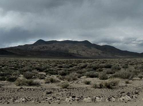


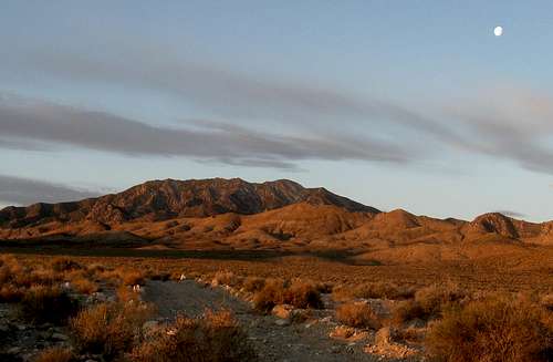


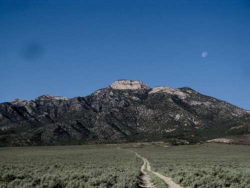


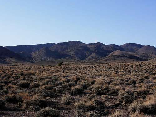


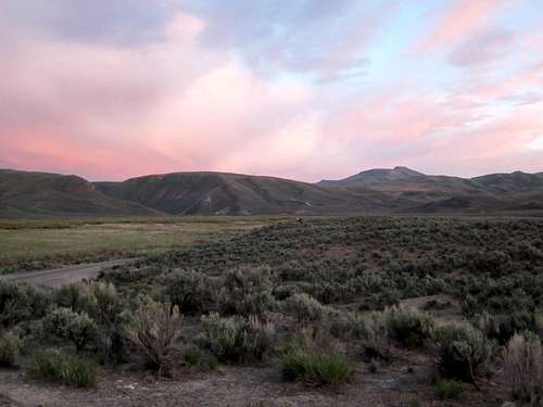


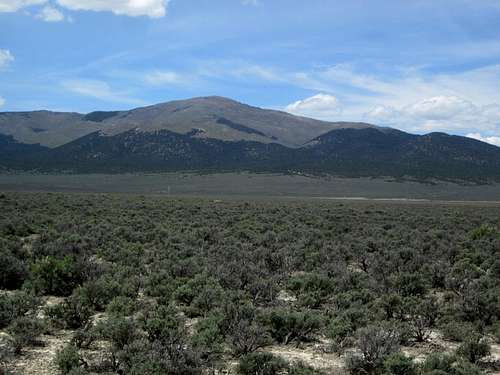


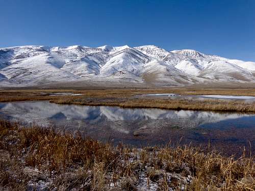


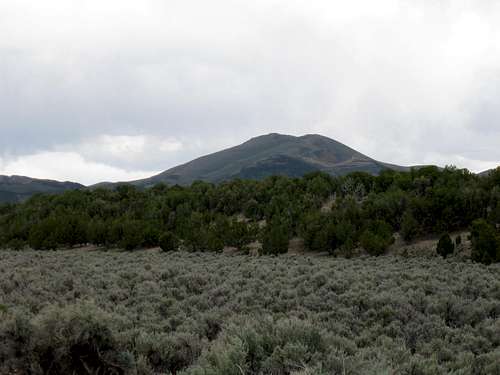


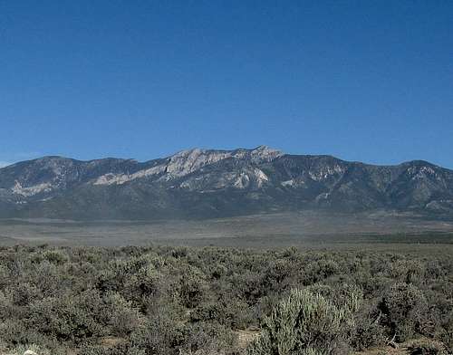


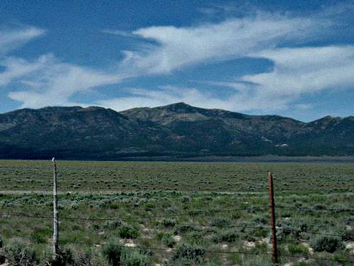


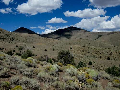


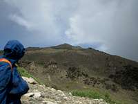


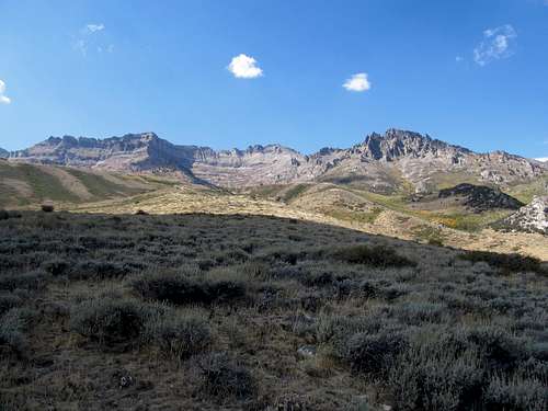


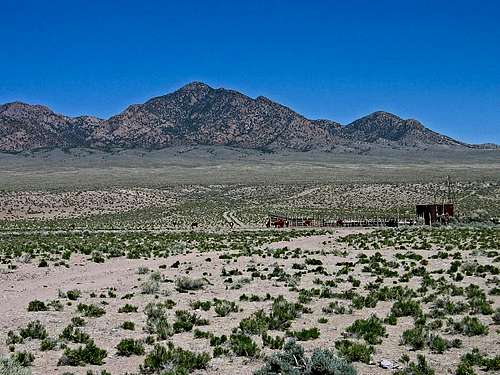


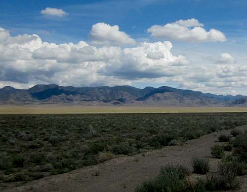


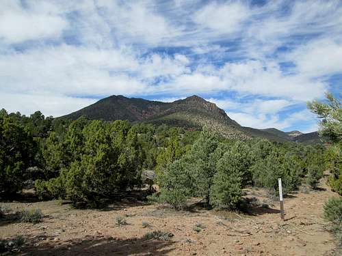


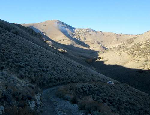


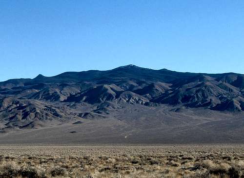


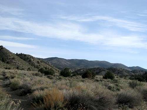


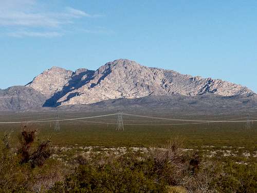


Comments
Post a Comment