
|
|
Mountain/Rock |
|---|---|
|
|
46.72100°N / 11.09360°E |
|
|
Hiking, Scrambling |
|
|
Spring, Summer, Fall |
|
|
8612 ft / 2625 m |
|
|
Overview
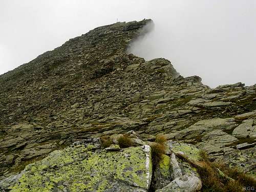
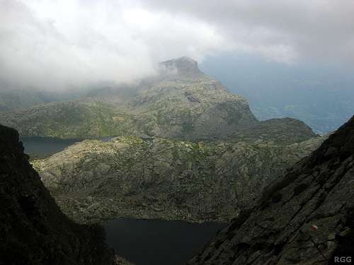
Approaching the summit from the west
Three ridges come together on the summit: from the east, the west and the north. Of these, the eastern one is the steepest. From the summit, it quickly drops down well over a 100 meters before rsing again to the Kleine Rötelspitze (2545m). But all the ridges pale when compared to the south side: that's a sheer vertical face, with a drop of more than 500m! When coming up the normal route, from the west, you get to see it in profile, and that's quite impressive.
The normal route to the summit comes from the west. It's mostly hiking, only very occasionally do you need to use a hand. It starts at the Hochgangscharte (2441m), almost one kilometer to the west. That's also the key saddle, which gives the mountain a prominence of 184 m. The parent peak is Tschigat (2998m), 3 km to the west.
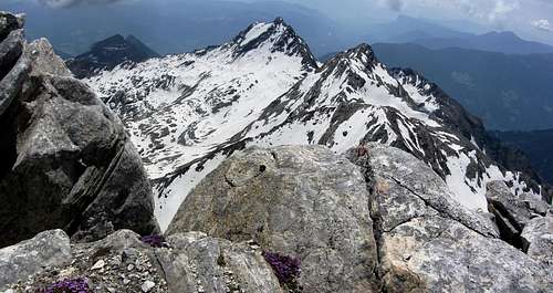
Lodner summit view.
The ominous dark shape on the left is the Spronser Rötelspitze, the prominent snow covered mountain in the center is Tschigat, and the somewhat less impressive peak to its right the Lazinser Rötelspitze.
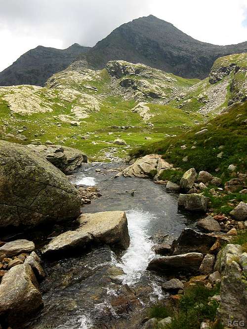
Many of the lakes can be seen from the summit. The largest one is the Langsee, which, as the name suggests, has an elongated shape and is about 1 km long. Its southern tip lies just north of the Hochgangscharte.
The green paddle points at the summit.
Click here to view a larger map
About the name
Sometimes the 'e' at the end is omitted.The Spronser Rötelspitze lies in Süd-Tirol, a relatively autonomous region in Italy these days. The main language is German. In earlier days, that was different: German was suppressed, and all geographical features received Italian names. In Italian, the mountain is called Cima Rosa.
Confusingly, the Lazinser Rötelspitze (3037m), a little further west in the Texel Group, is also called Cima Rosa in Italian. The two are not direct neighbors though; Tschigat lies between them.
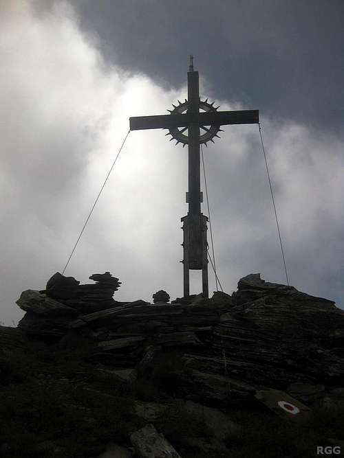
Spronser Rötelspitze summit cross
The summit
The summit itself isn't big, but the area around it offers room enough for a sizable party. The exposure isn't really serious as long as you don't get too close to the southern edge. A large cross marks the spot.Getting There
Getting to the area
The nearest city is Meran, a pleasant place southeast of the Texel Group. In summer, the area attracts a lot of visitors and for a small city it is well connected.By car
- From the north there are three options:
- Along the provincial road over the Reschenpass via Nauders and then down the Vinschgau valley;
- Via the mountain road over the Timmelsjoch (closed in winter) and then down the Passeiertal;
- Over the Brenner motorway via Sterzing, and then also down the Passeiertal.
- Along the provincial road over the Reschenpass via Nauders and then down the Vinschgau valley;
- From the south, the only way is by the motorway from Bolzano.
- From Switzerland, in the west, the Ofenpass and then down the Vinschgau valley is the most logical route
By public transport
Meran has regular train connections with Bozen / Bolzano, which is well connected to the rest of the Italian rail network as well as to Austria and Germany to the north. In addition, a regional train heads up the Vinschgau valley, west of Meran, as far as the small village of Mals.From the north, from Austria, regular buses come over the Reschenpass to Mals. And likewise, from the west, from Swizerland, regular buses come over the Ofenpass to Mals.
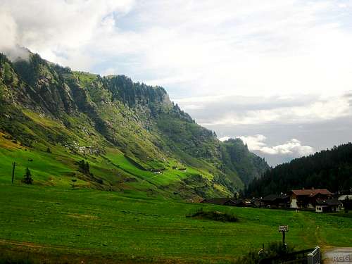
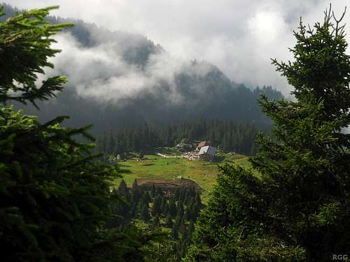
View down the Pfelderer valley, with Pfelders on the right
Trailheads
There are many ways to get to the mountain, so only the main trailheads I will. The main trailheads are to the southeast and to the north.From the southeast
On this side there are two good options to save some energy. The shortest approach starts by taking the lift from the village of Vellau (908m), west of Meran, which brings you to the Leiter Alm (1550m). There is parking space at the base station of the lift, or you can get there by bus or by yet another lift from Algund. Alternatively, from Dorf Tirol (573m), a village just north of Meran, a cable car can quickly whisk you up to Hochmuth (1361m). Again you can park at the cable car station, or take the bus from Meran.If you don't want to use the cable car, in the vicinity of Meran the highest place to park your car is at Gasthof Walde (1310m), just above the hamlet of Vernuer, north of Meran. However, from that trailhead the approach starts downhill and you'll loose about 250 m before going up again.
From the north
The most convenient northern trailhead is the village of Pfelders (1628m). The Pfelderer valley is a side valley of the Passeier valley north of Meran. Pfelders can be reached by bus, and there is ample parking space.Routes
On the OSM map, the mountain is called Rötl
West ridge
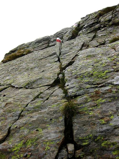
A funny route marker on the W ridge, pointing out that the route goes straight up here. It's just a few meters, but you'll need a hand now.
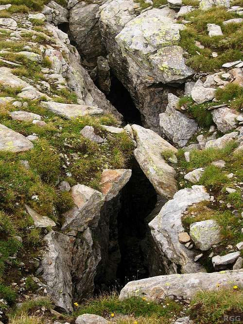
Rain and erosion have created some dangerous holes
At first, it's a mix of hiking and some easy scrambling. There is one spot where the trail traverses an angled slab, and as a precaution there is a rope to hold on to in case you slip. When I descended, another hiker thought it wasn't necessary, but grabbed the rope just in time when she did start slipping anyway!
After a short while, the summit comes into view. The route now cross a sort of plateau before the ridge continues going up again. On this plateau, there are some large holes in the ground, caused by rain eroding away the softer rocks. Be careful not to fall into one of these!
After the plateau the ridge rises again, and you may occasionally want to use your hands again.
Overall, although there is a little bit of scrambling required, it's too short and too easy to deserve a UIAA grade.
From the saddle to the summit takes the better part of an hour.
Getting to the Hochgangscharte
From the south
A very steep hiking trail heads up the south side of the scharte. If you start at the Leiteralm, follow the Meraner Höhenweg west for 1-1.5 hrs, until you get to Schutzhaus Hochgang (1839m). A not all to clear sign marks the turnoff. From there it's 1.5 hours to the scharte, which means it's 3.5-4 hours from the Leiteralm to the summit by this route.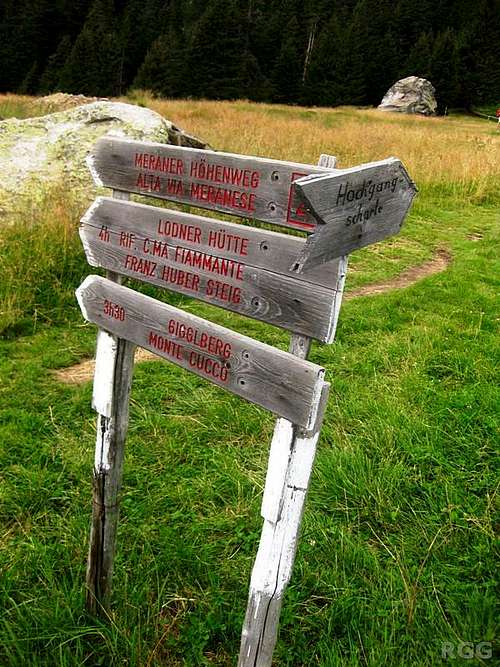
The signs at the trail junction at Schutzhaus Hochgang
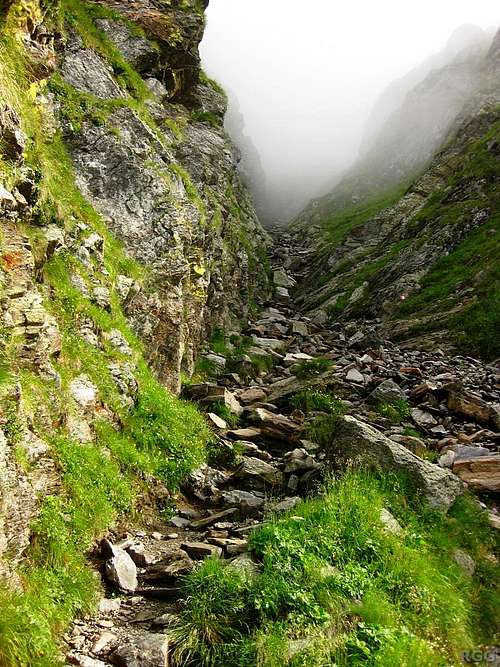
The rugged trail from the south up to the Hochgangscharte
If you start at Hochmut, follow the Meraner Höhenweg west as well, and after an hour you'll reach the Leiteralm.
If you start at Gasthof Walde, again follow the Meraner Höhenweg, and count on another two hours. In other words, if you want to do this as a one day trip, you have to start very early or be fast.
From the north
From Pfelders, the approach heads up the Faltschnaltal to the Spronser Joch (2581m). From there, continue south, passing a few small lakes along the way. You'll loose some altitude. Just south of the Grünsee / Lago Verde is a trail junction: go right here, initially to the west. A few minutes later the trail reaches the Langsee / Lago Lungo, the largest of the Spronser lakes. The Hochgangscharte is just south of its southern tip. From Pfelders it's 4 to 5 hours to the scharte, the other way around 3 to 3.5.From the Leiteralm, the scharte can also be reached from the north. As before, start out west on the Meraner Höhenweg. However, at the first trail junction go right, following the steep trail to the Taufenscharte (2230m) to the north (trail 25). Once across this saddle, the trail traverses the northeastern slopes of the Spronser Rötelspitze, eventually leading to the Grünsee where it joins the approach from Pfelders.
From Hochmut, a variation on this theme is possible by ignoring the Meraner Höhenweg altogether and instead traverse the Muthspitze to get to the Taufenscharte.
From Gasthof Walde, the northern approach is shorter than the southern one. Once more this approach starts west on the Meraner Höhenweg. After dropping some 250 m in about half an hour, the trail reaches the Spronser valley, with the trail junction. Take the trail up the valley, to the Spronser lakes and the Bockerhütte (1700m). Continue past the hut towards the Grünsee.
Spronser Rötelspitze from the NW, just north of the Langsee
N ridge
According to the Alpenvereinsführer Ötztaler Alpen (see below), the N ridge from the Kasersee / Lago della Casera takes 1.5 hours. I haven't tried this route.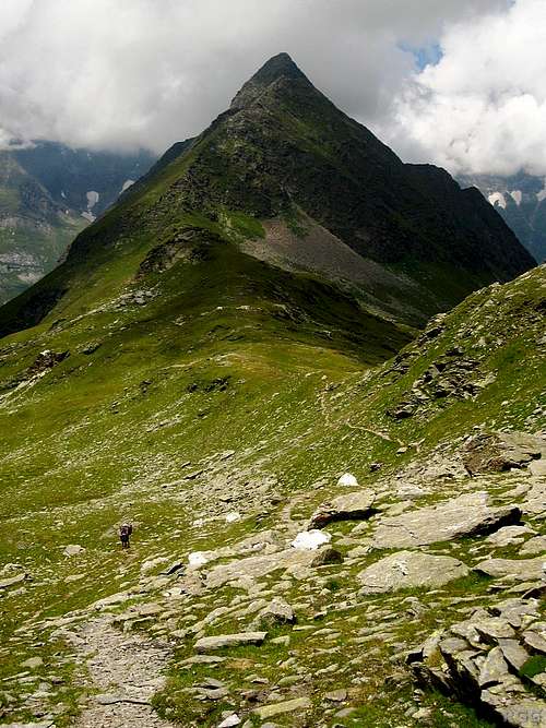
Erenspitze
Some suggestions
For a day trip, the Leiteralm is the most convenient trailhead. You can partly make it a circuit by heading up the Hochgangscharte from the south, going to the summit and back and then return over the Taufenscharte. If you feel experimental, by all means explore the N ridge and let me know the result. Or even better, write a route page for it.If you have more time than just a day, the possibilities to put together longer trips and climb several peaks in the Texel Group are endless. As an example, when I climbed the Spronser Rötelspitze I started in the Vinschgau valley with a cable car ride with the Texelbahn, from where it's 3 hours along the Meraner Höhenweg towards the east to reach Schutzhaus Hochgang. The next day I climbed the Spronser Rötelspitze, went back to the Hochgangscharte and then headed north to Pfelders. In fact, I wanted to traverse the Erenspitze along the way instead of hiking down the Faltschnal valley, but wasn't happy with the grass and somewhat loose rocks I found at the base of the south ridge. According to the guidebook, it's UIAA grade II. Maybe something for you?
When to Climb
The best period is from late spring to early fall. Having seen the sink holes high up the west side of the mountain, I wouldn't like to go up there when there is more than just a little snow.Accommodation
Looking own on Schutzhaus Hochgang from the trail to the Hochgangscharte
The Meraner Höhenweg, a little west of Schutzhaus Hochgang
Along the Meraner Höhenweg there are many more places to stay, including the Leiteralm, Hochmuth and Gasthof Walde.
And in Meran and the many nearby villages there are countless accommodation options.
Wild camping is not allowed.
Red Tape
The Texel Group is a Natural Park, and is protected as such.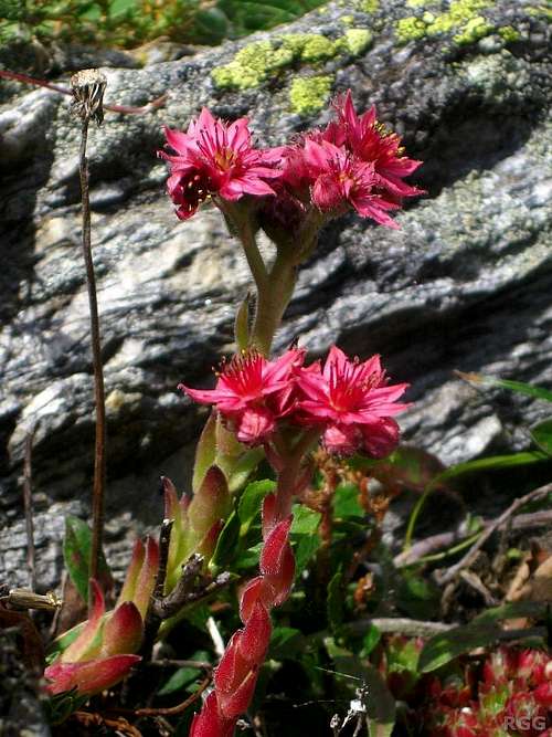 Houseleek (Sempervivum) along the Meraner Höhenweg near the Nassereithhütte, a few hours west of Schutzhaus Hochgang | 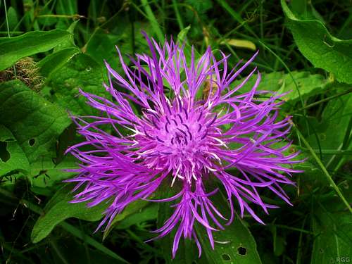 Brown knapweed (Centaurea jacea) along the Meraner Höhenweg 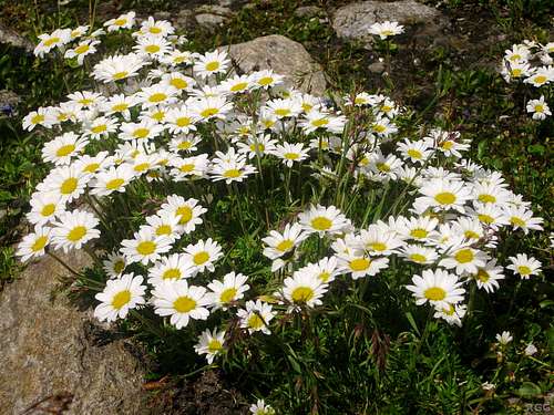 Ox-eye daisies (Leucanthemum vulgare) above the tree line, just north of the Spronserjoch | 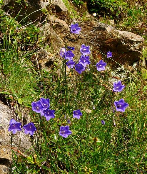 Alpine bellflowers (Campanula alpina) along the trail on the south side of the Hochgangscharte |
Maps and books
Spronser Rötelspitze from the west, from the Milchseescharte on the NE ridge of Tschigat
- The 1:25000 Tobacco map Parco Naturale Gruppo di Tessa covers the whole park. It is the most detailed map, but considering its scale, it gives relatively poor information.
- The 1:50000 Freytag&Berndt map WK S8, Passeiertal * Timmelsjoch * Jaufenpass is sufficient, although the 100m contours are rather coarse.
- Alpenvereinsführer Ötztaler Alpen, Walter Klier. 14th ed. Bergverlag Rother, 2006, ISBN 978-3-7633-1123-1. In German.
External Links
VinschgauPfelders
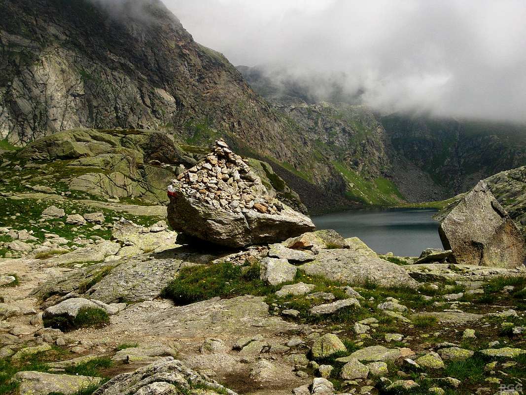
A big cairn marks the Hochgangscharte, with the Langsee to the north