


-
 5648 Hits
-
 82.48% Score
-
 15 Votes
|
|
Area/Range |
|---|---|
|
|
45.87910°N / 7.52742°E |
|
|
Hiking, Mountaineering |
|
|
Spring, Summer, Fall |
|
|
Note
La montagna chiama i suoi figli, ed essi rispondono fedelmente al suo appello… Osvaldo Cardellina, Diario alpinistico, 1964-65 Page texts: @ OsvaldoCardellina "Osva", passed away on May 2, 2022. Page owners: Christian Cardellina e Osvaldo Cardellina. Any updates from September 12, 2022: Antonio Giani, page administrator, friend and climbing companion. Testi della pagina: @ OsvaldoCardellina "Osva", scomparso il 2 maggio 2022. Proprietari pagina: Christian Cardellina e Osvaldo Cardellina. Eventuali aggiornamenti dal 12 settembre 2022: Antonio Giani, amministratore della pagina, amico e compagno di salite. |
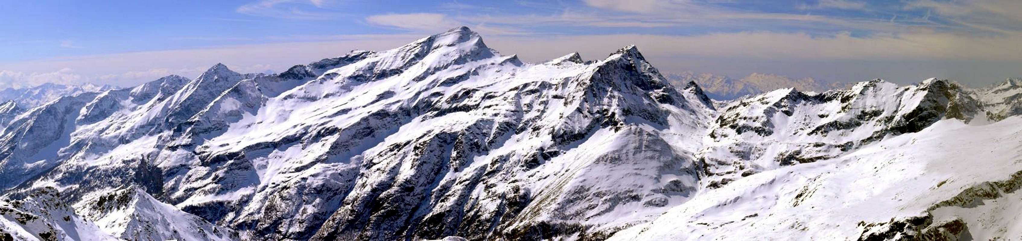
Northeast Overview
The great bulk of the work forces in the same split in turn into two other parts, after that A paid to that sector from Mount Blanc includes all the valleys to the Northeast, including Valpelline, this next part, still on the North Slope Hydrographic , is inclusive of:
4) - Large rectangular amongst Saint Barthélemy, Valtournenche, Ayas, Gressoney Valleys & Southern Appendages.
 |
 |
 |
 |
 |
 |
La grande mole di questo lavoro costringe a sdoppiare il medesimo a sua volta in altre due parti; dopo quella A rivolta al Settore che dal Monte Bianco comprende tutti i valloni verso Nordest, Valpelline compresa, questa parte successiva, pur sempre relativa al Versante Idrografico Settentrionale, é comprensiva del:
4) - Grande parallelepipedo frapposto tra le Valli di Saint Barthélemy, Valtournanche, Ayas, Gressoney & Appendici Meridionali.
Questa vasta area, che racchiude i valloni perpendicolari alla Dora Baltea con andamento Nord/Sud, nonché le Valli di Saint Barthélemy, del Marmore o Valtournanche, dell'Evançon o d'Ayas nonché del Lys o Gressoney. Inoltre comprende tutte quelle appendici che dalla Becca di Viou, sopra la Città di Aosta, scendono verso Sud fino all'inizio della Valle di Saint Barthélemy e le propaggini estreme tra questa e la Valtournanche sopra i Comuni di Quart, Nus, Chambave, Verrayes e Saint Dénis, concludendosi con le Sommità della Croix de Fana, Becca d'Aveuille, Mont Ander-Cima di Longhede-Becca d'Aver insino al Colle di Saint Pantaléon ed al Mont Roux, con le sue antiche ed ormai abbandonate miniere.
 |
Small VALLEYS perpendicular N / S to Central Baltea Valley
VALLEYS & small Valleys In order to deploy clockwise from Northern Valleys of Aosta/Saint Christophe/Quart/Chambave/Verrayes/Saint Dénis Walloons & Basins to the Central Dora Baltea Stream
Viou-Mary Basin: from Aosta Town to Theuvex/Senin Fractions (766m, 782m) by Municipal Road; between the same starts North the path n° 26 to old Parleyaz or Parléaz Village (1.274m; Napoleonic chimney, little Chapel). Continue into small vallon to Crete Pasture (1.398m) and in West, before crossing little torrent, to Blavy Hamlet (1.471/5m; nice tiny Church with beautiful sundial on wall); from this in North with path n° 25/105 to Varbre Pasture (1.674m; ruins) and dirt road (from Roisan or Saint Christophe Municipalities) in altitude 1.830 meters about. Crossing the same and torrent the muletrack turn East to Viou Pasture (2.062m; source below the house); continue into forest reaching the Tsa de Viou Alp (2.292m) and, in North after a morainic basin, Viou Hill (2.698m), nearby Penne Nere Bivouac (2.730m; always open), between Becca Viou (2.856m)/Mount Mary. Cretallaz-Cerisolaz-Voltola(i)naz small Valley: from Saint Christophe Commune with Municipal Road to alternative above Lumian Village (894m); before leaving East the road to Crétallaz/Jeanceyaz/Morgonaz Hamlets, immediately after turn left or Northwest near a second fork 1.350 meters around. Leaving West the continuation to Blavy Hamlet, turn North and through a long Northeast diagonal on dirt road reach Voltola(i)naz Hamlet (1.492m), above Cerisolaz Village (1.159m).
1) - Crossing various brooks in Northeast to walloon floor on main torrent; along the same (borderland Saint Christophe/Quart Municipalities) directly, pathless, go up in North on very wild walloon ("Death or Moon Vallon") to Mount Mary (2.815m) Sourhern Slopes.
2) - (better) through a dirt above Parleyaz reach the thread of the long South-southwest Ridge and with rare traces to Summit. Senevé Comba: A from Saint Christophe Commune (573m) with Municipal Road to Sorreley (805m), Veynes (834m) Hamlets up to the alternative above Lumian Village (894m); leaving West the road to Parleyaz/Blavy Hamlets, continue in East to Crétallaz (1.087), Jeanceyaz (1.092m), Morgonaz (1.205m) Hamlets and Prayon Farm (1.128m; just after, signal no transit); from this with dirt road in North to Les Ayettes (1.463m), Borelly (1.477m), Chamerod (1.615m), Les Preyes or Prèles (1.802m) Pastures. Always before with dirt, after path, passing an old in ruins alp and through the forest on a round promontory, with a Northern diagonal route in terminal part to Senevé Alpages (2.206m), below Mount Mary/Tete of Arpisson (2.856m).
 |
 |
 |
 |
 |
1) - Mount Mary (ski-mountaineering),
2) - Chamerod Top,
3) - Les Preles Summits,
4) - Chaudière Northeast Pass (2.746m) to Arpisson Vallon,
5) - Tête of Arpisson,
6) - Senevé Point (2.928m),
7) - Tsaat à l'Etsena Western (2.967/8m), Pass to Verdzignola Comba, Tsaat Eastern (2.974/5m) Summits,
8) - Fana Pass to Tall Dèche Comba and Fana Beaks (2.951m),
9) - Passo Alto (2.540m; good by snow rackets) to Middle Comba Dèche. Trois Villes Basin: from Trois Villes-Fonteil (1.423m; parking), in Northwest with unnumbered path to Croix de Fana (2.211m; even by snowshoes).
Verrayes-Saint Dénis Northern Basin: from National Road SS.26 to Verrayes/Saint Dénis Municipalities through Regional Roads.
A) - from Verrayes Municipal Road to Grand-Villa Hamlet (1.437m), Vieille (1.450m), Vencorère (1.563m; small parking), Prelaz (1.712m) Villages. From this in Southwest
1) - la Bourra Alp (1.748m), through dirt road, Mount de Pesse (1.708m) with path n° 3C;
2) - from Prelaz, pathless, to Mount Ander (1.931m) and with dirt to Filon Hill (1.894m).
3) - From Grand-Villa, with asphalt road, to Clavon (1.644m)/Petit Lozon or Loson/Low Lozon (1.525m; parking; pond) and from these to Fontane, Champlong Damon, Bornes Alps, Bornes Hill (1.774m), with path n° 1. From the Bornes Alp with path n° 1 in Northeast to fork 2.050 meters (path n° 2 from Gr. Villa), Becca of Aver (2.469m) and traverse in Southwest on ridge with path n° 16A to Cima of Longhede (2.416m; ski-mountaineering and snowshoes).
B) - From Chambave to Saint-Denis Communes with Regional Road and from this to Del (1.260m), Plau (1.305m), Semon (1.428m), Cheresoulaz (1.487m) Hamlets, Saint Pantaléon Hill (1.650m); from Semon through "Tour of Saint Evence" with dirt road-path n° 2 to Chapel (1.500m; beautiful by snow rackets, even in night) and in North-northwest to Sanctuary, just below the hill.
Central Valley (Saint Barthélemy)
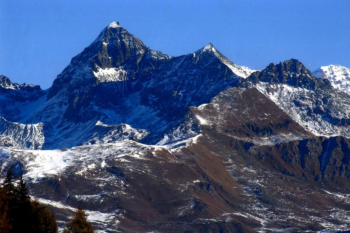
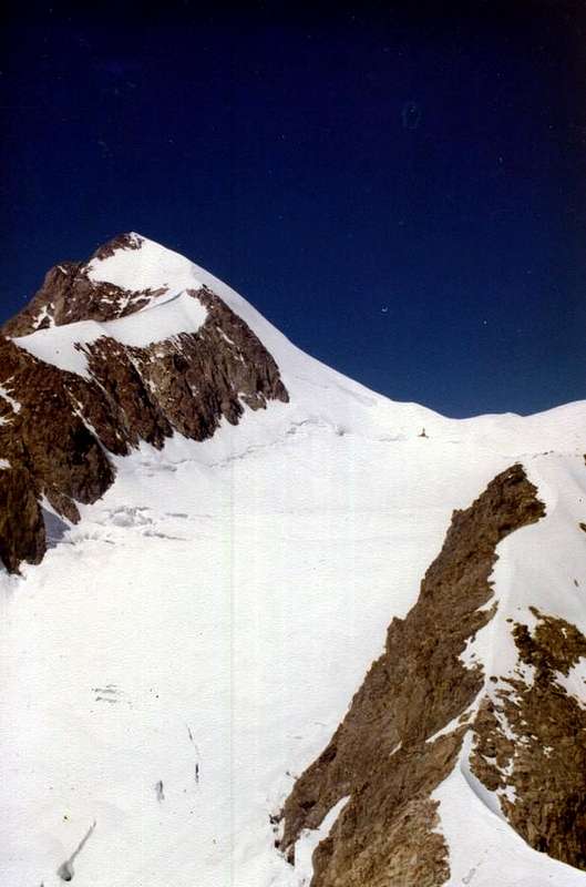
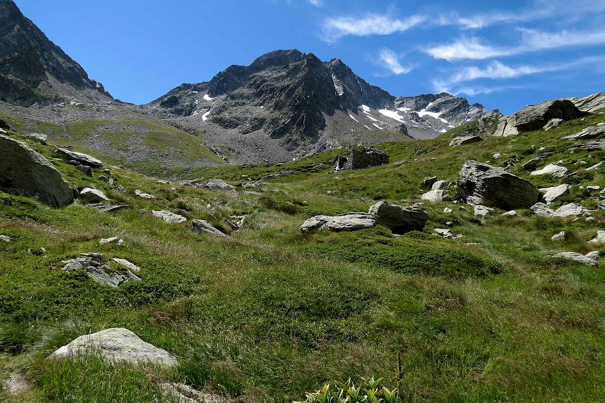
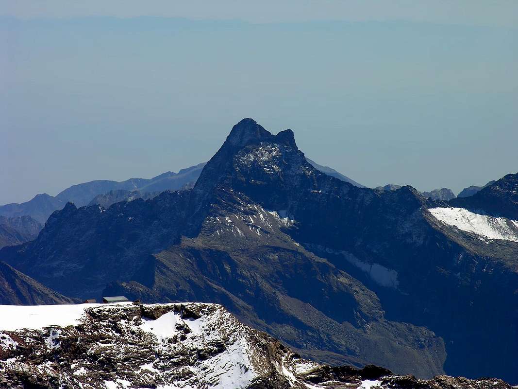
"The ancient Becca of Luseney dominates, hidden, the Valley of Saint Barthélemy / L'antica Becca di Luseney domina, nascosta, la Valle di Saint Barthélemy", by Corvus
VALLEYS & VALLONS In order to deploy clockwise from Dèche Vallon to Northern Aver-Longhede-Ander Basin
 |
 |
 |
 |
1) - Saint Barthélemy Hill (2.639m). In Southeast with path n° 4/105 to
2) - Léchy Hill (2.585m); from this in South on easy ridge, path n° 4, to
3) - Mount Grand Pays (2.724m; ski-mountaineering or snowshoes). From La Seyvaz in Southeast with path n° 5 to
4) - Collet Pass (2.500m) and in South with n° 5 up to the North Shoulder, after through steep and rotten rocks, to
5) - Becca d'Ave(u)ille (2.623m). From fork 2.100 meters around before La Seyvaz in Southwest with unnumbered path to
6) - to Cornet Hill (2.280m); descent on Senevé Comba. From Brunier before in South, after in Northwest with path n° 2 to
7) - Croix de Fana (2.211m). Variant: from Fonteil or from Trois Villes directly in North to junction with path n° 2 in altitude 1570/80 meters around and through East-southeast Crest, towards the forest, to Summit. Faroma small Valley: from Nus Commune through the Regional Road to Marsan (699m), Petit Fénis (939m), Blavy (1.056m), Val Dessous and Dessus (1.268m), Les Fabriques (1.411m), Issologne (1.514m), Lignan (1.633m; parking; Observatry Astronomical), Clémensod (1.665m) Villages; from this in Northwest with path n° 10/105 to Pleoles Dèsot (1.789m) and Damon (1.898m), Champanement (2.330m) Pastures and Alp, all below Mount Faroma East-Southeast Face. From Champanement, with path n° 8A/105 in Southwest under the same, to Léchy Alp (2.299m) and in West to homonym pass. Always from Champanement before in North, path n° 10, after in West 10/Haute Route number 1 to Bivouac Rosaire et Clermont (2.705m) and briefly to Vessona Hill (2.794m), between Mount Faroma/Vessona three Jags. Descent in Northwest, same path, to Comba Vessona in Valpelline.
Lignan-Fontaney-Salvé small Valley: from Lignan in North with path n° 10/B to Place Damon (1.910m), Fontaney (2.088m) Pastures, La Tsa de Fontaney (2.307m) and, through a small walloon below West Face Mount Morion, Salvé Hill (2.569m); shorth traverse in West, path n° 11A above a pond, to Chaleby Hill (2.653m). From both hills descent in North, path 11/Haute Route 1, below East Face Becca Fontaney to Cuney Sanctuary (2.653m), into homonym comba and under Mounts Pisonet, Nebbia, Becca of Merlo.
Porliod-Chavalary-Morion Comba: from Lignan in North through Municipal Road or with neighbor path n° 17/105 to Saquignod (1.690m), Vénoz (1.771m), Le Cret (1.791m), La Combaz, Porliod (1.879m; +; small parking before signal no transit); from the nearby alternative before Porliod in Northeast with path n° 11C to Larset (1.930m), Pra de l'Arp (1.978m) Pastures to alternative 2.023 meters; from this in Northwest through dirt road to Chavalary Alp (2.160m). In North, through easy South Crest with scarce traces-small rocks, to Mount Morion (2.710m), isolated Summit in center.
Cuney Basin: in descent from Chaleby or Salvé Hills to connection about 2.545 meters or, through more large tour, from Lignan-fork 2.023 meters in Northeast, with path n° 11C, to Le Serreun Alp (2.380m); from this in West-northwest, below North Face Mount Morion, to Connection/paths in altitude (2.545m) and Cuney Sanctuary-Refuge/Oratory (a delicate passage on traverse). In North Lac de l'Ermite (2.705m), path n° 11E.
Montagnaya-Arbière small Valley: from Refuge/Oratory continue Northeast with path Haute Route number 1 crossing below Cuney Pass (2.944m), East Face of Pointe Montagnaya (3.042m) and, by a deviation in West, pathless, on debris slopes with traces along the small torrent and a final rocky narrow couloir, to Montagnaya Pass (2.903m), between Pointe Montagnaya/Becca d'Arbière Southern Summit.
Variant: from Praterier (2.066m) Alp in Luseney small Valley go up to Pass with path n° 15/connection Haute Route amongst various small torrents and previous route in terminal part.
 |
 |
 |
 |
1) - Luseney Pass (3.162m); in North to
2) - Livourneaz Pass (2.840m), always path n° 13 crossing three small torrents.
3) - Luseney Becca (3.504m) by Southeast (Standard Route) or East (from pass) Crests (junction of the both at 3.389 meters; from pass in Northeast to
4) - Cime Livournea (3.288m), easily through Southwest Crest.
Livournea(z)-Redessau Southern small Valley: from Reboulaz Refuge in North-northeast with path n° 13 to
1) - Livourneaz Pass (2.840m); with the half same route, after turning right (Northeast) to
2) - Mount Redessau Northwest (3.253m) and Southeast (3.237m) Summits, from Praterier Carving on South-southwest Ridge; through the same (passages of II°/III°-), with subsequent delicate and aerial traverse (II°) from the last to first Top.
Fenêtre de Tsan small Valley: from refuge in East with path n° 13A/Haute Route number 1 to Fenêtre (2.736m), between Becca des Crottes-three small towers/Little Cima Bianca. Descent in East, same path, to Cian Lake (2.440m), nearby Cian Bivouac (2.882m) in Torgnon Vallon.
Cime Bianche Vallon: from Champlaisant Sanctuary, crossing torrent with path n°1B, to
1) - Pierrey Pasture (1.910m); from this in Northeast with path n° 1 to Tsa de Campagne (2.304m), Tsa de Pierrey (2.331m), Tsa de Voyoux (2.316m), turning right gradually to Cima Bianca (3.009m).
Variant a) - from Refuge La Servaz-Ollière in East with path n° 13B to Tsa de Voyoux;
b) - from valley floor with dirt road-path n° 1 to Pierrey.
Meabé-Fenêtre small Valley: from Les Fontanes Pasture (1.664m) in Northeast with path n° 17 to fork 1.700 meters, below Les Preles Alp (1.798m); in East with path n° 17/105 to Fenetre Hill (2.175m), between Mount Meabé/Mount Fenêtre. Descent in East, same trail, to
Torgnon Valley. Aver-Longhede Northern Basin: from Les Fontanes Pasture (1.664m) in Northeast with path n° 16/17, along the torrent, at the beginning of dirt road to Les Prèles; changing in South with path n° 16 to alternative 1.900 meters around; continue, leaving right the path n° 5 to Joux Alp, more in South to Saddle 2.310/20 meters around, between Cima Longhede/Becca of Aver. Cross in Northeast with path n°16 to Becca d'Aver (2.469m); in Southwest with path n° 16A to Cima of Longhede (2.416m), both easily. From Aver descent, through path n° 1, in South to Verrayes Basin.
Ander Southern Comba & Southwestern Appendages:
1) - from alternative 1.900 meters around in Southwest with path n° 5 to Joux Alp (1.803m), below Mount Ander (1.931m). Before the alpage in East, pathless, to Filone Hill (1.894m). Also continue to La Pesse Pasture (1.600m) and with path n° 3/3C to La Bourra Hill (1.748m); from this easily in crest to Mount de Pesse (1.708m).
2) - From the Bridge after Issologne (1.514m) in Southwest with path n° 3 to La Pesse and same routes.
3) - From Nus Commune through Regional Road to Petit-Fénis, Blavy Hamlets (1.056m); from this through dirt road or path n° 3 to Le Noueus (1.181m), Praille (1.242m) Pastures. Continue in North, crossing a first, reaching a second dirt road and with path n° 3 to
3) - La Pesse Alp or with path n° 3B to
4) - Mount La Pesse.
5) - Starting directly from valley floor (Nus-Le Bourg 540m) in North with path n° 3 to Plane (718m), Petit Fénis, Blavy Hamlets, Prailles Pasture and previous routes.
Northeasterner VALLEYS & small VALLEYS
VALLEYS & small Valleys In order to deploy clockwise from the Central Baltea Valley-Verrayes/Saint Dénis Basin towards Valtournanche to Mount Zerbion & Appendages
1) - Fenêtre Hill; from fork 2.048 meters in North with path n° 8 to
2) - Mount Meabé Southern Antesummit (2.566m). From Fontarin continue in North with dirt road-path n° 1, along Ru (brook) de Verrayes and through Chantorné, Arpeille, Brussoney Woods, to Tronchaney (2.048m), la Nouva de Tronchaney (2.100m), Courtthoud du Meitin (2.059m; from this path n° 6), Courthoud Damon (2.068m; source), Crot des Labies (2.356m), Tsomioy or Chomioi (2.450m) Alps; in Southwest with path n° 6 to
1) - Chomioi Pass (2.540m). From Pass in North through South Crest, pathless (a exposed passages after quota 2.825 meters), to
2) - Cima Bianca or Cime Bianche (+; 3.008m). Also from Crot des Labies in North with path n° ex 9A (or through upper neighbor unnumbered path) to
3) - Erbion Alp (2.522m) and in Southwest to East easy Crest Cima Bianca; from alp in North, path n°10 to
4) - Tsan Bivouac (2.472m), nearby Lac du Tsan (2.441m). From lake in West with path n° 4/Haute Route number 1 to
5) - Fenêtre du Tsan (2.738m) in Chavacour Comba. From fork, just below the hill, in North with unnumbered Path-traces in moraine to
6a) - Praz Terray Pass (3.034m) or
6b) - to Chavacour Pass (2.957m), between Mount Redessau/Chavacour Summits. From lake through traverse in East with Hate Route and short descent to
7) - Grand Raye-Drayere Alp (2.352m); from this in North with path n° 5 to Bivouac Rivolta on Fort Pass (2.906m), between Punta Cian or Tsan/Becca of Salé.
8) - Various departure variants: from Gialliarey Sanctuary (2.174m), with dirt road from Chantorné Desot (1.824m) or from Barmasse Refuge (2.175m), near Cignana Lake (2.149m) with Haute Route number 1.
Cignana small Valley: from Valtournanche (parking 1.537m) in Southwest through Municipal Road to Valmartin (1.510m); path n° 6/Haute Route in Northwest to Promoron (+; 1.612m), Falegnon (1.914m) Pastures, Cignana Lake and Refuge. From these in Southwest, with path n° 107 to
1) - Fornace Alp (2.135m), Fenêtre d'Ersaz (2.293m); before in Northwest, near Tsignanaz Chapel (2.186m), after in Southwest, path n° 4, to Fort Pass. From lake in North to fork 2.323 meters and in West-northwest, with path n° 6, to
2) - Bivouac D. Manenti (2.783m), nearby Lac de Balanselmo (2.740m); from this in North to
3) - Perucca-Vuillermoz Refuge (2.909m), below Valcornière Pass and nearby Dragon, Grand Lochs. Descent in Valcornière Comba-Valpelline. From Dragon in Northwest to small lake 2.988 meters, under
4) - Dragon Glacier and Pass (3.321m); descent on Solatset Glacier in Solatset Comba-Valpelline. From Grand Lac in North to
5) - ponds 2.942, 2.964 meters, under Bella Tsa Pass (3.064m); descent on Bella Tsa Glacier in Bella Tsa small Valley-Valpelline. From refuge in Northeast with path n° 9 to
6) - Vofrède Pass (3.121m). From Cignana Lake, source 2.323 meters in East to
7) - Cignana Fenêtre (2.445m) and in South on North-northwest Crest to
8) - Mount Pancherot (2.616m).
Vofrède Comba:from Regional Road to Breuil-Cervinia near alternative 1.948 meters, nearby a pond, with secondary road to Vofrède Village (1.980m); from this with unnumbered path in North to path n° 9 and before in Northwest, after Southwest, to point 2.417 meters. Following the rocky coasline between Col de Chateau des Dames/Vofrède Glaciers to
1) - Vofrède Pass (3.121m); descent in Southwest to Cignana Vallon.
2) -From Regional Road (parking 1.979m) turn left to Avouil Village (1.966/76m); from this in Southwest with path n° 10 to Bayettes Pasture (2.291m). Changing in North-northwest, over Vofrède Torrent, to Refuge Jumeaux-Refuge G. Bobba, below Point Budden on Little Murailles (to Mount Rouge).
Tabel small Valley: from Breuil-Morces (2.065m) from fork 2.117 meters in West along Mabérge Torrent; from upper fork in South with path n° ex 3 to
1) - Mabérge Pasture (2.301m) and previous route to Budden at Jumeaux Refuge; or in Southwest with path n° 11 always to
2) - Refuge. Also from alp in North with path n° 3
3) - to Cors (2.249m), Crot (2.367m) Pastures. In North, pathless but through steep moraine, to Mount Tabel Glacier, below Gr. Murailles (Dent d'Hérens/Gr. Murailles Pass/Pointes Margareth/Pointe des Cors-Punta Gastaldi Range). From Les Cors Alp in North-northwest, crossing Cors Torrent and unnumbered path, to
4) - Umberto Balestreri Bivouac (3.142m), below quota 3.307 meters of Cors Summit.
Chérillon small Valley: from Crot Alp in Northeast with path n° ex 3 to small dam (2.366m); from this with sinous rote among varios ramification of Fossu Torrent to fork 2.590 meters. In North with path n° 12 to Chérillon Glacier, below Dent d'Hérens/Pointes Carrel-Blanche-Maquignaz-Marie Christine/Enzo and Nino Benedetti Bivouac. Departure variant: from Breuil through dirt road to Crot de Palet Dèsot (2.273m) and path n° 12.
 |
 |
 |
 |
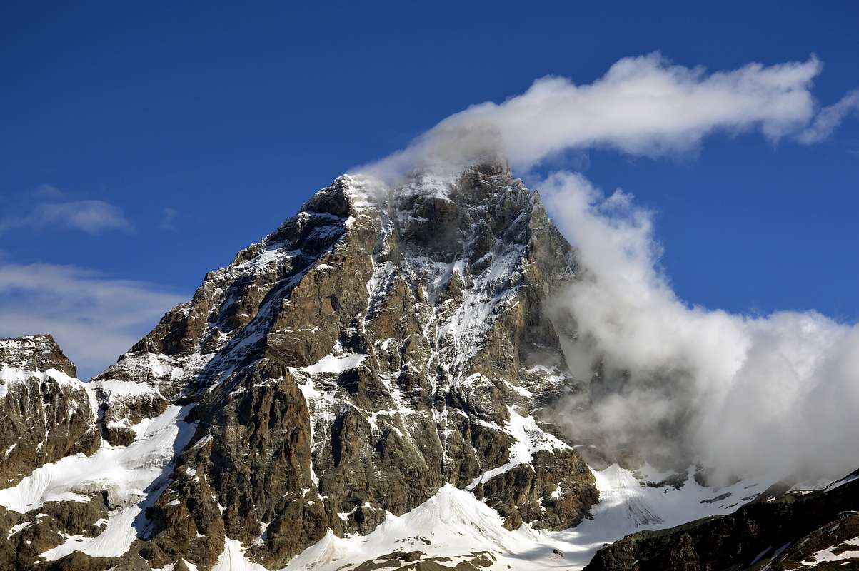
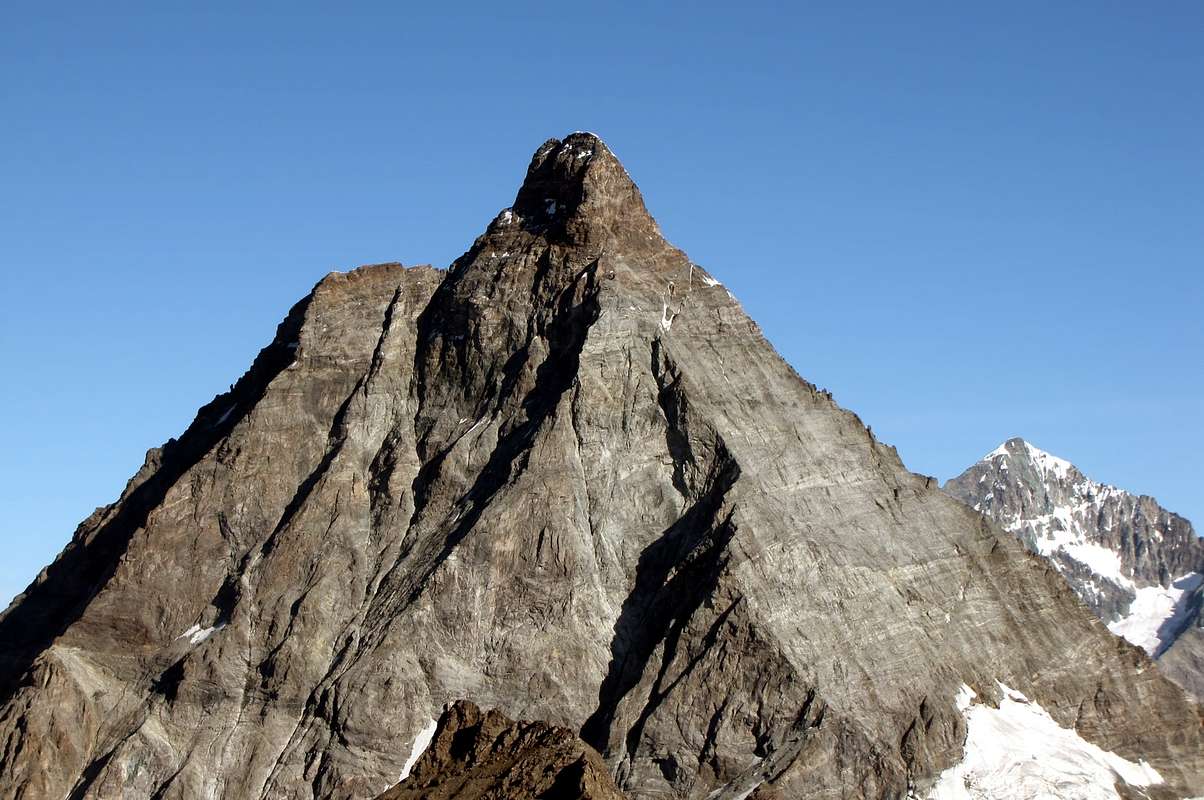
Breuil small Valleys: numerous walloons above Breuil/Cervinia and below the South Face of Matterhorn to
1) - Bas Glacier du Leon,
2) - Bas and Haut Glaciers of Peak Tyndall,
3) - Mount Cervin Glacier,
4) - Forclaz Glacier,
5) - Mount Saint Théodule and Refuge Basin,
6) - Tête Grise/Valtournanche/Plateau Rosa Pass/Cimes Blanches Northern Hill/Gran Sometta/Motta de Plété Eastern and Central Summits/Bec du Pio Merlo.
Cime Bianche small Valley: from Regional Road, near Notre Dame de la Garde (1.858m), to Perrère (1.845m), Cret (1.884m) Villages; from this in East, path n° 19, to Mandaz Wood, Torrent and Desot/Damon Pastures (2.113m, 2.315m); from this to alternative about 2.440 meters with path n° 21 (from Yette, Champlong, Cleyves de la Seyvaz Pastures). With this last continue in East along Cleyva Groussa Torrent to
1) - Southern Hill of Cime Bianche (2.894m), between Gran Sometta/Bec Carré; in North through path-traces-small easy rocks on South Crest to
2) - Gran Sometta (3.166m).
Roisetta-Aran Basin: from Mandaz Damon in Southeast with dirt road to Molar (2.315m), Cleyva Groussa (2.253m), Illiaz Perron Alps (2.249m), nearby Oratory of Notre Dame Madonna della Saletta (2.203m), between the very wild basin below Mount Roisetta/Dents d'Aran/Becca d'Aran/Mount de Molar. Pathless, through steep moraines to various rocky Western walls; all difficult and formed of rotten and dangerous rock.
1) - Aran Pasture (2.325m), fork 2.651 meters and in Northwest Becca d'Aran (2.953m), through easy Eastern Slopes; from fork in Northeast with path n° 29 on South Slope to 2) - Mount Roisetta (+; 3.324m). From Cheneil in Southeast with path n° 29/30/31/ Haute Route number 1 to alternative about 2.275 meters, below Champsec Pasture, and in East-northeast with path n° 30 to
3) - Tournalin Pass (3.145m), between Grand/Petit Tournalin; from alternative in East with path n° Haute Route number 1 to
4) - Nannaz or Nana Hill (2.772m). From this in North with path n° 3C to
5) - Bec Trécare (+; 3.032m), easily on South Crest; in South, with unnumbered path-traces, to
6) - Bec de Nana (3.003m), on North Crest. From fork about 2.250 meters, before the alternative, in South with path n° 31 to
7) - Fontana Freida Pass (2.472m), between Fontana Freida Summit (2.513m)/Clavalité Sanctuary/2.523m), both in a shorth time attainable; from Cheneil in South-southwest with path n° 107 to
8) - Cheneil Hill (2.278m), between Mount Charvaz/Point Fontana Fredda.
 |
Chamois-Nanna(z)-Grand Dent Comba: from Chamois Commune (1.812m; reached exclusively by Cableway from Buisson 1.124m; parking) in North with path n°107 to Lod Village, nearby homonym Lake (2.014m); from this to
1) - Cheneil Hill. From lake in Northeast with path n° 1 to
2) - Charavellessa (2.131m), Glavin (2.219m) Pastures, Clavalité Sanctuary. From Chamois in East-northeast with path n° 4 (ex n° 2) to
3) - Crepin, Foresus Cleyva Bella (2.243m) Pastures, below homonym small loch; from this, among various small torrents to Nana Hill. From pond in East, pathless and through moraines, to
4) - watershed in North of Grand Dent (2.834m) near small saddle 2.782 meters and through North Crest Summit; from Chamois-Moulin (+; 1.888m) in Southeast with path n° 5 to
5) - Cort Pasture (2.184m), Champlong mini Lakes (2.354m), Pillonet Pass (2.698m).
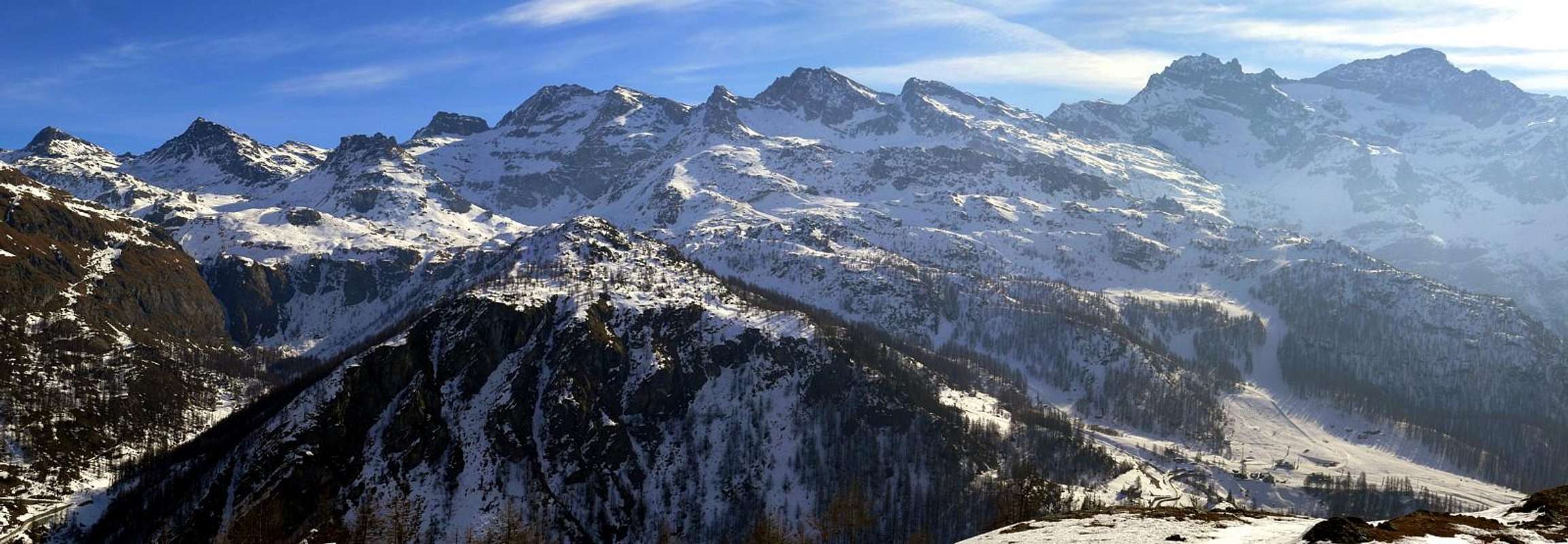
La Magdeleine-Tantané small Valley: from Regional Road to Valtournanche, alternative nearby Grand Moulin (1.048m; two parkings) to Antey Saint André Commune and, again through Municipal Road, to Petit Antey (1.092m). Continue to Chaillein (1.387m), Lod (1.474m), Noussan (1.509m) Villages and in North to
A) - La Magdeleine Resort, at the foot of Mount Tantané (2.734m); also in South to
B) - Promiod (+; 1.505m; Camping Dalai Lama 1.499m) Hamlet, below Mount Zerbion (2.722m). From La Magdeleine-Artaz (1.747m) in North with path n° 3 to
1) - Laye (1.855m), Croux (1.928m), nearby Croux Lake (1.917m), Borget (1.938m), near Lake Grande Puine, Pilaz Pasture, under Pila(z) Hill (1.954m; beautiful by snowshoes) and descent in Chamois Comba. Also, through "Nature Path", from Pilaz Pasture (1.962m) in East to
2) - Charey Dèsot Alp (2.136m) and Lake of Charey (2.136m). From Artaz in Southeast with path n° 4 to
3) - Novales (1.882m), Champ Cellier or Chancellier Damon (2.147m) Alpages and South-southwest Ridge of Mount Tantané, easy with small rocks. From Promiod in Northeast with dirt road, concomitant with path n° 6, to
4) - Boettes (1.722m), Supplin-Brovie (1.914m, 1.908m), Brenvey, Renard (2.046m), Nouva Pastures, Portola Hill (2.414m); in South to
5) - Mount Zerbion with path n° 6/2 or "Path of the Passion of Christ"; various tombstones. From alternative immediately after Boettes in Southeast with dirt-path n° 105 to 6) - Arsine (1.844m), Franquin Dèsot or Francou (2.021m) and Damon (2.044m) Pastures and following path n° 7 to Mount Zerbion, through very easy West Ridge. From the Western Shoulder at the base of crest, in point 1.991 meters, possibility of descent to Nuarsaz Alp (1.704m) in Nissod Basin.
Chatillon-Nissod-Nuarsaz-Zerbion Basin: from Chatillon Commune (550m) through Municipal Road to Chavod, Pissin, Closel, Domianaz, Perrière, Travod, Nuarsaz (1.704m) Hamlets on the High Hill of Chatillon. From this in Northwest with path n° 12 to Chesalet (1.735m), Jacquemin-Giacomet (1.777m) Alps and, more in North, to connection with path n° 7 (from Etavey/Deviaz/Cheney Alps). Briefly to Western Shoulder in point 1.991 meters at the beginning of West Ridge Mount Zerbion.
1) - Ascent to same or
2) - possibility of descent to Promiod in the La Magdeleine Basin.
 |
 |
Campings
Remember that free camping is forbidden (except for emergency reasons, over 2.500m, from darkness until dawn).
Mountain Conditions
- You can get meteo information at the official site of the Regione Valle d'Aosta:
- Valle d'Aosta Meteo
Webcam
- WEBCAM on Aosta Valley:
- Webcam
Books and Maps
BOOKS:
- "Guida dei Monti d'Italia - Alpi Pennine (Vol. 2)" di Gino Buscaini - Club Alpino Italiano/Turing Club Italiano, Luglio 1970 (In Italian).
- "Diari Alpinistici" di Osvaldo Cardellina e Indice Generale accompagnato da Schedario Relazioni Ascensioni 1964-2019 (inediti).
- "Guida delle Alpi Occidentali" di Giovanni Bobba e Luigi Vaccarone C.A.I. Sezione di Torino Volume II (parte II), 25 Maggio 1896.
- "Rifugi e bivacchi in Valle d'Aosta", di Cosimo Zappelli aggiornata da Pietro Giglio, Musumeci Editore, Luglio 2002.
- "I Rifugi della Valle d'Aosta" di Stefano Ardito, Ed. Guide iter, Febbraio 2003.
")


MAPS:
- Kompass "Breuil/Cervinia-Zermatt" Carta turistica 1:50.000.
- I.G.C. Istituto Geografico Centrale Torino "Cervino e Monte Rosa" 1:50.000.
- Studio F.M.B. "Cervino Monte Rosa" Bologna 1:50.000.
- I.G.C. Istituto Geografico Centrale Torino "Monte Rosa Alagna e Macugnaga" (n° 10), 1:50.000.
Important Information
 |
- REGIONE AUTONOMA VALLE D'AOSTA the official site.
- FONDAZIONE MONTAGNA SICURA Villa Cameron, località Villard de la Palud n° 1 Courmayeur (AO) Tel: 39 0165 897602 - Fax: 39 0165 897647.
- SOCIETA' DELLE GUIDE DEL CERVINO Via Jean Antoine Carrel, n° 10 - 11021 Breuil Cervinia - Valtournenche (AO) - Italia.
- A.I.NE.VA. (Associazione Interregionale Neve e Valanghe).
Useful Numbers
- Protezione Civile Valdostana località Aeroporto n° 7/A Saint Christophe (Ao) Tel. 0165-238222.
- Bollettino Valanghe Tel. 0165-776300.
- Bollettino Meteo Tel. 0165-44113.
- Unità Operativa di Soccorso Sanitario Tel. 118.