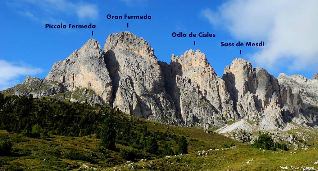
The area Odle-Pùez constitutes the North Western end of the Dolomites, bounded to the West by Valle Isarco, to the North by Val Pusteria, to the East by Val Badia and to the South by Val Gardena. It consists of two mountain ranges, including the Pùez and the Odle Group, this latter developing between Val Gardena and Val di Funes. The Odle Group is full of sharp and slender towers of “dolomia”, hence the name "Odle" - meaning needles - and offers a rich choice of climbs of varying difficulty and length. On the Southern side of the Odle Group there is a coastline of superb summits dominating the magnificent and scenic meadows of Alpe Cisles. Amongst them Sass de Mesdì appears like a beautiful rocky castle, clearly isolated and located between Odla di Cisles on the left and the deep gully of Mesdì on the right. The mountain stretches towards the Val di Cisles (South) with a beautiful wall 350 meters high built of good quality "dolomia", articulated in a succession of corners and chimneys, whose base there is the small monolith called Torre Kasnapoff. On Sass del Mesdì steep South wall run different cool classic routes, which represent an interesting lure for the climber.
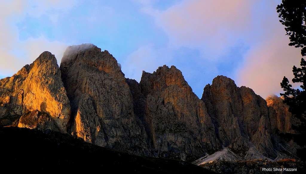
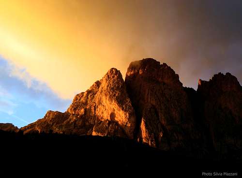
The summits of Alpe di Cisles lined up at sunset
History
The first known ascent to the top was made by the chamois hunter G.B. Vinatzer in the year 1884, August from Forcella di Mesdì.
Getting There
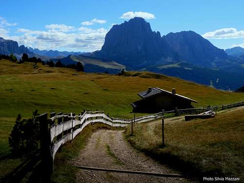
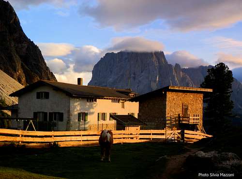
Cisles meadows and Sassolungo in the background
The starting point is Alpe di Cisles, accessible from Santa Cristina di Val Gardena. Road access to Val Gardena
- From Trento and Bolzano: Take the Brennero motorway, exit Bolzano North, then follow the road leading to the little town of Ponte Gardena. From here take the road entering Val Gardena, pass Ortisei and reach Santa Cristina
- From Brennero : Take the Brennero Motorway towards South, exit Chiusa and here follow the roadway joining the Val Gardena road, pass Ortisei and reach Santa Cristina
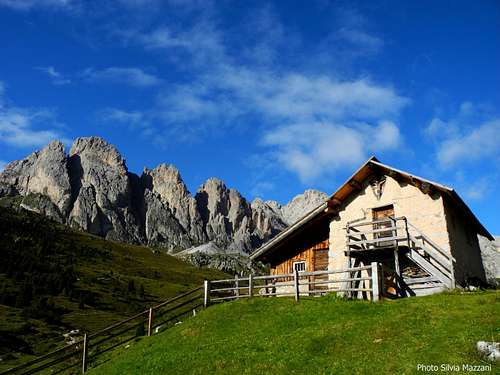
Walking access to South Face routes You can approach the peak directly from Col Raiser Cable car upper station m 2107, otherwise - if you want to take it easy - you can spend the night at Rif. Col Raiser, Rif. Fermeda or Rif. Firenze
Approach from Col Raiser Take the path that leads to the starting point of via ferrata Sass Rigais, and follow it uphill, approaching, after a couple of crossroads, the Southern walls of the Odle. Walking to the East you will meet in sequence Piccola Fermeda, Grande Fermeda, Odla da Cisles and Sass de Mesdì
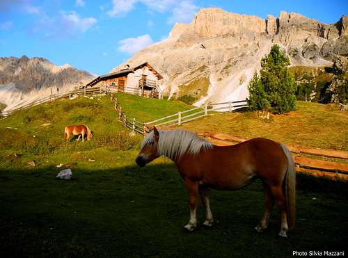
Avelignese horse in Cisles Valley
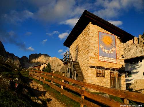
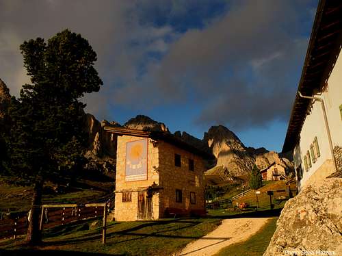
Nice sundial near Rifugio Firenze
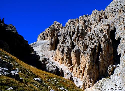
Approach from Rifugio Firenze Head to the North following the path n. 13 that goes up the slopes of the Alpe di Cisles, reaching a crossroads. Ignore the left path and the right one and continue directly, reaching an horizontal path skirting the peaks. Turn to right, then follow an uncertain track climbing the scree towards the gully between Odla da Cisles and Sass de Mezdì.
The coastline Fermeda - Odla da Cisles - Sass de Mesdì
Best Routes on Sass de Mesdì
Best routes on Sass de Mesdì - UIAA Scale
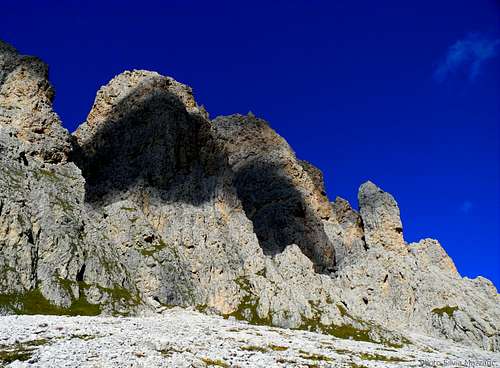
SSW ridge, S and SE Faces (from left to right)
- SSW Ridge Via Dibona V- (a move), 400 m. First ascent: Angelo Dibona, Rudi Heller, Karl Huter and Gustav Jahn 1917, June 23rd - Via Jahn IV+, V (a short move), 290 m. First ascent: K. Huter, G. Jahn, E Merlet, O. Müller, P. Richter 1917 - South Pillar Via Malsiner – Moroder VI (V+, A0), 235 m. First ascent: V. Malsiner, L. Moroder summer 1957 - Via della Rampa IV+, 180 m. First ascent: unknown
A fleeting shadow over Odla de Cisles and Sass de Mesdì
The groupe Fermeda - Odla da Cisles - Sass de Mesdì
SSW ridge Via Dibona report
Via Dibona report
Summit altitude: m 2762 Difficulty: Alpine D-, UIAA max V- Route length: 400 m Exposure: SSW First ascent: Angelo Dibona, Rudi Heller, Karl Huter and Gustav Jahn 1917, June 23rd Starting point: Col Raiser or Rifugio Firenze
The pleasant atmosphere, the facing S exposure, the rock generally good and the stunning views make this route one of the most classic and frequented climb of the Odle. An advisable climb. The number of pegs is essential (12 pegs on the route, belays included) and needs a good competence to integrate the protections.
Angelo Dibona
Approach from Col Raiser Take the path that leads to the starting point of via ferrata Sass Rigais, and follow it uphill approaching, after two crossroads, the Southern walls of the Odle; you will meet in sequence Piccola Fermeda, Grande Fermeda, Odla da Cisles and Sass de Mesdì. Carry on walking to the East and reach another crossroad; here take the less noticeable trail on the left, climbing up the scree coming down from the throat between Odla da Cisles on the left and Sass de Mesdì on the right. To get the starting point of the route Dibona climb to the right a grassy ramp that originates near the entrance of the gully. The route starts 10 meters before the notch above the ramp, near a horizontal ledge.
Route report
L1- Follow the horizontal ledge to the left for a few meters reaching soon a gully narrowing into a chimney. Climb it keeping the right side (1 peg) and then traverse left to reach a small terrace formed by a boulder jammed inside the chimney - II, III and IV, 40 m. Anchor on a hole. L2 - Climb the upper section of the chimney keeping on a slab on the right. At its end, easier rocks lead to the left to a little notch, then horizontally to the base of a pillar located to the left of an overhanging chimney - IV and II, 50 m. Belay on an outcrop. L3 - Climb the pillar for about ten meters. Before getting to a most steep and challenging section, traverse horizontally to the left, overlooking the gully between Odla de Cisles and Sass Mesdi. Climb a small overhang (peg) and then the slab to the right, going around the pillar and getting the upper section of an obvious chimney on the right. Belay on a big outcrop. IV, 40 m. L4 - Up the chimney on good holds, exiting on a terrace. From the terrace climb a slab, heading to a small corner on the right and reaching it below an overhang (2 pegs). Climb the corner (1 peg), passing a single challenging step (V-). Belay uncomfortably at its end III, IV, V- (a move) 45 m
Funny climbing on DibonaDibona, the traverse
L5 - Climb the chimney to the left of the stance, then on easier ground climb the next wall slanting left. At its end belay to the right on a large terrace. III+, 50 m.
L6 – Climb the wall on the right and continue with an exposed traverse to the right again. At the end you enter a short dihedral that leads to a ledge; follow it to the right to reach the stance. IV, 40 m.
L7 - Climb the next wall at first in the middle, then on the right (peg), then on the left heading to a big hole. Belay on the comfortable terrace to the right of the hole and at the bottom of a red chimney - IV, 35 m.
L8 - Enter the fun chimney with good holds; at the end traverse left, coming out on a terrace - IV and II, 35 m.
L9 – Up on easy rocks without a compulsory route heading to the summit ridge, belay on the summit, summit book, II, 50 m.
Via DibonaA chimney on Via Dibona
Descent: to the North follow the tracks on the left of the summit ridge descending just below a notch. Follow the track marked by several cairns (steps I and II) to a fork, where you should take the left.
Dozens of rocky needles on the way down
Further down the track cross diagonally to the right, reaching a wide grassy ramp that leads to the trail that runs to the right skirting the base of the wall and reaching the scree below the peak.
Red Tape
There are no special restrictions or prohibitions in hiking and climbing. Sass de Mesdì is situated inside the Natural Park Puéz-Odle, that extends for 9400 hectares and belongs entirely to the province of Bolzano. This area is one of the nine mountain systems of the Dolomites acknowledged as UNESCO World Heritage Site.
"Arrampicare Dolomiti Nord-Occidentali" vol. I by M. Bertolotti, L. Galbiati, F. Vascellari - Vividolomiti “Arrampicare in Val Gardena e dintorni Le vie più belle nelle Dolomiti”Vol. I by Mauro Bernardi, Ed. Athesia “Arrampicare in Val Gardena e dintorni Le vie più belle nelle Dolomiti” Vol. II by Mauro Bernardi, Ed. Athesia “Odle–Pùez” by Lorenzo e Pietro Meciani - Collana Guide dei Monti d’Italia, CAI TCI
Maps
Tabacco Val Gardena 1:25.000 Tabacco sheet 30 – Bressanone 1:25.000
Parents refers to a larger category under which an object falls. For example, theAconcagua mountain page has the 'Aconcagua Group' and the 'Seven Summits' asparents and is a parent itself to many routes, photos, and Trip Reports.

 8273 Hits
 89.77% Score
 30 Votes