
|
|
Route |
|---|---|
|
|
32.99083°N / 116.11242°W |
|
|
Hiking |
|
|
Winter |
|
|
Half a day |
|
|
Hike |
|
|
Overview
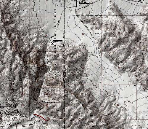
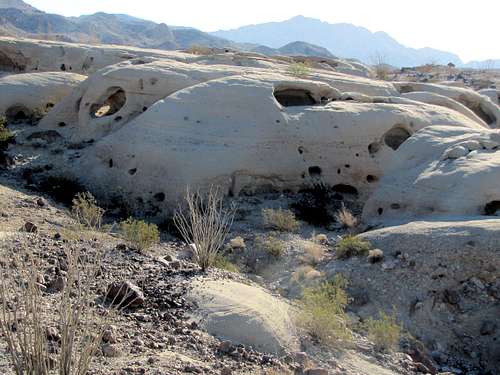
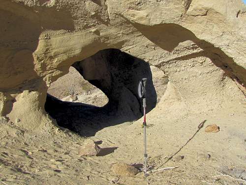
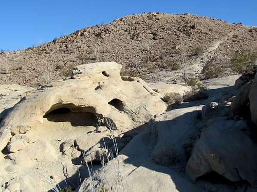
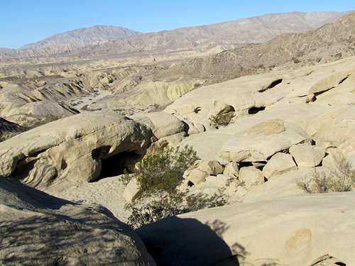
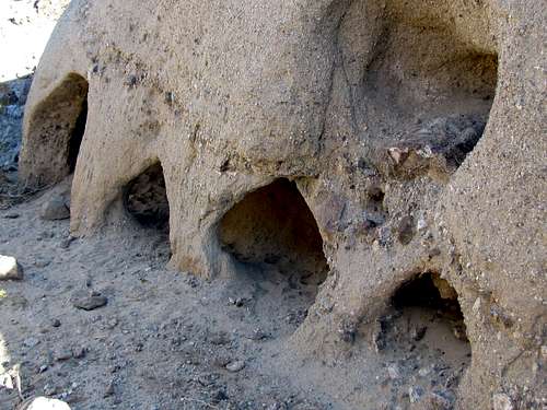
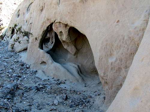
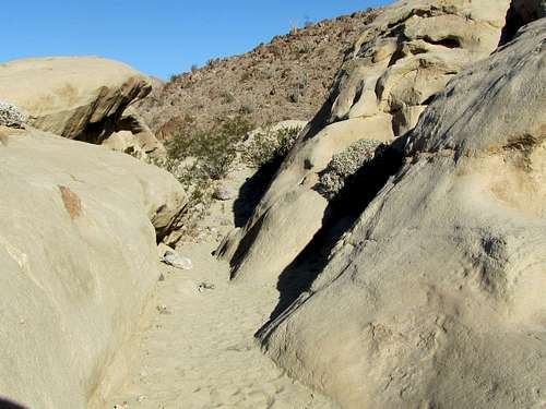
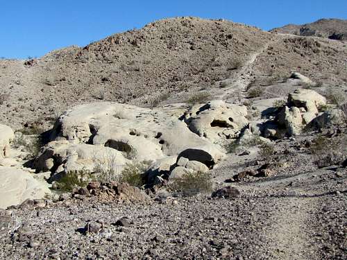
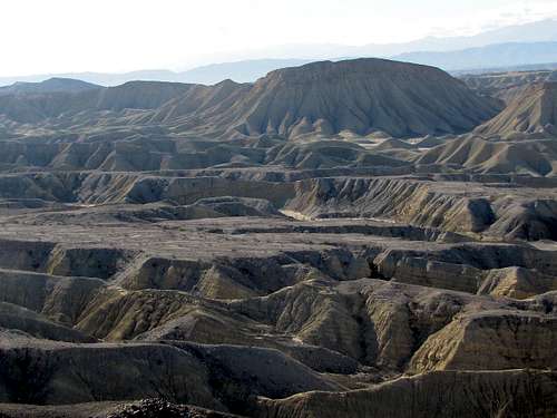
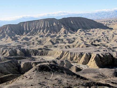
Wind Caves refers to a series of sandstone holes and small caves near Fish Creek (Dry) in the eastern parts of California’s Anza Borrego Desert State Park. A short trail goes 250 vertical feet above Split Mountain Road to the Wind Caves. You can follow a beaten path further up to the top of Point 860 ft to get great views of Carrizo Badlands and the desert mountains that rise above them.
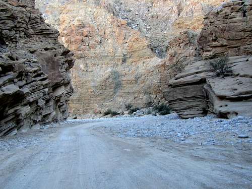
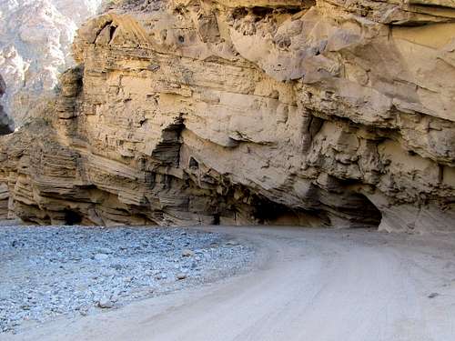
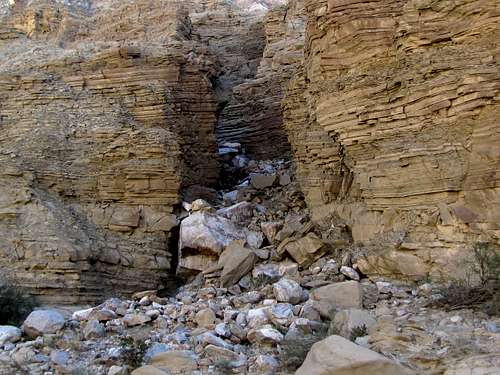
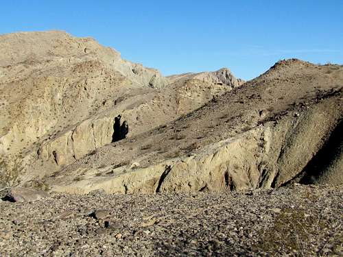
Split Mountain is a narrow gorge with a dry wash (Fish Creek) at the bottom of it. The wash is used as a dirt road to reach Wind Caves Trail.
Getting There
From the community of Ocotillo on Route 78, turn south onto Split Mountain Road and drive 8 miles to the end of pavement. Turn right onto the dry wash surface and go 1.4 miles to Fish Creek Primitive Campground. Split Mountain Gorge starts here. Drive another 2.7 miles to Wind Caves Trailhead.
The dry wash is officially a four wheel drive road. I drove with 2 wheel drive to the campground and chose to hike through the gorge. The road through the gorge did not seem rough but was sandy. Some sources say you can drive 2 wheel drive through the gorge. Use your judgment.
Route Description
Hike or drive the Fish Creek Dry Wash (Split Mountain) 1.4 miles to the campground where the gorge starts. Continue another 2.7 miles to Wind Caves Trailhead.
 |
||
 |
 |
 |
 |
||
 |
 |
 |
 |
||
 |
 |
 |
The gorge suddenly ends. 0.2 miles after the end of the gorge, you will see a sign for Wind Caves Trail.
 On Wind Caves Trail
The half mile long trail takes you from an elevation of 450 ft to 700 ft where the Wind Caves appear.
 |
 |
 |
 |
 |
 |
 |
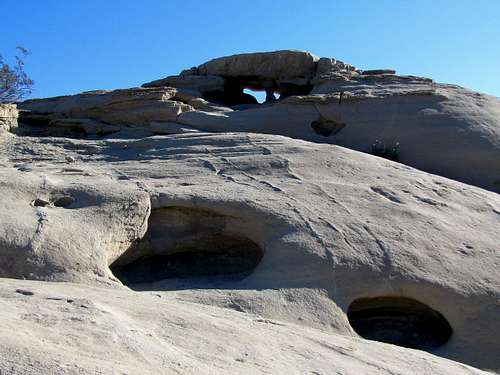 |
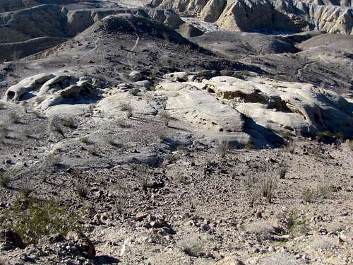
A beaten path can be seen going up to the top of Point 860 ft.
 Point 860 ft from Wind Caves Area
Views from the top of Point 860 ft.
 |
 Elephant Knees Elephant Knees |
 Looking down at Wind Caves Looking down at Wind Caves |
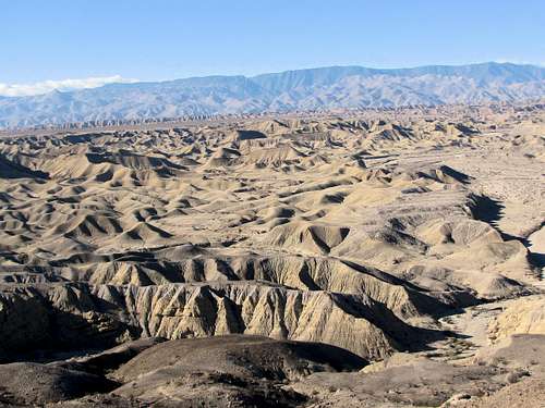 Carrizo Badlands Carrizo Badlands |
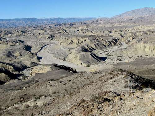 Fish Creek Wash Fish Creek Wash |
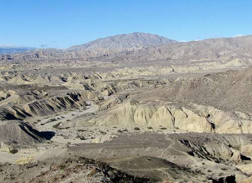 Fish Creek Wash Fish Creek Wash |
When to Hike
Winter, late autumn and early spring is the best time to hike. Summer can be dangerously hot.
External Links
http://www.hikespeak.com/trails/wind-caves-trail-anza-borrego-desert/.