


-
 7912 Hits
-
 78.27% Score
-
 9 Votes
|
|
Area/Range |
|---|---|
|
|
45.73040°N / 7.44841°E |
|
|
Hiking, Mountaineering, Trad Climbing |
|
|
Spring, Summer, Fall, Winter |
|
|
5249 ft / 1600 m |
|
|
Note
La montagna chiama i suoi figli, ed essi rispondono fedelmente al suo appello… Osvaldo Cardellina, Diario alpinistico, 1964-65 Page texts: @ OsvaldoCardellina "Osva", passed away on May 2, 2022. Page owners: Christian Cardellina e Osvaldo Cardellina. Any updates from September 12, 2022: Antonio Giani, page administrator, friend and climbing companion. Testi della pagina: @ OsvaldoCardellina "Osva", scomparso il 2 maggio 2022. Proprietari pagina: Christian Cardellina e Osvaldo Cardellina. Eventuali aggiornamenti dal 12 settembre 2022: Antonio Giani, amministratore della pagina, amico e compagno di salite. |
Hunting Preserve Overview
Saint Marcel Vallon or Valley?. This wide vallon dominates towards East the City of Aosta and falls in two Municipalities: Fénis and Saint Marcel. On top of that is made up of the Grande Roise small Mountain Chain (3.357m) on the more Western of the two watersheds that contain it. In fact this Summit is more deviated from the true Vertex of the valley formed by the Punta del Tessonet (3.266m), where the same ends forming two well defined watershed: the West precisely what the Subgroup of Rouèses, while on the opposite stretches that of two Averts, which culminates with the Grand (2.991m) to finally finish one hand to Mont Roux (2.530m) with the Coppermines of Chuc-Servette, while on the other, always after the Mont Corquet (2.530m), the partition is extended to the North-northeast until Torrasse or Mont Touriasse (1.985m) and the rocky promontory over the forest of Mont Saint Julien (1.377m), with its Sanctuary of San Grato above the Municipality of Fénis and the Hermitage of San Giuliano perched on the cliffs that dominate the entrance into the Clavalité Tableland. This vallon is unique in its development, starting from the valley floor near Saint Marcel Common with its two fraction of Surpian or Sorpian (568m) and Prayer or Prarayer (566m), but actually splits the approach road that "escapes", "cutting" almost vertically up the hill to the North; reached the small Villages of Les Druges Higher and Lower (1.600m, 1.567m); then continue just to the North-northwest reaching Dora Baltea between the Fractions of Tillier (550m; Fénis Common) and that of Valméanaz (601m; Saint Marcel Municipality), right in front of the Commune of Nus across the River Dora Baltea.
Vallone o Valle di Saint Marcel? Quest'ampia valle domina ad Oriente della Città di Aosta ed incombe su due Comuni: Fénis e Saint Marcel. Il vertice massimo della medesima é costituito dalla Grande Roise (3.357 m), sita sul più Occidentale dei due spartiacque contenenti la medesima. In realtà questa Sommità risulta più discostata dal Vertice vero e proprio della valle costituito dalla Punta del Tessonet (3.266 m), ove la medesima termina formando due ben definiti spartiacque: ad Ovest appunto quello del Gruppo delle Rouèses, mentre sull'opposto si allunga quello degli Averts, culminante con il Grand (2.991 m) per infine terminare da un lato al Mont Roux (2.530 m) con le Miniere di rame di Chuc-Servette, mentre dall'altro, sempre dopo il Mont Corquet (2.530 m) il divisorio s'allunga a Nord-nordest fino alla Torrasse o Mont Touriasse (1.985 m) ed al promontorio roccioso-boschivo del Mont Saint Julien (1.377 m), con il suo Santuario di San Grato sopra l'abitato di Fénis e l'Eremitaggio di San Giuliano abbarbicato alle pareti rocciose che dominano l'ingresso nella Clavalité. Questa valle é unica nel suo sviluppo partendo dal fondovalle nei pressi di Saint Marcel, ma in realtà si sdoppia nello avvicinamento stradale che "fuoriesce" dal suo percorso naturale; infatti la Strada regionale risale più ad Oriente di questa linea, che segue il corso del Torrente di Saint Marcel, transitando per tutta una serie di piccoli villaggi, con epicentro il Santuario di Plout, posti sulla medio-alta collina alle pendici del Mont Corquet. Anche i confini comunali con lo attiguo Comune di Fénis risultano particolari, poiché non seguono lo spartiacque ad Est, bensì dal Corquet s'indirizzano a valle "tagliando" quasi in verticale la collina verso Settentrione; raggiunti i piccoli Villaggio di Les Druges Alte e Basse (1.600 m, 1.567 m), proseguono poi appena più a Nord-nordovest raggiungendo la Dora Baltea tra la Frazione di Tillier (550 m; Fénis) e quella di Valméanaz (601 m; St. Marcel), giusto di fronte al Comune di Nus oltre il fiume.
 |
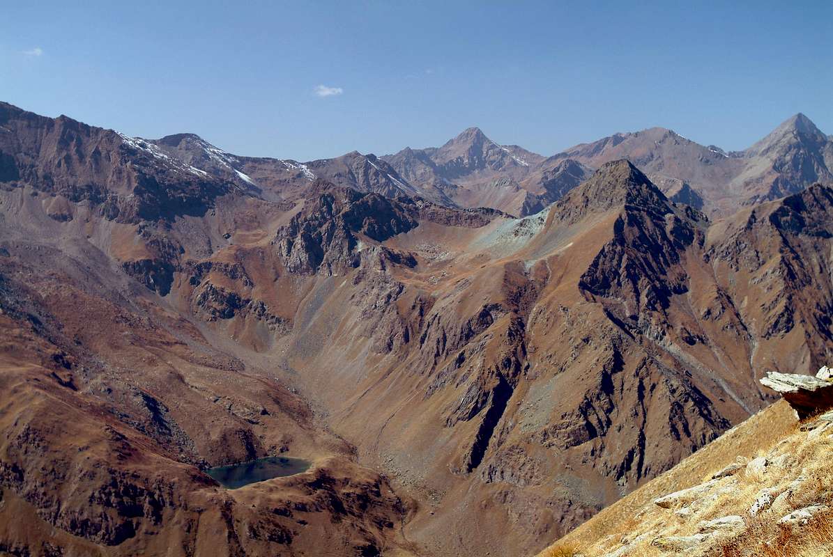
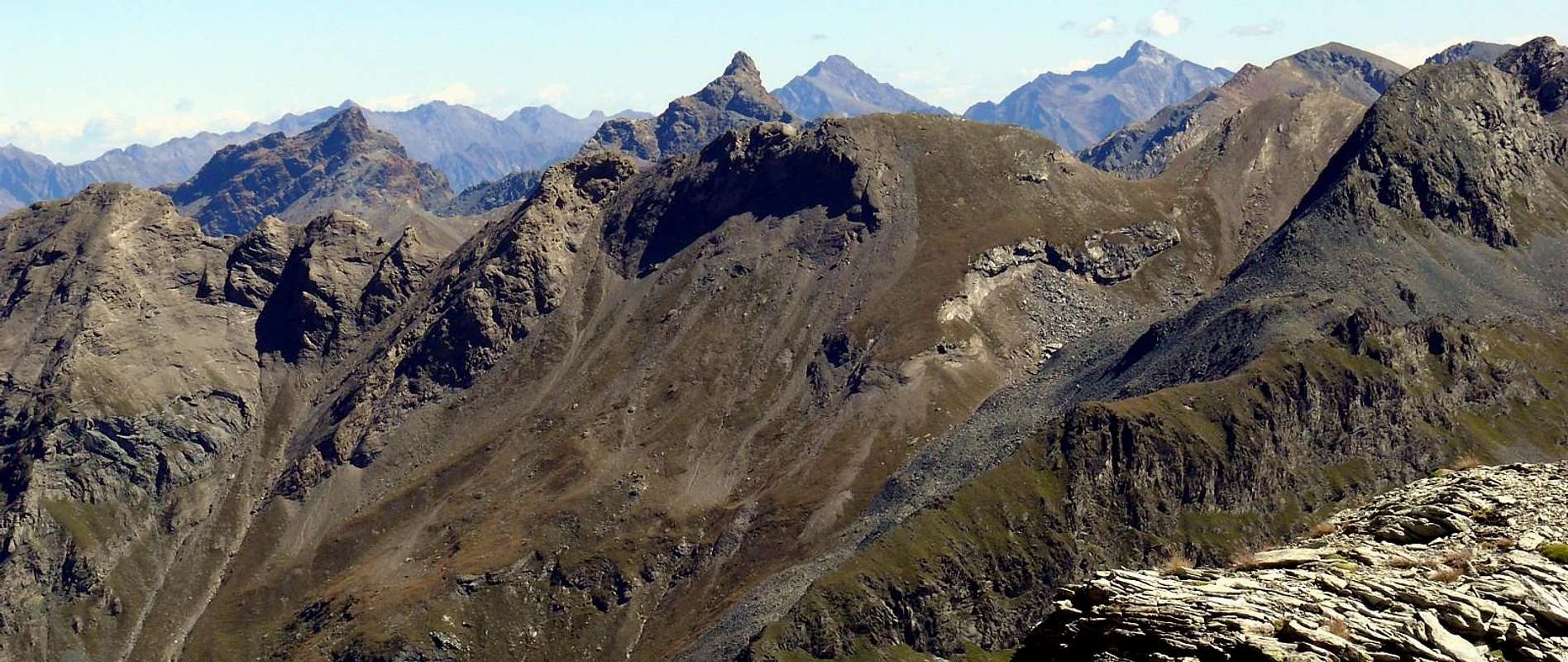
This border demarcation, rather atypical and unusual in Aosta Valley, determines that the small Vallone of Pieiller, at the foot of Mont Saint Julien, belongs to the Municipality of Fénis and not more than that of Saint Marcel. Even the highest sector complaint an anomaly with a valley "hinted" that is directed towards Southeast reaching always at the foot of Mont Corquet the Alps Meyes, Plan-de Meyes, Bren and Praz-Premier or Prapremier (1.875m, 1.893m, 1.961m, 2.010m), all now in the former municipality, even though on this side of the divide. This factor means that, in order to gain access to the Valley of Saint Marcel real, must be by Les Druges Alte continue on the road, which becomes from paved to farm and private dirt road Westward reaching the Picnic Area and the subsequent Pastures of Pouria (1.586m) and Vargney, at a warehouse on the edge of the meadows; continuing past is beyond the landfill of the mineral, turn decidedly in the South, entering into the walloon near the Mines of Chuc-Servette (1.591m), at the Eastern foot of Mont Roux. From this point the vallon, always with direction from North to South, after passing a small slope (gate with a sign indicating that the ban on driving) in the private Hunting Reserve Great Avert, currently owned by the Marquis Attilio Turati, already ex Reserve Baron Beck Peckoz Gressoney, runs the entire valley for about ten kilometres, passing the House Hunting Mulàc-St. Louis (1.937m), several pastures and ends in the South nearby the House Hunting Grande Chaux (2.370m) and Southeast Alp Petite Chaux (2.419m), the slopes of the two Averts and Lavòdilèc Hill (2.863m). From here continue to radiate the various paths that reach clockwise, beyond that hill, those of Tessonet (3.051m), St. Marcel or Coronas (2.913m), Vallonet (3.062m) and Leppe (3.110m), immediately after the Summit with the same name (3.305/6m) where do you get the beginning of the small Chain Grande Roise, that separating this vallon from that of adjoining Les Laures, ending above Grand Brissogne.
Questa demarcazione dei confini, piuttosto atipica ed inusuale in Valle d'Aosta, determina il fatto che il piccolo Vallone del Pieiller, ai piedi del Mont Saint Julien, appartenga al Comune di Fénis e non più a quello di St. Marcel. Anche la parte più elevata denuncia un'anomalia con un vallone "accennato" che s'indirizza verso Sudest raggiungendo alle pendici del Corquet le Alpi Les Meyes, Plan-de Meyes, Bren e Praz-Premier o Prapremier (1.875 m, 1.893 m, 1.961 m, 2.010 m), tutte ormai appartenenti al primo, anche se al di qua dello spartiacque. Questo fattore comporta che, onde poter accedere al Vallone di Saint Marcel vero e proprio, bisogna da Les Druges Alte continuare sulla strada, che da asfaltata diventa poderale, verso Ovest raggiungendo l'Area Pic Nic ed i successivi Alpeggi di Pouria (1.586 m) e Vargney, presso un magazzino al limite dei prati. Proseguendo oltre si oltrepassano le discariche del minerale e, volgendo decisamente a Mezzogiorno, si entra nel vallone nei pressi delle Miniere di Chuc-Servette (1.591 m), alle pendici Orientali del Mont Roux. Da questo punto il vallone, sempre con direzioe da Nord a Sud, dopo aver superato una piccola discesa (cancello con cartello segnalante il divieto di transito) nella privata Riserva di caccia Grand Avert, attualmente di proprietà del Marchese Attilio Turati, già ex Riserva del Barone Beck Peckoz di Gressoney, percorre l'intera valle per una decina di Kilometri, passando la Casa di Caccia di Mulàc-St. Louis (1.937 m), diversi alpeggi per terminare a Sud alla Casa di Caccia di Grande Chaux (2370 m) ed a Sudest all'Alpe di Petite Chaux (2.419 m), alle pendici dei due Averts e del Colle di Lavòdilèc (2.863 m). Da qui continuano a raggiera i vari sentieri che raggiungono in senso orario, oltre a questo colle, quelli del Tessonet (3.051 m), St. Marcel o Coronas (2.913 m), Vallonet (3.062 m) e di Leppe (3.110 m), subito appresso la Punta di Leppe (3.305/6 m) ove prende inizio la piccola Catena della Grande Roise che, separando questo vallone da quello attiguo delle Laures, termina sopra Grand Brissogne.
This vallon that, by extension and amplitude, deserves to be considered in all respects a valley, similar to those of Champdepraz or of the Lakes and Fénis-Clavalité High-Comba Tersiva, has many attractions ranging from the interest in Mineralogy and one for the attractions Naturalistic, being a full-blown Reserve for over a Century and a half, even for those Historical-Religious-Cultural in the medium-low hill, among which we highlight the famous Plout Sanctuary (968m; ample parking with a small fountain and other explanatory posters), a place of ancient Processions and numerous current visitations. The same is placed in the middle hill near the homonymous village, just beyond of that of Enchasaz, before the Regional Road asphalt changes its direction from the southwest to the East, reaching the Village of Seissogne (1.066m) and other subsequent. But we will, both for him and for the part of the mineralogical and Reserve Grand Avert, more clarification in the next section "Historical and some small notes Inquisitiveness".
Questo vallone che, per lunga estensione ed ampiezza, merita di essere considerato a tutti gli effetti una vera e propria valle, similarmente a quelle di Champdepraz o dei Laghi e di Fénis-Clavalité-Alta Comba Tersiva, possiede numerose attrattive che vanno dall'interesse per la Mineralogia, grazie alle numerose miniere che vi esistevano fino ad una sessantina di anni orsono, ed a quello per le attrattive Naturalistiche, essendo una Riserva conclamata ormai da oltre un Secolo e mezzo, a quello Storico-Religiose-Culturali nella parte medio-bassa, tra le quali s'evidenzia il famoso Santuario di Plout (968 m; ampio parking con fontanella e diversa cartellonistica esplicativa), meta di antiche Processioni e di numerose attuali visitazioni. Il medesimo é collocato nella media collina presso l'omonimo Villaggio, subito appresso a quello di Enchasaz, prima che la Strada Regionale in asfalto cambi la sua direzione da Sudovest ad Est raggiungendo il Villaggio di Seissogne (1.066 m) ed altri successivi. Ma daremo, sia per quanto gli concerne che per la parte mineralogica e la Riserva del Grand Avert, maggiori delucidazioni nella successiva apposita sezione "Historical and some small notes Inquisitiveness".
 |
 |
 |
Getting There
BY CAR:
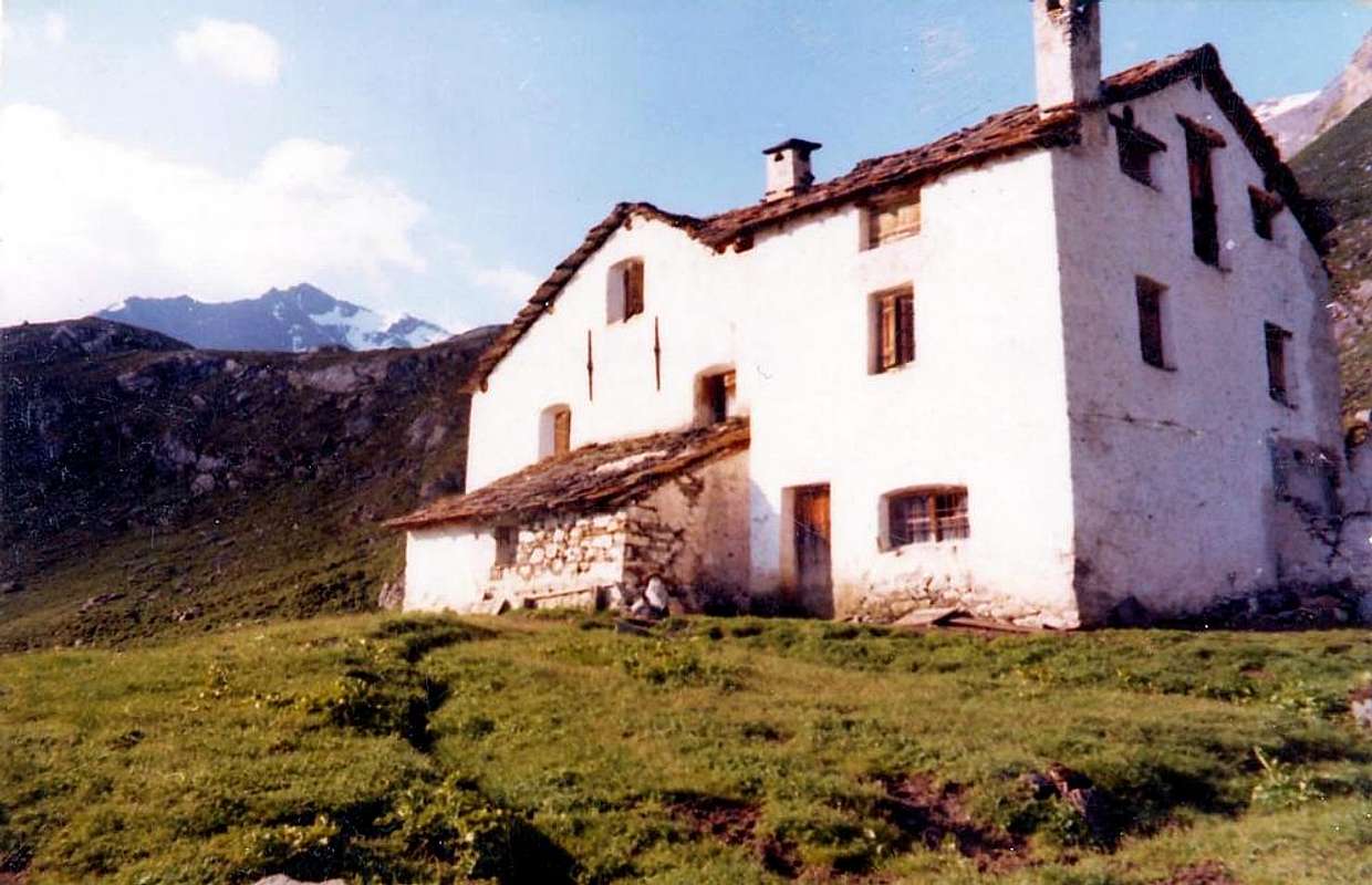
By Les Druges towards Grande Chaux: from Les Druges Alta, Pouria Pasture (1.600m); various panels) starting from the small lay-by beyond the rocky-wooden dump of the above abandoned Coppermines Chuc-Servette, and after rounding the cape entering the real vallon, walk "suspended" on the left (East) along the entire Vallon St. Marcel and, after passing a small gate, border of the Reserve by Marquis Turati ex Baron Peckoz, and after a short descent, remount passing through Mulàc Hunting House (1.937m; beautiful fountain with wooden steinbock) boarding on the right (Northwest) the manganese old Mine of Praz Bornaz also Prabor(g)na (1.882m; abandoned for years now). Cross the torrent on a footstep (1.995m) and walk up (little steeper with a final ramp to the East) get two Plan Ruè Pastures (2.100m) and, just after, to those Plan d'Emonin Dessous e Dessus Dessous e Dessus (2.129m, 2.219m). Once in Layet (2.233m; fine pond), flanked by a boulder, and in a short time, just after leaving the left (Southeast) deviation for Pastures of Petite Chaux (2.419m), you get the hunting House "Turati", ex Hunting House Baron Beck Peckoz Gressoney (2.370m), placed at the base of the Grand Vallon and Vallon Fenêtre. Little Histories & tiny Amenities
- From TORINO, MILANO, etc: Motorway A5. Exit at IVREA or Quincinetto (PIEDMONT)
- From IVREA Town: in West (Southern side) to Pont Saint Martin, Donnas, Bard, Champdepraz, Pontey, Fénis, Saint Marcel.
- From Fénis (537m) on Pieiller small Vallon towards Le-Pieiller-de-Sermaz, Maison Longue, Le Plany Hamlets (1.075m, 1.112m, 1.174m); through asphalt road) and subsequent connection with La Morgetta(z), Pressunettaz, alternative before Champremier (1.383m) at Les Druges Lower and Upper small Villages (1.567m, 1.600m).
- From Saint Marcel (630m) to Saint Marcel Vallon and Turati Reserve up to the Mulac & Grande Chaux Hunting Houses and Alp (1.937m, 2.370m). Specific Road By SS.26, 15 Km by Aosta Town, crossing the stonebridge over the Dora Baltea, just after the Country of Nus (output Motorways A5), arriving at the junction 539 meters, and immediately after the field of Football, leave the roundabout to the left on the same (various large signals), and go up to the Chief Lieu.
- From FRANCE: through the Mont Blanc Tunnel to Entrèves-crossroads to Vény/Ferret Valleys - Mountain Guides of Courmayeur - La Saxe Rock Gym - Courmayeur. By Little Saint Bernard Pass, closed since November until half May to La Thuile Valley - Pré Saint Didier - Courmayeur. It is not necessary to take Motorway A5: you can drive on SS.26, in the direction of AOSTA - IVREA - TURIN.
BY PLANE:
- Aeroporto "Corrado Gex" Saint Christophe (Aosta).
Road Itinerary & Route into the Vallon
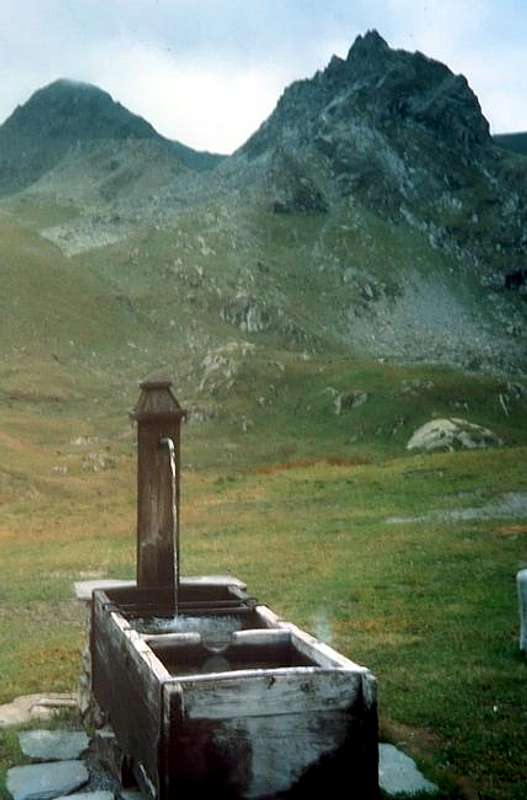
Strada Regionale Specifica verso il Vallone di Saint Marcel: dalla rotonda all'ingresso del Paese di St. Marcel, scavalcare su d'un largo ponte la Dora Baltea, portandosi nel centro dello stesso in direzione della sua grande Chiesa; contornarla e proseguire (molteplici indicazioni per la quale cosa, al fine di non sbagliare, seguire i cartelli di colore marrone con la dicitura Santuario di Plout. Risalire verso Sud con la Strada Regionale verso le Frazioni di Crétaz (653 m) e poi, decisamente verso Est, di Jayer (693 m) e Mezein (793 m); subito dopo questo punto, lasciando sulla sinistra una diramazione che scende al Paese di Fénis (divieto di transito per gli automezzi), la strada cambia completamente direzione verso Sudovest per raggiungere il Villaggio di Réan (898 m) e, tramite un lungo diagonale, il celebre Santuario di Plout (898 m; * splendida "Via Crucis" nel camminatoio ricoperto ed antistante), dove da secoli avviene una processione partendo proprio da Saint Marcel. Doppiando lo stesso la strada si indirizza nuovamente ad Est fino ad un largo tornante, dove rientra verso la precedente direzione raggiungendo il Villaggio di Seissogne (1.066 m) ed, attraverso grandi praterie, il successivo di Sazailland (1.220 m); seguono quelli di Ronc (1.359 m), Viplana (1.346 m), Champremier (1.383 m), oltre il quale si lascia sulla sinistra una deviazione per le alte alpi del Comune di Fénis (transitabile ed aperta al traffico) per raggiungere il bivio per Porteron (famosa per la sua pista internazionale dello slittino) e la successiva località di Leycher (1.506 m; rinomata "Locanda del Diavolo"). Ritornando ad Est, la strada lascia in basso la corta deviazione per Les Druges Basse (1.567 m) per pervenire subito dopo a Les Druges Alte (1.600 m circa; bella fontana presso un piccolo squadrato "rascard" in legno e Cappelletta votiva dedicata a San Bernardo, all'inizio del sentiero n° 14 per l'Alpe Fontanafreida (1.810 m), congiungentesi con la poderale verso l'Alpe di Bren (1.961 m).
 |
 |
 |
 |
All its Vallons
Fénis Valley Pieiller Vallon: from Fénis-Le Perron (582m) Hamlet, Champlan, Crou de Ban (926m), Le Pieiller de Sermoz (1.075m), Maison Longue (1.112m), Le Plany (1.174m), Le Pieiller (1.230m) little Villages, alternative on hairpin road (about 1.200m) to Le Coteau (1.234m) Village, with municipal road or path from valley floor; from this:
1) - in Northeast Mount Saint Julien (1.384m), Saint Grat Sanctuary and, through short descent, Saint Julien Hermitage, with path.
2) - From Le Pieiller road continuation in Southeast to La Morgnettaz (1.245m), Champremier (1.833m) Villages and connection with Les Druges Comba, at the entrance of Saint Marcel Vallon;
3) - or the same connection but with path, starting from The Morgnettaz, passes through the small Villages of Porteron (1.368m; sledge run Combasse), Malplanet (1.495m), Les Druges Low and High (1.567m).
Saint Marcel Valley Mounts Corquet-Roux Vallon: from Upper Les Druges (1.600/57m) in South Fontaine Froide (1.810m), Bren (1.961m), Praz Premier (2.011m) Alpages. From this
1) - in Southeast descent to Robioz or Robbio in Fénis alloon, with paths;
2) - in Southwest to Crotey Pass (2.486m) to Saint Marcel Vallon, with paths.
3) - In West Corquet old Alp (2.124m); from alp
4) - in South Mount Corquet (2.527m), easily with path.
5) - And yet true West to Mount Roux (2.277m) with its rich Chuc-Servette Mines of iron and copper, through uncertain path often covered with rhododendrons. Crotey small Vallon: from Les Druges towards Pouria Pasture (1.586m), Vargney Alp, Chuc-Servette Old Mines (1.810m), Etéley Alp (1.741m), through dirt road; fork 1.836 meters, near Praborna manganese mine (1.891m) and after Etéley (1.750m) in East to Lavanché Alp (2.071m) and in Northeast to Crotey Pass (2.486m); from this in North Mount Corquet, through paths. In Southwest Hunters Col de Belfrond (2.598m), on easy ridge. Plan Rué mini Vallon: from Plan Rué Alp (2.103m) on Saint Marcel farms dirt road in East to Belfrond Pass, with traces on grassy slope, earthly couloirs and easy rock bands, and from this in South to Plan Rué Point (2.883m), through traces and easy small rocks on North-northeast Crest.
 |
Saint Marcel Valley Terre Bleue Vallon: from Etéley, Mulac-Saint Louis Hunting House (1.937m) towards Plan Rué Pastures (2.100m, 2.129m), two Plan d'Emonin Alps (2.205m), Layet Alp (2.233m) and Lake to Grande Chaux Hunting House and old Alp (2.370m; ruines), through farms dirt road, in East-southeast to Terre Bleue Pass (2.827m) and from this:
1) - in Northeast Grand Avert (2.991m), without path, small traces and easy rocks on Southwest Crest (I°+, one passage of II°-, exposed to Southeast; snowy rope required);
2) - in South traverse to Little Avert (2.947m), through easy Northern Crest.
Avert-Lavodilec Vallons: from alternative 2.320 meters before Grande Chaux Hunting House in Southeast towards Petite Chaux Pasture (2.419m) in East, with dirt road, and through moraine:
1) - Grand Avert Pass (2.828m), between Grande Crête also Devil's Crest and Grand Avert; from this to Grand Avert, through easy (I°) Northern Crest, with snow rope required;
2) - to Southeast in long crossing Lavòdilèc Hill (2.863m), with path.
Fenêtre Vallon: from Grande Chaux in Southwest alternative 2.601 meters and
1) - in East-southeast Lavodilec Hill, with path; from this in North to Little Avert (2.947m), through debris on Southwest Slope and easy rock band in final part;
2) - in West-northwest Saint Marcel also Corona's Hill (2.913m; precious stone "Ollare" blue), with path, in South easy traverse to Laval Points (3.091m, 3.099m), Gianni Vert (3.150m) Points, with traces.
Grand Vallon: from Grande Chaux or from fork 2.601 meters in West to Vallonet Pass (3.062m), Mount Vallonet (3.101m), with small path-traces.
Petit Vallon: from Grande Chaux to West-northwest Grande Chaux Alp (2.391m), Leppe Pass (3.110m), with path, small path and traces. From this
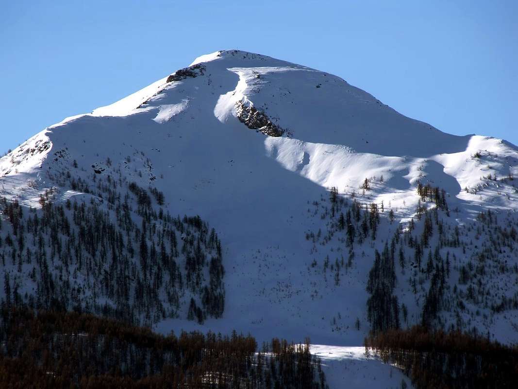
1)- in North Ilario Antonio Garzotto Point (3.274m), through debris and easy rocks on South Slope; in South Leppe Point, easy Northeast Crest. Eastern Arpisson Vallon: from fork 1.836 meters on farms dirt road to Mulac (1.937m) in Northwest long traverse to Choulet Alp (1.821m), small saddle with Cross 1.939 meters towards the entrance into vallon, Salé (2.209m) Alp, with paths, Bonplan Alp (2.374m) to Salé or Grande Roise also Brissogne Pass (3.008m), with rare traces, moraine, blocks and small earthy gullies in terminal part, with snow rope required. From this
1) - in North easily to Becca of Salé;
2) - in South Little Roise Northern Antesummit (3.270m), Summit (3.273/4m), with traces, debris, blocks and small rocks in final part (one passage of II°-/II° on Carving said "Pas du Baton", between the both; rope required), at the beginning of Grande Roise Range.
Historical and some small notes Inquisitiveness
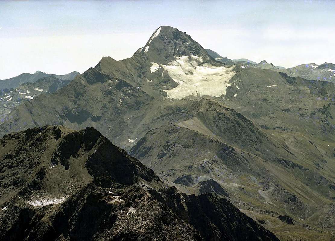
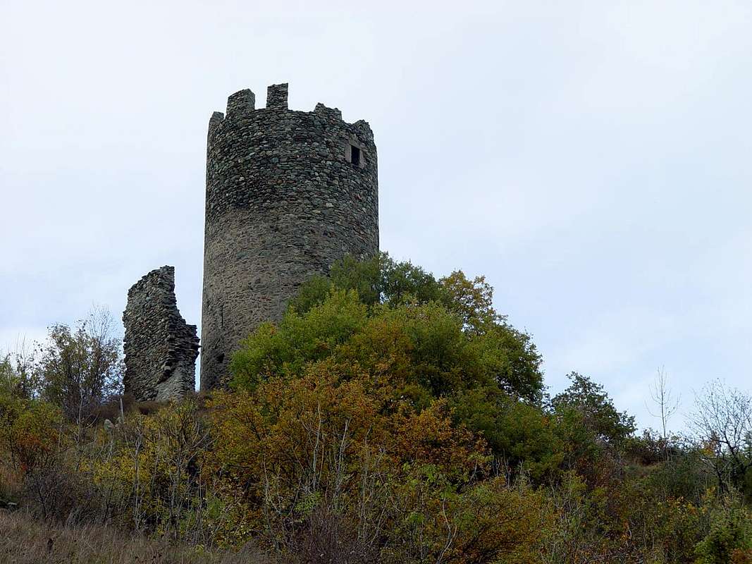
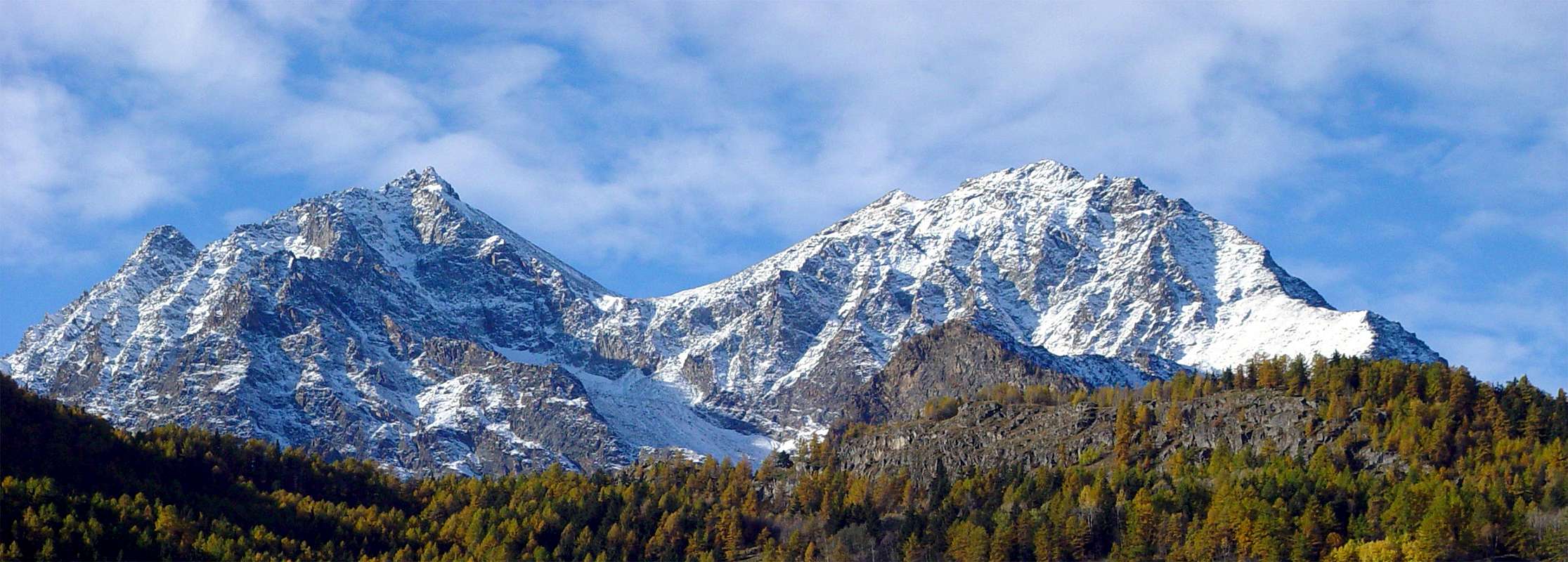
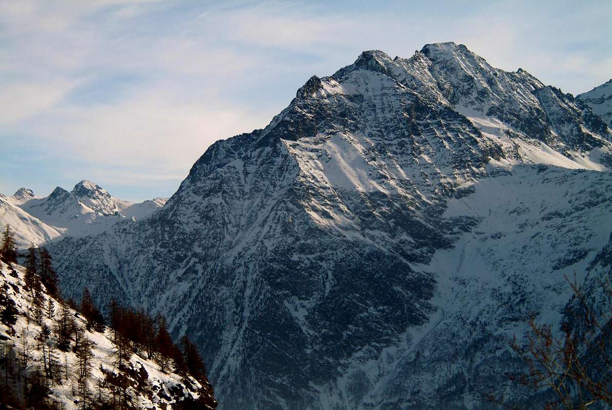
This enough long valley opens behind the Municipality of Saint Marcel (630m), sited with its beautiful Castle of 1600, between the Municipalities of Fénis to the East and Grand Brissogne. The same lies on the Southern side of the Central Valley of Baltea and at the slopes of Mounts Saint Julien, La Torrasse, Corquet and Roux, who constitute the last bastion of the same that had originated at the foot of the pyramid of Punta del Tessonet. Built by Giacomo of Challant beween the Villages of Surpian (568m) and Paquier, after the division of property following the death of the Ibleto il Giovane owner also of the Castle Ussel above the Municipality of Pontey, experienced many vicissitudes until Baron Paolo Emanuele of Châtillon who made the sale to the Barons Bianco of San Secondo (Piedmont). The latter, in order to avoid having to make the restoration of the same, sold it for little money to "Ranger Company of Mines" which, however, overlooked it completely letting go almost completely in ruins. He was also known as the "Castle of the Widows", as well as being a summer resort, after the construction of an adjacent room was the residence and refuge of the widows of the Counts of Challant both the aristocratic branch of the Val d'Ayas that for the noble branch of Aymavilles. Also worth visiting is the Parish Church, while the overlying Plout Sanctuary (968m; Patronal Festival September 14th, while in Saint Marcel is celebrated January 16th) has become a tradition almost millennia by tracing the construction of a primeval niche with a tiny statue of the Madonna in 1200 and is dedicated to "Notre Dame des Hermites". As for the part mining and naturalistic recommend a trip-excursion to visit the Coppermines of Servette, yet in sight with large wooden cable cars and the houses of the miners with substantial retaining walls built of dry stone, the Manganesemines Praborna (Prato della Buca) and of iron into the Reserve Turati or Grand Avert, formerly Nature Reserve and Hunting of Gressoney Baron Beck Peck(c)oz. In addition there are wonders of Flora and Fauna, rich of the King Steinbock, of chamoises, marmots and every other creature on the Mount, dominated by the royal flight of the eagle, which often sees flying, silhouetted high in the sky of the Grande Rouèze or Roise Range (Great Glacier, that there is hardly any at all, for which reason it is deduced that the name must be very old, (3.357m) jumping over it in the direction of His Majesty the Monte Emilius (3.559m). There should be noted that the same in 1800 had other dimensions, including also the parallels Walloons Les Laures and Arpisson, amongst the Monte Emilius, Becca di Seneva and Becca di Nona, up to the Carrel Hill (2.916m)), while in the South spanned the watershed with the Valley Grauson-Tessonet (Cogne) coming up on the glacial slopes of Punta Tersiva (3.515m). With regard to the waters, to remember to highlight how the same feature of the particular features: just above the floor of Emonin Dessous and Dessus (2.129m, 2.219m; Lower and Higher), to about the middle of the valley, with two brooks flowing with coloration completely different. One of a deep green above carbonates of copper, the other yellow-ocher on iron oxides. This is also the last color that trickle down from Sevette crossing the private dirt road, while the green copper reappears in the locality called Eve-Verda also Acqua Verde (1.331m, 1.305m; Green Water), where the ore underwent a first wash, hence the name before the transportation definitive downstream where it was processed and finished in the "Fabbica" or Factory at the great iron bridge of 60 meters above Baltea and within which runs the railroad, with calcium carbide production. The oven itself remained open until the end Sixties when it was closed simultaneously to the coppermines, as judged by the owners no longer profitable. The stone "Ollare": just below the Colle di Saint Marcel or Coronas Hill (2.913m), on the diagonal path that leads to this and also above the same, there is a much considerable quantity of this; of color blue mat is very malleable and then used to make traditional, refined and in great demand sculptures of Aosta Valley, also "all round". One last curiosity: in the Manganesemine of Praborna or Praz-Bor(g)na exist the mineral of the Violano, very rare and it seems that is the only place in Europe where there.
Brevi tratti Istorici & qualche Curiosità
 |
Quest'abbastanza lunga valle s'apre alle spalle del Comune di Saint Marcel (630 m), sito con il suo bel Castello del 1600, tra i Comuni di Fénis ad Oriente e di Grand Brissogne. Lo stesso s'adagia sul lato Meridionale della Valle Centrale della Dora Baltea ed alle pendici di Saint Julien, La Torrasse, Corquet e Roux costituenti l'ultimo baluardo della medesima originatasi ai piedi della piramide della Punta del Tessonet. Costruito da Giacomo di Challant tra i Villaggi di Surpian (568 m) e Paquier, dopo la divisione delle proprietà a seguito della morte di Ibleto il Giovane proprietario pure del Castello di Ussel al di sopra di Pontey, conobbe varie peripezie fino al Barone Paolo Emanuele di Châtillon che ne effettuò la cessione ai Baroni Bianco di San Secondo. Quest'ultimi, onde evitare di dover effettuare la restaurazione del medesimo, lo cedettero a misero prezzo alla "Società Esploratrice delle Miniere" che, però, lo trascurò completamente lasciandolo andare quasi in completa rovina. Era anche conosciuto come il "Castello delle Vedove", poiché, oltre ad essere luogo di villeggiatura estiva, dopo la costruzione d'un locale attiguo costituiva la dimora ed il rifugio delle vedove dei Conti di Challant sia per il ramo nobiliare della Val d'Ayas che per quello di Aymavilles. Inoltre degna di visita é la Chiesa Parrocchiale, mentre il soprastante Santuario di Plout ((968 m; Festa Patronale il 14 Settembre, mentre a Saint Marcel si celebra il 16 Gennaio con San Marcello) ha ormai una tradizione quasi millennaria facendone risalire la costruzione d'una primigenia nicchia con statuetta della Madonna al 1200 ed é dedicato a "Notre Dame des Hermites". Per quanto concerne la parte mineraria e quella naturalistica consigliamo una gita-escursione per visitare le miniere di rame di Servette con ancora in vista grandi teleferiche in legno e le case dei minatori e notevoli mura a secco di sostegno, quelle di manganese di Praborna (Prato della Borgna ovvero Buca) e di ferro della Riserva Turati o del Grand Avert nella ex Riserva Naturale nonché di Caccia del Gressonaro Barone Beck Peck(c)oz. Inoltre si trovano meraviglie della Flora e della Fauna, ricca del Re Stambecco, di branchi di camosci, marmotte ed'ogni altra creatura della Montagna, dominati dal regale volo dell'aquila, che spesso si vede transvolare, stagliandosi altissima nel cielo, sulla Catena della Grande Rouèze o Roise (Grande Ghiacciaio, ormai in via di pressocché totale estinzione, per la qual cosa si deduce che il toponimo deve risultare molto antico; (3.357 m)) scavalcandola in direzione di Sua Maestà l'Emilius (3.559 m). V'é da notare come la stessa nel 1800 aveva ben altre dimensioni, comprendendo anche i paralleli Valloni des Laures e d'Arpisson sin al Colle Carrel (2.916 m)), mentre a Sud scavalcava lo spartiacque con la Valle del Grauson-Tessonet (Val de Cogne) arrivando sin alle glaciali pendici della Punta Tersiva (3.515 m).
 |
 |
 |
 |
 |
Mountain Condition
- You can get meteo information at the official site of the Regione Valle d'Aosta:
- Valle d'Aosta Meteo
Important Information
- REGIONE AUTONOMA VALLE D'AOSTA the official site.
- FONDAZIONE MONTAGNA SICURA Villa Cameron, località Villard de la Palud n° 1 Courmayeur (AO) Tel: 39 0165 897602 - Fax: 39 0165 897647.
- A.I.NE.VA. (Associazione Interregionale Neve e Valanghe).
Useful numbers
- Protezione Civile Valdostana località Aeroporto n° 7/A Saint Christophe (Ao) Tel. 0165-238222.
- Bollettino Meteo (weather info) Tel. 0165-44113.
- Unità Operativa di Soccorso Sanitario Tel. 118.