Comboé and "Becca": a Walk for an Excursion for Kids & Teens / 1

Comboé and "Becca": a Walk for an Excursion for Kids & Teens / 1

Page Type Page Type: Article
Activities Activities: Hiking

Youth Spring Combuì Overview


Reading this Article is Absssolutely forbidden to children, unless accompanied by adults or by the Family. Why do we write of mountain always just for adults, and never for Children or the Boys? There are places in the mountains for the first, but that fit well for the seconds. And then there are places for kids who are also fine for adults, not excluding whole families. And this is it. But also a place where summer "retire" the Summer Camps by Priests of Sant'Orso on vacation-meditation or groups of families in secluded vacation. Or where, by placing the tent, they isolate groups of haggard students who are preparing exams at school; otherwise that, after having carried out the same, come here to recover from "stress" received in the same deal. Also pass Hikers that go Bivouac Federico and, occasionally, even some rare and true Mountaineer. Occasionally you find a Chorus of "Old Alpini" with their inevitable demijohn of good wine. But for them this is only a passage. For us, no, it is a real goal ...


"... Comboé or Combuì a Paradise Lost? ...", by Antonio


La lettura di sto Articolo é Assssolutamente Vietata ai bambini, se non accompagnati da adulti o dalla Famiglia. Perché scriviamo di montagna sempre e solo per gli adulti e mai pei Bambini od i Ragazzi? Esiston posti trai monti destinati ai primi, ma che van pur ben ai secondi. Eppoi altri pei ragazzi che van bene anche agli adulti, non escluse l'intere Famiglie. E questo lo é. Ma anche luogo dove d'estate si "ritirano"le Colonie estive dei Preti di Sant'Orso in vacanza-meditazione o gruppi di famiglie in appartata vacanza. Oppure dove, piazzando la tenda, s'isolano gruppi sparuti di studenti preparandi agli esami a scuola; altrimenti che, dopo averli effettuati, vengon qui a recuperare dallo "stress" ricevuto nell'affrontare i medesimi. Passan anche gli Escursionisti che van sù al Bivacco Federico Zullo ed, ogni tanto, anche qualche raro e vero Alpinista. Occasionalmente trovi un Coro di "Veci Alpini" con la loro immancabile damigiana di buon vino. Ma per costoro il Comboé é esclusivamente un passaggio. Per noi no, é vera e propria meta ...


"... By Becca over the City of Aosta ...", by Antonio Giani


Looking at an old B&W photograph, come to think of how many times we got up here, and then, looking down at the Basin Pila and all that way still to go on a long descent, we yearned to be already down here to drink the cool waters of the Torrent Comboé, that here rests before jumping the falls above Ponteilles and finally continue his mad rush in the Valley of the Dard reaching down, there, the Dora Baltea. Again we went running to reach the "Becca" or other goals then the most important, or at least appeared so. A few times we stopped at Comboé, looking from this place a higher goal to achieve. Him we only ever noticed on the way back when tired bodies craved a moment's rest and rejuvenating rest after the long fatigue. But not today, because we go to Combuì to reach Combuì. And just, perhaps bringing with us a group of children and to see in their eyes the wonder of splendid surprise. As it was for us, boys, arriving in this walloon starting from the valley floor and meeting the Shepherd who, through wide hand gestures, to us vaguely indicated the way forward. This time we do the trail backwards and looking from the top we go down, because it is the Comboé, and not the "Becca", our destination. Always starting from Pila or somewhere else different, but always and only to make this beautiful walk or hike leading to Comboé, because here we will stop becoming meditative or playing with the kids in his green meadows. Always paying attention to the Viper that lies beside the graysh screes, stony ground with blocks.
Unfortunately always present ...


"... Reminiscences towards Comboé & Pila Conca ...", by Osw


Guardando una vecchia fotografia in B&W ritrovata per sbaglio in un cassetto, viene da pensare a quante volte siamo arrivati quassù e poi, guardando giù verso la Conca di Pila ed a tutta quella strada ancora da percorrere in una lunga discesa, abbiamo anelato di essere di già qua sotto a bere le fresche acque del torrente Comboé, che qui si riposa prima di iniziare il salto con le cascate sopra Ponteilles ed infine continuare la sua folle corsa nel Vallone del Dard raggiungendo, laggiù, la Dora Baltea. Sempre siamo passati correndo per raggiungere la "Becca" od altre mete allora più importanti, o che almeno apparivano tali. Poche volte ci siamo fermati al Comboé, guardando da questo posto una meta più alta da raggiungere. Di lui ci siamo sempre e soltanto accorti al ritorno quando le stanche membra bramavano un attimo di sosta e rigenerante riposo dopo la lunga fatica. Ma oggi no, perché andiamo al Combuì per raggiungere il Combuì. E basta, magari portando con noi una schiera di bambini e per vedere nei loro occhi lo stupore della sopresa e della meraviglia. Come avvenne per noi, da ragazzi, arrivando in questo vallone partendo dal fondo valle ed incontrando il Pastore che, tramite larghi gesti della mano, ci indicava vagamente la strada da seguire. Questa volta invece facciam percorso inverso e guardando dall'alto scendiamo abbasso, perché é il Comboé, e non la "Becca", la nostra meta. Sempre partendo da Pila o da qualche altro posto diverso, ma sempre e soltanto per effettuare questa bella Passeggiata od Escursione che conduce al Comboé, perché qui ci fermeremo diventando meditativi o giocando coi bambini nei suoi verdi prati. Facendovi sempre attenzione alla Vipera che alberga accanto nelle grigiastre pietraie.
Sfortunatamente sempre presente ...


"... But this time we go down from the top down ...", by andrea.it


If a child wants to take a walk, where you lead him? Bring him in a wonderful place, almost a Lost Paradise, where he will be able to admire a new Heaven, a new drinking Water, run through the green Meadows remaining in harmony with Nature. But where is this Eden? Close, very close to Pila, immediately above Aosta City, bypassing the two hills of Replan (2347m, 2366m, the better of both this last or North), at the Chamolé Lake (2325m; accessible from Upper Station of the Chairlift departing between Bettères/Perchu order to expose 1774m) or, better, starting from Pila at Restaurant "Lyon Noir" (1800 m) and passing nearby the Alp Chamolé and bypassing the Plan Fenetre Hill (2229m); from this in a quarter of an hour to descend Comboé. But, always with the same start, you can reach the Hermitage of San Grato (1787m) and with an old path, steep and definitely tiring, insert the path before at the crossroads 2140 metres, just before the hill. The first route is suitable for children, the second is good for kids, but you can go even lower by several points intemediate, as they once did, and then you need good legs; then if we start from the valley floor (Roulaz, Felina Alta, Creton, Pian Felina and Pont Suaz various by Common Charvensod Fractions, on average 550/650 metres) is required good workout. If you switch from the Hills of Replan must be careful that the descent is steep, not suitable for children and to avoid with wet ground, despite the small path that reaches behind the Refuge private Sant'Orso (2114m). Past the Chamolé Pasture (2152m), where there is also a beautiful fountain, but be careful to make the turn off over the meadows where the trail passes the tree line, otherwise, pounding the grass, the shepherd rightly gets angry. Start with a slow pace and constant, because there is no one who runs after him, and when you come to Alp make a short stop and let the kids drink; then, going around the cowshed, address them to the East and with the path on a slight slope you reach the Plan Fenetre Hill. Here again stop admiring the "Becca" and, if climb just above the wooden Cross of reaching the nearby Punta Ponteilles (2263m), you can admire the North Wall with its base the great landslide of Flood of 2000, also because the return, being more tired, you will not want to do this thing. In 1h'30 reach Comboé, but if he also used 2h'00 nothing happens.
As long as this has given us right time to reflect, observe the right things better ...


"... The last Paradise ...", by Antonio


Se un Bambino vuol far una bella passeggiata, dove lo portate? Portatelo in un posto meraviglioso, quasi un Paradiso perduto, dove lui sarà capace di ammirare un nuovo Cielo, bere una nuova Acqua, correre su verdi Prati restando in sintonia con la Natura. Ma dove si trova questo Eden? Vicino, a due passi da Pila scavalcando i due Colli di Replan (2347 m, 2366 m; meglio quest'ultimo o Nord), presso il Lago di Chamolé (2325 m; raggiungibile dalla Stazione Superiore della Seggiovia con partenza tra Bettères/Perchu 1774m) oppure, e meglio, partendo da Pila presso il Ristorante "Lyon Noir" (1800 m), transitando per l'Alpe di Chamolé e scavalcando il Colle Plan Fenetre (2229 m); da questo in un quarto d'ora si scende al Comboé. Ma, sempre con l'identica partenza, potete raggiungere l'Eremitaggio di San Grato (1787 m) e con una antica mulattiera, più ripida e sicuramente faticosa, inserirvi sul sentiero precedente presso il bivio 2140 metri, appena prima del colle. Il primo percorso é adatto ai bambini, il secondo va bene per ragazzi, ma si può partire anche più in basso da vari punti intemedi, come facevano una volta, ed allora necessitano buone gambe; se poi si parte dal fondovalle (Roulaz, Felina Alta, Creton, Pian Felina e Pont Suaz, mediamente 550/650 metri) é necessario un buon allenamento. Se invece si passa dai Colli di Replan bisogna stare attenti alla discesa che é ripida, non adatta a bambini e da evitarsi con terreno bagnato, nonostante il sentierino che raggiunge alle spalle il Rifugio privato di Sant'Orso (2114 m).


"... Neighbor Comboè Sant'Orso Canons Shelter ...", by Osw


Passate dall'Alpe di Chamolé (2152 m)
, dove esiste anche una bella fontana, ma fate attenzione a far il giro largo sopra i prati dove passa il sentiero al limitar del bosco, altrimenti, pestando l'erba, il pastore giustamente s'arrabbia ed urla ai quattro venti. Partite con andatura lenta e costante, poiché non c'é nessuno che vi corre dietro, e quando arrivate all'alpe effettuate una piccola sosta e fate bere i bambini; poi, aggirando la stalla, indirizzatevi ad Oriente e con il sentiero in falsopiano raggiungete il Colle Plan Fenetre. Qui fermatevi di nuovo ammirando la "Becca" e, se salite appena sopra la Croce in legno raggiungendo la vicina Punta di Ponteilles (2263 m), potete ammirare la Parete Nord con alla sua base la grande frana dell'Alluvione del 2000, anche perché al ritorno, essendo più affaticati, non avrete voglia di far ciò. In 1h'30 sarete al Comboé col suo dolce laghetto, ma pur se ne impiegaste anche 2h'00 proprio nulla succede. Sempre che questo ci abbia concesso di rifletter e meglio osservar le giuste cose ...


"... A Great Heaven, a Sky not only for Children ...", by Antonio


The Child and the Boy live in another dimension. A different wordl, as for the Mountains, not all are created equal. So is all well and good to make known to them that there are other dimensions in the World and not just those of the home, the school, the gym or the football field. A nice walk-hike in the mountains and in the middle of the Nature can only stimulate their desire to grow with new experiences. It is not always easy to escape from big cities and urban agglomerations usual. Nothing better than a new knowledge in a new environment. I told a female colleague that, by hosting a child to his home in Milan, this was asking what was that thing that flowed in a stream. How, said the teacher, but it is water! No, replied the child: the water is in the tap. It seems an absurdity, however is true reality and not always able to understand certain situations. What applies to the child of the country, visiting for the first time the city is even more true in the reverse situation. In spite of the mass media which often give a distorted view of reality. It is not necessary to climb or practice Mountaineering. Sometimes it's just a nice walk in the woods or in the forest, looking at the flowers, which are not necessarily the ones in the jar, seeing a mountain pasture with the herdsman grazing cows, reaching a freshwater lake that is not the sea but lives higher in respect to him or coming to the snow, if not nearby the edge of a glacier, which is not that of a refrigerator. It sounds obvious, almost self-evident, but it is not so. When my Friends by Bari City are in Aosta look with astonished eyes, almost stunned the waterfalls and streams that glide over the rocks lost to an unknown destination. How much water have here! This exclamation that occurs between a childlike amazement. Sometimes we take for granted the things that are not at all so. Those who do not wonder most of us, but that may surprise others, eager for new experiences. Therefore, we propose a walk to Comboé and not only for the Childrens forced to live in the Big City. For a new Spiritual Life vision.
This the right way of thinking. Everything else comes from Evil ...


"... Reaching an very ancient and sacred destination ...", by Maria Grazia Schiapparelli


Il Bambino ed il Ragazzo vivono in altra Dimensione. Un mondo completamente diverso, come per la montagna, ove non tutti son stati creati uguali. Quindi é cosa buona e giusta far conoscer loro che nel Mondo esistono altre dimensioni e non solo quelle della casa, della scuola, della palestra o del campo di calcio. Una bella passeggiata-escursione in montagna ed in mezzo alla Natura non può che stimolare il loro desiderio di crescere facendo nuove esperienze. Non é sempre facile evadere dalle grandi Città e dagli agglomerati urbani usuali. Nulla di meglio che una nuova conoscenza in un ambiente nuovo. Mi raccontava una collega che, ospitando a casa sua un bambino di Milano, questo le chiedeva cosa fosse quella cosa che scorreva in un ruscello. Come, rispose la Maestra, ma é acqua! No, rispose il bambino: l'acqua si trova nel rubinetto. Sembra una assurdità, invece é vera realtà e non sempre riusciamo a capire certe situazioni. Ciò che vale per il bambino di campagna, che visita per la prima volta la città, vale ancora di più nella situazione inversa. A dispetto dei mass-media che spesso danno un'idea distorta della medesima. Non é necessario fare un'ascensione o praticare l'Alpinismo. A volte risulta sufficiente una bella passeggiata nei boschi o nella foresta, guardando i fiori, che non sono necessariamente quelli nel vaso, vedendo un alpeggio con il mandriano che pascola le vacche, raggiungendo un lago azzurro che non é il Mare ma vive più in alto di lui od arrivando alla neve, se non ai bordi d'un ghiacciaio, che non é quella del frigorifero. Sembra cosa scontata, quasi lapalissiana, ma non é così. Quando i miei Amici di Bari vengono in Valle di Aosta guardano con occhi stupiti, quasi sbalorditi le cascate ed i torrenti che scivolano sopra le rocce perdendosi verso una meta sconosciuta. Quanta acqua hanno qui! Questa l'esclamazione che ricorre tra uno stupore bambinesco. A volte diamo per scontate le cose che non lo sono affatto. Quelle che non meravigliano più noi, ma che posson meravigliare altri, desiderosi di fare nuove esperienze. Per questo proponiamo una bella passeggiata al Comboé e non soltanto per i bambini costretti a vivere nella Grande Città. Per una nuova visione della Vita, anche e soprattutto Spirituale.
Questo il giusto modo di pensare. Tutto il resto viene dal Maligno ...

Comboé s Valley and Torrent THE CRUCIAL KNOT OF PASSAGE FOR THE BECCA
Folk ... & Curtain IV° EMILIUS the GREAT SAKEM
Ila returning from North Wall in Comboé s Valley 1967
Testa Blantsette or Becca des Boucs
A great equipment!


"Every now and then you meet Mountaineers that starting to climb or return to resting ...", by Antonio, Ilario Antonio Garzotto & Osw


Two Alternative Routes


"... From Upper Chamolé Chairlift Station towards the two Replan Hills ...", by sarme


Despite that the most suitable for the children is that by Pila via the trail n° 19/16, we propose two alternatives, which in turn have many variants both starting that connection. So this article becomes a little also a "Route", but our goal remains the same, that is to give you some advice with precise instructions to make this beautiful Walk-Hike. But there are many other possibilities to reach Comboé starting from the Commons Charvensod Pollein. We choose only the other two, so do not make too much fuss, and return the other to some small and vague records and the considerations that we will do in the next section. The first of the two is not recommended for childrens, at least for the descent towards Comboé through Replan Hills, but more suitable for boys or to Families even with large groups. The second one has significant positive aspects, also instructive and solicitation of Fantasy, against children, which in any case must be accompanied by adults. The other choices, that we do not contemplate but only mention, are typical of "Boys Adventurous" (12-13/15-16) in search of raw Emotions and with the great spirit of Freedom and Independence, that is in this particular age. The places can, unfortunately, not knowing the territory, become dangerous (we saw die of the guys around here having the wrong road going to end up over precipices from which it is very difficult then return back), although the discoveries along the way can be quite fascinating, but careful not to risk too much and especially not to get lost! ...


"... Very dangerous Gorge of Dard ...", by Osw


Nonostante che la via più indicata pei bambini sia quella da Pila tramite il sentiero n° 19/16, ne proponiamo altre due alternative che a loro volta possiedon numerose varianti sia di partenza che di collegamento. Così questo Articolo diventa anche un pò una "Route", ma l'obiettivo nostro permane sempre il medesimo, cioé darvi qualche consiglio con precise indicazioni per effettuare sta bella Passeggiata-Escursione. Ma esiston molte altre possibilità di raggiungere il Comboè partendo dai Comuni di Charvensod e di Pollein. Ne scegliamo soltanto altre due, onde non effettuar troppa confusione, rinviando le altre ad alcune piccole e vaghe annotazioni ed alle considerazioni che faremo nella successiva sezione. La prima delle due non é consigliabile per i bambini, almeno per quanto concerne la discesa su comboé dai Colli di Replan, bensì più adatta a ragazzi od a Famiglie con gruppi pur numerosi. La seconda invece presenta notevoli aspetti positivi, anche istruttivi e di sollecitazione della Fantasia, nei confronti dei bambini, che comunque debbon esser accompagnati da adulti. Le altre scelte, che qui non contempliamo ma esclusivamente accenniamo, sono proprie di "Ragazzi Avventurosi" (12-13/15-16 anni) alla ricerca di prime Emozioni e di quello spirito di Libertà ed Indipendenza che sorge in questa particolare età. I luoghi posson, purtroppo non conoscendo a fondo il territorio, diventar piuttosto pericolosi (abbiamo già visto morire dei ragazzi da queste parti avendo sbagliato strada ed andando a finire su precipizi dai quali poi é molto difficile indietreggiare), anche se le scoperte lungo la via posson essere alquanto affascinanti, ma attenti a non troppo rischiare e soprattutto a non perdersi! ...


"Traditional Route through Col Plan Fenetre", by Osw


A) -: Station of the Chairlift Chamolè, rising from the lake and through one of the two hills of Replan.

From Station Chairlift (2311 m)
with the trail n° 19c towards Lake Chamolè (2325m), which somewhat scenic route with wide turns on a slight slope, and a short diagonal end, it reaches near its shore Northwest; bypassed in some grassy hills and down, or by a variation slightly lower, you reach a footbridge at its summit Northeast (T; 0h'15; signs with schedules and different destinations). From the bridge, left to right branch that goes with a long diagonal along the hillside towards the Arbolle Vallon, you take the path n° 19 in the Northeast, a natural continuation of the path Alp Chamolé (2152m), which leads to the two packages; passed a first short bastion of about fifty yards, you reach a junction for each of the two steps, keeping well in mind that the same descent is steep (especially from the South Col) and not suitable for children and that, again, to be excluded in case of misty, wet ground or, worse, with snow fresh making it slippery and dangerous path especially in South most steep and not always easily detectable:
1)- to the Southern Hill, continue through a path, not numbered, zigzagging on very narrow band below a grassy-rocky, and with direction coming to Northeast grassy saddle between the two Passes (2485, 2357/9 metres) to the South, below Tip of Replan, continuing in the North (T; great vantage point with wooden bench; quite popular for its proximity to the Chamolé Lake; 0h'25; 0h'45 Chamolé Station). From this hill the descent to the Vallon of Comboé but is faster, but also steep, and it is absolutely evitarre in case of wet ground. Passed a steep slope, the trail always unnumbered, bend right taking against a stony gray, to finally bend at an acute angle in the opposite direction and reach the right of the small Chaper by the Priests of Sant'Orso (EE; 2122 m; 323 metres in altitude; 0h'20 for the short descent; 1h'00/1h'10 by Upper Station).
2)- by the Northern Hill, about 2375 metres from the junction on the right to abandon the previous turn and continue with the tiny trail n° 19 and moving towards the North; continue with a diagonal, that "cuts" with a less steep slope at the base of the Western Slope of Punta Replan, then bend, above a small rocky band, towards Northeast reaching the pass (E; the same time). The descent is more comfortably reaching behind the little St. Orso Chapel (E; 252 vertical metres; 0h'30; 1h'20 in total by Station).


"... Starting by Lake towards Comboé ...", by livioz


A)-: dalla Stazione della Seggiovia di Chamolè, passando dal lago e tramite uno dei due Colli di Replan.

Dalla Stazione della Seggiovia (2311 m)
con il sentiero n° 19c verso il Lago di Chamolè (2325 m), che con percorso alquanto panoramico a larghi tornanti in falsopiano, nonché un breve diagonale finale, lo raggiunge nei pressi della sua sponda Nordovest; scavalcati in saliscendi alcuni dossi erbosi, o tramite una variante leggermente più in basso, si raggiunge una passerella presso il suo vertice Nordest (T; 0h'15; segnaletica con orari e diverse destinazioni). Dal ponticello, lasciata a destra la diramazione che sale con un lungo diagonale a mezzacosta verso il Vallone d'Arbolle, si prende quella a Nordest n° 19, naturale continuazione del sentiero dall'Alpe di Chamolé (2152 m), che porta ai due colli; superato un primo breve spalto di circa una cinquantina di metri, si raggiunge un bivio per ognuno dei due passi. Considerando bene che la discesa medesima é ripida (soprattutto dal Colle Sud) e non adatta per i bambini e soprattutto, ci ripetiamo, da evitarsi in caso di terreno umido-nebbioso, bagnato o, peggio, ricoperto da neve fresca:
1)- per il Colle Sud, continuare tramite un sentierino, non numerato, a zig-zag molto stretti, sottostante ad una fascia erboso-rocciosa, e con direzione Nordest arrivando alla sella erbosa tra le due Quote 2485 metri a Sud e 2357/59 metri, o Punta di Replan, a Settentrione (T; ottimo punto panoramico con panca in legno; abbastanza frequentato per la vicinanza al lago; 0h'25; 0h'45 dalla Stazione). Da questo Colle la discesa verso il Vallone del Comboé però è più rapida, ma altresì ripida, ed é assolutamente da evitarsi in caso di terreno bagnato. Superato un pendio scosceso il sentiero, sempre non numerato, piega a destra portandosi contro una pietraia grigia, per infine piegare ad angolo acuto nell'opposto senso e giungere sulla destra della Chiesetta dei Preti di Sant'Orso (EE; 2122 m; 323 metri in dislivello; 0h'20 per la discesa; 1h'00/1h'10 dalla Stazione).
2)- per il Colle Nord, dal bivio circa 2375 metri abbandonare sulla destra la deviazione precedente e continuare con il minuscolo sentiero n° 19 e con direzione verso Nord; proseguire con un diagonale, che "taglia" con salita meno ripida alla base del Versante Ovest della Punta di Replan, per poi piegare, al di sopra di una piccola fascia rocciosa, a Nordest raggiungendo il passo (E; stesso tempo). La discesa si effettua più comodamente giungendo alle spalle della chiesetta (E; 252 metri di dislivello; 0h'30; 1h'20).


"... Below Ponteilles Waterfalls 1965 ...", by Osw


B)-: from Villages Reverier du Tzat, Marendet, Dessous, Dessus or Gorres-St Salo also by Chenaux-La Barma (Pollein).

The other alternative route along the wild Walloon of Dard from Comboé that descends to the North through a deep gorge, passing from the Falls Ponteilles under the North Face of the Becca di Nona, until you reach the Baltea right on the border between the Commons of Pollein (to the East) and Charvensod. The path of that lends itself to many solutions with departures from the valley floor (Chenaux, Roulaz, Alto Felina, Creton, Pian Felina), from mid-hill (Pointier, various Reverier or du Tzat, Merendet, and Dessus Dessous and water intake of La Mare); or from the highest part of the same (Villages of Saint Salò-Les Gorres (1307m, 1385m) or from the Alps of Combatissière and Pouce or Pousses). If desired, the departure can also be done from Pila-Resort passing through the Hermitage of San Grato and connecting with a panoramic descent, but that makes losing 270 metres in altitude, via the private dirt road, a series of Pastures (Combatissière, Chevrère, Les Usellières, The Vaccoz, Les Leyzères), which always reach Les Pousses (1601m), at the entrance of the Dard Walloon. Among all these we choose one, we believe the most logical and comforted by the presence of the beautiful path n° 14D that Gorres, on the Regional Road to Pila, leads along an old "Ru de l'Eyve", Alp Ponteilles (1697m) and the overlying namesake waterfalls (1899m), right at the base of the tremendous landslide in 2000 that, breaking away from the base of "Becca", came down to here lapping the Torrent de Comboé. Note: Ponteilles comes the trail n° 13D/14A that, starting from the Municipal Road from Chenaux ((650m; Municipality of Pollein) near La Barma (1255m), here comes crossing the Torrent de Comboé just below Alp.
By it a series of steep switchbacks but comfortable with the route n° 14 leads to the entrance of Comboé real and true at Comboé Dessous (2041m); following the river and through meadows magnificent soon you reach the Dessus (2114m; E; 1h'15/1h'30 Les Gorres). This route is suitable for children and is also very instructive, since it allows you to observe life in the mountain pastures, the construction of an old irrigation canal, the famous "Devil's Wall" (erosion pyramids of 30/40 metres high, 150 metres long, well-known, as reported by the Abbot Henry, since the end of '800) and finally the observation of the enormous (a earthy couloir of more than 800 metres) landslide of 2000.


"Reverier du Tzat at the entrance of Gorge", by Osw


B)-: dai Villaggi di Reverier du Tzat, Marendet, Dessous, Dessus o da Gorres-St. Salò oppure da Chenaux-La Barma (Pollein).

L'altra via alternativa percorre il selvaggio Vallone del Dard che dal Comboè scende verso Settentrione tramite una gola profonda, passando dalle Cascate di Ponteilles sotto la Parete Nord della Becca di Nona, sino a raggiungere la Dora Baltea giusto al confine tra i Comuni di Pollein (ad Est) e Charvensod. Il percorso del medesimo si presta a molteplici soluzioni con partenze dal fondovalle (Chenaux, Roulaz, Alto Felina, Creton, Pian Felina), dalla media collina (Pointier, i vari Reverier o du Tzat, Merendet, Dessous e Dessus e dalla presa dell'acqua di La Mare); oppure dalla parte più elevata della stessa (Villaggi di Saint Salò-Les Gorres (1307 m, 1385 m) o dalle Alpi di Combatissière e Pouce o Pousses). Volendo, la partenza può essere effettuata anche da Pila transitando per l'Eremitaggio di San Grato e collegandosi con una discesa panoramica, ma che fà perdere 270 metri di quota, tramite la strada poderale, ad una serie di Alpeggi (Combatissière, Chevrère, Les Usellières, Le Vaccoz, Les Leyzères), che sempre raggiungono Les Pousses (1601 m), all'ingresso del Vallone del Dard. Tra tutti queste ne scegliamo una, a nostro avviso la più logica e confortata dalla presenza del bel sentiero n° 14D che da Gorres, sulla Strada Regionale per Pila, conduce lungo un vecchio "Ru de l'Eyve", all'Alpe di Ponteilles 
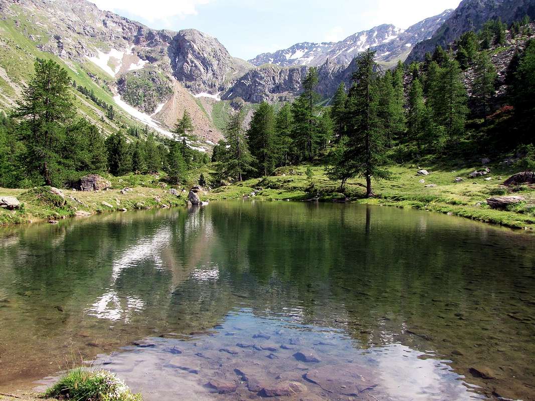
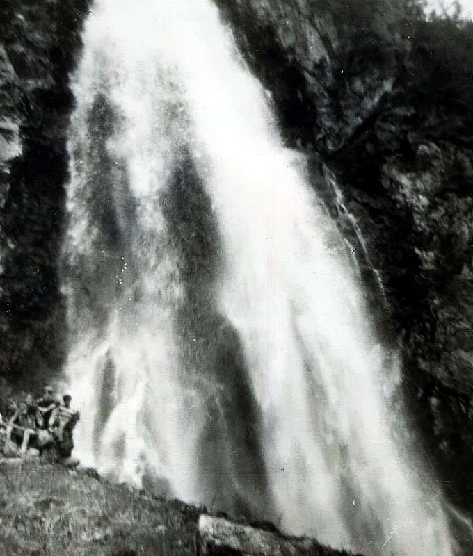
(1697 m) ed alle soprastanti omonime Cascate (1899 m), proprio alla base della tremenda frana del 2000, che, staccandosi dalla base della "Becca", scese fino a qui lambendo il Torrent de Comboé. Nota: a Ponteilles arriva anche il sentiero n° 13D/14A che, partendo dalla Strada Municipale da Chenaux ((650 m; Comune di Pollein) nei pressi di La Barma (1255 m), ivi giunge attraversando il Torrent de Comboé appena sotto l'Alpe.
Dalla medesima una serie di ripidi ma comodi tornanti con il sentiero 
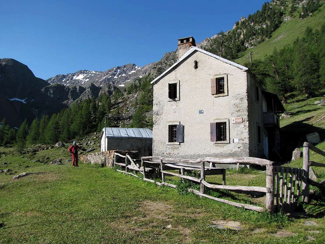
n° 14 conduce all'ingresso del Comboé vero e proprio presso il Comboé Dessous (2041 m); seguendo il torrente ed attraverso magnificici prati in breve tempo si raggiunge il Dessus (2114 m; E; 1h'1571h'30 da Les Gorres). Questo itinerario é adatto anche ai bambini e risulta inoltre molto istruttivo, poiché permette di osservare la vita negli alpeggi, la costruzione di un vecchio canale di irrigazione ("Ru"), il famoso "Muro del Diavolo" (piramidi di erosione alte da 30 a 40 metri e lunghe 150 metri, così conosciute, come riporta l'Abbé Henry, dalla fine dell'800) e da ultimo l'osservazione dell'enorme frana del 2000.


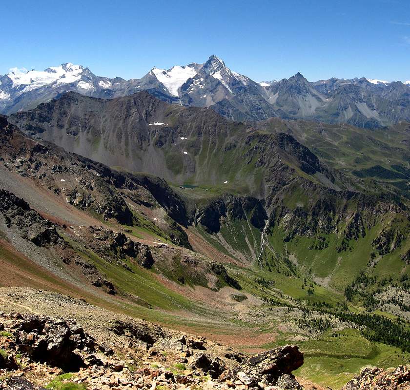
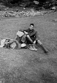
"By Comboé Ponteilles Waterfalls towards Dard Gorge-Vallon ...", by Gianni Junod

Ancient Roads falls into the Oblivion

HULK S CRY
Kids & Teens ... Dirt Road above Alto & Pian Felina 1985
Five Southern ... Towards Dard Vallon-Gorge 1985
Kids & Teens/1 Going to Reverier du Tzat Alp 1985
The impetuous brook and the flower of the Youth


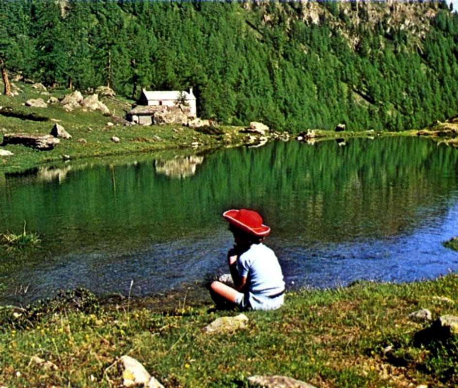
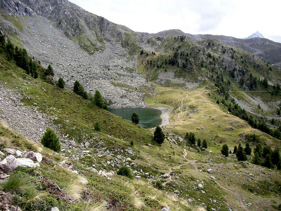
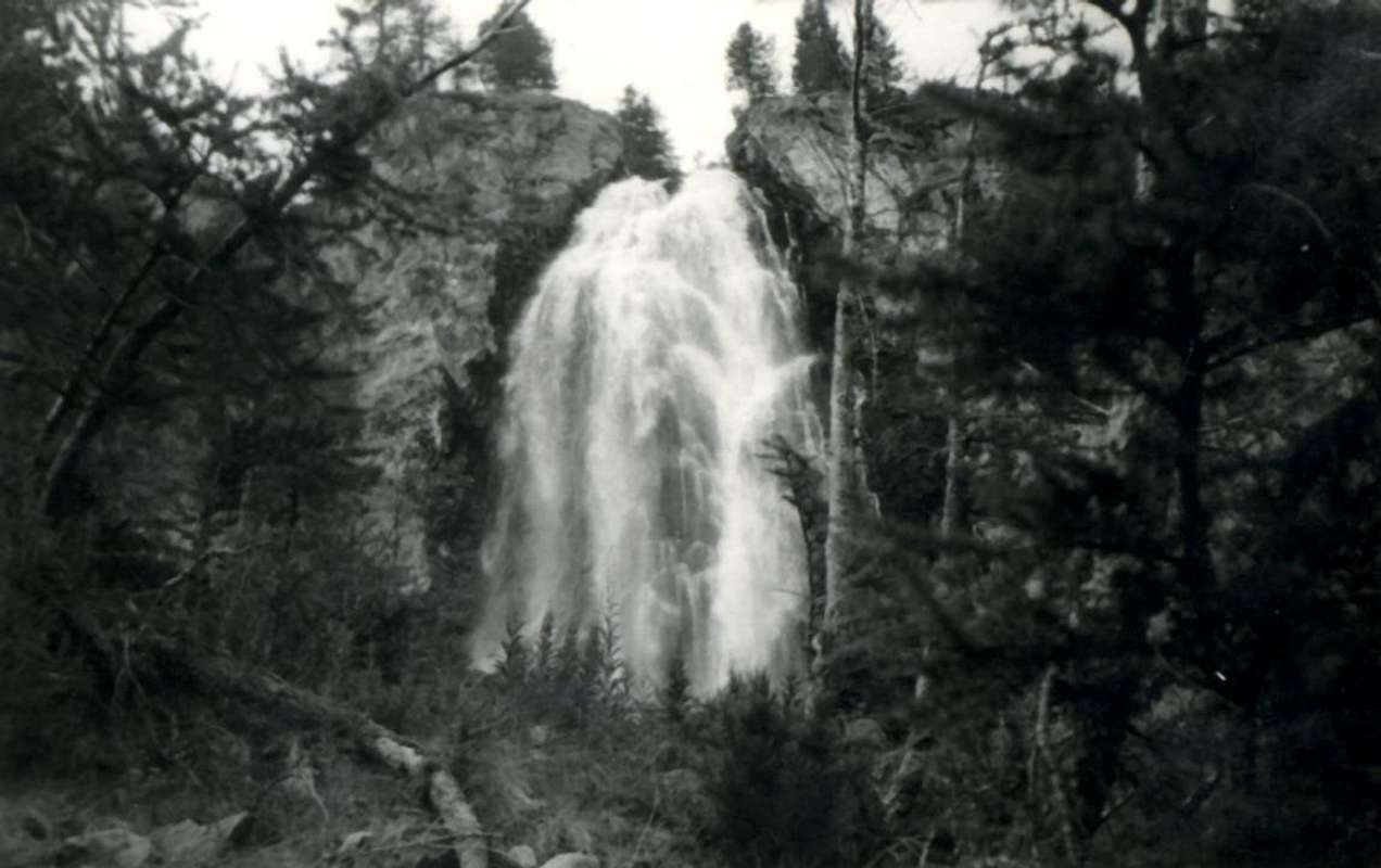
"From Chanaux Waterfalls towards Reverier du Tzat, Dessous, Marendet & Dessus into the Ponteilles/Dard Gorge...", by Osw


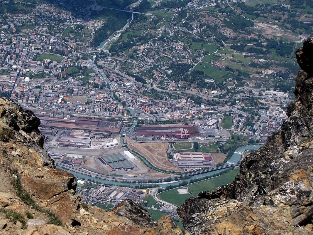
But once, in a time not too far away, it was not so. People walked more, crossed the Alps on foot and carried the Sacred Processions. Almost always starting from the valley floor to reach, through ancient paths tested by the Time, Sanctuaries, Hermitages or maybe only votive Chapels. It was the Top of the Sunday, after a hard week of work. Often in the fields. Then the trails have turned into lanes, these ruts in the roads and finally paved roads, which all have deleted doing progressively lose touch with the low hills and the highlands. But the trails were there, perhaps hidden by vegetation, to bear witness to a more ancient with which the Man is connected with the Mountain. Departed from each village or hamlet of Commons of Charvensod Pollein and gradually going up to feed the herd; of alp alp in the snow as they retreated, giving space to the grass. Until they reached, here, and then the Ponteilles and beyond Combuì, over the same Pollein via La Barma or Les Barmes crossing under the rocky 
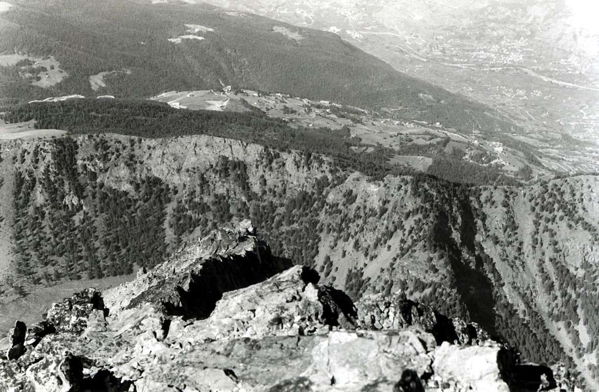
Promontory of Morion at the base of "Becca" with a path diagonally very exposed above the Gorge du Dard, nowadays in many places collapsed and therefore dangerous, first reaching the Torrent de Comboé and then Ponteilles. Is still trail by shepherds of Charvensod, the brothers Munier, but requires a good knowledge of the area and is therefore impractical and totally inadvisable. On the other side, directly above Pollein, climbed to Tchino or Chenoz, Terreblanche, Martsaouchy then, from Plan Croix, directed to the Pastures of Arpisson the entrance of the wild walloon of the same name, under the springs of Emilius with its large Northern Wall. A whole series of trails connecting united the two walloons and the same still, even at high altitude, to the East towards Les Laures and those in the Valley of Saint Marcel, while the opposite reached the Conca-Basin Pila. From Combuì then went higher and, from Grand Plan nearby Pasture, it reached the two lakes Arbole or Arbolle the beginning of the Southern Walloon of Mount Emilius. But up here rise only steers and foals as evidenced by the pitiful remains of two ancient shelters also called "des Poulains and des Modzonds", just below the Col or Bassa (Low) of Garin, as it was called the pass that leads to Cogne Valley. Even the lower-middle hill was completely crossed by paths, climbing, were always linked together; urbanization of the valley floor and the construction of the first roads in asphalt and then the farms private dirt roads have semi or completely deleted the same now choked with uncultivated vegetation. Even the ancient "Road of the Dead", which saw carry on their shoulders the deads from the bottom up to the Graveyard of Charvensod, has been covered by a farm dirt road that cuts from East to West above the forest. Civilization does not spare anyone. Likewise has disappeared near the path from Creton, cutting the same, led directly to the nearby Pointier, from which then went on to the various Pastures of Reverier reaching Ponteilles with its beautiful waterfalls. Are the paths of our Youth. A World almost disappeared during the period of half a century, ie since postwar period. Nevertheless other paths have managed to survive. Just try to know them, because they still exist and
are always a great and splendid Discovery, featuring marvellous and unexpected Surprises.


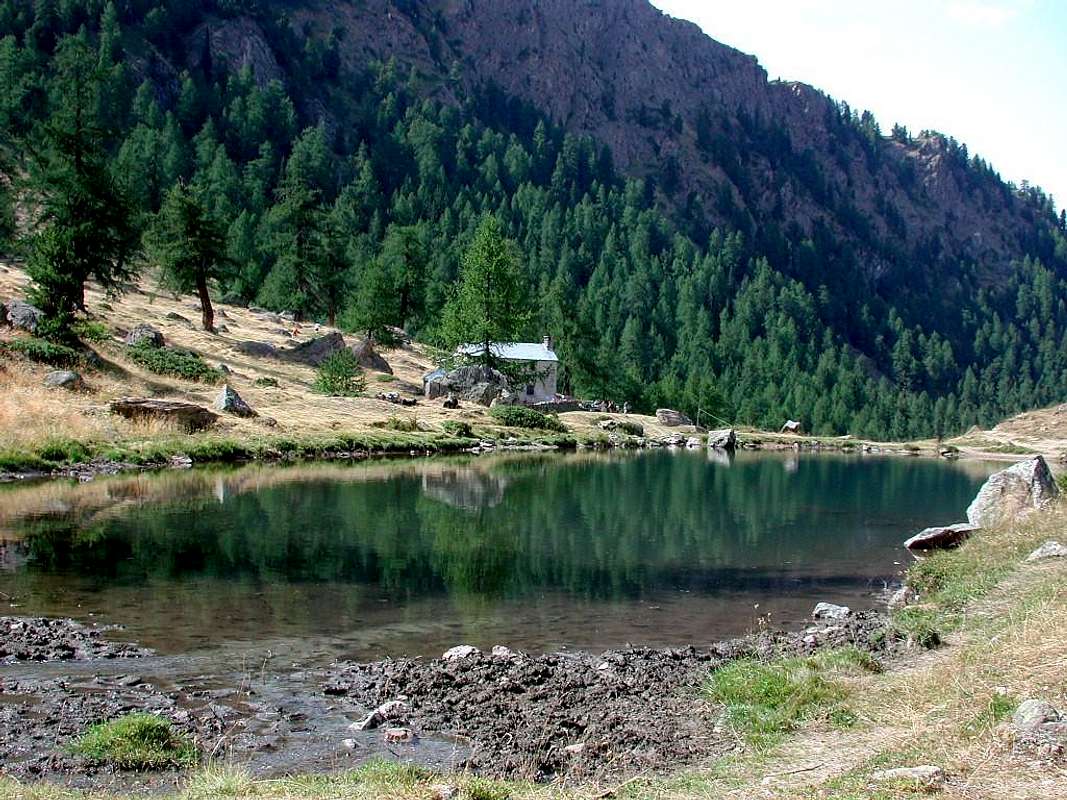
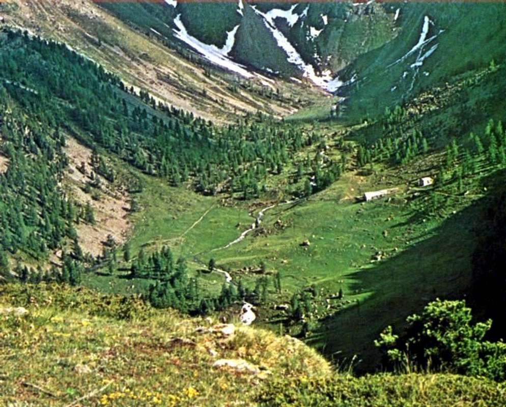
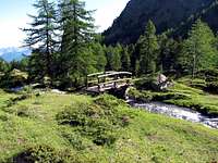
"... Towards Combuì through Reverier Dessous ...", by Osw


Ma una volta, in un tempo neppur troppo lontano, non era così. La Gente camminava di più, attraversava l'Alpi a piedi ed effettuava le Sacre Processioni. Quasi sempre partendo da fondovalle per raggiungere, tramite antichi sentieri collaudati dal Tempo, Santuari, Eremitaggi o magari soltanto Cappelle votive. Era il Top della Domenica, dopo dura settimana di lavoro. Spesso nei campi. Poi i sentieri si son tramutati in viottoli, questi in strade carraie ed infine in strade asfaltate, che tutto han cancellato facendo progressivamente perdere il contatto con la bassa collina e la media montagna. Ma i sentieri sono rimasti lì, magari nascosti dalla vegetazione, per testimoniare di un modo più antico col quale l'Uomo si rapportava con la Montagna. Partivano da ogni villaggio o frazione dei Comuni di Pollein e Charvensod progressivamente salendo per alimentare la mandria; di alpe in alpe man mano che le nevi si ritiravano dando spazio all'erba. Fino a che raggiungevano, di qua, Ponteilles e poi il Combuì e di là, sopra Pollein lo stesso passando per La Barma o Les Barmes attraversando sotto il roccioso Promontorio del Morion alla base della "Becca"con un sentiero in diagonale molto esposto sopra la Gorge du Dard, oggigiorno in molti punti franato e per ciò pericoloso, raggiungendo dapprima il Torrent de Comboé e quindi Ponteilles. Viene ancora percorso dai Pastori di Charvensod, i fratelli Munier, ma richiede un'ottima conoscenza del territorio e quindi risulta poco praticabile e del tutto sconsigliabile. Dall'altra parte, direttamente sopra Pollein, salivano a Tchino o Chénoz, Terreblanche, Martsaouchy per poi, passando dal Plan Croix, indirizzarsi agli Alpeggi dello Arpisson allo ingresso dello omonimo selvaggio vallone, sotto le sorgenti dello Emilius con la sua grande Parete Nord. Tutta una serie di sentieri di collegamento univa i due valloni e la stessa continuava, anche a grande altitudine, ad Est verso Les Laures e da queste nel Vallone di Saint Marcel, mentre all'opposto raggiungevano il Bacino-Conca di Pila. Dal Combuì poi si proseguiva più in alto e, passando dall'Alpe di Grand Plan, si raggiungevano i due Laghi di Arbole od Arbolle allo inizio del Vallone Meridionale dello Emilius. Ma quassù salivano soltanto i manzi ed i puledri come testimoniano i miseri resti di due antichi ricoveri ovverso "des Poulains e des Modzonds", appena sotto il Col o Bassa di Garin, com'era chiamato il valico che conduce a Cogne. Anche la medio-bassa collina era completamente percorsa da sentieri che, salendo, erano sempre collegati tra di loro; l'urbanizzazione del fondovalle e la costruzione prima delle strade in asfalto e poi delle poderali hanno semi o del tutto cancellato i medesimi ormai soffocati da incolta vegetazione. Anche l'antica "Strada dei Morti", che vedeva portare gli stessi "a spalla" dal fondovalle fino al Cimitero di Charvensod, é stata ricoperta da una strada poderale che taglia da Est verso Ovest il soprastante bosco. La Civiltà non risparmia nessuno. Parimenti é scomparso il vicino sentiero che dal Creton appena sopra al Pian di Felina, tagliando la stessa, conduceva direttamente verso il vicino Pointier a picco sulla Gorgia del Dard, dal quale poi si proseguiva pei vari Reverier onde raggiungere Ponteilles e cascata. Sono i sentieri della nostra Gioventù. Mondo quasi del tutto scomparso nel periodo di mezzo Secolo, cioé dal dopoguerra ad oggi. Ciononostante altri sentieri son riusciti a sopravvivere. Basta saperli cercare, perché esiston ancora e
son sempre grande Scoperta, ricca di magnifiche Sorprese.

 Comboè lake  <i>(2100m)</i>
Testa Blantsette or Becca des Boucs
At the head of Comboè valley: in the background Testa Nera  <i>(2819m)</i>
Returning from the Becca: Comboé footbridge 2006
Along the pathway to Becca di Nona <i>3142m</i>


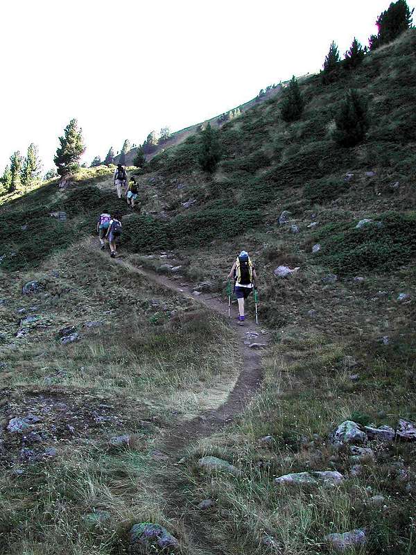
"An Old Track towards the Highlands", by emilius, livioz & Antonio


Comments

No comments posted yet.