
|
|
Mountain/Rock |
|---|---|
|
|
46.99067°N / 10.37190°E |
|
|
Hiking, Scrambling, Skiing |
|
|
Spring, Summer, Fall, Winter |
|
|
9006 ft / 2745 m |
|
|
Overview
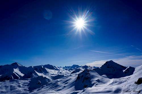
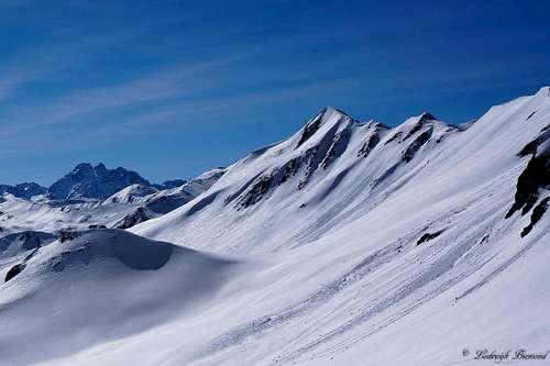 Fluchthorn (3398m) and Visnitskopf (NE-Face, 2745m) | 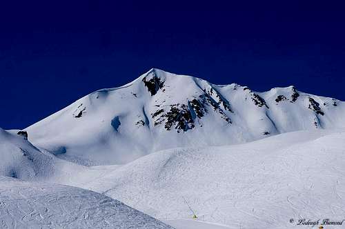 Visnitzkopf East Face |
The Visnitzkopf is a mountain located on the border between Austria and Switzerland in the southern part of the Samnaun Group mountains. Visnitzkopf is a popular objective for ski mountaineering in the winter season. From the summit it is possible to ski down towards the north into and through the Visnitz valley: A rugged, lonely valley very different compared to the southern slopes of Visnitzkopf, which are filled with ski facilities belonging to the Ischgl-Samnaun ski resort. The ski-tour of Visnitzkopf ends at the Visnitzalpe, which is situated almost at the end of the Visnitz valley. Further down, the valley connects with the main Paznauner valley directly south of Kappl.
Visnitzkopf offers great views in all directions. Towards the west Burkelkopf (3034m) and Vesulspitze (3089m) are dominating the view. Towards the north you can look down the whole Visnitz valley with Hoher Riffler (3168m) towering high above it. Towards the east the Otztal Alps with mighty peaks like Watze, Wildspitze and Weisskugel can be seen and towards the south are the ski facilities of Ischgl & Samnaun with Muttler and co. behind.
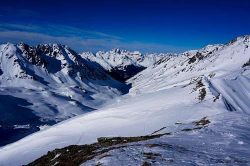 Summit view to the North: Visnitztal with Hoher Riffler (3167m) | 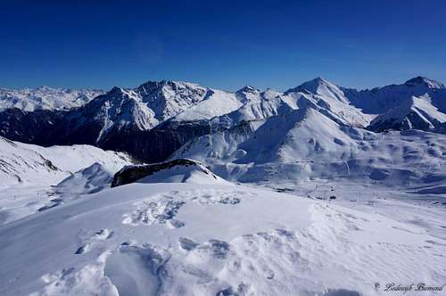 Summit view to the East: Piz Mundin, Muttler and Stammerspitz |
Visnitzkopf is located on the west-east orientated ridge exactly on the border of Switzerland (South) and Austria (North). To the west of Visnitzkopf, also on the ridge, is Burkelkopf (3034m) and to the right, once again also on the ridge, is Grubelekopf (2894m). Directly west of the summit is the Westliches Visnitzjoch, a saddlepoint directly beneath the summit, that connects the Alp Trida with the Visnitz valley.
During the summer season Visnitzkopf can be climbed from the Alp Trida (2268m). The route is graded T3+ and therefore a hikers destination. In the winter season Visnitzkopf is occasionally climbed from Alp Trida (or the ending of the ski facilities) by ski. After summiting the mountain is mostly skied down along the north flank into the Visnitz valley. But it is also an option, like I did, to climb up from Alp Trida just to enjoy the great views and ski back down towards the south to Alp Trida. In any way, Visnitzkopf is a great mountain to enjoy the views without the masses of the Ischgl-Samnaun ski area around you. But if you are the type that enjoys complete loneliness in the mountains, you shouldn’t go to the area in the first place. Towards the south of Visnitzkopf, everywhere you look you see ski facilities, not a very pretty sight I must admit.
 Summit view towards the South: Piz Rots and Fluchthorn | 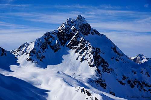 Summit view towards the West: The mighty Vesulspitze (3089m) |
Route
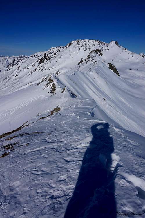 Summit view towards Grubelekopf | 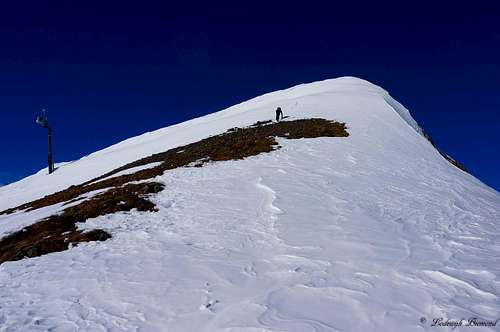 Climbing the South Flank to the summit of Visnitzkopf | 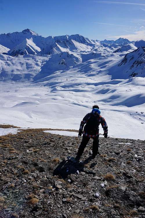 Descending Visnitzkopf |
From Alp Trida in winter
The easiest way is to take the N2 Chairlift up from the Alp Trida saddle. But if you don’t want to pay for the ski facilities, or in the case the facilities are closed, walk up in the direction of Visnitzkopf. You can more or less follow the line of the N2-lift up the South Flank of the mountain. Route finding should not be a problem. During the winter season you can follow the ski run of the N2 lift up as well. The part to the top station of the N2 lift will take up to an hour / an hour and a half. From the top station continue your way up in a straight line to the summit. In the winter season there are often tracks visible in the snow. The path is getting steeper at this point. Keep heading up the south flank of Visnitzkopf over increasingly steeper terrain until you reach the summit in about 30 minutes. The steepest point is more or less 35 degrees. From the summit there are two options. Ski or walk down back to the N2 summit station and ski further down to the Alp Trida to go back to either Samnaun or Ischgl. Another option is to ski down towards the north into the rugged and lonely Visnitz valley. This option is a popular ski-touring objective in the winter season. You can ski down the whole Visnitz valley back to the Visnitzalm and below it the village of Kappl in the main Paznauner valley. It is possible to rent a guide for this trip in Ischgl. Before heading out, be sure to inform yourself about the current avalanche danger.
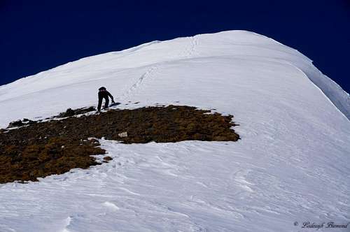 Climbing up the South Flank of Visnitzkopf | 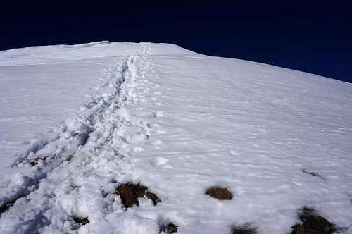 En route along the South Face |
In the summer season
Take the Silvrettabahn cableway up to the Idalp at 2300 meters. From here multiple hiking trails start. Follow route 715 towards the east. You need to go to the Flimjoch. Keep following the signs that say ‘’Flimjoch’’ . Eventually you will reach the Flimjoch at 2757m. At this point it is also possible to climb the Flimspitze (2929m) to the south of Flimjoch. From the Flimjoch leave the saddle towards the east. You are now entering the Alp Trida region. A marked trail (T3) keeps heading towards the east and eventually joins with the 712- hiking Trail. Visnitzkopf is visible to the North-NE of you at any point. The 712-trail crosses underneath the Visnitzkopf and continues towards the east. You need to leave the trail for Visnitzkopf. Leave the trail when Visnitzkopf is still to the NE of you and head up the SE-flank of the mountain.
Another option is to use the lift facilities from either Samnaun or Ischgl up to the Alp Trida at 2263 meters. From here take the marked trail towards the west. After 15 minutes this trail crosses the 712 hiking Trail. Follow the 712 towards the north. At this point continue towards the north and like the previous section, leave the 712 to hike up the SW-flank towards the Visnitzkopf. You will reach the summit in about 30 minutes over pathless, for hikers moderately difficult terrain (T3+).

Visnitzkopf Route Map
How to get there
The Starting point for climbing Visnitzkopf is either Ischgl or Samnaun. You can use the ski lift facilities in summer and in winter to reach the base of this mountain.
There are 3 ways to get to Ischgl from Germany:
-First of all take the A7 in Germany or the A95 heading south. Then on the Fernpassbundesstraße (B179) via Imst and Landeck, on the A12 motorway and continue on the S16 (Arlberg clearway) to the Pians exit. From here it is 20 kilometers on the main Silvretta road (B 188) to Ischgl.
-First of all take the A 93 in Germany heading for Innsbruck. Then take the Inntal motorway in Austria (A 12) via Kufstein, Innsbruck and Landeck on the S 16 (Arlberg clearway) to the Pians exit. From here it is 20 kilometres on the main Silvretta road (B 188) to Ischgl.
-First of all take the A96 heading for Lindau in Austria on the A 14. Then continue via Bregenz, Feldkirch and through the Arlberg tunnel on the S16 to the Pians exit.= From here it is 20 kilometres on the main Silvretta road (B 188) to Ischgl. In summer you can also exit the motorway in Bludenz and get to Ischgl via the Silvretta high Alpine road.
Getting to Ischgl from Switzerland:
-First of all take the A 3 to Feldkirch or the A 1 to Lustenau and Dornbirn. Then in Austria take the A 14 toward Innsbruck and continue through the Arlberg tunnel on the S 16 to the Pians exit. From here it is 20 kilometres on the main Silvretta road (B 188) to Ischgl. In summer you can also exit the motorway in Bludenz and get to Ischgl via the Silvretta high Alpine road.
How to get there MAP: Samnaun | How to get there MAP: Ischgl |
Maps
Title: Swisstopo Map Ischgl
ISBN-13: 978-3302011592
Scale: 1:25.000
Title: Kompass 42 Samnaungruppe
ISBN-13: 978-3854910480
Scale: 1:50.000
| |
Weather
Labelled Panorama from South-East (over South) to West
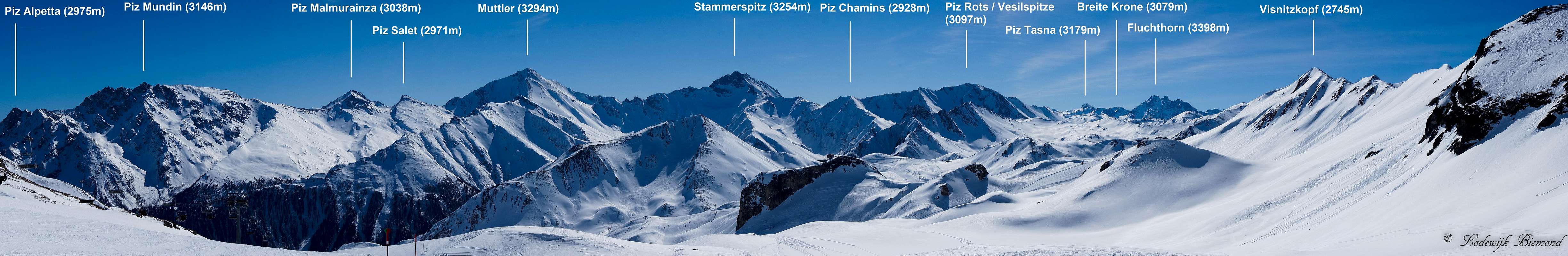  Visnitzkopf Labelled Panorama from SE to W |
Labelled Summit Panorama from West (over North) to East
 Labelled Summit Panorama from W to E |
Cableways
The Ischgl cableway prices and operating hours in WINTER: Click here
The Ischgl cableway prices and operating hours in SUMMER: Click here
The Samnaun cableway prices and operating hours: Click Here
Webcam
There is a webcam pointed at the Visnitzkopf in the winter season. In summer it is directed towards Muttler. The camera is located at the Alp Trida Saddle: Click for the Webcam
Accomodation
Accomodation in Ischgl: Click Here
Accomodation in Samnaun: Click Here
Camping Sport Samnaun: Click Here
SzaniUherkovich - Apr 29, 2015 2:17 pm - Voted 10/10
Vesulspitze, the highest mountain of the world!...Vesulspitze (39089m)...
Lodewijk - Apr 29, 2015 2:22 pm - Hasn't voted
Re: Vesulspitze, the highest mountain of the world!It sure would make this mountain more famous ;-) Very sharp; I changed the elevation. Cheers!
SzaniUherkovich - Apr 29, 2015 2:37 pm - Voted 10/10
Re: Vesulspitze, the highest mountain of the world!:-)