La montagna chiama i suoi figli, ed essi rispondono fedelmente al suo appello…
Osvaldo Cardellina, Diario alpinistico, 1964-65
Page texts: @ OsvaldoCardellina"Osva", passed away on May 2, 2022. Page owners: Christian Cardellina e Osvaldo Cardellina. Any updates from September 12, 2022: Antonio Giani, page administrator, friend and climbing companion.
Testi della pagina: @ OsvaldoCardellina "Osva", scomparso il 2 maggio 2022. Proprietari pagina:Christian Cardellina e Osvaldo Cardellina. Eventuali aggiornamenti dal 12 settembre 2022: Antonio Giani, amministratore della pagina, amico e compagno di salite.
Overview
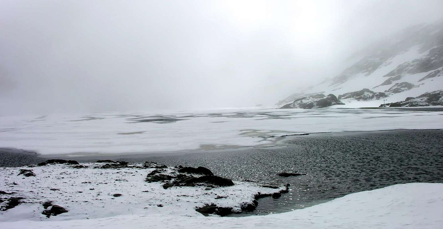
The Valley of Gran San Bernardo is a small basin in the size of the entire alpine arch, but has a large and particularly important in the whole History of the Alps. Already the season of skiing is time at the end, but you can continue with the Ski-Mountaineering (see the famous "Ottorino Mezzalama Trophy" going on these days on the glaciers of the Monte Rosa Lyskamms and Breithorns) or with Snowshoeing. For the first of these two disciplines is not an issue, given the enormous variety of routes available with only the embarrassment of choice, while for the second the same begin to deteriorate considerably. As a matter of fact this tool somewhat restricts the choice, not being possible via the same reach too high altitudes which often present considerable contraindications or, more simply, they require an effort anti ergonomic. Deleted from the heat, the wind and spring rains the streets of "Low Altitude" and not being able to perform for these reasons those "High", you must know rummage through what is available, which it is not little but not even much. The important thing is to know the local area and, with a bit of experiance, to adapt to the same. With wise choices. Among these we can point to the two most important ones, as well known, since ancient times, crossing the Aosta Valley: the Piccolo (Little) and Gran San Bernardo, or the "Alpis Graia et Poenina" by the Romans with their"Mons Jupiter aut Jovis", confirming and replacing the even older "Pen of the Salassians People". Two hills where the snow remains until almost the beginning of summer and therefore suitable to significantly prolong the season Snowshoeing, departing from Pont Serrand little Hamlet in the Valley of La Thuile and from Saint Rhémy en Bosses Municipality regarding the upper sector of Valley Gran San Bernardo, to which this specification is addressed the Route in question.
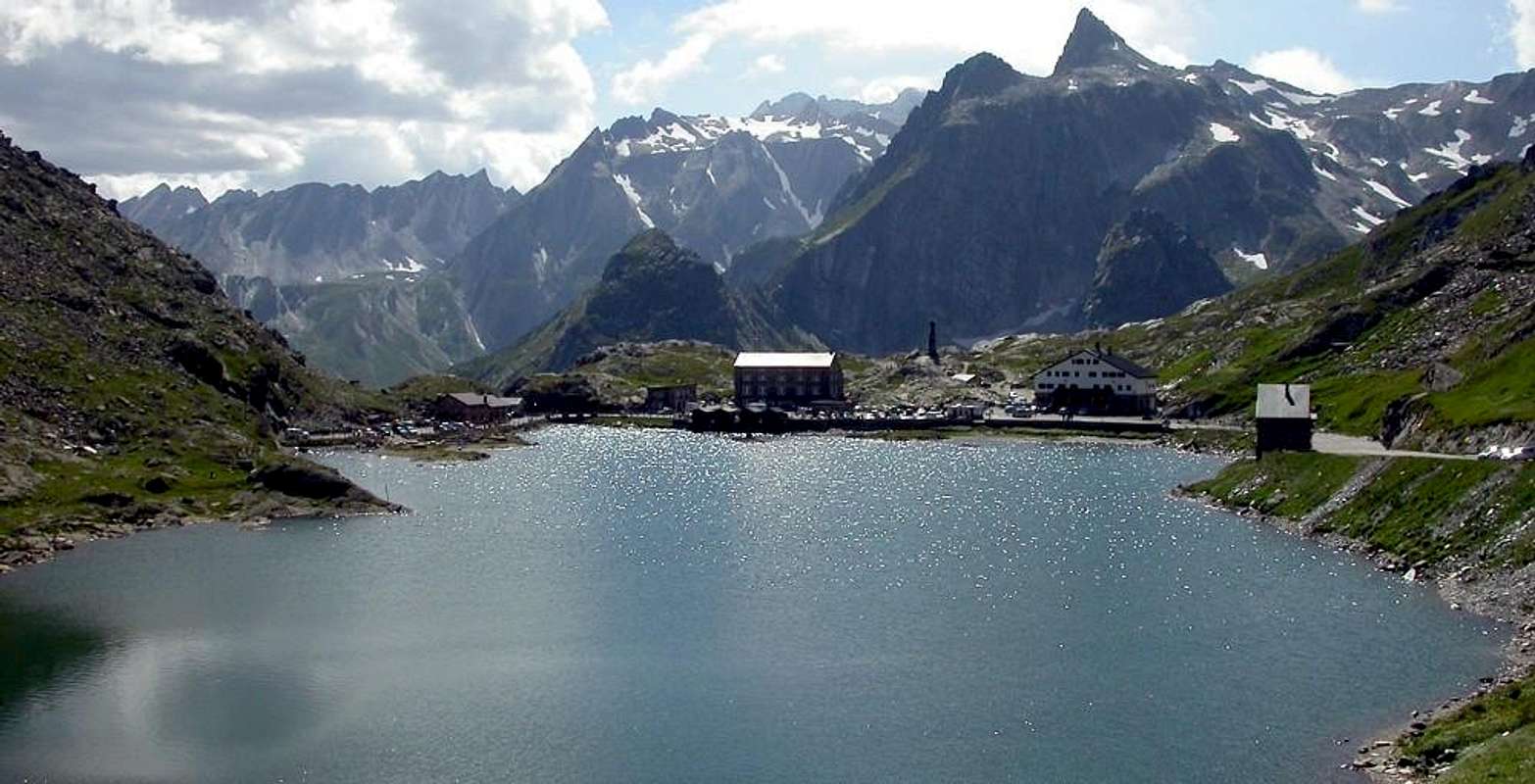
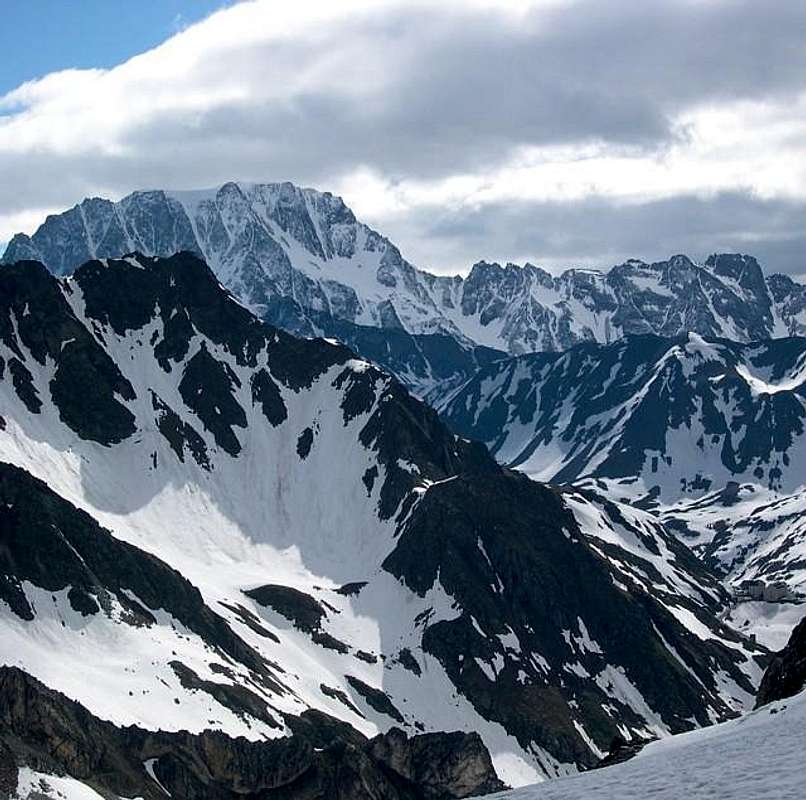
Great St. Bernard Hill & Mont Velan (3734m), by andreaperino La Valle del Gran San Bernardo é una piccola vallata nella grandezza dell'intero arco alpino, ma possiede una particolare importanza nell'intera Storia delle Alpi.
Già la stagione dello Sci è volta al termine, ma si può continuare con lo Sci-Alpinimo (vedi il famoso "Trofeo Ottorino Mezzalama" in corso in questi giorni sui ghiacciai dei Breithorns, Lyskamms e del Monte Rosa) oppure con le Racchette da neve, in volgo cosidette ciaspole. Per la prima di queste due discipline non esistono problemi, vista l'enorme varietà di percorsi disponibili con solo l'imbarazzo della scelta, mentre per la seconda i medesimi incominciano a ridursi notevolmente. Infatti questo attrezzo limita alquanto la scelta, non essendo possibile tramite il medesimo raggiungere quote troppo elevate che spesso presentano notevoli controindicazioni oppure, più semplicemente, richiedono uno sforzo antiergonomico. Cancellate dal caldo, dal vento e dalle pioggie primaverili le vie di "Bassa Quota" e non potendo effettuare per i motivi suddetti quelle di "Alta", bisogna saper rovistare tra ciò che rimane a disposizione, che non è poco ma neppur molto. La cosa importante risulta conoscere il territorio e, con un pò d'esperienza, sapersi adattere al medesimo. Con scelte oculate. Tra queste possiamo indicare quelle ai due più importanti, nonché conosciuti, sin dall'antichità, valichi della Valle di Aosta: il Piccolo ed il Gran San Bernardo, ovvero l'"Alpis Graia et Poenina" dei Romani con i loro "Mons Jupiter aut Jovis", a conferma ed in sostituzione dell'ancor più antico "Pen dei Salassi". Due colli dove la neve persiste fino a quasi all'inizio dell'estate e quindi idonei a prolungare notevolmente la stagione delle Racchette da neve, con partenze dal Villaggetto di Pont Serrand nelle Valle di La Thuile e da Saint Rhémy en Bosses per quanto concerne la parte superiore della Valle del Gran San Bernardo, alla quale questa specifica Route è rivolta.
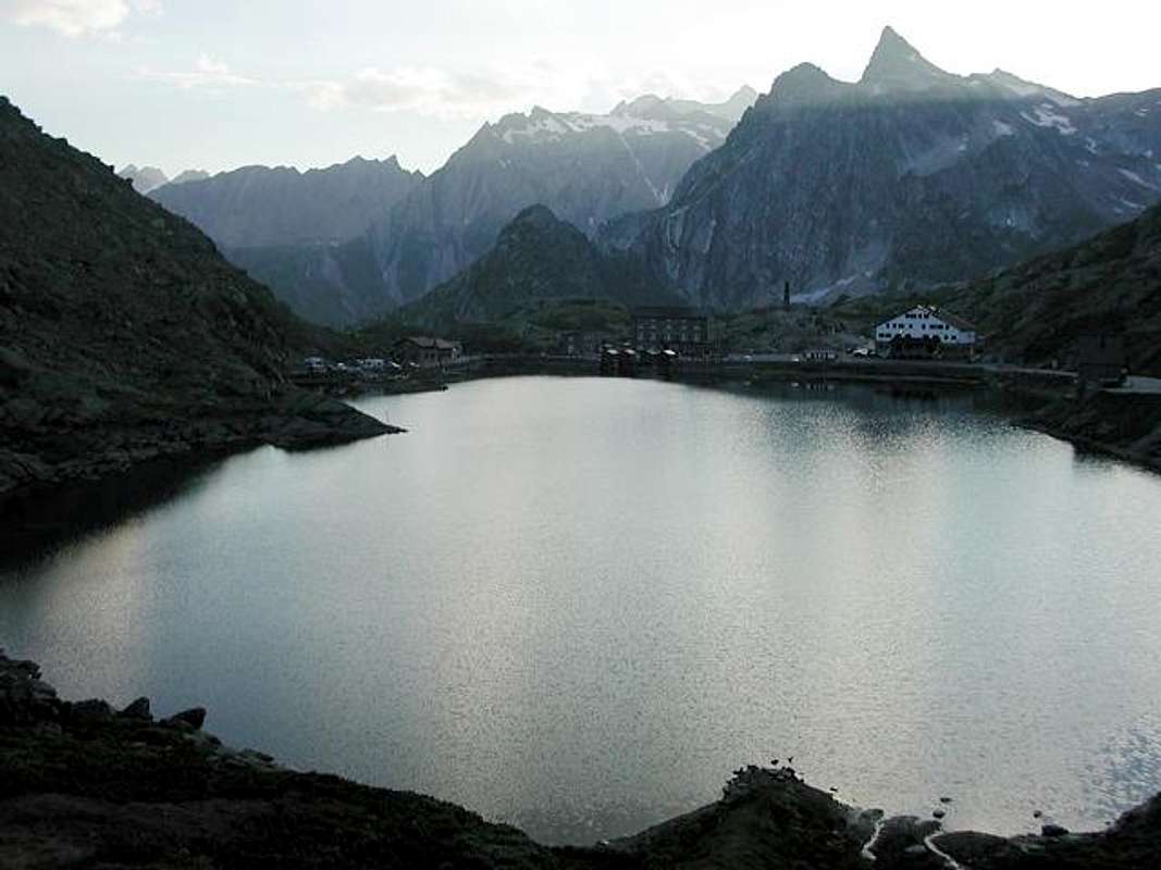
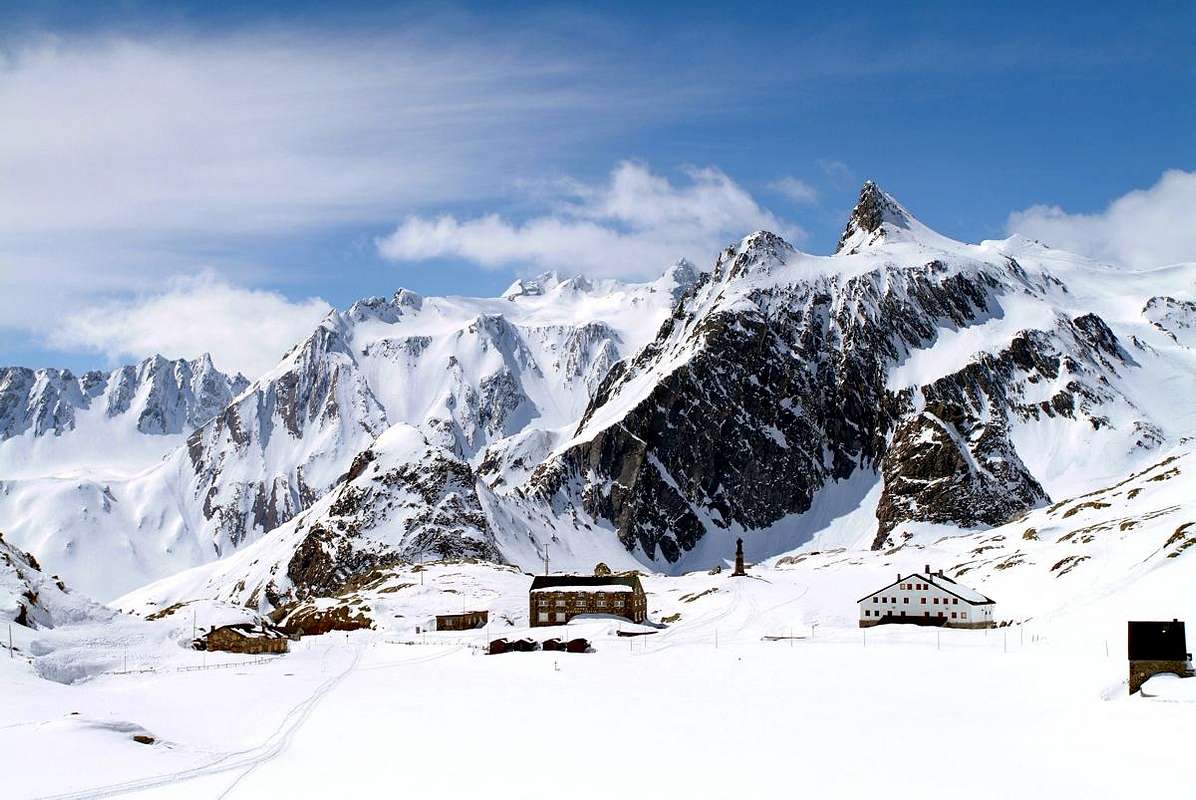
"Great St. Bernard Hill & Hospice (2.469m)", by Emilio Bertona
Getting There
BY CAR:
From TORINO, MILANO, etc: Motorway A5. Exit at IVREA or Quincinetto (PIEDMONT).
From IVREA Town: before in West to Aosta, after in Northwest to Gignod, Etroubles, Saint-Oyen, Saint Rhémy en Bosses Municipalities. From Courmayeur Resort: before in East to Aosta, after in Northwest to Gignod, Etroubles, Saint-Oyen, Saint Rhémy en Bosses Municipalities.
Specific Road From Aosta Town towards the subsequent Variney Fraction (785m) immediately before the Gignod Common(988m) with Great Saint Bernard SS.27; leaving right (North) the alternative towards Allain Commune(1.251m); from this reach before Etroubles Commune(1.280m) and just after Saint-Oyen Commune(1.377m). Continue West up to the entrance of Great St. Bernard Tunnel; abandoning left the same go up in North reaching Saint Rhémy en Bosses Municipality (1.632m) now into the upper part of Grand Saint Bernard Valley and, always through the State Road, up to the Grand Saint Bernard Hill (2.469m) with the Hospice.
From FRANCE: through the Mont Blanc Tunnel to Entrèves-crossroads to Vény/Ferret Valleys - Mountain Guides of Courmayeur - La Saxe Rock Gym - Courmayeur. By Little Saint Bernard Pass, closed since November until half May to La Thuile Valley - Pré Saint Didier - Courmayeur. It is not necessary to take Motorway A5: you can drive on SS.26, in the direction of AOSTA - IVREA - TURIN.
BY PLANE:
Aeroporto "Corrado Gex" Saint Christophe (Aosta).
Route Description
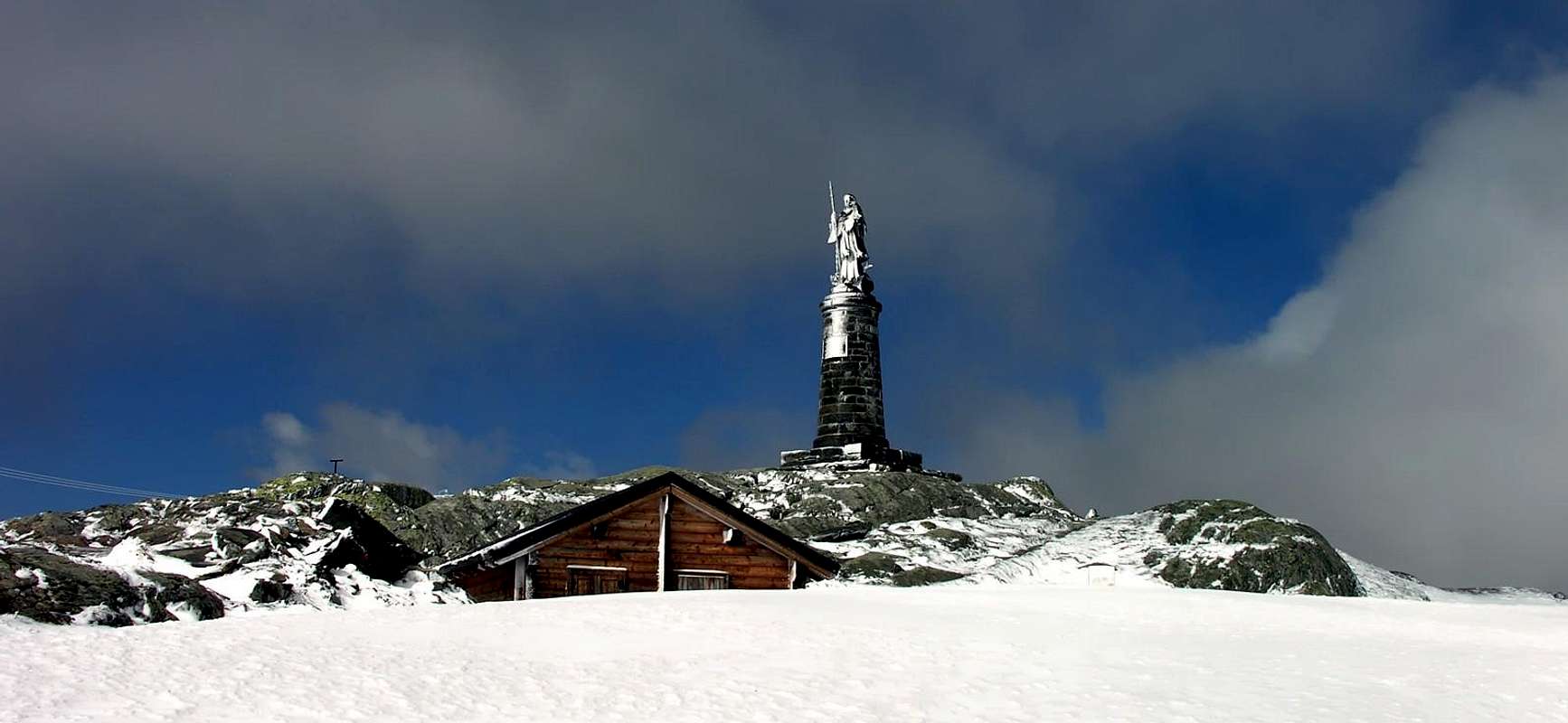
"... Saint Bernard Statue of 1905...", by Antonio
From parking just after Saint-Rhémy Center (Church) towards the upper part of the Great Saint Bernard Valley, along the Eastern shore of torrent in the first part and crossing under Saint Bernard Tunnel Road in altitude 1.860 meters around, nearby the forks towards and between Praz Dzentor/Plan d'Arc (1.876m), Praz d'Arc (1.992m), Fonteinte Pastures (+; 2.203m near "La Cantine d'Aoste"). Continue with State Road to Montagna Baou (2.365m), below the overhanging Tour des Fous (2.579m), and after a short tunnel in a terminal diagonal to Great Saint Bernard Lake and, just after having crossed the Customs, in East towards the Hill and Hospice Great Sainct Bernard. Properties by Benedictine Monks, Rule of St. Augustine built "ab immemorabilis" above a statue dedicated to Jupiter, while the actual statue of San Bernardo was inaugurated in 1905; in the Church are the relics of St. Faustina taken from the Roman catacombs and donated in 1828 by Pope Leo XII° to the Hospice. A "latere or fringes" of an ancient tombstone II°/III° Century that reads "Faustina dulcis anima or Faustina sweet soul". Moreover immediately behind is the ancient "Morgue", where the dead were withheld until the spring waiting for proper burial; many deaths occurred because of avalanches in an attempt to force a passage in the middle of winter. That occurred often in the "Vallon des Morts" and who registered even recently, is also in 2015 against three Ski-Mountaineers, while in the past mainly affecting Cigarette Smugglers and Pilgrims.
"Gr. St. Bernard, Velan & Hospice", by emilius"
Remarks technical logistics: exercise caution to avoid the opposite side, where passes the "Napoleonic Via", very exposed to avalanches from overlying Western slopes of Mont Mort. Also keep in mind that in the conclusive part between Praz d'Arc and Fonteinte you have to cross the rather steep slopes (from 20°/25° up to 30/33°) that require a good technique, as well as the overcoming of some stone walls of the road with compulsory of a clear choice:
1) - or remove the tool and then fit it again;
2) - or come up with the same not always easy climbing, and even
3) - lengthen the course with workarounds usually right (East), but on steeper slopes because of the great accumulation of snow. So the whole final climb, through Southern steep Slopes under the Comba (2.561m) at the end of Southeast Crest Pain de Sucre, reaching the wide Pass (2.469m; "Roman Mansio, Jupiter Statue, Hotel Italia, Restaurant of Lake, Saint Bernard Monks Hospice, Bazars, Exposition Saint Bernard Dogs, Morgue". M-; 3h'30/3h'45). By the pass possibility of descent to Entremont Valley in Switzerland with Swiss State Road and towards the Combes des Morts near Le Tronchet; also continue the descent towards Hospitalet (2.116m), Bourg Saint Bernard (1.918m) nearby the Mauvoisin enough long Dam and, after reaching Bourg Saint Pierre (1.632m), to Orsières Commune (879m).
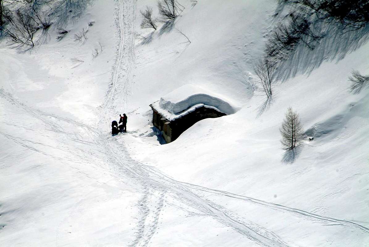
"... First stop in a third of the route ...", by emilius
Dal parcheggio immediatamente appresso al Centro del Paese di Saint-Rhémy sulla Strada Statale per la parte superiore della Valle del Gran San Bernardo, si prosegue nel primo terzo del percorso sino ad attraversare al di sotto della strada per il Tunnel in altitude 1.860 metri circa, presso i bivi verso e tra le Alpi di Praz Dzentor/Plan d'Arc (1.876m), Praz d'Arc (1.992m) e Fonteinte (+; 2.203 m nelle vicinanze della "La Cantine d'Aoste"). Si continua tramite la Strada Statale n°27 in direzione della soprastante Montagna Baou (2.365 m), sotto la caratteristica Tour des Fous (2.579 m), pendente sulla strada. Non molto dopo un diagonale porta al breve tunnel che, per mezzo d'un ulteriore nonché finale diagonale, conduce con un'ultima curva al Lago del Gran San Bernardo e subito dopo, oltrepassata la Dogana, verso Nordest al Colle ed all'Ospizio.Costruito proprio al valico é di proprietà dei Monaci Benedettini, Regola di Sant'Agostino; eretto "ab immemorabilis" sopra d'un simulacro dedicato a Giove, mentre la statua attuale di San Bernardo é stata inaugurata nel 1905. Nella Chiesa vengono conservate le reliquie di Santa Faustina prelevate dalle catacombe romane e donate nel 1828 da Papa Leone XII° all'Ospizio. A "latere" un'antica lapide del II°/III° Secolo che recita "Faustina dulcis anima". Subito dietro trovasi l'antica "Morgue", ove venivano trattenuti i morti insino a primavera in attesa d'adeguata sepoltura. Molti decessi avvenivano a causa delle valanghe nel tentativo di forzarne il passaggio in pieno inverno, evento verificatosi anche recentemente (2015) nell'adiacente "Vallon des Morts" nei confronti di tre Sci-Alpinisti, mentre nel passato colpiva soprattutto Contrabbandieri e Pellegrini.
"At the beginning of the descent", by emilius
Note tecnico-logistiche: non utilizzare l'opposto versante, ove scorre la "Via Napoleonica", alquanto esposta a valanghe dai soprastanti pendii Occidentali del Mont Mort. Inoltre da tenere presente che nella parte conclusiva tra Praz d'Arc e Fonteinte si devon attraversare dei pendii piuttosto ripidi (da 20°/25° anche fino a 30/33°) richiedenti una buona tecnica, nonchè il superamento di alcuni muri in pietra della strada che obbligano ad una scelta precisa:
1) - o togliere l'attrezzo per poi calzarlo nuovamente;
2) - salire i medesimi con non sempre facile arrampicata, ed ancora
3) - allungare il percorso con aggiramenti in genere a destra (Est), ma su pendii più ripidi causa l'accumulo delle nevi. Quindi tutta la parte terminale della salita avviene attraversando i ripidi pendii Meridionali, mentre al colle si trovano molte peculiarietà interessanti (2.469 m; "Roman Mansio", Statua di Jupiter (Giove), Hotel Italia, Ristorante del Lago, Hospice des Moines du Saint Bernard, Bazars, Esposizione dei famosi Cani San Bernardo, "Ancient Morgue". M-; 3h'30/3h'45)). Dal colle inoltre esiste, volendo prolungare la gita medesima, la possibilità d'effettuare la discesa nella Valle di Entremont in Svizzera tramite la locale Strada Statale svizzera nonché, sempre volendo, in direzione della tristemente famosa Combes des Morts; oppure continuare la discesa dalla piazzola di Le Tronchet verso Hospitalet 2.116 m), Bourg Saint Bernard (1.918 m), nelle vicinanze della abbastanza lunga Diga di Mauvoisin, per infine raggiungere da Bourg Saint Pierre (1.632m) il Comune di Orsières (879 m).
... Now is the hour of descent ...", by emilius
Difficulty & Equipment
This route can be considered E or EE (Experts Hikers) in winter.
L'itinerario è classificato E oppure EE in inverno.
Hiking gear with snowshoes in winter.
Da Escursionismo od in inverno con racchette da neve.
Mountain Conditions
You can get meteo information at the official site of the Regione Valle d'Aosta:
Children refers to the set of objects that logically fall under a given object. For example, the
Aconcagua mountain page is a child of the 'Aconcagua Group' and the 'Seven Summits.' The
Aconcagua mountain itself has many routes, photos, and trip reports as children.


 3019 Hits
 79.04% Score
 10 Votes

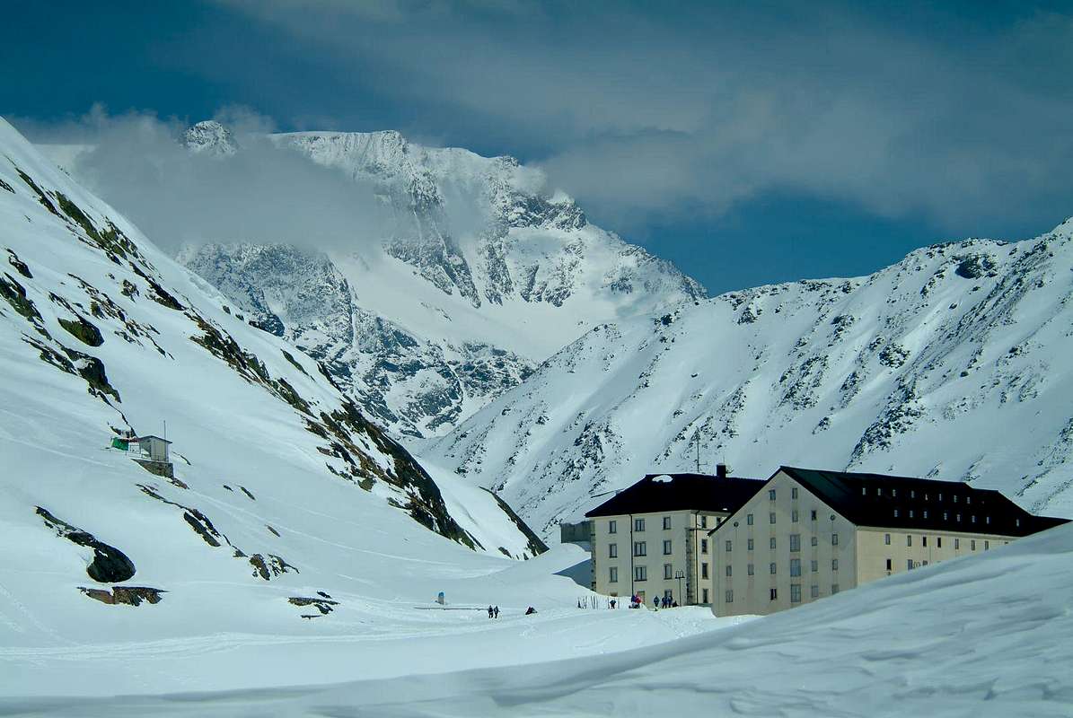 "Gr. St. Bernard, Velan & Hospice", by emilius"
 "At the beginning of the descent", by emilius
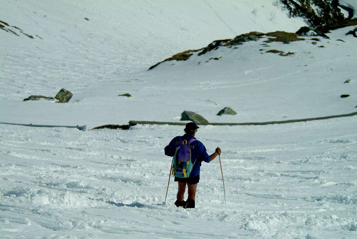 ... Now is the hour of descent ...", by emilius