

-
 4317 Hits
-
 75.79% Score
-
 6 Votes
|
|
Route |
|---|---|
|
|
47.90328°N / 121.6114°W |
|
|
Mountaineering |
|
|
Spring, Winter |
|
|
Most of a day |
|
|
Class 3 |
|
|
55° Moderate Snowclimb |
|
|
II |
|
|
Overview
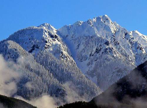 Mount Stickney. Wild Sky Rocket Couloir in center of photo | 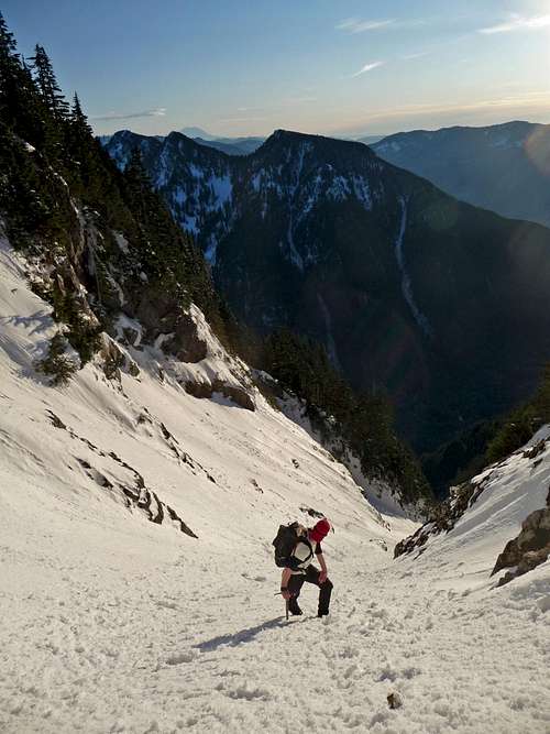 Michael looking towards Mount Zekes |
Getting There
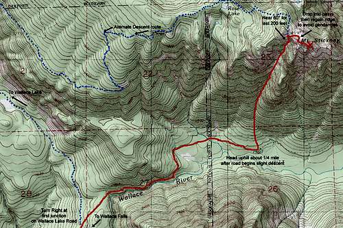
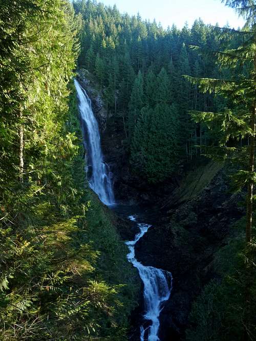
From the Seattle area, head East on US highway 2 to the town of Goldbar and look for signs indicating Wallace Falls State Park which will require a left turn onto 1st Street and right onto May Creek Road which changes names to Ley Road where May junctions off to the right. Continue on Ley until Wallace Falls Road which will be on the left and lead to the parking area.Google Maps Directions
Route Description
| |||
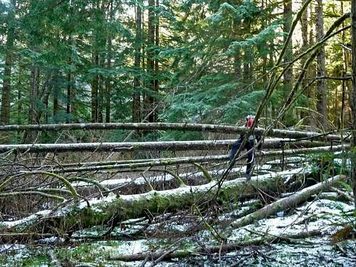
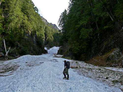
| From the Wallace Falls Trail Head follow the trail 2.7 miles to the Upper Falls. A trail now heads up hill to the left connecting with the Wallace Lake Road in 1/4 mile. Take a left on the road and follow it towards Wallace Lake keeping an eye out on the right for a spur road that should appear after about 1/2 mile. There are two entrances to the road so if you miss the first you might get the second a couple hundred feet later. The road starts out mellow and slowly gains ground. Some blow down may prove an obstacle as I doubt it's cleared often. You may encounter cougar tracks here and will get unique glimpses of Zeke's Peak and Nina point. On the last mile the road turns sharp left then right, crosses a creek and begins a slight descent downhill. A 1/4 mile after the road begins to descend, head up hill into the forest. This is about the 1961' benchmark. If you get to another creek you've gone too far. A large opening in the woods and avalanche debris coming from a gash in the mountain are a good indication you've found the route | |||
| |||
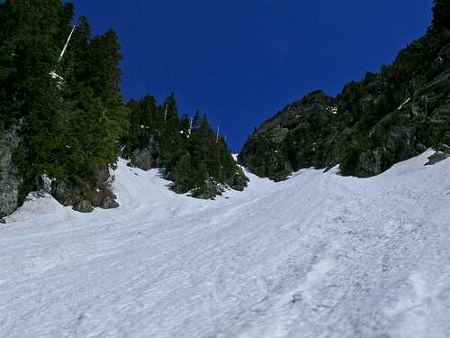
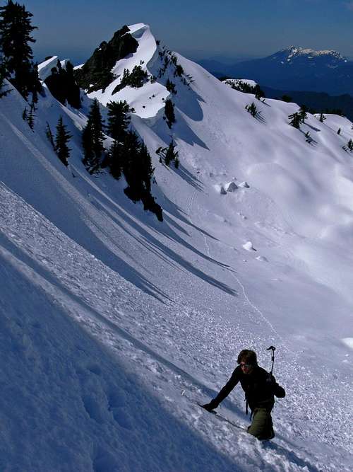
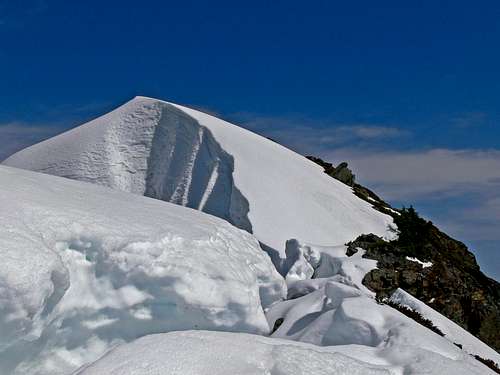
| This is the beginning of the fun part of the climb which gains 3,000' in only 0.9 miles. If it's a good snow year you will start on snow. If not, there will be boulders and class 2/3 scrambling to get to it. This will be like a highway to the 4,992' col where you drop to the North side of Stickney to join the standard route from Olney Creek at the summit scramble. The last 600' steepen up when you arrive at a convergence of many avalanche gulleys. Avoid the tendency to go left, a mistake I made the first time. Follow the thickest snow finger up a 55° ramp to the col. Be wary of possible cornices and drop into the basin on Stickney's North side to avoid class 4/5 gendarmes. Regain the ridge by heading up an easy gulley a few hundred feet to the East that takes you back up the ridge and to the summit. Watch for cornices on the summit ridge which can be nasty in winter or early season. The final scramble is simple class 2 but with exposure. Some parties bring a small rope for a hand-line. | |||
| |||
| If the snow is soft on your return you'll be in for a 3,000' glissade. If you climbed the route and it seemed too icy for a safe descent, you could alternatively bear West towards Rose Lake and continue on following old logging roads that lead back to the Wallace Lake Road. This route checks out but is much longer making a less risky bail-out or a possible alternative way to reach Stickney if access to the Olney Creek Road is closed and the couloir isn't quite consolidated. |
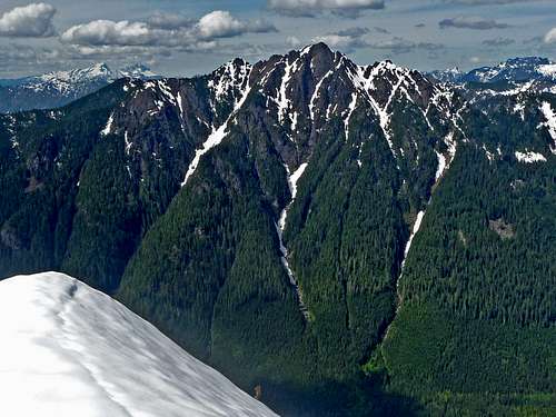
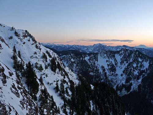 Evening to the South |  Looking Down the Couloir at Zeke's |
Red Tape
You will need an annual Discover Pass ($30) or daily pass ($10) to park at the Wallace Falls State Park Trail Head. There are exceptions and exemptions for this listed on the Discover Pass main page (mostly involving sno-park passes for snow-related recreation during winter season or disabled/veterans registered with state parks). The park has limited hours of operation from 8:00am to dusk. In winter you may need to park outside of the State park to allow time to make the trip (and avoid the fee/pass altogether).
Essential Gear
Helmet, Ice-ax, Crampons. Some parties bring a hand-line for the summit exposure. The snow must be deep and solid for this route to "go" all the way otherwise you face mixed conditions. This will not work as a snow-climb on a dry year and will be down right dangerous in high avalanche conditions/ deep powder. Consolidation is key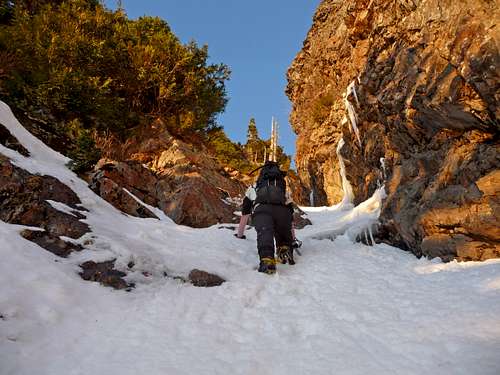 Climbing on the Upper Section of the Gully | 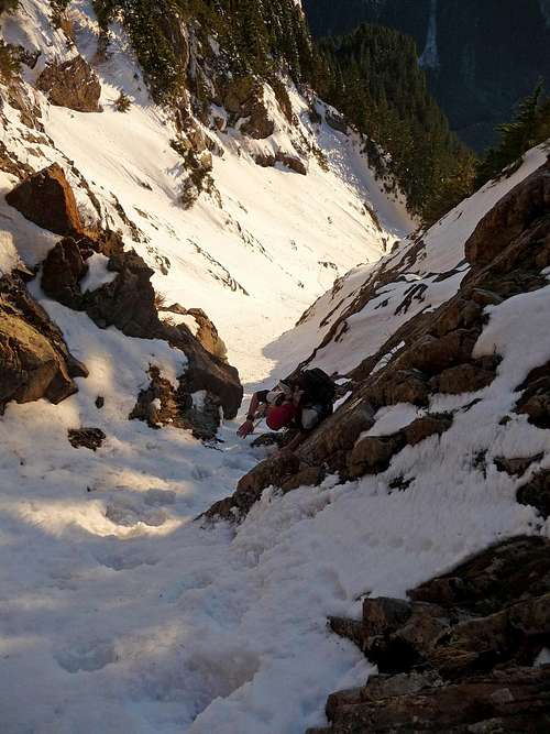 Climbing up the Hour Glass |
External Links
Contact information:14503 Wallace Falls Road
Gold Bar, WA 98251
Phone: 360-793-0420
Wallace Falls State Park site
Discover Pass information
NOAA point forecast
Northwest Avalanche Center