La montagna chiama i suoi figli, ed essi rispondono fedelmente al suo appello…
Osvaldo Cardellina, Diario alpinistico, 1964-65
Page texts: @ OsvaldoCardellina"Osva", passed away on May 2, 2022. Page owners: Christian Cardellina e Osvaldo Cardellina. Any updates from September 12, 2022: Antonio Giani, page administrator, friend and climbing companion.
Testi della pagina: @ OsvaldoCardellina "Osva", scomparso il 2 maggio 2022. Proprietari pagina:Christian Cardellina e Osvaldo Cardellina. Eventuali aggiornamenti dal 12 settembre 2022: Antonio Giani, amministratore della pagina, amico e compagno di salite.
Overview
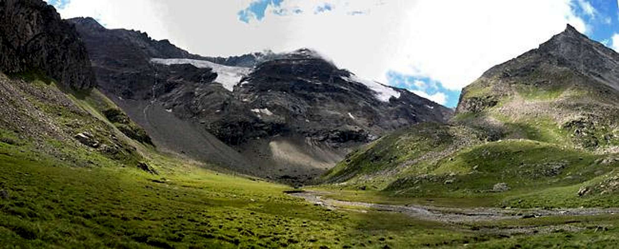
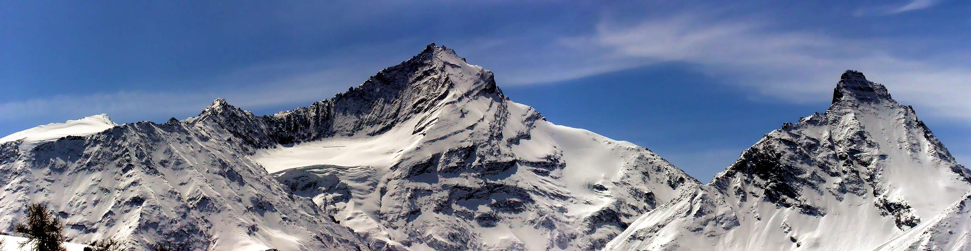
Among those Cogne perhaps the most isolated wild Vallon. Actually it does not belong to this municipality, but to the underlying Aymavilles immediately at the entrance of this obliquely than cross the valley in the course of Dora Baltea, reaching through the Torrent Grand'Eyvia about its middle and not far from the City Aosta. At the same time it represents the last spurs that starting from Gran Paradiso (4.061m) is adapted to separate this valley from the adjacent Valsavarenche, immediately to the West of the watershed with Grivola-Grand Nomenon. A truly wild partition and with the ghostly shapes reaching up to Aymavilles Villeneuve Municipalities to the East and by that of Introd, already at the interior of the second. From the fascinating pyramid Grivola (3.969m) in fact the same, flexing slightly to Northwest and crossing the Col de Belleface (3.095m), reaches the Grand Nomenon (3.488m); from this pyramid from the forms of Gothic Cathedral realigns the ridge toward the North and, after the next Col de Charbonnière (2.916m), reaches Mont Favret (3.171m). From this declines gradually towards the Pointe Valletta, Becca Plana and Mont-de-Poignon above the small Village of Pont d'Ael or Pondel with its Roman Aqueduct of the Third Century BC. On the opposite side another watershed, descending from the Grivola with "Arête des Clochettes" and above the round glacial basin Traio, after having climbed over a little Summit that the Grivoletta and subsequent Punta Crevasse (3.302m), reaches Colle del Trajo and the homonymous Punta also called Pointe du Tradzo (2.877m, 3.127m). This buttress addressed first in the Northeast and then North, starting from this last is decidedly tilted to the East-northeast, reaching the Pointe de Lavincusse and the homonymous Cote up to Becca d'Eytava or Dentavù (2.868m, 2.613m, 2.598m), which divide between the Epinel Fraction (East) and Laval Bridge. This watershed divides the Nomenon Vallon from the most Eastern of the Trajo over which falls the truly and wild glacier with same name.
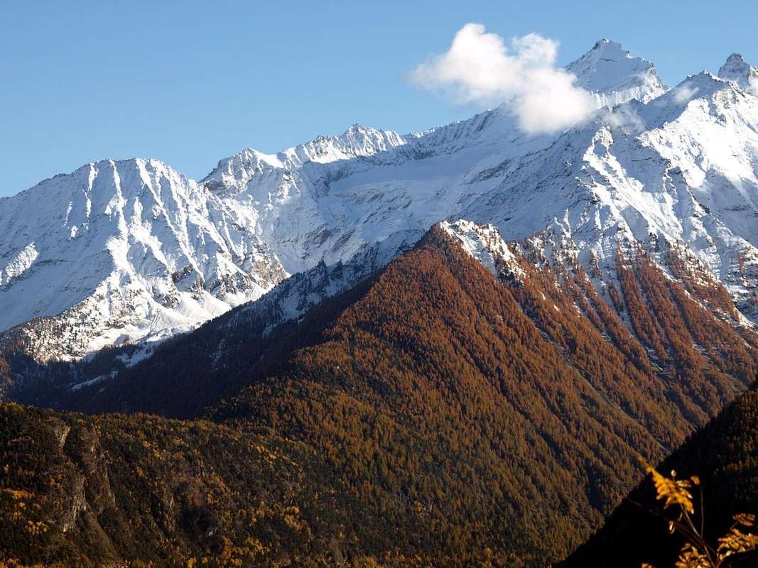
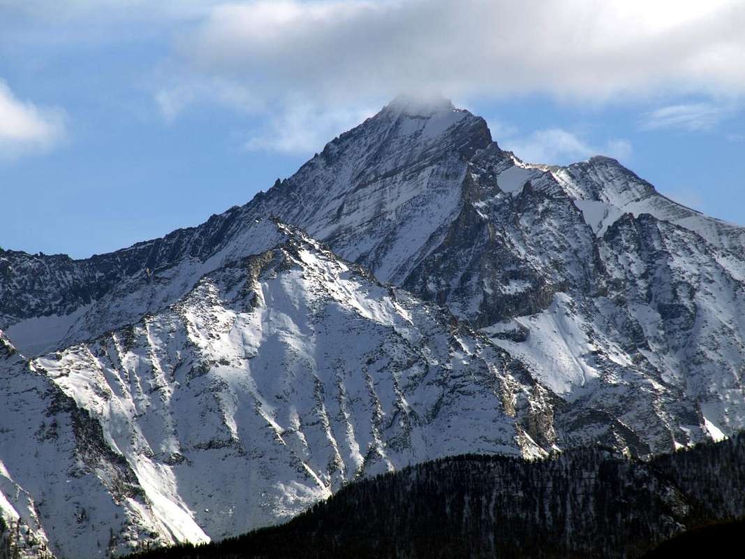
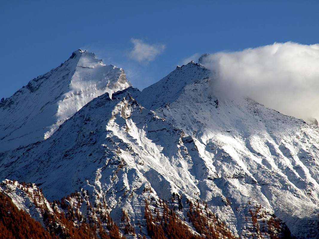
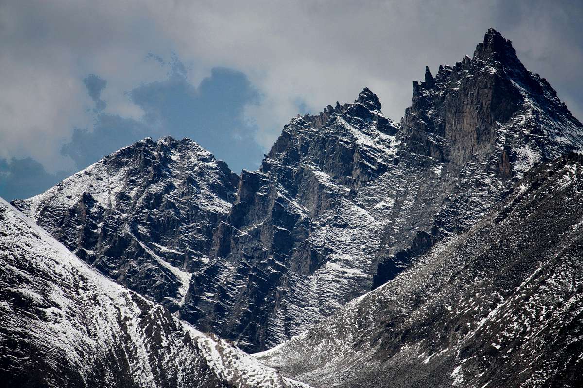
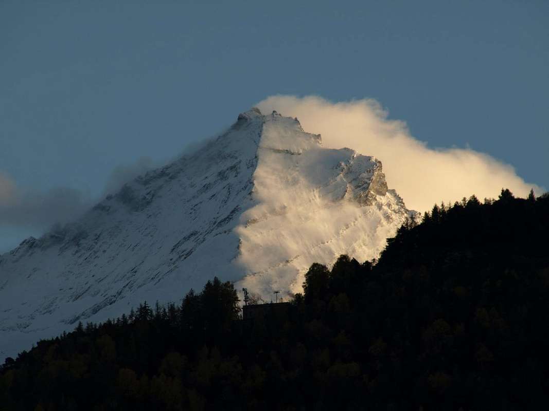
But here are the Glaciers of Grivola (East) below the steep Wall and Northeast Belleface, under the highest Northwest (respectively 600 and 1.500 meters) that dominates the scenery with the first one, falling like a frozen tear, preclude the access to its top plateau. A glacial environment, up to the Colle Trajo to the East and that of Belleface on the opposite side, gets to understand that this is an area reserved for the most talented Climbers between 1926 and 1936/7, those with a capital A, and that It marked the history of the Northern environment of this pyramid. An adventure that is prolonged with winter ascents of the same in March '59 and January of '70. Until, before the era of piolet-traction, large companies have existed on ice facing the walls with traditional methods and means; before the trivialization and the general flattening. Preceded only by the climbs classic, like the North Ridge, called the "Scimitar", which rises between the two. As they say Andreis, Chabod and Saints the itinerary "more beautiful and elegant to the summit ...". By the "usual" Britishs, ie W.M. and R Pendlebury with the "usual" Guides G. and J. Spechtenhauser. But that brings on subsequent repetitions, with some variations, even the names of Julius Kugy, Bolaffio, G. Croux, J.P. Farrar, D. and A. Maquignaz, H. Koderbacher, Emile Rey, Casimire Thérisod, G. Pession, R.L.G. Irving, G.H.L. Mallory and E.H.G. Tyndale; unfortunately also it marks the death of the two brothers, sons of "Alpini" General Segato. Until the first winter Reginato-Mohor 1942 and the solitary Gino Buscaini 1958, until the arrival of Amilcare Crétier Lino Binel in August of '26 on Northeast Wall. A past that drips with glory, while the later and exclusively rocky stretches that reach Grand Nomenon to West and Punta del Trajo to the East, while remaining purely mountaineering, are certainly less famous but almost always exclude the mass to be presented as such long routes and laborious. For both watersheds remain the Northern slopes respectively projected toward Grand'Eyvia and Baltea: the first one is aimed more at ascents by Hunters experts than to Hikers; for the second equal consideration, leaving space at the end of the easy hike to the Mont-de-Poignon from underlying Villeneuve Community. Two entirely off-limits areas towards the winter season, where the danger of snowslides and avalanches reigns totally sovereign and supreme.
Tra quelli di Cogne forse il Vallone più isolato e selvaggio.In realtà non appartiene a questo Comune, bensì al sottostante di Aymavilles proprio all'imbocco di questa valle obliquamente trasversale rispetto al corso della Dora Baltea, che raggiunge tramite il Torrent Grand'Eyvia a circa la sua metà e non molto distante dalla Città d'Aosta. Allo stesso tempo costituisce l'estrema propaggine che partendo dal Gran Paradiso (4.061 m) é atta a separare questa valle dall'adiacente Valsavarenche, subito ad Ovest dello spartiacque con la Grivola-Grand Nomenon. Un divisorio veramente selvaggio e dalle forme spettrali che raggiunge i Comuni di Aymavilles e Villeneuve ad Est da quello di Introd, ormai già all'interno della seconda. Dall'affascinante piramide della Grivola (3.969 m) infatti il medesimo, flettendo leggermente a Nordovest ed oltrepassando il Col de Belleface (3.095 m), raggiunge il Grand Nomenon (3.488 m); da questa piramide dalle forme di Cattedrale Gotica la cresta si riallinea verso Settentrione e, dopo il successivo Col de Charbonnière (2.916 m), raggiunge il Mont Favret (3.171 m). Da questo declina progressivamente verso la Pointe Valletta, Becca Plana e Mont-de-Poignon sopra il piccolo Villaggetto di Pondel o Pont d'Ael con il suo Acquedotto Romano del III° Secolo avanti Cristo. Sul lato opposto un altro spartiacque, scendendo dalla Grivola con l'"Arête des Clochettes" e sopra il rotondo bacino glaciale del Traio, dopo aver scavalcato una piccola punta detta la Grivoletta e la successiva Punta Crevasse (3.302 m), raggiunge il Colle del Trajo e l'omonima Punta detta anche Pointe du Tradzo (2.877 m, 3.127 m), Questo contrafforte rivolto dapprima a Nordest e poi a Nord, partendo da quest'ultima si inclina decisamente ad Est-nordest raggiungendo la Pointe de Lavincusse e l'omonima Cote fino alla Becca d'Eytava o Dentavù (2.868 m, 2.613 m, 2.598 m), che si sdoppiano fra la Frazione di Epinel (Est) ed il Ponte di Laval. Questo spartiacque divide il Vallone del Nomenon da quello più ad Oriente del Trajo sopra il quale scende l'omonimo e veramente selvaggio ghiacciaio.
Qui invece sono i Ghiacciai della Grivola (Est) al di sotto della ripida Parete Nordest e di Belleface, sotto la più alta Nordovest (rispettivamente di 600 e 1.500 metri) a dominare lo scenario con il primo che, cadendo come una lacrima ghiacciata, preclude l'accesso al suo plateau superiore. Un ambiente glaciale che, fino al Colle del Trajo ad Oriente ed a quello di Belleface sul lato opposto, fà comprendere che questa é una zona riservata agli Alpinisti più bravi tra il 1926 ed il 1936/7, quelli con la A maiuscola e che ha segnato la storia dell'ambiente Settentrionale di questa piramide. Un'avventura che si é prolungata con le salite invernali delle medesime nel Marzo '59 e nel Gennaio del '70. Fino a quando, prima dell'era del piolet-traction, sono esistite le grandi imprese su ghiaccio affrontando le pareti con metodi e mezzi tradizionali; prima della banalizzazione e dell'appiattimento generale. Preceduti esclusivamente dalle salite classiche, come la Cresta Nord, detta della "Scimitarra", che sale in mezzo alle due. Come dicono Andreis, Chabod e Santi l'itinerario"più bello ed elegante alla vetta ...". Ad opera dei "soliti" Inglesi, ossia W.M. e R. Pendlebury con le "solite" con Guide G. e J. Spechtenhauser. Ma che porta nelle successive ripetizioni, con qualche variante, anche i nomi di Giulio Kugy, Bolaffio, Croux, Farrar, Maquignaz, Koderbacher, Emile Rey, Thérisod, Pession, Irving, Mallory e Tyndale; purtroppo segna anche la morte dei due fratelli figli del Generale degli Alpini Segato. Sino alla prima invernale Reginato-Mohor del 1942 ed alla solitaria di Gino Buscaini del 1958, fino all'arrivo di Amilcare Crétier e Lino Binel nello Agosto del '26 sulla Nordest. Un passato che gronda di gloria, mentre i tratti successivi ed esclusivamente rocciosi che raggiungono Grand Nomenon ad Occidente e Punta del Trajo ad Est, pur rimanendo prettamente alpinistici, sono certamente meno famosi ma quasi sempre escludono la massa, poiché tali da presentare itinerari lunghi e faticosi. Per entrambi gli spartiacque rimangon le appendici Settentrionali rispettivamente proiettate verso Grand'Eyvia e Dora Baltea: pel primo trattasi d'ascensioni rivolte più a Cacciatori esperti che non ad Escursionisti; pel secondo ugual considerazione lasciando spazio nel finale alla facile salita al Mont-de-Poignon dal sottostante Comune di Villeneuve. Due aree completamente interdette nei confronti della stagione invernale, dove il pericolo di slavine e valanghe regna sovrano.
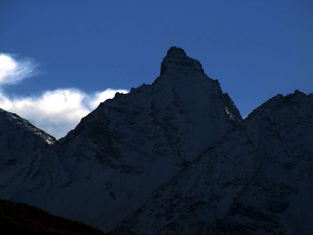
Why Nomenon? Where does this name is somewhat controversial but basically, in my opinion, also quite simple. Why else is nothing but a derivation with a play on words from the name Name and Vallon that does it mean small valley or little vallée as to indicate a less important than the main valley, or from the Cogne Valley. But at the same time a more important downstream of many other small and therefore a large valley, but still not exactly an entire valley. As the longest and most famous of Valnontey, Valeille and Bardoney. So the name of the combined Name Non that means this is a great and important vallon. Justified by the presence of two large pyramids: one on this side completely icy or the Grivola, and the other totally rock, such as the Grand Nomenon. So why not Vallon of the Grivola that, by the way, is somewhat higher and majestic and instead of Nomenon? Also in this case the answer is easy. The Grivola is a beautiful young girl from the white and candid lines as a Jungfrau that the Vallons suitors at his feet he has plenty of them (The usual gossipy see it as Grivolaye or Grivolina and even almost disparagingly The Grivolà, ie mottled by gray spots). So do not fear anyone ago, indeed attracts the eye but, being young and virgin, for all becomes unreachable. Imagine for the Shepherds poor! The rather Nomenon, dreary, horrible and terrifying with all those spiers that look like petrified waves in a stormy sea, incude fear and respect. Especially in the dark of night and under the temporal with red arrows that pierce his halberds. He is the true Lord, the Spectrum of the valley that watches from the West instilling awe fright & funk and sometimes terror. An alarm, an apprehension that almost hissing cuts through the valley forcing to shelter in safe ravines. To tell then, returning home in the valley floor, seeing the terrible warrior hamate that, holding out his swords into the sky, like a Dragon throwing large and great roars intermingled with flames. So not a protector Deyty, a benevolent Numen. That's why the old, ancient Grand Nomenon. To do before simply the Nomenon ...
Perché Nomenon? Da cosa derivi questo toponimo risulta alquanto controverso ma in fondo, a mio avviso, anche abbastanza semplice. Perché altro non é che una derivazione con un gioco di parole dai nomi Nome e Vallone che significa piccola valle o vallée tale da indicare una vallata meno importante di quella principale, ovvero dalla Val di Cogne. Però allo stesso tempo una valle più importante di tante altre piccole e quindi un grande vallone ma non ancora propriamente un'intera valle. Come quelle più lunghe e famose di Valnontey, Valeille e Bardoney. Quindi il toponimo di Nome abbinato al Non che stà ad indicare un grande ed importante vallone. Giustificato dalla presenza di due grandi piramidi: una su questo lato completamente glaciale, ovvero la Grivola, e l'altra totalmente rocciosa, come il Grand Nomenon. Ed allora perché non Vallone della Grivola che, tralaltro, é alquanto più elevata e maestosa ed invece Nomenon? Anche in questo caso la risposta risulta facile. La Grivola é una giovane e bella ragazza, dalle candide linee come una Jungfrau che di valloni pretendenti ai suoi piedi ne possiede a bizzeffe (i soliti pettegoli la vedono come Grivolaye o Grivolinaed anche Grivolà, ossia chiazzata da grige macchie). Quindi non fà paura a nessuno, anzi attrae lo sguardo ma, essendo giovane e vergine, per tutti diventa irraggiungibile. Immaginiamoci per dei poveri Pastori! Il Nomenon invece, tetro, orrido e terrificante con tutte quelle guglie che appaiono come onde pietrificate in un mare in tempesta, incude paura e rispetto. Soprattutto al buio della sera e sotto i temporali con le rosse saette che trafiggono le sue agguerrite alabarde. Lui é il vero Signore, lo Spettro della valle che vigila da Occidente incutendo timore ed a volte terrore. Un allarme, un'apprensione che quasi sibilando taglia la valle costringendo a riparsi in anfratti sicuri. Per poi raccontare, rientrando a casa nel fondovalle, d'aver visto il terribile guerriero uncinato che, protendendo l'irte spade al cielo, lanciava come Drago grandi ruggiti frammisti a violente fiammate. Ecco perché l'antico Grand Nomenon.Per far prima, il Nomenon ...
Getting There
BY CAR:
From TORINO, MILANO, etc: Motorway A5. Exit at IVREA or Quincinetto (PIEDMONT) also Pont Saint Martin, Verrès, Châtillon, AOSTA East (Nus) and West (Aymavilles) Municipalities.
From Aymavilles towards Cogne Valley From Aymavilles(646m) towards Cogne Valley with Regional Main Road: Vieyes (1.132m) Fraction; continue to Silvenoire(1.331m) Village, by small path in Nomenon Vallon up to the Mario Gontier Bivouac (2.323m) at Grand Nomenon Alp and with traces in terminal parts towards Trajo, Belleface and Charbonnière Passes. It is not necessary to take Motorway A5: you can drive on SS.26, in the direction of AOSTA - IVREA - TURIN.
Routes into ...
Nomenon Vallon
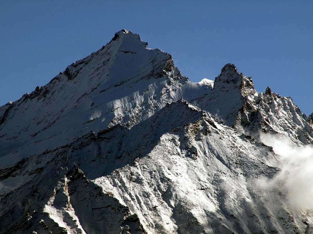
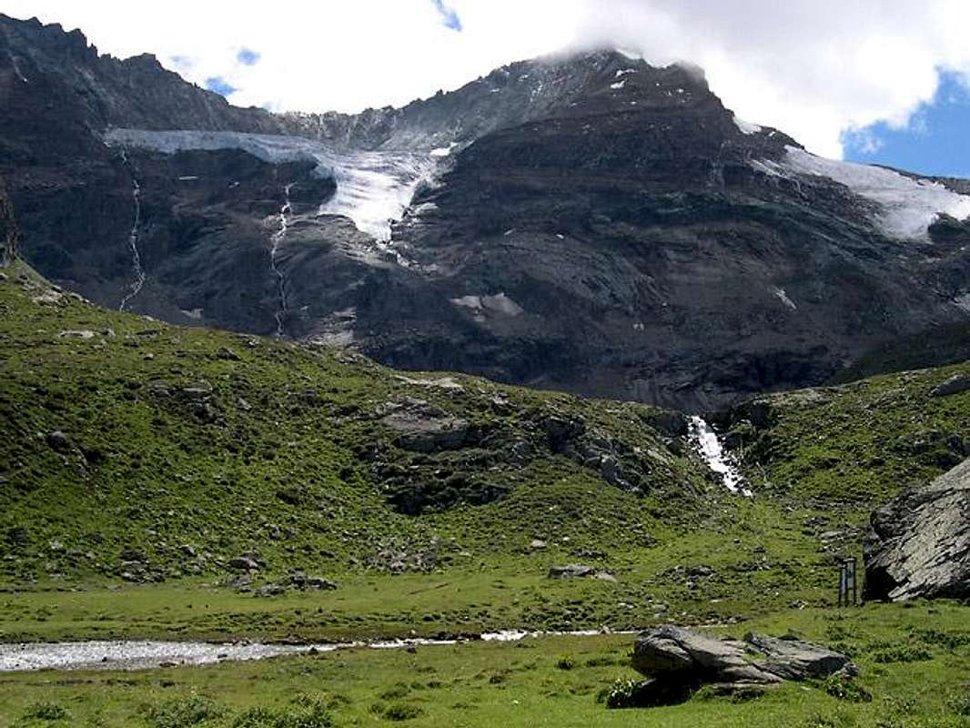
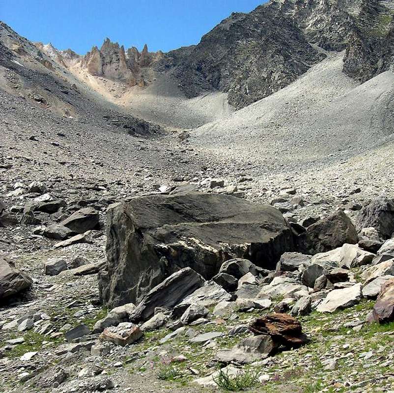
More in high, than the Camp Gontier, a harsh and desolate valley rises against the Glacier Trayo or Traso even Trajo that breaks against the Grivola (3.969m), under the "Arete des Clochettes" or Northeast, the North Ridge in the guise of "Scimitar" and beautiful Northeast Face between the two, it stops forcing him to turn to the West. The terrain becomes lunar and the terminal Trayo Pass, with its rocks and crumbling ocher, opens between the homonymous Top and Punta Crevasse with opposite the "Transylvanian" Cathedral Grand Nomenon. The environment becomes spectral and only bivouac, naively lying between green meadows, a little reassured by contrast the looming seracs of the Grivola, the jagged spiers of Nomenon certainly inhabited by Devils, and the Ocean of stones coming down from the Passes Belleface and Charbonnière. The descent down to Sylvenoire is in tune with that little path everything turns, as the spiral stairs of Notre-Dame. Imagine us the climb. Ah, let's not forget the vipers ...
1) -Vieyes (1.158m) or Sylvenoire Villages (1.331m): Excursion with trail base n° 4/5 in South towards Petit Nomenon Pasture (1.986m) and a following unnamed alpage (2.027m); fording on footbridge up Grand Nomenon Torrent (2.197m) reach Mario Gontier Bivouac (2.323m), neighbor Grand Nomenon Alp (2.323m) (E/F; 1h'30/1h'45).
2) - Gontier Camp to Trajo Pass (2.873m): Excursion with path before in South to sources of Nomenon Torrent; after East with path to the hill (EE/F+; 1h'20/1h'40).
3) - Gontier Bivouac to Belleface Pass (3.095m): Excursion with path before in South to fork 2.372 meters ; after Southwest with traces to the hill (EE/F+; 2h'15/2h'30).
4) - Grivola by Belleface Pass: reached the hill along the path n° 5C, continue Southwest with Climbing through West-northwest Ridge and, after an initial easy part on rotten, bust rocks often covered by ice, overcoming a interesting and challenging edge of about hundered metres; through the snowy ridge in terminal part (a sector suddenly not difficult but with delicate step in the presence of "verglass") reach the forked and cut Summit of La Grivola (3.969m) (A/PD/PD+/AD/AD+; 7h'15/7h'45).
5) - Gontier Bivouac (2.323m): Excursion with path in West-southwest with traces along meadows and moraines to Charbonnière Pass (2.916m) (EE/F+; 1h'45/2h'15).
6) - Grand Nomenon from Charbonnière Pass: reached pathless but traces from the camp with Climbing through the not difficult but challenging and rather long Northern Crest, with workarounds to the East in the initial part and Southwest in final, to Grand Nomenon (3.488m) (A/PD/PD+; 2h'00/2h'30). As well, by the enough difficult and challenging North-northeast "Crestone", starting through a little traces in altitude 2.596 meters to the base in altitude around 2.750 meters (A/PD-/PD; 3h'00/3h'15).
7) - Traverse towards Mont Favret Monte Ruje starting by Charbonnière Pass: Climbing by the quite long and enough challenging South-southeast Crest, with various workarounds to the West on West-southwest Slope, to Mont Favret (3.159m) and traverse on watershed to the Top also called Monte Ruje (3.171m) (A/PD-; 2h'00/2h'15).
8) - Becca Piana by Vieyes or Sylvenoire: Excursion with path in South towards Plan Pessey (1.373m, 1.382m) Pastures; from fork, just after, in West to Casotto P.N.G.P., near Arpissonet also called Chantel Alp (+; 1.999m) and Piana or Plana Hill (2.256m). From this briefly to Becca (2.296m) through short South Crest (E/F; 3h'45/4h'15).
Vallone del Nomenon
In alto, oltre il Bivacco Gontier, un aspro e desolato vallone sale contro il Ghiacciaio del Trayo o Traso oppure Trajo che si infrange contro la Grivola (3.969 m), sotto l'Arete des Clochettes" o Nordest, la Cresta Nord a guisa di "Scimitarra" e la bella Parete Nordest compresa tra le due, che lo arresta obbligandolo a girar ad Ovest. Il terreno diventa lunare ed il terminale Colle del Trayo, con le sue rocce sgretolate e color ocra, s'apre tra l'omonima sommità e la Punta Crevasse con di fronte la Cattedrale "Transilvanica" Gran Nomenon. L'ambiente diventa spettrale e soltanto il bivacco, ingenuamente sdraiato tra pascoli verdeggianti, rassicura un poco facendo da contrasto all'incombenti seraccate della Grivola, alle frastagliate guglie del Nomenon, sicuramente abitate dai Diavoli, e l'Oceano di pietrame giù dai Colli Belleface e Charbonnière. La calata giù a Sylvenoire é in sintonia con quel sentierucolo tutto giravolte, come le scale a chiocciola di Notre-Dame. Immaginiamoci in salita. Ah, non dimentichiamoci delle vipere ...
Mountain Condition
You can get meteo information at the official site of the Regione Valle d'Aosta:
"Guida dei Monti d'Italia-Gran Paradiso Parco Nazionale" E. Andreis, R. Chabod, M. C. Santis, Club Alpino Italiano/Touring Club Italiano, prima Ed. 1939; seconda Ed. 1963; terza Ed. 1980.
"I Rifugi della Valle d'Aosta" di Stefano Ardito, Ed. Guide iter, Febbraio 2003.
"Parco Nazionale del Gran Paradiso" di Stefano Ardito, Ed. Guide iter, Novembre 2001.
"Guida delle Alpi Occidentali", di Giovanni Bobba e Luigi Vaccarone C.A.I. Sezione di Torino Volume II (parte II), 25 Maggio 1896.
"Rifugi e bivacchi in Valle d'Aosta", di Cosimo Zappelli aggiornata da Pietro Giglio, Musumeci Editore, Luglio 2002.
"Guida della Regione Autonoma Valle d'Aosta" di Mario Aldrovandi,Ed. S.P.E. di Carlo Fanton, Torino 31 Dicembre 1964.
"Gran Paradiso itinerari escursionistici" di Franco Brevini, Ed. Musumeci, Luglio 1982.
MAPS:
Kompass "Gran Paradiso Valle d'Aosta Sentieri e Rifugi" Carta Turistica 1:50.000.
Enrico Editore Ivrea-Aosta "Gruppo del Gran Paradiso" 1:50.000.
L'Escursionista "Valle di Cogne Carta dei Sentieri" 1:25.000.
L'Escursionista "Tour de la Vallée de Cogne Grand Paradis" 1:25.000.
I.G.C. Istituto Geografico Centrale "Parco Nazionale del Gran Paradiso" 1:50.000.
Parents refers to a larger category under which an object falls. For example, theAconcagua mountain page has the 'Aconcagua Group' and the 'Seven Summits' asparents and is a parent itself to many routes, photos, and Trip Reports.


 3103 Hits
 77.48% Score
 8 Votes