
-
 10435 Hits
-
 83.1% Score
-
 16 Votes
|
|
Canyon |
|---|---|
|
|
38.02120°N / 110.54479°W |
|
|
Hiking, Canyoneering |
|
|
Spring, Summer, Fall, Winter |
|
|
Overview
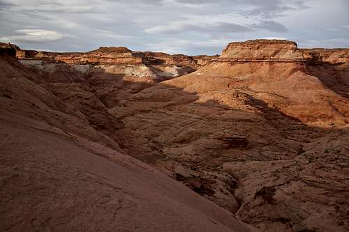
View into the Blarney Canyon - from the slick rock approach
The canyon has 2 forks divided into the Right = East Fork and Left = West Fork. Left = West Fork is the more popular one, and slightly more technical.
Blarney Canyon together with neighboring Shillelagh (same approach), Leprechaun Canyon (0.5 miles down the road) and Sandthrax are also known as Irish Slot Canyons.
I have done only the left fork fork of Blarney since per descriptions and information it is more spectacular and technical. Road Trip Ryan is describing it as one of the best slots in North Wash. I was not disappointed - nice narrows, fun down climbs, easy access and straightforward canyon.
Getting There
The Blarney Canyon is located just south of Hanksville (about mile post 27.6 = therefore the name 27.6 Mile Canyon per some references).From the junction of Utah highways 276 and 95, drive south on highway 95 about 1.5 miles to a turn off to a short dirt road. The turn off is not signed, just measure the distance and as soon as you pass the culvert take the dirt road heading east. The road drives straight back from the highway about 100 meters then it drops and ends into a wash next to a sandstone wall. It is not signed, but easy to spot (if you drive too far on Highway 95, you get to Leprechaun canyon cca 0.5 miles further south and just back track).
 Blarney Wash as seen from near the parking lot | 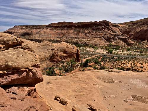 Parking lot as seen from Slick Rock, also note Highway 95 |
Canyon Approach
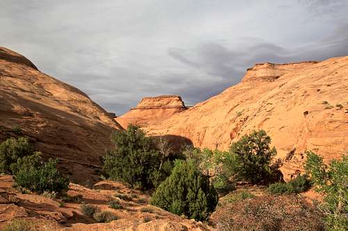
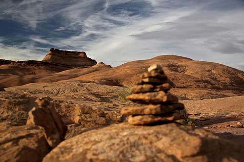
From the parking area, cross the Blarney wash and follow a path out of the wash going towards the slick rock. The trail is pretty obvious. Slightly ascend up and you will find yourself between the Blarney wash and another drainage on the west. About 150 meters from the car between these two drainages scramble up a slick rock. It may appear initially slightly steep, but the rock is grippy and easy going up (even down going is easy). Use your route finding skills, but nothing should exceed class 3. I put a few cairns up there just for fun. The slick rock will become less steep, continue always towards the highest point you can see. This section of approach trail is very beautiful and gives you nice views into the lower Blarney drainage on your right (see the first photo overview section), and great views of Henry Mountains in the distance. You will pass several little summits on slick rock and reach a big rock face, the trail will re-emerge here in a sand/dirt. Skirt around the left (west) side of the rock face on a good and easy to follow trail. The trails levels here, you will reach another slick rock section, and trail will re-emerge again after getting back onto the dirt section. Cairns mark the trail on slick rock. The route finding was pretty obvious. The trail continues in northerly direction and you will get nice views into the Blarney on your right, and into the Shillelagh Canyon on your left. The trail goes up following the rim of the Blarney canyon. At the junction, continue right towards the head of Left Fork of Blarney (going left would take you to Shillelagh Canyon). It is obvious when to start heading down since you can see where the canyon starts pretty abruptly.
 Slick rock approach - head for the rock face in the distance, then skirt left = west | 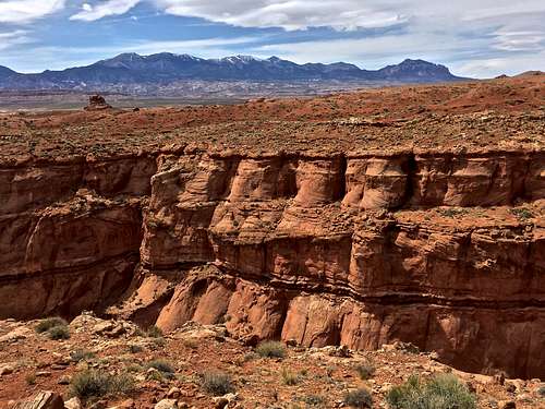 Shillelagh Canyon and Henry Mountains in the distance |
Note this is the same approach as used for Shillelagh Canyon.
To reach the right fork, contour around the head of the left fork, and continue contouring to the head of the right fork.
Route Description
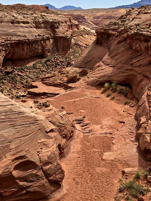
Left Fork of Blarney - The left fork is the first you will reach and easy to identify. It starts with a short down climb on the side to reach the flat bottom - walk around the start of the canyon right and follow the rim for about 25 meters for an easy area to do your down climbing. You can see a flat area with a large boulder with webbing below you - nice re-assuring mark.
Rappel 1: Anchor is a large boulder with webbing and rappel ring (in good condition April 2016 - always check and carry extra webbing with you in case replacement or back up is needed). Rappel starts down a fluted through then a short spot of free hang. It is easy and obvious rappel about 40 feet = 12 meters long.
Rappel 1 can by bypassed by walking about 250 feet east to the head of another drainage dropping to the canyon floor. It appears like class 4 slick rock scramble down. I preferred rappelling since the fluted start appeared really inviting.
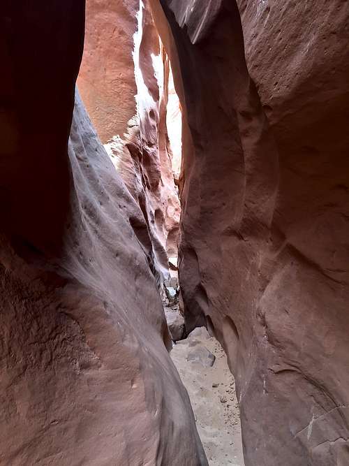
Down climb or a possible rappel 2 into a tight slot: About 40 meters down the canyon is the start of a deeper and narrow slot - I expected another rappel, but did not find any anchors/webbing, only a sign of rope wear on a slick rock. I opted down climbing into this slot, which may appear scary for some, but was not that bad. There is an opening under the choke stone on the right side and several good footholds. Climbing over the choke stone is more exposed and sketchy. I any case, if members of your party are concerned, there are boulders there for setting up a rappel. Use good judgement here.
There are several down climbs in this section up to 3-4 meters high. I felt comfortable, but can imagine unexperienced people asking for some assistance.
Rappel 2 or 3 (depending whether you rappelled above) into a dark chamber: There was single webbing extended over a choke stone. The start of this rappel felt awkward and the webbing appeared older (may need replacement soon). This rappel is 15 meters - 50 feet long. This area has some darker and narrow sections of the slot and several down climbs. Some may need assistance on these down climbs, even setting up another rappel station. I did not find it very challenging. This was a really nice slot area.
Junction with the Right Fork of Blarney is about 0.3 miles down canyon of rap 2. The canyon opens up here and it is mostly easy walking along sand and slick rock. You will enter the last section of narrows which will be only 100 feet long and finally exit into Blarney wash which will bring you back to your car.
 Head of Left Fork | 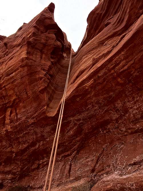 1st rappel | 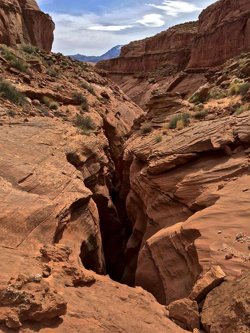 Start of the slot | 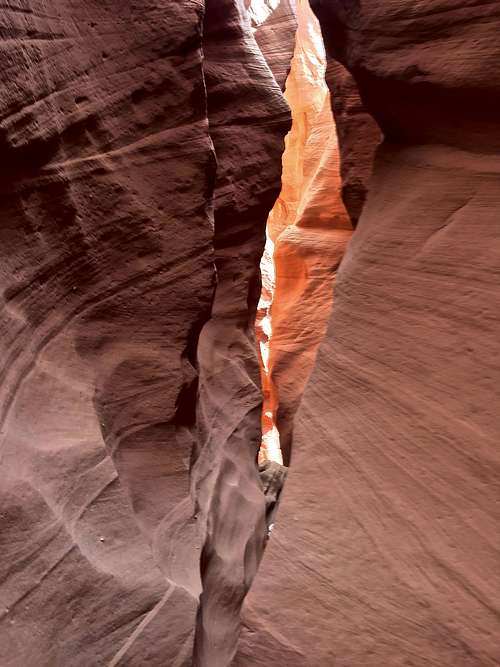 Entry into a tight slot |  Blarney canyon |
 Blarney Canyon | 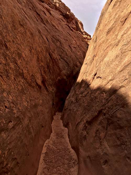 Little widening Blarney |  Blarney Canyon |  Down climb |  Another down climb |
Rating: 3A
Length: 2-3 hrs most parties (I took only 1.5 hrs at what felt like a leisurely pace with taking photos and exploring the area, but I also felt comfortable with down climbs).
Rappels: 2-3
Flashflood: always check the weather report and check the skies
Water: generally none
Season: any, summer can present a hot approach
Elevation Range: 4530-4900 feet
Right Fork - start with a rappel off the left side of the canyon. The rappel is from boulders and is about 10 to 15 meters long. Head down the canyon with several down climbs. This fork is second place to the left fork per internet resources, and I have not explored it.
Red Tape
The canyon is easily accessible from SR 95, located 27.6 miles south of Hanksville. It is basically right on the road. A short dirt road (less than 100 meters) brings you to a small parking lot next to a sandstone wall. There are no fees to access this canyon. You don't need 4WD vehicle.You can camp right at the parking lot - primitive camping, no water.
There is no bolting in this area, only natural anchors.
Gear
- harness, rappel device, prussik, extra webbing for anchor replacement if needed, nice to carry some ascending equipment
- rope: 1 50 meter rope sufficient
- helmet ?
- map, route description
- dry canyon: no wetsuit needed
- small backpack - canyon has tight sections and expect to drag the backpack behind you
- consider knee pads for chimney down climbs
- camera
External Links
- Blarney Canyon on climb-utah.com
- Canyoneering Left Fork Blarney Canyon on bluugnome (good detailed instructions)
- Canyoneering Blarney Canyon - North Wash | Road Trip Ryan (I use this site a lot, registering is for free)
- Blarney Canyon - Tood's Desert Hiking Guide
- Irish Slot Canyons | Bryce Canyon Country
- Slot Canyons of the American Southwest - Blarney Canyon, a tributary of North Wash, Utah