


-
 2376 Hits
-
 79.04% Score
-
 10 Votes
|
|
Area/Range |
|---|---|
|
|
45.68590°N / 7.15451°E |
|
|
Hiking, Mountaineering |
|
|
Summer, Fall |
|
|
9715 ft / 2961 m |
|
|
Note
La montagna chiama i suoi figli, ed essi rispondono fedelmente al suo appello… Osvaldo Cardellina, Diario alpinistico, 1964-65 Page texts: @ OsvaldoCardellina "Osva", passed away on May 2, 2022. Page owners: Christian Cardellina e Osvaldo Cardellina. Any updates from September 12, 2022: Antonio Giani, page administrator, friend and climbing companion. Testi della pagina: @ OsvaldoCardellina "Osva", scomparso il 2 maggio 2022. Proprietari pagina: Christian Cardellina e Osvaldo Cardellina. Eventuali aggiornamenti dal 12 settembre 2022: Antonio Giani, amministratore della pagina, amico e compagno di salite. |
Overview
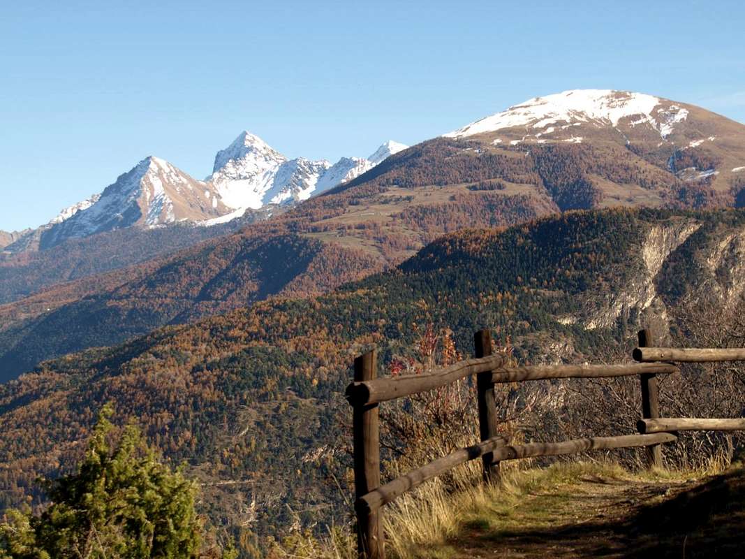
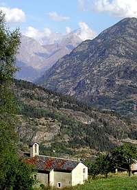
A little flat basin, which then turns into a small valley, sited between the Valleys of Rhêmes and Valgrisenche in a vast and picturesque wooded promontory overlooking -both the entrances of two beautiful valleys.
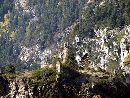
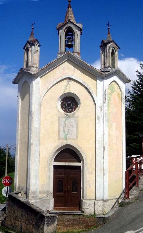
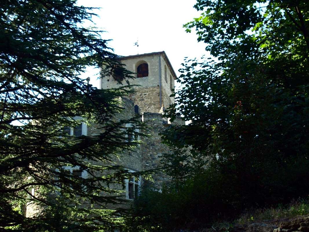
A tiny resort, located into a forest at the foot of Becca del Merlo or Becca Chamin (2.961m) at the end of the long divide between the two starting from Punta Galisia (3.346m) at the extreme borders with Piedmont and France, became famous for the attendance of two amongst the last Vatican Popes (John Paul II° and Benedict XVI°). But also a happy island of peace not only choice and frequented by them but also by various Naturalists, Hikers and Mountaineers or simply as numerous Tourists eager to visit these places, as well as the underlying small Villages of Petit Haury and Grand Haury at the terrifying Tower Montmayeur or Tour d'Haury with its bleak horrified Legends. By Aosta City, through the SS.26 towards Courmayeur and the Mont Blanc Tunnel, arrive at Villeneuve (670m, 10 Km. from Aosta; Tower of Châtel Argent of XI° Century built by Bard's Lords) and from this continue Westward, while we can go through the village past the Church of Santa Maria Assunta and Bell Tower of 1400, rebuilt in 1782. Leaving just left the deviations for Savara and Rhêmes Valleys, through the new bridge to reach the main road. Or, to avoid the crossing of the same, go just before Chavonne at the same through the old bridge on the Baltea, semi destroyed by the flood of 1907 and partly rebuilt with the stones of the road to Petit Saint Bernard as the country destroyed by a terrible hurricane. Soon, passing nearby the squared Tour Colin reach Arvier (776m, 14.5 Km. from Aosta) located under the Becca del Merlo or Becca de Chamin (2.961m) at the end of the long watershed that originates even with the Punta Galisia, this last bordering with Piedmont Region and the nearby France. But, if you listen to my advice, do not operate any of these two choices, but you reach Arvier with a third and most impressive road itinerary. Villeneuve to take the Regional Road to Introd but not reach the same why you visited already since the second day. Instead reached the junction 806 meters for Villes Dessous at the Chapel of St. James of 1867 cross the country reaching Ville Dessus with small Church of St. Hilary always 1800. Here (863m) can also be reached by continuing briefly on Regional Road and with short descent that leads to the tiny square in front of the same, where as part of a much shorter nice walk on an ancient paved and signaled path and adressed to the above little Chapel of Santa Anna (0h'15) on the road that goes down to Arvier. From this, with mini "Picnic area" and small car park as well as magnificent views over the Central Valley of Baltea and the Group of Mount Emilius (3.559m), continue straight on the right, leaving the detour to Les Combes (1.341m), the place of spiritual summer retreats of the Popes "John Paul II° Benedict XVI°" in recent years; passing high above the "Comba Neye de la Mort" and through a wild valley, down towards Northwest Arvier with beautiful view over the remains of the Château de la Mothe or of Arvier XIII° Century and the nearby Parish Church with Romanesque Steeple, immediately below to a small "Naturalistic Area" with a pond. Leaving Arvier toward State Road meet one after the other a Monumental Cross, wrought iron of a Mission of 1933 and an artistic roundabout dedicated to the local cyclist "Maurice Garin", winner in 1903 of the first "Tour de France" and even two Paris-Roubaix. Just beyond you meet the Hamlet of Leve or Liverogne (water mange or growling), where he arrived in a gorge the Doire de Valgrisenche (Rochefort Chapel, built on the ruins of an ancient castle).
![]()
Questa conca, trasformantesi in un valloncello "appiattito", é sita a cavallo tra le Valli di Rhêmes e Grisenche in un vasto e pittoresco promontorio boschivo dominante l'ingresso d'entrambe le due belle vallate.
Località, collocata ai piedi della Becca del Merlo o Chamin (2.961 m) al termine del lungo spartiacque tra le due, diventata famosa per la frequentazione di due degli ultimi Papi.Ma anche un'isola di pace non solo scelta e frequentata da Giovanni Paolo II° e Benedetto XVI° ma pur da Naturalisti, Escursionisti ed Alpinisti o semplicemente da Turisti desiderosi di visitare sti luoghi, nonché i sottostanti Villaggetti del Petit e Grand Haury presso la terrificante Torre di Montmayeur o Tour d'Haury con le sue tetre Leggende. Dalla Città di Aosta, tramite la SS.26 verso Courmayeur ed il Tunnel del Monte Bianco, raggiungere il Comune di Villeneuve (670 m, 10 Km. da Aosta; Torre di Châtel Argent del XI° Secolo dai Signori di Bard) e continuare verso Occidente, mentre passando nel medesimo si può visitare la Chiesa di Santa Maria Assunta con Campanile del 1400, ricostruita nel 1782. Da questi, lasciando subito sulla sinistra la deviazioni per le Valli Savara e Rhêmes, tramite il nuovo ponte raggiungere la Statale. Oppure, evitando la traversata del medesimo, passare appena prima presso Chavonne sulla medesima per mezzo del vecchio ponte sulla Baltea, semi distrutto dall'alluvione del 1907 ed in parte ricostruito con le pietre della strada del Piccolo San Bernardo come il paese distrutto da un terribile uragano. Ben presto, passando presso la quadrata Tour Colin raggiungiamo Arvier (776 m; 14,5 Km. da Aosta) sita sotto la Becca del Merlo oppure di Chamin (2.961 m) al termine del lungo spartiacque che si origina addirittura con la Punta Galisia ai confini con la Regione Piemonte e la viciniora Francia. Ma, se ascoltate un consiglio, non operate nessuna di queste due scelte, bensì raggiungete Arvier con un terzo e più suggestivo itinerario stradale. Da Villeneuve prendete la strada per Introd ma non lo raggiungete poiché lo avete visitato di già nella seconda giornata. Raggiunto invece il bivio 806 metri per Villes Dessous presso la Cappella di San Giacomo del 1867 attraversate il paese raggiungendo Ville Dessus con Chiesetta di Sant'Ilario sempre del 1800. Qui (863 m) si può giungere anche continuando per breve tempo sulla Strada Regionale e con breve discesa che porta alla piazzetta davanti alla medesima, dove parte una tanto corta quanto bella passeggiata su d'un antico sentierucolo lastricato nonché segnalato verso la soprastante Cappelletta di Santa Anna (0h'15) sulla Strada che scende ad Arvier. Da questa, con mini parcheggio e minuscola "Area Picnic" nonché magnifico panorama sulla Valle Centrale della Dora Baltea ed il Gruppo del Monte Emilius (3.559 m), si prosegue lasciando subito sulla destra la deviazione per Les Combes (1.341 m), luogo dei ritiri estivi spirituali dei Papi "Giovanni Paolo II° e Benedetto XVI°" negli ultimi anni. Passando alti sopra la "Comba Neye de la Mort" ed attraversato un selvaggio valloncello, si scende verso Nordovest ad Arvier con bella vista sui resti del Château de la Mothe o d'Arvier del XIII° Secolo e la vicina Chiesa Parrocchiale con Campanile romanico, subito appresso ad una piccola "Area Naturalistica" con laghetto. Uscendo dal Comune d'Arvier verso la Statale s'incontrano una dietro l'altra una Croce monumentale in ferro battuto di una Missione del 1933 ed un'artistica rotonda dedicata al locale ciclista "Maurice Garin", vincitore nel 1903 del primo "Tour de France", nonché di due Parigi-Roubaix. Appena oltre si incontra la Frazione di Leve o Liverogne (acqua che rogna ovvero che brontola), dove arriva in una forra la Doire de Valgrisenche (Cappella di Rochefort, costruita sui resti d'un antico castello).
 |
 |
 |
Getting There
BY CAR:
- From TORINO, MILANO, etc: Motorway A5. Exit at IVREA or Quincinetto (PIEDMONT) From IVREA Town: West to Pont St. Martin, Donnas, Bard, Verrès, St. Vincent, Châtillon, Nus, Quart, St. Christophe, Aosta, Sarre, St. Pierre, Villeneuve, Arvier Commons. From Courmayeur Resort: in East to Pré St. Didier, Morgex, La Salle, Avise, Arvier and Villeneuve Municipalities.
- 1) - From Aosta with the SS.26 towards Courmayeur-Mont Blanc reaching Villeneuve Common (670m) and Ville Dessous/Dessus Hamlets and following crossroads 806/863 metres, just below Introd Commune (880m). From these with Regional Road to West-southwest until the junction 256 meters below Combes.
- 2) - From Aosta always towards Villeneuve Commune and, continuing on State Road, until Arvier Municipality (776m); from this, leaving West the State Road, continue Southwest and, passing Crête (821m) and Verney (894m) Villages, reach before those of Petit Haury, Grand Haury (1.081m, 1.177m) and then Combes (1.323m).
- From FRANCE: through the Mont Blanc Tunnel to Entrèves-crossroads to Vény/Ferret Valleys - Mountain Guides of Courmayeur - La Saxe Rock Gym - Courmayeur. By Little Saint Bernard Pass, closed since November until half May to La Thuile Valley - Pré Saint Didier - Courmayeur. It is not necessary to take Motorway A5: you can drive on SS.26, in the direction of AOSTA - IVREA - TURIN.
BY PLANE:
- Aeroporto "Corrado Gex" Saint Christophe (Aosta).
 |
 |
 |
Approach & Routes
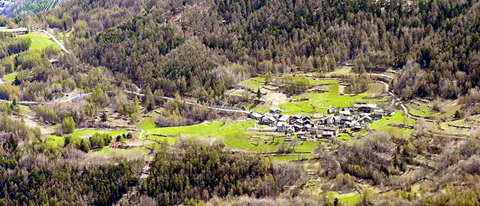
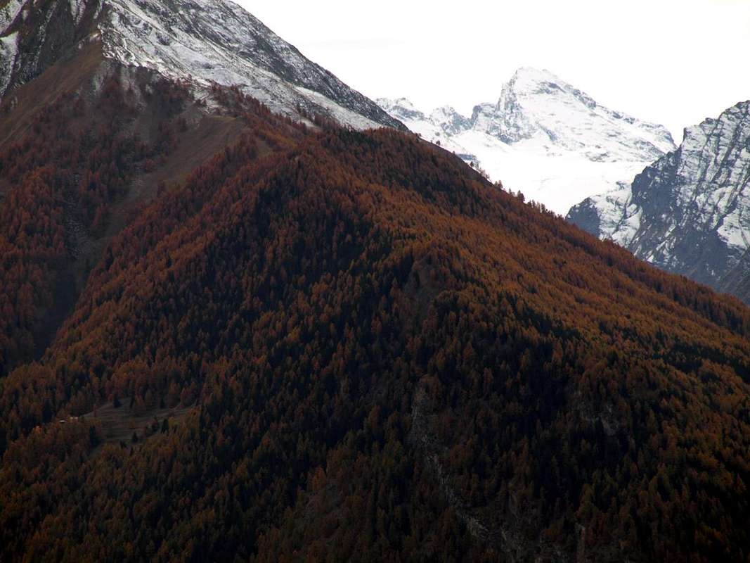
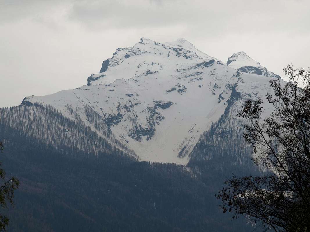
from Petit to Grand Haury (1.081m, 1.177m) through the asphalt road, then to Les Combes (1.323m) and in Southwest Combientse (1.783m), Plan Bry 1.918m); from this, chancing in Southeast, towards Maison Crou (2.219m), with paths 5A, then unnumbered. This last through North-northeast Ridge Mont de l'Âne (2.361m), Cross (2.439m), with traces, below Quota 2.690 meters and, through North Crest Becca of Merlo also of Chamin (2.961m), with debris, traces and small easy rocks. With snow rope required.
Dalla Frazione del Petit Haury (1.081 m) a quella del Grand Haury (1.177 m) continuando poi con deviazione verso il Villaggio di Les Combes (1.323 m fontanile e Museo dedicato a Papa Giovanni Paolo II°) con la strada asfaltata e quindi a Sudovest in direzione di Combientse (1.783 m), Plan Bry 1.918 m), dopodiché a Sudest verso Maison Crou (2.219 m), tramite sentieri 5A, poi non numerato. Da quest'ultima per mezzo della Cresta Nord-nordest al Mont de l'Âne (2.361 m), Croce 2.439 metri, su tracce sottostantemente alla Quota 2.690 metri e, tramite la Cresta Nord alla Becca del Merlo o di Chamin (2.961 m), tramite detriti, tracce e roccette facili. Con neve sicuramente meglio se con corda.
Campings
Remember that free camping is forbidden (except for emergency reasons, over 2.500m, from darkness until dawn).Mountain Condition
- You can get meteo information at the official site of the Regione Valle d'Aosta:
- Valle d'Aosta Meteo
Books and Maps
BOOKS:- "Guida delle Alpi Occidentali" di Giovanni Bobba e Luigi Vaccarone C.A.I. Sezione di Torino Volume II (parte II), 25 Maggio 1896.
- "Guida dei Monti d'Italia – Alpi Graie Centrali" di Alessandro Giorgetta, Club Alpino Italiano/Touring Club Italiano, 1985.
 |
 |
MAPS:
- L'Escursionista "Valgrisenche Val di Rhêmes" Carta dei sentieri (n° 3) 1:25.000.
- I.G.C. Istituto Geografico Centrale Torino "Valsavarenche Val di Rhêmes Valgrisenche P.N.G.P.", 1:25.000.
- I.G.C. Istituto Geografico Centrale Torino" Il Parco Nazionale del Gran Paradiso" 1:50.000.
- Enrico Editore Ivrea-Aosta "Gruppo del Gran Paradiso" 1:50.000.
- Kompass "Gran Paradiso Valle d'Aosta Sentieri e Rifugi" Carta Turistica 1:50.000.
- Studio F.M.B. "Gran Paradiso" Bologna 1:50.000.
- Comunità Montana Valdigne Mont Blanc, "Les Sentiers" Edizione 2001, 1:50.000.
Important Information
- REGIONE AUTONOMA VALLE D'AOSTA the official site.
- FONDAZIONE MONTAGNA SICURA Villa Cameron, località Villard de la Palud n° 1 Courmayeur (AO) Tel: 39 0165 897602 - Fax: 39 0165 897647.
- SOCIETA' DELLE GUIDE DI VALGRISENCHE.
- A.I.NE.VA. (Associazione Interregionale Neve e Valanghe).
Useful numbers
- Protezione Civile Valdostana località Aeroporto n° 7/A Saint Christophe (Ao) Tel. 0165-238222.
- Bollettino Meteo (weather info) Tel. 0165-44113.
- Unità Operativa di Soccorso Sanitario Tel. 118.