
-
 14099 Hits
-
 80.49% Score
-
 12 Votes
|
|
Mountain/Rock |
|---|---|
|
|
47.97685°N / 89.65429°W |
|
|
Hiking |
|
|
Spring, Summer, Fall |
|
|
1348 ft / 411 m |
|
|
Overview
Minnesota’s ‘North Shore’ – the part that stretches northeast toward Canada along the north coast of Lake Superior, is a four season home for summits, canyons, woodlands and lakes. The views of mighty Lake Superior, the world’s largest freshwater lake, gives many mountains here a feeling of grandeur far beyond what their size would indicate. And no mountain shows off this Great Lake better than Mount Josephine.
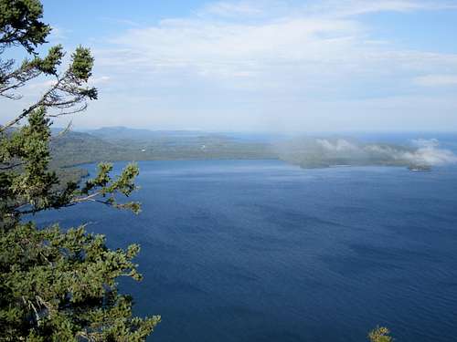 Mount Josephine Summit View - North towards Canada
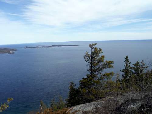 Mount Josephine - Views East
Mount Josephine bears witness to thousands of years of human history. It stands over the Grand Portage, ‘big carrying place’, an 8.5 mile canoe portage route between Lake Superior and the inland waterways guarded by the huge falls that crash over the red anorthosite rocks of the North Shore. Home to the Ojibwa tribe for several centuries, it became a gateway for first French, then English fur traders eager to exploit the fur bounty of the Northern forest. Today it lies within the Ojibwa Grand Portage Reservation in the US. A US National Monument tucked within the reservation focuses on this historic strategic outpost with recreated buildings and programs.
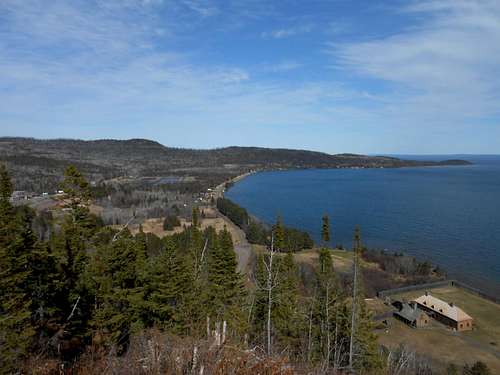 Mount Josephine and Grand Portage National Monument
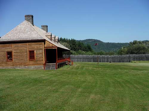 Mount Jospehine and The Great Hall
By the way, the waterfalls and rapids that necessitated the Grand Portage are impressive even by Minnesota North Shore standards. Make every effort to check them out if you can at the nearby Grand Portage State Park, directly on the US/Canada border. The High Falls are 120 feet of beauty.
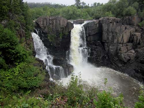 High Falls - Pigeon River
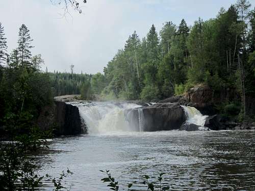 Middle Falls - Pigeon River
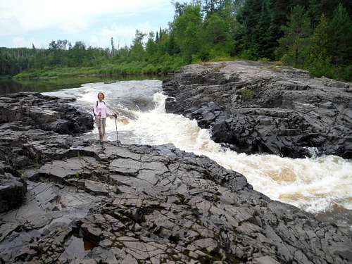 8 Feet from Canada
Getting There
The village of Grand Portage lies 3 hours Northeast of Duluth Minnesota along beautiful Route 61. It is 1 hour southwest of Thunder Bay Ontario along its Route 61 as well.
The trailhead is almost entirely unmarked. I had to stop by the National Monument Visitor Center, which is easy to reach and is well signed, to get exact directions to the trailhead. Below is the map they gave me. The key is the spotting the blue address marker ‘183’ along Route 17 northeast of the village. Please drive carefully, there is a school and community center on the route.
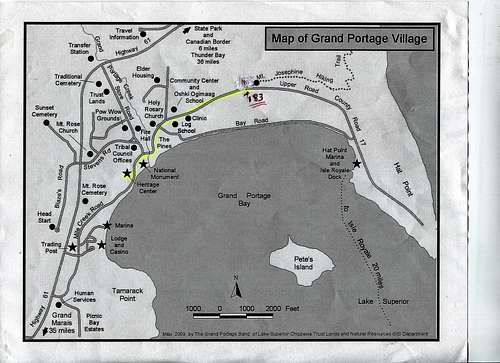 Mount Josephine - Locale and Trailhead
Warning: once you turn into the ‘entrance’ of 183 you have only a few places to park. The trail, an old jeep road, begins immediately (though again without signage) – there are only a couple of spots in the wider part of the turn off.
Route
The initial trail is a very flat old jeep road through the woods. The second time I hiked this, in Spring, it had a lot of water but it was not really ‘muddy’ as I am used to farther south in the Midwest. In a half mile or so you will reach a wider clearing with a sign ‘Summit 1 Mile’. Your journey up begins here.
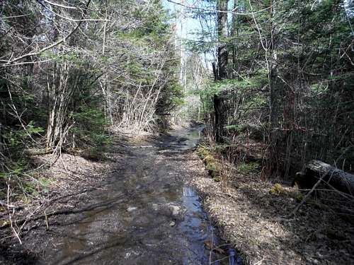 Mount Josephine trail - Initial Section
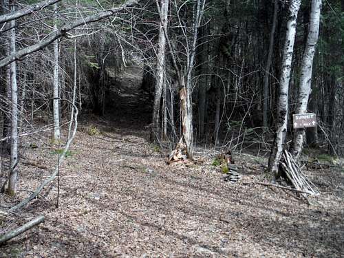 Mount Josephine - Start of Trail Up
Mount Josephine stands over 750 feet above Lake Superior. The trail up is steep and easily discerned. However, near the rocky top a multitude of trails will spring out in various directions toward a number of great overlooks throughout the lightly forested top. All trails eventually seem to lead to the foundation of a watchtower, and all the various overlooks are stunning.
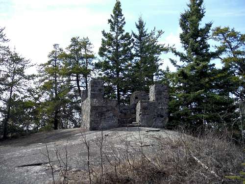 Mount Josephine Watchtower Ruins
The true summit lies to the west another quarter mile or so and 30 odd feet higher- but each of the two times I climbed Mount Josephine I could not bring myself to leave the lake overlooks.
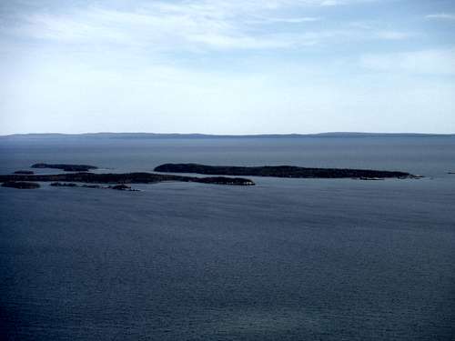 Isle Royale National Park on the Horizon, Susie Islands in Foreground
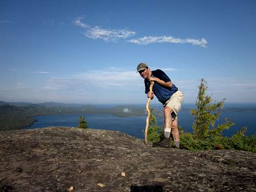 Enjoying the Top
Red Tape
There are no fees for the National Monument or for the Grand Portage Reservation.
When to Climb
Spring, summer and fall for sure. A winter snowshoe would be very steep indeed and I imagine very dangerous at the top.
Camping
Camping at and near the Monument
External Links
A very good Visitor Center and beautifully recreated buildings. Grand Portage National Monument
