
-
 9559 Hits
-
 84.27% Score
-
 18 Votes
|
|
Mountain/Rock |
|---|---|
|
|
37.92968°N / 107.54589°W |
|
|
San Juan |
|
|
Hiking |
|
|
Spring, Summer, Fall, Winter |
|
|
13328 ft / 4062 m |
|
|
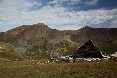
Overview
Cinnamon Mountain as seen from Cinnamon Pass
Cinnamon Mnt. and UN 13535 (true summit hiding further south and east)
Cinnamon Pass is a high mountain pass, accessible by high clearance 4WD vehicles. Elevation: 12,620 feet
![Cinnamon Pass]()
Cinnamon Pass![Cinnamon Mnt. and UN 13535]()
Cinnamon Mnt. and UN 13535 (true summit hiding further south and east)Cinnamon Pass Trail Little History: The Utes used this pass road before white exploration of the area. Then, in the early 1860s, Charles Baker used the pass on his journey into the San Juan Mountain when he reported finding gold, triggering a minor gold rush. In 1873, The Hayden Survey Party crossed the pass. In 1877, Enos Hotchkiss constructed the first wagon road over the pass. It was an important freight road for a period but was not maintained after the ore in the area declined. ![Trail up Cinnamon Mountain]()
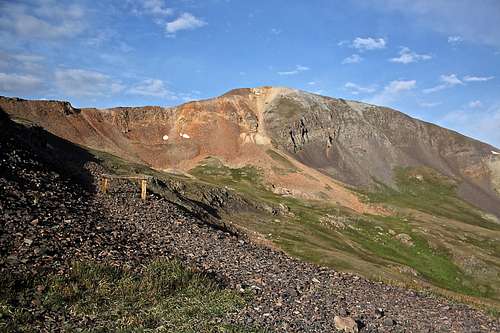
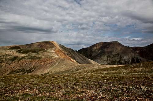
Trail up Cinnamon Mountain![East Slopes - Cinnamon Mnt.]()
East Slopes - Cinnamon Mnt.
As any mountain there are many routes up it.
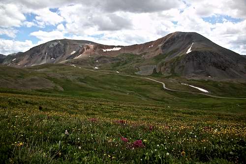
![Cinnamon Mnt. and Animas Forks Mnt.]()
Cinnamon Mnt. and Animas Forks Mnt. as seen from the slopes of UN 13,535
Why Cinnamon Mountain A? because there is B - Cinnamon Mountain in Elk Range, elevation 12,293'.
Guide to the Colorado Mountains with Robert Ormes again does not provide much information: "Cinnamon Mountain (13,328') and its higher neighbor, Peak 13,535' a mile southeast, are easy hikes from Cinnamon Pass".
Cinnamon Mountain A combines really nicely with Unnamed 13,535 foot mountain.
Colorado Rank: 370
Parent Lineage: Line Parent: 13535
Proximate Parent: "Animas Forks Mountain"
Class: 1-2
Nearby Mountains:
- Unnamed 13535
- "Animas Forks Mountain" 13,722 1.10 miles
- Wood Mountain 13,660 feet 1.3 miles
- Unnamed 13708 1.43 miles
- Unnamed 13688 1.71 miles
- Gravel Mountain A 2.10 miles
- Seigal Mountain 2.13 miles
- Houghton Mountain 13,052 feet 2.33 miles
- Jones Mountain 13,860 feet 2.53 miles
- American Peak 13,806 feet 2.77 miles
- Whitecross Mountain 13,542 feet 2.86 miles
- Niagara Peak 13,807 feet 2.87 miles
- Handies Peak 14,053 feet 2.53 miles
Getting There
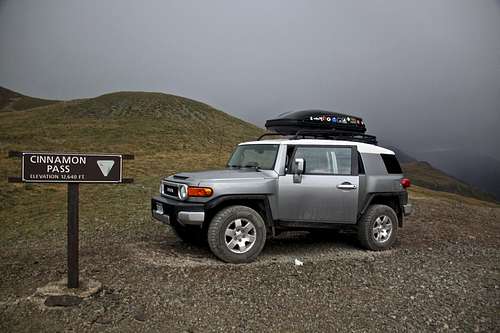
Cinnamon Pass
Cinnamon Mnt. and UN 13535 (true summit hiding further south and east)
Description: Today Cinnamon Pass Trail is a seasonal, moderately difficult 4WD road. It is a part of the very popular Alpine Loop. The other half of the loop is Engineer Pass Trail. You can access Cinnamon Pass Road either from Lake City, or from Silverton. You can also access it from Ouray over Engineer Pass, but it does take longer than driving Million Dollar Highway over Red Mountain Pass to Silverton. The scenery varies from the rugged alpine environment and barren talus slopes near the summit to the wild flower covered valleys and rushing streams. You will pass by Animas Forks ghost town. At either end of the route are wonderful historic town.
From Silverton: Drive through Silverton in its main street northeast out of town. Bear rich onto Colorado 110. Pass a campground on your right, and Hillside cemetery on your left. Continue on paved road until it changes into a good dirt road. The route follows the Animas River and it passes through numerous mines. At 4.2 miles drive across the bridge spanning Cunnigham Creek. At 7.8 mile point is the town site of Eureka, this is where the road closes in the winter. There is a campground in Eureka and a cabin (available for hire and popular with ice climbers in the winter).
Pass Sunnyside Mill on your right and follow the more narrow road up and above Animas River. About 4 miles from Eureka is a public restroom on your left and right above it the road is signed for Cinnamon Pass. (To the right would be the ghost town of Animas Forks). The road here becomes steeper and bumpy. 4WD and high clearance is needed at this point. Engineer Pass Rd. will continue straight and you will take a sharp turn right and uphill, well signed for Cinnamon Pass. The roughest section of the road is just above Animas Forks for about 1/2 mile. It is roughly 2 more miles from Animas Forks to the top of Cinnamon Pass. The road winds along the southern slopes of "Animas Forks Mountain". If you don't have 4WD, you can just park close to Animas Forks ghost town and hike up.
From Lake City: Dive on Colorado 149 and follow signs for Alpine Loop past San Cristobal Lake. At 14 miles pass the intersection County 35 to Sherman townsite (up to here snowplowed in the winter). Continue on main road towards Cinnamon Pass. At 18 miles pass Grizzly Gulch - a popular TH for three 14ers: Sunshine, Redcloud and Handies. At 21 miles there is a turn off for American Basin. It is another 2.2 miles from here to the summit of Cinnamon Pass.
Route
Trail up Cinnamon Mountain
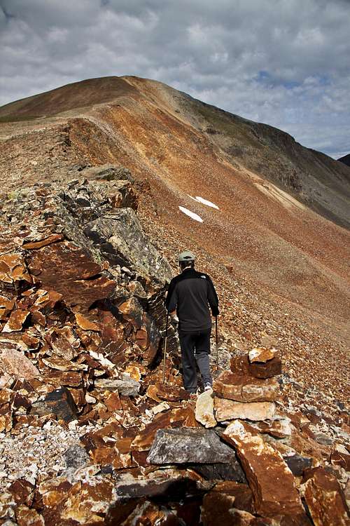
East Slopes - Cinnamon Mnt.
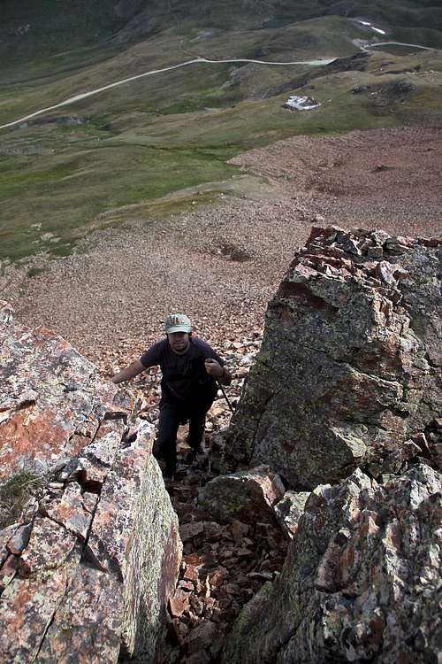
The easiest way is to drive to Cinnamon Pass, elevation 12,620 feet and hike up the trail on the southern end of the pass. The trail is not marked, but it is pretty obvious. List of John marks the difficulty as class 2 - and it does have a few class 2 moves to gain the eastern ridge, however most of the hike is class 1. The route finding is very obvious since you can see the summit of Cinnamon Mountain from your hike and trail is faint at some places but easy to follow.
Another approach can be from Grouse Gulch - great for those who have no 4WD vehicle. Follow the instructions to drive from Silverton towards Animas Forks and later to Cinnamon Pass and Engineer Pass, prior reaching the ghost town of Animas forks is Grouse Gulch and there is a pack trail leading up along a creek and towards an unnamed lake. You can either first ascent Unnamed 13,535, or you can hike up part of the trail and then ascend south slopes of Cinnamon Mountain.
Views along the hike and summit
 Animas Forks Mnt. and UN 13708 from slopes of Cinnamon Mnt. | 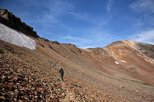 Trail up Cinnamon Mountain |
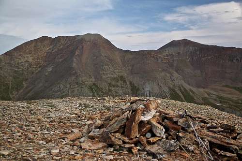 Cinnamon Mnt. summit with Animas Forks Mnt. and UN 13,708' in the back | 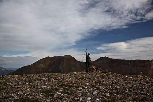 Cinnamon Mountain summit |
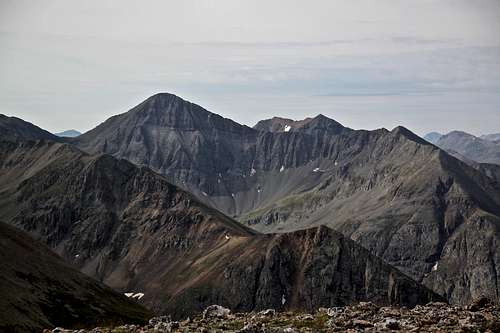 Niagara Peak | 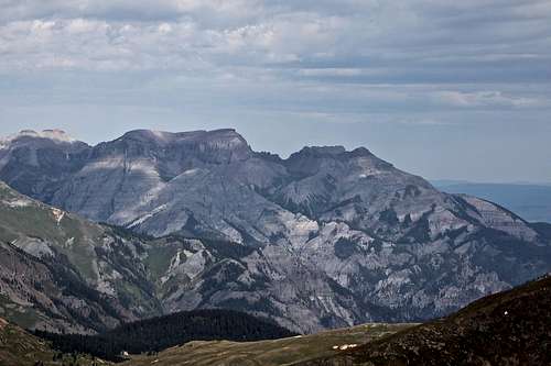 Corbet, Whitehouse and Ridgway |
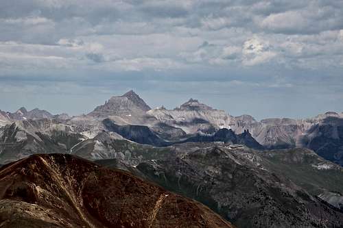 Mount Sneffels | 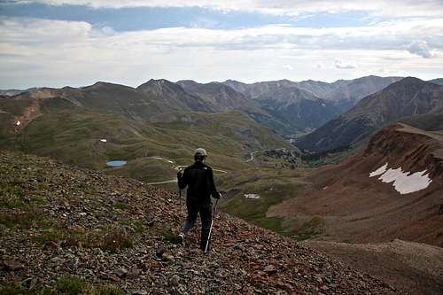 Cinnamon Mountain |
Red Tape
Driving scenic Alpine Loop is free. There are enough parking places at the summit of Cinnamon Pass and a sign. Expect a lot of traffic of different off road vehicles during the peak summer months. Hiking is free.When to Climb
Summer is the easiest since you can drive to the top of Cinnamon Pass. Autumn, winter and spring provide a more difficult access, and you have to travel through avalanche prone terrain. Check avalanche conditions prior venturing out there in the winter - Northern San Juan Avalanche Information Center.
Cinnamon Mnt. and Animas Forks Mnt. as seen from the slopes of UN 13,535
Camping
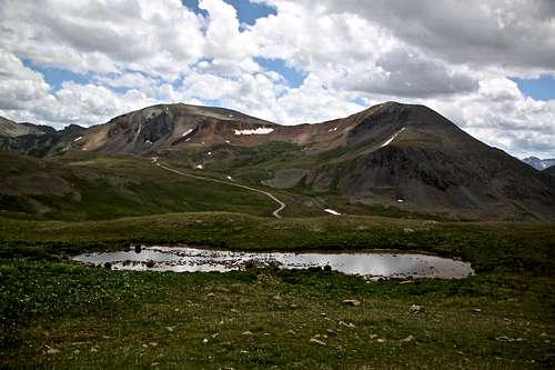
Primitive camping is available along the Cinnamon Road at various turn offs. You can sleep at the top of the pass - flat parking makes sleeping in a car comfortable. There is a small unnamed lake just north of the pass (? 100 feet) you could easily pitch a tent over there and watch a sunrise over Handies.
Developed campgrounds are closer to towns - Eureka Campground on Silverton site.