
-
 5388 Hits
-
 83.69% Score
-
 17 Votes
|
|
Mountain/Rock |
|---|---|
|
|
37.94190°N / 107.71606°W |
|
|
Ouray |
|
|
Hiking, Mountaineering |
|
|
Spring, Summer, Fall, Winter |
|
|
13315 ft / 4058 m |
|
|
Overview
 T 8 from Richmond Pass
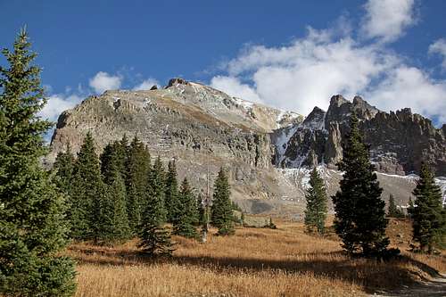 T 8 from Imogene Pass Road
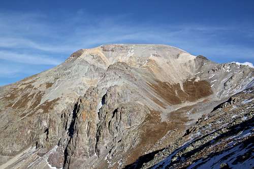
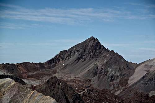
Guide to the Colorado Mountains with Robert M. Ormes (sort of a bible of Colorado Mountains) only briefly mentions T 8 (13,315') in conjunction with Hayden Mountain. "From a mile northwest of the last switchback as US-550 descends north from Red Mountain Pass, an old and sometimes obscure trail, whose beginning is difficult to find, climbs northwest to 12,567' Richmond Pass, and then down the west side to Imogene Creek. The official summit of Hayden is 0.5 mile north of the pass. T 8 (13,315') and T 7 (13,359') are a greater distance up-ridge to the southwest of Richmond Pass".
Colorado Rank: 378
Parent Lineage: T 7
Class: 2
What's up with the name? There are many summits that have unofficial names that have sprung up because of local usage or traditional agreement in the climbing community. Examples of these are some of the "T", "S", or "V" designation summits in the San Juans.
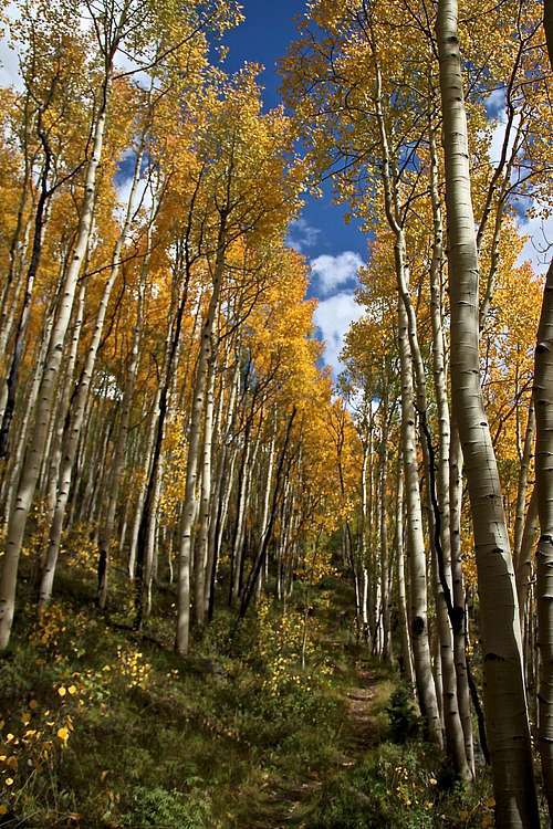
![Richmond Pass Trail]() Richmond Pass Trail
Richmond Pass Trail![Richmond Pass trail]() Richmond Pass trail
T 8 (13,315') is easily accessible from Richmond Pass. Richmond Pass can be reached either from Ironton Trailhead from US-550 (=Million Dollar Hwy), or the other trailhead off Imogene Pass Rd. If you have 4 WD vehicle, the trailhead from Imogene Pass Rd. will make your hike a little shorter, but if you do not have a 4 WD vehicle, use the trailhead off US-550. This section of the trail is especially spectacular in the fall when aspens are changing colors. The area around Ironton is a very popular in the autumn with photographers.
Richmond Pass trail
T 8 (13,315') is easily accessible from Richmond Pass. Richmond Pass can be reached either from Ironton Trailhead from US-550 (=Million Dollar Hwy), or the other trailhead off Imogene Pass Rd. If you have 4 WD vehicle, the trailhead from Imogene Pass Rd. will make your hike a little shorter, but if you do not have a 4 WD vehicle, use the trailhead off US-550. This section of the trail is especially spectacular in the fall when aspens are changing colors. The area around Ironton is a very popular in the autumn with photographers.
Nearby Peaks:
- T 7 0.66 miles
- Hayden Mountain South 1.14 miles
- Chicago Peak 1.53 miles
- Telluride Peak 1.60 miles
- United States Mountain 1.62 miles
- "Tomboy Peak" 1.97 miles
- Unnamed 13510 B 2.06 miles
- Hayden Mountain North 2.31 miles
- Trico Peak 2.79 miles
- T 5 2.86 miles
- Mendota Peak 3.65 miles
- T 10 3.69 miles
- Potosi Peak 3.77 miles
Getting There
 Richmond Pass Trail
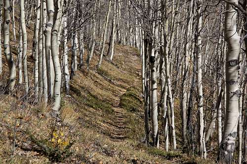 Richmond Pass trail
Ironton Trailhead is in the southern portion of Ironton Park on the west side of Highway 550 as you head toward Red Mountain Pass. It is before the first switchback above Ironton Park and can be hard to find. Turn onto a short dirt road to reach it. Parking is limited to several cars. It is 2.5 miles from Ironton TH to the top of the Richmond Pass. The trail is easy to follow as it climbs through aspen trees, making many switchbacks. The higher sections of the trail are over grassy tundra and if trail is not very visible just follow cairns and posts all the way to the pass. You will get amazing views of Hayden Mountain here, and across the valley great views of Red Mountains, Brown Mountain and Abrams Peak. If you continue down the pass, you will reach the Richmond Basin Road where it joins with Imogene road. It is about 3.8 miles from Ironton to Imgene Pass.
The altitude at the Richmond Pass is 12,678 feet.
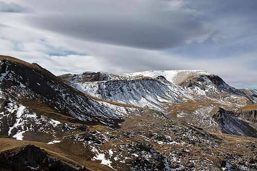
![T 8 route]() T 8 route overview from Richmond Pass
T 8 route overview from Richmond Pass![Wildflowers]() Wildflowers along Imogene Pass RoadAs any mountain there are many ways to reach its summit.
Wildflowers along Imogene Pass RoadAs any mountain there are many ways to reach its summit.
Route
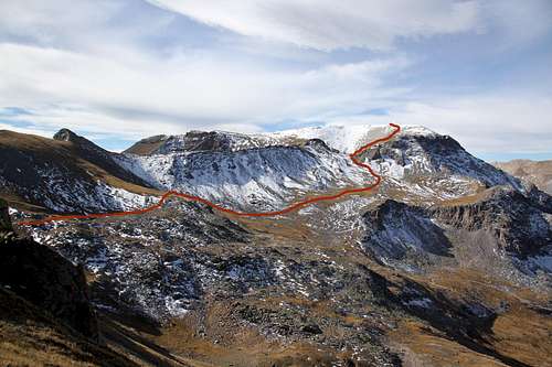 T 8 route overview from Richmond Pass
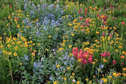 Wildflowers along Imogene Pass Road
The easiest way to teach the summit of T 8 is from the Richmond Pass. This hike will be mostly on trail all the way to the pass - elevation 12,678 feet, then over tundra and very little scree. The steepness does not exceed class 2 and there is pretty much no exposure. Richmond Pass can be hiked either from Ironton Trailhead, or from Imogene Pass Trailhed (see above). This approach combines really well with Hayden Mountain South. The summit of T 8 is located about 1 miles from the top of the pass in the southwest direction. Basically drop onto the SW side of the pass and try to stay high and traverse mostly over grassy slopes until you join a unmarked 4 WD road (unmarked on maps). Follow this road to a clearance between steeper slopes of T 8, go up this clearance (see photo) and up gentle slopes of T 8. The summit is decorated with a small cairn and summit register. The views are spectacular in all directions.
A more complicated route would be a traverse from T 7, involving loose class 3 moves and lots of scree. This approach would require 4 WD vehicle and driving/or hiking up Imogene Pass Road.
 "T 8" from" T 7" slopes
 | 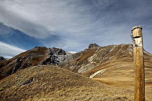 T 8 from Richmond Trail
 |
 Mount Sneffels
 | 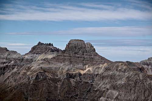 Potosi Peak and Teakettle
 |
 Whitehouse Mountain
 | 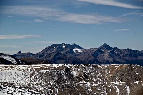 Wilson group
 |
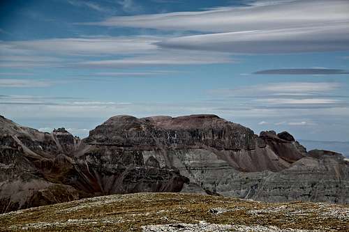
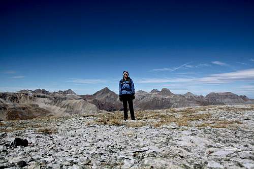 Large summit of T 8
 | 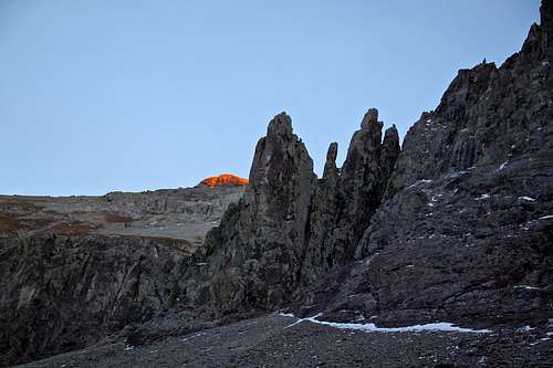 Cliffs on the west side of T 8
 |