The page was successfully edited.

-
 6363 Hits
-
 83.1% Score
-
 16 Votes
|
|
Mountain/Rock |
|---|---|
|
|
37.85930°N / 107.42417°W |
|
|
Hinsdale |
|
|
Hiking |
|
|
Spring, Summer, Fall, Winter |
|
|
13450 ft / 4100 m |
|
|
Overview
 Tundra Top
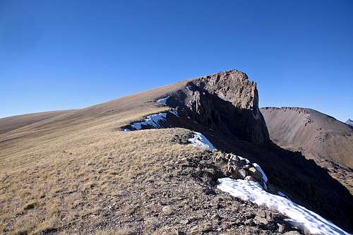
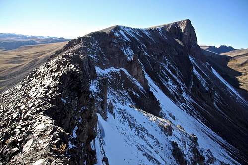
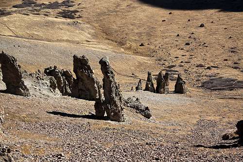
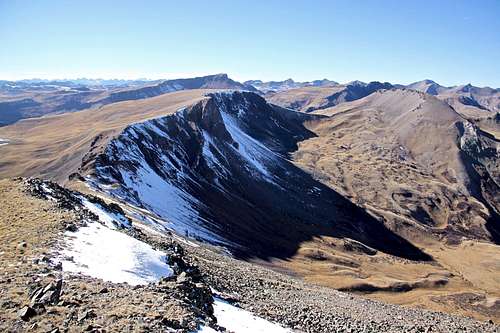 Tundra Top and Cataract Peak from Carson Peak
"Tundra Top" as the name suggest is only class 1 walk up on tundra when coming from the south. Its north side is steep, vertical and consist of loose rock. I came over from Carson Peak and found the ridge traverse interesting for a very short section - once you are at the saddle between Carson and "Tundra Top" you will have to negotiate a very narrow, loose and exposed ridge.
The summit is huge. I think I walked for about one mile until I found a tiny summit cairn and glass sign in register.
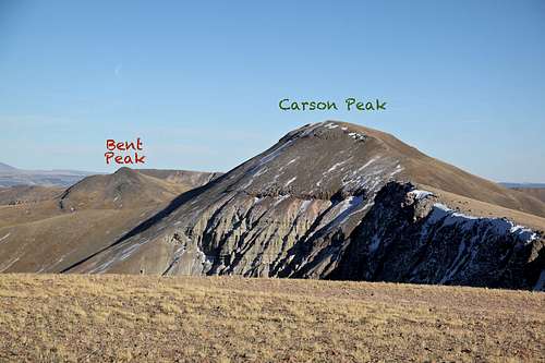
"Tundra Top" combines really well with surrounding 13ers. Most people climb it together with "Cataract Peak". I chose a different combination, starting at Carson Pass, I went over Bent Peak, Carson Peak to "Tundra Top" and since I started late, I was running out of daylight to continue onto Cataract. One can also add Unnamed 13,580 B. It can also be combined with the centennial Half Peak.
"Tundra Top" is located along the Continental Divide. The Continental Divide is a mountainous hydrological divide of the watersheds that drain into the Pacific Ocean and those that drain into the Atlantic Ocean.
Guide to Colorado Mountains with Robert Ormes briefly mentions this peak, they use the name Unnamed 13450. "Peaks 13,450' and 13,580' are easy ascents north and south respectively from where the Continental Divide and Colorado trail crosses 12,900'."
Colorado Rank: 290
Parent Lineage: Line Parent: Carson Peak
Proximate Parent: "Cataract Peak"
Class: 1 if coming from the south (from Continental Divide Trail), 2 if coming from Bent Peak or "Cataract Peak".
Nearby Peaks:
- "Cataract Peak" 0.60 miles
- Carson Peak 1.22 miles
- Unnamed 13580 B 1.53 miles
- Unnamed 13581 2.22 miles
- Half Peak 2.35 miles
- "Quarter Peak" 2.37 miles
- Bent Peak 2.38 miles
- Unnamed 13164 2.91 miles
- "Northwest Pole" 3.34 miles
- Pole Creek Mountain 4.29 miles
Getting There
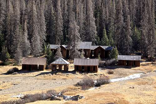 Carson City ghost town
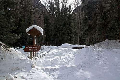 Cataract Gulch TH
Wager Gulch/Carson Pass: from the town of Lake City, drive south on highway 149 and then turn right onto County Road 30 to Lake San Cristobal, part of the scenic alpine loop drive (very popular in the summer). The road is paved past the lake then turns to graded dirt, passable for all passenger cars. About 2 miles past the Williams Creek campground, watch for a road turning off to the left (south) for the old townsite Carson. It is well signed as "Wager Gulch" road. From this point you need a high clearance 4 WD vehicle.
Head up the road through aspen and conifer forest. The road climbs steeply, higher up you will encounter a few primitive camping spots. The road was not very difficult, and I would almost say that the roughest section were lower down. I chose to stop at the old townsite of Carson since per other reports the road higher up was supposedly in a bad condition. However, as of October 2016, the road was good to go all the way to the Carson Pass. Carson Pass is not signed, but it is an obvious highest point of the road. There is plenty of parking. If you choose to park at the ghost town of Carson as I did, it will add about one mile to your hike, and some elevation gain. The Wager Gulch Road is about 5 miles long and the driving is slow.
Wager Gulch/Carson Pass approach is better if you are planning for Bent Peak, Carson Peak, and then "Tundra Top".
Cataract Gulch: from Lake City take highway 149 south, 2.5 miles. Turn right onto the road to Lake San Cristobal (the same as for Water Gulch above). Follow the road for approximately 12.3 miles. At the fork in the road turn left toward Sherman and drive 1.4 miles. A sign marks the trailhead. Just beyond the parking area the trail crosses Cottonwood Creek on a bridge and then steeply ascends on switchbacks through forest. The trail crosses several times Cataract Creek. During the first 2 miles the hike gains over 2,000 feet. You get nice views through openings in the trees of Sunshine Peak (14,001') on the north side across the valley. Between 2-3 miles on the trail, you will get more open views and you should be able to see Half Peak (13,841') on the west side of the trail. At 3 miles the trails goes through an alpine meadow past a few tarns to Cataract Lake at 12,100 feet, 3.8 miles from the trailhead. It is another 0.3 miles from the lake to the Continental Divide trail.
Cataract Gulch Trail is better if you are planning for "Cataract Peak" and "Tundra Top". You don't need 4 WD vehicle for this approach.
Route
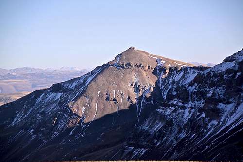
Southern slopes from Continental Divide Trail (also Colorado Trail), Class 1 - just an easy walk up over tundra. There is no established trail, but the walking is easy and not very steep. It is a little hard to find the actual summit. I walked in the fall, so the grass turned yellow, but could imagine that during the summer it is booming with wildflowers. When the mountain starts to flatten up start looking for a small summit cairn with a sign in register. The summit area is huge. Continental Divide Trail and Colorado Trail are passing just below the southern slopes of "Tundra Top".East Ridge from Carson Peak, Class 2 - 2+. The initial descent from Carson Peak is very easy. When you start to reach the saddle, the trail becomes more rocky and for a short section very exposed, loose and narrow ridge. Pay attention to your footing. There is also a short ascending section with some exposure and higher you get, easier it becomes. I spent some time exploring the eastern high plateau wondering whether this is the actual summit, but then continued for another 0.5 miles to the actual summit westward. The views from the summit are excellent.
 The ridge between Carson Peak and "Tundra Top" The ridge between Carson Peak and "Tundra Top" | 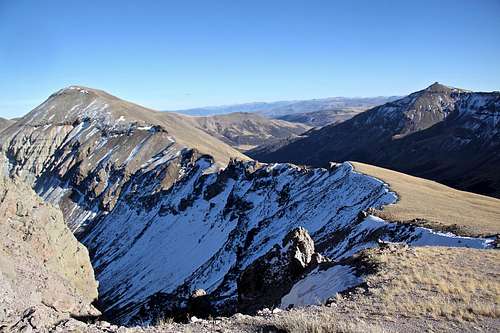 Carson west ridge from Tundra Top slopes Carson west ridge from Tundra Top slopes |
 The ridge between Carson Peak and "Tundra Top" The ridge between Carson Peak and "Tundra Top" | 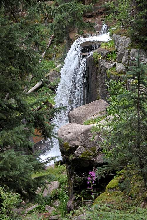 Waterfall along Cataract Gulch Trail Waterfall along Cataract Gulch Trail |
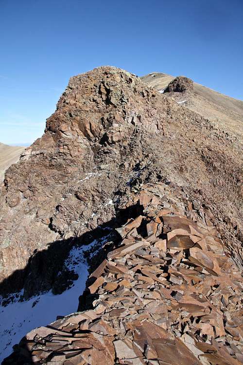
 CDT and Colorado Trail below the Carson - Tundra Top Ridge CDT and Colorado Trail below the Carson - Tundra Top Ridge | 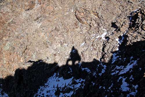 Shadow on the rocks - ridge between Carson and Tundra Top Shadow on the rocks - ridge between Carson and Tundra Top |
 Bent and Carson from Tundra Top Bent and Carson from Tundra Top |  Tundra Top summit Tundra Top summit |
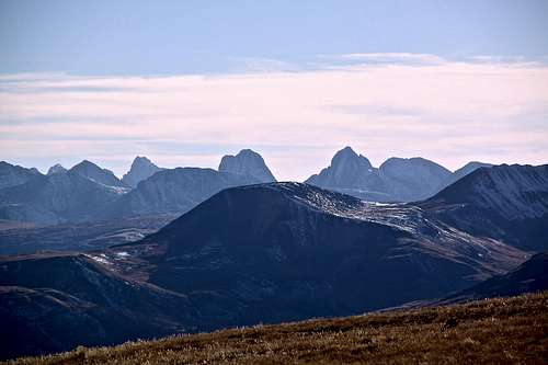 A view into Grenadiers A view into Grenadiers | 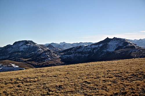 Pole Creek and NW Pole Pole Creek and NW Pole |
 UN 13581 UN 13581 | 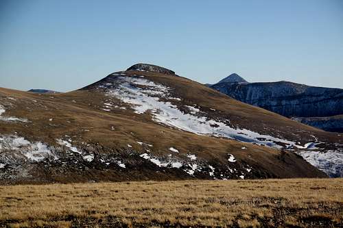 UN 13580 B UN 13580 B |
Red Tape
Driving to trailhead, parking and hiking are free. The peak is not a part of wilderness area. It is located in the Gunnison National Forest.When to Climb
Summer is obviously the easiest, but autumn and spring are excellent as well. Winter would add a longer access, and some avalanche exposure. (The road up Wager Gulch is a little bit over 5 miles long and is closed in the winter).
The trailhead to Cataract Gulch is open year round. I have snow shoed a part of the trail in the winter.
Camping
Primitive camping along Wager Gulch road - higher up. The lower part of the road goes through some private property and the road is too narrow and steep to stop and find a parking spot.
Forest Service Campgrounds:
- Lake Cristobal: Wupperman campground, on the east side of Lake San Cristobal, 15$ per night, vault toilets, grills, picnic tables. Reservations possible.
- Williams Creek: no reservations. First Come, First Serve basis. 14$ per night. There is drinkable water. 23 campsites.
- Mill Creek Campground: 7$ per night, BLM campground, 22 sites.
I don't stay in campgrounds since there are so many options for primitive camping in a high country.