


-
 3172 Hits
-
 79.78% Score
-
 11 Votes
|
|
Area/Range |
|---|---|
|
|
45.85870°N / 7.19714°E |
|
|
Hiking, Mountaineering |
|
|
Spring, Summer, Fall, Winter |
|
|
9731 ft / 2966 m |
|
|
Note
La montagna chiama i suoi figli, ed essi rispondono fedelmente al suo appello… Osvaldo Cardellina, Diario alpinistico, 1964-65 Page texts: @ OsvaldoCardellina "Osva", passed away on May 2, 2022. Page owners: Christian Cardellina e Osvaldo Cardellina. Any updates from September 12, 2022: Antonio Giani, page administrator, friend and climbing companion. Testi della pagina: @ OsvaldoCardellina "Osva", scomparso il 2 maggio 2022. Proprietari pagina: Christian Cardellina e Osvaldo Cardellina. Eventuali aggiornamenti dal 12 settembre 2022: Antonio Giani, amministratore della pagina, amico e compagno di salite. |
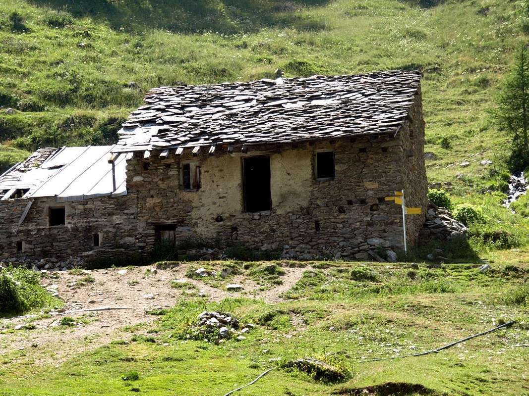
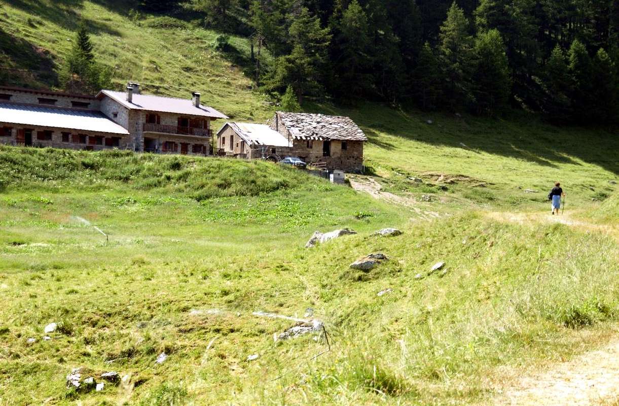
Barracks Overview Barasson
Pictures in page are by Emilio Bertona also emilius, Antonio Giani aka Antonio & Osvaldo Cardellina or Osw
Perpendicular to the Valley of Great Saint Bernard constitutes a her Eastern branch. Starting North from the border with Switzerland and to Artanavaz Torrent.
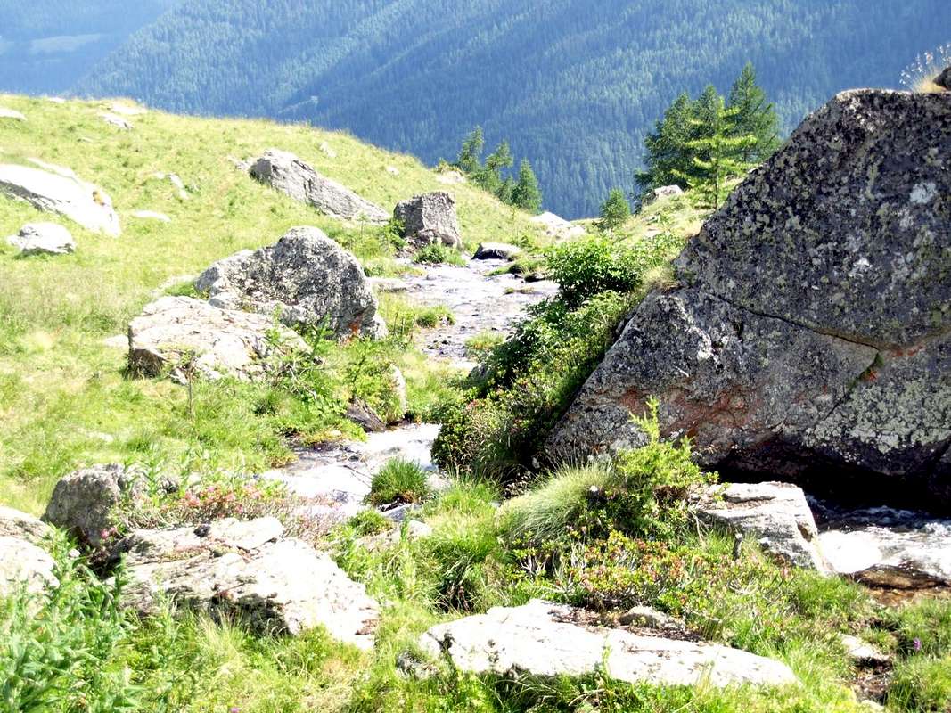
This last is also known as Buthier de Bosses, with the name that distinguishes many Butier or Torrents of Valle del Gran San Bernardo, in the adjoining Ollomont and the most Eastern of Valpelline. But, between the median part of the San Bernardo (to the West) and the Menouve Valley or Měnový, East and above the Village of Etroubles, he descends with his namesake and small creek or torrent that reaches the Artanavaz right above the Municipality of St. Oyen (1.373m). On the opposite side, ie to Switzerland down the Combe de Barasson reaching Plan des Dames at Tronchet with its pond (2.423m). Even the Western watershed has the name of Côte de Barasson, which reaches to the North the Tête de Barasson (2.730m), between the two Hills of Barasson Eastern Western. In the maximum Nordest vertex is situated the Punta Barasson (2.962/3m), point of union between three distinct valleys (Barasson, Combe de Barasson and Menouve Valley), as well as is the highest elevation of this small area. The Valley of Barasson down towards South-southeast, reaching first the homonymous alp (1.868m) and then proceed, passing between small Villages of Lessana or Essanaz (to the East) and Morguinaz, above the Municipality of St. Oyen. This in turn is placed between the two adjacent Etroubles, to the entrance to the Val di Menouve, and St. Rhémy en Bosses at the beginning of the real Gran San Bernardo Valley. Beyond the Rio Artanavaz or Buthier de Bosses and open to the South in front of the Valleys of Ars or Arsy (East) Flassin. At the base of the Valley of Barasson, bypassing Puitz Plan (2.127m) and coming from the Great St. Bernard Pass, passes the old Napoleonic Road, traveled in May 1800.
Vallata laterale e perpendicolare a quella del Gran San Bernardo costituisce ramo a se stante. Da Settentrione dal confine con la Svizzera e verso l'Artanavaz.
Quest'ultimo é anche conosciuto come Buthier de Bosses, con il toponimo che contraddistingue molti Butier o Torrenti della Valle del Gran San Bernardo, dell'attigua di Ollomont e di quella più Orientale della Valpelline. Ma, compreso tra la parte mediana del San Bernardo (ad Ovest) ed il Vallone di Menouve o Menovy, ad Oriente e sopra l'abitato di Etroubles, scende con un suo omonimo e piccolo torrente che raggiunge l'Artanavaz proprio sopra il Comune di St.Oyen (1.373 m). Sul versante opposto, cioé verso la Svizzera scende la Combe de Barasson che raggiunge Plan des Dames presso le Tronchet con il suo laghetto (2.423 m). Anche lo spartiacque Occidentale possiede il nome di Côte de Barasson, che raggiunge a Nord la Tête de Barasson (2.730 m), posta a cavallo dei due Colli di Barasson Orientale ed Occidentale. Nel vertice massimo di Nodest é situata la Punta di Barasson (2.962/3 m), punto di unione tra tre distinte vallate (Barasson, Combe de Barasson e Vallone di Menouve), nonché massima elevazione di tutto questo piccolo comprensorio. Il Vallone di Barasson scende verso Sud-sudest raggiungendo dapprima l'alpe omonima 1.868 m) per poi procedere, passando tra i Villaggetti di Lessana od Essanaz (ad Est) e Morguinaz, verso il Comune di St. Oyen. Questo a sua volta é collocato tra i due adiacenti d'Etroubles, all'ingresso della Val Menouve, e di St. Rhémy en Bosses all'inizio della vera e propria del San Bernardo. Al di là del Rio Artanavaz o Buthier de Bosses e verso Sud si aprono frontalmente le Vallate di Ars o Arsy (Est) e Flassin. Alla base del Barasson, scavalcando Plan Puitz (2.127 m) ed arrivando dal Colle del Gran San Bernardo, passa la vecchia Strada Napoleonica percorsa nel Maggio del 1800.
Getting There towards Saint Oyen
BY CAR:
- From TORINO, MILANO, etc: Motorway A5. Exit at IVREA or Quincinetto (PIEDMONT) From IVREA Town: before in West to Aosta, after in Northwest to Gignod, Etroubles, Saint-Oyen, Saint Rhémy en Bosses Municipalities. From Courmayeur Resort: before in East to Aosta, after in Northwest to Gignod, Etroubles, Saint-Oyen, Saint Rhémy en Bosses municipalities.
- From FRANCE: through the Mont Blanc Tunnel to Entrèves-crossroads to Vény/Ferret Valleys - Mountain Guides of Courmayeur - La Saxe Rock Gym - Courmayeur. By Little Saint Bernard Pass, closed since November until half May to La Thuile Valley - Pré Saint Didier - Courmayeur. It is not necessary to take Motorway A5: you can drive on SS.26, in the direction of AOSTA - IVREA - TURIN.
BY PLANE:
- Aeroporto "Corrado Gex" Saint Christophe (Aosta).
 |
 |
 |
Specific Road
From Aosta Town towards the subsequent Variney Fraction (785m) immediately before the Gignod Common (988m) with Great Saint Bernard SS.27; leaving right (North) the alternative towards Allain Commune (1.251m); from this reach before Etroubles Commune (1.280m) and just after Saint-Oyen Commune (1.377m). Continue West up to the entrance of Great St. Bernard Tunnel; abandoning left the same go up in North reaching Saint Rhémy en Bosses Municipality (1632m) now into the upper part of Grand Saint Bernard Valley.
Route towards & from the Barasson Valley
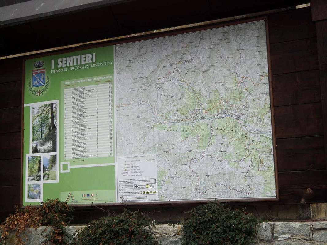
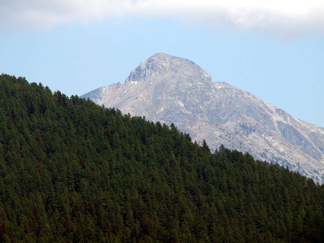
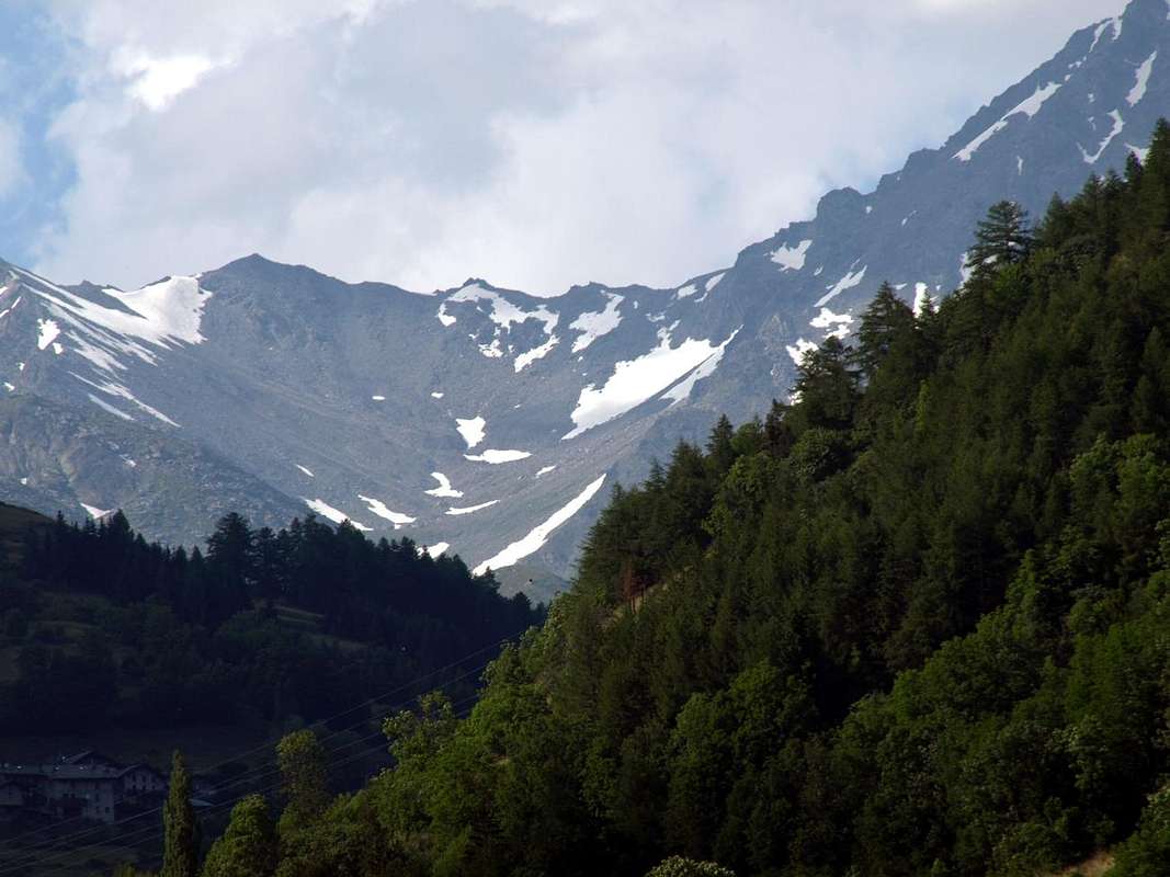
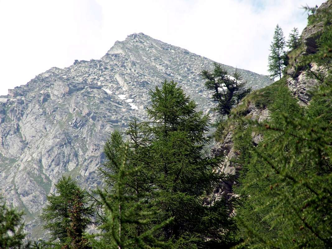
The Valley of Barasson presents beautiful Day Trips Ski-Mountaineering through several departures, while starting from the isolated Eternon Village (1.645m) you can explore itineraries suitable for Snowshoeing also with links to the nearby Val Menouve above Etroubles Commune. Classic two trips to Mount Paglietta (2.320m) to the North, or in Northwest to the Plan Puitz (2.127m) passing first for the Alp or Barasson Mountain (1.868m). Beautiful views to the South towards the Monte Emilius (3.559m) and its complete group and to the Grande Rochère (3.326m) in Southwest, while frontally is raised imposing Mount Fallère (3.061m), dominant all over his small subset. Many excursions can be made at an early start to the season, being well exposed to Southern Slopes; but for the same reason accurately control the state of transformation of the snows. In the case of danger to settle for medium altitudes (2.000/2.200 meters), or beautiful walks to base with secure farm dirt roads inside the Forests Bois de Rovine, Boiu su Grand Plan and more to the West to the Bois de Plantaluc, Bois Coupé, Bois des Teppes, just below the hump back rounded off Plan Puitz (Napoleonic Route 1800). As for the Mountain Climbing, but it would be more accurate to call for Mountaineers Hiking Experts (EEA), the only two ascents concern the Head and Tip Barasson (2.730m, 2.962/3m), usually reaching the same by crossing. Even from the Western Hill of Barasson (2.635m), now between the Vallons des Morts in Switzerland and the average Valley of Gran San Bernardo. Or along, in the West, the nearby Côte de Barasson (2.351m, 2.381m, 2.601m) from Lessana or Essanaz Village (1.820m) via the Mountain of Barasson.
![]()
![]()

Il Vallone di Barasson presenta belle Escursioni e gite di Sci-Alpinismo tramite varie partenze, mentre partendo dal Villaggio di Eternon (1.645 m) si possono percorrere itinerari adatti alle Racchette da Neve anche con collegamenti alla vicina Val Menouve sopra Etroubles. Classiche le due gite al Monte Paglietta (2.320 m) verso Settentrione, oppure a Plan Puitz (2.127 m) transitando dapprima per l'Alpe o Montagna di Barasson (1.868 m). Splendidi panorami verso Meridione dall'Emilius (3.559 m) alla Grande Rochère (3.326 m), mentre frontalmente s'innalza imponente il Monte Fallère (3.061 m), dominante l'intero suo piccolo sottogruppo. Molte gite possono essere effettuate in precoce inizio di stagione, essendo i versanti ben esposti a Meridione; ma per lo stesso motivo controllare accuratamente lo stato di trasformazione delle nevi. Nel caso di pericolosità accontentarsi di escursioni a media quota (2.000/2.200 metri), oppure di belle passeggiate alla base con strade poderali sicure all'interno delle Foreste Bois de Rovine, Boiu su Grand Plan and more to the West to the Bois de Plantaluc, Bois Coupé, Bois des Teppes, appena sotto del retrostante dosso arrotondato di Plan Puitz. Per quanto riguarda l'Alpinismo, ma sarebbe più esatto chiamarlo Escursionismo per Alpinisti Esperti (EEA), le due uniche ascensioni riguardano la Testa e la Punta di Barasson (2.730 m, 2.962/3 m), in genere raggiunte in traversata. Anche partendo dal Colle Occidentale di Barasson (2.635 m), ormai tra il Vallons des Morts in Svizzera e la Valle media del Gran San Bernardo. O percorrendo ad Occidente la vicina Côte de Barasson (2.351 m, 2.381 m, 2.601 m) partendo da Essanaz (1.820 m) passando dalla Montagna di Barasson.

Campings
Remember that free camping is forbidden (except for emergency reasons, over 2.500m, from darkness until dawn).
Mountain Conditions
- You can get meteo information at the official site of the Regione Valle d'Aosta:
- Valle d'Aosta Meteo
Books and Maps
BOOKS:
- "Guida delle Alpi Occidentali", di Giovanni Bobba e Luigi Vaccarone C.A.I. Sezione di Torino Volume II (parte II), 25 Maggio 1896.
- "Guida dei Monti d'Italia-Alpi Pennine" (Vol. I°) di Gino Buscaini-Club Alpino Italiano/Turing Club Italiano, Luglio 1971 (in Italian).
 |
 |
MAPS:
- Kompass "Monte Bianco Valle d'Aosta Sentieri e Rifugi" Carta turistica 1:50.000.
- L'Escursionista "Gran San Bernardo Ollomont" Ed. Rimini (n°5) 1: 25.000.
Important Information
 |
 |
 |
 |
- REGIONE AUTONOMA VALLE D'AOSTA the official site.
- FONDAZIONE MONTAGNA SICURA Villa Cameron, località Villard de la Palud n° 1 Courmayeur (AO) Tel: 39 0165 897602 - Fax: 39 0165 897647.
- SOCIETA' DELLE GUIDE DELLA VALPELLINE Etroubles-Strada Nazionale, n° 13 - Tel +39 0165 78559 - Valpelline-Loc Capoluogo, n° 1 - Tel +39 0165 713502 (AO) Italia.
- A.I.NE.VA. (Associazione Interregionale Neve e Valanghe).
Useful numbers
- Protezione Civile Valdostana località Aeroporto n° 7/A Saint Christophe (Ao) Tel. 0165-238222.
- Bollettino Meteo (weather info) Tel. 0165-44113.
- Unità Operativa di Soccorso Sanitario Tel. 118.