![]()
Over there he rose the great Mountain of Iseran and there, but a lot more distant, the Provence of the Gaul. There were many other small Iseran with different names which usually bore the name of the owner who owned pastures at the base, as Becca Montandayné, ie the Mountain Dayné. Or marked a passage as les Laures, Fénis, Pontonnet Fenêtre de Champorcher and other possessions with a name Piedmont as Moncorvé, Ciarforòn, Monciair, Broglio and Gay.
The Gran Paradiso did not exist. They invented in '800.
But Coing, the ancient Roman "Conia", was a perfect angle from which divided all the vallons of this great valley that descends with the Grand'Eyvia towards Baltea and Central Aosta Valley. But parallel and not perpendicular. From birth the
"Cogneins" required due respect and did not accept any subjection. With
"Ciamporcieri" there was always a certain rivalry; as with
"Valsaverains" with whom they competed to win
The Grivola, the only virgin left in the Valley of Aosta. But they were okay with the
"bad Piemùnteis cousins" with whom exchanged goods, carried the ore down to Eporedia, maybe even marrying these women.
Bypassing the Passes of Acque Rosse, the Arietta and Bocchetta of Rancio.
![]()
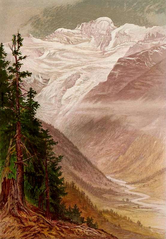
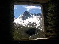
Iseran or Great Heaven even Gran Paradiso in Cogne Valley,
by by Elijah Walton - 1868 & submitted by om 2015
Là in fondo si alzava la grande Montagna dell'Iseran e laggiù, ma molto più oltre, la Barbara Provincia delle Gallie.
C'eran tanti altri piccoli Iseran con diversi nomi in genere assumenti il nome del proprietario che possedeva i pascoli alla base, come la Becca di Montandayné, cioé la Montagna di Dayné. Oppure segnavano un passaggio come Les Laures, Fénis, Pontonnet Fenêtre de Champorcher ed altre che possedevano nome piemontese come Moncorvé, Ciarforòn, Monciair, Broglio e Gay.
Il Gran Paradiso non esisteva. L'hanno inventato nell'800. Ma
Coing, l'antica romana "Conia", era perfetto angolo dal quale s'aprivano tutti i valloni della grande vallata discendente alla Dora Baltea. Ma parallela e non perpendicolare. Già dalla nascita i
"Cogneins" richiedevano dovuto rispetto e non accettavan nessuna sudditanza. Con i confinanti ad Est
Ciamporcieri c'era stata sempre una certa rivalità; come con i
Valsaverains con i quali avevano gareggiato per conquistare
la Grivola, l'unica Vergine che par sia rimasta in Val d'Aosta. Andavan più o men daccordo coi
"cuginastri Piemùnteis" scambiandone le merci e portando il minerale giù ad Eporedia e, magari, anche prendendo lor donne moglie.
Scavalcando i Colli d'Acque Rosse, dell'Arietta e la Bocchetta del Rancio.
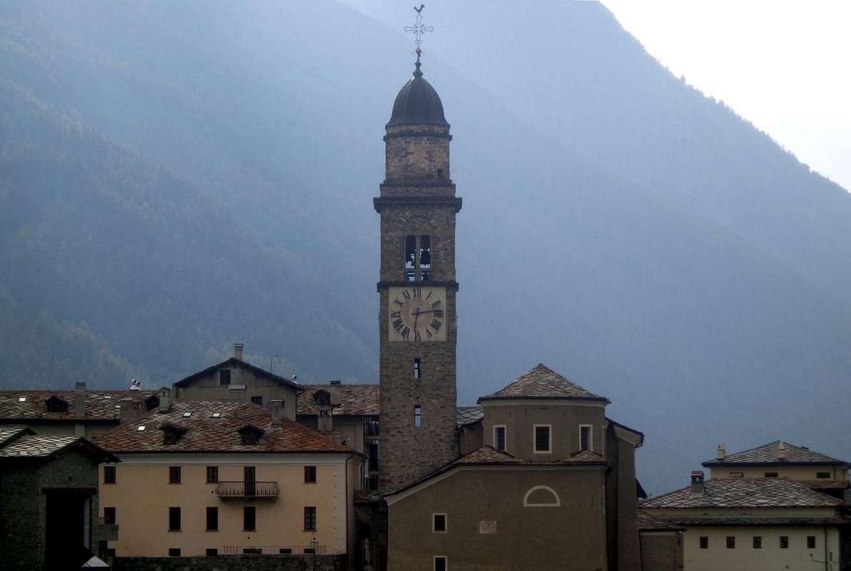
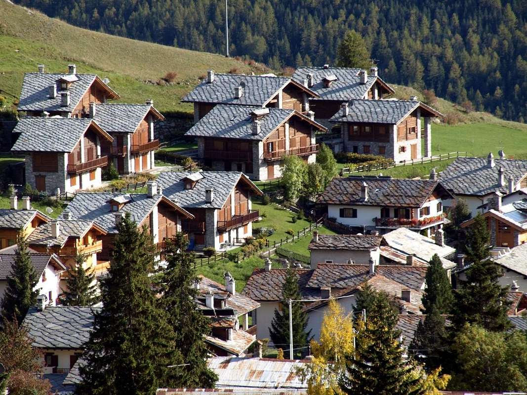
Commemorative Plaque Artistic Sculptures and Windows above Cogne & Surroundings,
by sarme, sergioenrico, ronfo, OliettiPaolo & Osw since April 2005
Over there he rose the great Mountain of Iseran or Mountain above the Valley of Isère Stream and there, but a lot more distant, the Region of Barbarian Gauls.
Where today it is instead Cogne-Resort with all its valleys that flow at the foot of what has become the Gran Paradiso for Big Sky, becoming a Great Heaven, covers its great glaciers. A place that, apparently as small and secluded, instead seems to have no boundaries expanding laterally towards four cardinal points and
rising over 4000 metres.
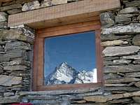
We do to the window and with the Lens of Time are in a
360 ° Tersiva, Torre Lavina, Grande Arolla, Sengie, Valeille, Ondezana, San Pietro, Roccia Viva, Gay, Tribolazione, Ceresole, Roc & Granpa, Herbetet, Grand Sertz Peaks, Grivola and Grand Nomenon. Here instead and just above Cogne rise, starting from
Punta Rossa, the combination of
Mount Herban Mont-de-l'Ouille and at the bottom, the true symbol of Cogne, the pyramid of
Pointe Pousset, which is thrown sharp against the sky. If you go to Lillaz, over there you're receiving the bulk mass of Mont Blanc, which seems to close the Western Horizon. As if the world had its term, while towards the North lie the
"revival" of Graians.
Là in fondo s'alzava la grande Montagna d'Iseran o Montagna della Valle dell'Isère e laggiù, ma molto oltre i confini della Civiltà, la Regione dei Barbari Galli.
Dove oggi invece sorge Cogne con tutte le sue valli che scorrono ai piedi di quello che é diventato il Gran Paradiso per il Grande Cielo che ricopre i suoi grandi Ghiacciai. Un posto che, per quanto ristretto ed appartato, sembra non avere confini espandendosi lateralmente verso tutti e quattro punti cardinali ed innalzandosi
fino a superare i 4000 metri.
Affacciandoci alla finestra e con la Lente del Tempo troviamo in un giro di 360°
Tersiva, Torre di Lavina, Grande Arolla, Sengie, Valeille, Ondezana, San Pietro, Roccia Viva, Gay, Tribolazione, Ceresole, Roc & Granpa, Hebetet, Grand Sertz, Grivola e Grand Nomenon. Di qua invece e proprio sopra Cogne si innalzano, partendo dalla
Punta Rossa, il binomio del
Monti Herban e l'Ouille ed in fondo, vero emblema di Cogne, la piramide del
Pousset, che si slancia appuntita contro il cielo. Se vai a Lillaz, là in fondo ti appare la gran massa del Monte Bianco, che par chiudere l'Orizzonte Occidentale. Come se davvero qui il Mondo avesse suo termine, mentre a Settentrione s'estendon i
"rigurgiti" delle Alpi Graie.
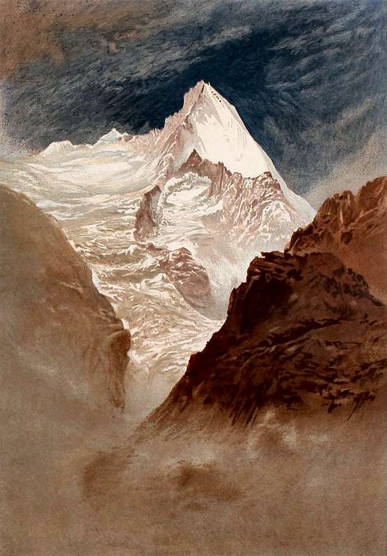
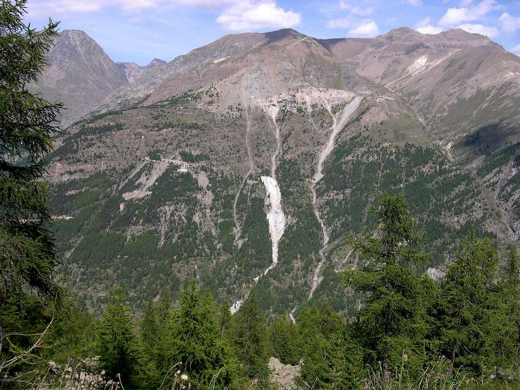
![]() The Grivola above Traso or Trayo even Trajo Glacier,
The Grivola above Traso or Trayo even Trajo Glacier,
by Elijah Walton - 1868 & submitted by om 2015
Getting There
By car:
- From TORINO, MILANO, etc: Motorway A5. Exit at IVREA or Quincinetto (PIEDMONT) also Pont Saint Martin, Verrès, Châtillon, AOSTA East (Nus) and West (Aymavilles) Municipalities (AOSTA Valley).
From IVREA Town towards Pont St. Martin, Donnas, Bard, Verrès, St. Vincent, Châtillon, Nus, Quart, St. Christophe, Aosta, Sarre, Aymavilles and Cogne Municipalities.
![]()
From Aymavilles to Cogne Valley
From Aymavilles (646m) towards Cogne Valley with Regional Main Road: Vieyes (1132/58m) Fraction, Mario Gontier private Shelter, through small path in Nomenon Vallon. Continue to Sylvenoire (1331m), Laval's Bridge (1364m) before Epinel Crétaz Hamlets (1434m, 1494m), Cogne (1534m) Resort, through Main Road.
To Valnontey (1678m), through Municipal Road: to Money, Alessandro Martinotti, Stefano Borghi, Carlo Pol, Marcello Gerard and Ettore Grappein, Lionello and Lucio Leonessa, Mario Balzola, Luciano Gratton (this last from Epinel or Crétaz) Bivouacs, through paths, moraines and glacier, and Vittorio Sella Refuge, through muletrack). From Lillaz Fraction (1607m) to Sogno di Berdzé, Denis Gérard and Guido Antoldi and Laura Malvezzi Refuges, by dirt road, muletrack or paths in Urtier and Valeille Vallon. To Gimillan Village (1785m), Franco Nebbia Bivouac, with path in Upper Arpisson Vallon. All the three last through Regional Roads from Cogne.
![]()
It is not necessary to take Motorway A5: you can drive on State Road n° 26, in the direction of AOSTA - IVREA - TURIN.
By plane:
- Aeroporto Internazionale "Corrado Gex" Saint Christophe (Aosta)
Walking Excursions & Climbs to 360 ° from East to West
![]()
Punta Loie towards homonym Lake & Cogne Valley,
by OliettiPaolo November 2008
Over there rises the great Mountain of the Gran Paradiso or "Granpa" and not more Iseran and nor even Great Heaven. Anyone can watch him, but not everyone can go up also because on this side the wide, expanded and great
Tribulation Glacier is a real bulwark. A bad very bad
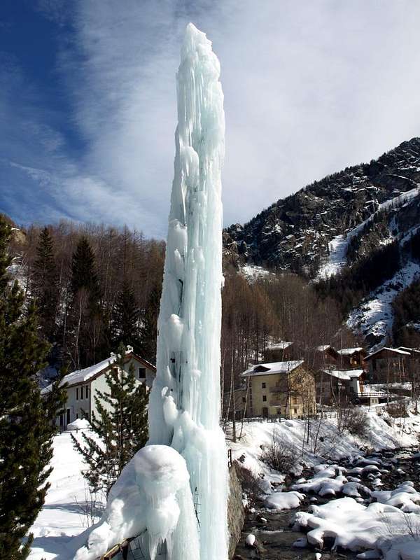
Ogre ugly that swallows its prey. We are content to "fly" lower. Besides this valley it offers everything: from riding to the Waterfalls of Pila, Tsavanis, Lillaz and Nomenon up to visits to Monuments, Lakes, Ponds or towards the Magnetite (Loadstone) Mines of "Larsinaz, Costa del Pino, Colonna and Liconi". Or from large Climbs
"classic" to the traditional Ascents, to easy Hikes as well, to remain so in fashion, to Climbing on ice falls, so today in
"vogue". Also beautiful Walks-Excursions by Snowshoes. If not go to look for the gold into Vallon of Chaz Fleurie, where Legend tells that existed into moraines at the foot Tour Grauson. Full tour of 360° that allows to know the whole Cogne Valley. We give you only a few small suggestions in this regard.
The remainder go to discover you ...
![]()
"Larsinaz, Costa del Pino, Colonna & Liconi" Veins,
by livioz August 2004
Là in fondo s'alza la grande Montagna del Gran Paradiso o "Granpa". Tutti possono guardarlo, ma non tutti possono salirlo anche perché da questo lato il
Ghiacciaio della Tribolazione é un baluardo estremo. Un brutto
Orco cattivissimo che inghiotte le sue prede. Accontentiamoci di
"volare" più in basso. Daltronde questa valle offre proprio di tutto: dalle Passeggiate alle Cascate di Pila, Tsavanis, Lillaz e Nomenon fino alle Visite a Monumenti, Laghi, Laghetti od alle Miniere di "Larsinaz, Costa del Pino, Colonna e Liconi". Oppure dalle grandi Ascensioni
"classiche" fino alle tradizionali, alle facili Escursioni ed anche, per restare in moda, alle Arrampicate sulle Cascate di ghiaccio, oggigiorno così in
"vogue". Inoltre delle belle Passeggiate-Escursioni con le Racchette da neve. Altrimenti andate a cercar l'oro nel Vallone di Chaz Fleurie, dove Leggenda racconta ch'esistesse ai piedi della Tour Grauson. Completo giro a 360° permettente di conoscere l'intera Val di Cogne. Diamo, ad esempio, sol qualche piccolo suggerimento al proposito.
Il restante andate a scoprirvelo ...
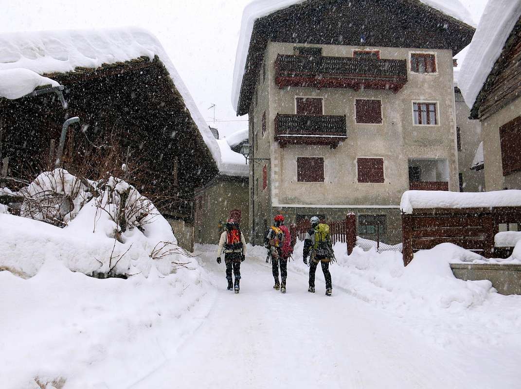
![]()
"A classic Ice Climbers" towards Lillaz icy Waterfalls,
by Silvia February 2014
Let's take a ride around Cogne looking at where you can go. By making a 360 ° rotation we try to visit a little of everything, starting from the East or the wide Vallon Urtier to go toward the south to Punta del Pousset. We expect a number of Excursions, also feasible with Snowshoeing, as well as a traditional Climb to the rocky pyramid of Pousset, above the vallon with same name and that of Vallon Traso or Trayo, and from which it dominates the entire valley and Cogne the view covers much of the its valleys.
We can, starting from
Lillaz, traced the first reaching the Champorcher Fenêtre (Window) that communicates with the Valley of Champorcher; or, if with Snowshoes, be content to get to the
Rifugio "Sogno di Berdzé" (Dream of Shepherd), immediately below the same. Otherwise, always with the same route but turning first toward the South, reach the Alpe Broillà or Broillot; this a path we leads to the beautiful
Lakes of Miserino, placed between Punta namesake and Hill and
Punta Nera. From this last it dominates Cogne with a wooden and colorful rooster that serves as a compass
"pecking" the same, while to the north the view rests on the Punta Tersiva and Peak Garin. After greeting the Ice Climbers that going to the icy
Falls of Valeille and changing area is back to
Cogne go up by car to Valnontey (once the true Mountaineers went on foot or at most by the mule). Front stand Roccia Viva, Becca of Gay and
"Granpa" with the great and extended in the midst of terrible seracs
Glacier of the Tribulation. Never mind all these complications and, crossing the Torrent de Valnontey on a beautiful stone bridge, we go to visit the
"Botanic Garden Chanousia" dedicated to the famous
Abbé Pierre Chanoux; past a beautiful waterfall reach Rifugio Vittorio Sella, and from there to the South in a short time a beautiful trail leads us to tiny
Lakes Lauson, amid herds of ibex and chamois
"domesticated" and with great views over the
Apostles Mountain Range. But if we want to walk and sweat a little bit, the
Alta Via n° 2 leads us to
Col Lauson or Lozon, bordering the Valsavarenche. Now we have to go back along the great
Grand Eyvia Torrent until you reach the underlying
Crétaz Epinel Fractions, in the middle valley. From these, respectively, we make a nice, easy Hike to the grassy
Mount Herban and then a
"classic" Climb to rocky
Punta del Pousset, again encountering magnificent but isolated steinbocks and admire the South wall climbing by the daring of Bern rope Hans Dielter and Robert Winterhalter August 18th, 1903, soon imitated by English C.K.F. Carfrae with Courmayeur Guides Antoine and Hans Brocherel, October 15th, 1909 on the Eastern Ridge-Edge. After this nice and historical small picture, which makes us understand that already in past times were good in the art of climbing, we must remember that, while the first is binding from
Crétaz, for the Pousset you can start from both villages with a path then rejoins between the two Dèsott and Damon Pousset Alpages (splendid wooden
"rascards" near the Dessous or Lower Pastures). We abandon the idea of the Vallons of the Traso (from Epinel) and Nomenon (from Villages of
Sylvenoire or Vieyes now already from the
Municipality of Aymavilles) because the former is eternally long and the second, leading to above
Mario Gontier Bivouac and both fascinatingly below the
Grivola, full of vipers.
Although, even if with a certain regret ...
"Sogno di Berzè" Shelter & Fenêtre de Champorcher, Refuge Sella & Lauson Lakes, Miserino's Lochs & Pointe du Pousset
by marco87, emilius, maria grazia s & om since February 2005
Proviamo a fare un giro attorno a Cogne guardando dove si può andare.
Osservando la rotazione a 360° cerchiamo di visitare un pò tutto, partendo da Est o Vallone dell'Urtier per andar a Sud fino alla Punta del Pousset. Ci attendon una serie di Escursioni, fattibili anche con Racchette da neve, nonché una tradizionale Ascensione alla piramide rocciosa del Pousset, sopra al Vallone omonimo ed a quello del Traso o Trayo, e dalla quale si domina tutta la Valle di Cogne, mentre la vista ricopre gran parte dei suoi valloni.
Possiamo, partendo da
Lillaz, risalire il primo raggiungendo la Finestra di Champorcher che comunica con la Valle di Champorcher; oppure, se con Racchette da neve, accontentarci di arrivare al Rifugio
"Sogno di Berdzé", subito al di sotto del medesimo. Altrimenti, sempre con la stessa strada ma girando prima verso Mezzogiorno, raggiungere l'Alpe Broillà o Broillot; da questa un sentierino ci porta agli splendidi
Laghi del Miserino, posti tra l'omonima Punta e Colle e la
Punta Nera. Da quest'ultima si domina Cogne con un galletto in legno e colorato che funge da rosa dei venti
"beccandola", mentre verso Settentrione la vista si posa su Punta Tersiva e Pic Garin. Dopo aver salutato gli Arrampicatori in ghiaccio che vanno verso le
Cascate della Valeille e cambiando zona si torna a
Cogne risalendo con l'auto fino a
Valnontey (una volta i veri Alpinisti andavano a piedi od al massimo con il mulo). Davanti si stagliano Roccia Viva, Becca di Gay ed il
"Granpa" con il grande ed esteso in mezzo a terribili seraccate
Ghiacciaio della Tribolazione. Lasciate stare tutte queste complicazioni ed, attraversato il Torrent de Valnontey su di un bel ponte in pietra, andiamo a visitare il
"Giardino Botanico Chanousia" dedicato al famoso
Abbé Pierre Chanoux; passata una bella cascscata raggiungiamo il
Rifugio Vittorio Sella, Da lì e verso Sud in breve tempo un bel sentiero ci conduce ai
Laghetti del Lauson, in mezzo a branchi di stambecchi e camosci
"addomesticati" e con grande vista sulla
Catena degli Apostoli. Ma, se abbiamo voglia di camminare e faticare un pò, l'
Alta Via n° 2 ci conduce al
Col Lauson o Lozon, al confine con la Valsavarenche. Adesso dobbiamo ritornare indietro insieme alla
Grand'Eyvia sino a raggiungere le sottostanti Frazioni di Crétaz ed
Epinel, nella media valle. Da queste rispettivamente facciamo una bella e facile Escursione al
Monte Herban e poi una
"classica" ascensione alla
Punta del Pousset, anche qui incontrando magnifici ma isolati stambecchi ed ammirando la Parete Sud scalata dagli audaci Bernesi Hans Dielter e Robert Winterhalter il 18 Agosto 1903, subito imitati dallo Inglese C.K.F. Carfrae con le Guide di Courmayeur Antoine ed Hans Brocherel, il 15 Ottobre 1909 sulla Cresta-Spigolo Orientale. Dopo questo simpatico e storico quadretto, che ci fà comprendere che già nei tempi passati erano bravi nell'arte arrampicatoria, dobbiamo però ricordare che, mentre per il primo si deve obbligatoriamente partire da
Crétaz, per il Pousset si può iniziare da entrambi i villaggi con sentiero ricongiungentesi tra le due
Alpi del Pousset (bei
"rascards" in legno presso quello Dessous). Abandoniamo l'idea dei Valloni del Traso (da Epinel) e del Nomenon (da
Sylvenoire o Vyeies ormai già verso
Aymavilles) perché il primo é eternamente lungo ed il secondo, che porta al
Bivacco Mario Gontier ed entrambi fascinosamente sotto la
Grivola, pieno di vipere.
Pur con un certo rimpianto ...
To the West & North then returning to the East
Passing on the other side of the Grand Eyvia and going from Aymavilles until Urtier Torrent are completely different area where glaciers have turned into lakes.
We skip the first part of which dates back from Aymavilles towards Ozein and Turlin Dessus Villages and to Rompérein, Champchenille, Bardoney and La Pierre Alps introducing in the Valley of Cogne. On the inside rough and vertical walls accompany the watershed above the horrid throat of Pondel up towards Vieyes, Epinel and Crétaz until you reach the Village of Gimillan, the dual input towards the Vallons of Arpisson (West) and Grauson. These offer a number of easy, though long, Trips to the West towards
Col Tsa Sètze, Northwest to the
Bivouac Franco Nebbia below to
Hill, Lake Peak Garin, bordering the Valley Arbolle. While, at first directly to the North and then in various directions from
Grauson Vieux Alpages, you can reach a number of lakes. In the North those of
Lussert (four), Northeast
Lakes of the "Rane" (Frogs) and
Corona and to the East the three
Lakes Doreire below the
Pas d'Invergneux or des Hevergnes and at the foot of
Punta Tersiva. Further on, starting from the Villages of
Montròz or Colonna and passing below the
Monte Creya, are both within easy Walkings the
"Strands Larsinaz Costa del Pino" and with longer Excursions those of
"Colonna Liconi Veins", where until the Seventies was extracted from the fine
Magnetite destined in the past before to the
Steelworks Ansaldo then Cogne Aosta. A long farm road to the East takes us off in the
Urtier Vallon up under the
Pas des Hevergnes, also accessible from this side and above the eponymous village-pasture live all year in the distant past.
Before returning permanently to the "Dream of Berzì" ...
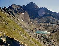
Col Tsa Sètze, Franco Nebbia Bivouac & Garin Hill; Garin, Lussert & Doreire Lakes
by livioz, Gino Bolfo, Antonio & Osw since October 1994
Passando all'altra sponda della Grand'Eyvia e risalendo da Aymavilles fino all'Urtier troviamo un'area completamente diversa dove i ghiacciai son diventati laghi.
Tralasciamo la prima parte che da Aymavilles risale ai Villaggi di Ozein e Turlin Dessus ed alle Alpi di Rompérein, Champchenille, Bardoney e La Pierre introducendo nella Valle di Cogne. Sul lato interno aspre e verticali pareti accompagnano lo spartiacque che da sopra l'orrida gola di
Pondel risale verso Vieyes, Epinel e Crétaz fino a raggiungere il Villaggio di
Gimillan, al duplice ingresso verso i Valloni di Arpisson e del Grauson. Questi offrono una serie di facili, anche se lunghe, Gite ad Ovest verso il
Col Tsa Sètze, a Nordovest verso il
Bivacco Franco Nebbia sottostante al
Colle, Lago e Punta Garin, al confine con il Vallone di Arbolle; mentre, dapprima direttamente verso Settentrione e poi in varie direzioni a partire dall'
Alpe Grauson Vieux, si possono raggiungere tutta una serie di laghi: a Nord quelli di
Lussert, a Nordest i
Laghi "delle Rane" e Corona ed ad Est i Laghi
Doreire sotto al
Pas d'Invergneux o des Hevergnes nonché ai piedi della
Punta Tersiva. Più in là, partendo dai villaggi di
Montròz o Colonna e passando al di sotto del
Monte Creya, si raggiungono con facili Passeggiate i
"Filoni Larsinaz e Costa del Pino" e con più lunghe Escursioni le Vene di quelli di
"Colonna e Liconi", dove fino agli Anni Settanta veniva estratta la pregiata
Magnetite destinata nel passato verso le
Acciaierie Ansaldo e poi Cogne d'Aosta. Una lunga poderale verso Oriente ci riporta nel largo
Vallone d'Urtier sin sotto il
Pas des Hevergnes, raggiungibile anche da questo opposto lato e sopra l'omonima alpe-villaggio abitato per tutto l'anno nei tempi più remoti.
Prima di tornar definitivamente al "Sogno di Berzì" ...
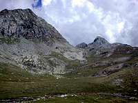
Cogne with St. Ours Meadow, Grivola & Pousset, Roccia Viva & Gay, Tribolazione and Lavina/Tsesère/Arolla from Gimillan
by Osw since February 2016