-
 37934 Hits
-
 92.59% Score
-
 39 Votes
|
|
Mountain/Rock |
|---|---|
|
|
38.37773°N / 110.3381°W |
|
|
Hiking, Bouldering, Scrambling, Canyoneering |
|
|
Spring, Summer, Fall, Winter |
|
|
5500 ft / 1676 m |
|
|
Overview
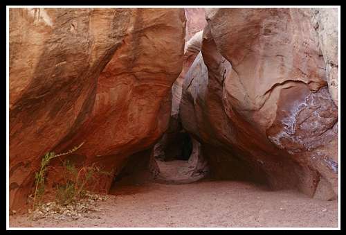
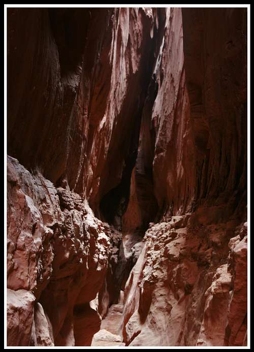
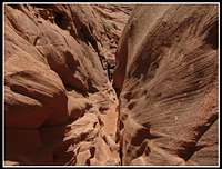 Working through Shenanigans Canyon
 Leprechaun Canyon
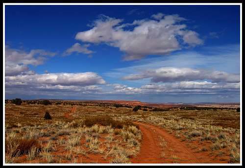
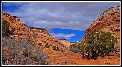
 Open desert from Hans Flat road
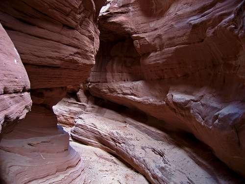
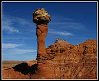 Little Egypt Geologic Area
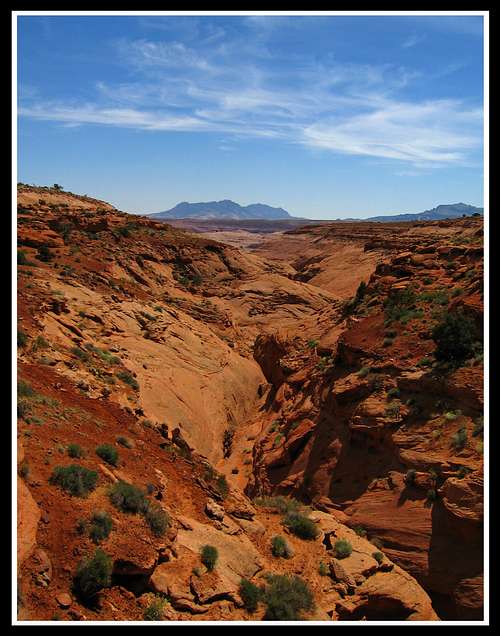
The Robbers Roost Country is a large area at about 70 miles long in the north-south direction and 40 miles long in the east-west direction. It lies at the very heart of Utah’s canyon country bounded by the Henry Mountains to the south and southwest, Canyonlands National Park and Glen Canyon National Recreation area to the east, the Green River to the northeast, Interstate 70 to the north and the San Rafael Swell to the northwest. This area is also known as the San Rafael Desert as much of the landscape is a wide open rolling expanse of sandy desert with small brush like sage and juniper growing as far as the eye can see. Hidden in this expansive desert however are some of the best technical and non-technical slot canyons in the country. You will probably not notice these canyons though if you drive down the Hans Flat road towards the Maze district of Canyonlands National Park. This road keeps you high on the flats as it weaves around all the slots and eventually gets to the Hans Flat Ranger Station which marks the transition from the San Rafael Desert to the Orange Cliffs unit of the Glen Canyon National Recreation area. Many old spur roads travel in all directions taking you closer to these slot canyons.
Robbers Roost Country can be divided up into four major drainage areas. The first of these areas is the North Wash slot canyons that drain into North Wash in the southern end of the area. This also includes the Trachyte Creek slot canyons which extend further south and are accessed via Highway 276. Highway 95 is the main access route for the area and heads south from Hanksville towards Lake Powell and follows North Wash in what is known as Long Canyon for many miles before making its last descent to Hite and Lake Powell. This group of canyons is mainly oriented northeast-southwest and drain into North Wash that flows from the northwest to the southeast. A few of the more famous canyons in this section include:
2. Blarney Canyon, Death Canyon and Sandthrax
3. Butler and West Butler Canyons which includes Shenanigans, Monkey Business, Fooling Around and No Kidding
4. Stair Canyon
5. Hog Canyon and upper forks
The second section is the Dirty Devil slot canyons. These canyons are located north of the North Wash Canyons and mainly drain from the northeast to the southwest into the Dirty Devil River. A few other canyons drain from the southwest although most of the canyons here drain into the Dirty Devil from the northeast. A few of the more famous canyons in this section include (from north to south):
1. Buck Canyon
2. Pasture Canyon
3. Robbers Roost Canyon
4. No Mans Canyon
5. Larry Canyon
The third section is the High Spur slot canyons located east of the Dirty Devil slots and drain from south to north into the Green River. Canyonlands National Park has an external unit that encompasses Horseshoe Canyon as there are some of the best pictograph displays in the world on the canyon walls of Horseshoe. All of the High Spur slot canyons drain into Horseshoe Canyon which then drains into the Green River. Some of the more famous canyons in this section include:
1. High Spur and upper forks
2. Spur Fork Canyon and upper forks
  |
The forth includes all the outlaying canyons, overlooks, hills and arches in the San Rafael Desert. Some of these attractions are Three Canyon, Moonshine Wash, Crumble Canyon, Arsenic Arch, Bowknot Bend, the Flat Tops, Chaffin Ranch Geyser, the Little Egypt Geologic Area and many more. There are enough slots in the Robbers Roost Country to spend a lifetime so start exploring now!
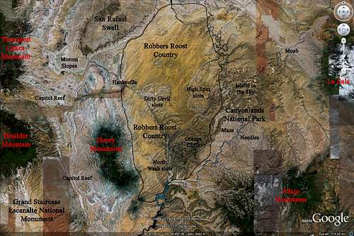 GE image showing Robbers Roost
Geology
There are two principal rock units that are seen everywhere in the San Rafael desert. The Carmel formation is a more resistant rock layer averaging maybe only 30 feet thick but is seen at the surface in most of the San Rafael desert. This layer has a deep red color and is the rock layer driven on when one drives the Hans Flat Road. This layer supports decent vegetation ranging from sagebrush to juniper trees and is the only rock layer seen when away from the slot canyons. Cross country hiking is very easy on this rock layer. As you hike closer to the canyons, the lighter colored Navajo sandstone, a rock layer representing a time when this area was once a vast open desert similar to today’s Sahara, comes into view and sits below the Carmel formation. The Navajo sandstone averages 1000 feet thick. Every slot canyon in this entire area has Navajo narrows with Carmel rims. Many times as one descends into a slot canyon, there is a large dry fall that often needs to be repelled at the transition from the Carmel into the Navajo. This is because the Navajo sandstone erodes much quicker. Many technical slot canyons in Utah are only technical because of one rappel at the transition of the two layers. Once you get into the Navajo narrows in many canyons, travel is usually much easier. See the Utah strat column below.
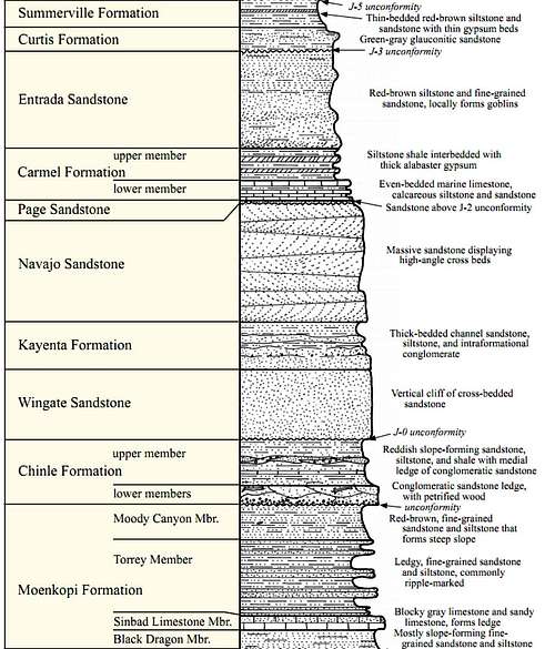 Strat column showing the rock units in southern Utah
History
This area has a lot of history and it got the name Robbers Roost Country for a reason. Many people may recall the old west outlaw named Butch Cassidy. Throughout the 1880’s and 1890’s he and his followers forming a group known as the Wild Bunch were responsible for many hold-ups in many areas throughout Utah, Rock Springs Wyoming, Telluride Colorado and southeastern Idaho. This bunch allegedly stole gold and money from wealthier people and businesses to give to the “small men” or self sufficient ranchers that had hard times sustaining themselves and their families. It is this lifestyle Butch Cassidy grew up in. In his many runs against the law it was fairly easy to avoid getting caught as the west was so remote and unsettled and all the small ranchers were helping the Wild Bunch stay hidden. This bunch hid in two major places one of which was Browns Park in northeastern Utah and northwestern Colorado. This was a great place as it was in a central area at the junction of three states and two major rivers and very remote. The other was the area known today as Robbers Roost Country. The abundance of slot canyons and the remoteness was a perfect place for hiding grounds. In the early 1900’s a uranium mining boom started throughout Utah and many old drill sites are seen throughout Utah including the Robbers Roost area. This boom didn’t last long as it was quickly seen that extracting the uranium that was found all over the state wasn’t profitable.
Advice from the author
This area is very complex and nearly every canyon in Robbers Roost Country is technical and requires rappelling knowledge and gear to descend. This area is not for beginners. Everything is cross country and navigation skills are absolutely required to attempt these canyons. Knowing where you started (and how you got there), where you are going, what gear you need and how you are getting back (escape route, old road etc.) is essential for exploring this area. Maps showing the possible driveable roads and starting points as well as where the canyons are and escape routes are very important to have. A GPS will also work wonders in the Utah desert.
This page is not to be used for detailed information about these canyons but rather to provide an introduction to the area which may provide experienced canyoneers some exposure about a cool area they may have not heard of. If you are a beginner who is just looking for a nice hike on a defined trail, your best bet would be Horseshoe Canyon within the National Park boundaries. This hike takes you through a large canyon with some incredible pictograph displays that ends at the Great Gallery, the largest, best preserved single gallery of Pictograph displays around. A beginner will also be fine in the lower part of Leprechaun Canyon but otherwise it is advised that you have outdoor and canyoneering experience to attempt any of these canyons.
It is also essential that you know your vehicle in and out and have knowledge and experience with off road driving. You also need to have repair equipment and tools with you in your vehicle just in case. The roads throughout this area are rough and remote and a tow could cost thousands of dollars. The only road in the area that even thinks of being maintained is the Hans Flat Road from Highway 24 to the ranger station. All other spur roads likely haven’t been maintained in decades and only still exist because enough outdoor enthusiasts use them with high clearance vehicles. That being said, this area is one of the most spectacular in all of the Colorado Plateau and can be explored safely. To someone with experience this area is easy to navigate and all the canyons are a thrill.
 Old Roads in Robbers Roost Country
Hiking/Canyoneering the North Wash slots
The main access point for these canyons is Highway 95 as it heads south from Hanksville. Parking areas and nice camp spots are abundant along the highway between mile markers 24 and 29. Short hikes into the lower parts of Blarney, Leprechaun and Sandthrax Canyons starting from just off the highway can be done by anyone. There are many great places to camp along the highway at the mouth of these canyons as well as at Three Forks where Butler and Stair Canyons dump out into North Wash. Shown below are some Google Earth images labeled with all the major canyons in the North Wash area.
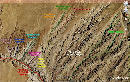 GE Image showing the northern half of the North Wash area canyons GE Image showing the northern half of the North Wash area canyons |
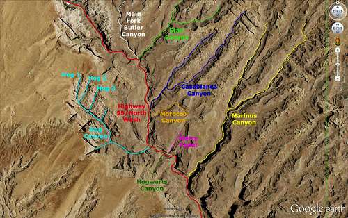 GE Image showing the southern half of the North Wash area canyons GE Image showing the southern half of the North Wash area canyons |
 Lower Blarney Canyon Narrows Lower Blarney Canyon Narrows |
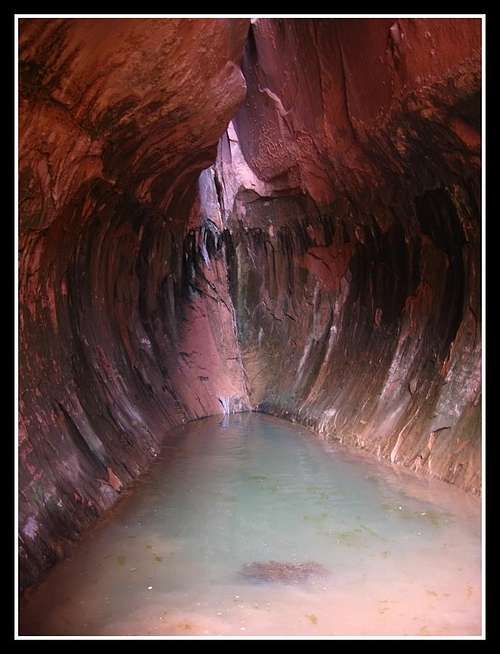
 Lower Leprechaun Canyon Lower Leprechaun Canyon |
The two canyons mentioned above (among a few more nearby) have rappels at their upper parts however if you hike in from the bottom starting at the highway, you should be able to get through most of these canyons. They are however very narrow and require entering sideways. They are great family hikes with children. Hog Springs located about a mile up Hog Canyon is a nice natural spring where you can cool off after a hot day canyoneering! Start at the Hog Springs Picnic Area and hike up a nice trail up Hog Canyon to the springs. Three technical slot cantons (Hog 1,2 and 3) end here as well. There is also a great place to cliff jump into the spring...just make sure you aim correctly! The spring is plenty deep enough.
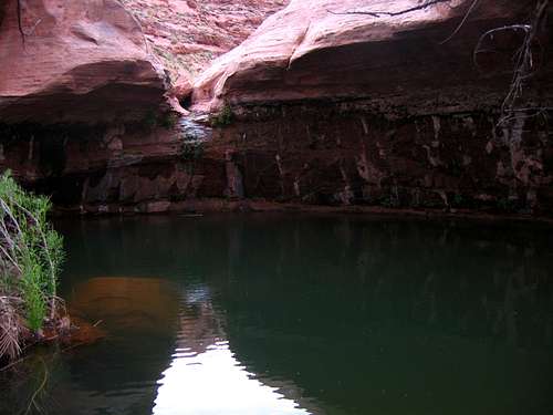 Hog Springs and the cliff jump
Another access point would be to head east off highway 95 at mile mark 25.4 onto the graded Cedar Point Road. This would be the preferred approach for someone wishing to descend one of the technical canyons. Drive on this road passable to most passenger cars about 4-6 miles where a number of pull-offs can be used for descending the upper forks of Butler and West Butler Canyons. Often there are cross country walks through open desert to get to the entrance of these slots.
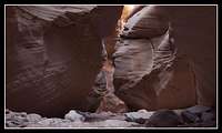
 Monkey Business, AKA West fork of West Butler Monkey Business, AKA West fork of West Butler |
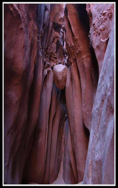
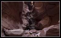
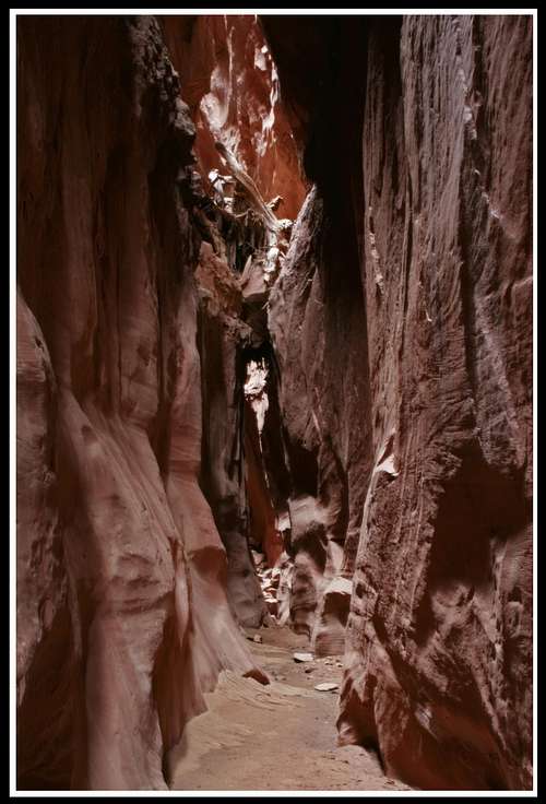
 Shenanigans Canyon Narrows Shenanigans Canyon Narrows |
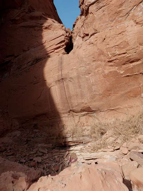
 Shenanigans Canyon final rappel Shenanigans Canyon final rappel |
Be sure you know where you are going and which canyon you are descending. Also know what technical moves you have to do and what your escape/return routes are. I have learned that GPS devices are extremely handy in Utah because there are many places where your approach can be a straight line (simply walking through the desert) and a GPS waypoint will give you your exact bearing to make approaches minimal. Passenger cars will be able to drive 14 miles down this dirt road until the sand will get too deep. A 4WD vehicle is needed to get all the way to the Cedar Point overlook or to the starting place for the upper slots of Stair Canyon. Butler and Stair canyons themselves are very large open canyons with many benches. These can be hiked through back down to the highway but two cars will be needed. The main interest is also the upper slots of these canyons and few people ever hike all the way through these canyons from start to end.
Hiking/Canyoneering the Dirty Devil slots
A network of dirt roads, including the Hans Flat Road exists throughout the open expanse of the San Rafael Desert taking you to many different slots. Between mile markers 15 and 16 on highway 95 is the Burr Point dirt road. This road leads 10 miles to its end at the Burr Point overlook and gives access to the canyons on the southwest side of the river. Nearby canyons are Poison Spring Canyon, Happy Canyon Narrows, Burr Canyon and Beaver Canyon. The Happy Canyon Narrows is the best slot in the area. Get to it by driving down the 4WD road through the large Poison Spring Canyon until you reach a fork in the road. Take the left fork and drive as far as you can on the olf mining track. Walk the rest of the track and descent to the river near a pile of Petrified logs where Happy Canyon lies just across the river. Or see information about the Miners Trail and Rappel route on my "Happy Canyon Narrows" page. For access to the abundance of canyons on the northeast side of the river, take the dirt road heading east off Highway 24 between mile markers 119 and 120. A map showing the network of dirt roads will be necessary. Taking the right roads one can get to great slot canyons such as Robbers Roost Canyon, Bull Canyon, Pasture Canyon, No Mans Canyon and Larry Canyon. All these canyons have many upper forks that make for great technical descents and narrow slot canyoneering adventures. If you make your way all the way down to the Dirty Devil River, a spectacular gorge will take your breath away as there is 1600 feet of relief from the Burr or Cedar point overlooks down to the river.
 Happy Canyon Narrows Happy Canyon Narrows |
 Happy Canyon Narrows Happy Canyon Narrows |
 Entering Larry Canyon Entering Larry Canyon |
 Larry Canyon final rappel
Hiking/Canyoneering the High Spur slots
This region is probably the most well known area of Robbers Roost Country and is accessed from the Hans Flat Road. Take this good graded road all the way to the Hans Flat Ranger station and take the spur road north on the Spur Road (that’s actually its name) for access to the Spur fork of Horseshoe Canyon slots. This road is probably not suitable for passenger cars however if you know what you are doing and drive VERY carefully it can be done. A junction comes at 3.6 miles where you can head left onto the Head Spur road or continue right on the High Spur Road. The Head spur road takes you to a starting point for the Spur Fork of Horseshoe Canyon slots and the Cowboy Caves. Continue on the High Spur Road for good starting points for the Moqui Fork, Northeast Spur Fork and the High Spur Fork of the Spur Fork of Horseshoe Canyon. For access to Lost Canyon and Horseshoe Canyon, drive the Hans Flat road to a nice pull off near the Goat Park Junction a few miles short of the ranger station. For access to all the forks of Bluejohn Canyon, park at the Ekker Ranch junction (Burr Pass) and see the Bluejohn Canyon page.
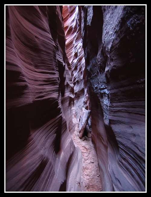
 Deep into the Main fork of Bluejohn Canyon Deep into the Main fork of Bluejohn Canyon |
 The Main fork of Bluejohn Canyon The Main fork of Bluejohn Canyon |
 Exiting the West fork of Bluejohn Canyon Exiting the West fork of Bluejohn Canyon |
 Narrows in the west fork of Bluejohn Canyon Narrows in the west fork of Bluejohn Canyon |
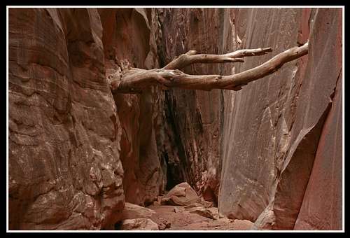 This famous tree has been stuck high on the walls of the Main Fork for years This famous tree has been stuck high on the walls of the Main Fork for years |
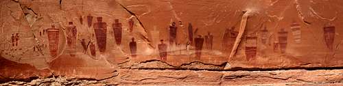 The Great Gallery in Horseshoe Canyon - Photo courtesy of thephotohiker
Camping
Although most of this area lies on BLM lands, some areas on the perimeters lie in the Glen Canyon National Recreation Area. You can’t camp in the NRA without a permit and you will only be allowed to camp in certain places if you get one. These permits aren't free either as this area is managed by the National Park service. The restrictions that apply to the Maze District also apply to the Glen Canyon NRA. However if you know where the boundaries are and you stay on BLM lands you can camp anywhere.
Seasons
This is a desert climate therefore it is very hot in the summer and very cold in the winter. Slot canyon travel isn't really recommended in winter but is can be done without too much trouble if you have the right gear. Spring, summer and fall are great seasons to explore the area however cross country approaches to slots through the open desert in summer can be very dangerous. Carry enough water and take it easy on the approaches during summer. Down in the deepest slots it can cool off by more than 30 degrees in summer making them very comfortable places to be. It is also important you know the weather forecast as it would be suicidal to enter a slot canyon when summer thunderstorms are in the forecast nearby. Know how big the drainage basin is for the canyon you’re going into as a thunderstorm hundreds of miles away can cause a flood where you are if the drainage basin is large enough. Below is a description of the climate for Hanksville.
| MONTH | AVE HIGH | AVE LOW | REC HIGH | REC LOW | AVE PRECIP (in) |
| JAN | 39 | 9 | 69 | -35 | .33 |
| FEB | 49 | 19 | 74 | -33 | .21 |
| MAR | 60 | 27 | 88 | 4 | .42 |
| APR | 70 | 35 | 98 | 10 | .40 |
| MAY | 81 | 44 | 107 | 23 | .46 |
| JUN | 91 | 53 | 110 | 31 | .27 |
| JUL | 97 | 60 | 114 | 38 | .48 |
| AUG | 94 | 57 | 110 | 35 | .80 |
| SEP | 85 | 48 | 105 | 24 | .68<td< td=""></td<> |
| OCT | 72 | 35 | 95 | -6 | .68 |
| NOV | 56 | 22 | 82 | -8 | .42 |
| DEC | 44 | 14 | 70 | -24 | .29 |
Red Tape
None if you stay on BLM lands. Most of the canyons in Robbers Roost are on BLM lands. Please leave no trace and try to stay off the cryptobiotic soil.External Links
See Michael Kelsey's book "Hiking and Exploring Utah's Henry Mountains and Robbers Roost" This is an excellent resource and has route and road maps of the entire area including the Henry Mountains. Detailed route descriptions for hundreds of slots and nice photos are all in this book. Also in his book is the story of Butch Cassidy and a history of mining in the area. Hanksville Weather CanyoneeringUSA - Tom Jones Mini Slot Canyon Guide by Dave Pimental Bogley Outdoor Community Average Joe Trips - Canyoneering Tales