As a kid, growing up in Pittsburgh, Pennsylvania, I learned about the
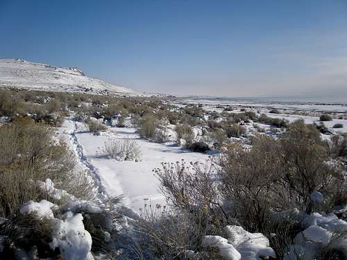
Great Salt Lake in school. I never dreamed that one day I'd call Salt Lake City home, but that is where my husband, Joe, landed a job, and so we moved here in 1987. Shortly after arriving we headed to the south shore of the lake prepared to swim, expecting to find a nice white sand beach, showers, and concession stands. The beach was icky brown and dirty, the showers were nozzles attached to the outside of a tanker truck, and neither of us remembers there being any food. It stunk horribly, 100 times worse than the ocean. We never even made it to the water. We were devoured by sand fleas which were everywhere. We only stayed long enough for me to yell "I can't stand it, I can't stand it", and so we left, dashed. It was 14 years before we ventured back the second time for a visit, this time to Antelope Island and then another 12 years (this fall) for a second visit to the island. Those visits went much better as there weren't any bugs in the spring or fall and we weren't expecting resort conditions.
In the meantime, I had become fixated on Fremont Island, which lies about 6.5 miles north of the causeway that runs between the town of Syracuse and Antelope Island. There were three named summits on the island, the highpoint called Castle Rock, and two lesser summits, David E Miller Hill and Beacon Hill. Oh how I would love to stand on the tops of them, but it didn't seem possible as I didn't have any way to get there. Being salty, the lake doesn't freeze, so I couldn't just ski or walk across in winter. However, some googling revealed this very nice blog in which the author tells of an intermittent land bridge/sand bar that appears in times of low water, running between the causeway and the island. According to the blog, the sand bar has been water free only 14 times in the last 167 years. In normal years it is under 6 feet of water and in record wet years under as much as a whopping 17 feet. The author of the blog walked the sandbar in 2008, telling of his experience as well as some interesting history.
I was fascinated. I wanted to do this too if the chance ever came in my lifetime, but with 2010 and 2011 being particularly wet, I thought it would be many years away. I was stunned, when in October of 2013, on our visit to Antelope Island, it appeared that the land bridge had resurfaced. On our way back over the causeway, I marked on my GPS what I thought was a good spot to start.
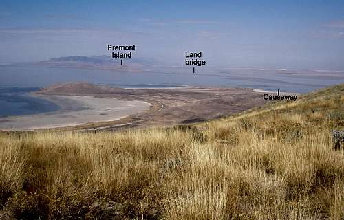
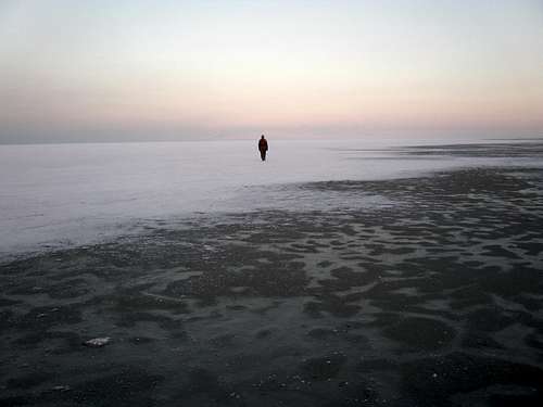
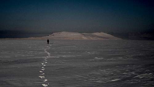
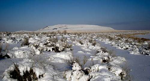
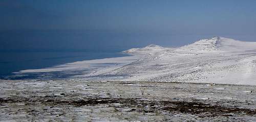
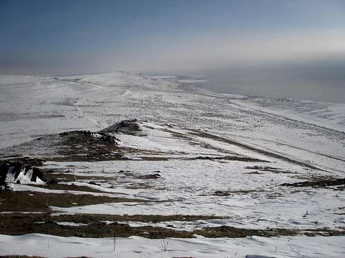
![The land bridge]() The land bridge seen from Antelope Island
The land bridge seen from Antelope Island
Unfortunately, I couldn't just say "hey, let's go", because Fremont Island is privately owned and I had to get permission first. Not knowing who to ask was a problem. After an unsuccessful attempt at googling for it, I called the folks on Antelope Island and was told that a ranger would contact me with the info. After not hearing back, I called again and was told that the ranger was really busy, but would surely give me a call as soon as he had a chance. After not hearing back again, I called and was told that the ranger had just retired. I thought I had missed my chance since a view of the land bridge from the mountains to the east appeared to have a gap in it. And so, I gave up, but a month or so later I heard that some trail runners had successfully made it across twice. The weather was still good as we had a beautiful dry fall with warm temperatures, but it wouldn't last forever as it was now late November. I asked my husband, Joe, the google champion of the world, to help me find the owner. He figured it out in about 5 minutes and put a call in, and unlike the state employees that run Antelope Island, this guy actually called us back and in addition gave us permission. Unfortunately, by this time, the weather had turned. It had snowed twice, and was bitter cold. It was now the beginning of December, but there was no waiting until next year, because for all we knew, there wouldn't be another chance in our lifetime.
Nevertheless, at this point, cold might be a good thing as the mud would be frozen. The modeled snow amount for the island was only a trace to 4" as opposed to 30" for the nearby mountains. For the land bridge as for the rest of the lake, there was no modeled snow, presumably since it's not typically land, but salt water which never froze.
We thought maybe it was still possible, but weren't sure. Would we find water, snow, sand, or mud? The land bridge was about 6.5 miles each way and there was another 8 miles on the island for a total of 21 miles round trip. That seemed like a long way to slog through snow and mud. I started checking the
water level compulsively, fearing that with the recent precipitation, that it would go up, but it was even lower than it had been in October.
We made plans to go for it on Tuesday December 10. But a forecast for calm wind and reasonable temperatures deteriorated to a low of 5, a high in the teens, and a 14mph wind. The killer for us was the wind as it would be completely flat, without even be a blade of grass to hide behind. So we delayed it two days and left with a forecast for hazy skies, temps between 10 and 20, and most importantly, calm wind.
One complication was that the causeway gate was only open between 6am and 6pm. What if we didn't get out in time? But, we were assured that if the gate was approached slowly from the inside, it would open. Another complication was that you aren't allowed to park on the causeway. We decided that Joe would dump me out with our gear and he would park on the far side which was closer and then bicycle the 1.7 miles back.
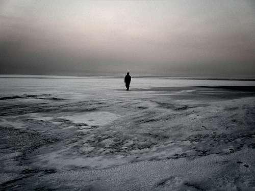
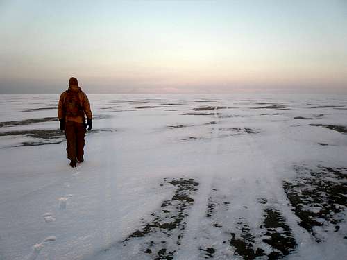
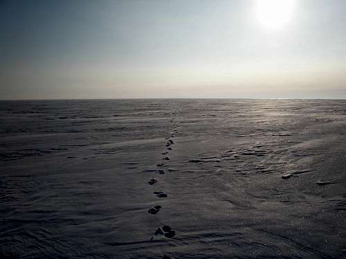
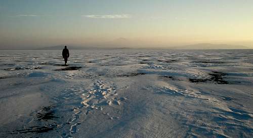
We got to the spot I had marked with my GPS at 6:45 am in the pitch black and spent some time going back and forth looking for a suitable place to start walking and a suitable pole to lock the bike to. It looked kind of grim, but grim is not impossible which it would have been if I hadn't marked the spot. Instead of the trace of snow we expected, it was about 6" deep, enough to make the going very slow for a 21 mile trip. In addition to white, we also saw large dark areas. What were they? Water? We couldn't tell in the dark and we could not make out a clear path of white to follow. I had thought we would be met with an unbroken sea of white, but that was far from the case. I was so thankful that we hadn't gotten there at 6am which was our original plan. It would be light soon. The temperature was -2F. We were hoping that the large expanse of water would moderate temperatures making the low warmer than expected, not colder.
![The Great Salt Lake]() Starting out
Starting out
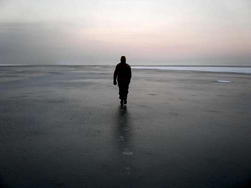
By the time Joe dropped the car off, bicycled back, locked up the bike, and we were ready to go, it was 7:22, before sunrise, but light enough to see. However, there was a light fog so we couldn't see very far. We walked west on the road a bit to just past a dark spot, headed down the short, rocky slope from the causeway, and onto the flat surface of the land bridge. We took a round about route at first trying to stay away from the dark areas. The snow on the land bridge, initially wasn't deep at all and was easier to walk on than the shore. We kept up a good pace until the snow ran out and we had to either walk on one of the dark patches or turn around. It turned out to be about an inch or so of frozen slush over the dark sandy lake bottom and was fairly easy to walk on although slippery. Even though it was below zero, it was not frozen solid, presumably because it was salty. It was fine now, but what would it be like when it melted on our way back? I tried to put the thought of being swallowed up by mud out of my mind and focus on the task at hand, but it was tough.
![Slush]() Some slush
Some slush
Looking north, south, or west, there was absolutely nothing to see, just a flat featureless expanse. Had it not been foggy, perhaps we could have seen something. To the east we could see the mountains of the northern Wasatch.
![Northern Wasatch Mountains]() Looking east at the Wasatch
Looking east at the Wasatch
The first mile and a half or so was mainly easy to walk on snow with a few patches of frozen slush thrown in. Then came a frozen slush patch that was so large we couldn't see the end of it. At the 2 mile mark we were at the end of the slush and the snow was now a mix of easy to walk on and 4" of slippy slidey stuff that didn't compact when you walked on it, merely squishing around underfoot. It was foggy and still darkish so we couldn't see much.
![The Great Salt Lake]() Transitioning from slush to snow
Transitioning from slush to snow
![Slush]() Looking back through some slush
Looking back through some slush
The sun finally rose over the mountains of the northern Wasatch and we began to make out the dim shape of Fremont Island far in the distance through the light fog. At 2.3 miles we encountered some ATV tracks that had filled with snow. I wondered how long they had been there.
![The Great Salt Lake]() Old ATV tracks
Old ATV tracks
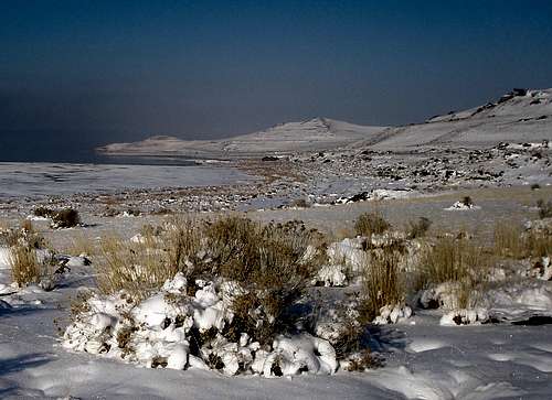
At 3.3 miles we encountered some clearly open water to our left. By now, the snow was slowing us down as it transitioned from mostly easy to walk on to mostly not. Rough looking snow was fine, smooth looking snow was not.
![Fremont Island]() Open water at left
Open water at left
At first it had been bitter cold, but seemed to warm up as we got away from the causeway, but right in the middle of the land bridge it got cold again even with the sun shining. I couldn't take any pictures until I warmed up my camera inside my coat. I had started out wearing three layers on my legs and four on my top. I used toe and hand warmers, and had my face covered up. I had recently broken a finger on my right hand and was wearing a metal splint which did not allow me to bend it. That made it extra hard to manipulate items in the cold as well as making my hand extra cold.
![Fremont Island]() Looking forward
Looking forward
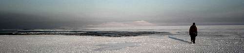
![The Great Salt Lake]() Looking back
Looking back![Fremont Island]() Getting close
Getting close
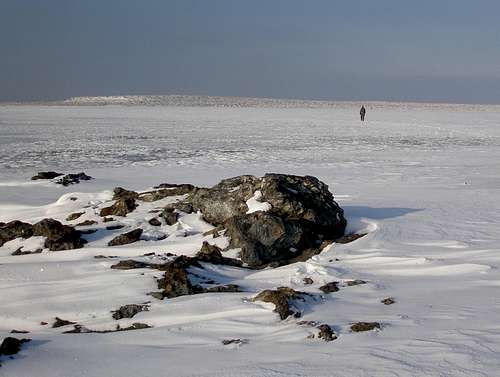
We walked and walked and walked, but the island still seemed far away. We spied some rocks in the distance and knew we were getting close. Until now, there had been nothing to break up the flat plain of the land bridge, no rocks, no little bumps, nothing, it had been completely featureless. The last bit seemed to take forever, but finally we stood on Fremont Island. It had taken us 2 hours and 28 minutes to cover the 6.7 miles from our car. I thought this was great time given the conditions.
The island had been in the local news recently. It seems that some wild exotic boars were introduced on the island for the purpose of hunting and with the low water levels, there was thought that they would make their way to Antelope Island and wreak havoc with the ecological balance over there. Hunters were hired to eradicate them, but I can say with 100% certainty, that one got away. OMG, there's goes a pig!!! Joe wondered if they were dangerous. I didn't think it was going to bother us because it was running away from us as fast as it could.
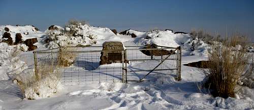
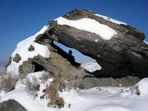
There is a spot on the map marked "graves" where lie the bodies of Kate and Uriah Wenner who lived on the island in the late 1800's. Uriah died in 1891 at the age of 42. Poor Kate was only 34 at the time. She lived until 1942 and her ashes were returned to the island to be buried with her husband. The site was easy to find as it is near a prominent rock outcropping near where we came ashore and is pretty accurately marked on the map.
![Lonely grave site]() Grave site
Grave site
After paying our respects we started our trek across the island. First up was
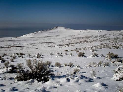
David E Miller Hill. David E. Miller was a noted University of Utah historian who was an authority on the Great Salt Lake. He died in 1978. In the distance we could see our 3rd peak of the day, Beacon Hill.
![David E Miller Hill]() David E Miller Hill
David E Miller Hill
![Beacon Hill]() Beacon Hill
Beacon Hill
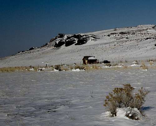
On the way, we passed a shack and a pickup truck. How did the truck get there? How long had it been there? We hadn't see its tire tracks on the land bridge and there were no obvious roads underneath the snow.
![Fremont Island]() Shack and pickup truck
Shack and pickup truck
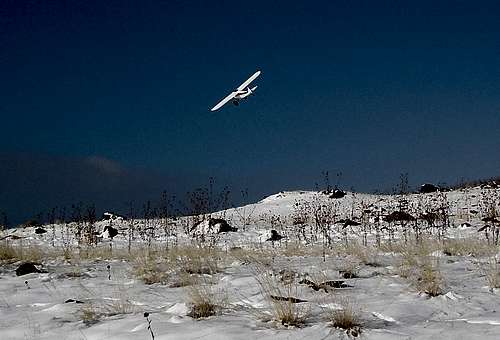
From a distance, the island was whiter than expected. I thought that the south slopes would be melted out, but they weren't. The snow was more powdery than on the land bridge and so was easier to walk through. On the land bridge, Joe was faster and had done virtually all of the trail breaking while I lagged behind, but on the island I was faster than him and did virtually all the trail breaking there. We started up the slopes and a small plane appeared. The pilot flew over us twice and the second time buzzed us, coming irresponsibly close, within 20'. It was pretty annoying. I wasn't sure if he was trying to be friendly or trying to scare us. On the phone, the owner had explicitly complained about unauthorized planes landing on his beach.
![Fremont Island]() Plane
Plane
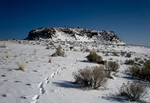
The grades on the island were gentle and we quickly hiked the 1.7 miles to the top of David E Miller Hill and had nice views of the northern part of the island. We didn't see a single tree on the whole thing. The vegetation mainly consisted of grasses, rabbit brush, and sunflowers. It was an easy matter to get to our next summit, the highpoint of the island, Castle Rock, 1.6 miles away. The final little bit was steep, but not quite castlelike. On the north side of the summit is an interesting rock formation with a big hole in it. Kit Carson carved a cross on the rock many years ago, but unfortunately, we couldn't locate the cross and didn't want to spend too much time looking for it as we had a long way to go. From there it was a mere 1.2 miles to our last summit, Beacon Hill.
![Fremont Island]() View from David E Miller Hill
View from David E Miller Hill![Kit Carson's rock]() Kit Carson's rock
Kit Carson's rock![Beacon Hill]() Beacon Hill
Beacon Hill
![Fremont Island]() Looking back at Castle Rock
Looking back at Castle Rock
From Beacon Hill, we could look south down the whole length of the island to the point where we had come ashore. It was 3.8 miles to get back to the land bridge. On the way there, we followed a well established animal trail for a while, wondering if it was made by pigs.
![Fremont Island]() Looking down the length of the island
Looking down the length of the island![The pig trail]() The pig trail
The pig trail
Close down to the shore we spotted what seemed to be a road or a wide path and headed for it, thinking it would be easier walking than through a sea of snow covered rocks and sage brush. We were mistaken as the sandy ground on the road was quite soft and we sunk into the dirt an annoying amount, even when stepping on snow. Later, we found another small road covered with gravel and I thought this one would surely be firm, but again, we sunk into the rocks/dirt and thought it was much harder than walking through the snowy rocks and sagebrush. My thinking was if the dirt is this soft here, then what is it going to be like on the causeway?
![Fremont Island]() Soft sand road
Soft sand road
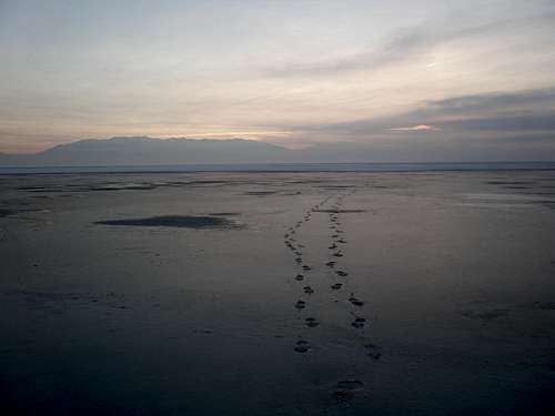
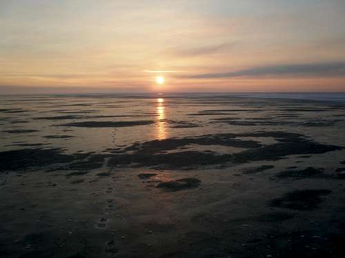
It had been fun exploring the island. I wished we had more time and that it was warmer. It was 2:46pm when we started our trek back across the land bridge. We were tired by this time and it took more time going back than coming over. We couldn't actually see the causeway, but we did see a car driving on it, appearing to be floating on air. At first it was nice and sunny, but our shadows got longer and longer and it got colder and colder.
![The Great Salt Lake]() Heading back
Heading back
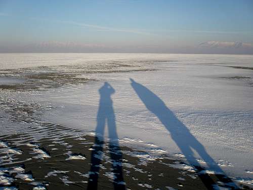
![Long shadows]() Long shadows
Long shadows
The sun had set by the time we got to the big dark slush spot, but it was still lightish. This is what I had been dreading all day. It had been very reassuring to follow our footprints back, but now they disappeared. I was hoping that the slush would refreeze by the time we got there, but that was not the case. We were going to have to walk through standing water on top of who knows what. By some miracle, whatever was on the bottom, was reasonably firm, unlike on the island. It was extremely disconcerting though, because we didn't know how deep it was going to get, and light was fading fast. Every once in a while I would step on a small ice patch and all the water would squish out around the sides. In the end, the water never got over an inch deep, and this stretch was actually easier to walk on than the snow had been. Nevertheless, I thought it nerve wracking in the dark, and my adrenaline really got going. Before, I couldn't keep up with Joe, but now he couldn't keep up with me.
I never saw the causeway side of the land bridge in the daylight, but if the map is correct, it is pretty narrow there and without a GPS track to follow, it could have been hard to get back in the dark. Both of our headlamp batteries gave out but there was an almost full moon and once we made it past the standing water section we were able to follow our footprints again. We made it back to the bike just before 6pm and had to put in fresh batteries to see well enough to get it unlocked and then Joe took off for the car. He came back with the heater blasting and said his hands were too cold to turn the bike light off. We drove to the causeway gate and voila! it opened just as advertised.
We were salivating at the thought of eating at the Crown Burger near our house but didn't like that it would take an hour to get there. Just as I was about to voice "too bad there isn't a Crown Burger in Layton or wherever the hell we are", Joe exclaimed "there's a Crown Burger right over there". He went in ahead of me and when I followed I couldn't find him. I thought surely he wouldn't have climbed up the steps to the upper section, but that was the only place left, so I went up and found him parked at a table 2 feet from a huge fireplace. It was absolute heaven.
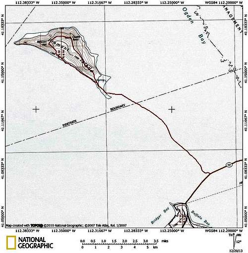
![Fremont Island topo]() Trip topo
Trip topo


Comments
Post a Comment