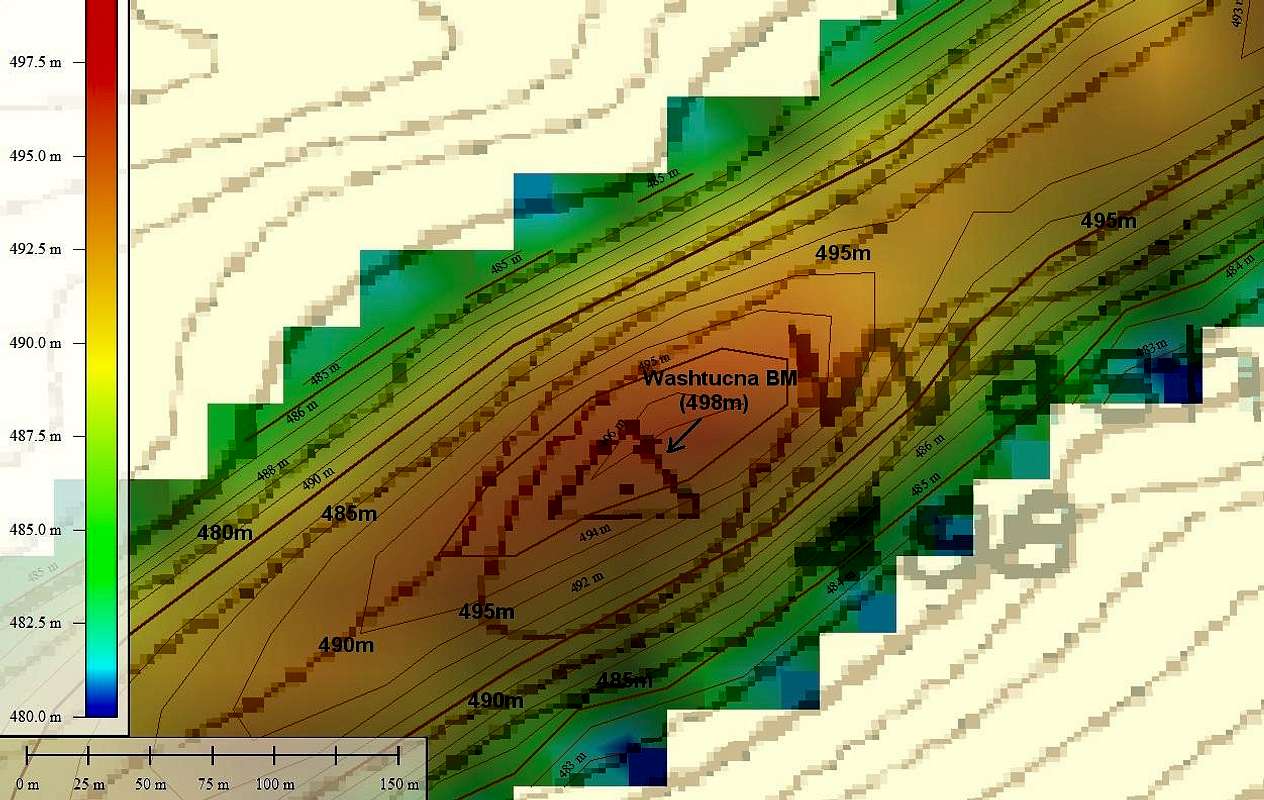
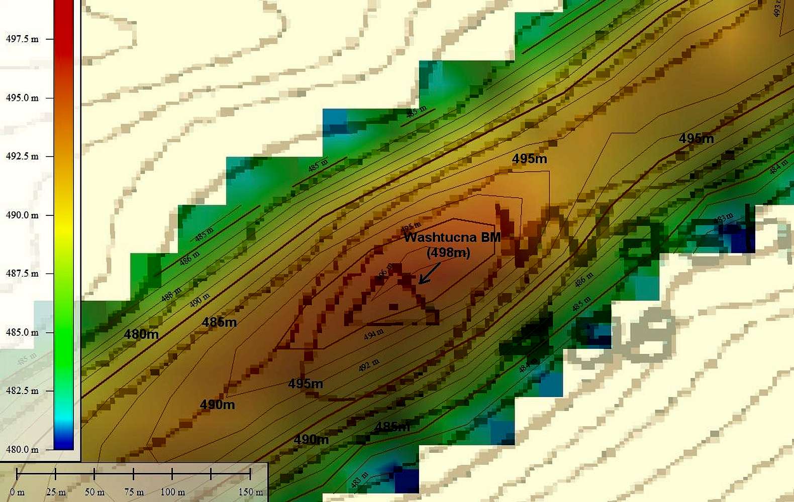
Color-coded map of SRTM data overlaying the topo map for
Washtucna BM (Pt. 498 meters).
The max data points for the SRTM data are three 497m (1630-ft) points. Each data point is a point at a specific latitude-longitude with a reported average elevation for a 30m radius disk centered at that point.
The topo map contours have been labeled with large black text. The small contour labels are for the SRTM data. You will probably have to view the original size image to see this detail.
SRTM results courtesy of Martin Shetter.


